Google Map |
USA :: Sedona :: Courthouse Butte |
GPS Track |
|
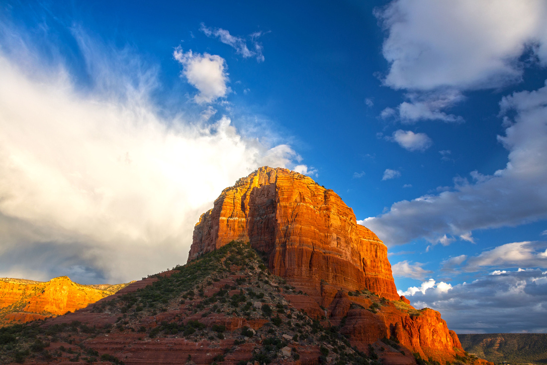
Dramatic Sky over Courthouse Butte from Bell Rock Trailhead on Hwy 179 |
|||
| Trip Summary | |||
Multiple Dates, last Nov 20, 2023
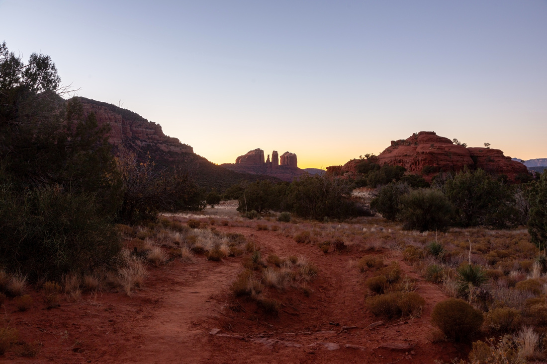
Bell Rock and Courthouse Butte are Two Distinct Rock Towers just north of Oak Creek with network of well developed Hiking Trails. Variety of options exist and everyone can make their own itinerary as there are Trail Maps and Signs at all junctions. I prefer to start from Bell Rock Pathway Parking Lot in Oak Creek, circle around Courthouse on east side via Big Park Loop Trail, then finish by hiking around Bell Rock west side back to start. Pleasant diversion is distinct Rock Dome on north side, ~45min to an hour from the start, with great viewpoint at the Top. It is just a bit off main trail with one easy slickrock scramble step. Distinct Rock Tower to the East, called Oak Creek Needle, is super photogenic with light reflecting of Red Rock in late afternoon. Both Baby Bell and Bell Rock could be included to extend the day, although climb to the top of Bell Rock is technical. Area is also one of known Sedona Vortexes which adds to the appeal. |
|
Gallery |
|||
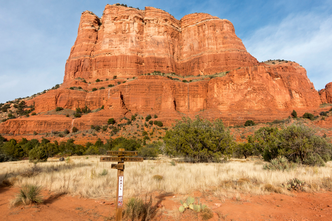 Courthouse Butte Courthouse Butte Big Park Loop Junction few minutes from Bell Rock Trailhead in Oak Creek
 |
|||
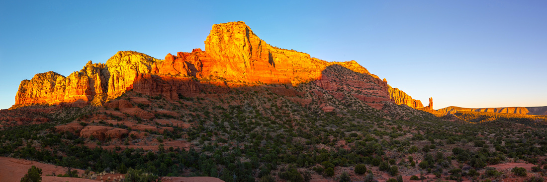
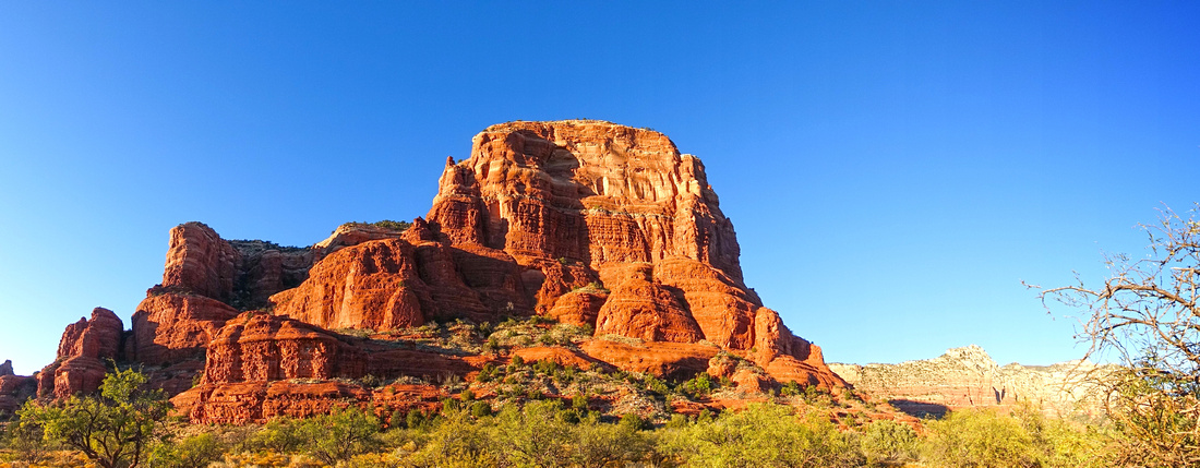 Courthouse Panorama
Late Afternoon Sunlight reflecting off Courthouse Butte from Big Park Loop Trail Courthouse Panorama
Late Afternoon Sunlight reflecting off Courthouse Butte from Big Park Loop Trail |
|||
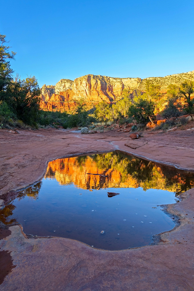 Wash Reflections Wash Reflections
Shallow Pool of water on slickrock at east side offering nice photo op |
|||
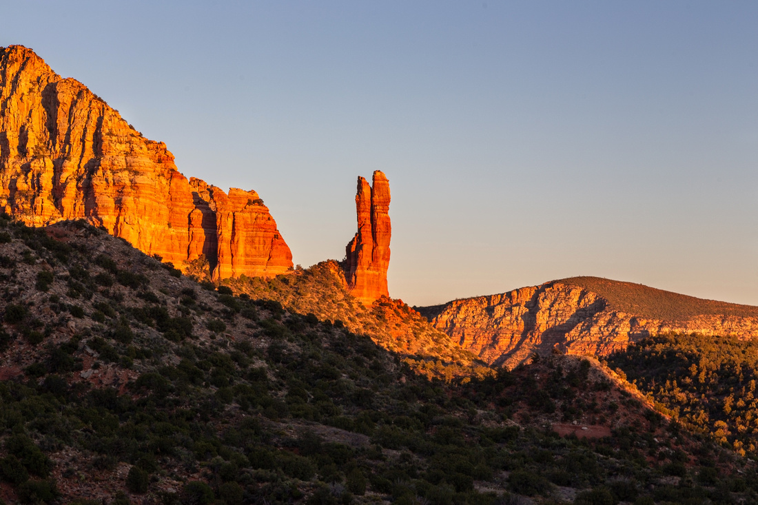 Oak Creek Spire
Distinct Rock Needle in Munds Wilderness east of Rock Dome on Courthouse North Side Oak Creek Spire
Distinct Rock Needle in Munds Wilderness east of Rock Dome on Courthouse North Side
|
|||
 Munds Peaks
Panorama NE from Rock Dome. Oak Creek Spire distant center right Munds Peaks
Panorama NE from Rock Dome. Oak Creek Spire distant center right |
|||
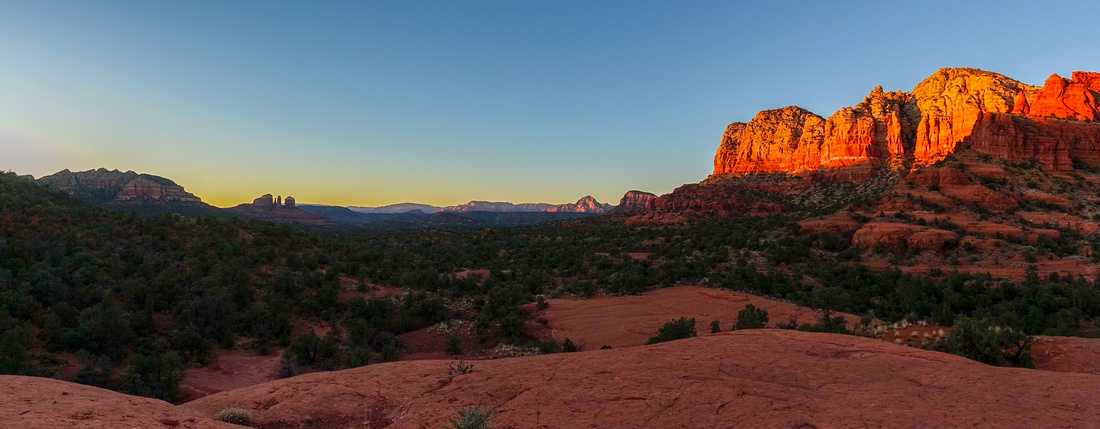 Rock Dome Panorama
Looking west from Courthouse Rock Dome. Cathedral Rock Distant Center Left Rock Dome Panorama
Looking west from Courthouse Rock Dome. Cathedral Rock Distant Center Left |
|||
 Closing the loop at Sunset towards Baby Bell Rock just right of center with Cathedral Rock in the Background
 |
|||
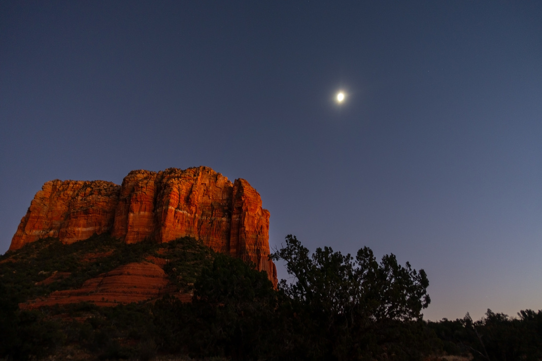 Courthouse Moon
Moonrise over Courthouse Butte from Bell Rock Trail Courthouse Moon
Moonrise over Courthouse Butte from Bell Rock Trail |
Abstract
| Overall Difficulty | D2 | Gentle rolling trail with couple of moderately steep sections. Brief easy slickrock scramble to top of Rock Dome at North Side | |||
| Scenery | Different aspects of Courthouse Butte and Bell Rock. Impressive Oak Creek Spire | ||||
| Trail/Marking | Excellent | Well defined trail with marked junction and trail maps | |||
| Suggested Time | 3 hrs | Casual Pace for full loop. Vast network of trails can extend the day as desired | |||
| Elevation | Start: 1300m Max: 1380m Total: ~210m | Round Trip: 7km | |||
| Gear | Light hikers are sufficient | ||||
| Water | No reliable source. Carry 0.5-1L, depending on season | ||||
| Dog Friendly | Yes | Busy area - keep control of the pet for courtesy to other hikers | |||
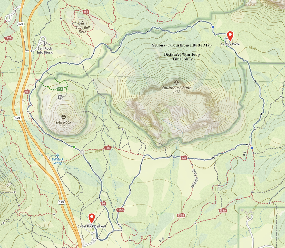 Courthouse Butte GAIA Map
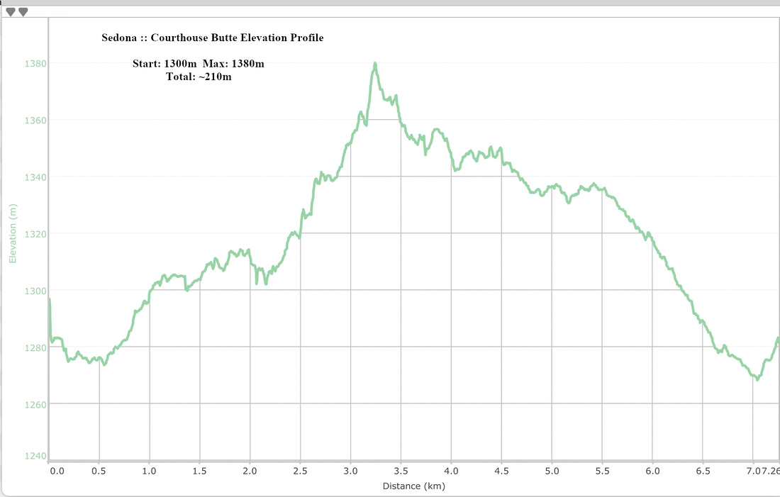 Courthouse Butte Loop Elevation