Google Map |
Rockies :: Kananaskis :: Mt. Baldy Main Peak |
GPS Track |
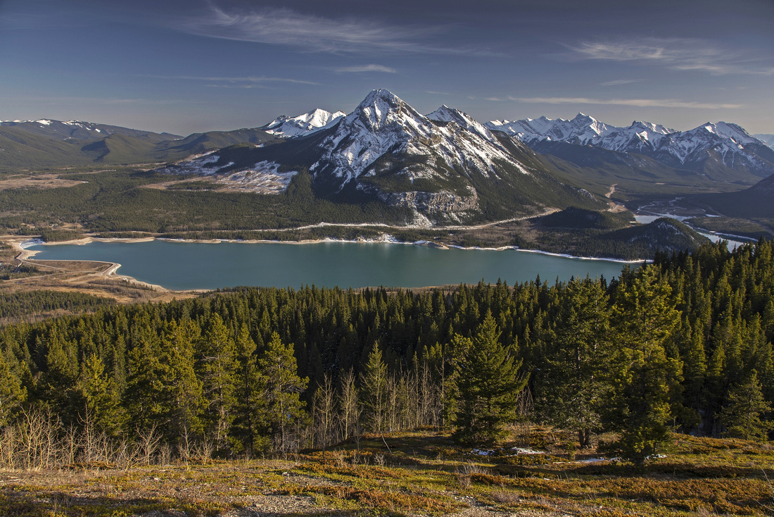 
Mt. Baldy seen from Barrier Lake Viewpoint on McConnell Ridge Trail |
|||
| Trip Summary | |||
Multiple Dates, last May 14, 2024Mount Baldy is first mountain towering over Barrier Lake on the east side of Hwy40 ~10min south of Trans-Canada Highway junction. Being fairly close to Calgary it became a popular ascent after inclusion in Alan Kane Scrambles guidebook. Trailhead is at left (east) side of the road by small creek shortly after signed Barrier Lake Hills turnoff; if busy car can be parked at west side pullout ~50m further down. Standard route follows prominent west-facing rib with mostly easy scrambling and one harder rock step about halfway which must be downclimbed going up (see Gallery). This technical part can also be bypassed by trashing on south side (Waypoint "1-Bypass" on GPS Track, download Top of Page - go right). For variety I prefer to use bypass going up, then descend by staying on ridge to treeline. Summit block, despite appearance, is quite straightforward with many trails developed over the years bypassing short cliff bands. Summit Ridgewalk is very pleasant - without snow. On my Ascent in mid May '24 wet snow here made me feel quite unsafe and on return I used alternate descent route by trashing west face before re-joining standard access below summit ridge.
Other 2 Baldy Peaks are just south, connected by well defined ridge below Main summit. When dry it is possible to do 3-Peak traverse, then return by trashing gully between Main and South Peaks. Crux is the drop below Main Peak - exposed class 3/4, with serious potential for accident. Approach via Baldy Pass trail is much better and very scenic option. Center Peak also has West side route that is downright dangerous and should be avoided, even if published on GAIA and other Scrambling guidebooks.
If returning the same way from Main summit, brief side visit to prominent Buttress nicely seen from The Highway is a must. Wide plateau which seems to attract rock cairn building enthusiasts offers excellent views that might even be better from Main summit. |
|
Gallery |
|||
 Hwy40 Parking
Normal Parking area on east side of Hwy40 Hwy40 Parking
Normal Parking area on east side of Hwy40 |
|||
 Baldy Trailhead
Trail starts climbing steep ditch to the left of Baldy Creek Baldy Trailhead
Trail starts climbing steep ditch to the left of Baldy Creek |
|||
 Forest Trail
Well defined trail switchbacks moderately angled Forest to Treeline Forest Trail
Well defined trail switchbacks moderately angled Forest to Treeline |
|||
 Crux Scramble
Crux section above Treeline. Bypass Trail below on Right side Crux Scramble
Crux section above Treeline. Bypass Trail below on Right side |
|||
 Crux Downclimb
Crux Rock Step you dowclimb going up. Much easier from what this photo might suggest; ~5m of class 2 with good holds Crux Downclimb
Crux Rock Step you dowclimb going up. Much easier from what this photo might suggest; ~5m of class 2 with good holds |
|||
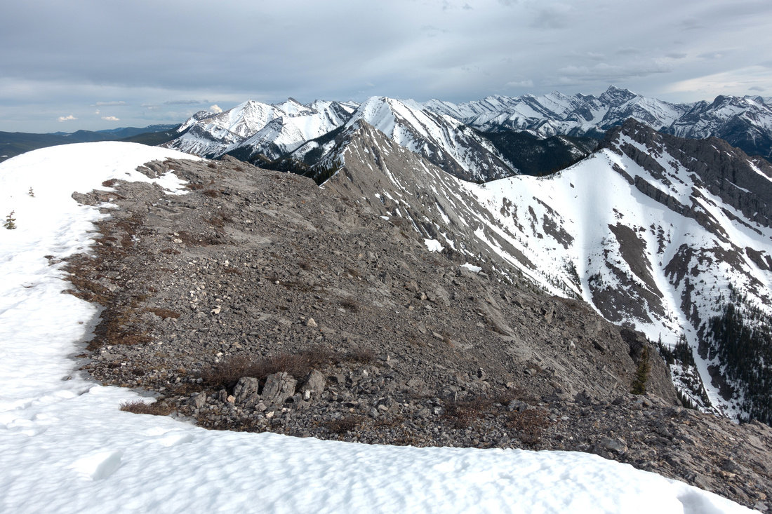
 Scramble Ridge Scramble Ridge
Ascent ridge looking back; Crux rock step dead center. Bypass trail joins ridge around here |
|||
 Baldy Center/South
Baldy South (L) and Center Peak Panorama with Kananaskis Valley to the Right Baldy Center/South
Baldy South (L) and Center Peak Panorama with Kananaskis Valley to the Right |
|||
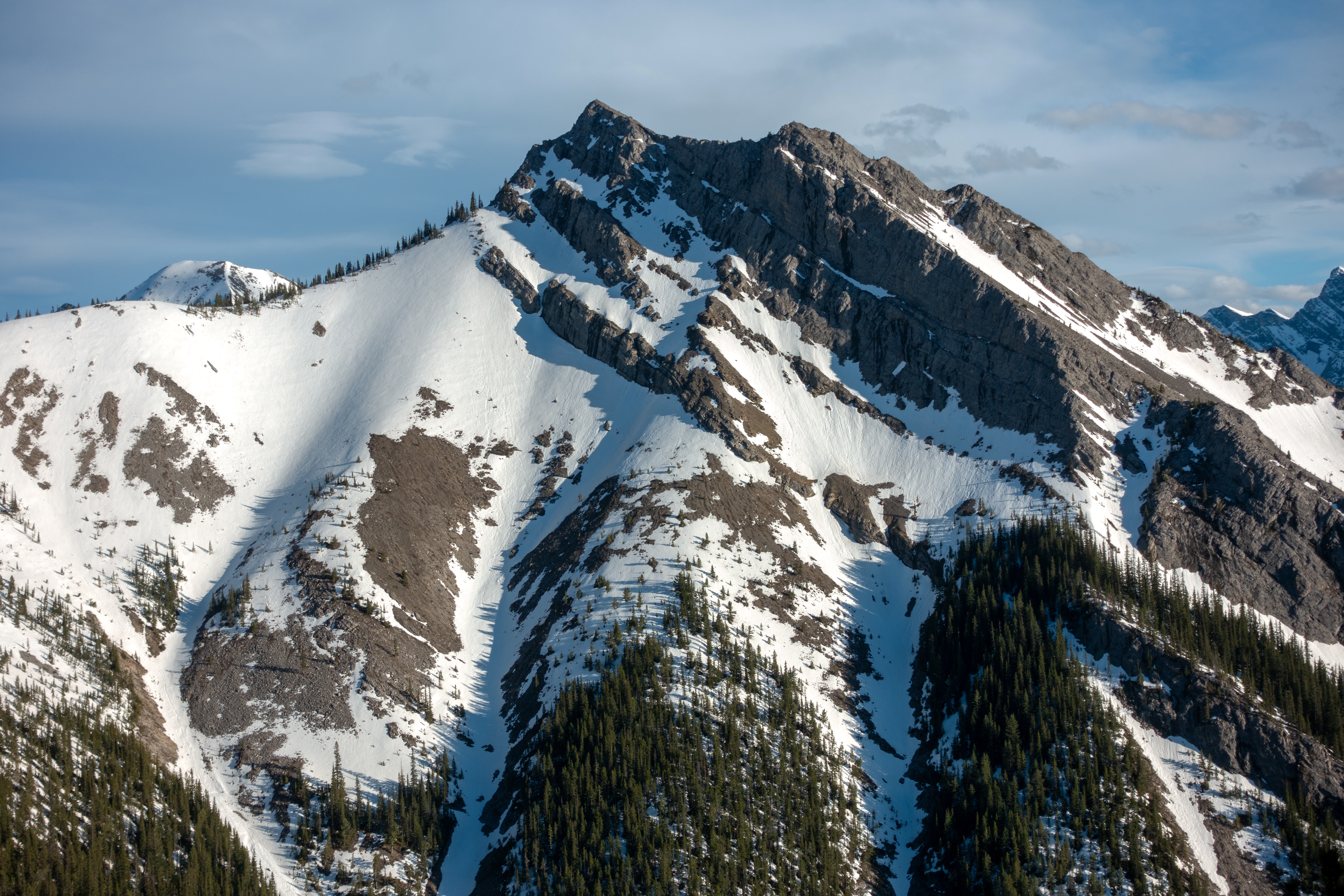
 Mt. Baldy Three Peaks
Three Peaks of Mt. Baldy from quick side trip to Prominent Gendarme viewpoint. Main Peak route zig-zags rock face left side of photo Mt. Baldy Three Peaks
Three Peaks of Mt. Baldy from quick side trip to Prominent Gendarme viewpoint. Main Peak route zig-zags rock face left side of photo |
|||
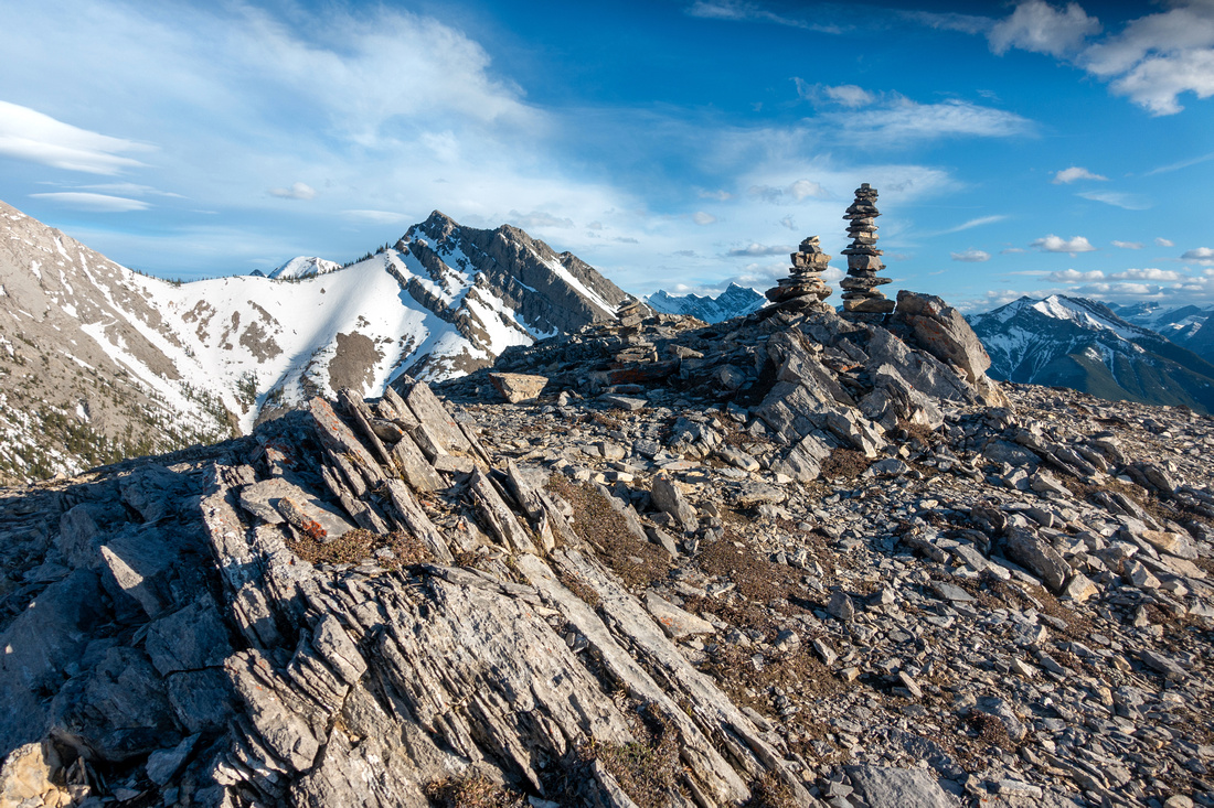 Rock Cairns
Rock Gendarme with several cairns with snowy Center Peak in the background Rock Cairns
Rock Gendarme with several cairns with snowy Center Peak in the background |
|||
|
|||
 Barrier Lake
Aerial view of Barrier Lake near the start of Baldy Summit Ridge. McConnell Ridge across Barrier Lake
Aerial view of Barrier Lake near the start of Baldy Summit Ridge. McConnell Ridge across |
|||
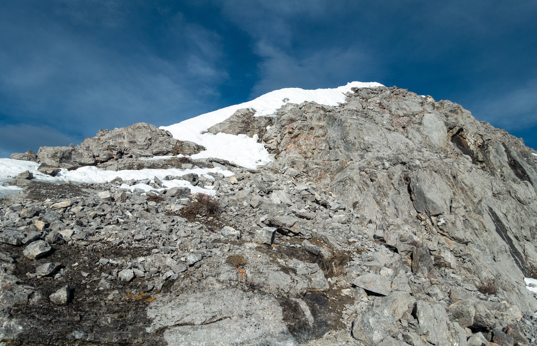 Summit Block
Start of Baldy Summit Ridge. Ensuing section upper center can be very tricky when snow covered Summit Block
Start of Baldy Summit Ridge. Ensuing section upper center can be very tricky when snow covered |
|||
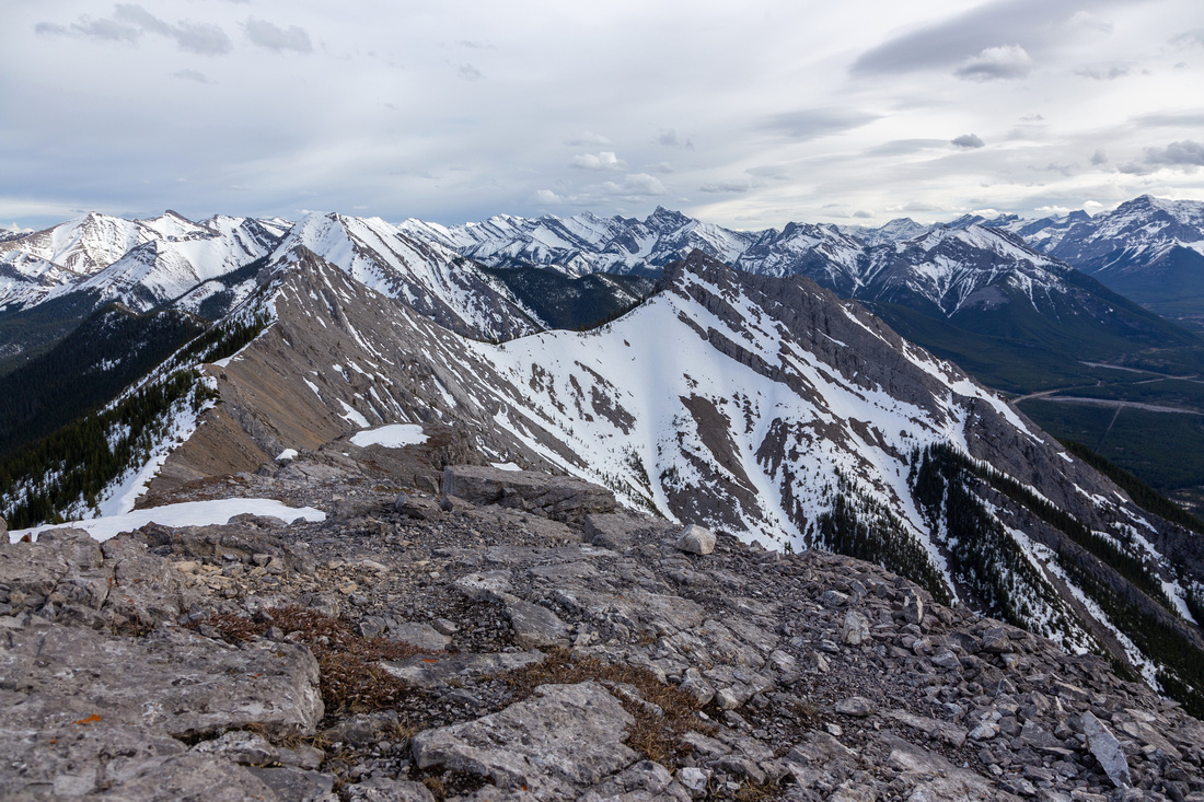
 Baldy Summit Ridge
Looking back length of Summit Ridge near the Highpoint Baldy Summit Ridge
Looking back length of Summit Ridge near the Highpoint |
|||
 Baldy Summit
Baldy Main Peak summit area Baldy Summit
Baldy Main Peak summit area |
|||
 Baldy Summit
Descent towards South Peak connecting Ridge is difficult and not recommended, even when dry Baldy Summit
Descent towards South Peak connecting Ridge is difficult and not recommended, even when dry |
|||
 Tricky Descent
Alternate descent route in order to avoid snowy summit ridge is not particularly safe either. It is best to wait till all snow has completely melted Tricky Descent
Alternate descent route in order to avoid snowy summit ridge is not particularly safe either. It is best to wait till all snow has completely melted |
Abstract
| Overall Difficulty | D5 | Steep trail with eroded sections. Class 2 rock scramble with one harder step. | |||
| Snow Factor | S4 | Not feasible as winter ascent. Snow melts early on west facing ascent slopes, but final summit ridge, often snowbound well into May, can present problems | |||
| Scenery | Fantastic view of Barrier lake, Foothills and Kananskis Front Range Peaks | ||||
| Trail/Marking | Good | Unofficial but well defined trail with occasional flags/cairns. Way is obvious | |||
| Suggested Time | 5 hrs | Return time if not doing the Traverse to South/Center Peaks | |||
| Elevation | Start: 1420m Max: 2200m Total: ~810m | Round Trip: 5km | |||
| Gear | Full hiking boots much preferred for ankle support. Poles essential. Climbing Helmet not out of place with large(r) groups | ||||
| Water | Baldy Creek at Trailhead, dry afterwards. Carry 1-2L, depending on season | ||||
| Dog Friendly | No | Although I've seen dogs on Baldy I advise not taking them due to overall nature of terrain | |||
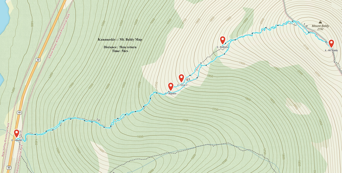 Mt. Baldy Main Peak GAIA Map
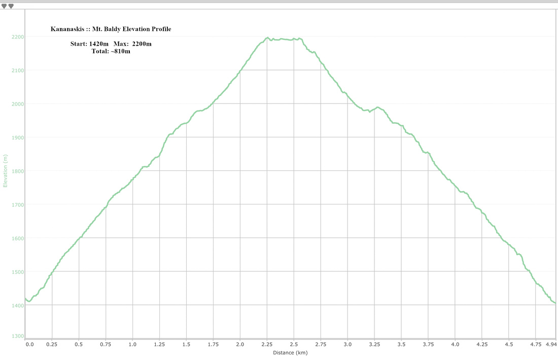 Mt. Baldy Main Peak Elevation Profile