Google Map |
Rockies :: Icefields :: Big Bend Peak |
GPS Track |
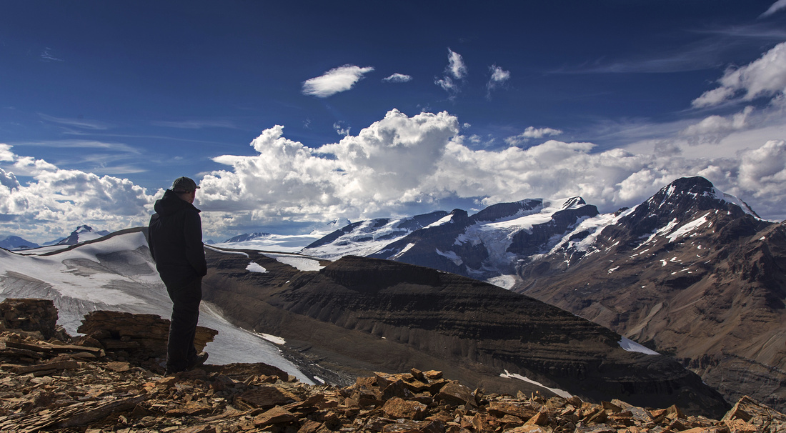 
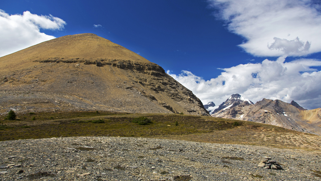
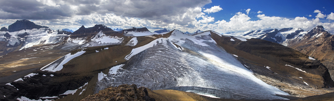
Summit view from Big Bend Peak. To the left is Castleguard Mtn (3090m), to the right and behind is mighty Mt. Columbia - 3747m (highest in Alberta and 2nd highest in Rockies, after Robson). To the right are Andromeda and Athabasca, both well over 3000m |
|||
| Trip Summary | |||
August 16, 2016Unofficially named Big Bend Peak (BBP) owes its name to 180 degree turn of Icefields Parkway below. It is highest end of long ridge extending on south side of Saskatchewan Glacier valley. While most casual hikers ascend Parker ridge on the other side, very few venture on BBP. While there is no trail or markings, the way up is very logical and generally free of technical difficulties. Views are fabulous and include several Icefield giants that can not be seen from tourist viewpoints along the highway.
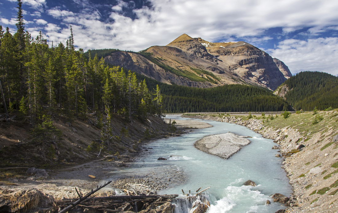
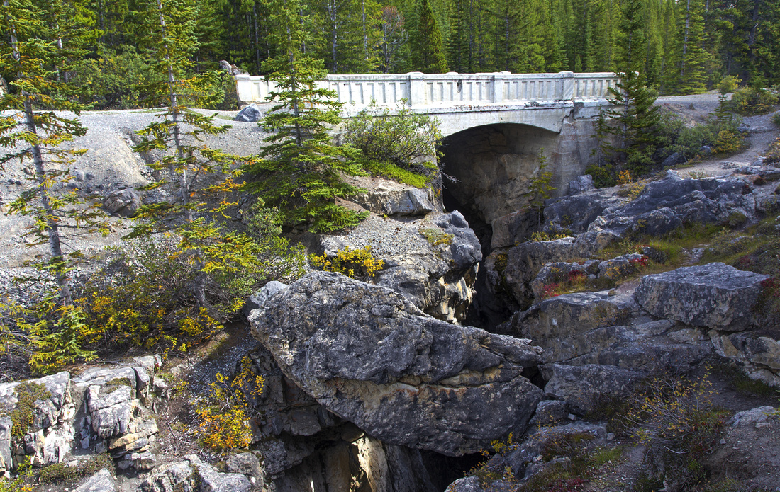
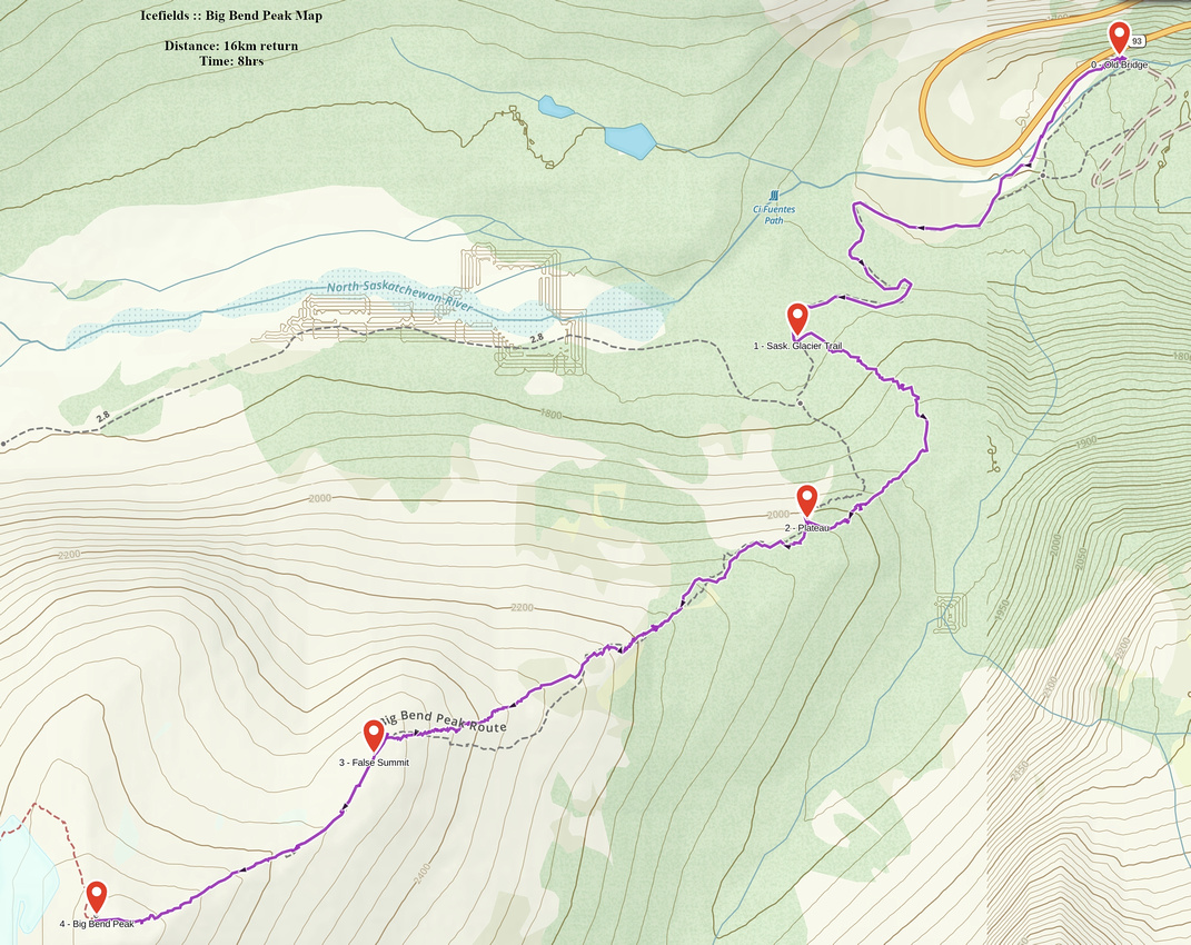
Parking is at the pullout few seconds south from Big Bend on the right (south) side. This pullout is not obvious, and if coming from the opposite direction you are likely to miss it. Gravel road descends to old military bridge. There is room for 4-5 cars maybe. Cross the bridge, and turn immediately right. First part is shared with Saskatchewan Glacier access; follow the river flats then at far end pick-up old forest road that climbs the forested hill. In winter you might be able to park directly at Big Bend then cross frozen river on snow bridges thus saving ~20-30 minutes. Follow the road as it switchbacks left, then right to high point but do not descend to on the other side. Instead head left (south) into the forest. There is no trail and no cairns/flags, but you don’t need them. The goal is to intercept low point of BBP ridge then follow to the summit; whole route can easily be studied from the parking by old bridge. Forest is open and with little luck you might stumble upon open cutblock that offers soft, mossy hiking on moderate angle at most. Higher up turn right and climb further staying close to the edge on the right side. You will likely intercept faint trail here; follow to the clearing that offers fabulous views of Saskatchewan Glacier valley and Parker Ridge on the other side. It should take about 1.5 hours of moderate pace to get here from the parking and it is good place for first break, as majority of elevation gain is yet to come.
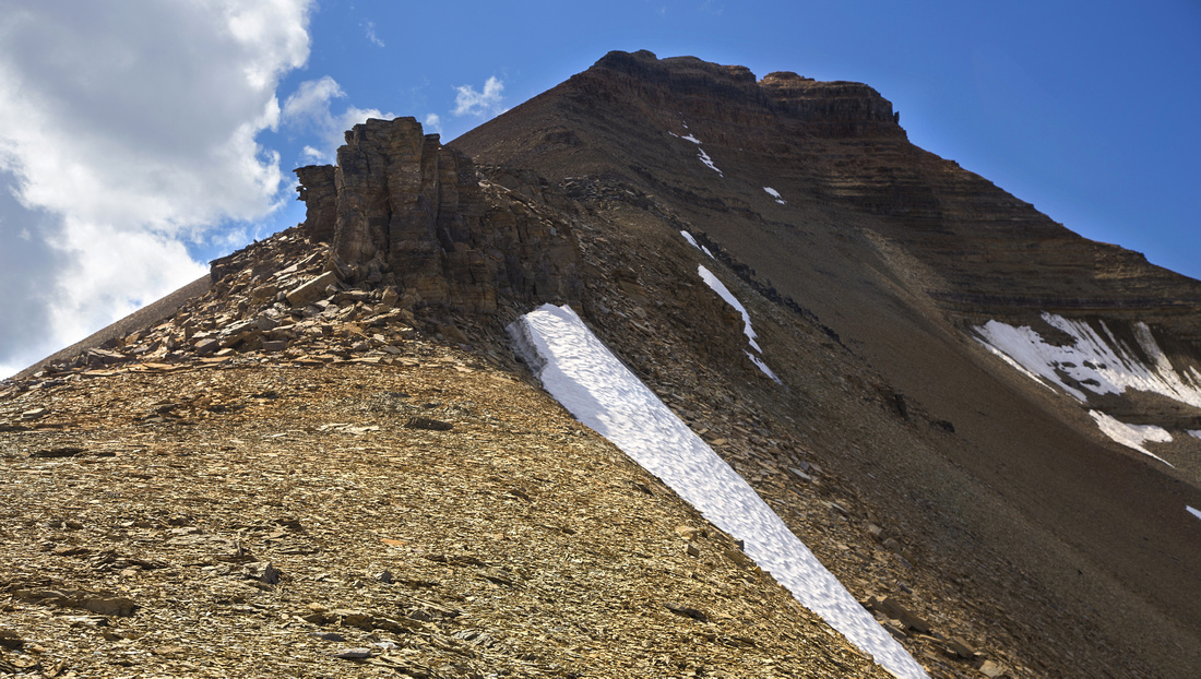
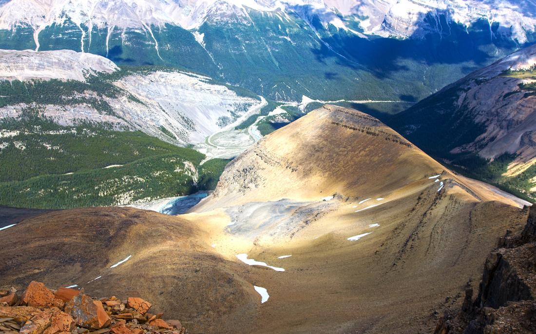
Continue up forested ridge staying again close to the right edge reaching treeline in about 15-20 minutes. Steep-ish slope leads to the plateau below the sub-summit. This orange talus cone that appears very prominent when seen from the Highway is the crux. Initial part is still fairly solid, and crumbling rock band in the lower part is a non-issue. But higher up slope steepens and footing becomes very unstable and lose. Hiking poles are great asset here, and with group climbing helmets might be a good idea. Curses are silenced at the top as remainder of the ascent comes into view. Fabulous panorama unfolds with eye-catcher being long valley on the south side leading to the high-col between Mt. Saskatchewan and the Towers. (This valley is sometimes used as alternate highline access to Castleguard Meadows; it avoids long trudge on Alexandra River or glacier travel on Saskatchewan Glacier valley). Strangely enough the cairn contains the register, while true summit has none; it would be real shame to stop here, because worst is now behind and upper ridge is nowhere as troublesome.
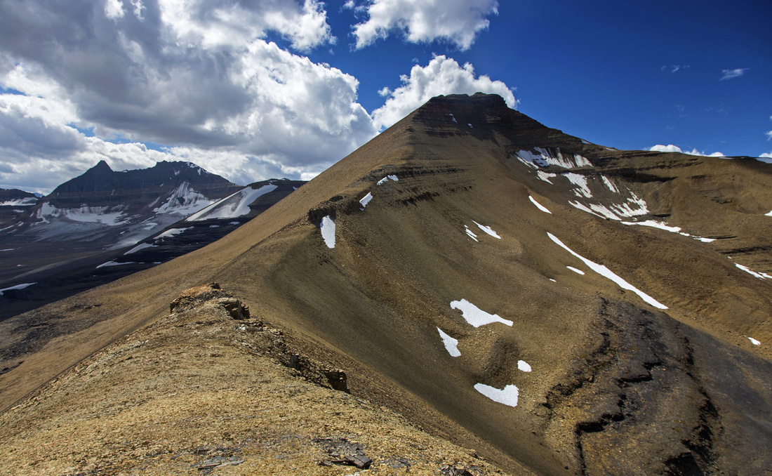
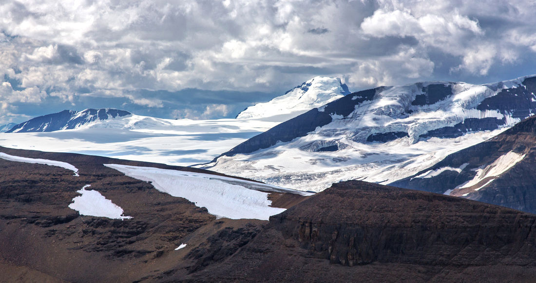
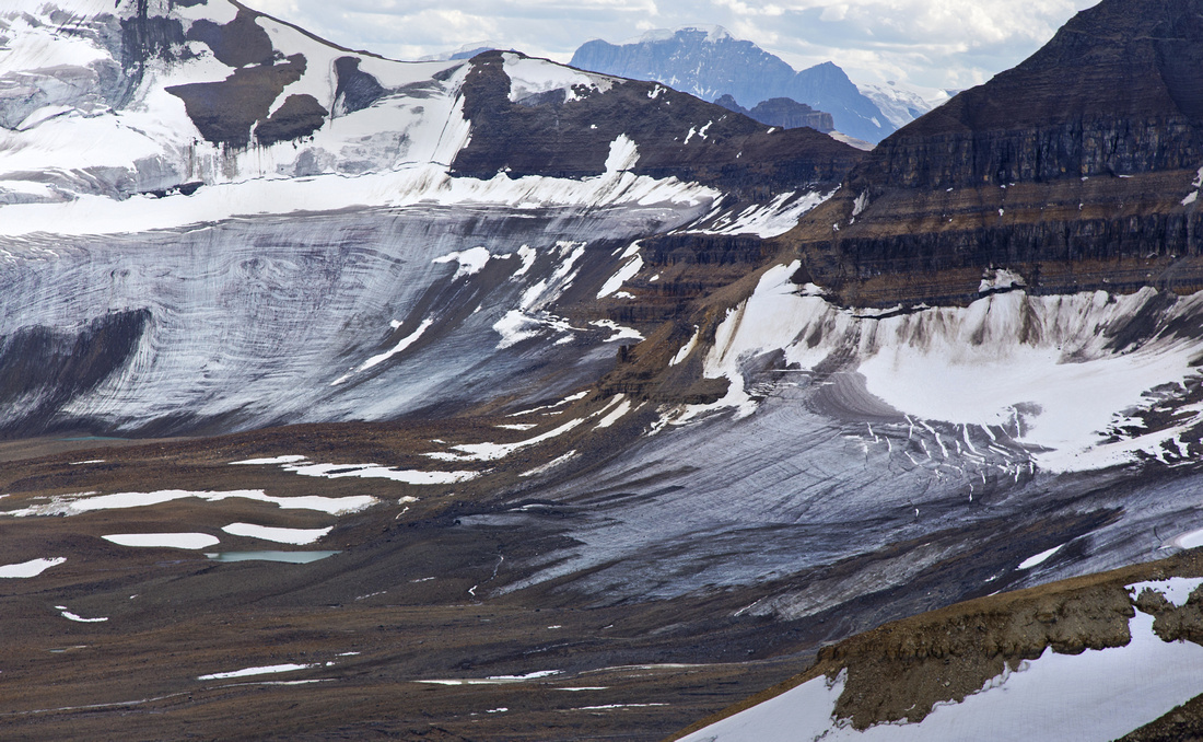
Follow the ridge all the way to the summit, avoiding couple of gendarmes on left or the right side. There are couple of minor class 2 steps but no difficulties. Summit panorama is one of best in the Rockies and includes giants like Mt. Bryce and Mt. Columbia. On the other side of the valley are Snow Dome, Athabasca and Andromeda. Directly ahead is Saskatchewan Junior. Unfortunately intervening ridge, although it appears easy from the top becomes technical lower down. In addition glacier bars the way; ascent is much easier in snow conditions with approach via the valley on the south side.
Return the same way. For a longer day it is possible to trash down from the sub-summit south to the valley, then descend on game trail by Sideways Falls (visible from the flats) down to military road, about 1km from the bridge and parking. This is exploratory route and will require a very long day. |
|
Gallery |
|||
 Big Bend Peak from the parking by old military bridge
 |
|||
 Old military bridge by North Saskatchewan River
 |
|||
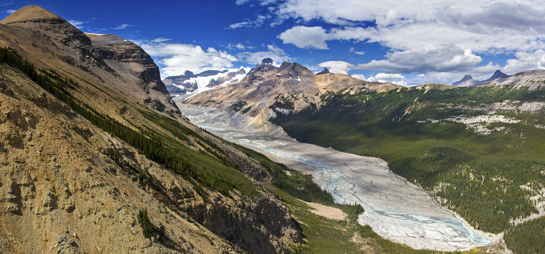 Saskatchewan Glacier Valley from the lower ridge
 |
|||
 Crux of the climb: Very steep and lose talus cone
 |
|||
 BBP Summit Ridge from the sub-summit
 |
|||
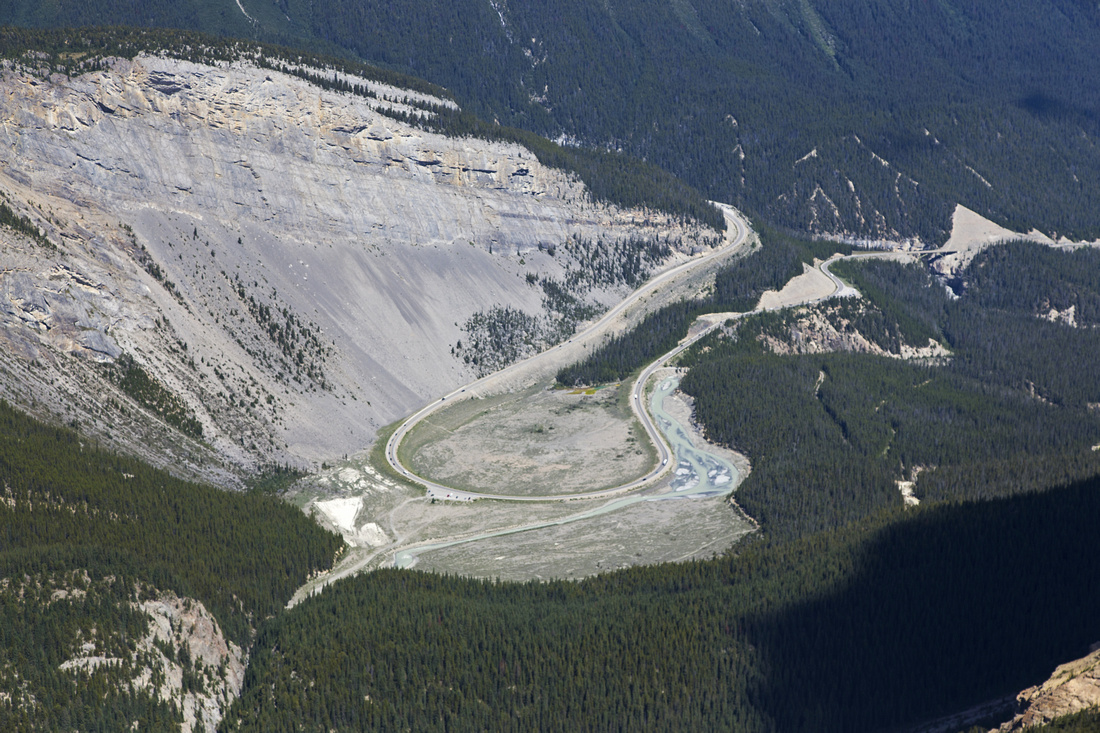 Icefields Parkway / Big Bend from the sub-summit
 |
|||
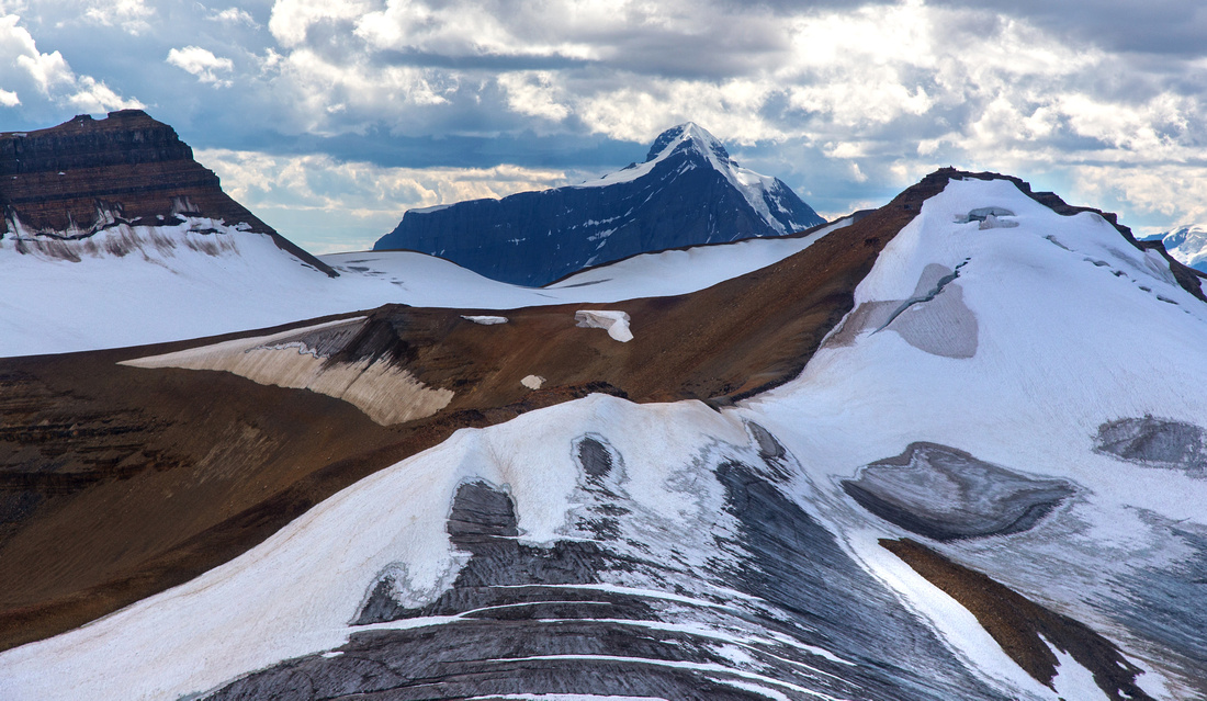
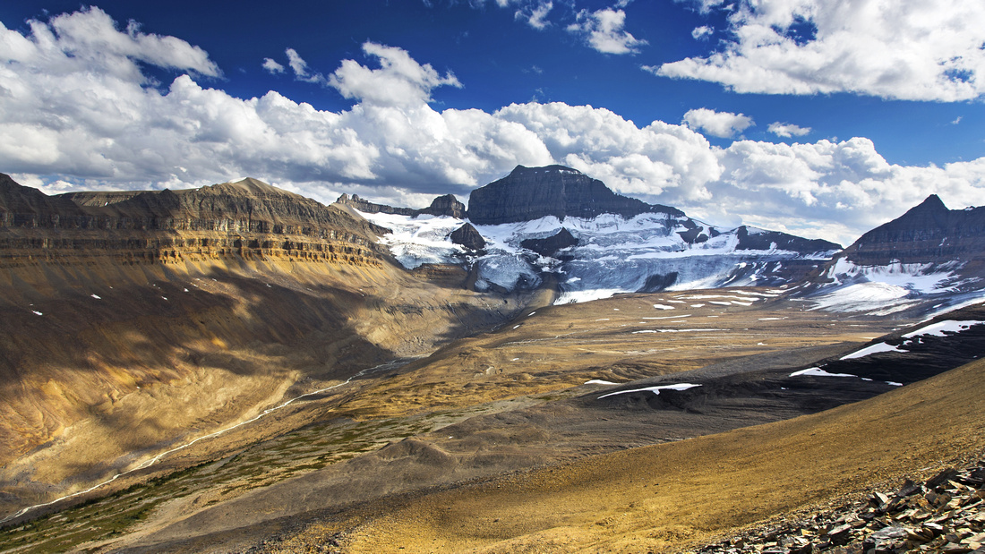 Head of the valley below Mt. Saskatchewan (center)
 |
|||
 Final BBP ascent ridge. Bypass gendarme to the left
 |
|||
 BBP summit panorama
 |
|||
 Mt. Castleguard
 |
|||
 Mt. Bryce
 |
|||
 Mt. Columbia
 |
|||
 View back from BBP summit showing ascent ridge above sub-summit
 |
|||
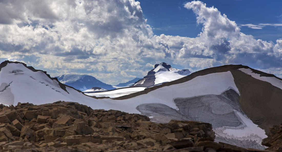
 Col between Mt. Saskatchewan and the Towers - alternate route to Castleguard Meadows
 |
Abstract
| Overall Difficulty | D5 | Moderate bushwhacking. Very steep and lose talus slopes. Minor class 2 rock steps in upper ridge. | |||
| Snow Factor | S5 | Steep and exposed slopes with high-avalanche danger. You must be able to properly evaluate snow conditions and carry avi gear. Not recommended for winter ascent; mountaineering | |||
| Scenery | Fantastic views in the heart of the Icefields including major peaks like Mt. Saskatchewan, Castleguard, Mt. Bryce, Mt. Columbia, Andromeda and Athabasca | ||||
| Trail/Marking | None | Except for initial part that follows Saskatchewan Glacier access trail, entire ascent is off trail. Occasional cairns on upper ridge | |||
| Suggested Time | 7-8 hr | Return time from the summit of Big Bend Peak. Add several hours if dropping to the head of the valley below Saskatchewan Towers | |||
| Elevation | Start: 1680m Max: 2820m Total: ~1200m | Round Trip: 16 km | |||
| Gear | Full hiking boots. Poles and gaiters essential. GPS helpful for navigation in lower part. Climbing helmet - optional. | ||||
| Water | Except for river flats right at the start this is very dry hike. Possibility of snow patches on upper ridge. Carry 3L minimum. | ||||
| Dog Friendly | Yes | Standard bear country precautions | |||
 Big Bend Peak GAIA Map
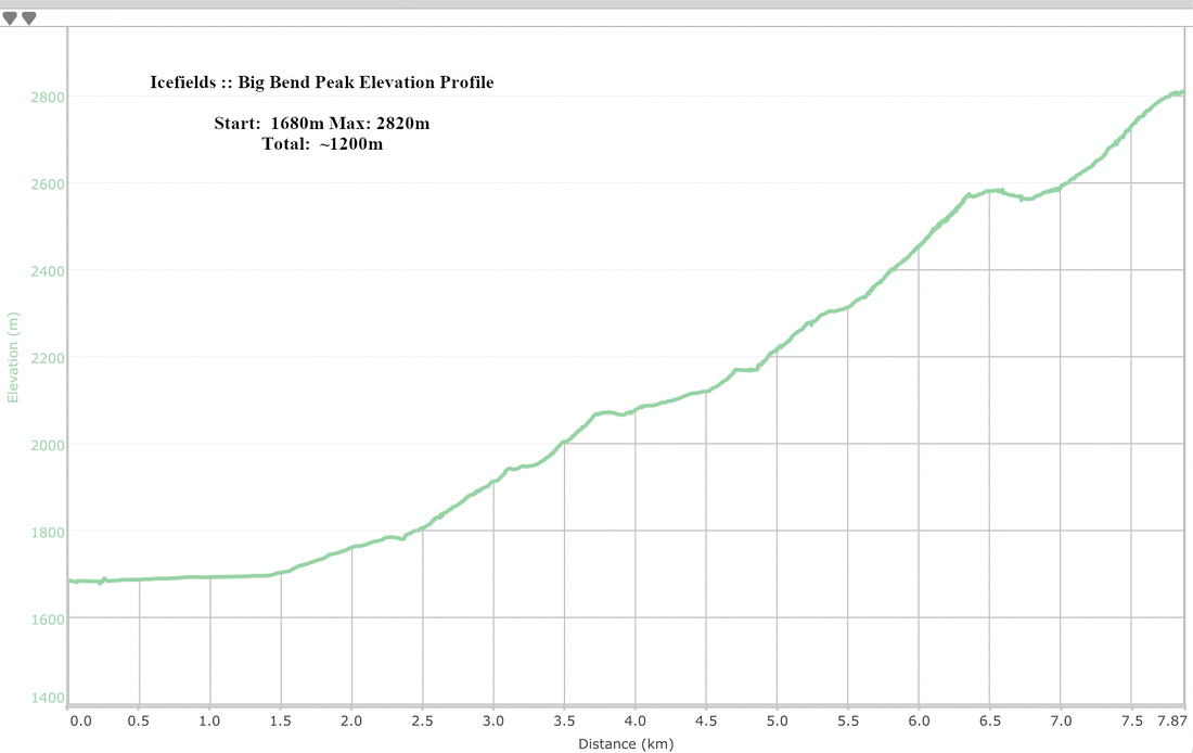 Big Bend Peak Elevation Profile