Google Map |
Rockies :: Icefields :: Parker Ridge |
GPS Track |
|
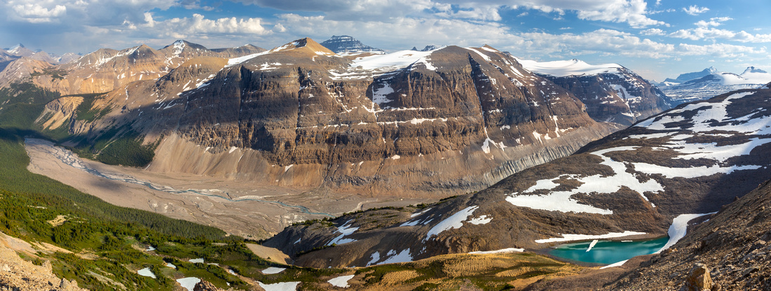
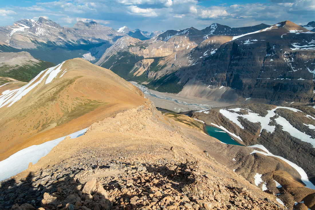
Panoramic view south from lower east Athabasca Ridge. Saskatchewan Glacier Valley below, Big Bend Peak directly across, dark hulk of Mt Saskatchewan behind. Mt. Bryce and Castleguard Mountain extreme right |
|||
| Trip Summary | |||
June 8, 2023Parker Ridge is well known easy outing leading to fantastic viewpoint in the heart of Icefields. Hike is documented in Patton&Robinson Canadian Rockies Trail Guide and being family friendly quite popular. Parks maintained trail splits of signed parking lot on west side of Trans-Canada highway few km south of Columbia Icefields Center, already in Banff National Park. Wide switchbacks effortlessly gain low saddle in ~40 minutes. There are many signs asking hikers not to use shortcuts and stay on trail in order to prevent erosion. Once on saddle views really open up and it is quite amazing one can achieve such superb viewpoint with so little effort. Parker Trail continues another 10 minutes or so to great viewpoint of Saskatchewan Glacier Valley and Mount Castleguard; you are not likely to have it to yourself though. This part, normally known as "Parker Ridge", can be completed in 2hrs return time.
Options to escape crowds, as usual, exist. First follows less defined trail from Parker saddle to the north aiming for elegant ridge rising towards shoulder of Mt. Athabasca gaining ~400m vertical along the way. This ridge looks hiker friendly and I am quite amazed it has largely stayed below the radar. There are two bumps, along the way; to ascend first one either skirt on talus trail to climber left, or ascend directly on snowpatch that persists late in season. Only last few steps below second bump ("Parker Summit") are light scrambling, remainder is "hands in your pockets" kind of stuff - see Gallery. Parker Summit is probable turnaround point although it might be feasible to drop into rocky basin directly below then angle past lovely and unexpected tarn, then reconnect with trail below first bump. Other option is to visit rounded shoulder on east side of Parker Trail. Absence of Trails is quite surprising in as it is very logical extension. 20-30 minutes only of gentle ascent on grass and small rock outcrops leads to fantastic viewpoint, much better than official end of Parker Trail. Much wondering on this plateau is possible, including high viewpoint directly above Trans Canada Big Bend. I usually combine both these options when visiting the area. |
|
Gallery |
|||
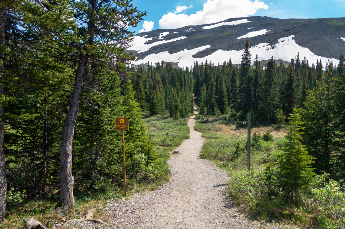 Parker Trailhead Parker Trailhead Wide trail just starting up just below Parking lot
 |
|||
 Parker Trail
Many wide switchbacks with fences and signs to prevent shortcuts. Hilda Peak center, Mt. Athabasca to its left Parker Trail
Many wide switchbacks with fences and signs to prevent shortcuts. Hilda Peak center, Mt. Athabasca to its left |
|||
 Parker Saddle
Broad saddle after ~45min from Parking. Parker trail continues another 10min ending at Saskatchewan Glacier viewpoint. Turn right for East Athabasca Ridge. Big Bend Peak across Parker Saddle
Broad saddle after ~45min from Parking. Parker trail continues another 10min ending at Saskatchewan Glacier viewpoint. Turn right for East Athabasca Ridge. Big Bend Peak across |
|||
 East Athabasca Ridge
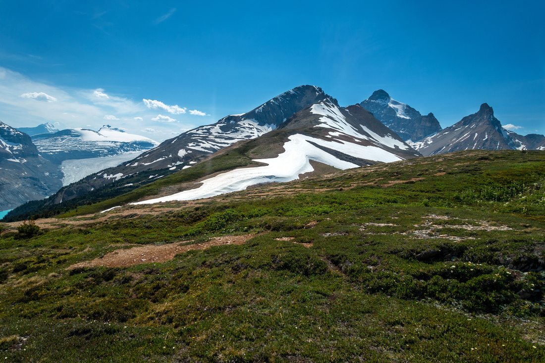
Gentle slopes of East Athabasca Ridge extension, leading to 2 bumps center right, 1hr away. Bryce and Castleguard left East Athabasca Ridge
Gentle slopes of East Athabasca Ridge extension, leading to 2 bumps center right, 1hr away. Bryce and Castleguard left |
|||
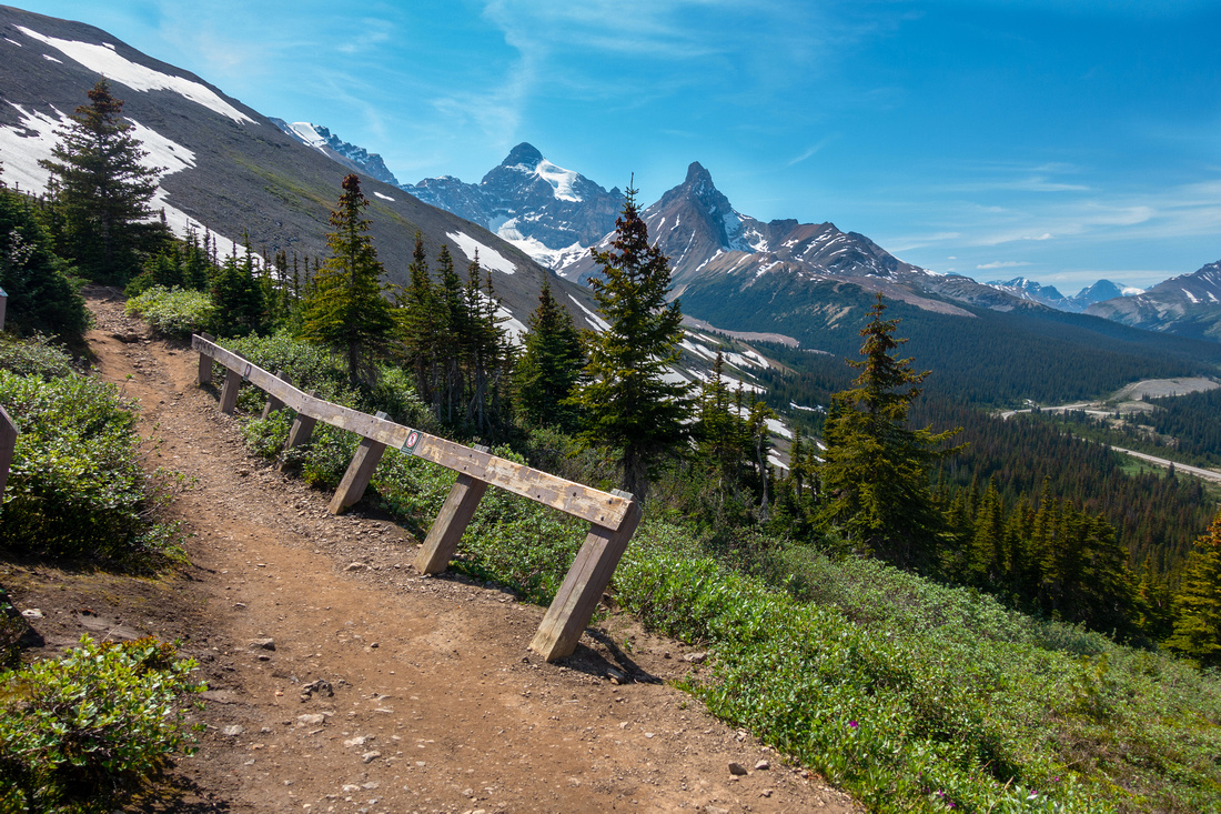
 East Athabasca Ridge
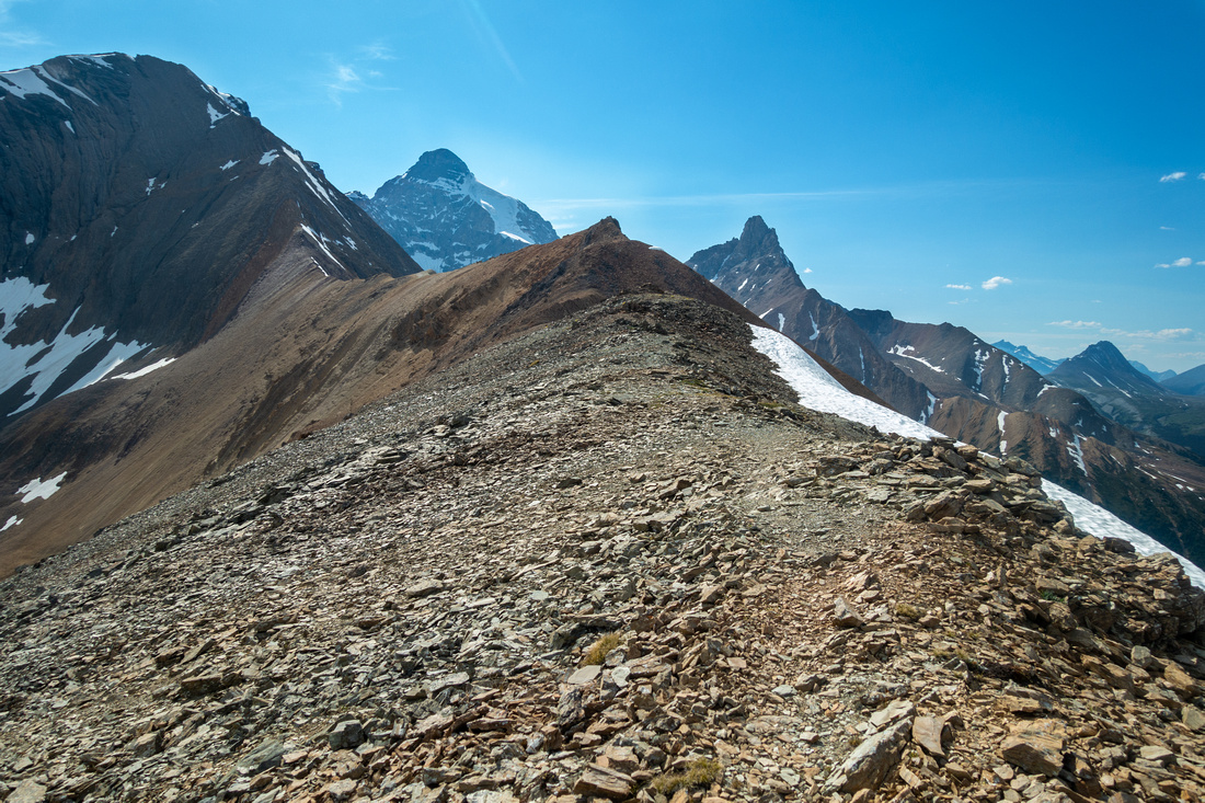
Talus saddle below first bump. Easy scrambling to end of trail at "Parker Summit", sandwiched between Mt. Athabasca (L) and Hilda Peak (R) East Athabasca Ridge
Talus saddle below first bump. Easy scrambling to end of trail at "Parker Summit", sandwiched between Mt. Athabasca (L) and Hilda Peak (R) |
|||
 |
|||
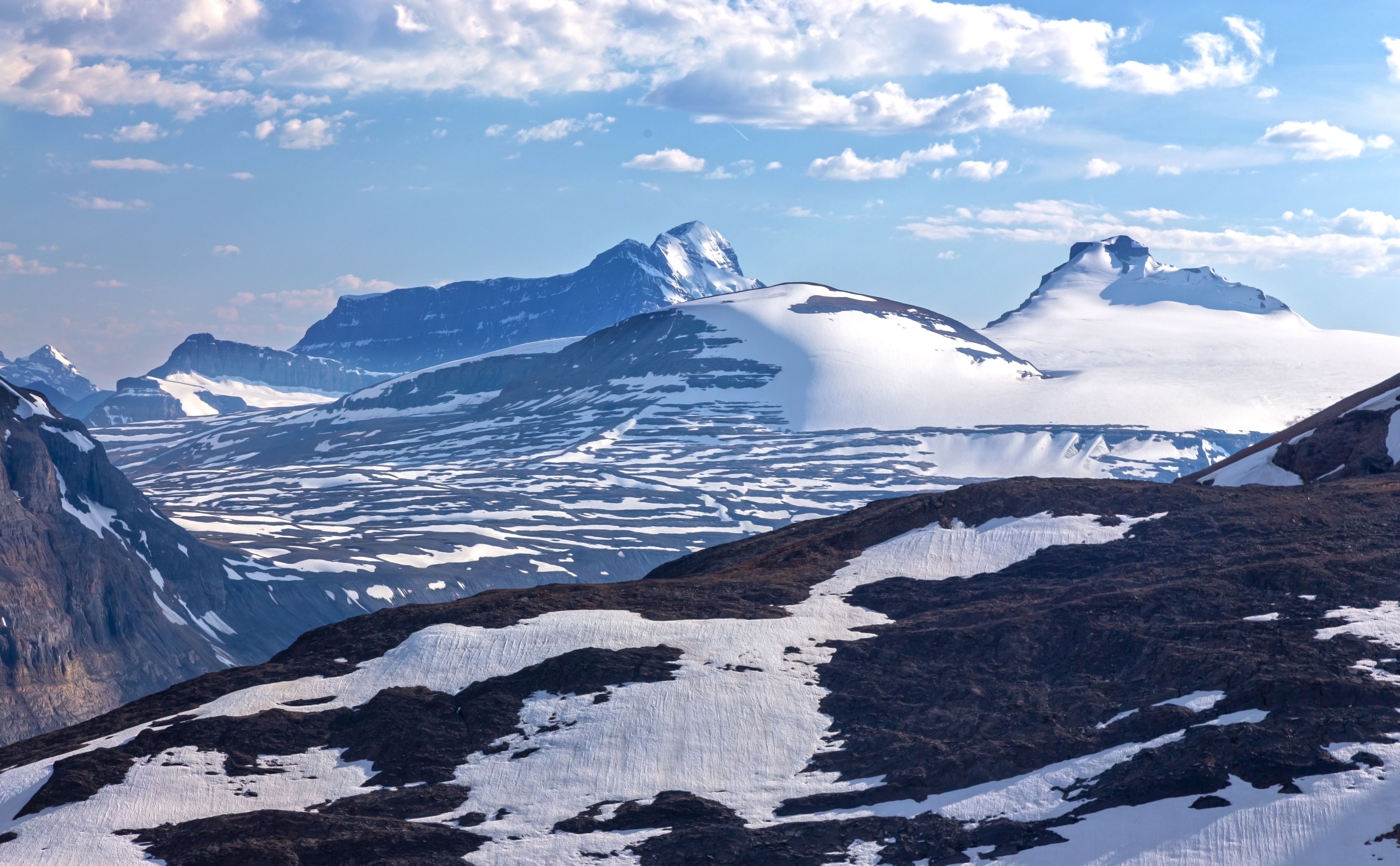
 South Athabasca Ridge
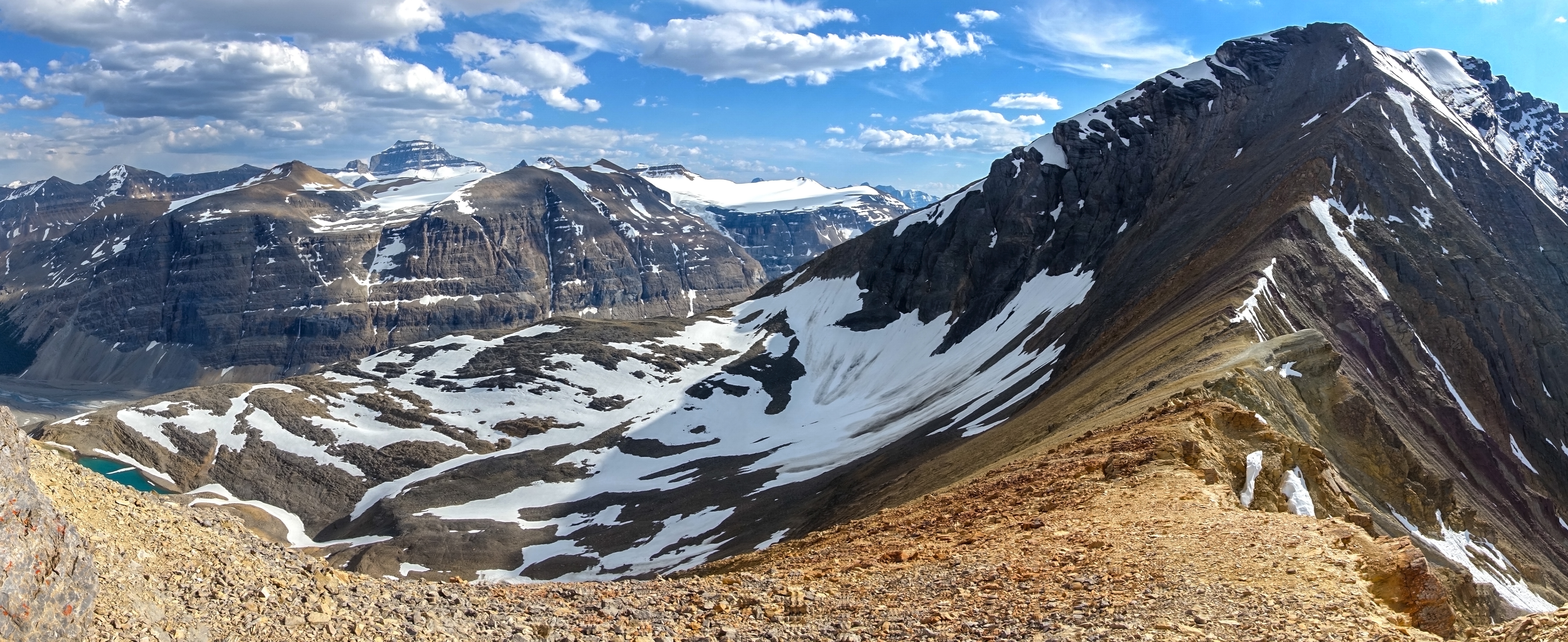
Looking down lower part of South Athabasca Ridge from "Parker Summit". End of Parker Ridge trail is extreme center left. Note hidden tarn below center right - easily visited off trail from by angling down from below first bump South Athabasca Ridge
Looking down lower part of South Athabasca Ridge from "Parker Summit". End of Parker Ridge trail is extreme center left. Note hidden tarn below center right - easily visited off trail from by angling down from below first bump |
|||
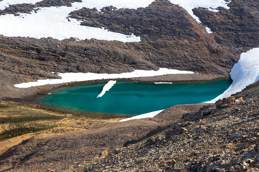 Parker Tarn
"Parker Tarn" close-up on descent; unexpected and very beautiful Parker Tarn
"Parker Tarn" close-up on descent; unexpected and very beautiful |
|||
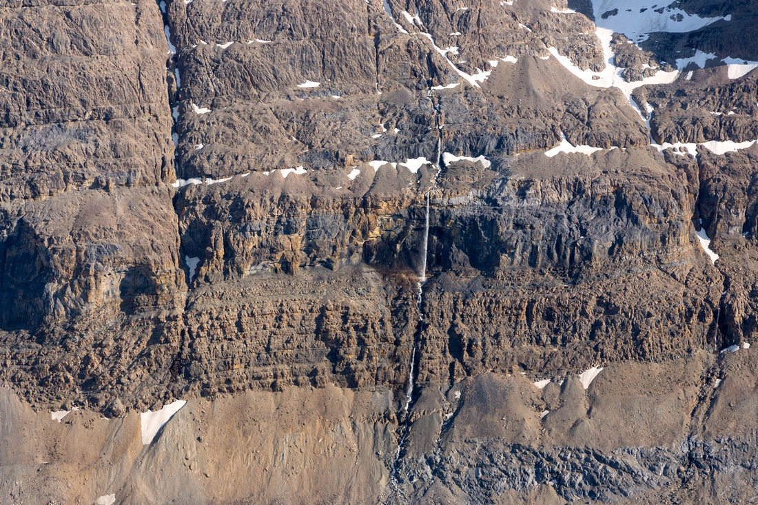 Big Bend Waterfall
Terrific drop from Big Bend Peak on the other side Big Bend Waterfall
Terrific drop from Big Bend Peak on the other side |
|||
 |
|||
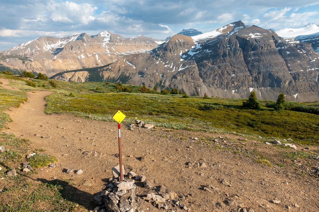
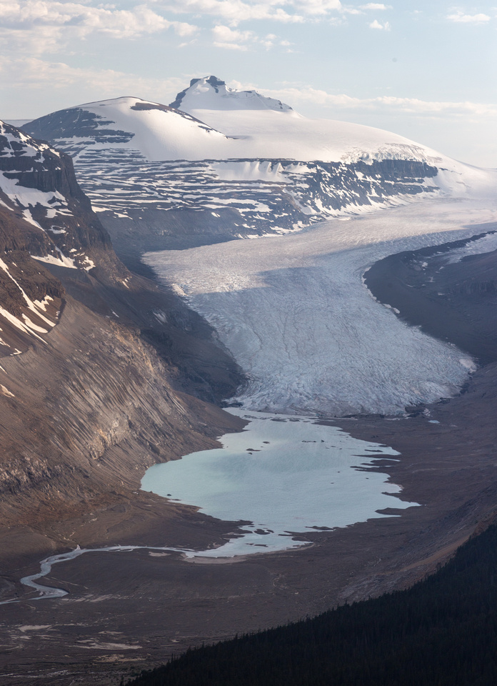
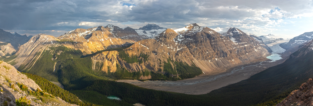 Saskatchewan Glacier Valley
 panorama from bump on east side, ~29-30min from Parker saddle. This valley is Well known winter ski trip. I visited Glacier toe in October '17 and it stands as one of most memorable Icefield trips. Saskatchewan Glacier Valley
Saskatchewan Glacier Valley panorama from bump on east side, ~29-30min from Parker saddle. This valley is Well known winter ski trip. I visited Glacier toe in October '17 and it stands as one of most memorable Icefield trips. |
|||
|
Saskatchewan Glacier Telephoto with Castleguard Mtn behind. Glacier has retreated significantly in recent time. There was lot of haze in the air so photo is not crisp, but with clear air this is terrific early to mid morning photo opportunity |
Abstract
|
Overall Difficulty |
Gentle trail hiking on wide switchbacks for Parker ridge; easy scrambling for East Athabasca Ridge |
||||
|
Snow Factor |
Ascent slope above Icefields has avalanche potential in unstable snow conditions |
||||
|
Scenery |
Heart of the Icefields. Saskatchewan Glacier, Big Bend Peak. East Ridge of Mt. Athabasca, distant Mt. Bryce and Castleguard Mtn |
||||
|
Trail/Marking |
Excellent |
Wide, marked and maintained trail for Parker Ridge. Obvious and cairned route for east Athabasca Ridge extension. |
|||
|
Suggested Time |
5 hr |
2hr return for Parker Ridge only. Add 2-3 hrs for exploring east Athabasca Ridge and Parker East side |
|||
|
Elevation |
Start: 2040 m Max: 2635m Total: ~650m (250m for Parker Ridge) |
Round Trip: ~12km (5km for Parker Ridge) | |||
|
Gear |
Full hiking boots preferred to day hikers even when completely dry. Poles helpful for east Athabasca Ridge |
||||
|
Water |
Seasonal snowmelt only. 1L is enough for Parker ridge, more if exploring beyond |
||||
|
Dog Friendly |
Yes |
Keep good control of your pet as this is busy trail |
|||
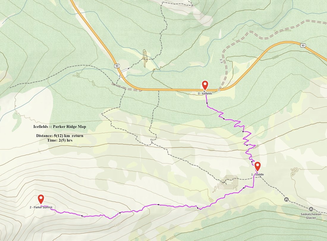 Parker Ridge GAIA Map
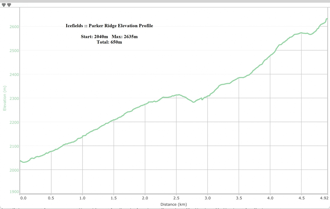 Parker Ridge Elevation Profile