Google Map |
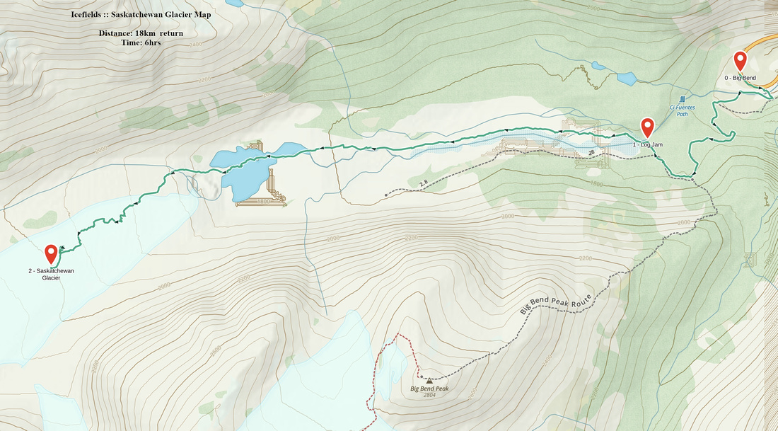
Rockies :: Icefields :: Saskatchewan Glacier |
GPS Track |
|
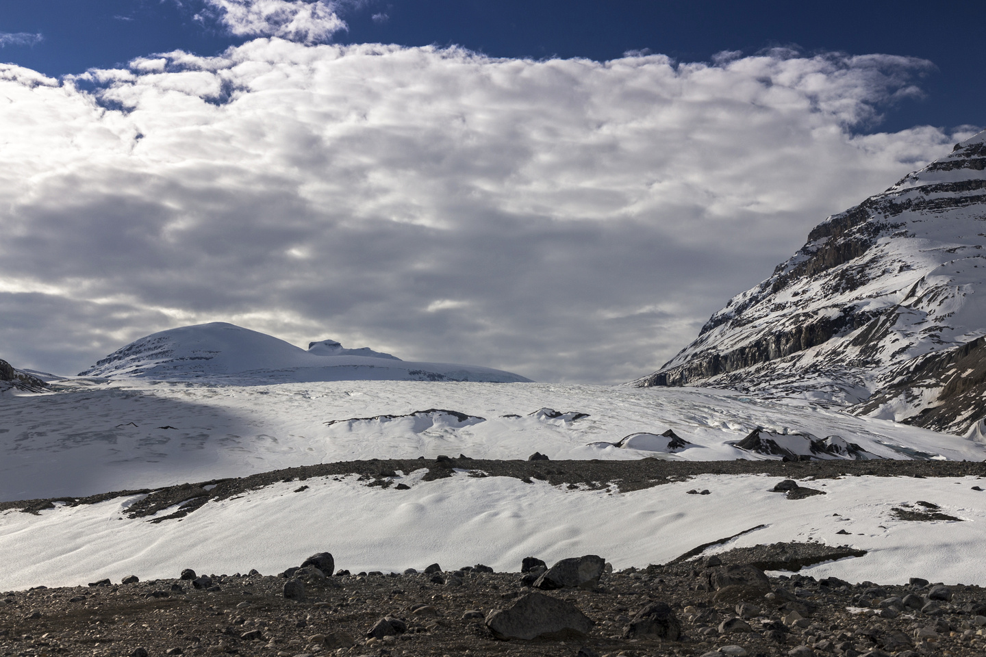
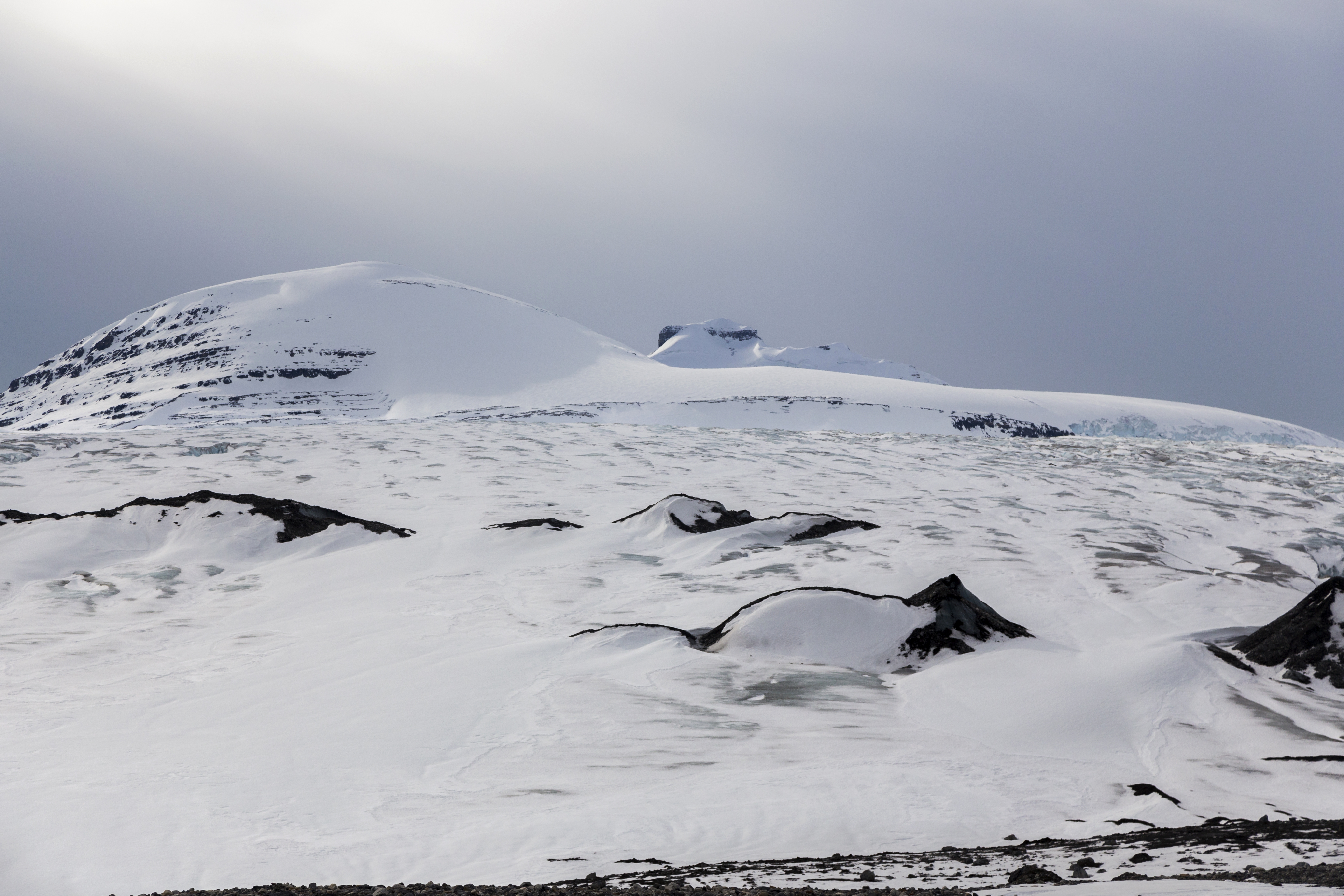
Terminal Moraine at base of Saskatchewan Glacier. Mt. Castleguard left of center looks much closer than it is |
|||
| Trip Summary | |||
October 28, 2017Saskatchewan Glacier valley provides optional access to vast Columbia Icefields Neve (second, more frequently used, starts from Icefields Center on Banff-Jasper Parkway) and several mountaineering objectives, including Mount Columbia. This valley is often admired from popular hike up Parker Ridge -- or from scramble on Big Bend Peak. For non-mountaineers hike to base of glacier is well-worth the effort as scenery of perpetual ice and glaciated peaks is Rockies at their best. Trip is feasible year round; skis in winter conditions provide fastest way to glacier base.
Initial part is shared with approach for Big Bend Peak. Parking is either at Big Bend pullout on Icefields Parkway, or on old military bridge about 1km further east. In late summer it is unnecessary to park at the bridge as creek can easily be negotiated even without taking the boots off; in winter and spring snow bridges can be used (caution!). Either way, find start of old forest road and follow across the initial hill and down to start of the valley. Road ends near old cabin; continue on the right (north) side and find log jam to cross canyon draining the valley. This log jam is sturdy, but fall is not an option as it would lead to serious injury or death -- carefully pick your way across. Once past this obstacle, trail disappears -- simply follow your nose for 5-6 km to base of the glacier. Stay on the right side (cairns); in the past several parties have followed the left side only to find insurmountable obstacle near the glacier and having to backtrack. Large glacial melt 1-2 km before the glacier is real treat; deep blue water, ice, small beaches and mountain peak reflections! Eventually reach base of glacier some 9km from parking at Big Bend. It is hard to tell where glacier actually starts; best way to tell is maybe when your feet start sinking in "quicksand" -- soft, glacial puddles that suck your boots deep in. This is more serious than it might sound as you might have problems pulling your feet out. There are also several large rocks that provide shelter from cold wind that blows almost always from the glacier -- appropriate lunch break spot and turnaround point.
Continuing on the glacier is in realm of mountaineering. Glacier itself is quite benign and in winter when layer of snow covers it you might think you are simply walking up (never ending) snow slope. Regardless, ice is below and there are crevasses -- glacier travel precautions are mandatory. Of special interest is access to elusive Castleguard Meadows, about 4km up the glacier on the right side. This is serious undertaking but it cuts down boring multi-day approach via Alexandra River. Fit parties have been able to complete this loop as day trip in the past though!
|
|
Gallery |
|||
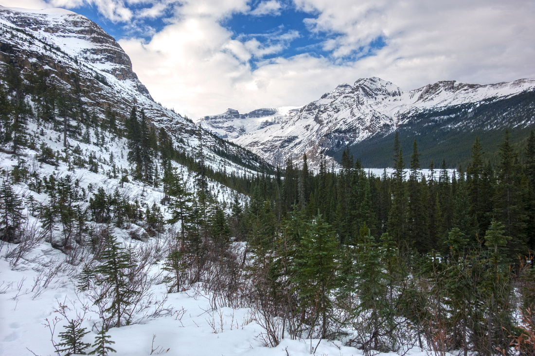 Big Bend Shoulder Big Bend Shoulder Crossing initial rise before descent to glacial valley
 |
|||
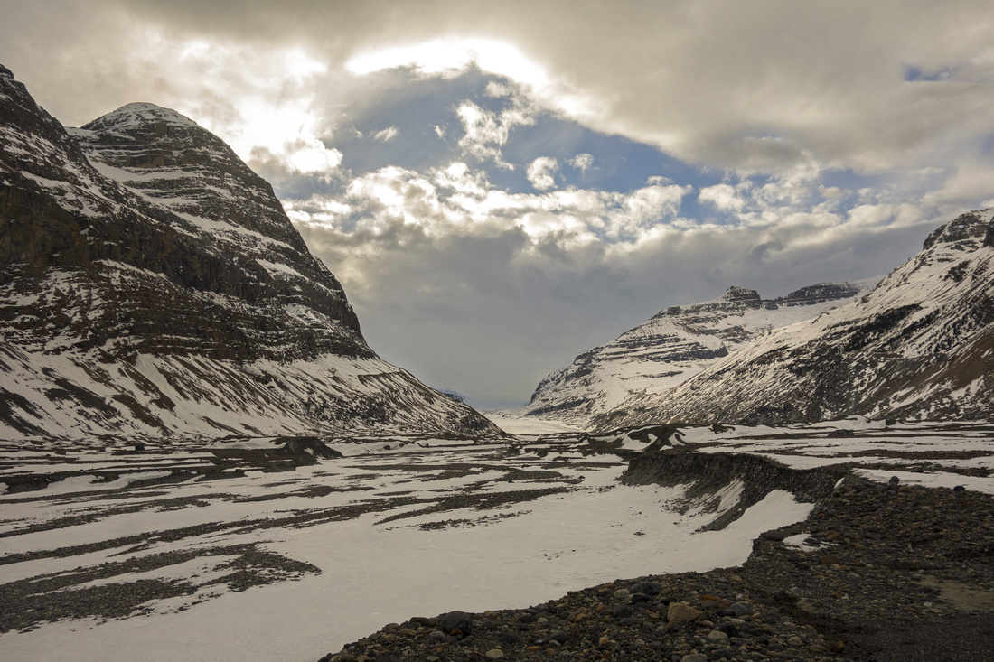 Saskatchewan Glacier Valley
Valley mid-point with ~5km to base of the glacier Saskatchewan Glacier Valley
Valley mid-point with ~5km to base of the glacier |
|||
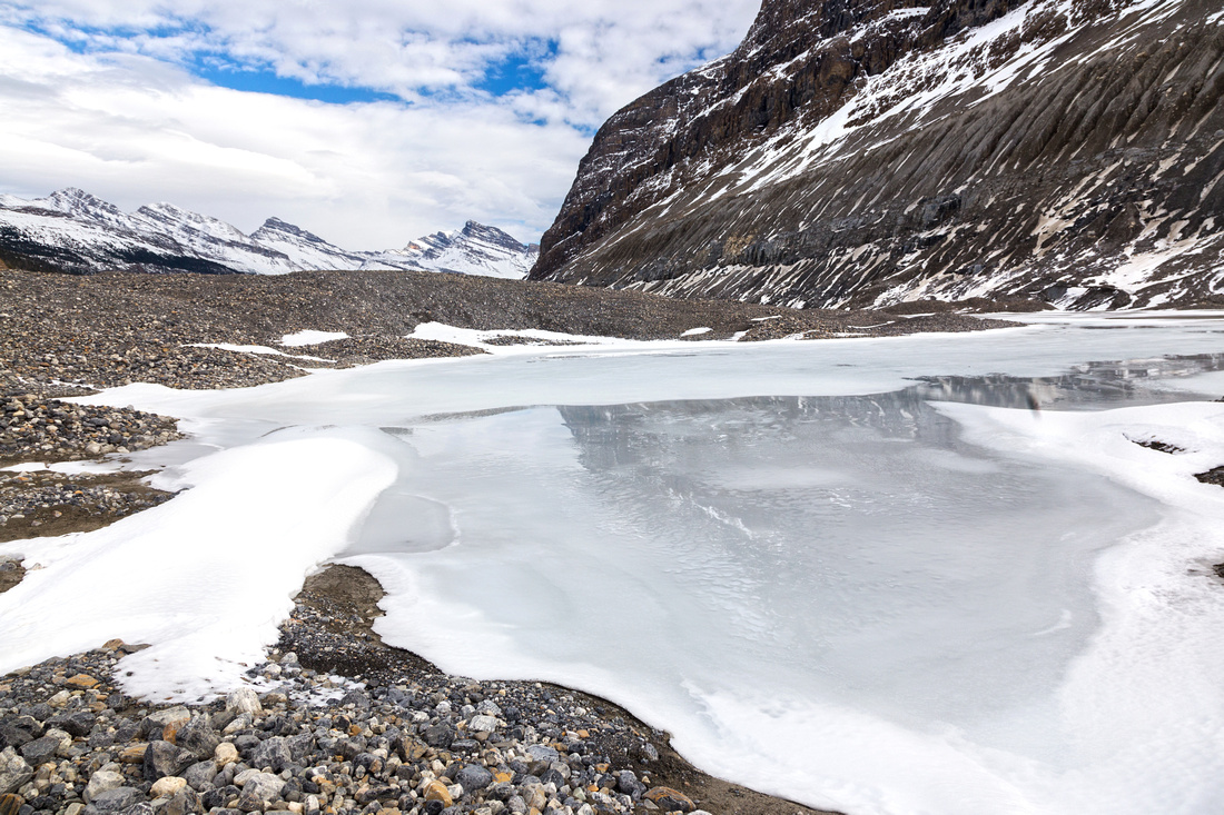
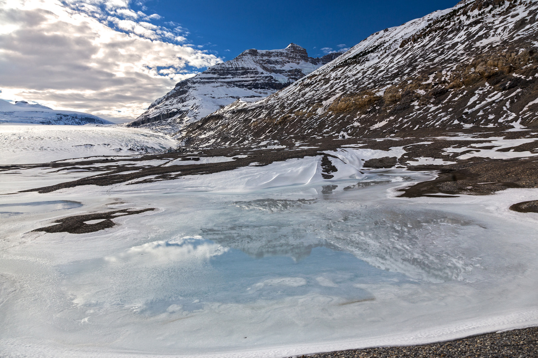 Saskatchewan Glacier Valley
Glacial melt at top of valley; stay on right side! Saskatchewan Glacier Valley
Glacial melt at top of valley; stay on right side! |
|||
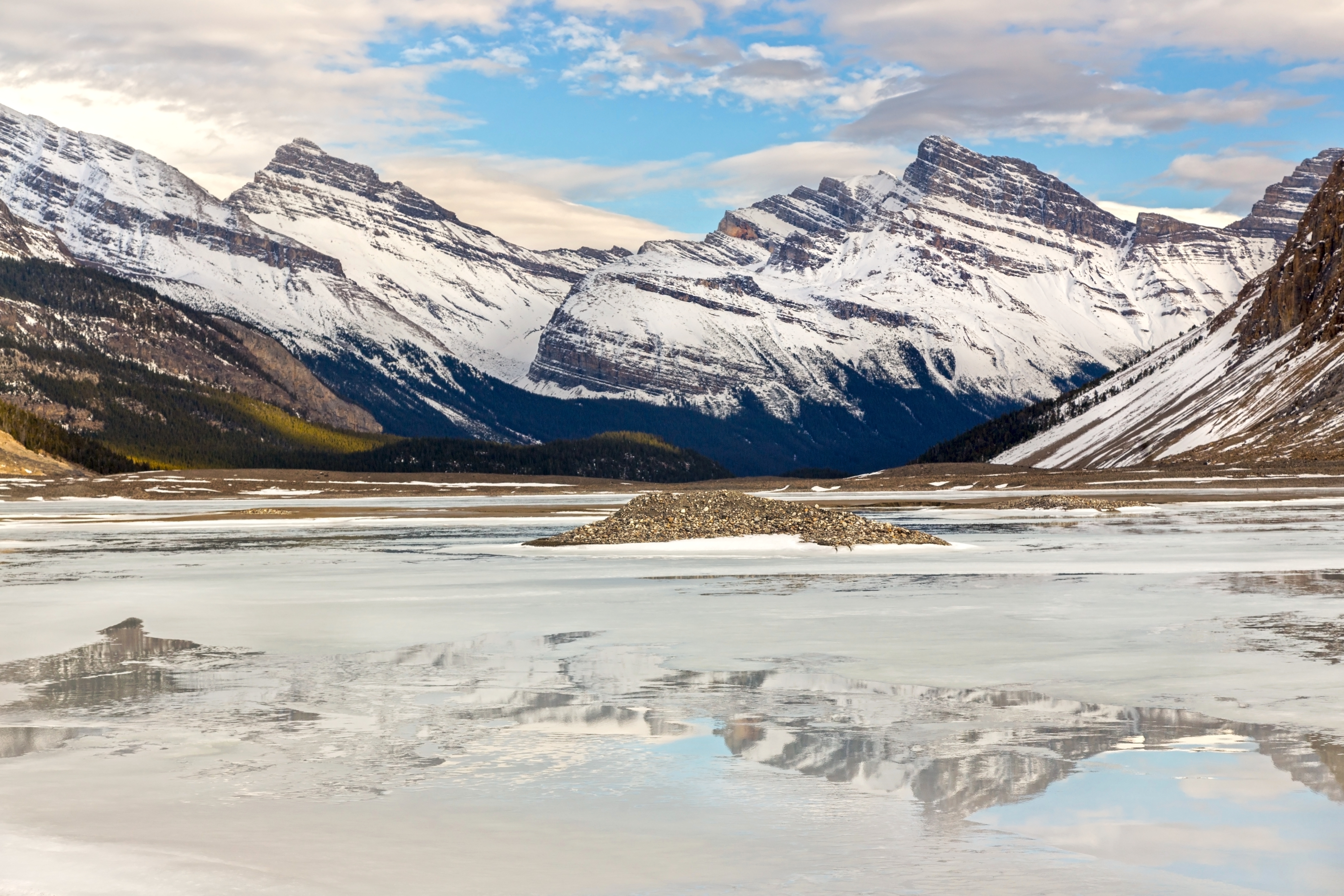
 Saskatchewan Glacier Valley
Same glacial melt looking back towards the Icefields Saskatchewan Glacier Valley
Same glacial melt looking back towards the Icefields |
|||
 |
|||
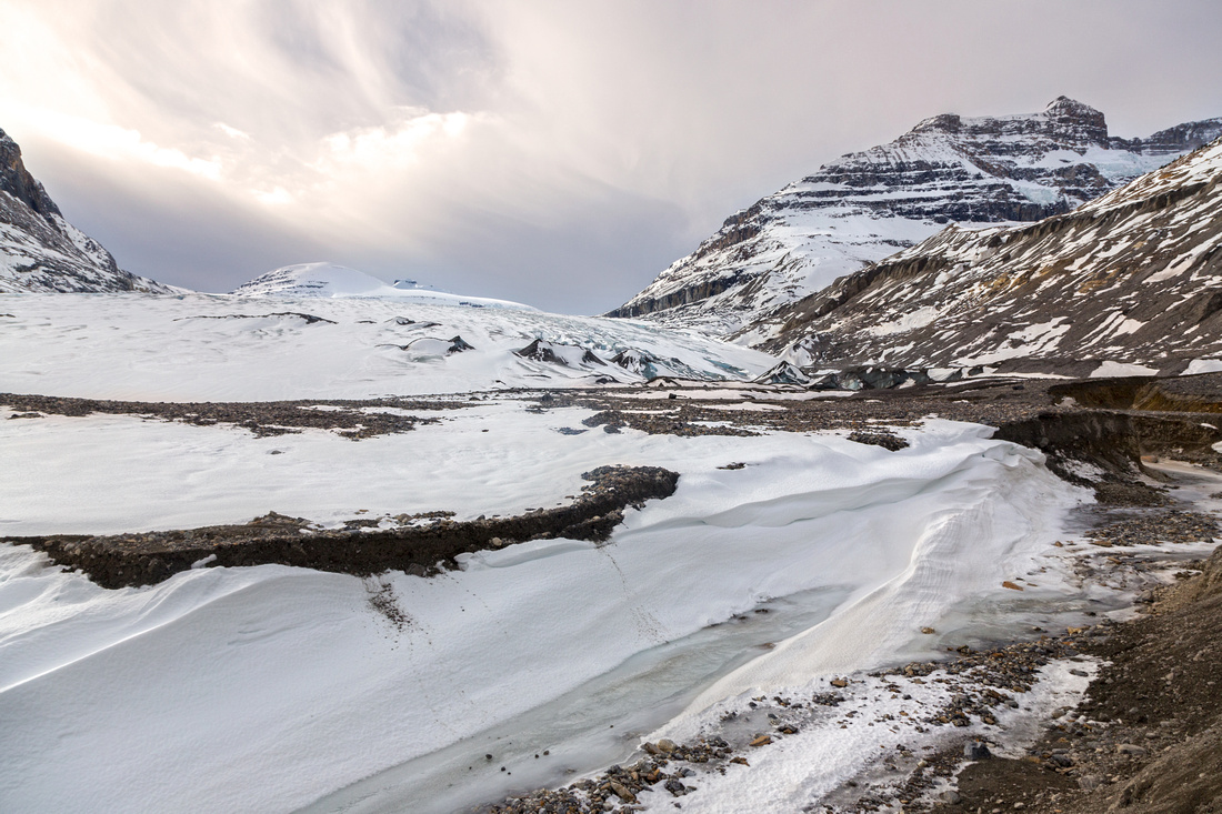 Saskatchewan Glacier Toe
Saskatchewan Glacier Base. Andromeda upper right Saskatchewan Glacier Toe
Saskatchewan Glacier Base. Andromeda upper right |
|||
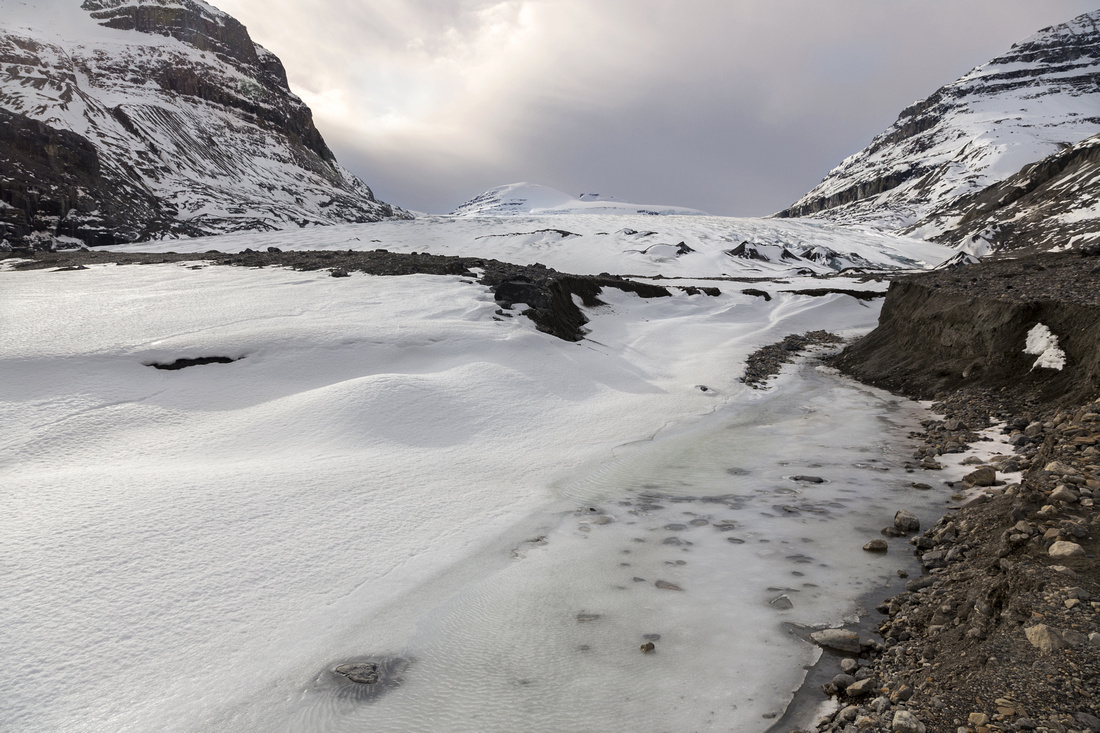 Saskatchewan Glacier Toe
Initial part of glacier travel; hard to tell where ice really starts Saskatchewan Glacier Toe
Initial part of glacier travel; hard to tell where ice really starts |
|||
 |
Abstract
|
Overall Difficulty |
Glacial moraine off-trail travel. One tricky canyon crossing on sturdy log jam near valley start. Continuing on the Glacier is mountaineering and requires proper equipment and skills --regardless of season. |
||||
|
Snow Factor |
Popular winter ski trip; feasible as snowshoe as well. Some brief avalanche danger traversing hill below Big Bend Peak on approach. Most winter trips continue up the glacier to Columbia Neve and/or mountaineering ascent of Castleguard Mountain |
||||
|
Scenery |
"Valley of the Gods" -- deep glacial valley sandwiched between Big Bend Peak and Parker Ridge. Melt pools, distant peaks and impressive Saskatchewan glacier |
||||
|
Trail/Marking |
Good / None |
Old army road to start of the valley (getting overgrown), none after |
|||
|
Suggested Time |
6-7 hr |
Return time to glacier snout with plenty of time for photo breaks and poking around. Significantly longer if continuing up the glacier; both popular objectives (Castleguard Meadows or Mount Castleguard summit are better done as overnight trips |
|||
|
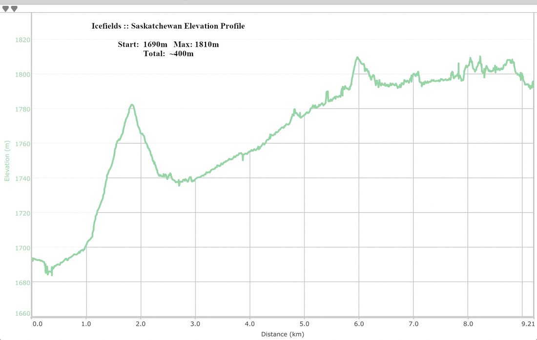
Elevation |
Start: 1690 m Max: 1810m Total: ~400m |
Round Trip: ~18km (glacier base) | |||
|
Gear |
Full hiking boots and poles. Gaiters essential. Skis or snowshoes in winter. Mountaineering equipment -- crampons, ice-axes and ropes for glacier travel |
||||
|
Water |
Several glacial creeks and melt of Saskatchewan Glacier. Carry no more than 1L |
||||
|
Dog Friendly |
Yes |
Standard back-country travel precautions |
|||
 Saskatchewan Glacier GAIA Map
 Saskatchewan Glacier Elevation Profile