Rockies :: Icefields :: Alexandra River
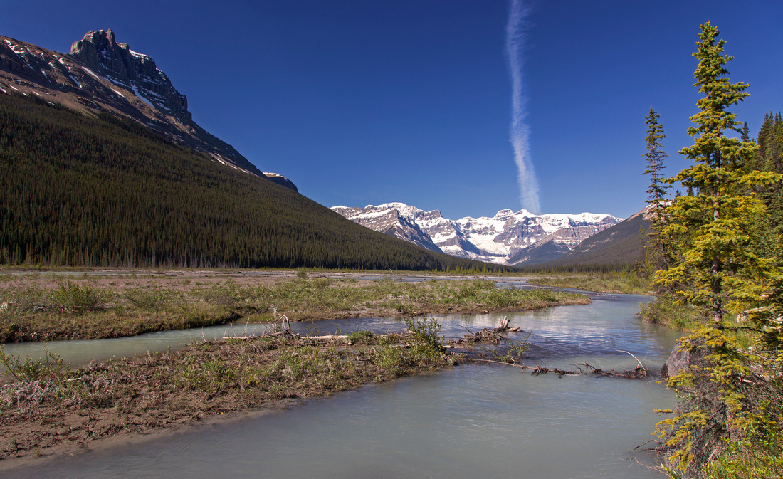 
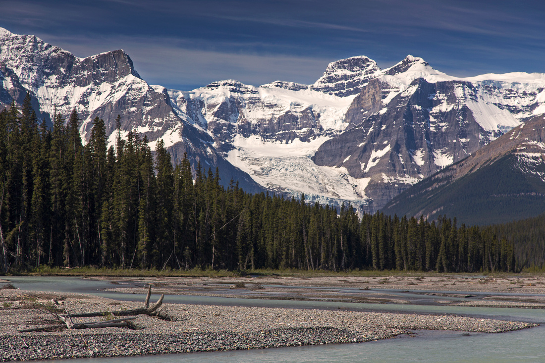
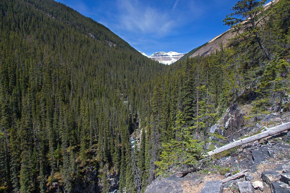
Descending to river flats around 11 km mark with initial crossing just ahead. Hanging glacier of Mt. Alexandra still far down the valley |
|||
|
Alexandra River is one of most beautiful and desolate valleys on the Icefields. Once official trail leading to Castleguard Meadows has been decommissioned and area has reverted back into wilderness. Access is still reasonable due to volunteer effort that tries to keep trail as free of deadfall as possible. Still bridges are long time gone making the trek challenging, and depending on water level sometimes even not feasible. Visit to Alexandra valley is much more natural as backpack for 2 reasons:
For visit beyond Terrace creek, timing is essential. Ford of this creek is the crux of the journey and water level must be low. In late spring it is often swollen from snow melt making the ford dangerous if not impossible. Be ware that in the afternoon/early evenings creek will be harder to cross than in the morning and might leave you stranded! For (very) fit hikers potential day trip objective could be Castleguard Ranger Cabin at confluence of Alexandra and Castleguard Rivers -- or even the lake at toe of Alexandra glacier. This is very long day (48 km for the lake) and can not realistically be recommended.
Mountain bike is asset for 12km (one way) approach. However it is far from cakewalk. Most of the way it is bushy single-track requiring concentration and good biking skills. Bush often flies in your face and your hands will get scratched without gloves or long sleeves. Trail is rolling with several ups and downs, but there is more uphill on return -- bear this in mind as you will be more tired at the end of the day!
(... other parts to follow ...) |
Google Map |
To Terrace Creek |
GPS Track |
|
Park at pull-out at west side of Icefields Parkway some 26km north of Saskatchewan River Crossing. This is not obvious - it will be soon after signed Coleman Day Use area. Hidden from casual eyes rough road descends to Saskatchewan River about 20 meters north from this pullout. It is steep and narrow, but could be driven. Distance is short so probably not worth the effort -- parking at Icefields pullout is recommended. Cross the bridge and mount the bike. Ride in consists of 2 parts:
Around 11km mark trail descends to river level. Soon you come to the spot where ever shifting river course has destroyed the trail and you must ford the outwash channel over to the flats. This is the usual place to leave the bikes and continue on foot. It is a mistake to ford the river immediately where trail has been cut-off. Instead, find the good trail side-hilling for about 5 minutes. It then descends back to river level, where there should be just a single very easy channel to cross -- barely requiring to take the shoes off! Continue across the flats and pick-up the trail at far end - it leads in 10 minutes or so to Terrace Creek. Do not try to cross at site of old bridge - instead descend 100 meters downstream where Terrace has braided into 2 channels, with shrubby island in the middle. Near channel is easy, but far end is wider, deeper and much faster. This is the crux that determines how far you will go on your Alexandra trek. Once again, bear in mind that snow-fed creeks are usually higher late in the day! Primitive campground is just on the other side. If you are turning back here (or camping, so have spare time) worthwhile side trip is exploration of very deep gorge of Terrace Creek, starting soon above the site of old bridge. Do not waste time looking for alternate crossing here -- although at one spot it looks like you might even be able to jump across! ( Fall would most certainly kill you). Indistinct, but reasonably well defined trail can be picked up higher up. It has sections with deadfall, but is generally easy to follow. It rises steeply on right bank of Terrace creek, then higher up goes around several side canyons but always staying close to Terrace canyon. It is possible to reach hanging valley between Mt. Saskatchewan and Terrace Peak this way, thus presenting alternate approach for ascents of these 2 peaks -- or alternate exit if coming in from Castleguard Meadows. |
||
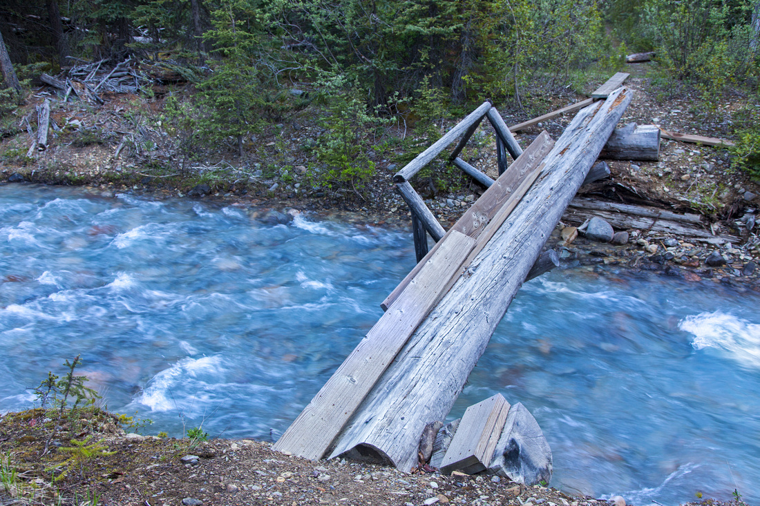 The only left bridge on the trail around 1.5 km mark
 |
|||
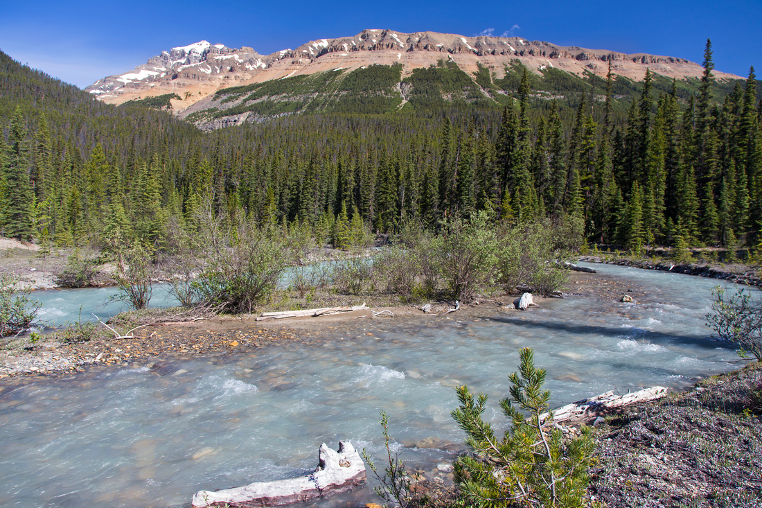
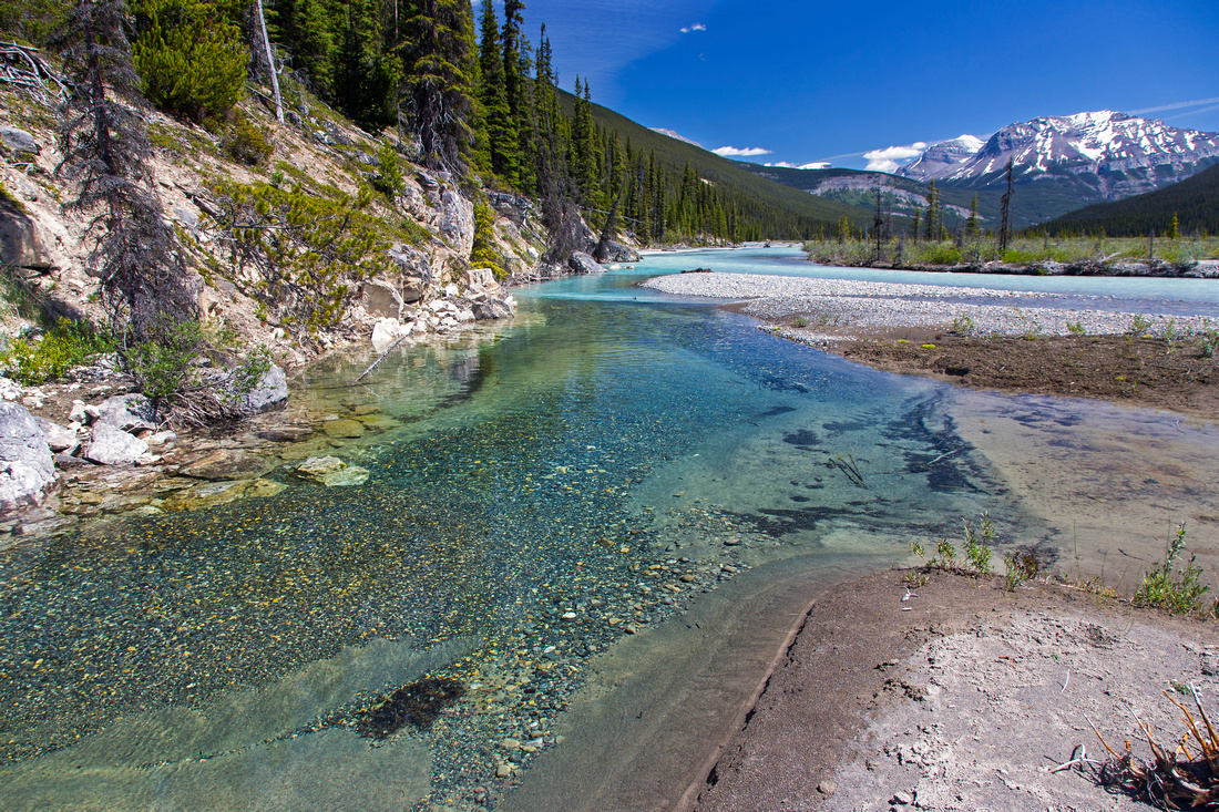 Emerald Alexandra pools looking back to the Icefields
 |
|||
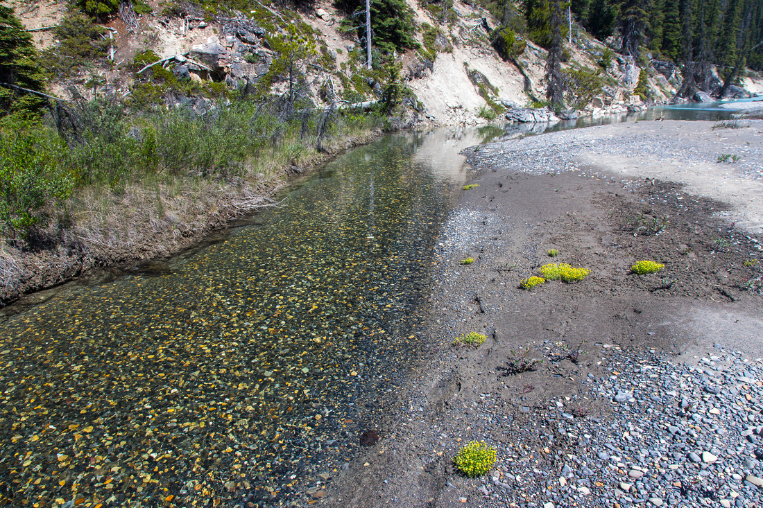 Easy crossing of Alexandra around 12 km mark
 |
|||
 Telephoto towards Alexandra glacier from flats at Terrace creek
 |
|||
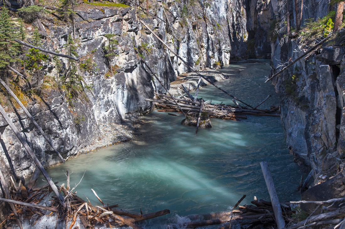
 Old Terrace Creek crossing with bridge long time gone
 |
|||
 Easiest place to ford Terrace creek, couple of minutes downstream from old bridge. Mt. Saskatchewan behind
 |
|||
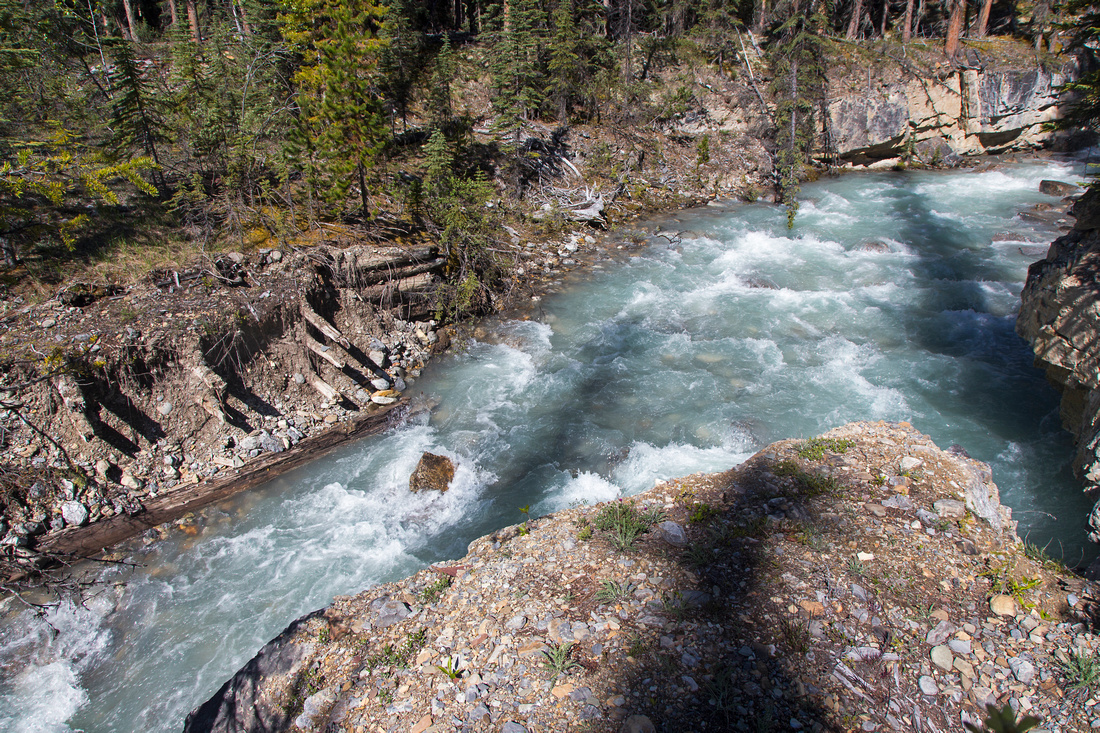
 Deep gorge of Terrace creek above the old bridge
 |
|||
 Upper Terrace creek valley. Terrace Mtn in the distance
 |
Abstract
| Overall Difficulty | D5 | Remote area with non-bridged river fords. Challenging mountain-bike approach on bushy singletrack. Route finding. | |||
| Snow Factor | S3 | Low elevation river flats hike without avalanche danger. Overall remoteness makes it challenging winter trip | |||
| Scenery | Beautiful river flats of Alexandra River with braided channels and smaller emerald pools. Hanging glacier of Mt. Alexandra. Views of Mt. Saskatchewan, Mt. Amery, Cleopatra Needle and Mt. Willerval | ||||
| Trail/Marking | Poor / None | Once official Castleguard Meadows Parks trail falling into disrepair and kept semi-accessible only by volunteer effort. | |||
| Suggested Time | 6-8 hr | Day trip to Terrace Creek only. Continuing to Castleguard cabin or Alexandra Lake is very long day and more realistic as backpack. 3-4 days (return) for Castleguard Meadows. | |||
| Elevation |
Start: 1510m End: 1480m Total: (+285m) (-310m) |
Round Trip: 28 km (Terrace Creek) | |||
| Gear | Day Hikers might be preferred to full hiking boots. Mountain bike. Old sandals for river fords. GPS is essential | ||||
| Water | Alexandra river and many side streams draining into the valley. Carrying ~1L should be sufficient | ||||
| Dog Friendly | No | Dogs are not recommended as this is prime grizzly bear habitat | |||
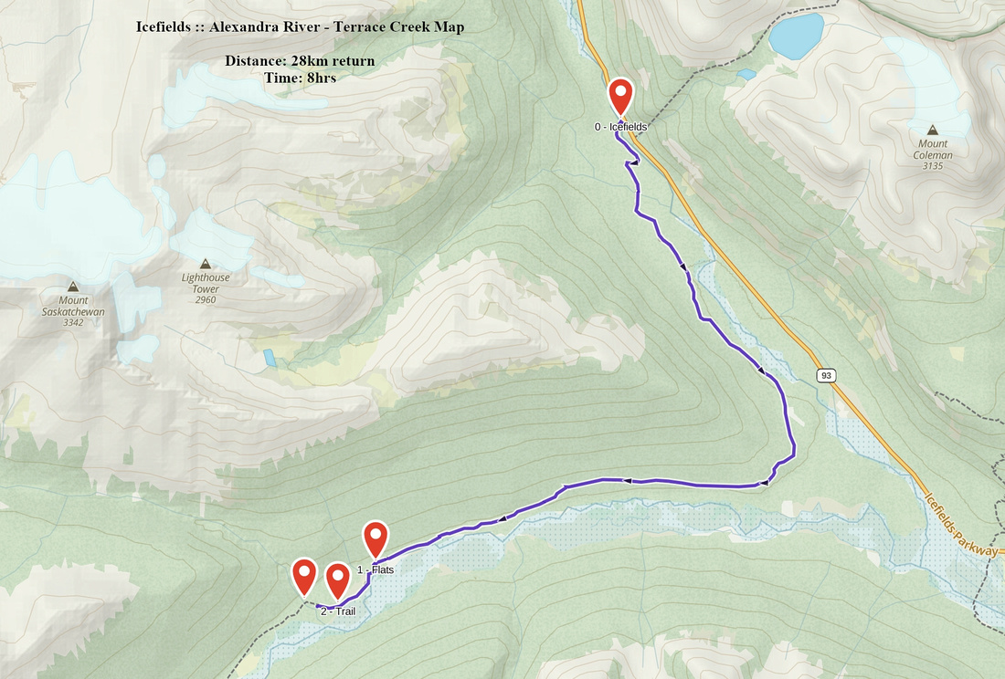 Alexandra River - Terrace Creek GAIA Map
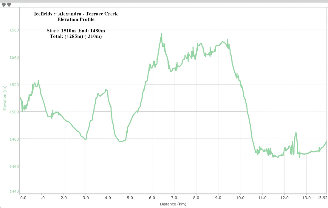 Alexandra - Terrace Creek Elevation Profile