Google Map |
Rockies :: Canmore and Bow Valley ::Grotto Creek Canyon |
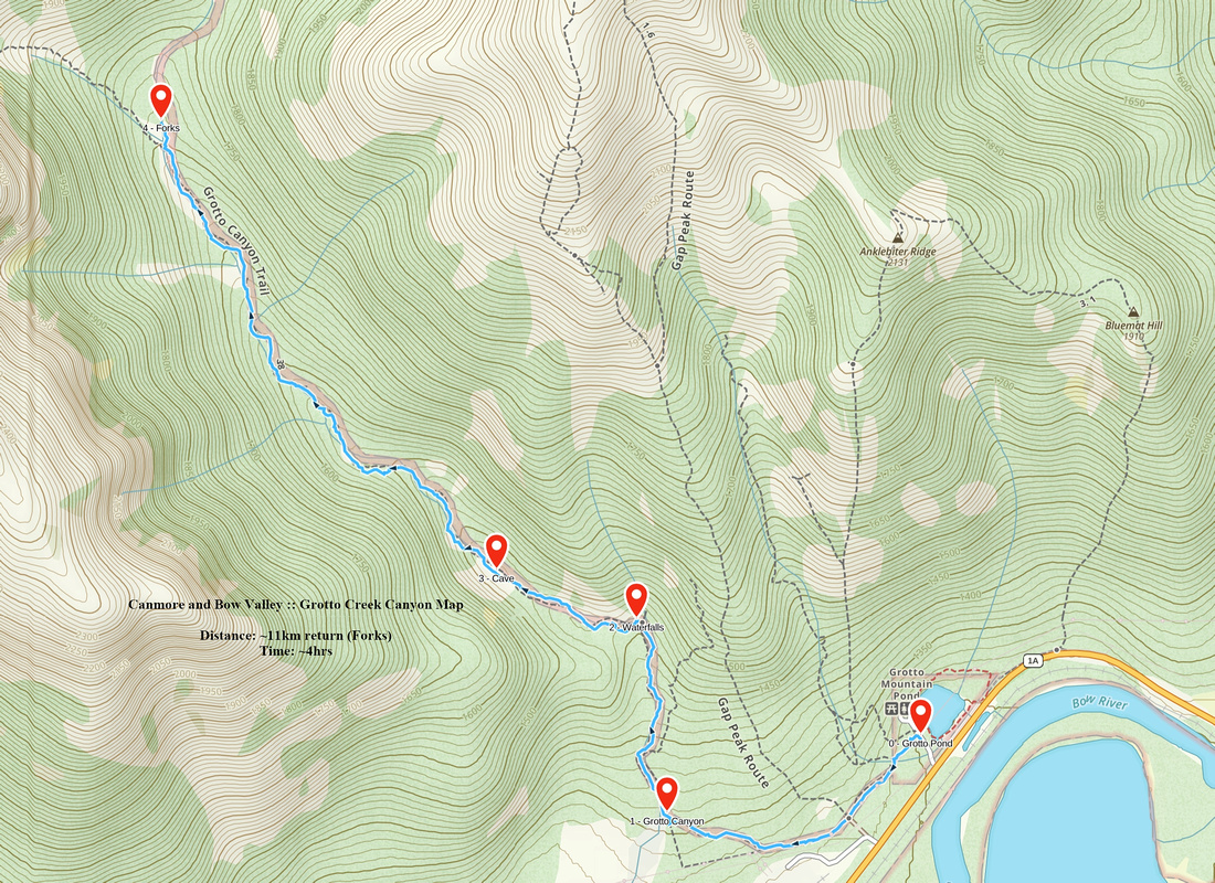
GPS Track |
|
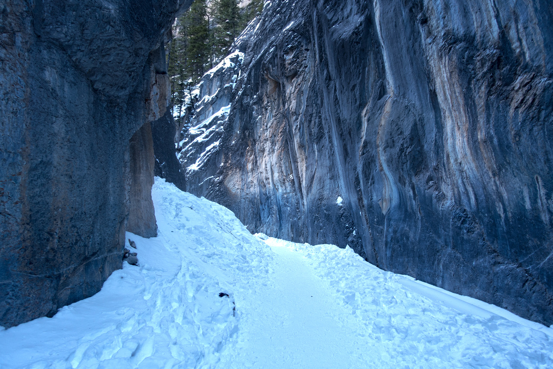 
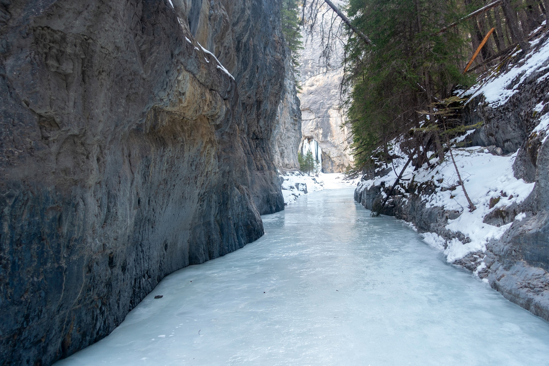
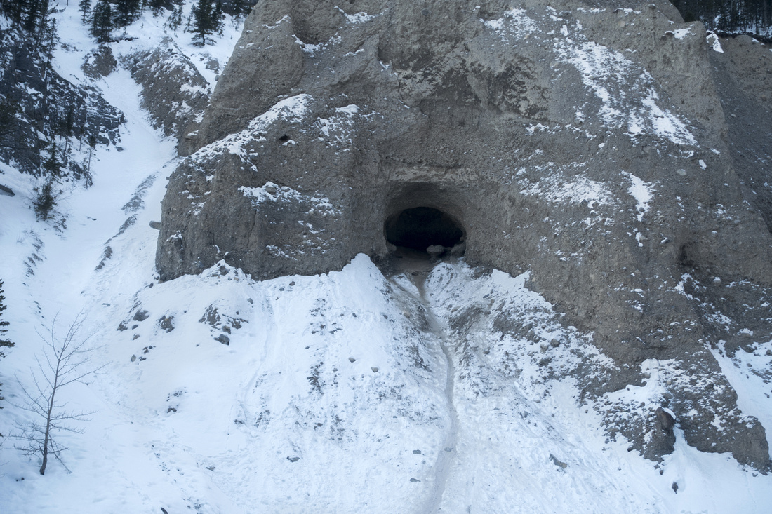
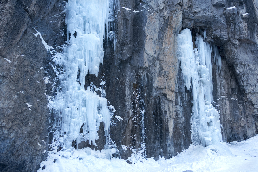
Lower part of the canyon before the Icefalls. Usually impassable during spring runoffs (bypass trail in the forest on right side) |
|||
| Trip Summary | |||
Multiple Dates, last March 19, 2025
North side of Bow Valley has several canyons that penetrate deep into ridges of Fairholme Range. Grotto Creek Canyon is one of these, and well known family hike starting from Grotto Pond day use area on 1A just west of Exshaw. Winter is the time to go because of couple of frozen waterfalls, popular with ice climbers. It is also good choice on a windy day because you are completely shielded.
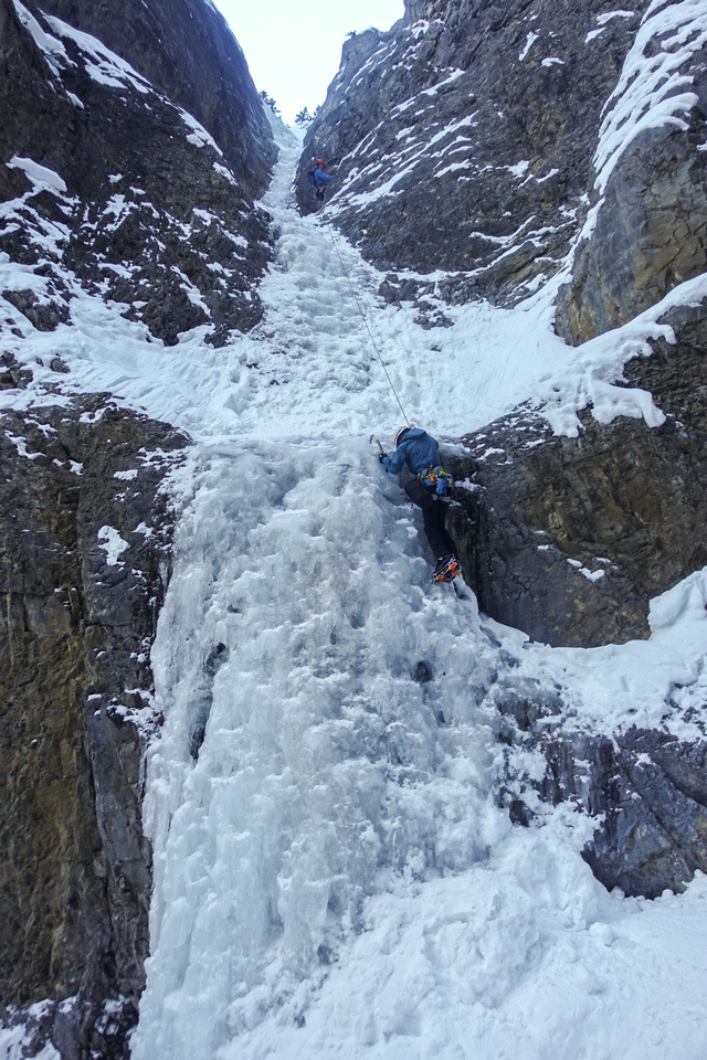
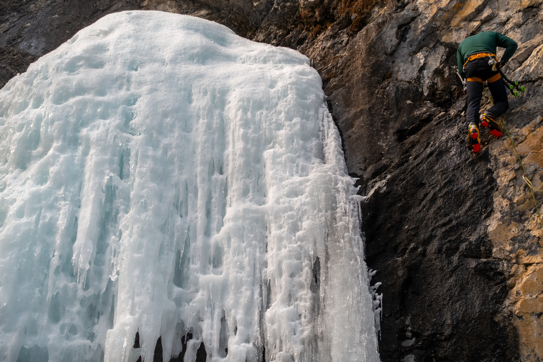
Trail leaves the parking lot on west side by large interpretive sign (first photo in gallery) and follows the powerline for about a kilometer passing Baymag Plant along the way. (Quarry on right side ~10 min from parking is usual trailhead for Gap Peak scramble). Nice but often windy park bench with great views of Grotto Mountain east side is directly above canyon entrance; descend and turn sharp right. This part is bit more rough now after historic 2013 floods, but still mostly hands in your pockets. It is also good spot to put micro-spikes in winter as at least some part of the canyon will be icy. Continue easily past couple of bends for ~15 minutes to the Icefalls -- lower canyon hub and usual turnaround point for families. During spring runoffs last part (lead photo on this page) might be impassable because of high water, but good bypass trail exists in the forest above right (east) canyon wall. Side steep canyon/gully to right side of the waterfalls leads to popular ice climbing area; it can be quite entertaining watching the climbers polishing their skills, but please respect their privacy as too much attention can be quite annoying.
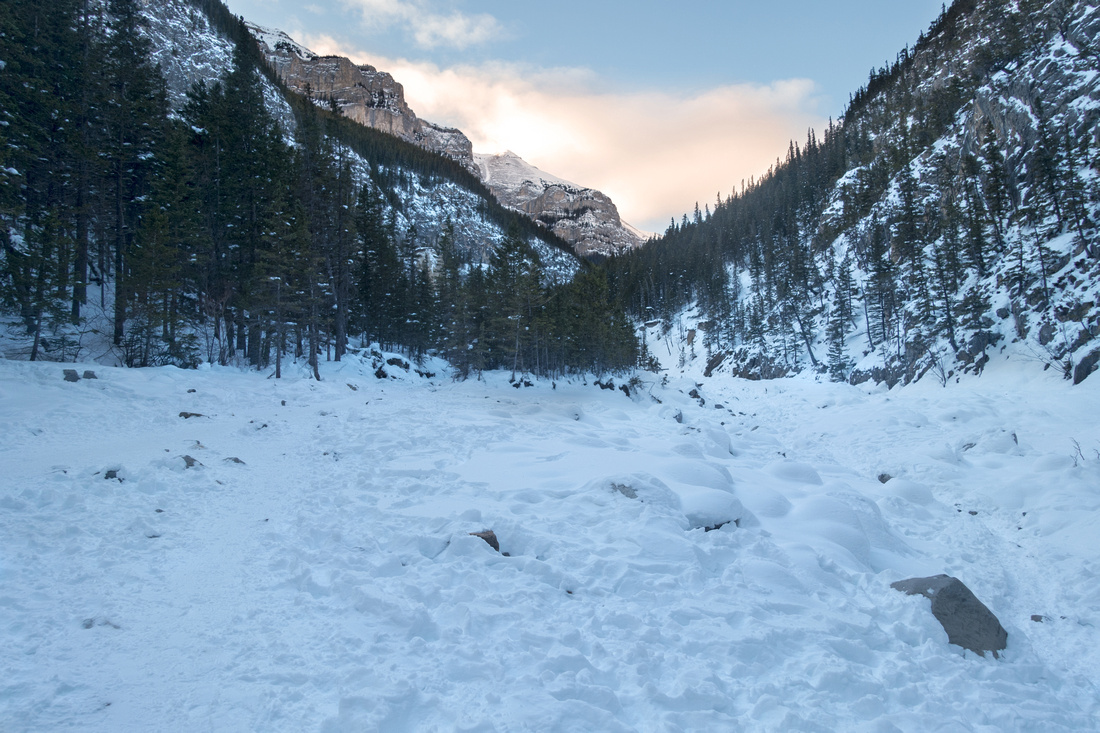
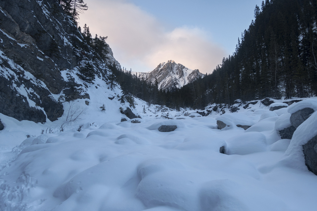
Past the waterfalls canyon soon widens up and heads in northerly direction. "Hoodoo Cave" is found on left (west) side soon by; even if not exploring upper canyon, it is worth going at least to here. Carefully scramble to cave entrance if you feel so inclined, but be mindful of the rockfall. Trail is usually not broken in winter past the Cave and can present challenge, in particular at the "Narrows" with some Avalanche risk on right side (see Gallery). Forks are reached ~1hr past the waterfalls. Left branch leads steeply to the col between main block of Grotto Mountain and prominent Outlier on the east side, but steep cliffs in upper part of this gully place it in technical domain. Main branch continues to the right towards Fable mountain mostly parallel to "Gable" ridge. It might be possible to scramble up at the end and intersect Grotto - Fable ridge system (then possible loop back via Mythic / Cougar Canyon), but I have not verified feasibility of this adventure. |
|
Gallery |
|||
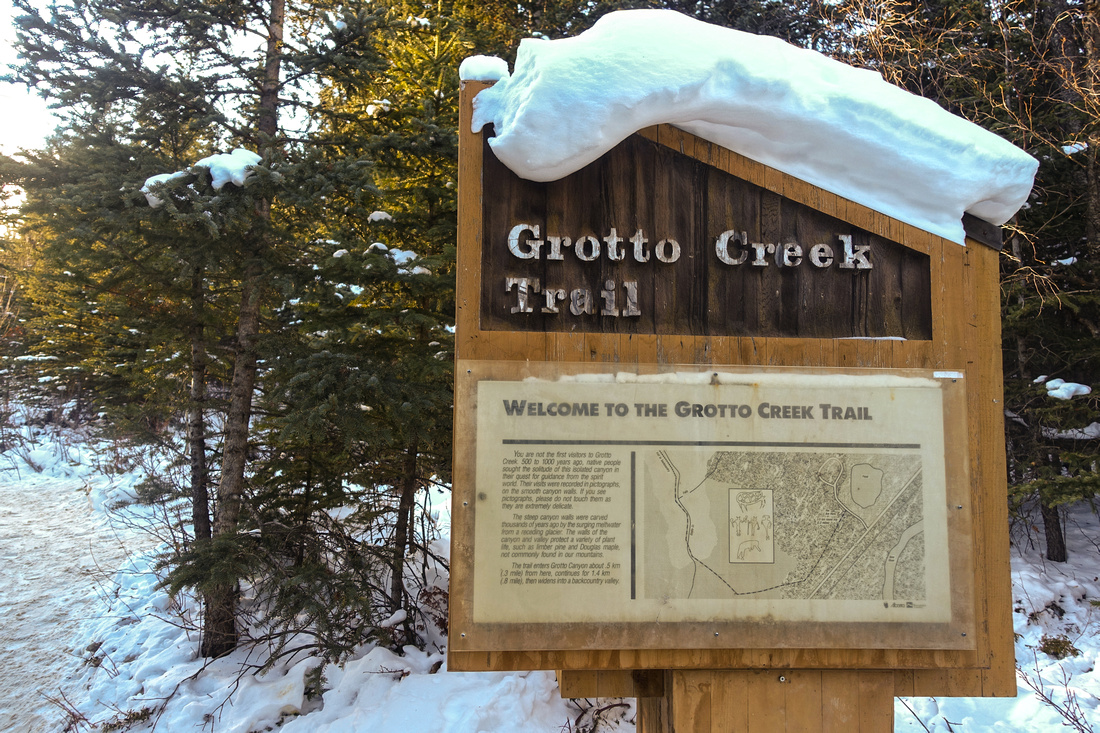 Grotto Pond Trailhead
Trailhead table with interpretive sign at Grotto Pond Parking Grotto Pond Trailhead
Trailhead table with interpretive sign at Grotto Pond Parking |
|||
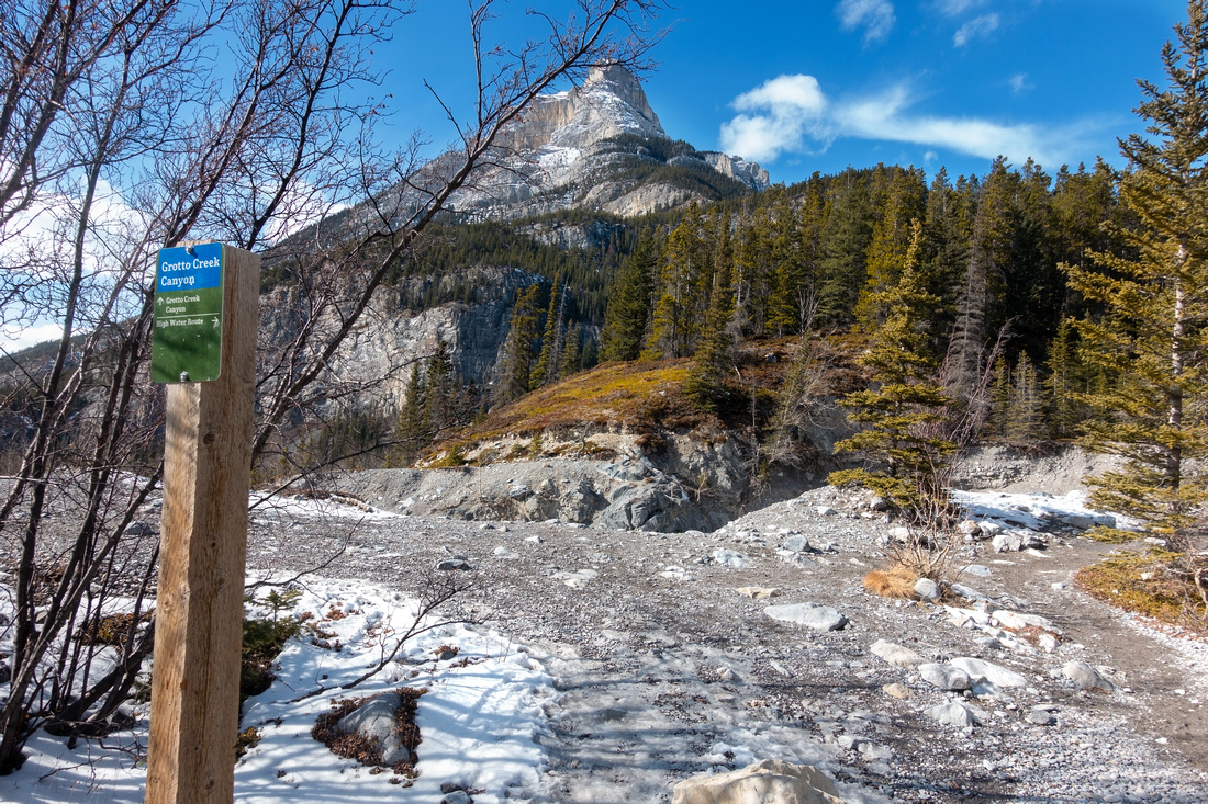 Canyon Entrance
View of Grotto Mountain east end ~1km from parking. Trail descends and turns sharp right entering canyon (just out of view to the right) Canyon Entrance
View of Grotto Mountain east end ~1km from parking. Trail descends and turns sharp right entering canyon (just out of view to the right) |
|||
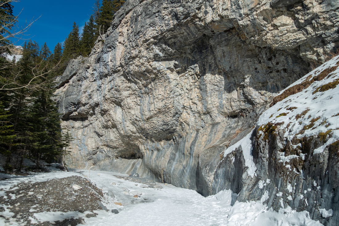 Lower Canyon
Pleasant going in Lower canyon. There are several Rock Climbing areas on right hand-side wall Lower Canyon
Pleasant going in Lower canyon. There are several Rock Climbing areas on right hand-side wall |
|||
 Ice River
Approaching Icefall Area. This photo illustrates best why Spikes are mandatory in winter conditions Ice River
Approaching Icefall Area. This photo illustrates best why Spikes are mandatory in winter conditions |
|||
|
|
|||
 Ice Climbers
Short steep side canyon right of main Icefall area Ice Climbers
Short steep side canyon right of main Icefall area |
|||
 Ice Climber
 putting up a show in main Icefall area Ice Climber
Ice Climber putting up a show in main Icefall area |
|||
 The Opening
Canyon opens up shortly after the Icefalls and heads into upper valley. Hoodoo Cave is ~10 min away The Opening
Canyon opens up shortly after the Icefalls and heads into upper valley. Hoodoo Cave is ~10 min away |
|||
 Hoodoo Cave
"Hoodoo Cave" on left side ~15 min past the Icefalls; rough path scrambles to cave entrance. Watch for rockfall Hoodoo Cave
"Hoodoo Cave" on left side ~15 min past the Icefalls; rough path scrambles to cave entrance. Watch for rockfall |
|||
 Approaching the Forks
Upper Canyon Trail is usually not broken in winter and can present a challenge. Obvious peak in center is Grotto Mtn Outlier. Approaching the Forks
Upper Canyon Trail is usually not broken in winter and can present a challenge. Obvious peak in center is Grotto Mtn Outlier. |
|||
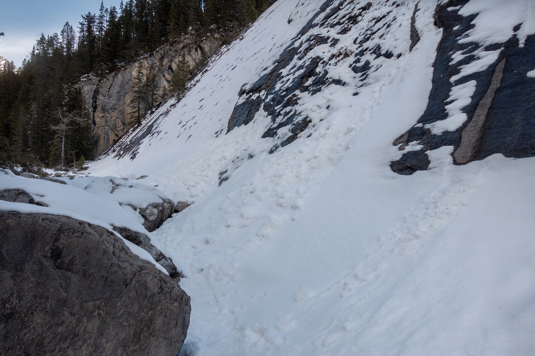 Avalance Slabs
Rough section of Upper Canyon at the Narrows with some Avalanche risk Avalance Slabs
Rough section of Upper Canyon at the Narrows with some Avalanche risk |
|||
 Below the Forks
Past the Narrows going becomes relatively easy again Below the Forks
Past the Narrows going becomes relatively easy again |
|||
 The Forks
NW Drainage above the Forks would be fun to explore, but Hikers can likely not get very far The Forks
NW Drainage above the Forks would be fun to explore, but Hikers can likely not get very far |
|||
 Gable Ridge
Sunlit Gable (Gap + Fable) Ridge can be seen from NW drainage couple of minutes above the Forks Gable Ridge
Sunlit Gable (Gap + Fable) Ridge can be seen from NW drainage couple of minutes above the Forks |
|||
 McGillivray
Mt. McGillivray from NW Drainage, showing rough route linking with Skogan Pass center right McGillivray
Mt. McGillivray from NW Drainage, showing rough route linking with Skogan Pass center right |
|||
Abstract
| Overall Difficulty | D3 | Straightforward with negligible elevation gain to Icefalls, more rugged if continuing to upper canyon and the Forks | |||
| Snow Factor | S2 | Sheets of ice in Lower Canyon require micro-spikes. Some avalanche danger in Upper Canyon | |||
| Scenery | View of Bow Valley area peaks from canyon entrance. Impressive cliffs of Grotto Mountain. Waterfalls / Ice Falls and Hoodoo Cave. View of Gable Ridge from the Forks | ||||
| Trail/Marking |
Very Good |
Wide trail with official trailhead kiosk and marked junctions to Canyon Entrance and the Icefalls. Trail usually not broken in Upper Canyon in winter | |||
| Suggested Time | 4-5 hrs | Return time to the Forks; 2 - 2.5 hrs if going just to the Icefalls and Cave | |||
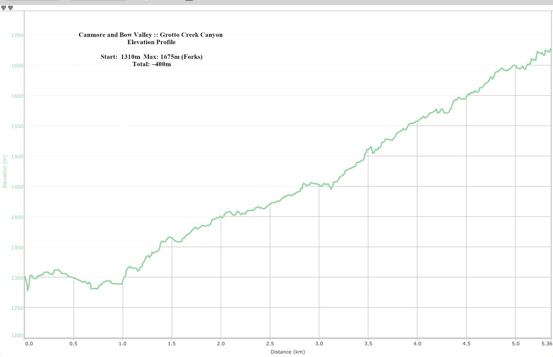
| Elevation | Start: 1375m Max: ~1675m (Forks) Total: ~400m | Round Trip: 11 km (Forks) | |||
| Gear | Day hikers sufficient. Micro-spikes essential in winter for icy parts. Poles / Gaiters for upper canyon. | ||||
| Water | Grotto creek dries out past Hoodoo Cave. Carry ~0.5-1L | ||||
| Dog Friendly | Yes | Keep dog on leash to the Icefalls as this is very popular family hike | |||
 Grotto Creek Canyon GAIA Map
 Grotto Creek Canyon Elevation Profile