Rockies :: Canmore and Bow Valley :: McGillivray Canyon |
|
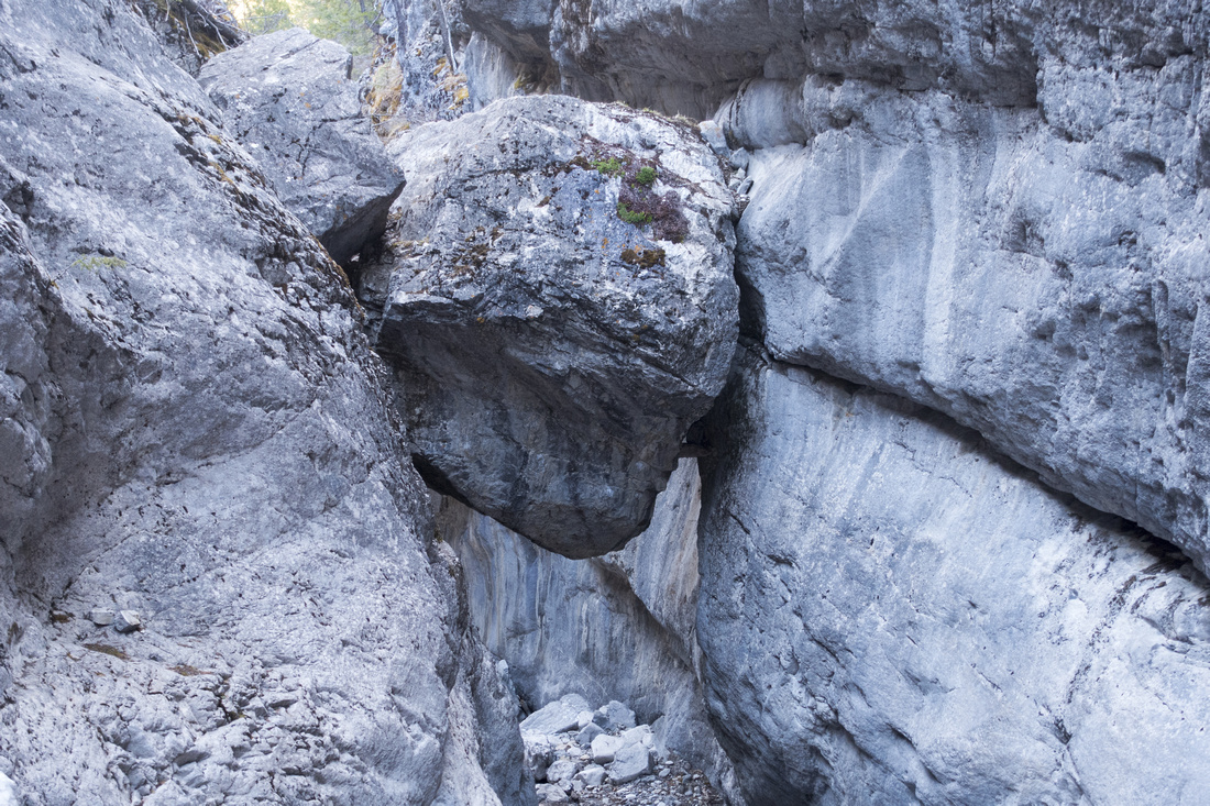 
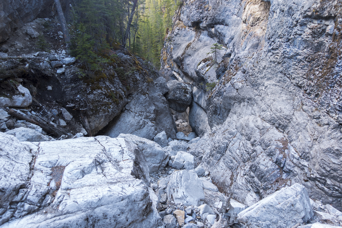
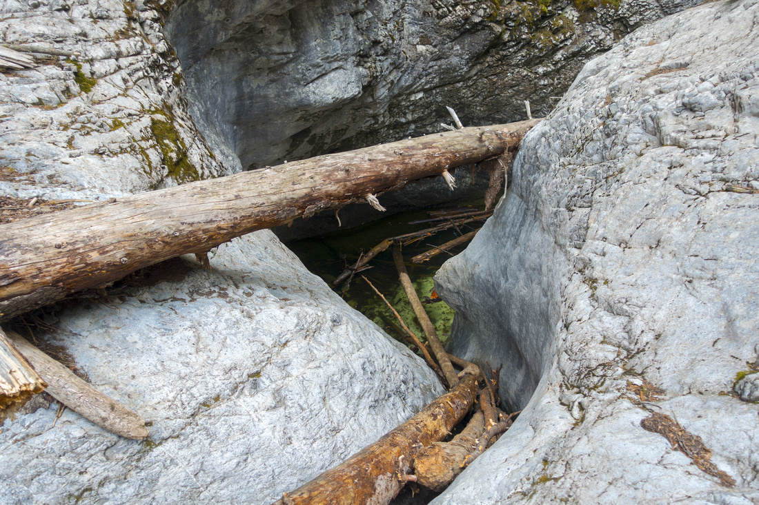
Infamous Chokestone wedged between steep walls of McGillivray Canyon |
|||
| Trip Summary | |||
May 16, 2022
McGillivray Canyon is deep drainage sandwiched between Pigeon Mountain to the west and Mt. McGillivray to the east, similar in nature to Heart Creek canyon further east but more rugged. It is unexpectedly scenic and great choice for anyone into canyons, but not for claustrophobic people as sections are fairly confined and surprisingly high sheer rock walls offer no escape. Lower part is an "obstacle course" with narrow sections and potholes that require non-trivial climbing moves. At one time ropes and slings facilitated the going, but have been removed and now trailhead sign warns hikers about venturing in this part at their own risk. Bypass trail on east side is the normal and recommended way in. Usual turnaround point is celebrated chokestone - giant boulder wedged between the walls like doomsday rock straight from Indiana Jones movie. Several climbing walls are nearby. Continuing past the boulder canyon becomes steep and going much rough so this is usual turnaround point. Hike is feasible year round, but late spring should be avoided due to snow melt when canyon might be impassable.
Unofficial parking is at south side of eastbound Trans-Canada lane; if coming from Calgary, do a U-turn at Deadman Flat overpass then drive back few km. Entry is not marked so slow down and watch for obvious turn on right side. Parking area is larger than expected. To get to canyon hike for few minutes along the clearing south to TCT junction and turn right (left is Bow Link that eventually leads to Heart Mountain and Canyon). McGillivray canyon trail forks off into the forest within few minutes, just past Provincial Park boundary sign - see first photo in Gallery. Neither of these 2 junctions is marked. Good trail heads through the forest and reaches mouth of McGillivray canyon in another 10-15 minutes of mainly flat walk. Several side trails drop to lower canyon, but bypass trail continues uphill on east side. This trail is not cakewalk either as there are steep and eroded sections, followed by narrow-ish traverse and finally rough descent into the Canyon, past the lower "Obstacle Course". Remainder of the walk to the Chokestone is way more scenic than anticipated and simply great fun. Depending on season it could also be icy with micro-spikes proving to be invaluable asset.
Few bother, but it is possible to reach rocky alpine plateau at Pigeon/McGillivray Saddle higher up, then link with Skogan Pass trail for loop trip of a sort (2 cars or bicycle needed). I have not done this part yet, but if/when I do update will be posted, along with GPS track, so stay tuned. |
|
Gallery |
|||
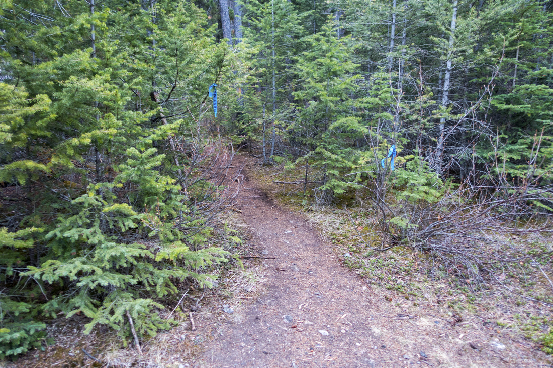 TCT Junction
McGillivray Access Trail branching off on south side of TCT trail TCT Junction
McGillivray Access Trail branching off on south side of TCT trail |
|||
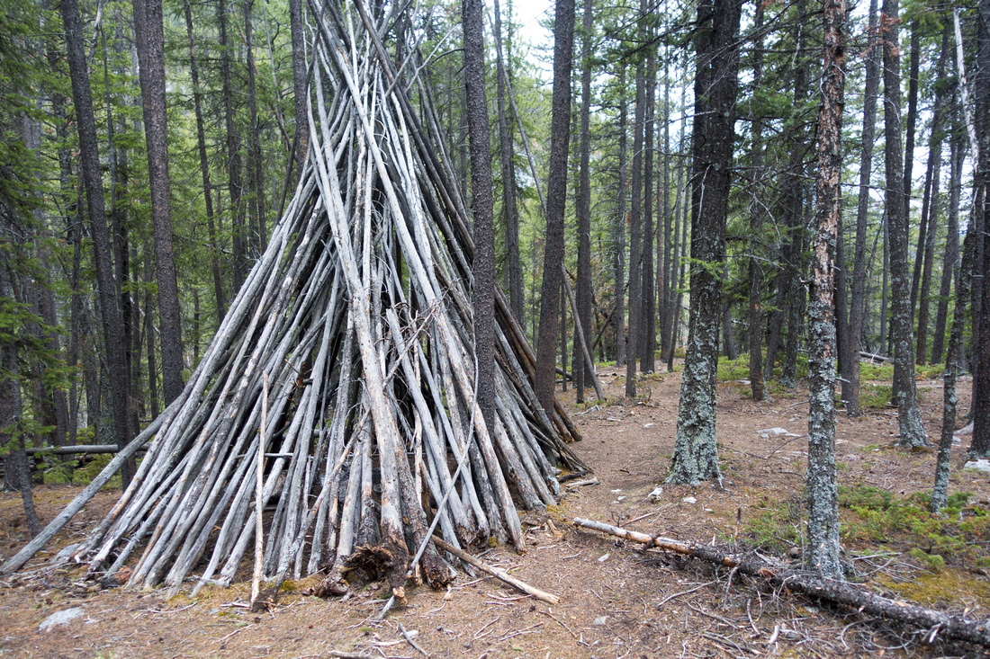 Teepee Bypass
Large Teepee on lower Canyon Bypass Trail Teepee Bypass
Large Teepee on lower Canyon Bypass Trail |
|||
|
|
|||
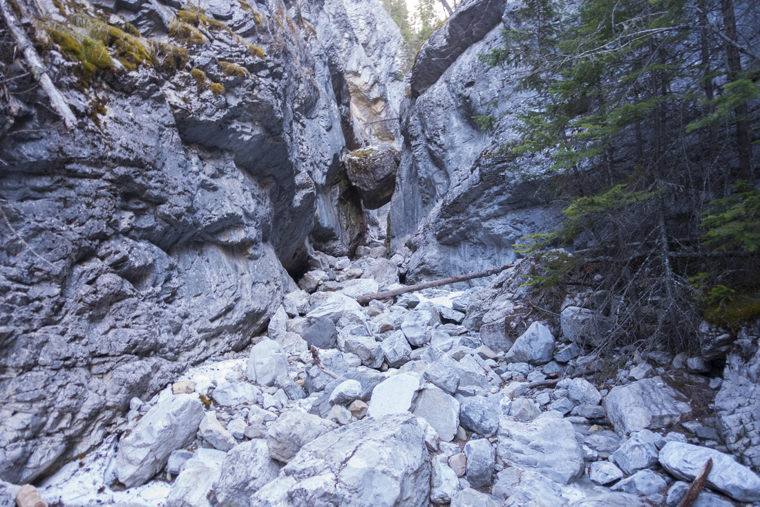
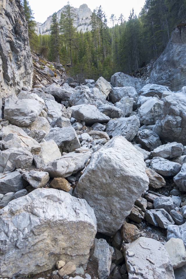
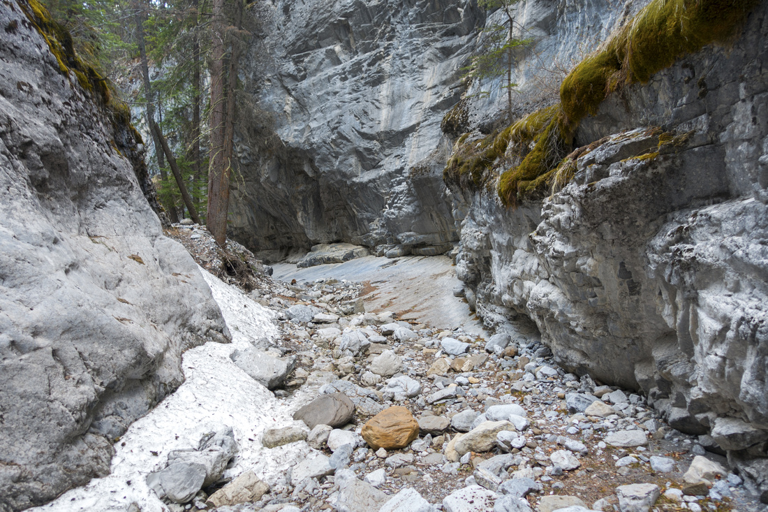 McGillivray Canyon
Pleasant going in dried creek bed McGillivray Canyon
Pleasant going in dried creek bed |
|||
 Wedged Boulder
Approaching Infamous Chokestone. Canyon steepens up considerably past this obstacle and progress is much more difficult Wedged Boulder
Approaching Infamous Chokestone. Canyon steepens up considerably past this obstacle and progress is much more difficult |
|||
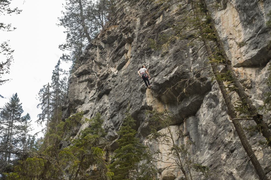 Climber Wall
West side of the Canyon features several hard rock climbing routes Climber Wall
West side of the Canyon features several hard rock climbing routes |
|||
 Upper Canyon
Steep boulders past the Chokestone put further progress in scrambling territory Upper Canyon
Steep boulders past the Chokestone put further progress in scrambling territory |
|||
 Upper Canyon
Looking down to the Chokestone from upper Canyon Upper Canyon
Looking down to the Chokestone from upper Canyon |
|||
Abstract
| Overall Difficulty | D3 | Occasionally steep and eroded bypass trail. Conditions in Canyon depend on season. Do NOT attempt to hike lower canyon (dangerous) | |||
| Snow Factor | S2 | Creek bed likely icy in winter, but otherwise safe and due to low elevation likely snow free good part of the winter | |||
| Scenery | Steep canyon walls and water filled potholes. Impressive Wedged boulder at transition to upper Canyon | ||||
| Trail/Marking | Good/None | Initially good trail to lower canyon, followed by well-defined bypass trail. Junctions not marked | |||
| Suggested Time | 2-3 hrs | Assuming bypass trail and return the same way. Add several hours if exploring upper canyon or continuing to Skogan Pass | |||
| Elevation | Start: 1500m Max: 1750 m Total: ~250 m (Chokestone) | Round Trip: ~5 km (Chokestone) | |||
| Gear | Day Hikers and Hiking Poles; Micro-Spikes could be essential with icy creek bed | ||||
| Water | McGillivray creek dries out, depending on season. Carry 0.5 - 1L | ||||
| Dog Friendly | Yes | Black bears often seen in Skogan area in late spring/early summer | |||