Google Map |
Rockies :: Canmore and Bow Valley ::AM Trail |
GPS Track |
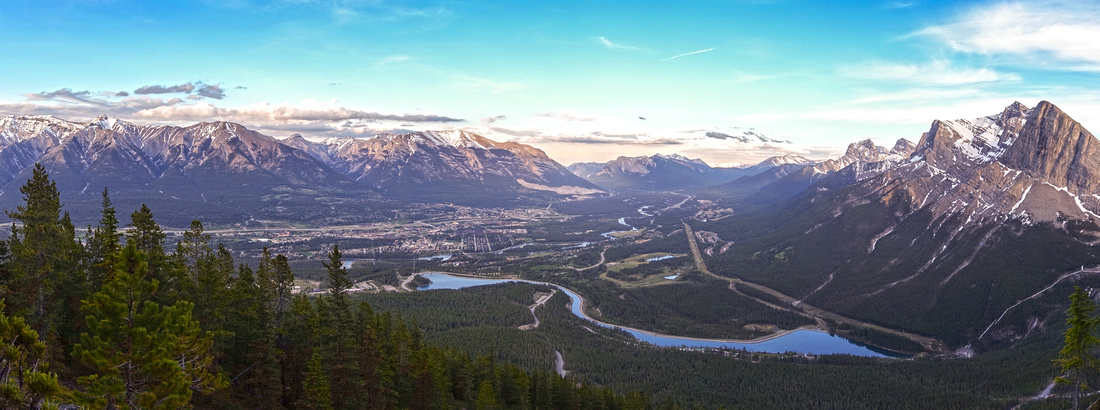 
Panoramic view of Bow Valley from final slope of AM Trail. Rundle Forebay lower down, Ha Ling center right |
|||
| Trip Summary | |||
June 16, 2020
AM Trail ("AM" presumably stands for "Alpine Meadow") is, according to Daffern K-country guidebook, only hiking trail in Canmore Nordic Centre area. It is a pleasant few hours exercise ending at great viewpoint below East End of Rundle Cliffs. Lower part is confusing network of mountain biking trails, but things drastically improve once you reach actual hiking trail. There are several nice viewpoints along the way and final part is open rise up EEOR shoulder to base of climbing paths. Panoramic view of Bow Valley are fantastic! This would also be a great place to watch sunrise. Partial loop return is feasible in lower part by descending to Spray Road & hiking via cutline over to Nordic Center.
Park at Nordic Center. (Alternatively, you can also park at Grassi lakes trailhead and hike back to Spray Road - in that case find trail just opposite traffic sign). Head up on cycling paths. From Nordic Centre follow Centennial then up Killer Bees. Junctions are marked. Spray Road start -- optional loop descent -- joins in near Backdoor junction. Follow Backdoor to semi open clearing at its highpoint. Signed Nectar Noodle, that can also be used as descent to Nordic Center, continues on the other side. Turn left - this is start of AM trail. From here way is obvious and marked with yellow squares. Trail climbs moderate at first then steeper and leads to great viewpoint of rough gully between first and second bump of EEOR. Trail is less defined in this part as it climbs much more steeply past old bike trestle and traverses left (east) to open shoulder with fantastic views of Bow Valley. These are probably the "Alpine Meadows". From here it is pleasant 15 min moderate hike to trail end at base of climbing cliffs. Rough paths can be found at both side of the cliff, but they are climber access trails that lead nowhere. Best viewpoint is probably just below the cliffs. Watch for ticks here! Descend the same way, utilizing one of several possible ways as described above.
Note that AM Trail passes through AB Provincial Park wildlife corridor that is seasonally closed till June 15. |
|
Gallery |
|||
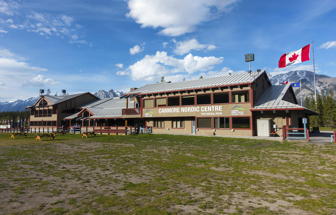  Canmore Nordic Centre Day Lodge. Alternate start is from Spray road gate, opposite Grassi lakes road
 |
|||
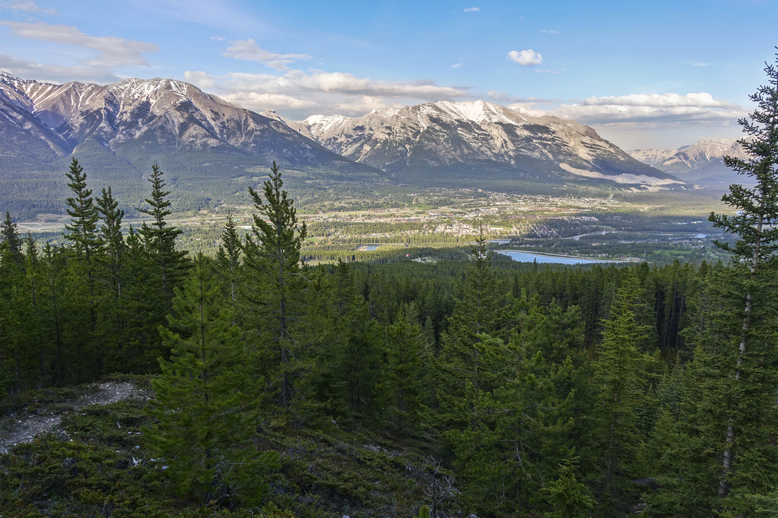  View back from first clearing, already on AM Trail above biking trails
 |
|||
|
|
|||
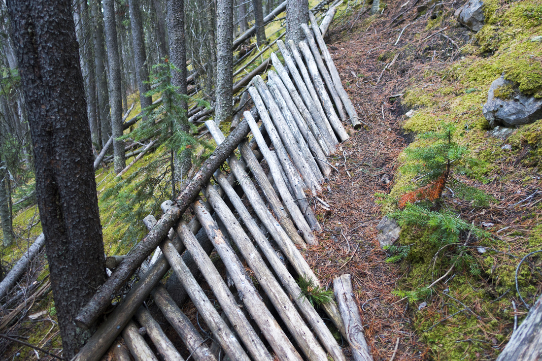  Old trestle on steep bit of AM Trail indicating this was maybe used at some point as biking trail
 |
|||
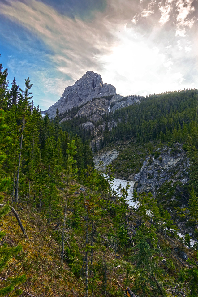  Above steep part of trail looking up gully between EEOR first and second bump (center)
 |
|||
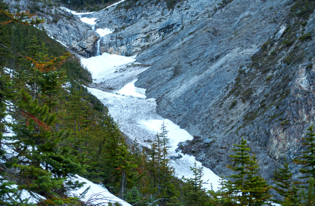  EEOR gully choked with spring runoffs
 |
|||
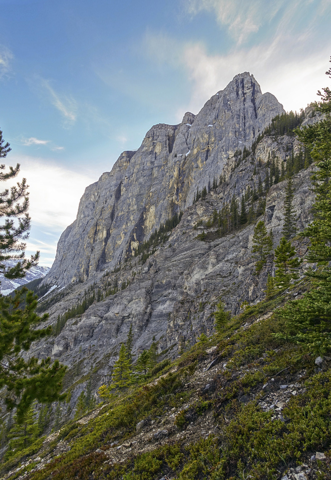  Trail turns right at shoulder below EEOR first summit and climbs last ~100 vertical in open terrain
 |
|||
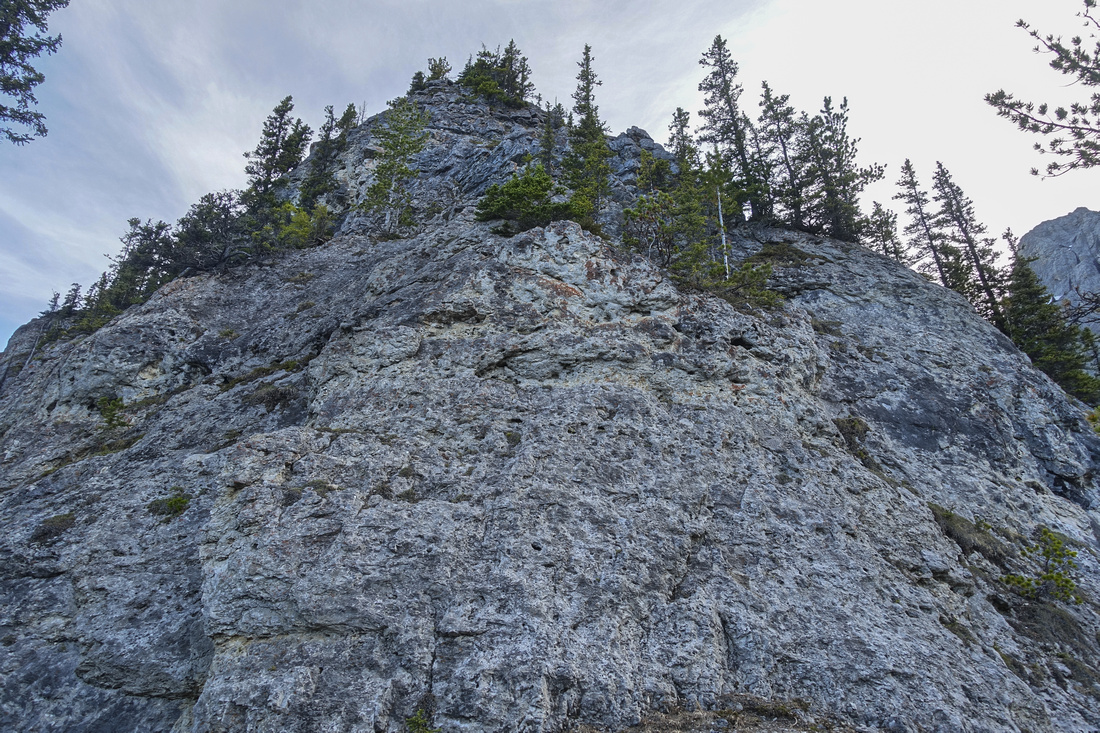  Cliffs at end of AM Trail. Faint climber access paths continue on both sides
 |
|||
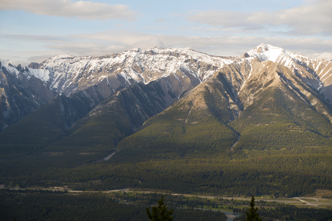
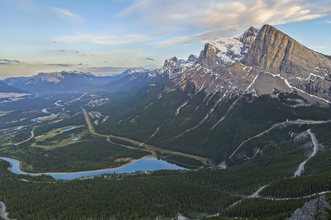  Early evening landscape view of Bow Valley. Rundle Forebay lower left, Ha Ling / Miners peak upper right. Little Sister poking upper center
 |
Abstract
| Overall Difficulty | D3 | Network of easy cycling paths in first part, followed by steep but well defined hiking trail. One steeper bit that requires extra caution and brief use of hands | |||
| Snow Factor | S5 | City of Canmore normally does avalanche control snow release each spring near upper part of AM Trail | |||
| Scenery | Great views of Canmore and Bow Valley from final open slopes below EEOR cliffs | ||||
| Trail/Marking | Good | Multitude of well-defined but potentially confusing Nordic Centre cycling trails (watch for cyclists!). AM Trail junction is unmarked (use GPS track). Faint trail in upper part but way is logical | |||
| Suggested Time | 3-4 hr | Alternate descent via Spray Road connector adds 10-15minutes only | |||
| Elevation | Start: 1435m Max: 2010m Total: ~600m | Round Trip: 8.5km | |||
| Gear | Day hikers are usually enough if dry. Hiking poles essential for stability in upper steep part | ||||
| Water | Dry hike. Seasonal water could be found in gully but access is awkward. Carry 1L | ||||
| Dog Friendly | Yes | Keep dog on leash while hiking lower cycling trails! Standard back-country precautions after (area frequented by bears and cougars) | |||
 AM Trail GAIA Map
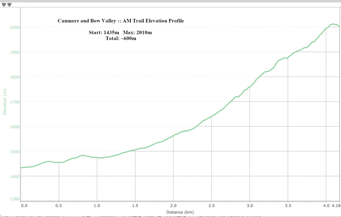 AM Trail Elevation Profile
