Google Map |
Rockies :: Canmore and Bow Valley ::Tibitts Ridge |
GPS Track |
 
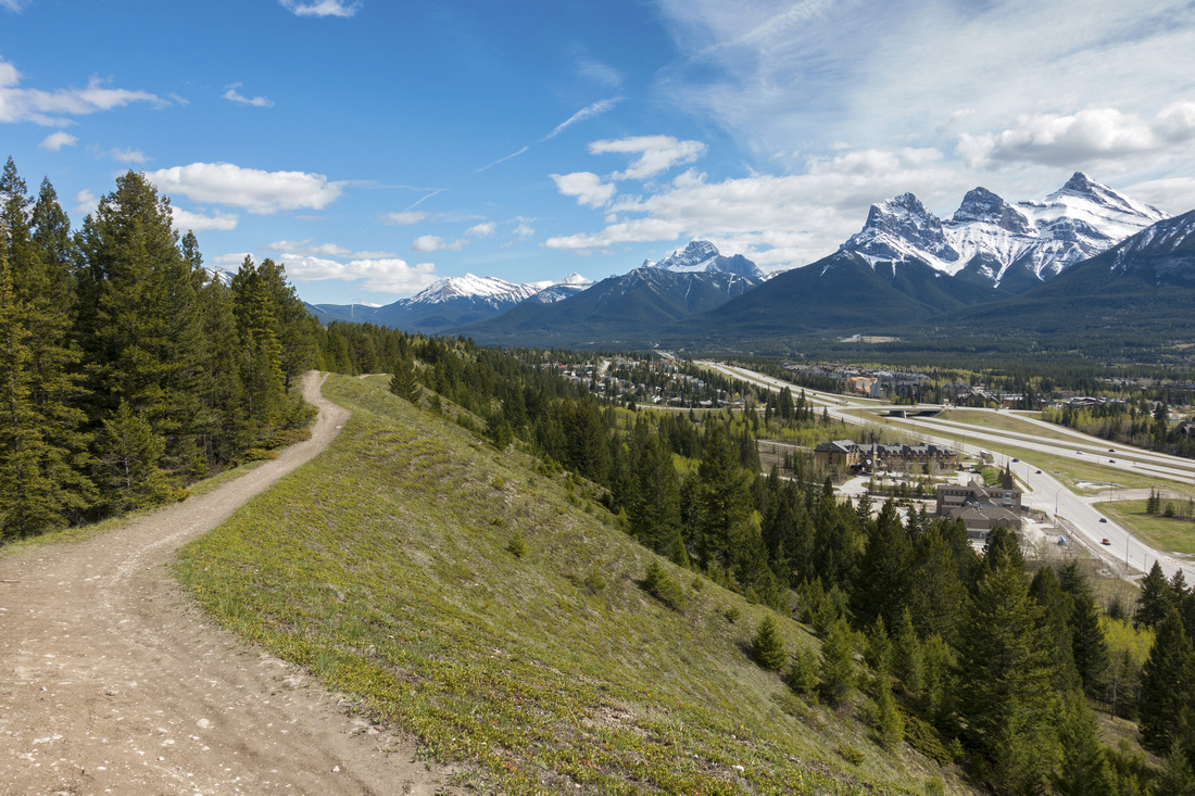
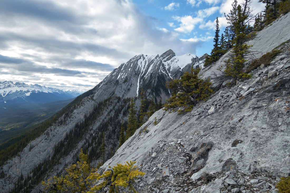
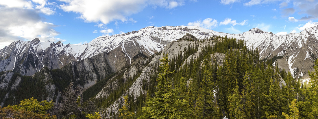
Panoramic View West from first Highpoint of "Tibitts Ridge". Princess Margaret center, Cascade Mtn / Banff distant left |
|||
| Trip Summary | |||
May 24, 2020
Where is "Tibitts Ridge"? If you are not Canmore local, this name likely won't not ring a bell. As one drives by Harvey Heights just before BNP gate it is visible as jagged ridge just west of The Tit. The name is unofficial - I coined it "Tibitts" as it rises from well known "Tibitts Quarry", part of Montane network of hiking/mountain biking trails on north side of Bow Valley. In Kananaskis Country guidebook (vol 3, orange) Daffern briefly mentions Alcove climber access trail branching off Tibitts Quarry, but Alcove is further up the canyon and guidebook contains no info whether ridge is feasible for hikers/scramblers.
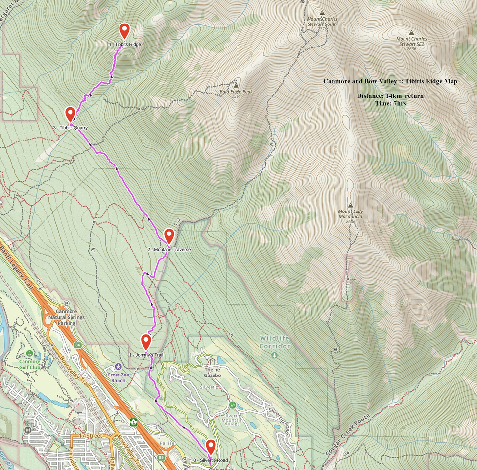
There are different ways to reach Tibitts Quarry and start of Alcove Trail. Fastest and most direct is to drive up Silvertip road and park by the golf course, then hike up to Montane Traverse and continue west (all junctions marked, with map) -- about an hour of moderate pace. Alternate start is from Harvey Heights and approach via Tibitts Quarry trail, but this is not recommended as parking is difficult to find and this approach is quite boring. Most scenic and vehicle free -- if you live in Canmore -- is to cross highway from town centre then continue west via Douglas Fir Bench, transition into Johnny's Trail and finally turn left into Montane. This variation will take ~2 hours but is very scenic and preferred option. Stats in Abstract are given for this approach. Beware of mountain bikers at each case.
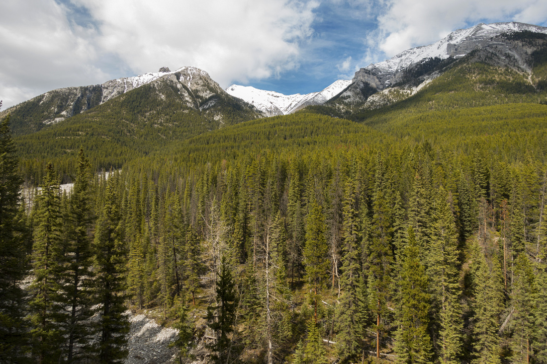
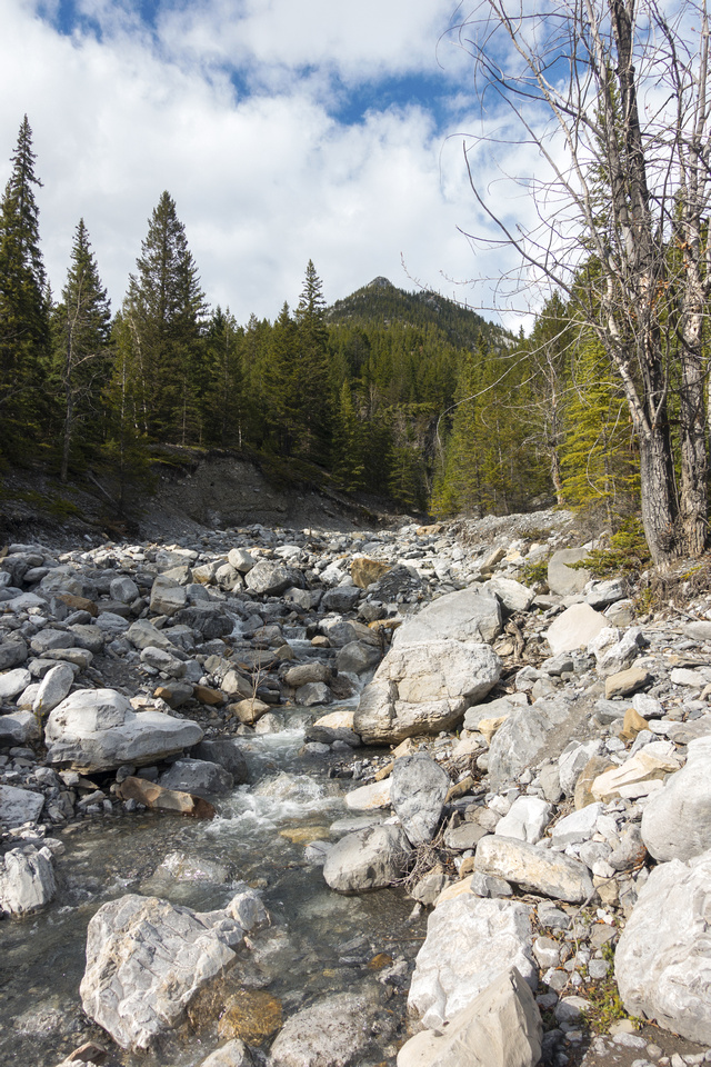
Alcove trail starts as Montane turns into Tibitts Quarry after crossing drainage coming of canyon west of The Tit. In spring water will be flowing but it is an easy rock-hop. Turn right and follow faint trail rising north above the canyon. There is ~700m vertical to gain to first highpoint of "Tibitts Ridge". Alcove is initially easy to follow but becomes more and more indistinct and finally peters out completely -- I don't know if climbing area exists or not. At this point access for "Tibitts Ridge" is obvious though -- simply charge straight up. Forest is open and there is no bushwhacking, but grade is steep. Mix of talus and forest undergrowth it even calls for occasional use of hands. It is probably easiest to stay as far climber right as possible. After about 1.5 hours grade somewhat relents and summit block comes into view. This part must be dry; with snow or ice it can be dangerous. Cliff scramble is not particularly difficult, but requires good micro-terrain route finding skills. Rock is firm with decent holds. Brief description of easiest line: From the base don't charge straight up; walk briefly left to west side, then turn right and scramble small cleft to narrow ledge that can be followed to the east side. Transition into middle part and scramble couple of class 3 steps roughly in center. Final bit is best scrambled on climber right side. After topping up walk for a minute on grass to sizeable cairn, testimony that "Tibitts Ridge" sees some traffic after all.
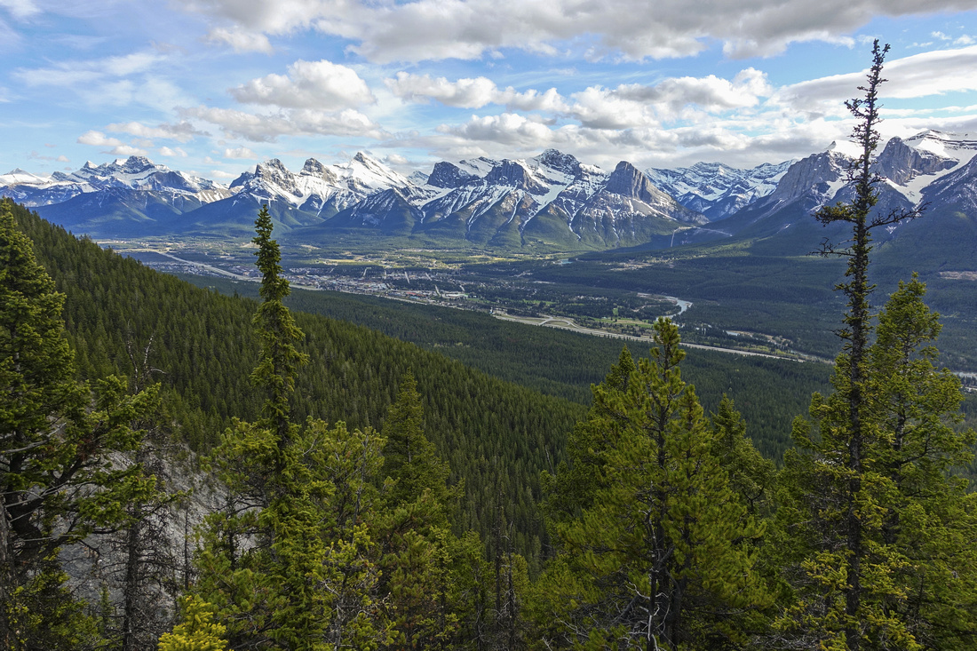
Views are fantastic. Princess Margaret directly west looks stunning, The Tit on east is equally scenic and one can readily study normal Kane scramble route. Panoramic view of Bow valley spreading from Canmore all the way to Banff is south, while on the north ridgeline extending from The Tit over Buffalo Point to Charles Stewart is the main prize. Could one access Charles Stewart via "Tibitts Ridge"? It was hard to tell; ridge extends for at least a kilometer over several bumps then transitions into shale - this part might be a scramble only but I did not have time to investigate. However there is fairly well defined line of cliffs below Charles Stewart and this is probably a show stopper for non-technical oriented folks.
Return the same way. If you decide to continue along the ridge to obvious highpoint, do not try to descend directly to the canyon as it narrows lower down and becomes impassable.
|
|
Gallery |
|||
 View back hiking Douglas Fir bench above Silvertip Road. Three Sisters, Lougheed Towers and Allan/Collembola extend right to left across the horizon
 |
|||
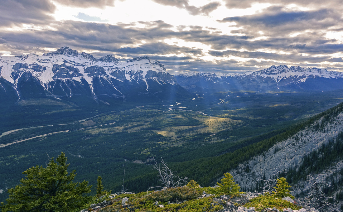
 Johnny's Trail above washed out drainage coming from Stoneworks Canyon. Lady Mac right, The Tit left; Charles Stewart SE (Buffalo Point) in between
 |
|||
|
|
|||
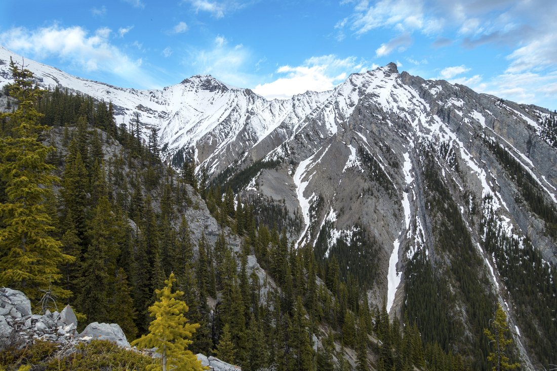
 View back to Bow Valley as Alcove Trail peters out; charge straight up at this point
 |
|||
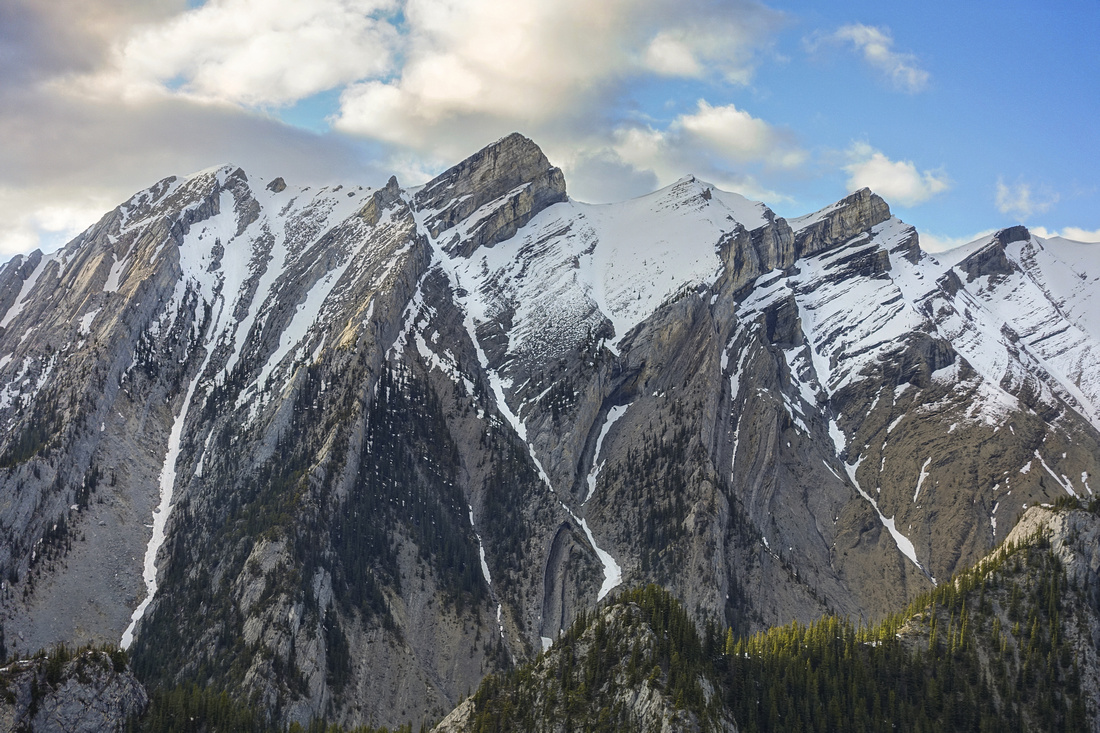
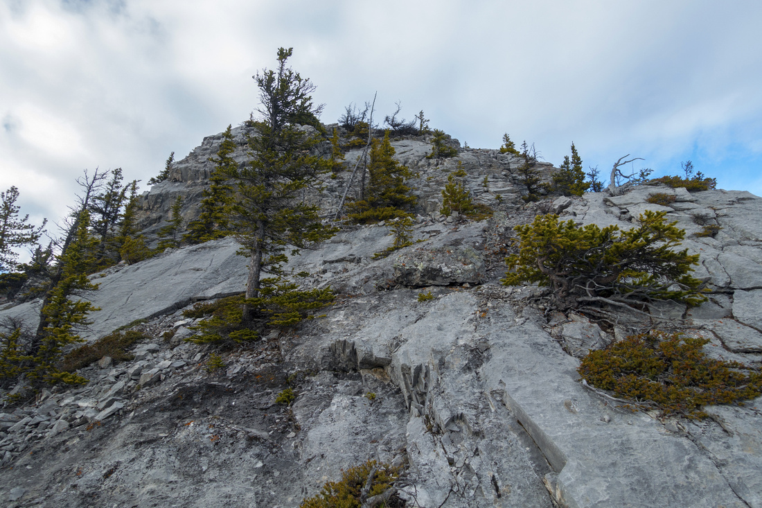 Cliffs guarding the first Highpoint. Easiest line contours around to left, then scrambles up a cleft and follows ledge back to right side and up via couple of class 3 steps with minimal exposure. Final bit, out of sight here, will be easiest breached on climber right
 |
|||
 Indicator of fairly step angle while scrambling the middle part; Princess Margaret center
 |
|||
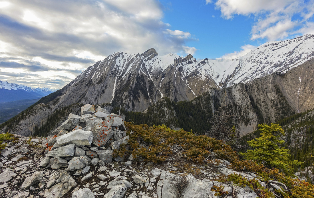 Decent size cairn at first Highpoint, past all difficulties
 |
|||
 Great view of The Tit (center right) on east side. Charles Stewart SE (Buffalo Point) is to the left. Connecting ridge between the two has been scrambled but is very difficult and not recommended
 |
|||
 Closer look at Princess Margaret on west side. Note jagged ridge in lower foreground extending left to right. It is similar in nature to "Tibbits Ridge" but I don't believe it is a scramble
 |
|||
 Panoramic view north; Charles Stewart distant center. Highest point of "Tibitts Ridge" is prominent rise just right of center and might be a scramble
 |
|||
 Nice view SW towards Banff area. Rundle Range upper center left, Cascade Mtn to the right
 |
Abstract
| Overall Difficulty | D6 | Trail hiking on approach, followed by steep off trail ascent. Final block is moderate class 3 rock scramble with minimal exposure | |||
| Snow Factor | S4 | Not recommended in winter conditions since summit block must be snow/ice free | |||
| Scenery | Panoramic view of Bow Valley. Close up of jagged mountain peaks on north side, including Princess Margaret, Charles Stewart and The Tit | ||||
| Trail/Marking | Very Good/None | Well defined Network of Montane Hiking trails on approach followed by faint Alcove climber approach; none thereafter | |||
| Suggested Time | 6-7hr | Varies depending on starting point and whether one decides to explore ridge part first Highpoint | |||
| Elevation |
Start: 1300m Max: 2100m Total: ~950m (from Canmore) |
Round Trip: ~15km (from Canmore) | |||
| Gear | Day Hikers with good ankle coverage. Hiking poles are big asset on steep forest ascent above Alcove Trail | ||||
| Water | Tibbits Quarry drainage but none after. Carry ~2L | ||||
| Dog Friendly | No | Dogs will have problems scrambling rock below first Highpoint, although they could be left below as this bit is short. Best is to leave pets at home. | |||
 Tibitts Ridge GAIA Map
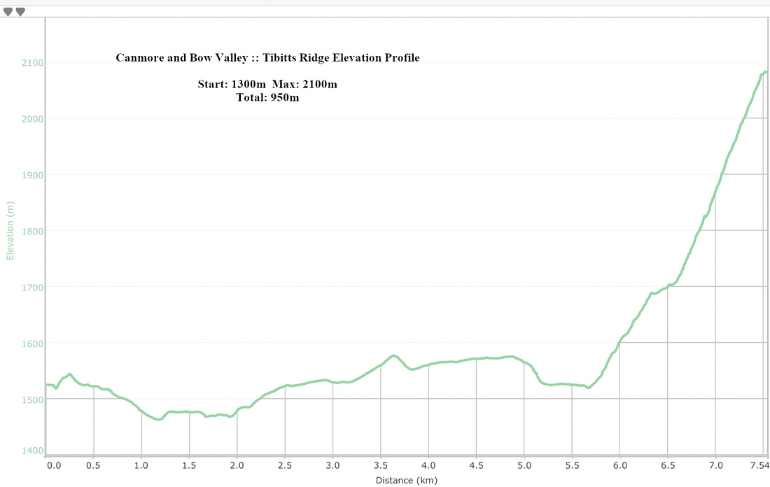 Tibitts Ridge Elevation Profile