Google Map |
Rockies :: Banff-Louise :: Gibbon Pass - Little Copper |
GPS Track |
|
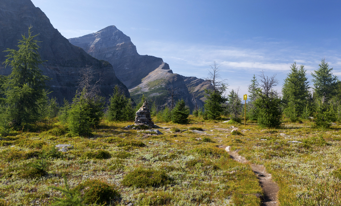
Gibbon Pass with Memorial Cairn and Mt. Storm in the Background |
|||
| Trip Summary | |||
August 18, 2021
Gibbon Pass is one of several high alpine passes traversed on well-known Bow Valley Highline route. It is named by John Murray Gibbon, publicity agent for Canadian Pacific Railway between 1913 and 1945. He discovered the pass, which now has memorial cairn in his name. This pass is also exceptional alpine environment; in summer of 2021 dominated by wildfire smoke any clear day that are few and far in between needs to be taken advantage off. In the past I visited the area from Banff-Radium Highway via Arnica to Lower Twin lake, but did not have enough time (or energy) to continue to the Pass. This time I approached via official "Twin Lakes Trail" starting near Castle Junction. Although far less scenic, this approach is also considerably shorter & allowed enough time to continue on Bow Highline South to Gibbon Pass. From the Pass unofficially named "Little Copper", sometimes also called "Gibbon Pass Peak", is simple walk-up. This terrific viewpoint was more than enough reward for fairly long and generally view-less approach. Alpine area is brimming with larches and is probably great autumn golden larch destination.
Trailhead is at Castle Junction and bit hard to find. Take Hwy 93 (Banff-Radium Highway) exit off Trans-Canada, but immediately after crossing overpass, do a U turn and onto side road by the fence on right (south) side This road leads in ~200m to fairly large parking area, with usual Parks Trail Table. (In winter gate will be closed, so you will have to walk this bit). Trail crosses Altrude creek and turns right; keep straight at next junction, then after crossing back to right side settle down for long forested hike to lower Twin Lake. This section has fairly bad rap as being boring, but I didn't find it too bad - forest was nice enough, and last 2km before Lower Twin lake were in alpine meadows. This bit was also very muddy, rocky and rooty requiring concentration in order not to lose balance. After intersection Bow Highline by the sign, turn left and cross Lower Twin Lake outlet at good bridge. Lake is further ~100m to the right - it is a good spot for lunch break; being familiar from previous trip I left it for return. Bow Highline then ascends semi-open mature forest for another 2.9km to Gibbon Pass with Memorial Cairn. You can call it a day here, but it would be a shame if weather is nice, not to hike up Little Copper - it is straightforward easy ascent, 1.5km and 300m vertical from the pass. You can go anywhere, easiest is to head straight up through meadows and larch forest, then diagonally up bits of trail slanting right-left to summit ridge (On return beeline to treeline is great fun here!). Delightful hike on open ridge then leads to rocky summit, which on my visit also had nowdays ever-present pink register. Views on clear day are phenomenal; I had real problems leaving and only knowledge I'd be hiking out by headlamp if lingering too long eventually made me leave. I plan to return sometime in larch season as backpack trip, for pure photography reasons.
Photographer Note: Due to position of the sun, Gibbon Pass is best photographed in first part of the day. Later in the day sun moves above Storm Mountain Massif and by mid-afternoon area is in shade. But as approach is fairly long, backpack is probably best strategy in this case, with overnight either by Shadow Lake (Re 14) or upper Twin Lake (Tw 7), followed by short day hike to the pass in the morning
|
|
Gallery |
|||
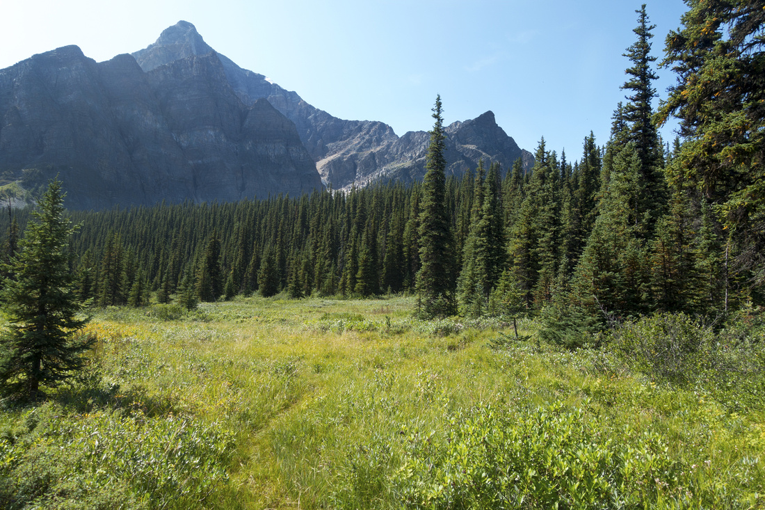 Twin Meadows Twin Meadows Twin Lakes Trail entering often muddy Meadows after ~1.5 hrs of steady forested ascent
 |
|||
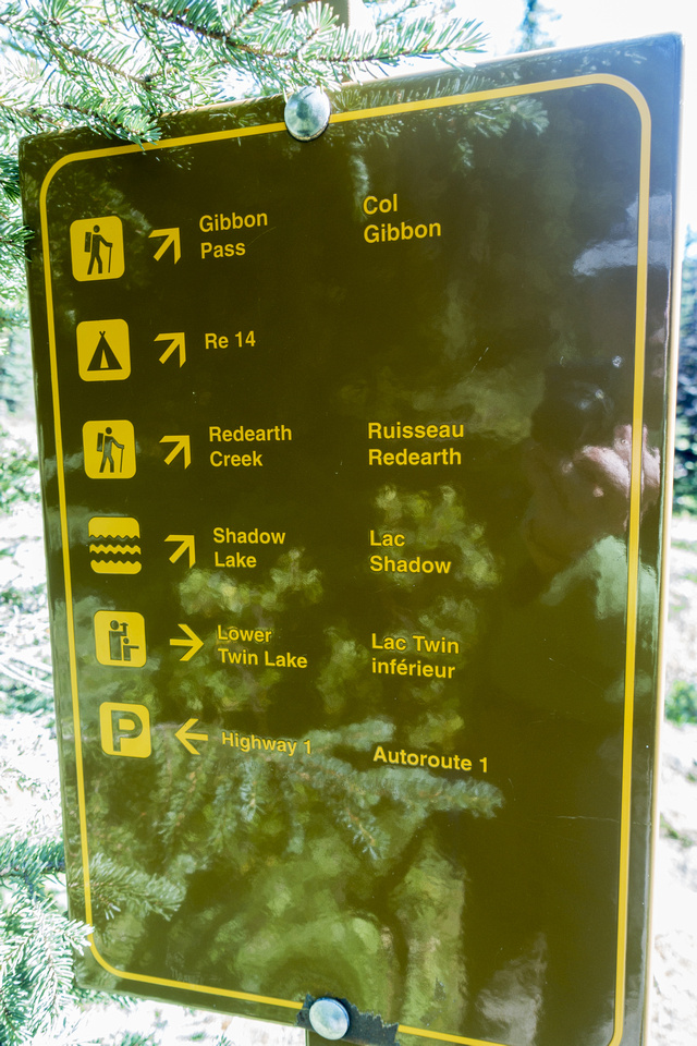 Bow Highline Junction
Parks Table at Twin Lakes / Bow Highline Junction Bow Highline Junction
Parks Table at Twin Lakes / Bow Highline Junction |
|||
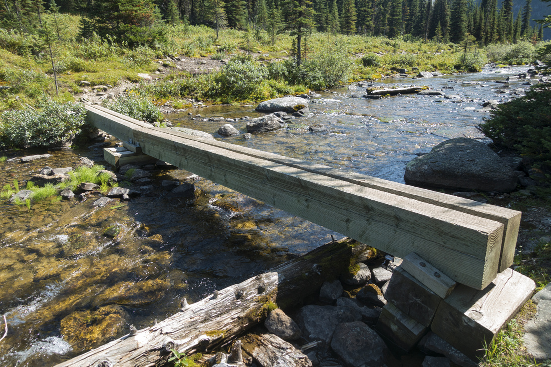 Lower Twin Lake Outlet
Solid Two log Bridge over lower Twin Lake outlet, already on Bow Highline trail Lower Twin Lake Outlet
Solid Two log Bridge over lower Twin Lake outlet, already on Bow Highline trail |
|||
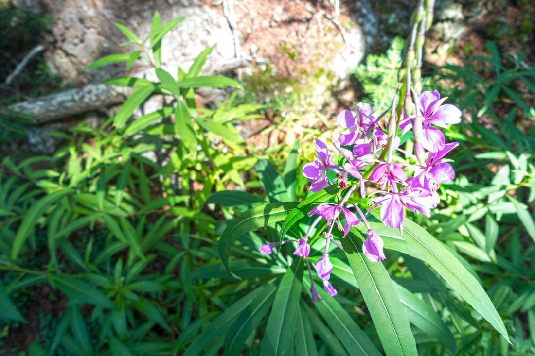 Pink Fireweed
Summer Wildflowers as Gibbon Pass Trail rises through semi-open forest above lower Twin Lake Pink Fireweed
Summer Wildflowers as Gibbon Pass Trail rises through semi-open forest above lower Twin Lake |
|||
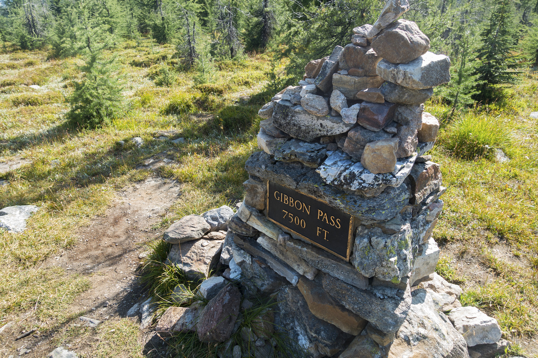 Memorial Cairn
John Murray Gibbon Memorial Cairn at the Pass Memorial Cairn
John Murray Gibbon Memorial Cairn at the Pass |
|||
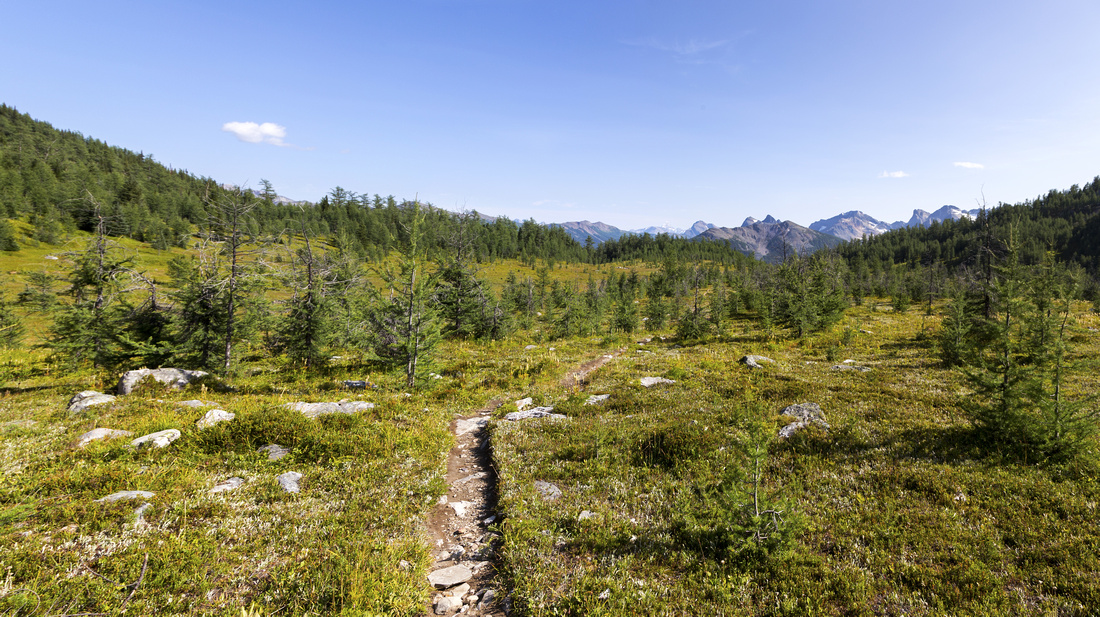 Gibbon Meadows
Expansive Alpine Meadows dotted with larches on south side of Gibbon Pass. Bow Highline trail descends in ~3km to Redearth / Shadow Lake junction Gibbon Meadows
Expansive Alpine Meadows dotted with larches on south side of Gibbon Pass. Bow Highline trail descends in ~3km to Redearth / Shadow Lake junction |
|||
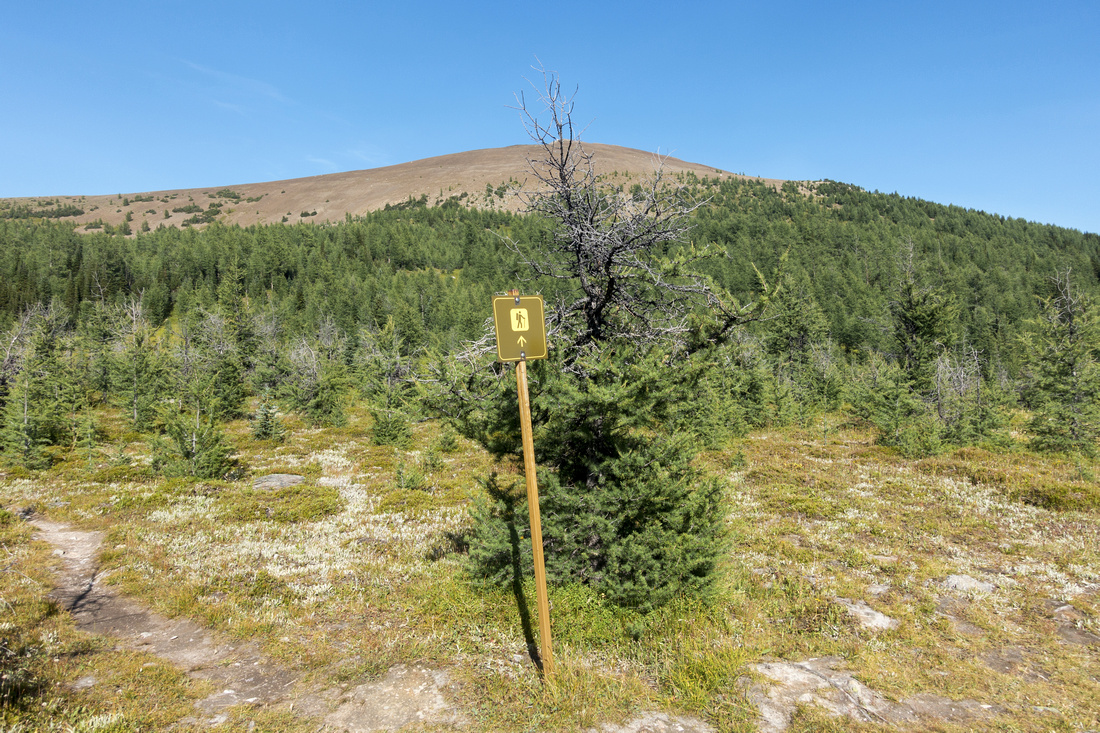
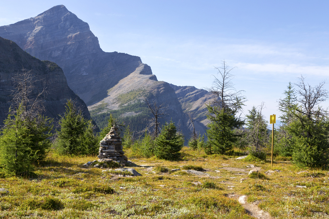 Gibbon Pass
 looking north; note Hiker sign pointing in direction of Bow Highline Trail Gibbon Pass
Gibbon Pass looking north; note Hiker sign pointing in direction of Bow Highline Trail |
|||
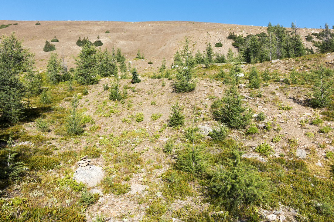
 Little Copper
, sometimes also called "Gibbon Pass Peak". Cross meadows and hike up through larches then pick-up faint trail leading to base of talus Little Copper
Little Copper, sometimes also called "Gibbon Pass Peak". Cross meadows and hike up through larches then pick-up faint trail leading to base of talus |
|||
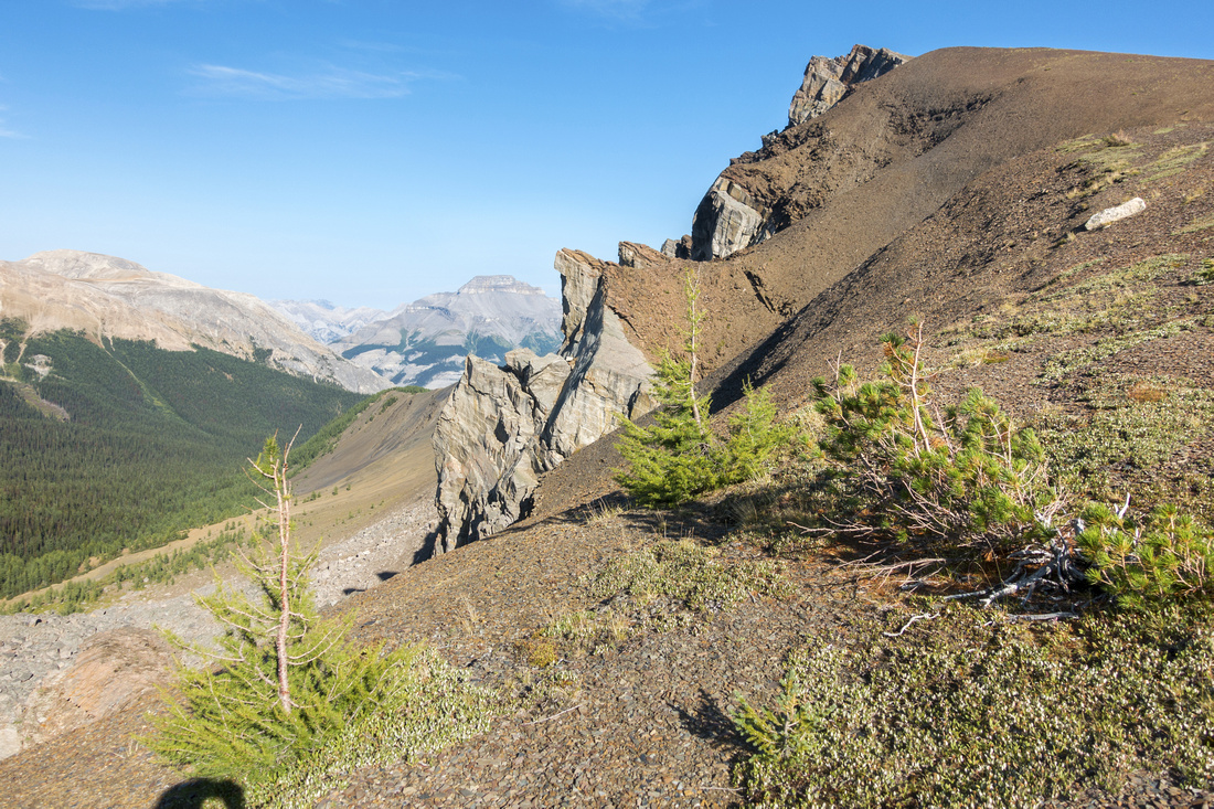
 Little Copper Ascent
Gentle Talus slopes leading to Little Copper summit ridge. Note cairn lower left Little Copper Ascent
Gentle Talus slopes leading to Little Copper summit ridge. Note cairn lower left |
|||
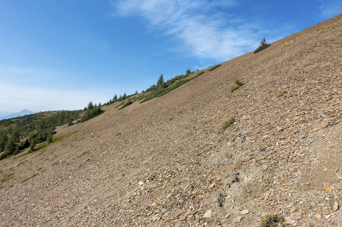 Talus Slope
Diagonal ascent of reddish rubble on bits of trail; great fun digging your heels on descent Talus Slope
Diagonal ascent of reddish rubble on bits of trail; great fun digging your heels on descent |
|||
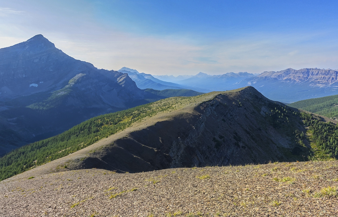
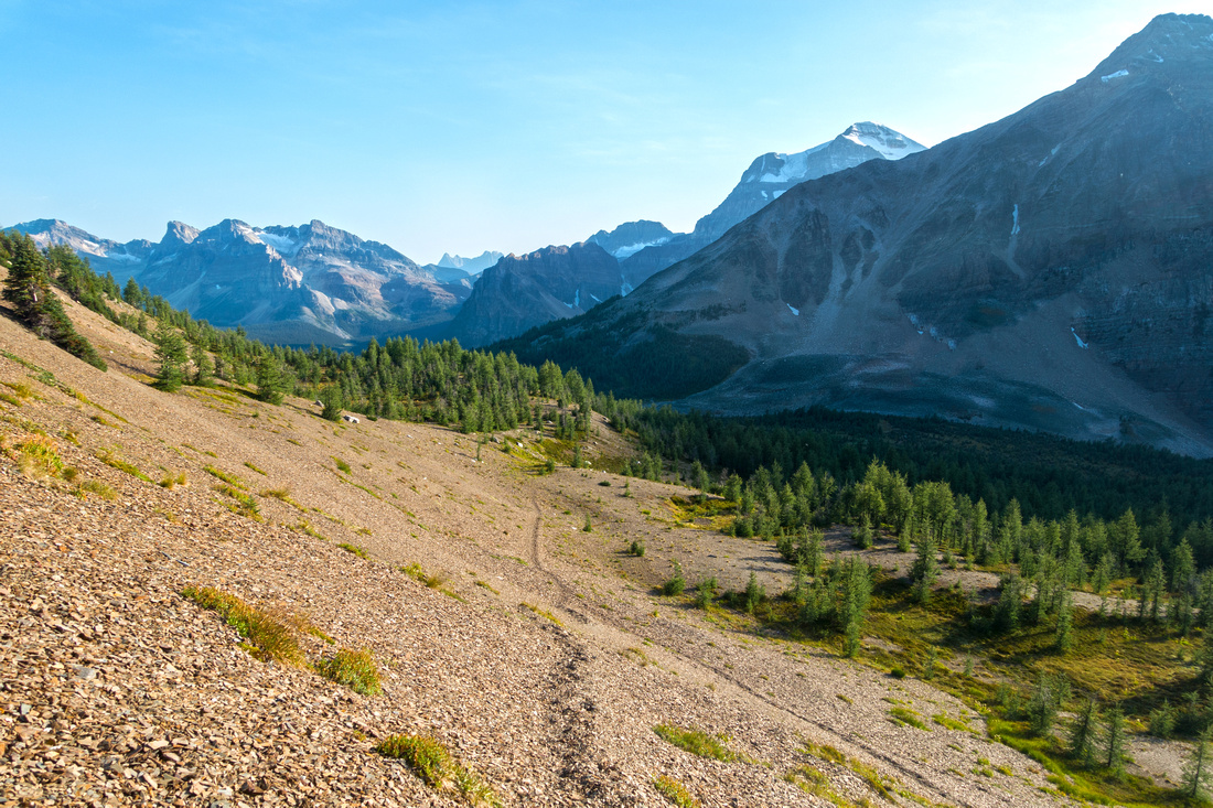 Gibbon Pass
Looking down to Gibbon Pass from Little Copper ascent with Mt. Ball already poking upper center right. The Pass is already in shade mid-afternoon; this photo illustrates best why for optimal lighting in this direction you need to be here in first part of the day Gibbon Pass
Looking down to Gibbon Pass from Little Copper ascent with Mt. Ball already poking upper center right. The Pass is already in shade mid-afternoon; this photo illustrates best why for optimal lighting in this direction you need to be here in first part of the day |
|||
 Little Copper Ridge
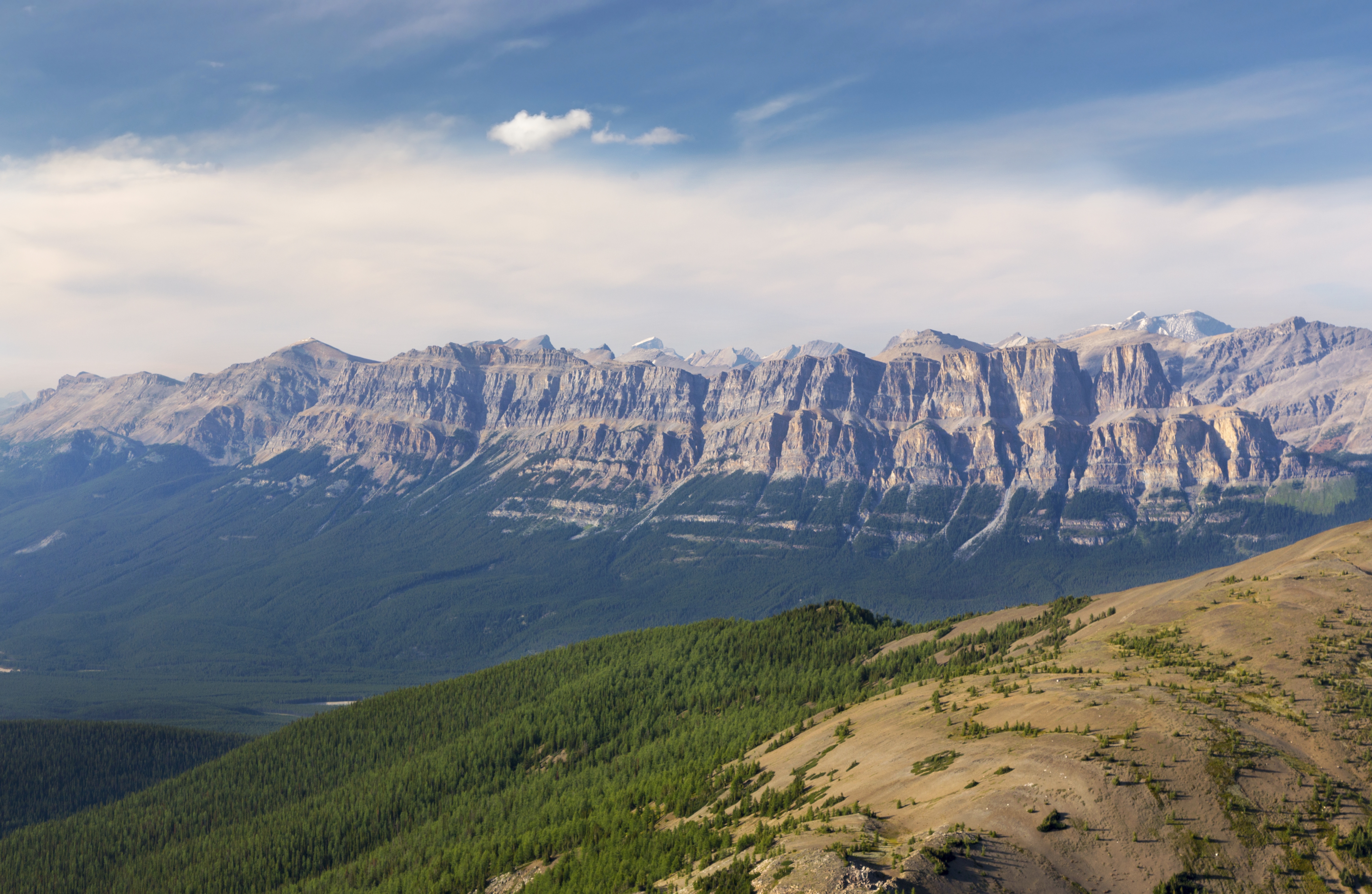
Gentle Ridge leading to Little Copper Summit (upper right). Pilot Mtn distance center Little Copper Ridge
Gentle Ridge leading to Little Copper Summit (upper right). Pilot Mtn distance center |
|||
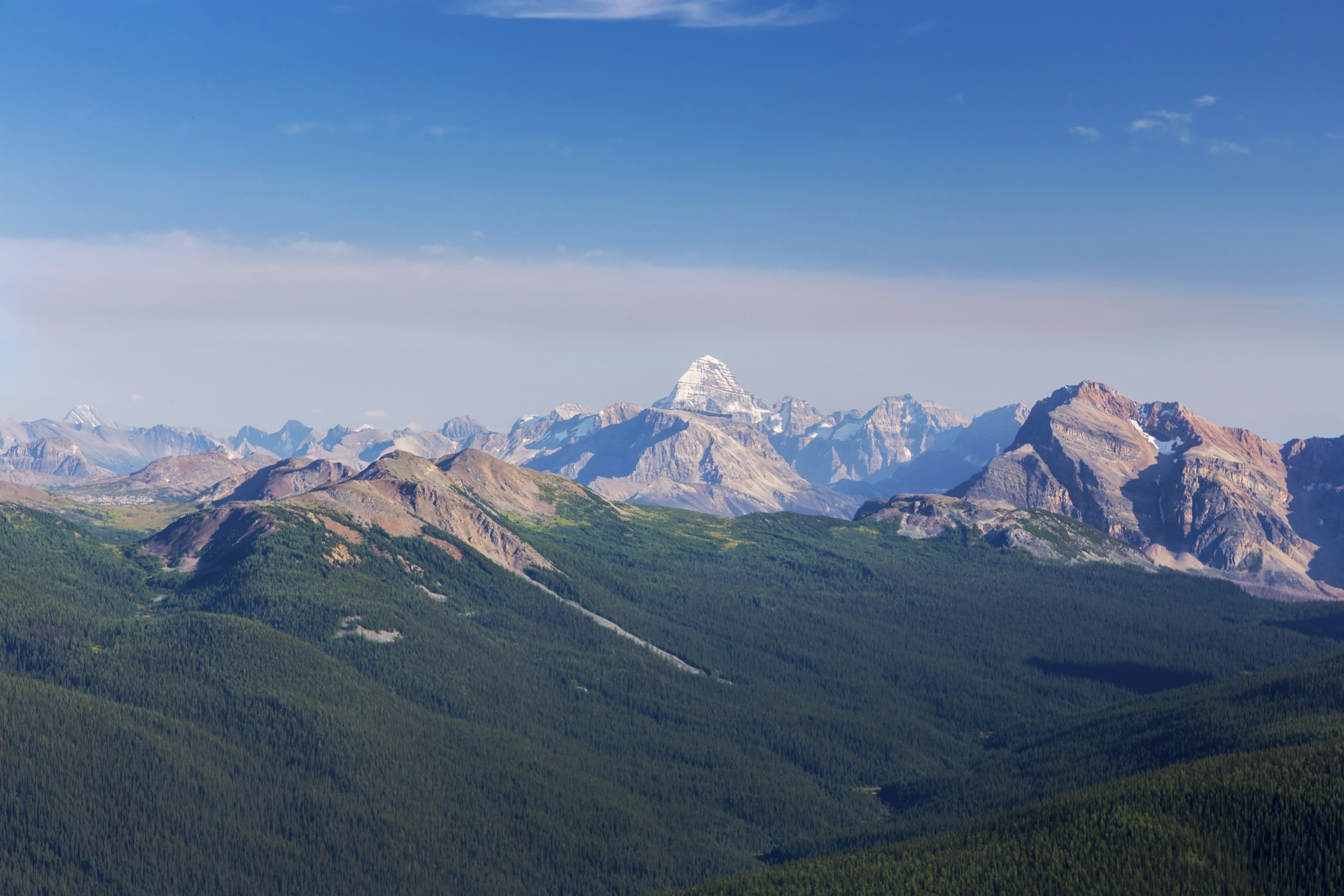
 Little Copper Ridge
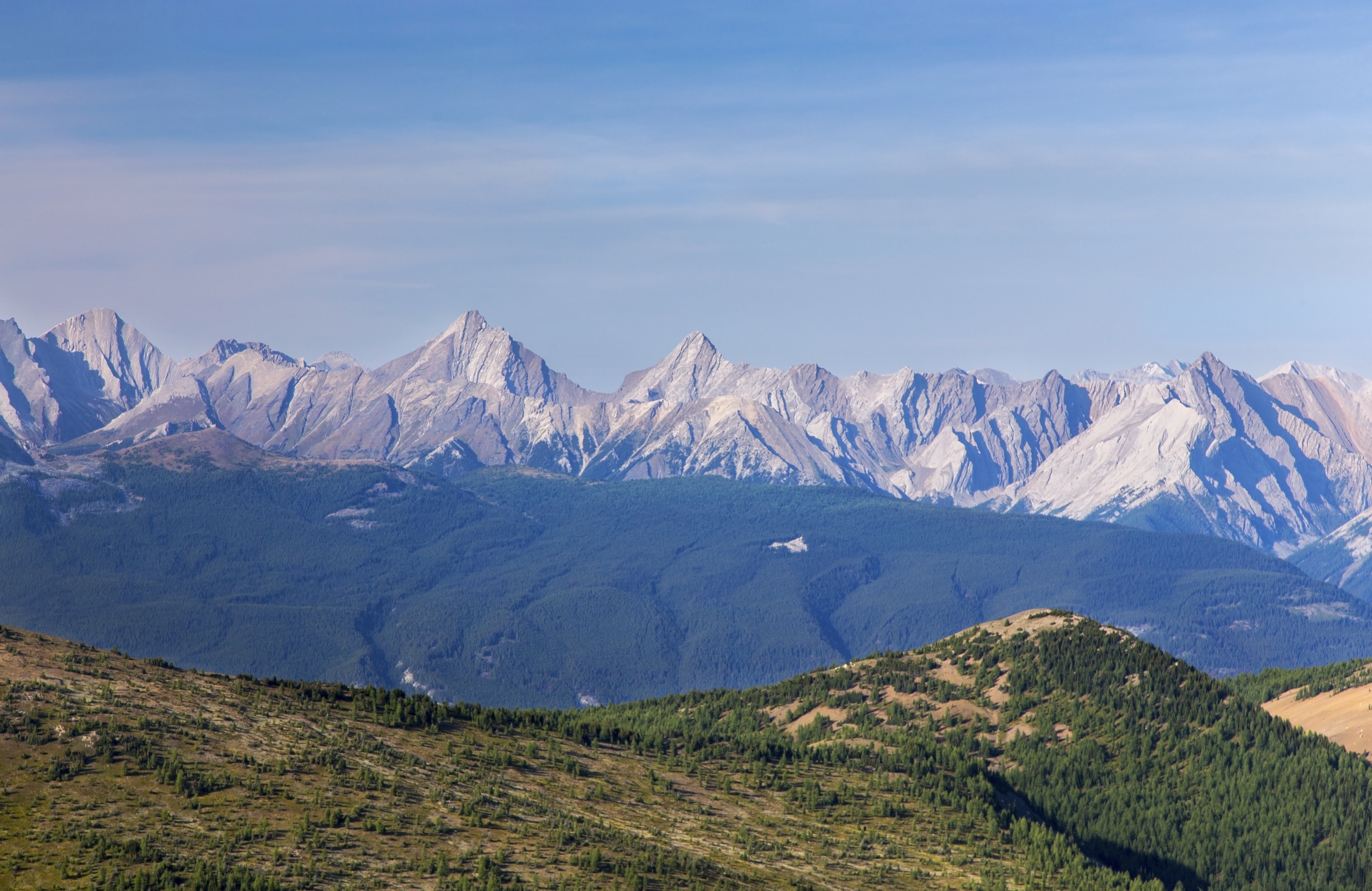
Looking back from near Little Copper summit. Lower Twin Lake is emerging lower left, with Mt. Storm rising above. Castle Mtn area upper right Little Copper Ridge
Looking back from near Little Copper summit. Lower Twin Lake is emerging lower left, with Mt. Storm rising above. Castle Mtn area upper right |
|||
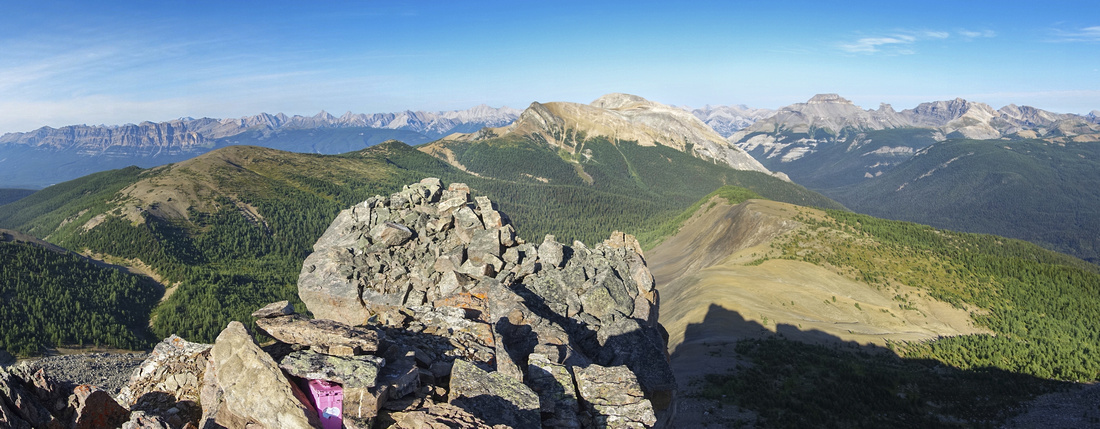 Summit Panorama
Panoramic view east from Little Copper summit; note nowdays ever-present Pink container Summit Panorama
Panoramic view east from Little Copper summit; note nowdays ever-present Pink container |
|||
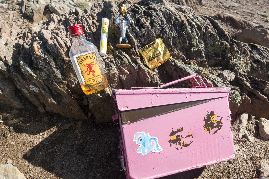 Booze, Dope and Condoms
Interesting contents of Pink Box; there was also register notebook inside Booze, Dope and Condoms
Interesting contents of Pink Box; there was also register notebook inside |
|||
|
|||
|
|||
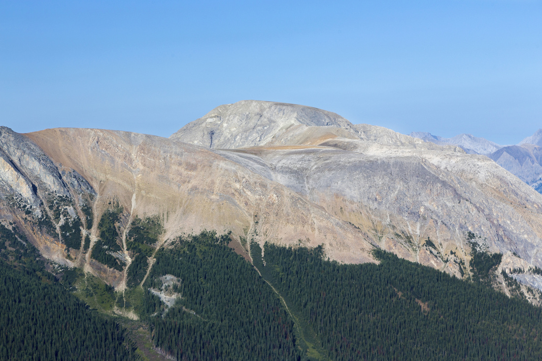 Big Copper
 (Kane moderate) directly east; normally ascended from Redearth Trail Big Copper
Big Copper (Kane moderate) directly east; normally ascended from Redearth Trail |
|||
|
|||
|
|||
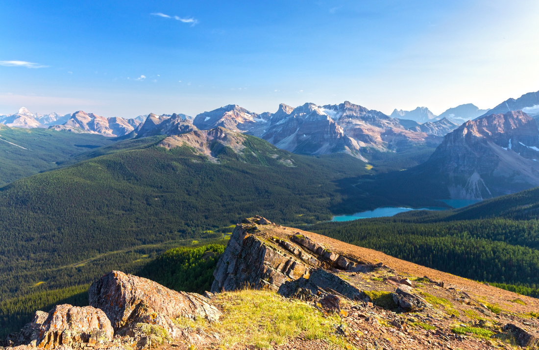 Shadow Lake
 / Redearth Circuit from Little Copper SW Ridge Shadow Lake
Shadow Lake / Redearth Circuit from Little Copper SW Ridge |
|||
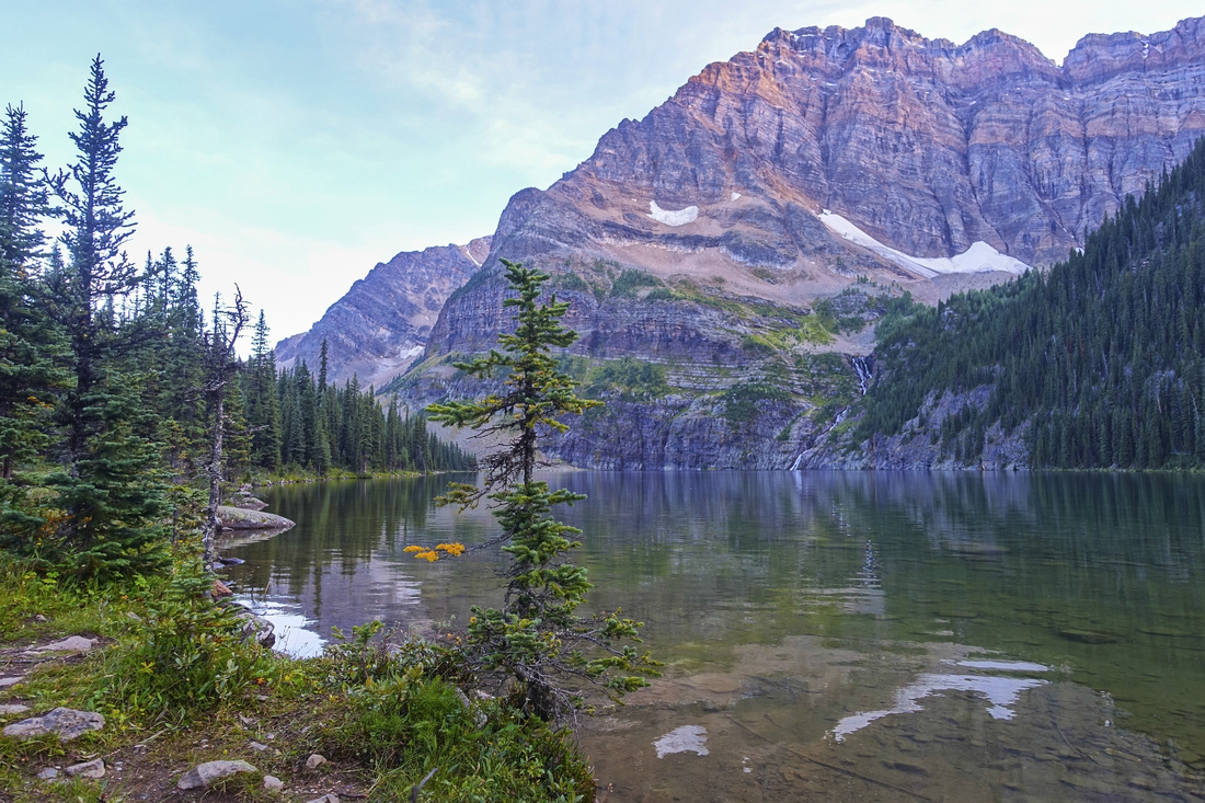 Lower Twin Lake
 on return, well into early evening shade Lower Twin Lake
Lower Twin Lake on return, well into early evening shade |
Abstract
| Overall Difficulty | D4 | Established Trail hiking with moderately steep parts. Rocky, Rooty and Muddy sections around lower Twin Lake. Easy talus ascent from Gibbon Pass. Considerable overall distance and elevation gain | |||
| Snow Factor | S2 | Occasionally done as alpine ski tour. Forested terrain to Gibbon Pass and mostly low angle slopes for Little Copper present low avalanche danger, but trip is bit too long for short winter hours | |||
| Scenery | Beautiful Lower Twin Lake below Mt. Storm cliffs. Expansive Alpine meadows dotted with larches on Gibbon Pass. Far reaching aerial views from Little Copper, including Mt. Assiniboine, Mt. Ball, Monarch, Sawback Range and many others | ||||
| Trail/Marking | Excellent | Established and marked trail to Lower Twin Lake / Gibbon Pass; off-trail ascent of Little Copper (way is obvious) | |||
| Suggested Time | 9 hr | Return time from Twin Lakes trailhead at Hwy 1; more if approaching from Hwy 93 / Arnica Lake. Subtract ~2hrs if going just to Gibbon Pass | |||
| Elevation | Start: 1480m Max: 2590m Total: ~1275m (Twin Lakes Trail) | Round Trip: 26km (Twin Lakes Trail) | |||
| Gear | Full Hiking boots preferred. Gaiters (muddy trail in Twin Meadows), poles for stability. Camping gear for overnight trips. Skis/Snowshoes in winter | ||||
| Water | Altrude Creek to lower Twin Lake only, dry afterwards. Carry 1.5L | ||||
| Dog Friendly | Yes | Standard back-country travel precautions | |||
 Gibbon Pass - Little Copper GAIA Map
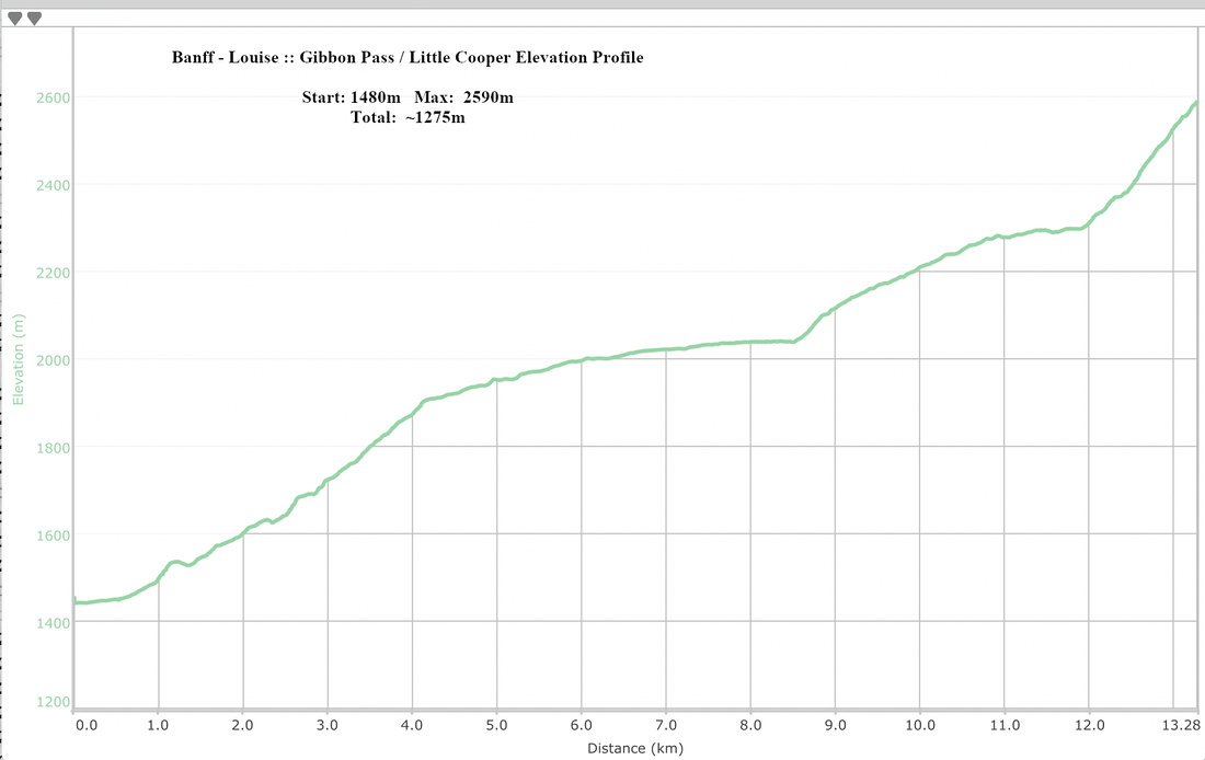 Gibbon Pass / Little Cooper Elevation Profile