Google Map |
Rockies :: Banff-Louise :: Arnica and Twin Lakes |
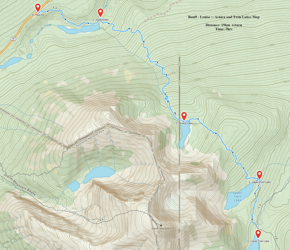
GPS Track |
 
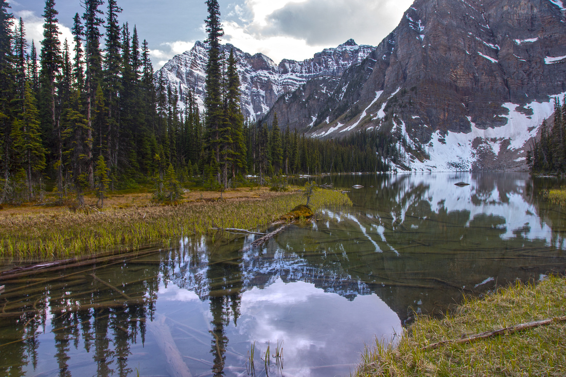
Reflections of Storm Mountain in Arnica Lake |
|||
| Trip Summary | |||
May 31, 2016
One of most scenic moderate hikes in Banff National Park leading to beautiful alpine lakes under cliffs of Storm Mountain. The approach described here follows official parks trail starting from tourist lookout on Banff-Radium Highway (Hwy 93), but it is also possible to hike in via Altrude creek at Castle Junction - or combine the two for loop hike, in which case 2 cars are needed. Shorter variation is to hike just to Arnica lake which is the most beautiful of the 4 visited along the way. This is also recommended fall season trip as there are many larches around the lakes. Pleasant option is off-trail ascent of minor lookout above Arnica/Twin divide, from where both sets of lakes can be seen. Upper Twin lake has official campground for those wanting an overnight trip. This is just a part of possible multi-day excursion as trail continues past lower Twin Lake over Gibbon Pass to Shadow Lake and beyond towards expansive alpine of Sunshine area.
Park at viewpoint on south side of Hwy93, about 1 minute west of Boom lake parking lot. Watch for opposite lane traffic if coming from Castle junction! Parking lot is not too big, but majority of people will be tourists that just stopped for few minutes to snap a photo. Trail starts next to official park kiosk and descends to Vista lake which can be seen from the parking. You lose ~120 vertical meters to the lake -- keep this in mind as you must ascend this at the end of the day if hiking back the same way! Trail crosses Vista lake outlet on good bridge, then starts steady ascent towards Arnica. Grade is moderate with several switchbacks. Forest opens higher up and it is worth a pause for moment or two to enjoy views of peaks north of Hwy93 -- including Mt. Whymper, Mt. Boom and Bell, as well as Quadra Mountain above Consolation Lakes valley. You gain about 500 vertical meters on the way to Arnica, passing pretty seasonal tarn along the way.
Beyond Arnica trail climbs for another ~150 vertical meters to col separating it from Twin Lakes cirque. From this col it is possible to hike off-trail towards Mt. Storm reaching lovely viewpoint from where both sets of lakes can be seen. Past the col trail drops steeply losing close to 200m vertical till upper Twin lake. Official campground is on the far side of lake outlet crossed via easy rock-hop. It takes about 45 minutes from Arnica to upper Twin and then another 15-20 minutes to lower Twin, which is a day-hiker turnaround point. Marked Altrude creek trail junction is just before the bridge over the outlet and is recommended return with 2 cars as it avoids all the ups and downs when returning the same way. It is far less scenic though as most of the way back will be spent under tree cover.
Update August '21: I returned to the area in summer of 2021 and visited the area via official Twin Lakes Trail from Castle Junction. It is considerably less scenic, but faster approach allowed enough time to continue on Bow Highline to Gibbon Pass and even ascend unofficially named "Little Copper". See here for full details. |
|
Gallery |
|||
 Vista Lake and Storm Mountain from trailhead on Hwy 93
 |
|||
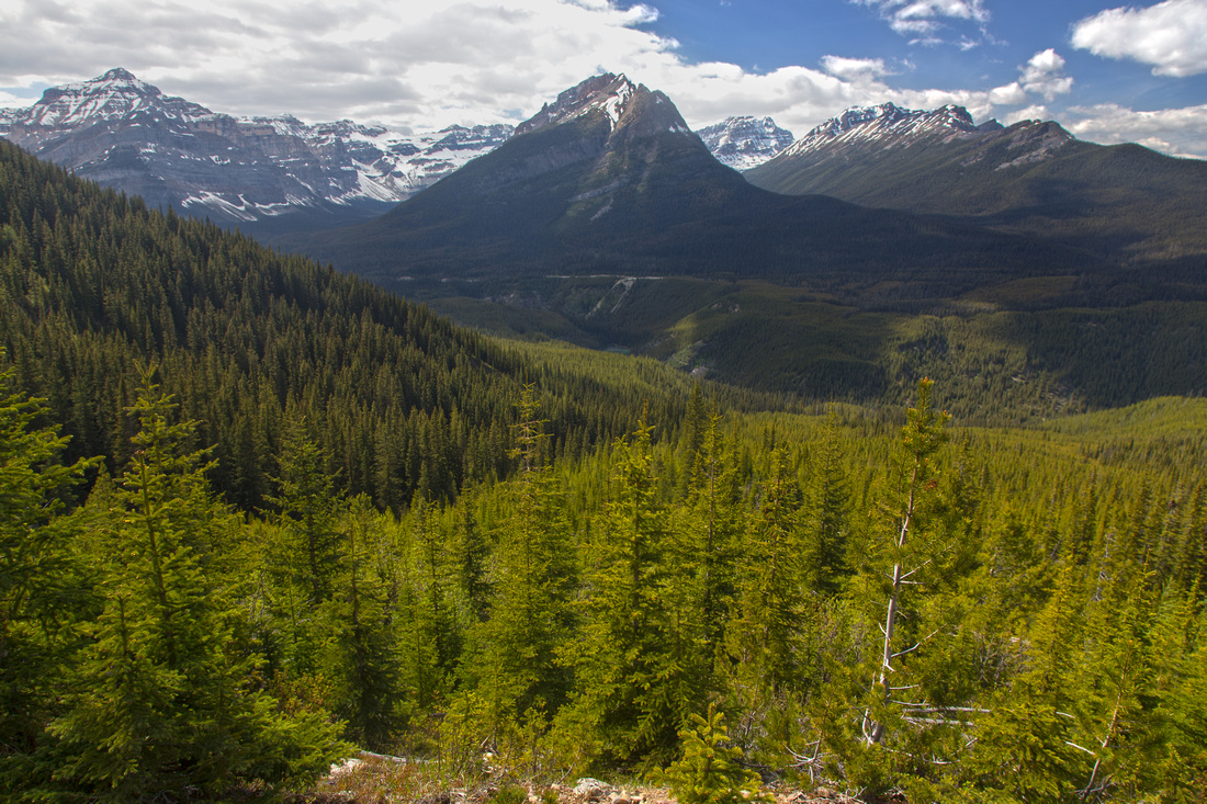 View back north while ascending to Arnica Lake
 |
|||
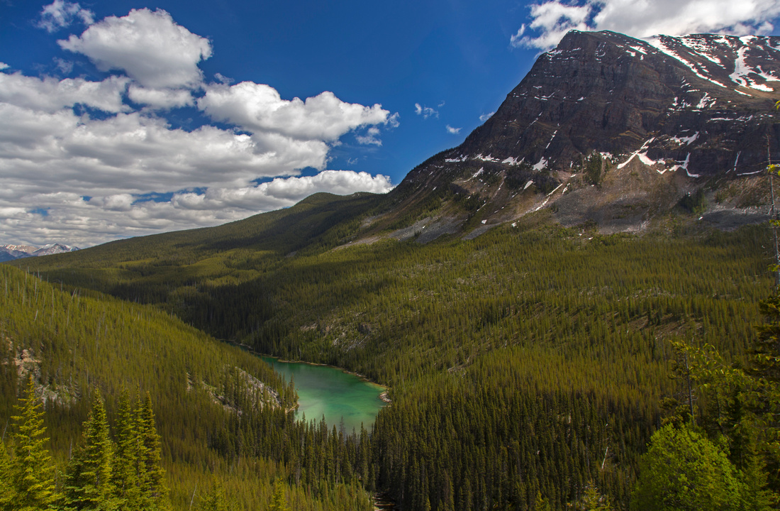
 Seasonal pond along the way to Arnica Lake
 |
|||
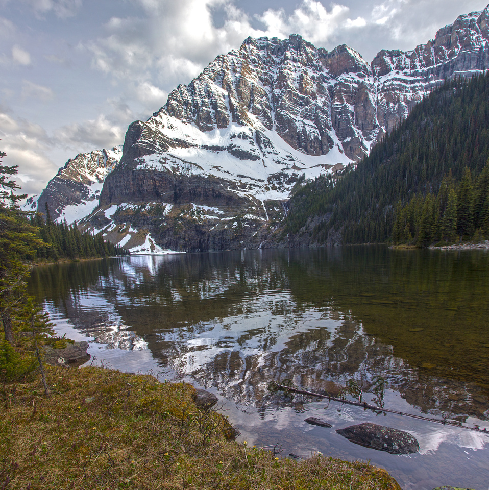
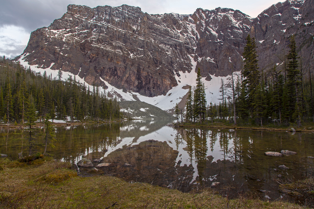 Classic view of Arnica Lake under Storm Mountain
 |
|||
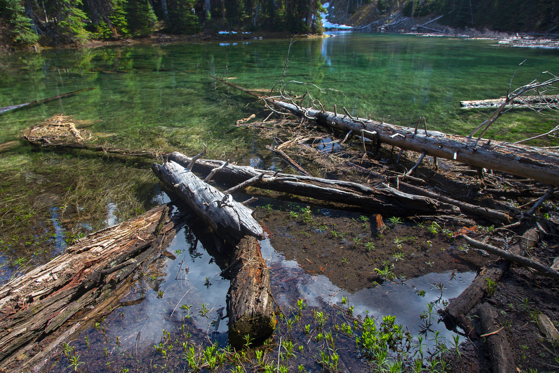
 Upper Twin Lake. Campground is on the other side
 |
|||
 Lower Twin Lake and day-hiker turnaround point
 |
Abstract
| Overall Difficulty | D3 | Moderately steep trail with some rough parts. Muddy spots in early season | |||
| Snow Factor | S3 | Low avalanche hazard, but fairly steep for casual snowshoe. High col between Arnica and Upper Twin lake snowboud till late Spring | |||
| Scenery | Beautiful alpine tarns under sheer cliffs of Storm Mountain. Larch hot-spot in fall season. Views across Hwy93 corridor to Louise group peaks. | ||||
| Trail/Marking | Excellent | Official Parks trail with signposts and marked junctions. Minor deadfall | |||
| Suggested Time | 7 hr | Return time for lower Twin lake from Hwy93. If going just to Arnica Lake under 5 hours. Alternate return via Altrude creek will cut down trip time for ~1hr, but two cars are needed | |||
| Elevation | Start: 1700m Max: 2270 m Total: ~1100 m (lower Twin Lake with return the same way to Hwy93) | Round Trip: ~19 km (lower Twin Lake) | |||
| Gear | Light hikers or full hiking boots. Gaiters helpful in spring for boggy and/or snowy parts. Poles recommended | ||||
| Water | Several creeks along the way. Carry no more than 1L | ||||
| Dog Friendly | Yes | Prime grizzly habitat | |||
 Arnica and Twin Lakes GAIA Map
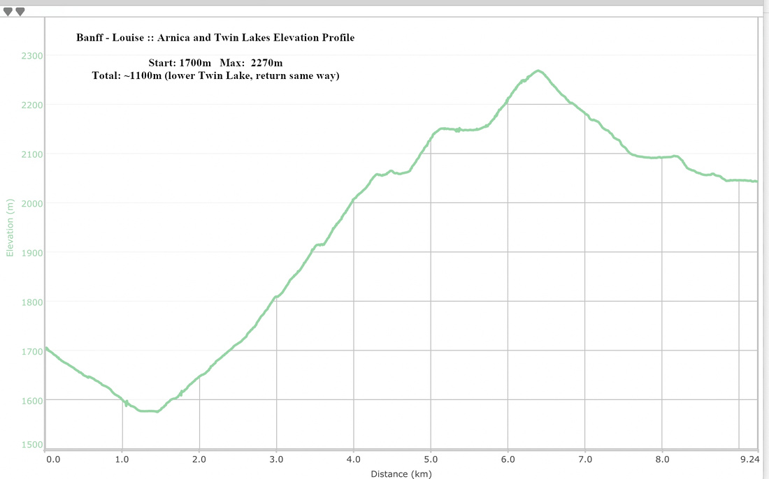 Arnica and Twin Lakes Elevation Profile