Google Map |
Rockies :: Banff-Louise :: Redearth Circuit |
GPS Track |
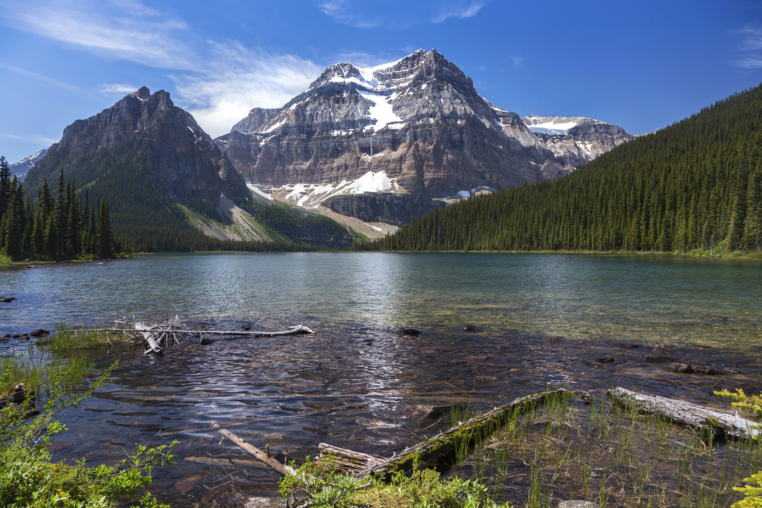 
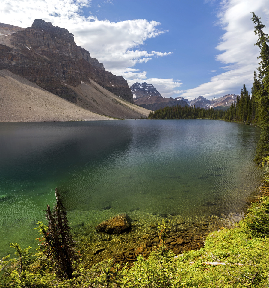
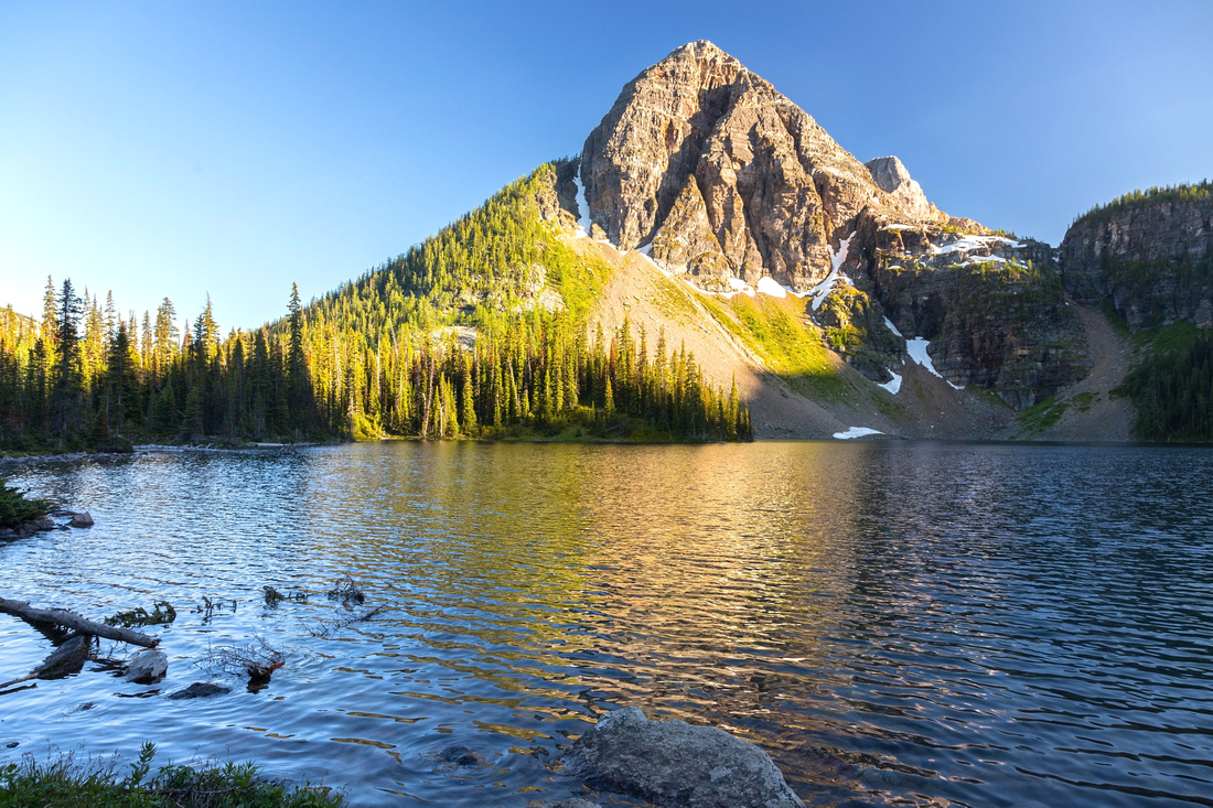
Classic View of Beautiful Shadow Lake and Snowcapped Mount Ball |
|||
| Trip Summary | |||
July 22, 2019
Redearth Creek leading to beautiful Shadow Lake below glaciated east aspect of Mount Ball is one of premier back-country corridors in Banff National Park. Alpine Meadows before the lake host popular Shadow Lake Lodge. In summer this valley is also popular cycling trip, while in winter it is frequented by cross-country skiers. Real scenic rewards however lie beyond Shadow Lake that is usual turnaround point for day hikers. It is also most scenic part of well known “Bow Higline” backpacking route between Banff/Radium Highway and Sunshine/Bourgeau Area. This page presents one possible loop that links Redearth Creek/Shadow Lake with Pharaoh and Haiduk Creek valleys. Starting point can be one of several back-country campgrounds; Egypt Lake/Shelter or Pharaoh Creek are some of the options. Easiest approach to the area from the Highway is via Redearth Creek fire road, and although this extra distance (~10km each way) can be cycled, it would bring total count to ~50km and make day trip non-feasible for most people; backpacking in via Healy Pass is far better option. Otherwise if coming in via Redearth Creek backcountry campground near Shadow Lodge (Re14) is best option - if you can find space. Clockwise direction is recommended due to favourable sun position for photography purposes.
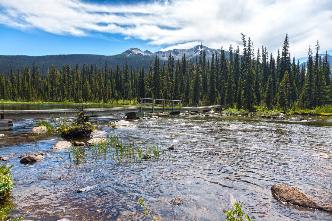
Loop starts and ends at Pharaoh and Redearth creek junction. If coming from Healy Pass and camping at Egypt Lakes, follow generally well defined trail descending Pharaoh Creek for 8km, passing Re16 back-country campground about halfway down. This campground is good option in summer months when others are usually fully booked. Only 5 tent sites with outhouse, metal food lockers and food preparation area (descent to Pharaoh creek to fetch water is steep and awkward!). Trail passes Redearth Ranger station few 100’s of meters before reaching bike lockers. Turn left and hike up Redearth trail towards the lake, passing Shadow Lake Lodge on the way. Bow Highline trail coming in from Arnica/Twin lakes joins in near the lodge. Cross Shadow Lake outlet on good wood bridge; best views are just past the bridge. Trail then starts gentle ascent up Hawk creek valley and reaches Ball Junction campground in ~4km. Ball Pass is ~2km from here, but it is better visited as OnB day-hike from Hwy93 on west side. Past the junction Redearth Trail ascends to Haiduk creek valley. Haiduk lake is perfect lunch spot. This beautiful back-country lake is quite large and it can not all be seen from its shore, only later from Whistling Pass.
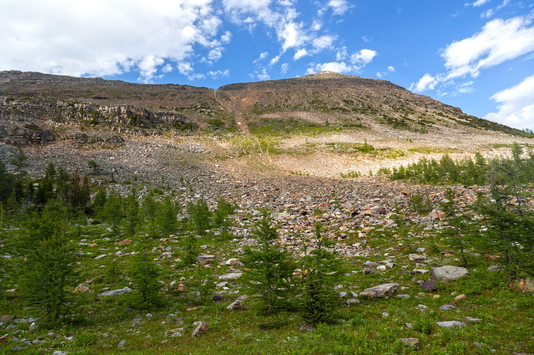
Beyond Haiduk lake trail ascends steeply to Whistling Pass. Talus field is somewhat steep but otherwise presents no problems. Views from the pass are some of finest in Banff National Park. Scramblers can also ascend Pharaoh Peek from Whistling Pass vicinity; if doing so mid to late afternoon is best time to be on the summit from photography perspective. This scramble is probably not feasible if day hiking Redearth loop because of overall distance though; better to do it as separate trip from overnight base at Egypt lakes, which are ~3km from the pass. On descent Scarab and Egypt lakes are recommended short extension; Scarab lake is preferably visited during Natalko (Talc) Lake crossover. Finally reach Egypt campground/shelter where Pharaoh creek trail begins, 8km from Redearth Creek junction.
|
|
Gallery |
|||
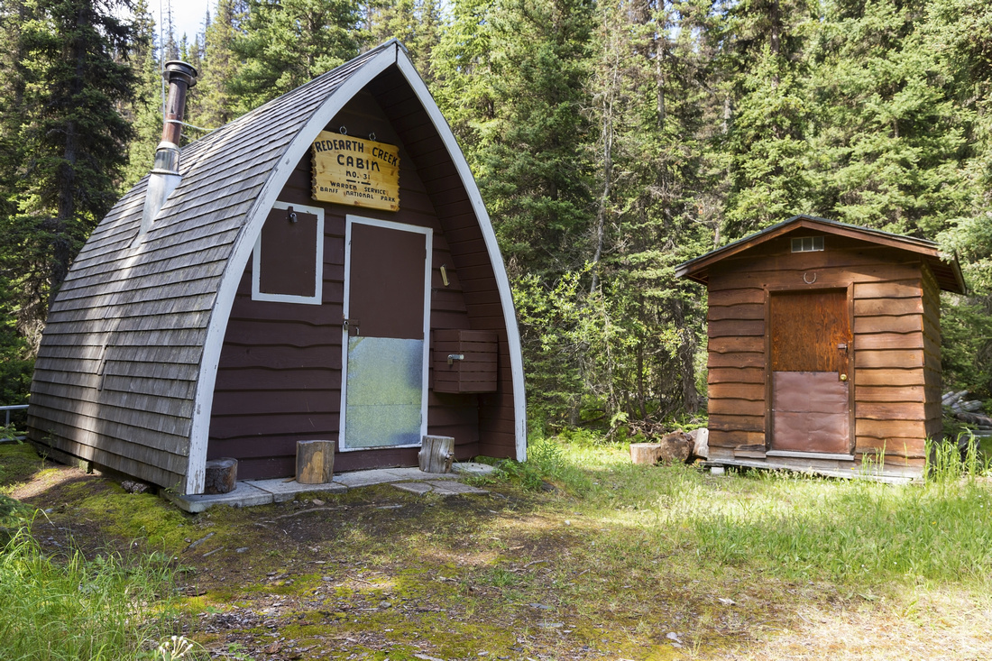 Ranger Cabin near junction of Pharaoh and Redearth Creek trails; ~10.5km from Trans-Canada
 |
|||
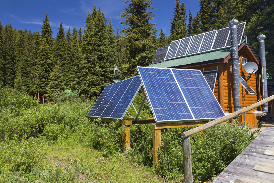 Solar Panels at Shadow Lake Lodge
 |
|||
|
|
|||
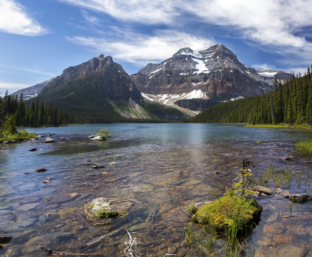 Vertical stitch of 3 frames looking across Shadow Lake from outlet bridge on previous photo
 |
|||
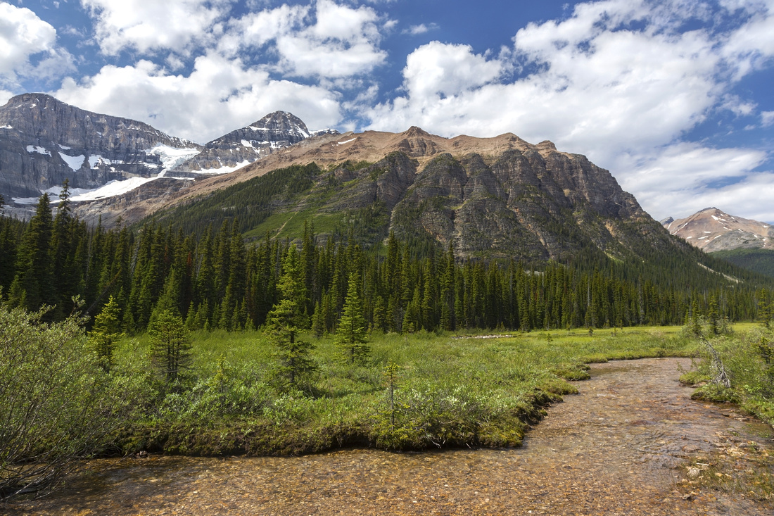 Ball Pass junction near the campground, some 4km from Shadow Lake. 'Redearth' moniker is fully justified
 |
|||
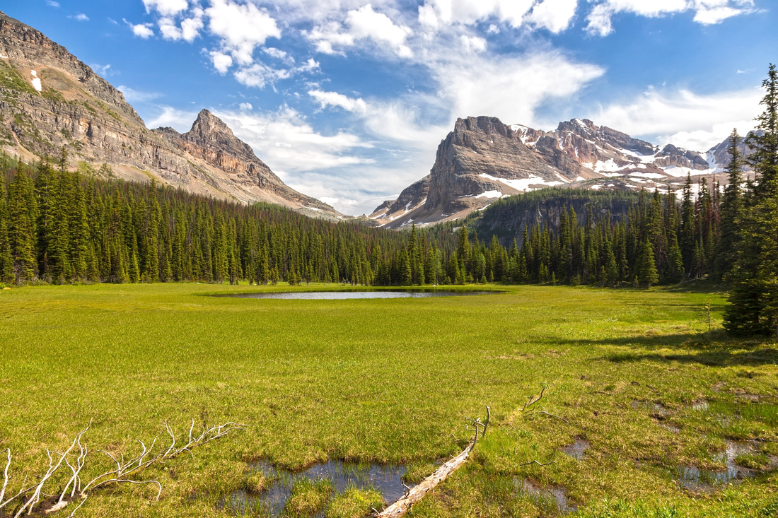 Beautiful alpine meadows in Haiduk creek valley approaching Haiduk Lake
 |
|||
 Haiduk Lake (vertical stitch of 4 frames), looking back as trail hugs lake shore on east side. Mt. Ball distance center is already quite far
 |
|||
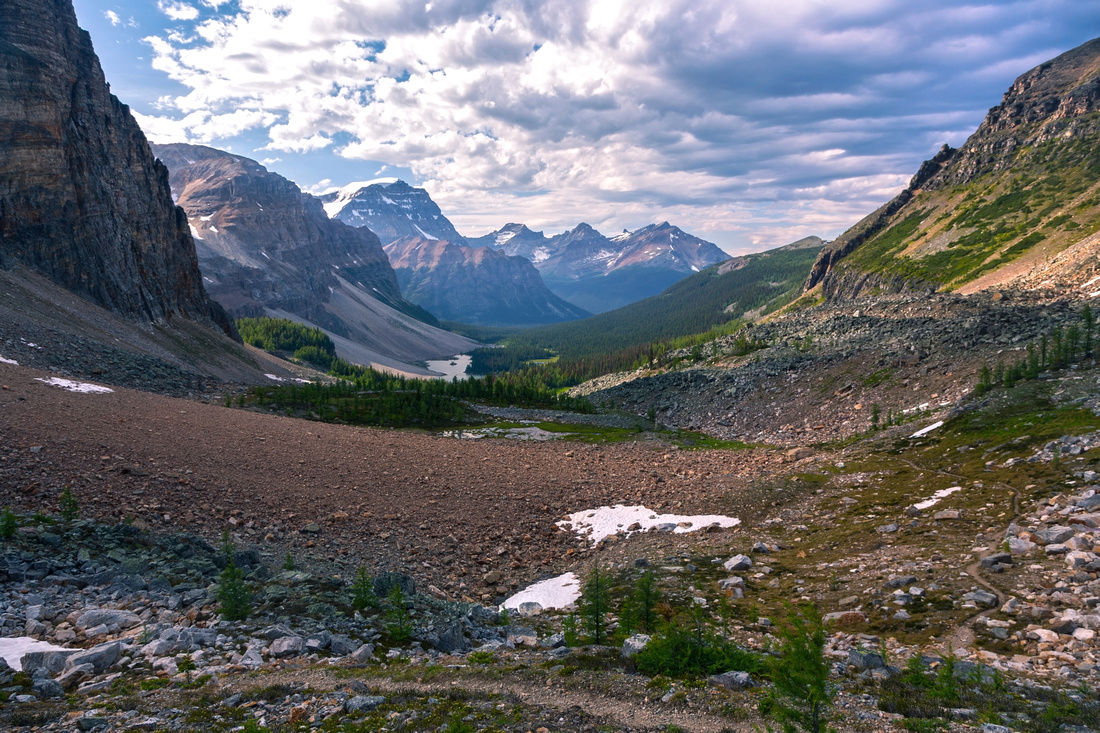 Looking back to Haiduk Creek Valley from Whistling Pass. Note hiking trail on right side of the photo
 |
|||
 Normal route up Pharaoh Peek just below Whistling Pass. Ascend obvious shallow gully in the middle, then angle right across easy talus to the top; about an hour, descent is much faster
 |
|||
 Early evening sun reflected of Sugarloaf Mountain as Egypt Lake is already in shade
 |
Abstract
| Overall Difficulty | D3/4 | Established trail hiking with some steep parts. Several talus slopes. Rough section above Egypt Lake. Significant overall distance | |||
| Snow Factor | S3 | Some avalanche danger on open slopes crossing Whistling Pass. Entire loop, due to its length, is probably not feasible as day trip in winter | |||
| Scenery | Shadow Lake and Mount Ball. Several back-country alpine lakes in Egypt area. Rolling Meadows and High alpine pass with far reaching views. | ||||
| Trail/Marking | Very Good | Official Park trail with signed junctions and cairns on talus slopes. Some unbridged rock-hop creek crossings. Possible muddy sections around Shadow Lake | |||
| Suggested Time | 10 hr | For full loop as day-trip with light pack and starting point one of several back-country campgrounds. Redearth Creek side approach from the Highway adds 20km, and although this part can be cycled, total distance of ~50km will make day hike non-feasible for most people. | |||
| Elevation | Start: 1740m (Redearth Creek) Max: 2300 m (Whistling Pass) Total: ~950 m | Round Trip: ~30 km | |||
| Gear | Full hiking boots. Hiking poles very helpful for stability traversing talus slopes in Whistling pass vicinity, as well as rough section of trail above Egypt lake | ||||
| Water | Several creeks between lakes. Fresh water readily available. Carry no more than 1L | ||||
| Dog Friendly | No | If backpacking, as most people will. Ok if dayhiking from Highway, but overall distance of 50km might be too much even for 4-legged creatures. | |||
 Redearth Circuit GAIA Map
 Redearth Circuit Elevation Profile