Google Map |
Rockies :: Kootenays :: Ball Pass via Hawk Creek |
GPS Track |
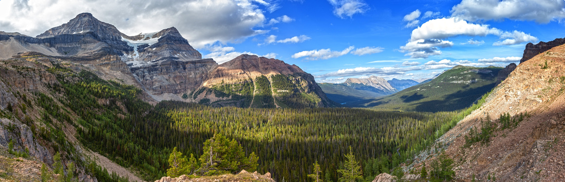 
Ball Pass Panorama looking NE. Glaciated Mt. Ball upper left, distant Shadow Lake tiny spec just right of center |
|||
| Trip Summary | |||
Aug 26, 2024Hike up Hawk Creek Valley to Ball Pass is Diamond in the Rough. Compared to ultra-popular Floe Lake / Rockwall across the valley, Ball Pass trail is very lonely one and you might have it to yourself, even on a sunny weekend as most people that do venture this way are Kane peakbaggers destined for Mt. Isabelle. This is real shame as Alpine meadows bordering the Pass on west side are some of nicest I've seen in this Part of the Rockies, while main highlight - view of South Ball Glacier from the Pass - is reason by itself to head this way. Trail is official and described in Patton / Robinson Canadian Rockies Trail Guide. Lower Hawk creek has burned in 2003 wildfires resulting in lots of young growth in first 4km as well as occasional deadfall that, despite obvious regular maintenance, will require hopping over / under in first 4km of the hike.
Parking is at Floe Lake Trailhead on Hwy93 west side. Lot is small and fills fast; moron camper vans that use pullout for U-turns only add to gong-show - if busy, simply park at Hwy93 shoulder without going in. Trail starts on the other (east) side directly opposite parking lot entrance (first photo in Gallery below). After paralleling the Highway for ~5min cross Hawk Creek and head up. First 4km are fairly tedious as canopy of young growth created tunnel - like effect. After crossing major tributary stream ~km4, things improve in a hurry. Scenic Rockslides, cool subalpine forest and Hawk Creek cascades make this stretch very enjoyable. After climbing a bit steeper and passing Mt. Isabelle scrambler junction (~2hrs from highway, possible flag, Waypoint "3 - Isabelle Route", GPS Track download Top of Page) trail tops at super scenic series of Alpine Meadows below the Pass. Be on alert for bears - I've seen plenty of fresh diggings here during my visit. Final rise to the Pass at Kootenay - Banff National Parks boundary is pure joy to hike with stands of larches at both side. From the sign hike another few minutes to rock outcrop that grants unobstructed view of main prize - South Ball Glacier - as well as distant Bow Highline Shadow Lake / Redearth Circuit. This is the day-hiker turnaround point. Trail continues on the east side and descends to Re21 backcountry campground in another ~2km below the Pass.
Ball Pass can also be visited from the East side, but this requires a backpack, most likely as after dinner short jaunt from Re21 campground. My recommendation is to day-hike from the Kootenay side and enjoy upper Hawk Alpine very few people visit. |
|
Gallery |
|||
 Hwy93 Trailhead
Parks Table on east side of Hwy93 opposite Floe Lake Parking area Hwy93 Trailhead
Parks Table on east side of Hwy93 opposite Floe Lake Parking area |
|||
 Young Growth
Typical section of lower trail traversing burn area with young growth Young Growth
Typical section of lower trail traversing burn area with young growth |
|||
 Hawk Valley
Views opening ~km 3 approaching Isabelle Peak (L). Ball Pass is "V" upper center right Hawk Valley
Views opening ~km 3 approaching Isabelle Peak (L). Ball Pass is "V" upper center right |
|||
|
|
|||
 Sturdy Bridge
Crossing very sturdy 3-log bridge. Trip becomes much more scenic from here Sturdy Bridge
Crossing very sturdy 3-log bridge. Trip becomes much more scenic from here |
|||
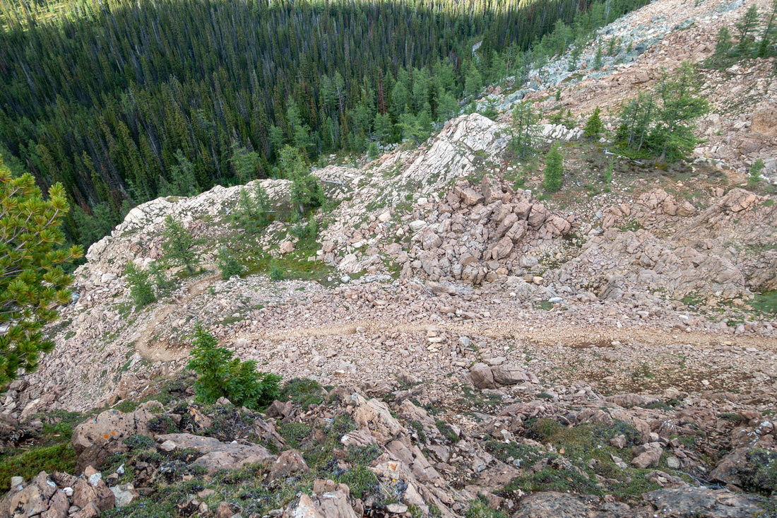
 Isabelle Cliffs
Traversing rockslide below Mt. Isabelle Isabelle Cliffs
Traversing rockslide below Mt. Isabelle |
|||
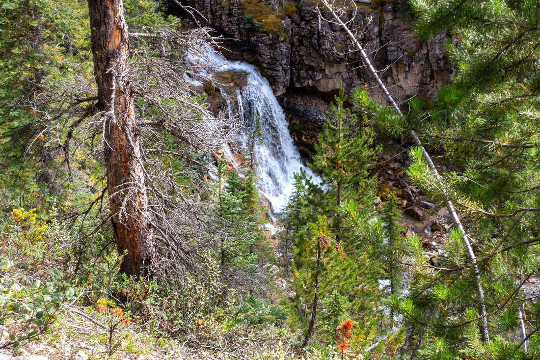 Hawk Cascade
Hawk Creek Cascades as trail dips back into forest and starts climb to the Alpine Hawk Cascade
Hawk Creek Cascades as trail dips back into forest and starts climb to the Alpine |
|||
 Isabelle Junction
Orange Flag marking point where Mt. Isabelle scramble route leaves trail Isabelle Junction
Orange Flag marking point where Mt. Isabelle scramble route leaves trail |
|||
|
Lower part of Mt. Isabelle Scramble Route; it will take at least 3hrs to the Top from here and it is much more serious outing |
|||
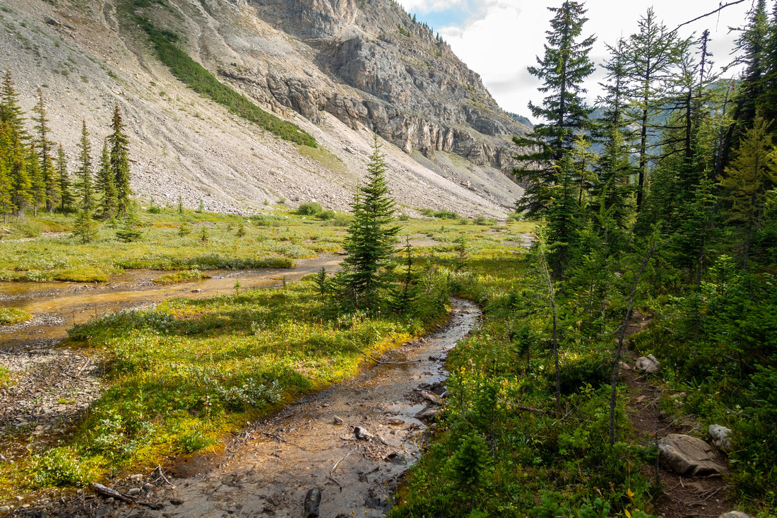
 Hawk Alpine
Very beautiful and pristine Alpine meadow ~30min before Ball Pass Hawk Alpine
Very beautiful and pristine Alpine meadow ~30min before Ball Pass |
|||
 Hawk Alpine
View back hiking by very young Hawk Creek. Plenty of bear diggings - be alert and make noise Hawk Alpine
View back hiking by very young Hawk Creek. Plenty of bear diggings - be alert and make noise |
|||
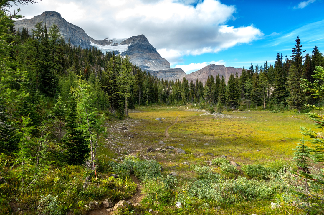 Ball Pass Alpine
Crossing last Alpine meadow before Ball Pass Ball Pass Alpine
Crossing last Alpine meadow before Ball Pass |
|||
 Ball Pass
Parks Sign at 2210m Ball Pass continental divide and Kootenay / Banff National Parks boundary Ball Pass
Parks Sign at 2210m Ball Pass continental divide and Kootenay / Banff National Parks boundary |
|||
 Ball Pass
Very scenic hiking just east of Ball Pass sign before trail starts east side descent. Mt. Ball and Ball Glacier upper center right Ball Pass
Very scenic hiking just east of Ball Pass sign before trail starts east side descent. Mt. Ball and Ball Glacier upper center right |
|||
 Mt. Ball
Front Row view of Mt. Ball and south Ball Glacier from little rise east of Ball Pass / usual day-hiker turnaround point Mt. Ball
Front Row view of Mt. Ball and south Ball Glacier from little rise east of Ball Pass / usual day-hiker turnaround point |
|||
 |
|||
 Haiduk Peak
View back to Ball Pass area with Haiduk Peak rising above Haiduk Peak
View back to Ball Pass area with Haiduk Peak rising above |
|||
 Redearth Trail
Trail descends Ball Pass east side. RE21 backcountry campground / Redearth Circuit junction is ~30min away Redearth Trail
Trail descends Ball Pass east side. RE21 backcountry campground / Redearth Circuit junction is ~30min away |
|||


Abstract
| Overall Difficulty | D3 | Trail hiking with moderate grade and some rocky sections | |||
| Snow Factor | S3 | Brief Avalanche danger crossing rockslide below Isabelle Peak between km 5 and 6. | |||
| Scenery | Hawk Creek and Mt. Isabelle. Ball Pass Alpine, Mt. Ball and South Ball Glacier. Bow Highline / Redearth Circuit from the Pass. Rockwall area to the west on return | ||||
| Trail/Marking | Very Good | Official Parks Trail with Signs. Some Deadfall and Muddy Sections | |||
| Suggested Time | 6 hrs | Day Hiker Return time from Hwy93 | |||
| Elevation | Start: 1350m Max: 2215m Total: ~950m (Hwy93) | Round Trip: ~19km (Hwy93) | |||
| Gear | Full Hiking boots preferred to Day Hikers. Poles helpful | ||||
| Water | Hawk Creek and side drainages. Carry 0.5 - 1L | ||||
| Dog Friendly | Yes | Grizzly Bears frequent Ball Pass alpine | |||
 Ball Pass via Hawk Creek GAIA Map
 Ball Pass via Hawk Creek Elevation Profile