Google Map |
USA :: Sedona :: Rabbit Ears |
GPS Track |
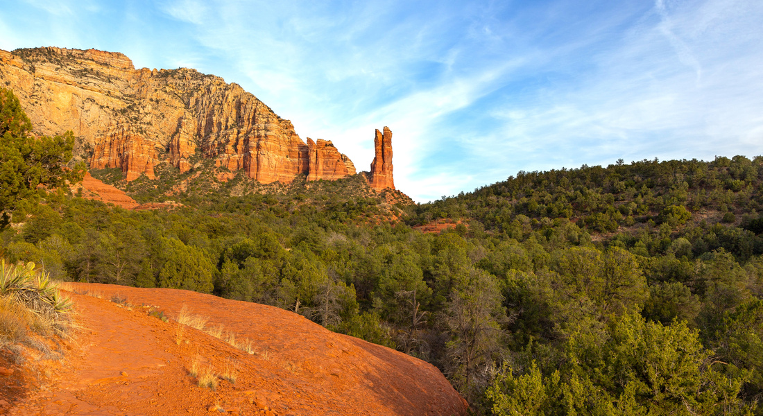 
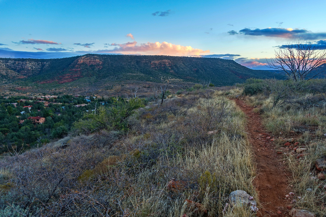
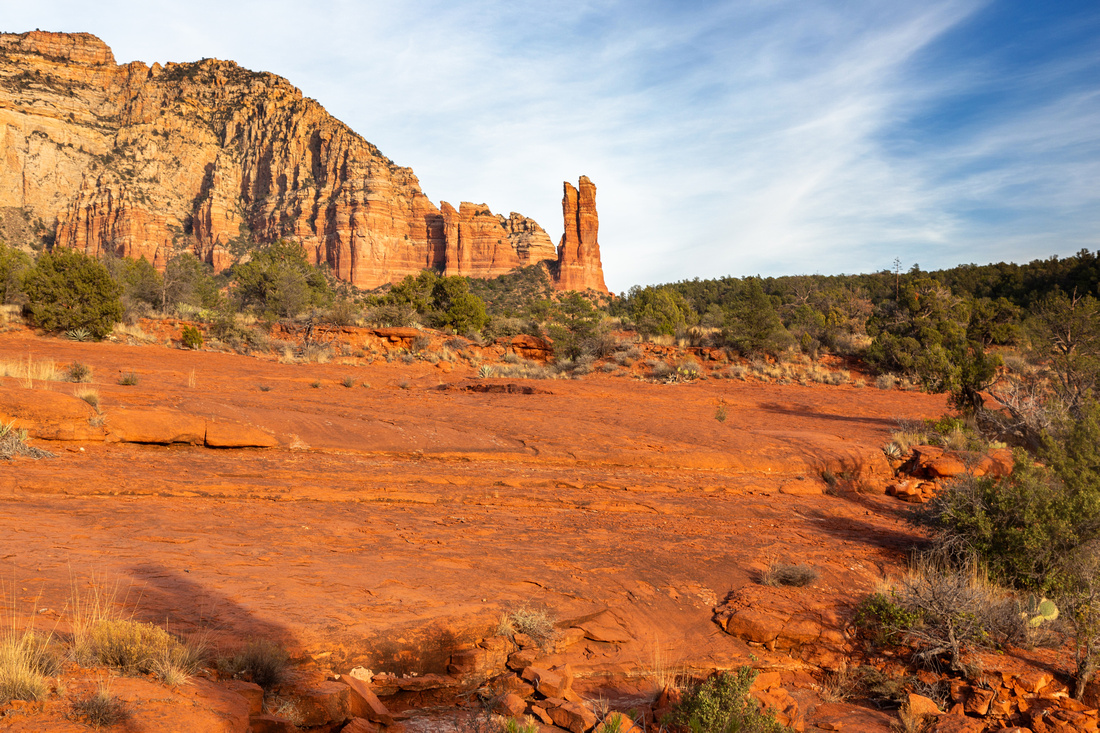
View from "Wash" Route that deviates from official Rabbit Ears Trail; both join at hilltop center right |
|||
| Trip Summary | |||
Dec 1, 2023
Unique Rock Formation resembling Rabbit Ears, also sometimes called Oak Creek Spire. Trail can be enjoyed by hikers, bikers or trail runners. Approach follows Courthouse Butte loop trail starting from Bell Rock Pathway Trailhead just north of Oak Creek Village. After reaching signed junction ~30 min from trailhead (second photo in Gallery), there are 2 options. Standard route follows Big Park Loop shortly to start of official Rabbit Ears Trail but it is also possible to follow unsigned route that stays closer to Lee Mountain Cliffs by following obvious wash and then bits of trail and cairns. (GPS Track - download on top of page - is for official trail; Point where it joins official route on top is 2 - Rabbit Ears Route). Route approach is more scenic - lead photo on top the page. My guess is that rock climbers also use this approach on attempt to scale this unique rock feature.
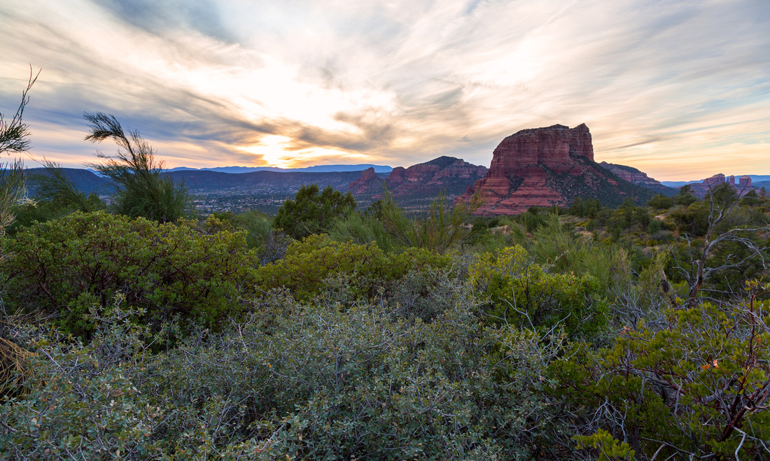
After both approaches merge on top of hill just south of Rabbit Ears, you can return same way or continue down Rabbit Ears trail towards Jacks Canyon Road, then loop back via Little Rock and Big Park Loop (junctions are signed as always). Loop return is recommended, specially in first part of the day as sunlit Courthouse Butte will probably look quite spectacular. Beware of mountain bikers, although this variation if far less popular from crowd infested trail further west - on my hike in early December '23 I was entirely by myself; cold weather probably had something to do with it. |
|
Gallery |
|||
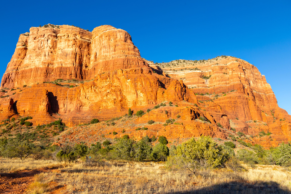 Courthouse Butte
Initial approach follows standard Courthouse Butte loop trail Courthouse Butte
Initial approach follows standard Courthouse Butte loop trail |
|||
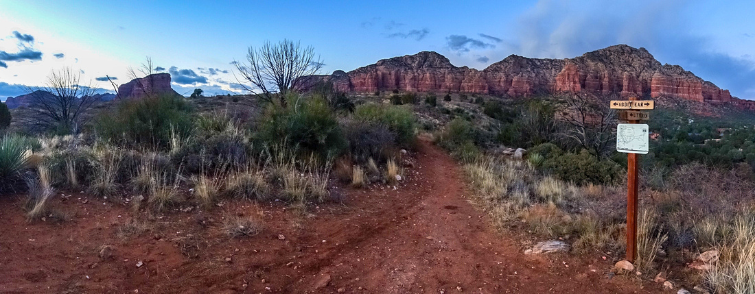
 Wash Junction Wash Junction
"Wash" Junction at Courthouse Butte Loop. Go right and follow Big Park Loop for short distance to official start of Rabbit Ears Trail. For "Wash Route" go straight up slickrock, then head right as first side wash comes in from the right |
|||
|
|
|||
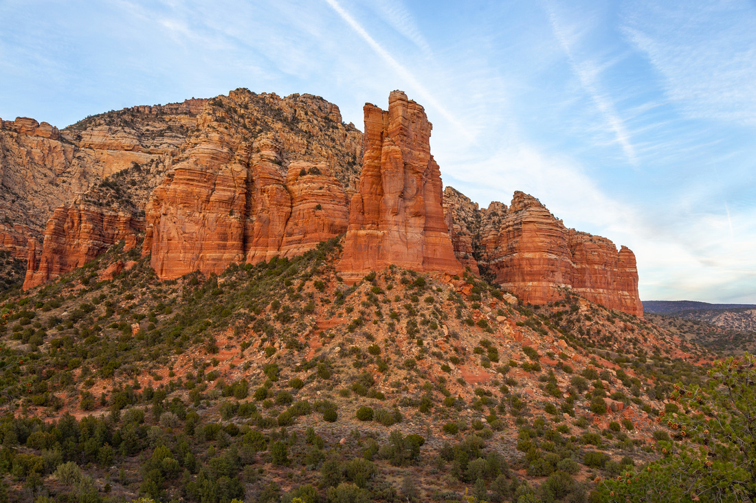
|
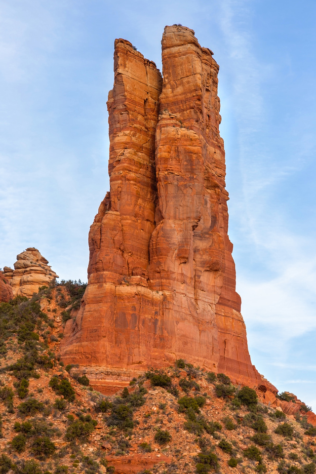
Rabbit Ears close up just after "Wash" route joins official trail. From this shot it is apparent where the name comes from |
|||
|
|
|||
 Rabbit Ears
Side view of Rabbit Ears as trail loops on hilltop and starts southerly descent Rabbit Ears
Side view of Rabbit Ears as trail loops on hilltop and starts southerly descent |
|||
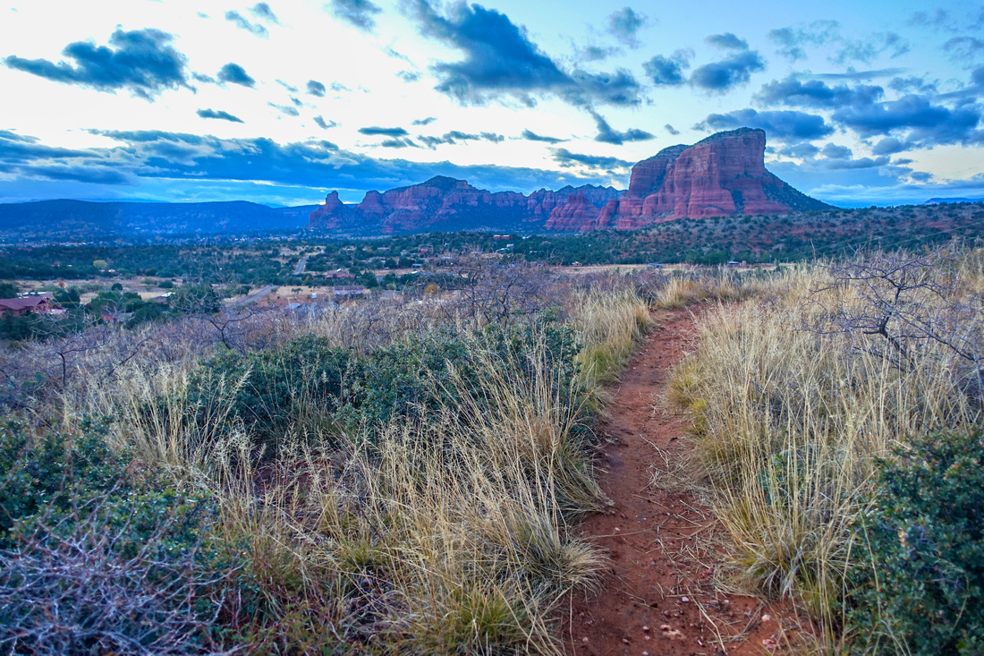
 Jacks Canyon Descent
View of Jacks Canyon area as Rabbit Ears descends towards Little Rock junction Jacks Canyon Descent
View of Jacks Canyon area as Rabbit Ears descends towards Little Rock junction |
|||
 Little Rock Junction
Signed Little Rock junction panorama looking back. Rabbit Ears descends to Jacks Canyon Road Little Rock Junction
Signed Little Rock junction panorama looking back. Rabbit Ears descends to Jacks Canyon Road |
|||
 Little Rock
Pleasant hiking on Little Rock back to Courthouse Butte. This trail is somewhat roundabout as it crosses several gorges before merging with Big Park Loop. Views are excellent, specially in mid-morning as sun will be behind you Little Rock
Pleasant hiking on Little Rock back to Courthouse Butte. This trail is somewhat roundabout as it crosses several gorges before merging with Big Park Loop. Views are excellent, specially in mid-morning as sun will be behind you |
|||
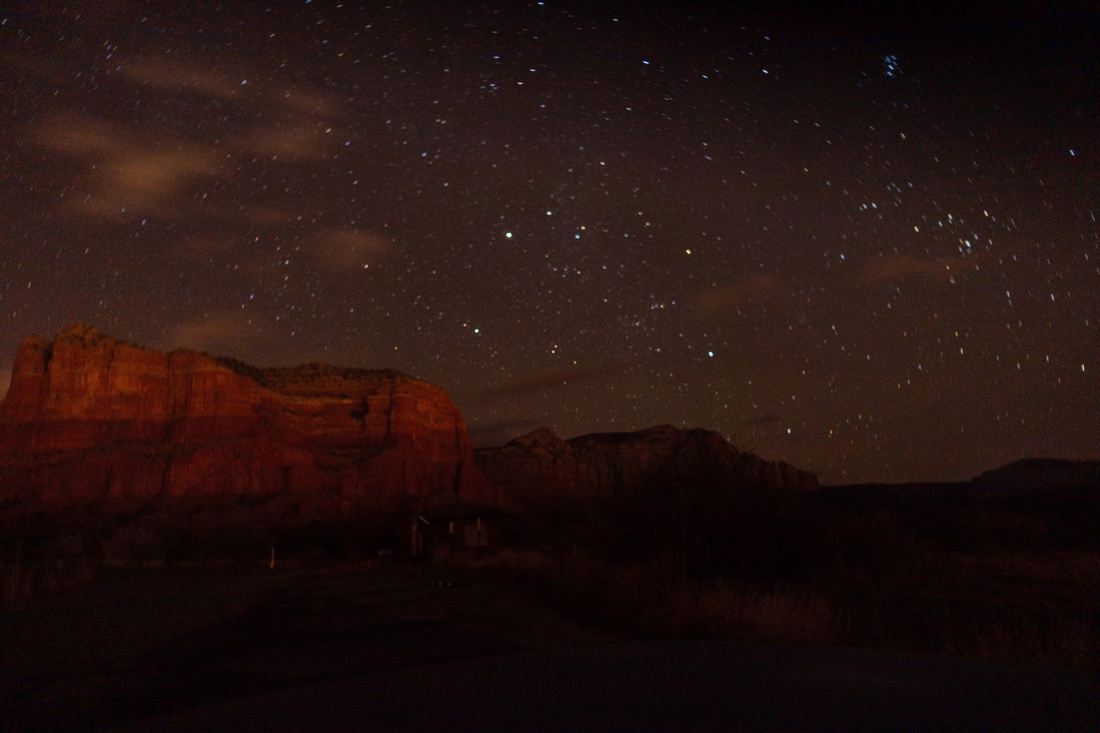 Courthouse Sky
Small sensor camera leaning on signpost shot of night sky over Courthouse Butte already back on Big Park Loop Courthouse Sky
Small sensor camera leaning on signpost shot of night sky over Courthouse Butte already back on Big Park Loop |
Abstract
| Overall Difficulty | D2 | Short moderately steep sections with some lose gravel | |||
| Scenery | Rabbit Ears, Courthouse Butte and Bell Rock Formations. Wide Panoramas on loop return via Little Rock trail | ||||
| Trail/Marking | Very Good | System of Official Trails with marked junction and trail maps. Optional wash route less defined but still easy to follow | |||
| Suggested Time | 3 hrs | Full loop with return via Little Rock / Big Park, less if coming back same way from Rabbit Ears Viewpoint | |||
| Elevation | Start: 1270m Max: 1445m Total: ~200m | Round Trip: 10km | |||
| Gear | Light hikers are sufficient | ||||
| Water | No reliable source. Carry 1L or more, depending on season | ||||
| Dog Friendly | Yes | Frequented by Mountain Bikers - keep control of your pet | |||
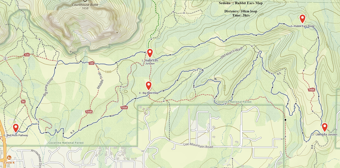 Rabbit Ears GAIA Map
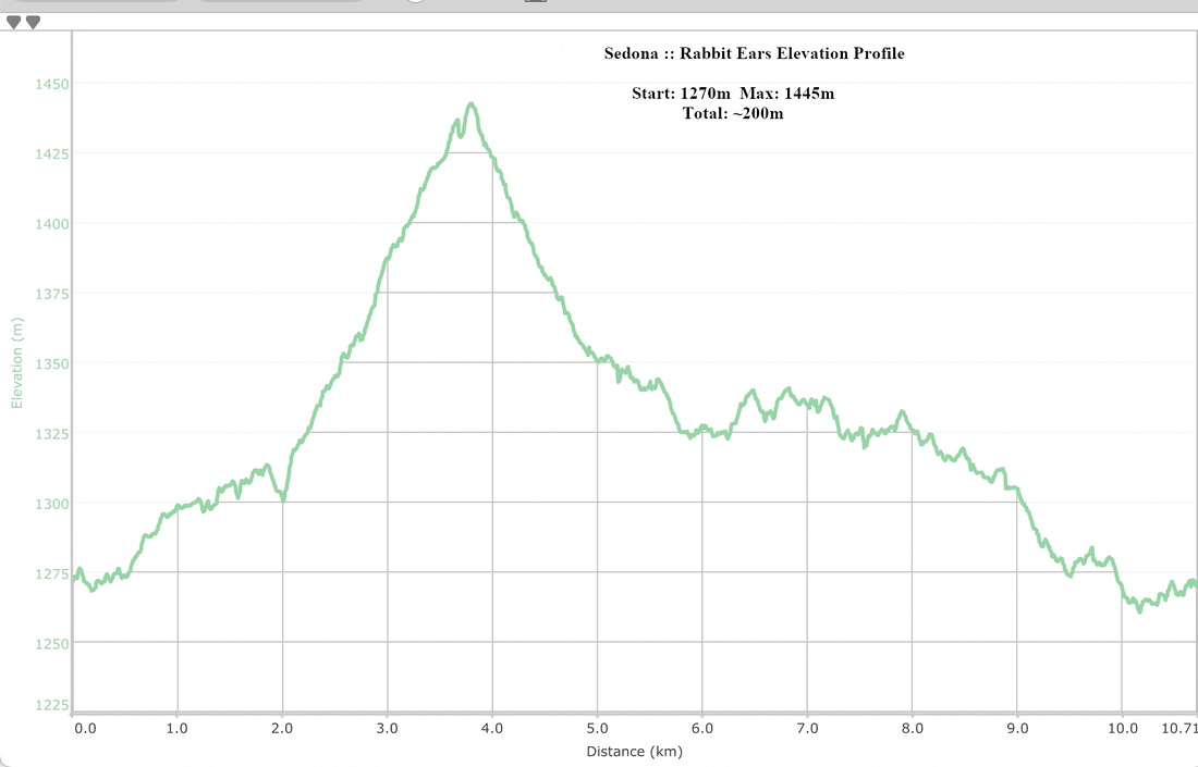 Rabbit Ears Elevation Profile