Google Map |
USA :: San Diego ::Minshall Trail - Stonewall Mine |
GPS Track |
|
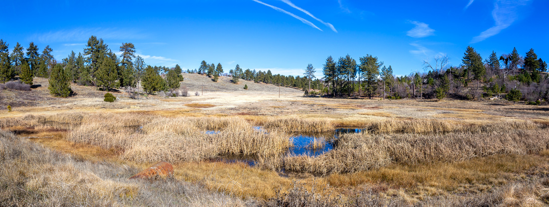
MInshall Trail meandering Prairie Grassland and Beaver Ponds; Stonewall Mine is on the semi-forested Hill upper center left |
| Trip Summary | |||
Jan 29, 2024
Alpine Meadows near Lake Cuyamaca have network of developed trails; one of them is Marty Minshall Trail that circles small hill on east side of the Lake. Top of the Hill is site of Historic Stonewall Mine (more info - see here). While one can also drive to the mine, it is far better to do it as undemanding and very scenic hike starting from Trout Pond parking ~1mile north of Paso Picacho / Cuyamaca Park Headquarters on Hwy79. Parking here was free in January '24, but this might change.
From Trout Pond follow Los Vaqueros trail for 7-8minutes to marked Minshall Junction. First part can be muddy, and while not presenting huge problem it can also be avoided by walking up (east) the Highway for ~100m, then cutting left across the grass to intercept trail past the muddy spot. Minshall Trail then cuts north across what looked like it might have been small dam in the past, then starts leisurely circle around the hill east of Lake Cuyamaca. Marked Stonewall Mine junction is reached in ~15min; Mine Trail forks right. On my trip I decided to continue straight on Minshall circling the Hill clockwise. Trail stays behind the fence but I just hopped over and walked by the lake, then once on the north side rejoined the trail; different options exist. Gentle rise leads to Mine Site that had protective fence placed around the pit and rusted mining artifacts. Old Miners Cabin nearby is now apparently the Museum, but it was closed during my visit - see Gallery. Trail then closes the loop by descending open grassy slopes and rejoins Minshall Trail near the dam feature (lead photo on the page).
This short hike is family friendly and regardless of ability / interest level everyone should enjoy the outing, specially on a sunny clear day. Trip can also be combined with ascent of Stonewall Peak or Cuyamaca Mountain for full day of exploration. |
|
Gallery |
|||
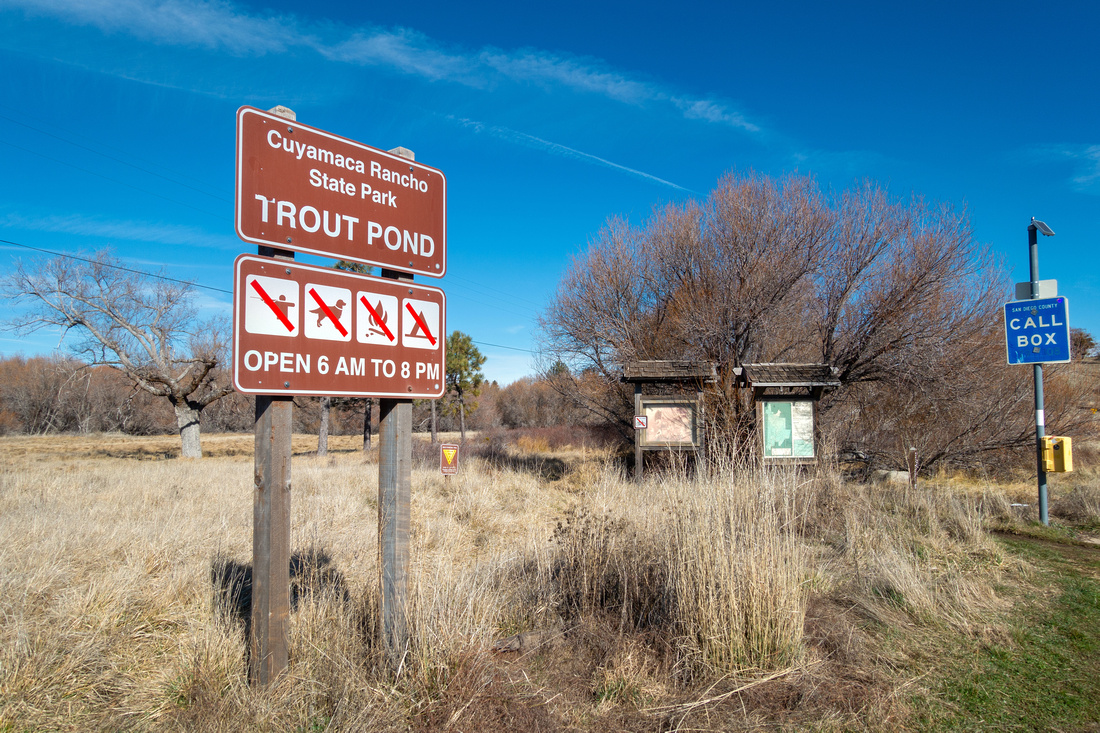 Trout Pond Trout Pond Trout Pond Parking Area ~1mile north of Paso Picacho on Hwy 79
 |
|||
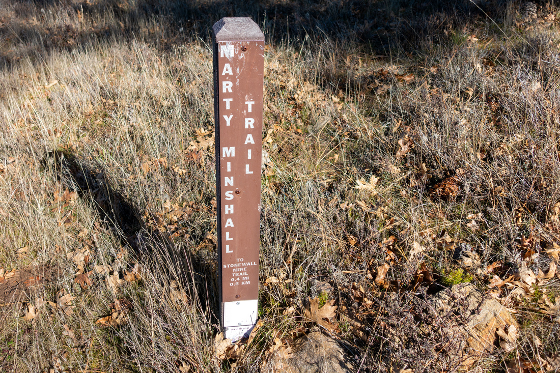 Minshall Signpost
After initial stretch on Los Vaqueros, Minshall trail forks left. All junctions are signed with posted distances Minshall Signpost
After initial stretch on Los Vaqueros, Minshall trail forks left. All junctions are signed with posted distances |
|||
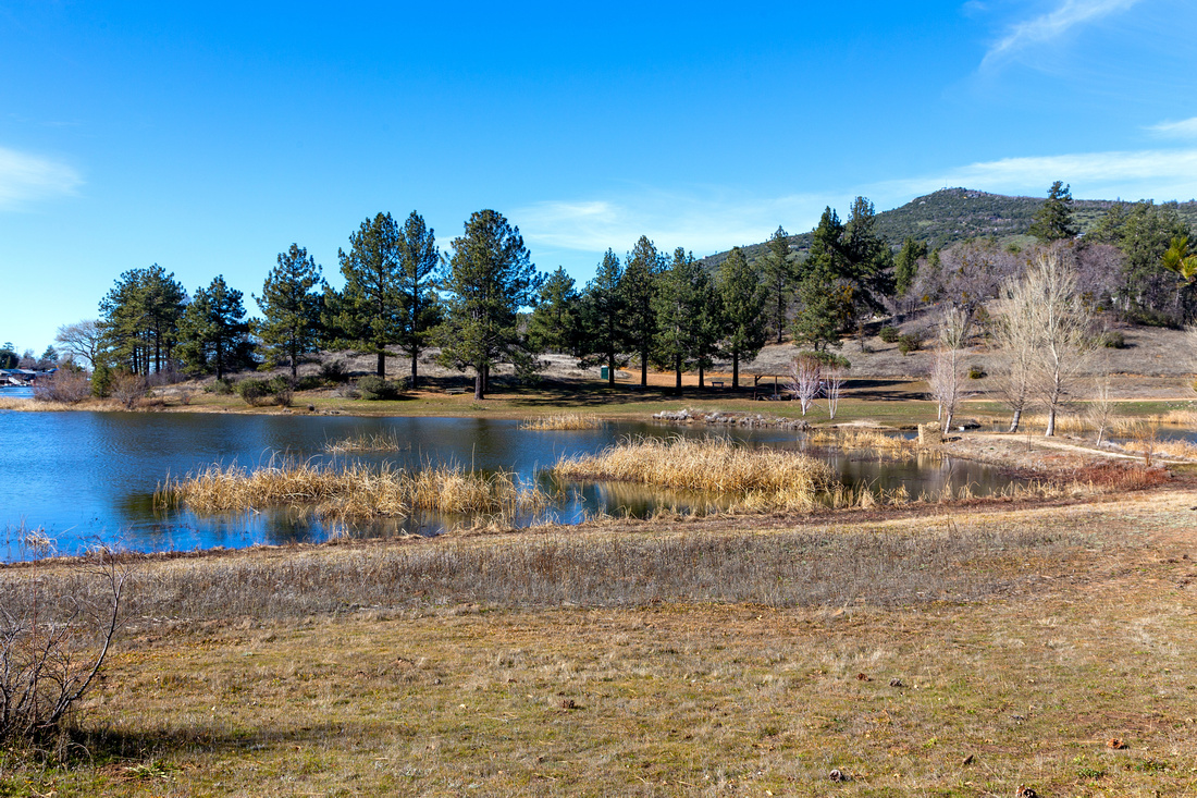 Cuyamaca Lake
Circling around east side of Cuyamaca Lake Cuyamaca Lake
Circling around east side of Cuyamaca Lake |
|||
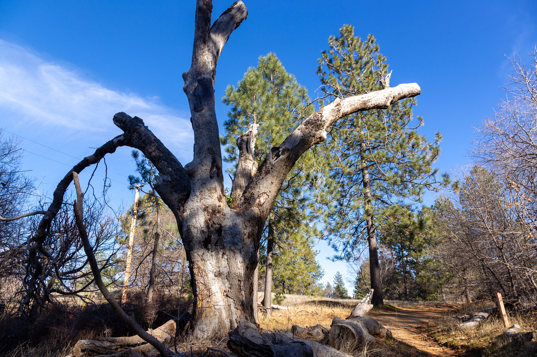 Old Dry Tree
Many scenic highlights like this one as Minshall Trail starts gentle ascent to Stonewall Mine Old Dry Tree
Many scenic highlights like this one as Minshall Trail starts gentle ascent to Stonewall Mine |
|||
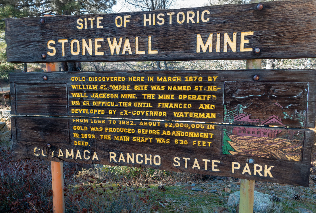 Stonewall Mine
State Parks Table by Stonewall Mine Stonewall Mine
State Parks Table by Stonewall Mine |
|||
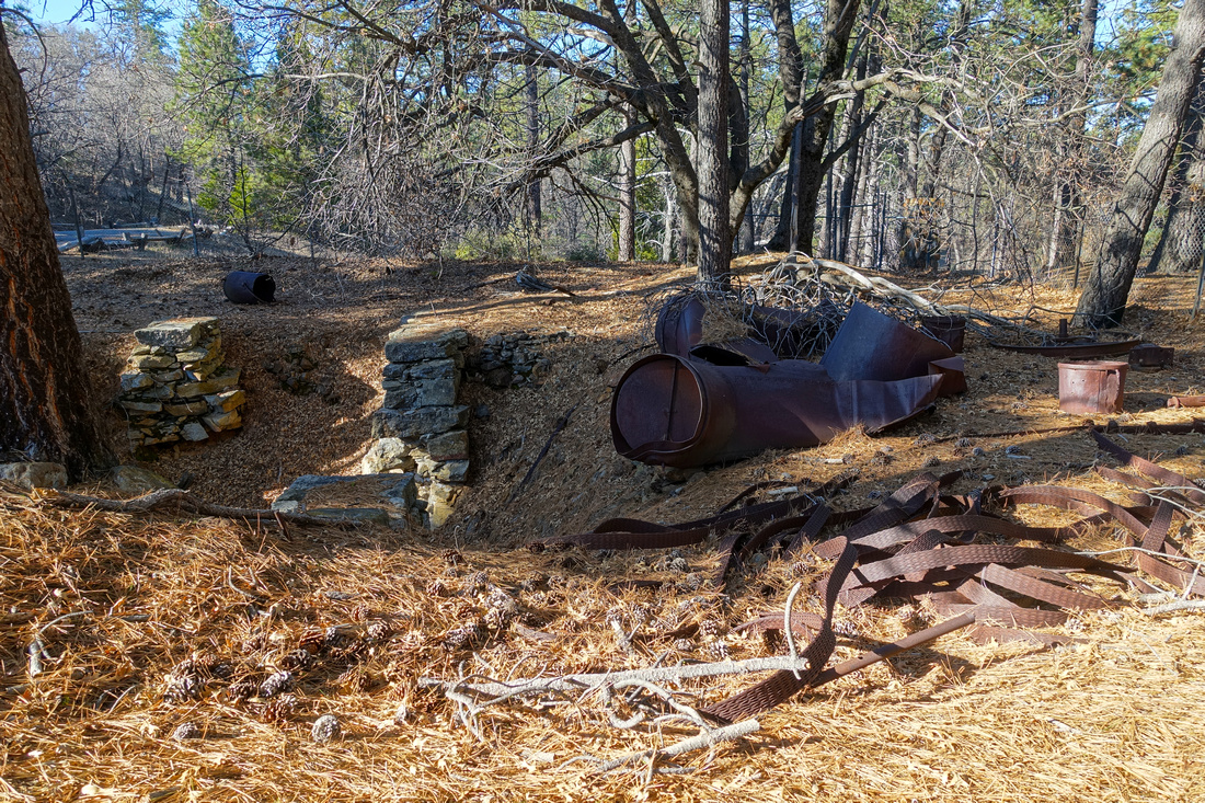 Mine Artifacts
Old Rusted Stonewall Mine Remains Mine Artifacts
Old Rusted Stonewall Mine Remains |
|||
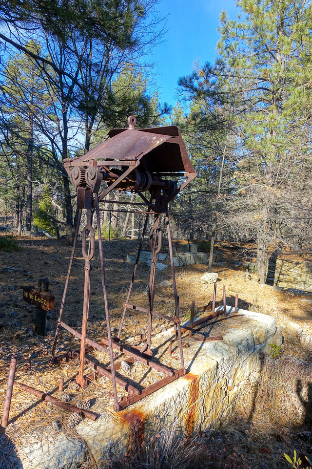 Mine Artifacts
Mine and equipment remains are guarded by fence; this image was taken by pushing tiny RX100 lens through the wire opening Mine Artifacts
Mine and equipment remains are guarded by fence; this image was taken by pushing tiny RX100 lens through the wire opening |
|||
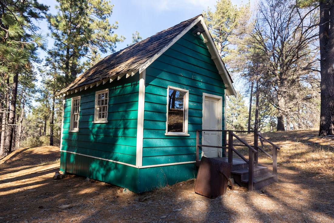 Stonewall Mine Museum
Old Miners Cabin now serves as Mine Museum; it was unfortunately closed when I was here Stonewall Mine Museum
Old Miners Cabin now serves as Mine Museum; it was unfortunately closed when I was here |
|||
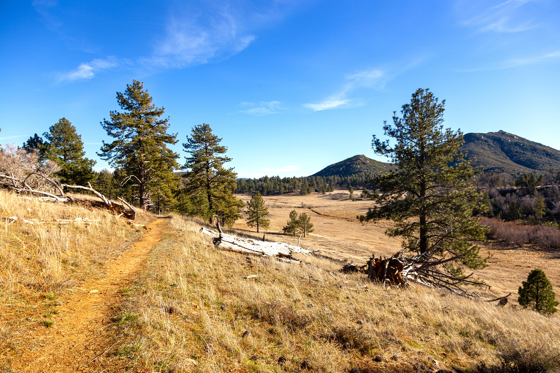 Mine Trail
Descending the Mine trail back to Marty Minshall. Stonewall Peak center right Mine Trail
Descending the Mine trail back to Marty Minshall. Stonewall Peak center right |
|||
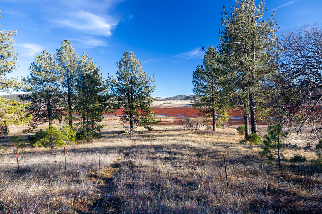 Cuyamaca Meadows
Photo taken later from Hwy79 pullout just past Cuyamaca Lake village. Minshall Trail is on the other side Cuyamaca Meadows
Photo taken later from Hwy79 pullout just past Cuyamaca Lake village. Minshall Trail is on the other side |
|||
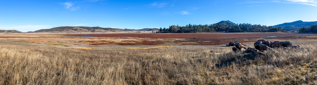 Cuyamaca Meadows
 Panorama from spot just below road pullout; Minshall Trail circles that forested Island on the other side. Stonewall Peak behind Cuyamaca Meadows
Cuyamaca Meadows Panorama from spot just below road pullout; Minshall Trail circles that forested Island on the other side. Stonewall Peak behind |
Abstract
| Overall Difficulty | D1 | Easy walk on wide rolling trail with minor ups/downs | |||
| Scenery | Lake Cuyamaca and Alpine Meadows. Stonewall Peak and Mt. Cuyamaca. Historic Mine Artifacts | ||||
| Trail/Marking | Excellent | Trails are well defined and junctions marked | |||
| Suggested Time | 2 hrs | For proposed CW loop options with casual pace. Options exist to extend the day | |||
| Elevation | Start: 1420m Max: 1450m Total: ~150m | Round Trip: ~5km | |||
| Gear | Day Hikers or running shoes | ||||
| Water | Trip is short and water is not an issue; carry 0.5L | ||||
| Dog Friendly | Yes | Dogs are allowed, but must be leashed at all times | |||
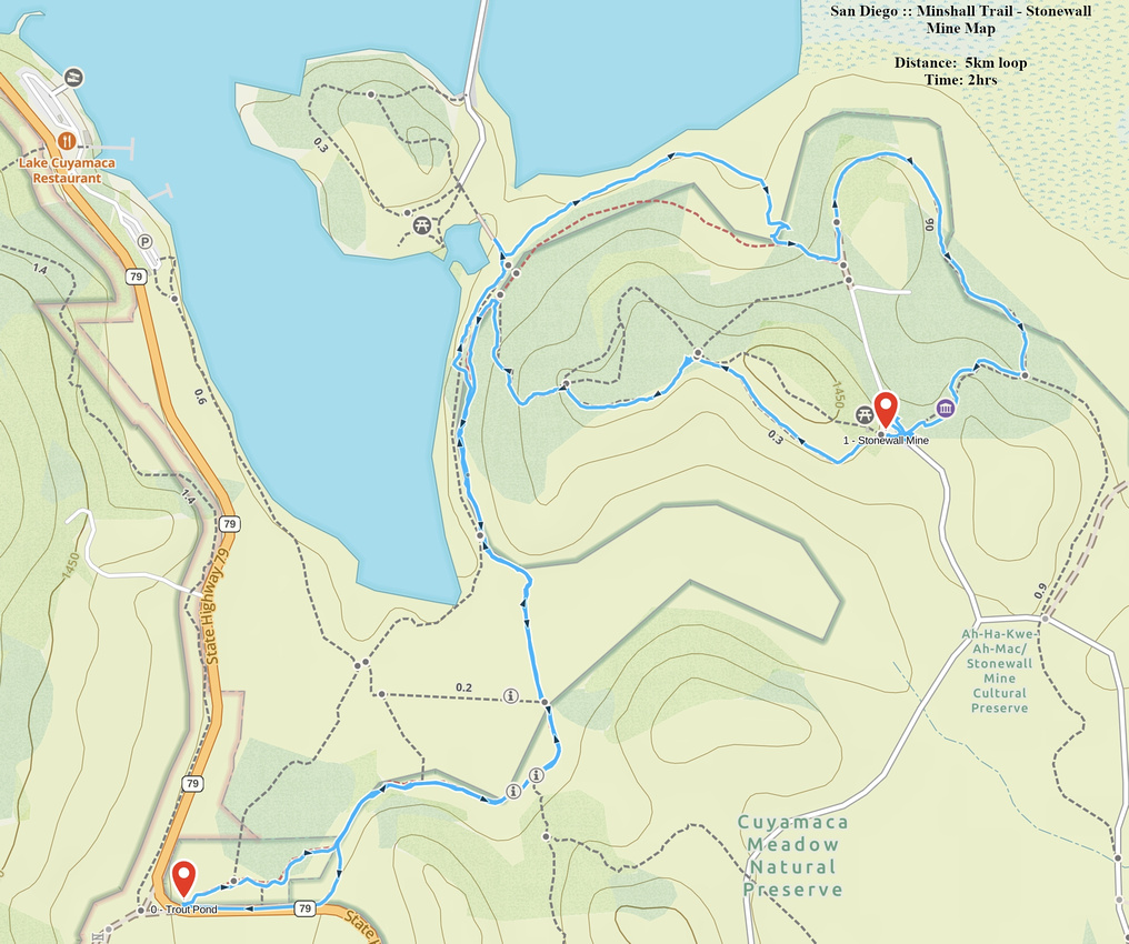 Minshall Trail - Stonewall Mine GAIA Map
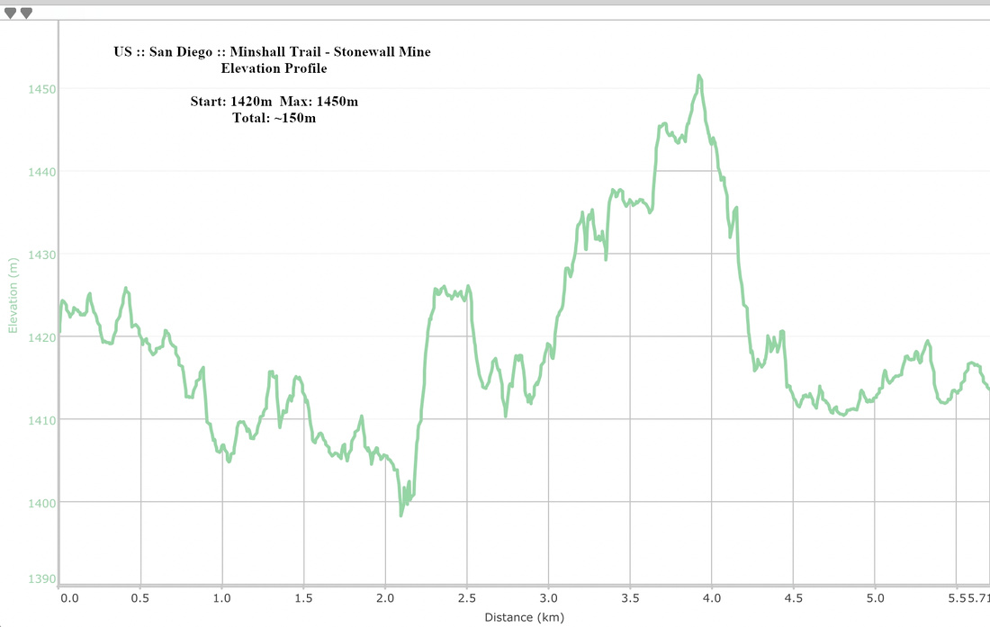 Minshall Trail - Stonewall Mine Elevation Profile