Google Map |
USA :: San Diego :: Mount Cuyamaca |
GPS Track |
|
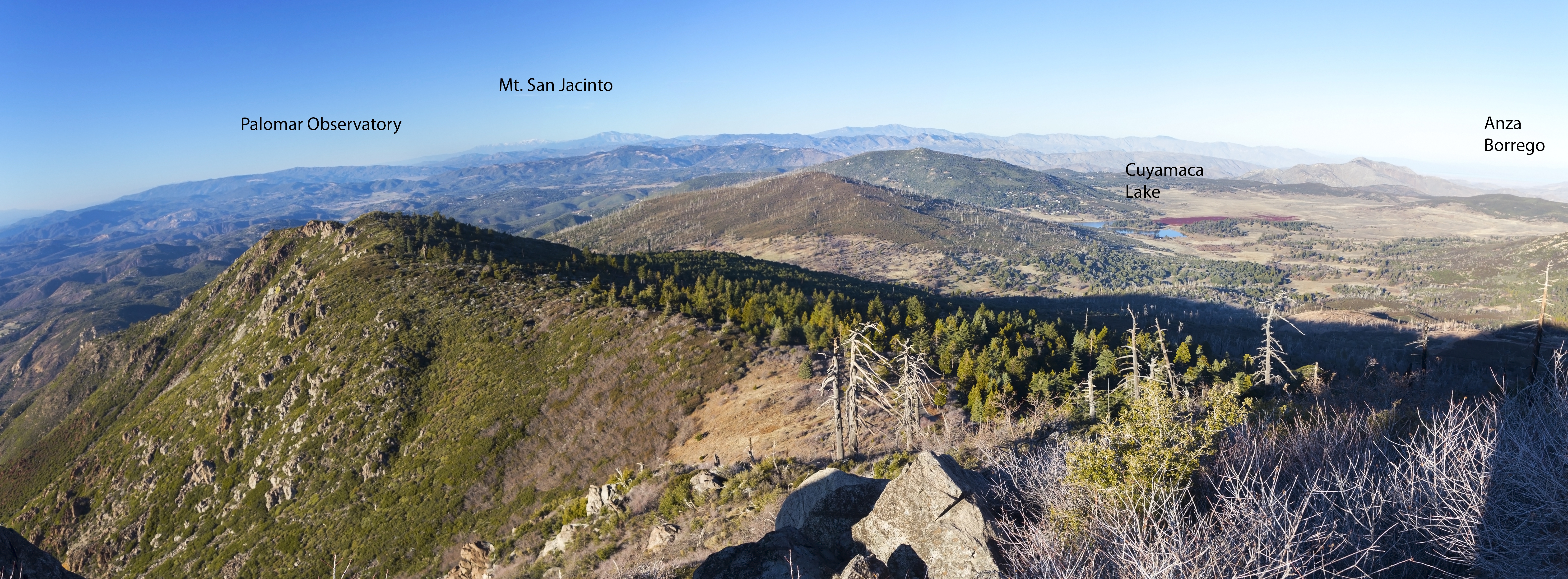
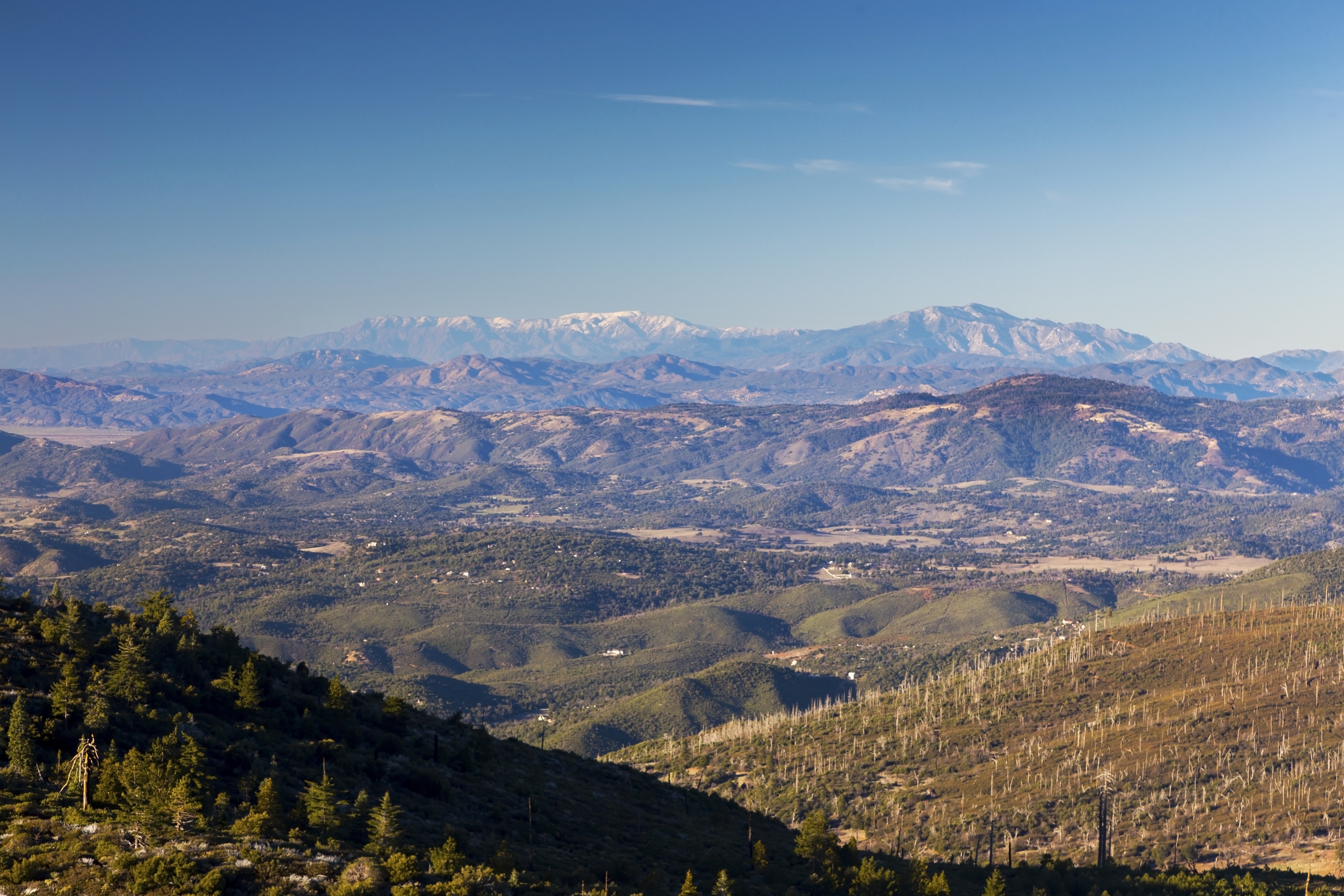
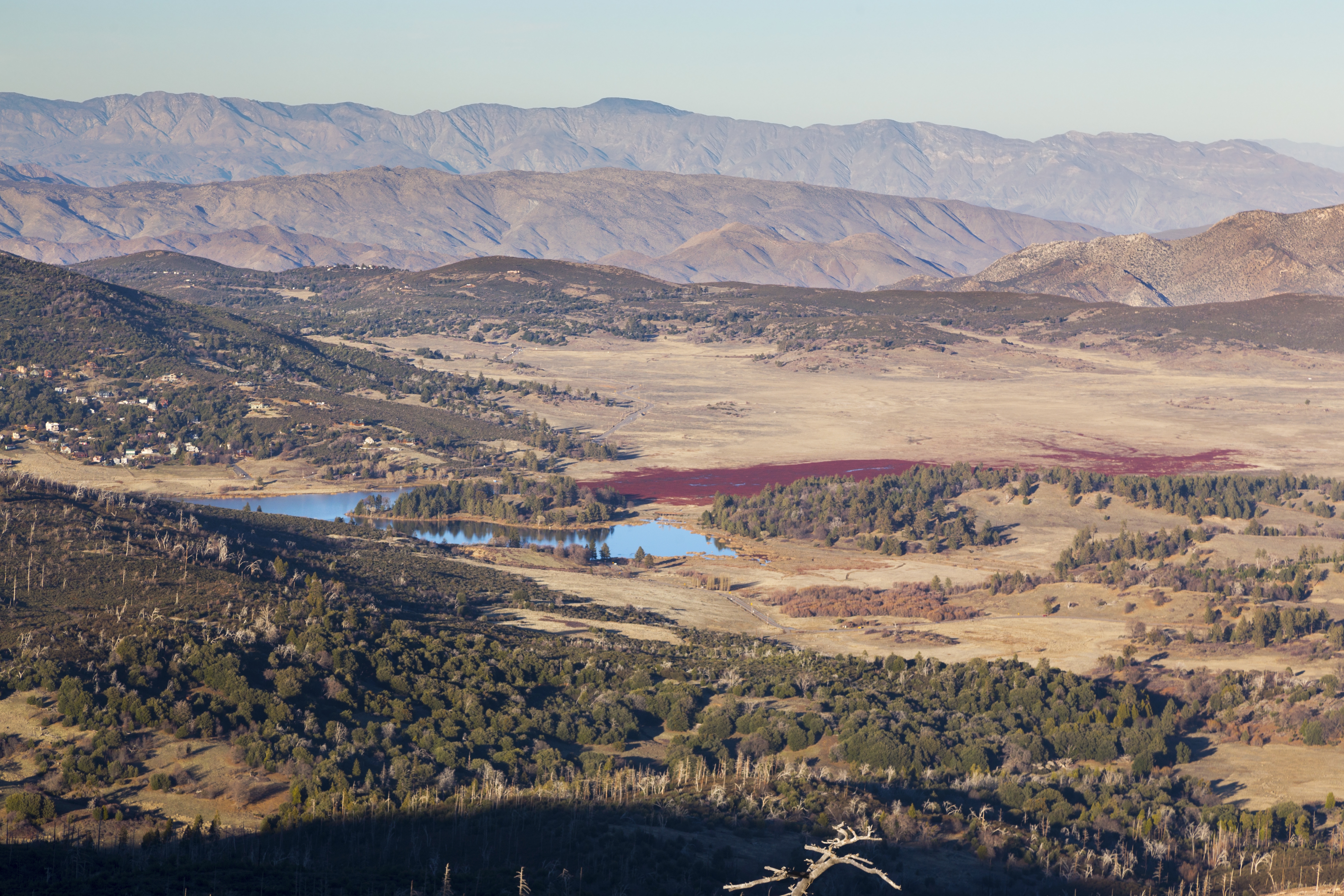
Panoramic View north from end of Cuyamaca Fireroad. Distant Snowy San Jacinto Range center left, Cuyamaca Lake mid-center right with Anza Borrego Desert State Park extreme right. Click to see labels |
| Trip Summary | |||
Multiple Dates, last January 20, 2022
Mt. Cuyamaca is second highest in San Diego County. With elevation of 1985m it only 20 feet lower than Hot Springs Mountain in Warner Springs. It is in Cuyamaca Rancho California State Park, area less than hour drive east from metro San Diego along I-8, and then SR 79. Starting from behind Park Headquarters building at Paso Picacho, entire hike is on old paved Fireroad. Lacking of true wilderness feel is compensated by decent exercise and fantastic summit views. Optional descent - or ascent - is possible via network of old roads around Azalea Spring. Note that Parking at Paso Picacho, normal Cuyamaca Trailhead, costs $10 USD (Jan '22) as it is State Park; there are also "No Parking" signs at SR79 shoulder throughout.
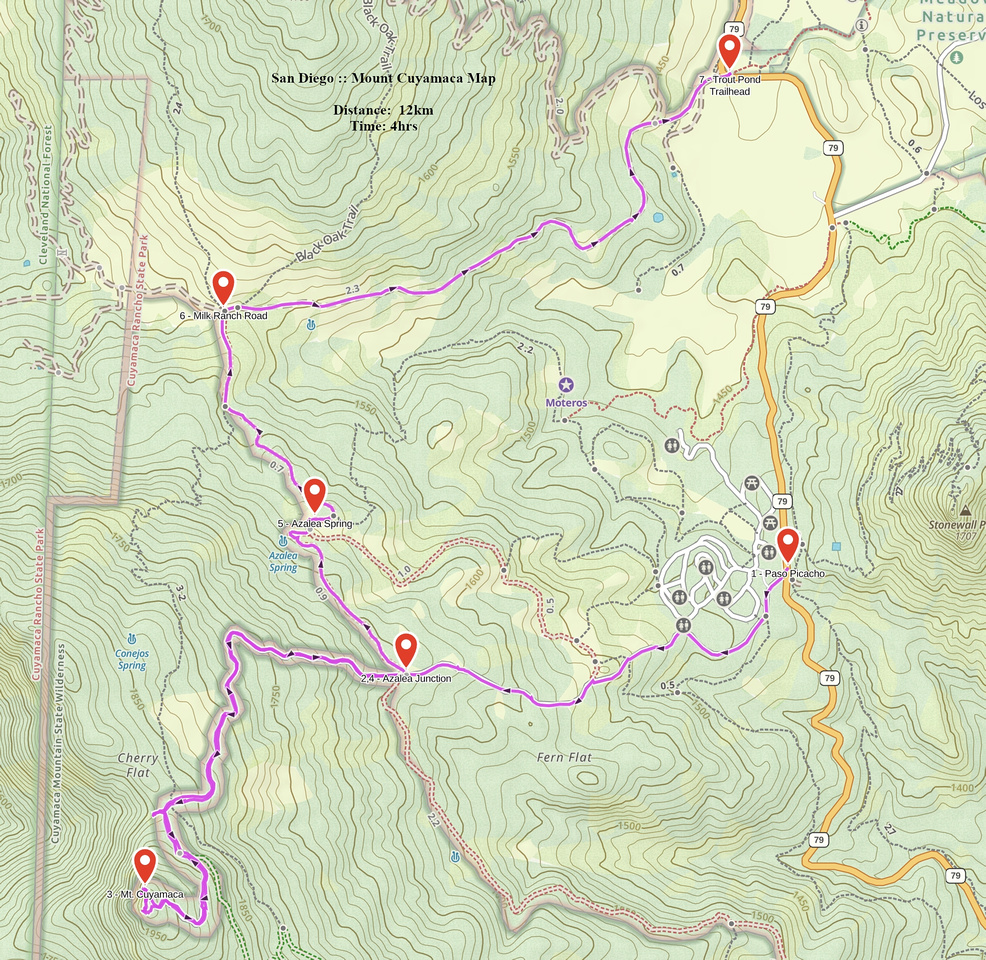
On my Jan '22 trip I left the car at Los Vaqueros parking, about 1km north from Paso Picacho. This is also trailhead for several other area hikes (Trout Pond, Middle Peak, alternate Stonewall access) and parking was free. This was not money saving move, but deliberate plan to avoid spending entire day on paved fireroad as I did first time when I hiked Cuyamaca and form bit of a loop. GPS Map (top left corner) shows the route. SR79 walk back to Paso Picacho is only 15-20min so not too bad - although I doubt many people resort to this approach. Fireroad ascent was not overly exciting but did provide for exercise - elevation gain of ~550m over 4.8km. Strong cyclists probably ride their bikes here too, with amount of pushing depending on overall fitness; ride down must be a huge blast! Regardless of chosen strategy, do not miss lovely bench ~10min below end of Fireroad at wide and sunny saddle. Bench is not seen from the road and views are spectacular; this is much better spot for the lunch than summit itself. After topping up lovely north/west views await; but this is not highest point. To reach top of Mt. Cuyamaca you have to bushwhack behind fenced telecom towers; this bit of extra effort will be awarded with distant southerly views towards Mexico and Baja California across rolling Southern California hills.
On descent, if wishing to form the loop via Azalea Spring / Milk Ranch roads 2 alternatives exist. First utilizes Conejos trail - marked junction is 1-2min down the Fireroad from "Bench Saddle" viewpoint, on skier left side. Entirely trail hiking it connects with Azalea Spring road just before Milk Ranch Road. Alternative I chose descended Fireroad for ~2km to marked Azalea Spring junction, then followed old equestrian trail to Spring itself (lacking water in Jan `22) visit. Upon reaching Milk Ranch Road junction (marked) turn right; Los Vaqueros parking will be 2.5km down this road. |
|
Gallery |
|||
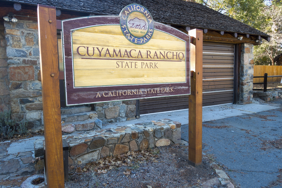 Cuyamaca Trailhead Cuyamaca Trailhead Trailhead just beyond State Park Visitor Center at Paso Picacho on SR 79
 |
|||
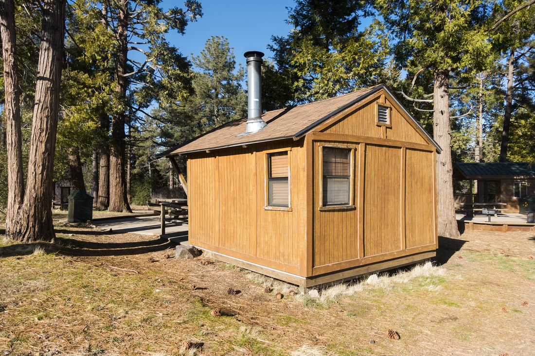 Picacho Cabin
Log Cabin just behind Paso Picacho campground Picacho Cabin
Log Cabin just behind Paso Picacho campground |
|||
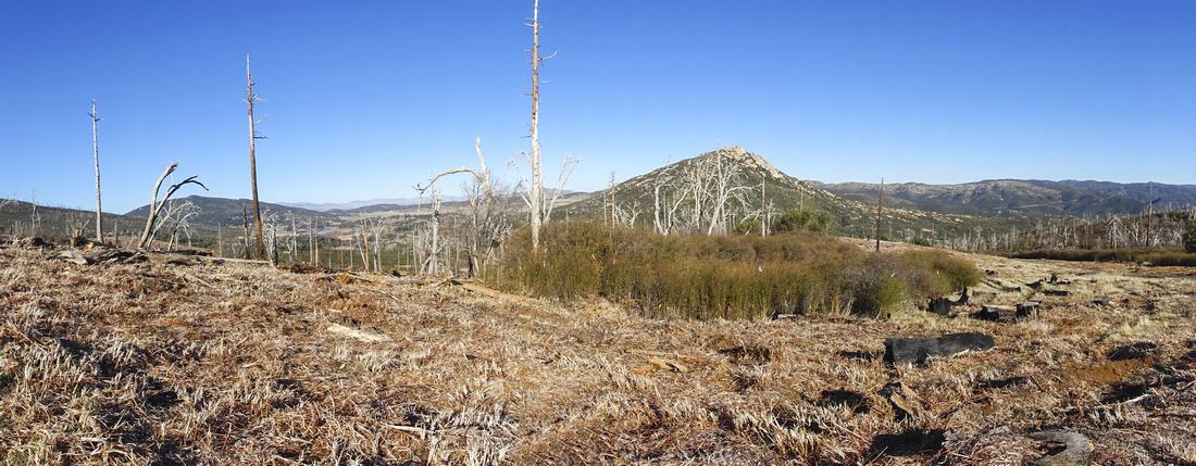 Stonewall Panorama
Panoramic view east from lower part of Fireroad with Stonewall Peak in center Stonewall Panorama
Panoramic view east from lower part of Fireroad with Stonewall Peak in center |
|||
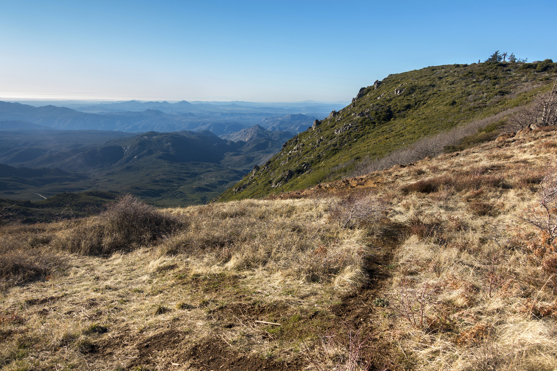 Bench View
View west from nice bench at sunny side of saddle some 10min below the summit Bench View
View west from nice bench at sunny side of saddle some 10min below the summit |
|||
 Summit Table
 at end of Fireroad. For the highest point you need to bushwhack by the fence behind Telecommunications tower Summit Table
Summit Table at end of Fireroad. For the highest point you need to bushwhack by the fence behind Telecommunications tower |
|||
 |
|||
 |
|||
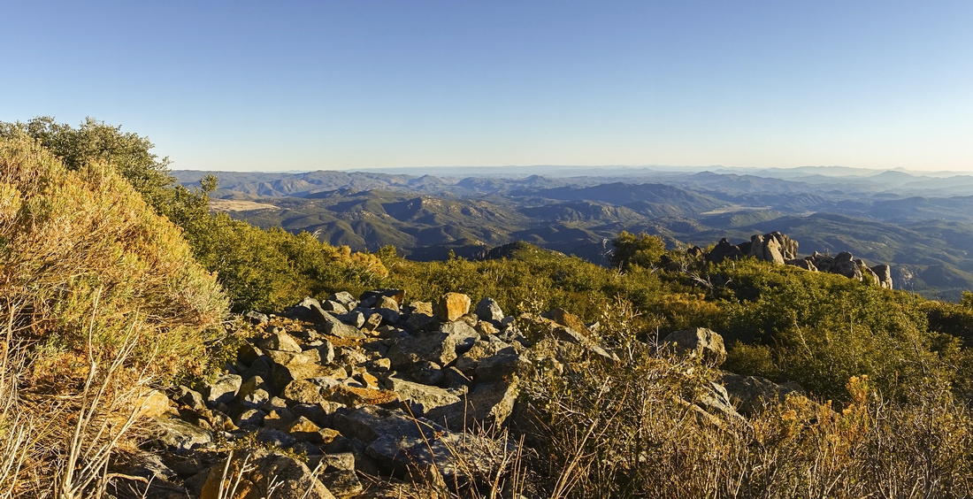 Baja View
Southerly views from highest point just behind Telecommunication Tower towards Mexico and distant Baja California Baja View
Southerly views from highest point just behind Telecommunication Tower towards Mexico and distant Baja California |
|||
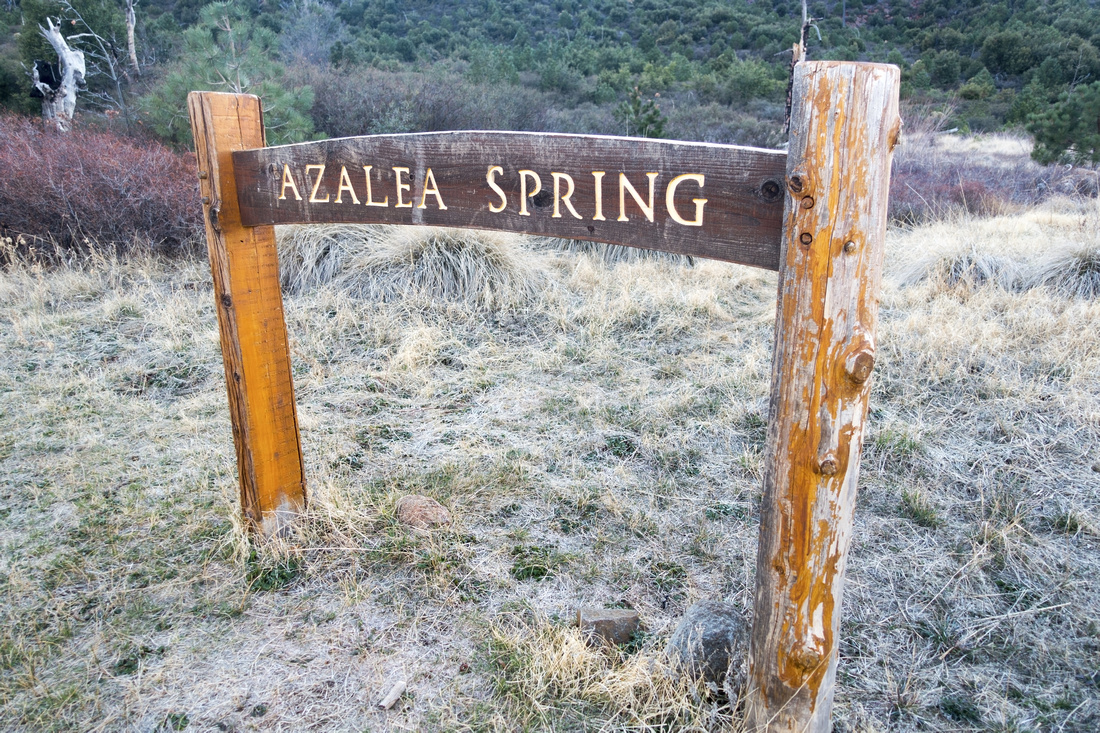 Azalea Spring
 Table on alternate loop return Azalea Spring
Azalea Spring Table on alternate loop return |
|||
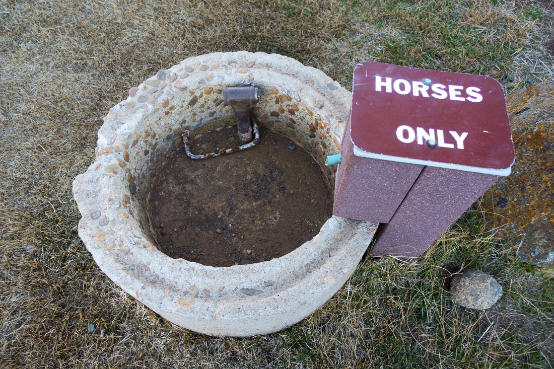 Horse Bucket
Drinking bucket for Horses at Azalea Spring Horse Bucket
Drinking bucket for Horses at Azalea Spring |
|||
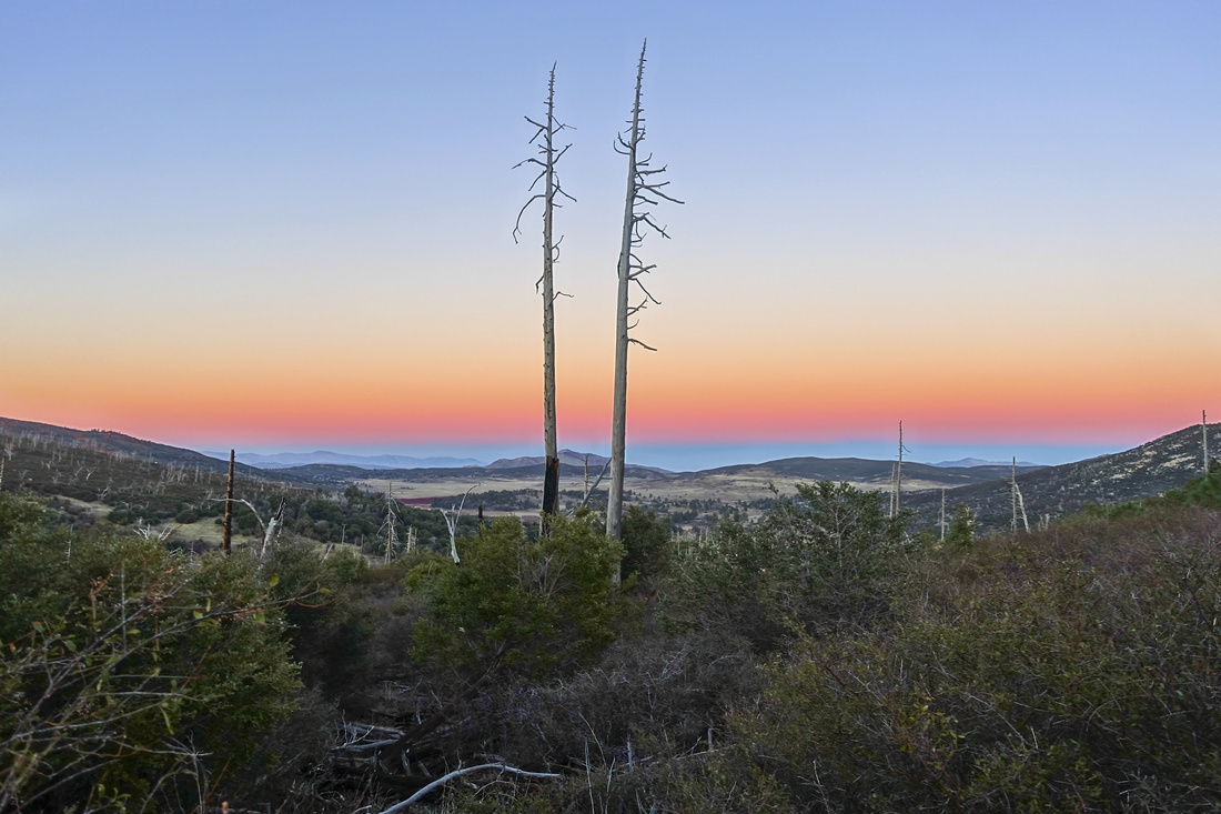 Sunset Colors
Sunset colors just above junction of Azalea Spring and Milk Ranch Roads Sunset Colors
Sunset colors just above junction of Azalea Spring and Milk Ranch Roads |
Abstract
| Overall Difficulty | D3 | Moderately steep ascent on old paved Fireroad and/or network of equestrian paths | |||
| Scenery | Distant views of San Jacinto Mountain Range. Lake Cuyamaca and Anza Borrego Desert State Park. 360 degree views of San Diego County | ||||
| Trail/Marking | Excellent | Old Fireroad / Network of Ranch / Equestrian trails. Junction marked and signed | |||
| Suggested Time | 3-4hrs | Depending on return route; Azalea Spring loop requires approximately extra hour | |||
| Elevation | Start: 1450m Max: 1980m Total: ~550m | Round Trip: ~9(12)km (Extra 3km for Azalea loop) | |||
| Gear | Day Hikers sufficient. Upper parts may be ice or snowy in winter (spikes) | ||||
| Water | Water available at Trailhead only. Carry 1L depending on season | ||||
| Dog Friendly | Yes | Dogs are restricted to the campgrounds, picnic areas, paved roads and Cuyamaca Peak Fire Road | |||
 Mount Cuymaca GAIA Map
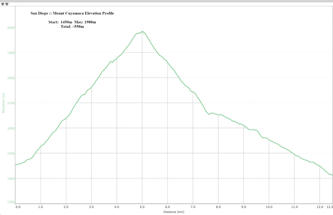 Mount Cuyamaca Elevation Profile