Google Map |
USA :: San Diego :: Stonewall Peak |
GPS Track |
|
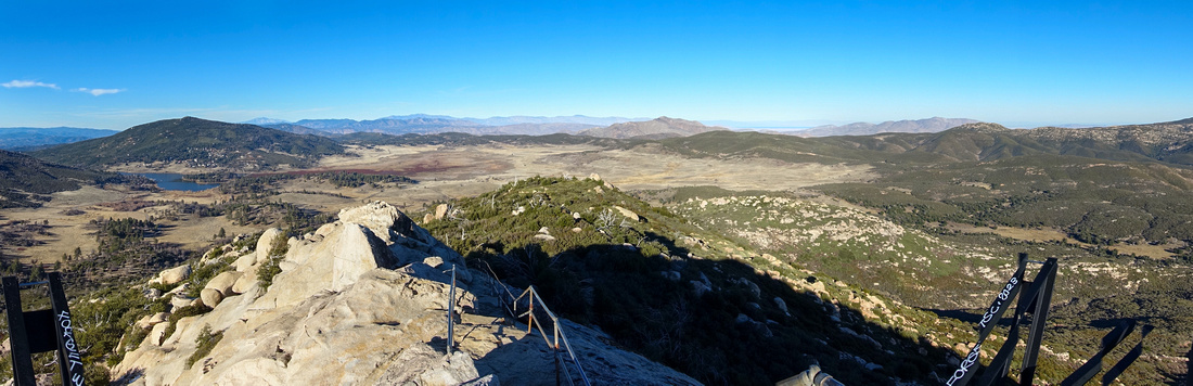
Panoramic View north from Stonewall Summit. Cuyamaca Lake center left with distant San Jacinto Range in far Background |
| Trip Summary | |||
Multiple Dates, last January 8, 2024
Stonewall Peak is Rock outcrop at east side of Paso Picacho - Cuyamaca State Park Headquarters. White Mt. Cuyamaca on west side is higher, Stonewall is more scenic. In addition there are 2 developed trails, meeting just below the summit, that lead itself naturally to a loop. Final bit rising gently up open rock is slightly exposed, but presents no problems as there is permanent handrail for safety. Views include large part of San Diego County to the west, Cuyamaca Lake surrounded by "Prairie" Grassland, distant San Jacinto Mountain Range, and Anza Borrego State park NE while Laguna Mountains are directly across to the East.
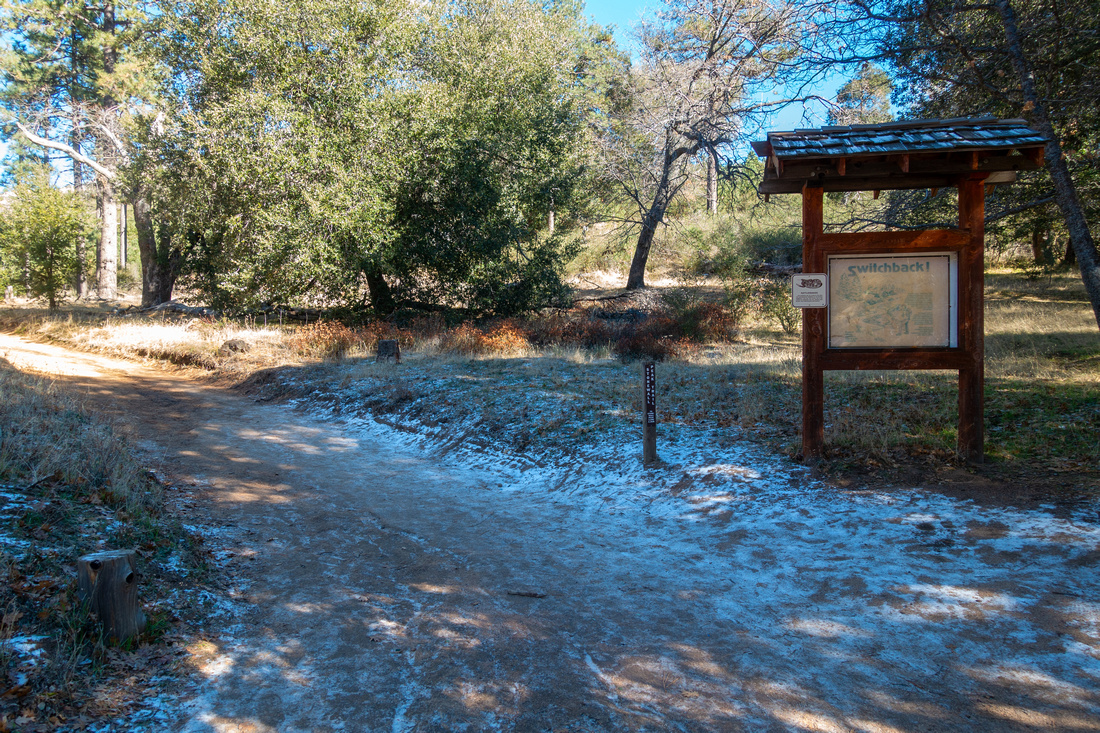
Coming from San Diego on I-8 eastbound take SR79 exit and drive to Paso Picacho, usual trailhead for both Mt. Cuyamaca and Stonewall Peak. Unreasonably high Parking costs $10 USD/day (Jan '24), but there is a way to avoid this ripoff. Simply continue on SR-79 for about a mile north and park for free at Trout Pond pullout - this is Los Vaqueros Trailhead. If you wish to ascend via west side trail, walk back to Picacho Trailhead on SR-79 takes ~20min only. Alternatively - longer, but more scenic - is to follow Los Vaqueros to Los Caballos junction (Waypoint 6 on GPS Track, download at Top of Page), then take a right on Whitaker to Cold Stream which is then followed to Paso Picacho. You can also walk SR-79 for about 10min to gated side-road on east side, then merge into Cold Stream there. Map / Elevation Profile / Abstract are only for Picacho - Los Vaqueros CCW loop, sans described connection between the two.
Posted distance at Paso Picacho is 2 miles, with ~300m of vertical elevation and can easily be done in under an hour. Lazy wide switchbacks meander from one side to the other before reaching junction with Los Vaqueros approach ~0.3 miles before the summit. On my ascent in Jan '24 this bit was quite icy and I actually wished I took micro-spikes, something I never thought I'd have to think about hiking in San Diego County! Bit of easy boulder hoping ends with Stone Staircase and Rock Ledge guarded by Handrail leading to the summit. Summit area is fairly narrow; I imagine it must be quite a squeeze on sunny weekend. Interpretive signs I saw during '18 trip have been destroyed in '24 (once again, what do CA State Parks use these fees for?). Views are still the same though (lead photo on this page) and on sunny clear day even Salton Sea can be spotted far behind Anza Borrego State Park to the NE.
Los Vaqueros descent is considerably nicer - and less busy - compared with Picacho side. North side switchbacks eventually end at beautiful semi-open "Prairie Grassland" below the peak. There are several different options back to SR-79; on signed Whitaker junction either left or right will lead to Los Vaqueros and walk to Trout Pond pullout. This final bit is very scenic if you are there early enough as meadows fall in shade mid-afternoon (last photo in Gallery). |
|
Gallery |
|||
 Paso Picacho Trailhead Paso Picacho Trailhead Stonewall Peak Trailhead at Paso Picacho opposite Cuyamaca Park Headquarters
 |
|||
 Stonewall Peak
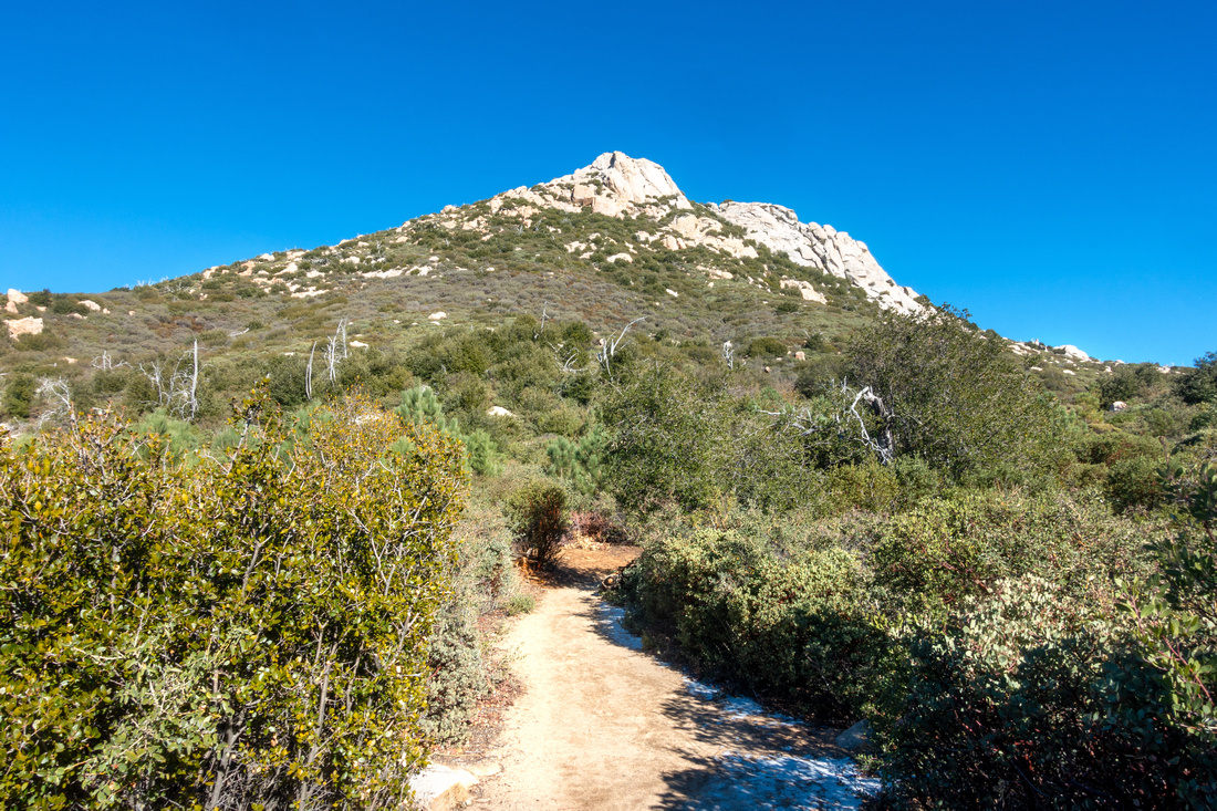
Lower part of the trail just before switchbacks; Stonewall Peak above Stonewall Peak
Lower part of the trail just before switchbacks; Stonewall Peak above |
|||
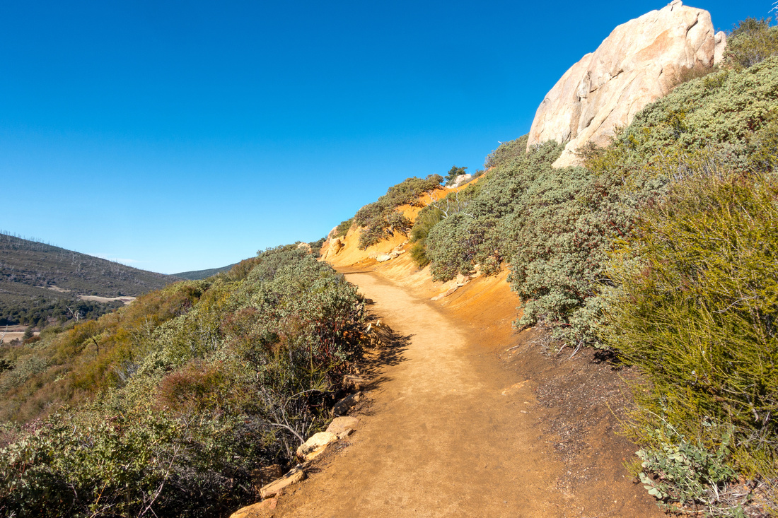 Switchbacks
Lazy ultra wide switchbacks make west side ascent quite undemanding Switchbacks
Lazy ultra wide switchbacks make west side ascent quite undemanding |
|||
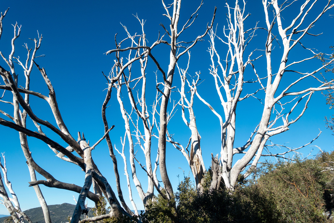 Dry Tree
Interesting Dry Tree Detail in upper part of Picacho Trail Dry Tree
Interesting Dry Tree Detail in upper part of Picacho Trail |
|||
 Slippery Junction
Paso Picacho and Los Vaqueros trails junction below Stonewall Summit Block Slippery Junction
Paso Picacho and Los Vaqueros trails junction below Stonewall Summit Block |
|||
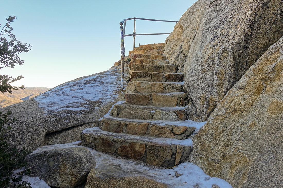 Stone Staircase
Final ascent follows stone staircase at east side of Stonewall Peak Stone Staircase
Final ascent follows stone staircase at east side of Stonewall Peak |
|||
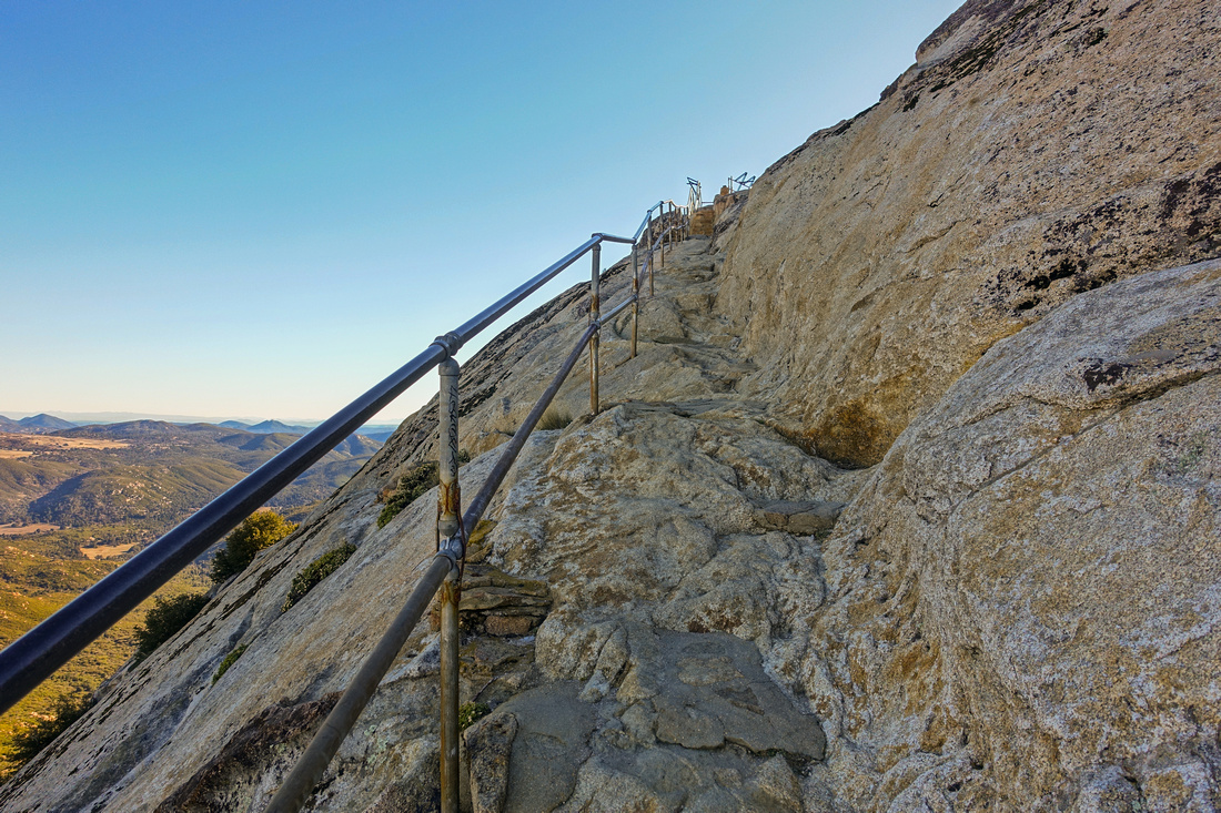 Railing Fence
Railing protecting mildly exposed rock ledge just below the summit Railing Fence
Railing protecting mildly exposed rock ledge just below the summit |
|||
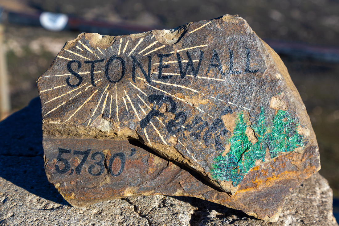 Stonewall Stone
Painted Stone at Stonewall Summit during Jan '24 visit Stonewall Stone
Painted Stone at Stonewall Summit during Jan '24 visit |
|||
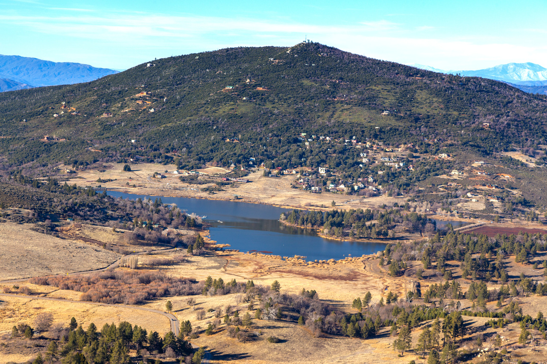 Lake Cuyamaca
 Telephoto from Stonewall Summit Lake Cuyamaca
Lake Cuyamaca Telephoto from Stonewall Summit |
|||
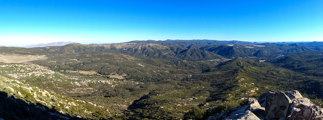 Laguna Panorama
Panoramic view SE of Laguna Mountains from Stonewall Summit Laguna Panorama
Panoramic view SE of Laguna Mountains from Stonewall Summit |
|||
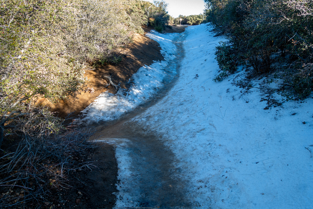
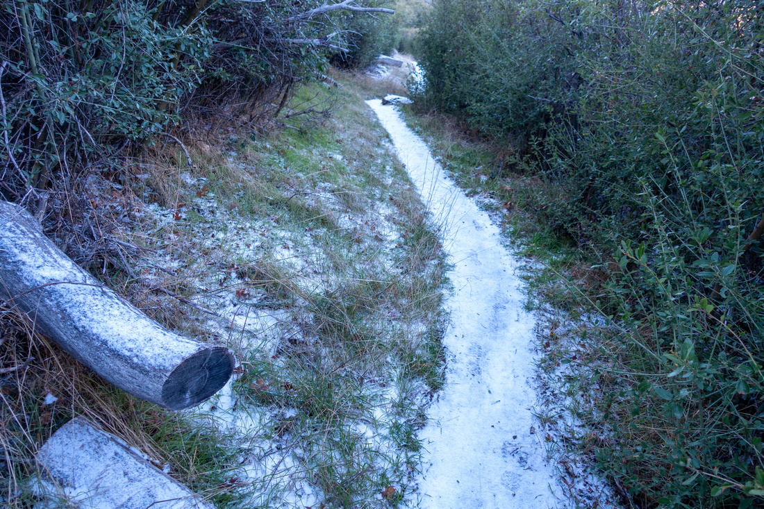 Snowy Trail
 on Los Vaqueros shady north side descent Snowy Trail
Snowy Trail on Los Vaqueros shady north side descent |
|||
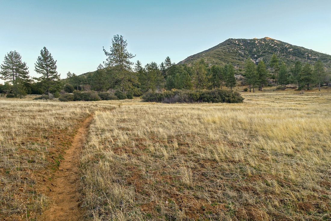 Los Vaqueros Meadows
Delightful Hiking on grassy meadows ~10min before Hwy79 looking back at Stonewall Peak Los Vaqueros Meadows
Delightful Hiking on grassy meadows ~10min before Hwy79 looking back at Stonewall Peak |
|||
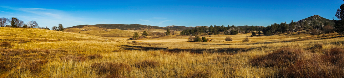 Cuyamaca Meadows
Sunny Prairie Grassland near Hwy79 during Jan '18 trip; "Little Stonewall" extreme center right Cuyamaca Meadows
Sunny Prairie Grassland near Hwy79 during Jan '18 trip; "Little Stonewall" extreme center right |
Abstract
| Overall Difficulty | D3 | Some rocky sections with minor boulder hoping in upper part. Mildly exposed rock ledge below summit is protected | |||
| Scenery | Distant views of San Jacinto Mountain Range. Lake Cuyamaca and Anza Borrego Desert State Park. 360 degree views of San Diego County | ||||
| Trail/Marking | Excellent | Well defined wide trail with some rocky sections. All junctions are signed | |||
| Suggested Time | 3hrs | Los Vaqueros loop; less if just hiking up/down from Paso Piscacho | |||
| Elevation |
Start: 1520m (Paso Picacho) Max: 1740mm Total: +280m -380m (loop) |
Round Trip: ~8km (loop) | |||
| Gear | Day Hikers sufficient. Upper parts may be icy or snowy in winter (spikes) | ||||
| Water | Water available at Paso Picacho Trailhead only. Carry 1L depending on season | ||||
| Dog Friendly | No | Except Cuyamaca Fire Road, State Park does not allow dogs on Hiking Trails | |||
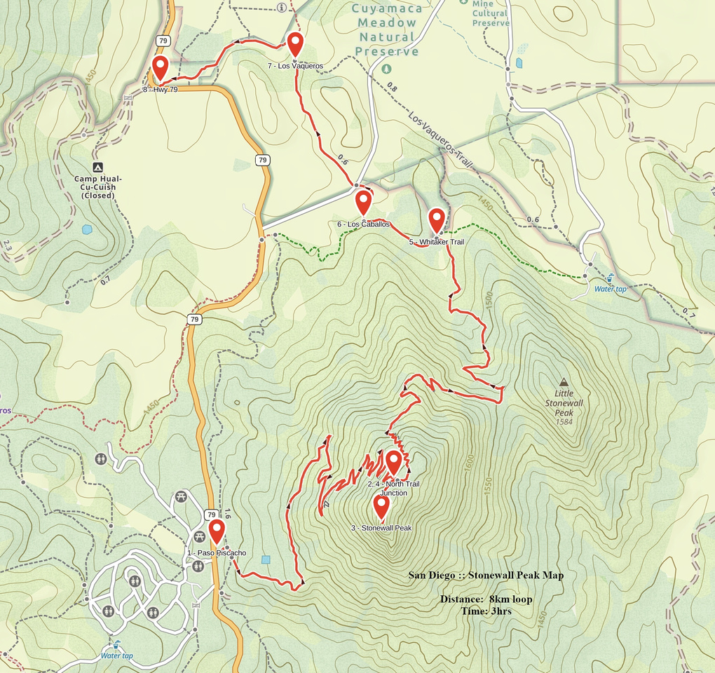 Stonewall Peak GAIA Map
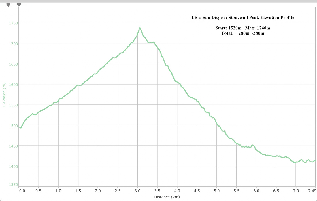 Stonewall Peak Elevation Profile