Google Map |
USA :: San Diego :: Mt Cowles - Pyles Peak |
GPS Track |
|
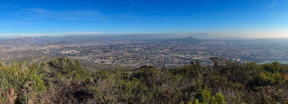
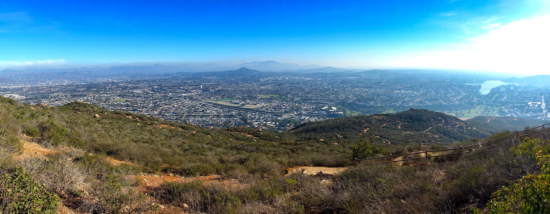
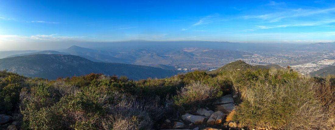
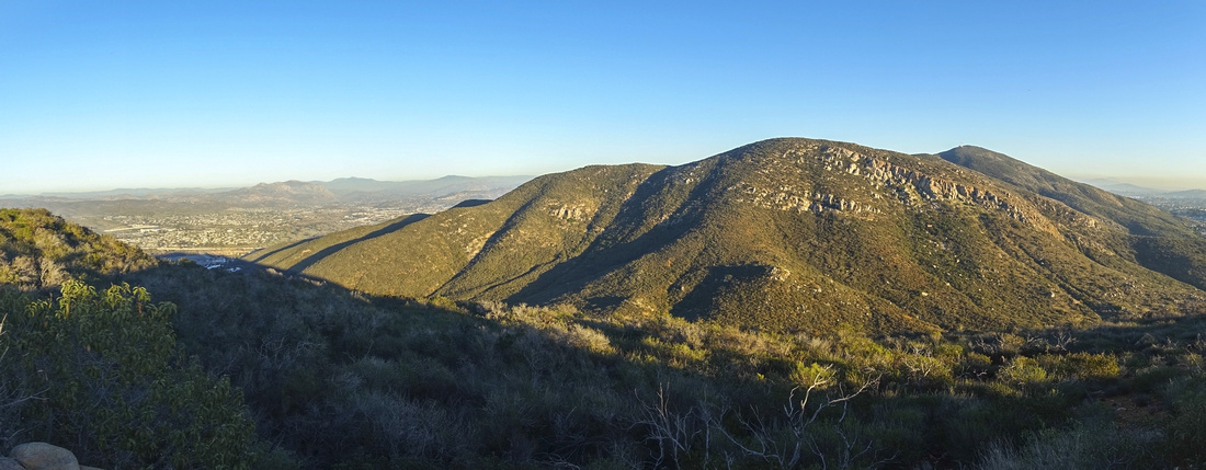
Panoramic View SE from Mt. Cowles across smog covered San Diego County. Cowles service road far center left |
| Trip Summary | |||
January 16, 2024
Mt. Cowles is highest peak in San Diego and part of Mission Trails Regional Park. It is also the most popular of Mission Trails Regional Park 5 Peak Challenge. There are several routes to the top, of which "Navajo Road" Route from the SW is by far the most popular. Mt. Pyles to the NW is much less visited despite good trail that takes no more than an hour from Cowles summit. This page describes elegant and rarely done loop from the "backside" climbing Cowles via Big Rock Trail and Service Road, then descending Pyles via obscure but perfectly feasible north side. Check the Map at top of Page; stats in the Abstract are given for this variation. For brief description of standard Cowles trail see bottom of this page.
Parking is at Big Rock Park at top of Mesa Road. Take I-52 Mast Blvd exit 13, then follow signs to Mission Gorge Road and turn left, then after couple of blocks right into Mesa Road and drive to the obvious public park. There is plenty of street parking - another reason to prefer this side approach to congested Navajo Road. Big Rock Trail is well defined and all junctions are signed. After exiting to Cowles Service Road 35-40min from the start turn right and follow the road to the summit that is closer than it perhaps looks. Just before the summit I turned left and merged with standard Navajo Road trail but you can also follow road to the top. It takes 1:15-1:30 of moderate pace from Mesa Parking to the summit.
To continue to Pyles Peak walk back to service road and find signed trail junction just below Cowles summit (see Gallery). Trail switchbacks to intervening saddle losing over 100m vertical that must be regained on the other side. Advertised viewpoint about halfway in to Pyles is not really worth but close enough you can check for yourself. Trail is mostly gentle with only bit steeper section just below Pyles summit above Corral Viewpoint. It will take roughly an hour from Cowles summit.
To close the loop, find rough trail starting at north side of Pyles Summit Monument. On my Jan '24 trip it was reasonably well defined and appeared recently brushed. There were no "closed" signs - despite faulty information found at various mapping sites such as GAIA. Trail generally stays close to the crest and there are couple of easy scrambling bits as it navigates some rock outcroppings and steeper parts. Hiking Pole(s) are of great help here. Eventually it descends to residential Water Tower - about an hour from Pyles summit. To walk back to the parking, easiest is to follow Shantung Drive east to Big Rock Road and trail back to Mesa Road Park - about 20min from Water Tower.
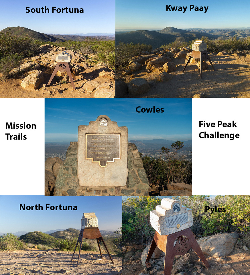
By hiking this loop, I also completed Mission Trails Regional Park 5 Peak Challenge. Photo from MTRP site:
Challenge was originally established in 2015, but discontinued at end of 2022 at what time I still needed Pyles. Despite not being able to get the pin anymore, I still wanted to complete the challenge; This was primary motivation for this '24 trip. Five Mission Peaks Monument Plaque Collage:
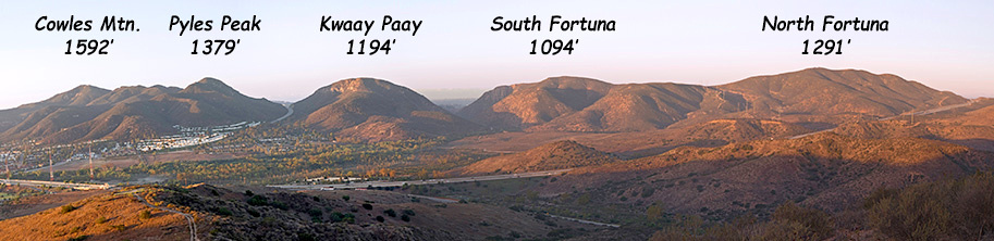
North/South Fortuna and Kwaay Paay reports. Cowles and Pyles on this page
|
|
Gallery |
|||
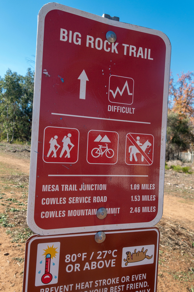
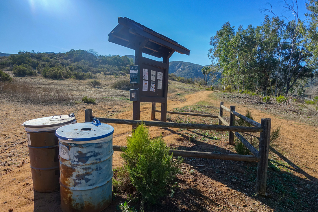 Big Rock Trailhead Big Rock Trailhead Big Rock Park Trailhead at top of Mesa Road
 |
|||
 Big Rock Trail Table
Trail Table with posted Distances (check the Dog lower right) Big Rock Trail Table
Trail Table with posted Distances (check the Dog lower right) |
|||
 Big Rock Trail
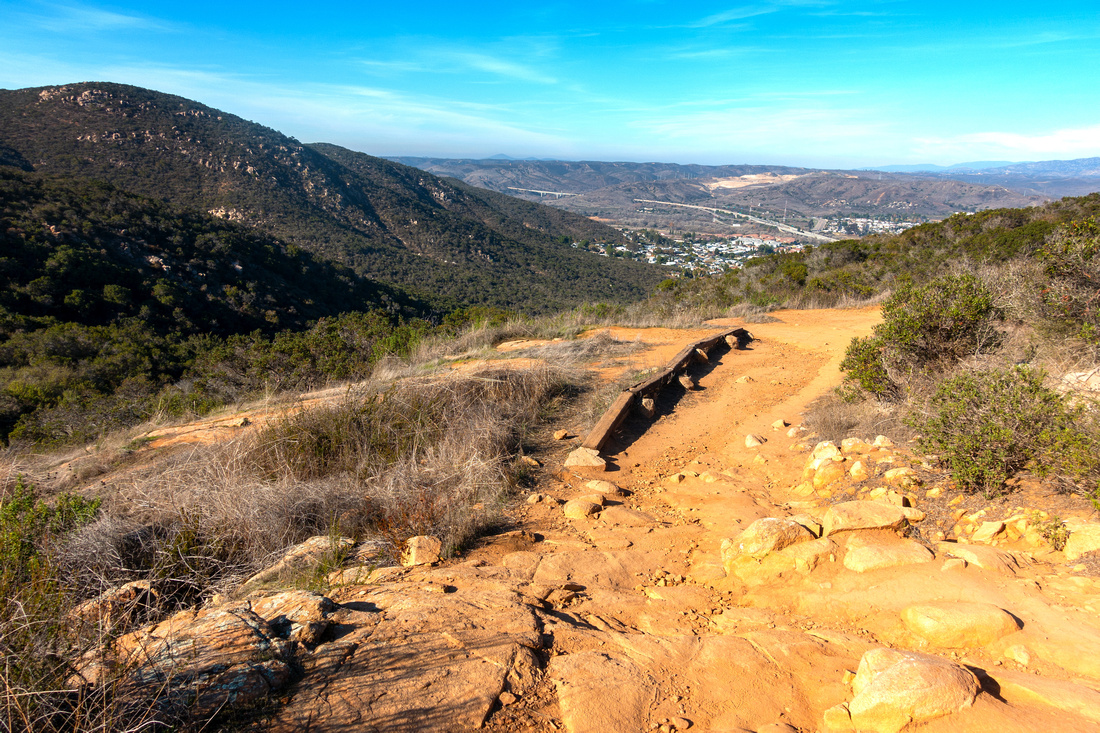
Looking back as Big Rock Trail lazily meanders semi-open slopes. Hwy 52 distant center Big Rock Trail
Looking back as Big Rock Trail lazily meanders semi-open slopes. Hwy 52 distant center |
|||
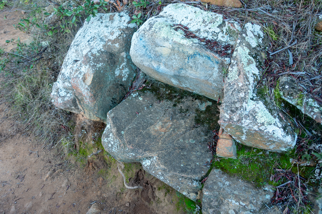 Rock Chair
Neat Rest Stop at one of lower switchbacks Rock Chair
Neat Rest Stop at one of lower switchbacks |
|||
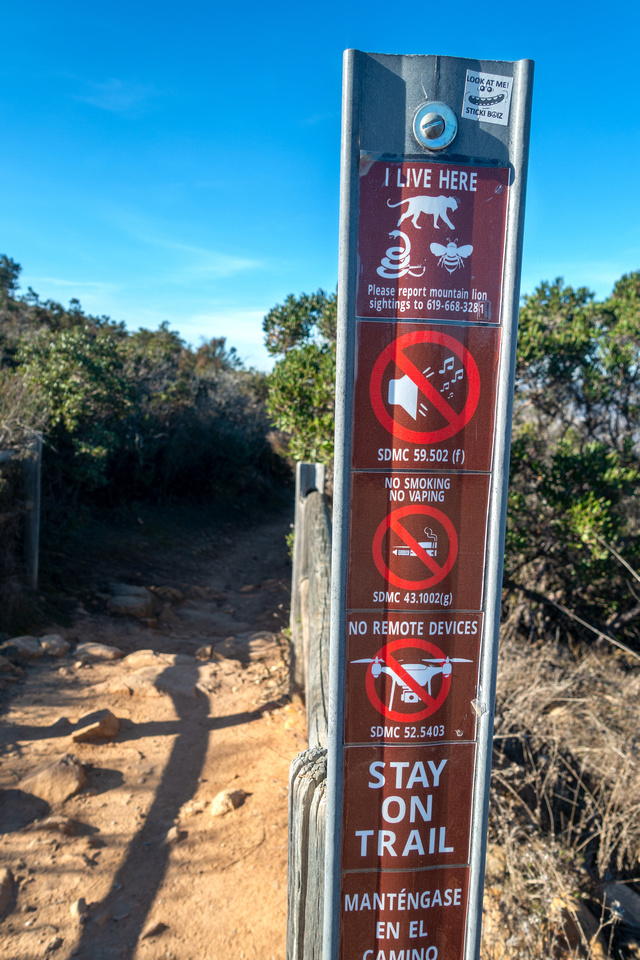 Mesa Trail Junction
Mesa Trail joins from east about 30min in. Some of these signs are hillarious - does it really need to be said "no vaping, no drones, no loud music"? Apparently it does with modern generation of social media hikers that frequent Mt. Cowles Mesa Trail Junction
Mesa Trail joins from east about 30min in. Some of these signs are hillarious - does it really need to be said "no vaping, no drones, no loud music"? Apparently it does with modern generation of social media hikers that frequent Mt. Cowles |
|||
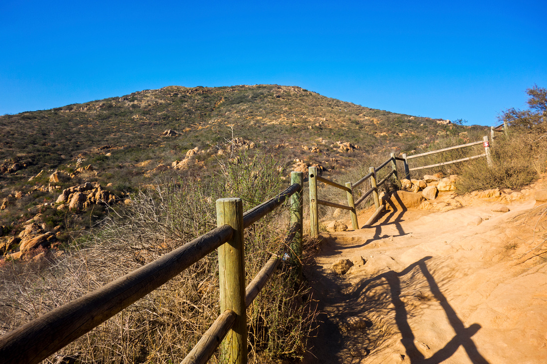
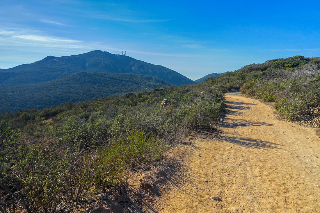 Cowles Service Road
Big Rock Trail exit to Cowles Service Road which is followed to the end. Summit is closer than it looks and only 35-40min away Cowles Service Road
Big Rock Trail exit to Cowles Service Road which is followed to the end. Summit is closer than it looks and only 35-40min away |
|||
 Navajo Trail Junction
Shortly before the summit standard Trail starting from Navajo Road comes in from the south. Washed out Murray Lake extreme right. Note layer of smog over San Diego County; not idling cars while texting or checking social media is still largely unknown concept in US Navajo Trail Junction
Shortly before the summit standard Trail starting from Navajo Road comes in from the south. Washed out Murray Lake extreme right. Note layer of smog over San Diego County; not idling cars while texting or checking social media is still largely unknown concept in US |
|||
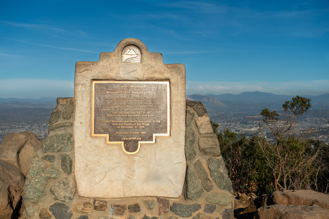 Cowles Summit Plaque
Customary Mission Monument Plaque at 485m summit of Mt Cowles Cowles Summit Plaque
Customary Mission Monument Plaque at 485m summit of Mt Cowles |
|||
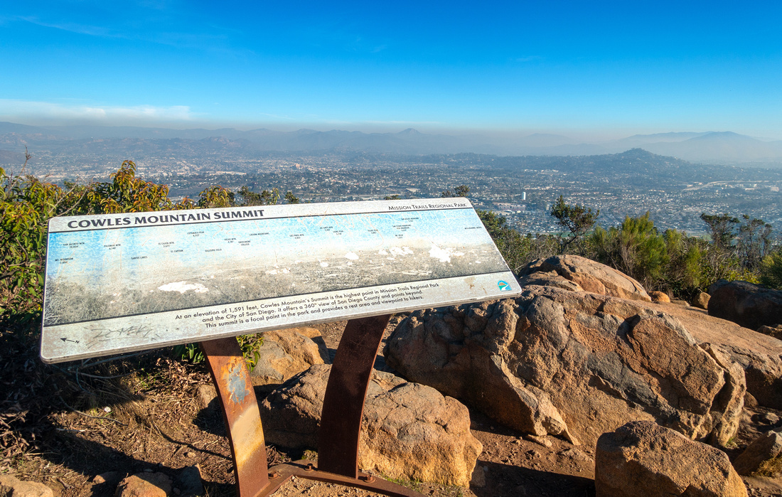 Badly scratched and Largely unreadable peak ID table at Cowles Summit
 |
|||
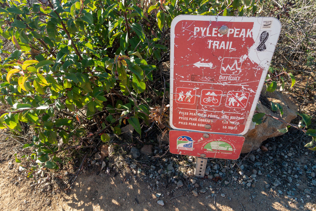 Pyles Trailhead
Weathered Trail Sign as Pyles Peak Trail branches off Service Road near Cowles Summit Pyles Trailhead
Weathered Trail Sign as Pyles Peak Trail branches off Service Road near Cowles Summit |
|||
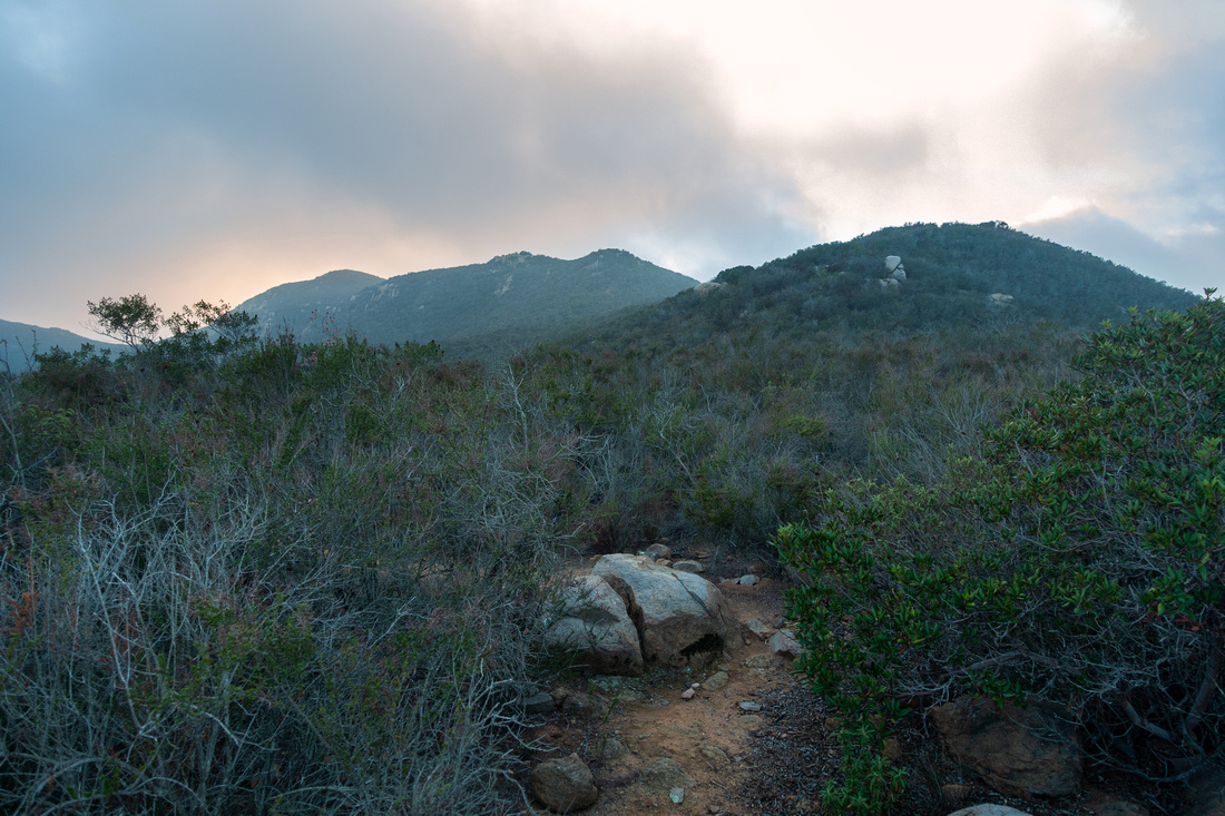
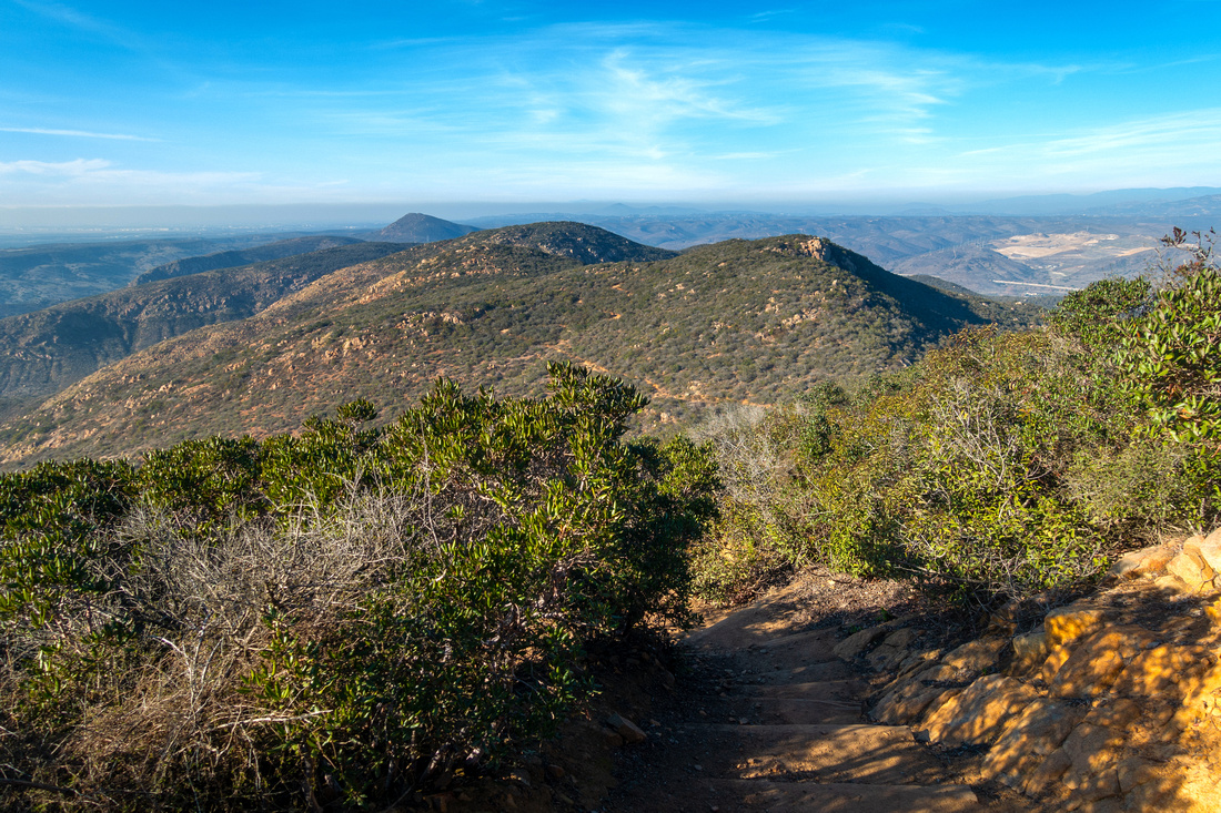 Pyles Ridge
Descent from Cowles to saddle below losing over 100m vertical. Pyles Peak behind just left of center - not closer bump right midground Pyles Ridge
Descent from Cowles to saddle below losing over 100m vertical. Pyles Peak behind just left of center - not closer bump right midground |
|||
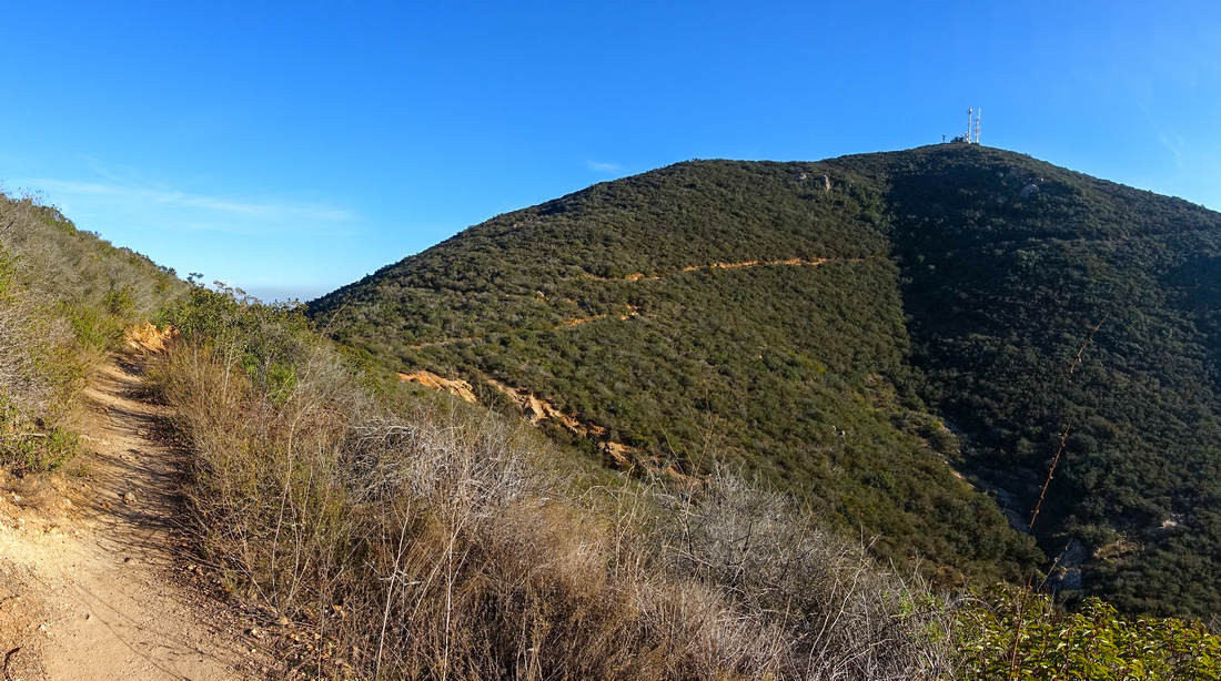 Pyles Trail
Looking back at Mt. Cowles as trail contours intervening bump above the saddle Pyles Trail
Looking back at Mt. Cowles as trail contours intervening bump above the saddle |
|||
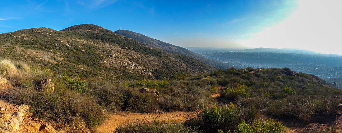 Corral Panorama
Mountain Cyclists are allowed only to the "Corral" - fenced viewpoint right of center. Mt. Cowles now significantly far away just left of center Corral Panorama
Mountain Cyclists are allowed only to the "Corral" - fenced viewpoint right of center. Mt. Cowles now significantly far away just left of center |
|||
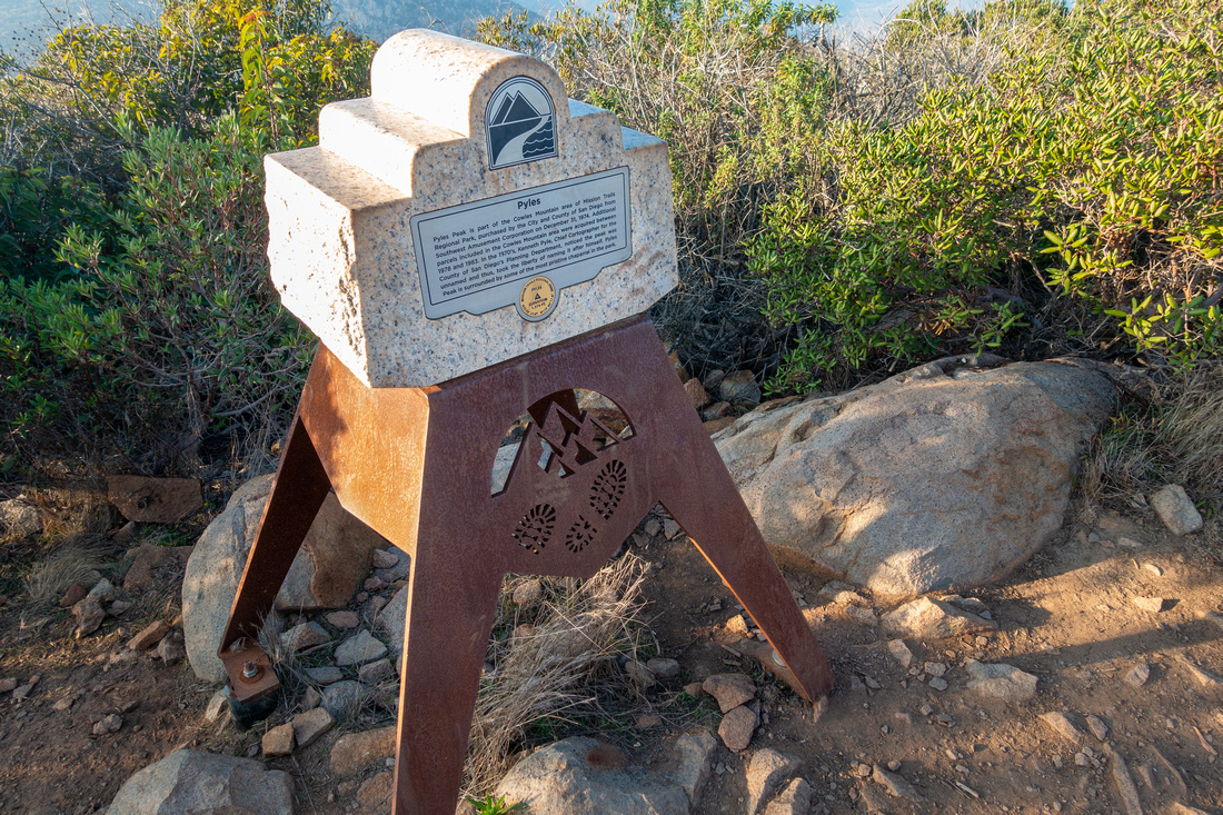 Pyles Peak Monument
Standard Mission Trails Monument at 420m high Pyles Peak Pyles Peak Monument
Standard Mission Trails Monument at 420m high Pyles Peak |
|||
 Pyles Peak Panorama
Panorama North from Pyles Peak with view of Hwy 52 and smog filled San Diego County. North side descent follows ridge in right midground Pyles Peak Panorama
Panorama North from Pyles Peak with view of Hwy 52 and smog filled San Diego County. North side descent follows ridge in right midground |
|||
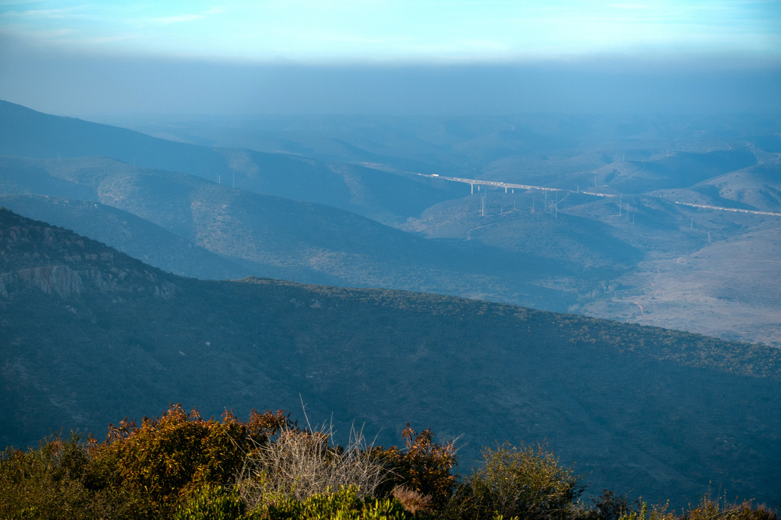 Hwy 52
 Viaduct Telephoto from Pyles Peak as Marine layer moves in from the Pacific Hwy 52
Hwy 52 Viaduct Telephoto from Pyles Peak as Marine layer moves in from the Pacific |
|||
 Pyles North Ridge
Looking back to Pyles Peak (upper left center, behind) as north trail that generally follows ridge crest drops towards residential Water Tower Pyles North Ridge
Looking back to Pyles Peak (upper left center, behind) as north trail that generally follows ridge crest drops towards residential Water Tower |
|||
 Pyles North Ridge
Pyles Peak North Ridge as seen from Kwaay Paay; Mt. Cowles center right Pyles North Ridge
Pyles Peak North Ridge as seen from Kwaay Paay; Mt. Cowles center right |
|||
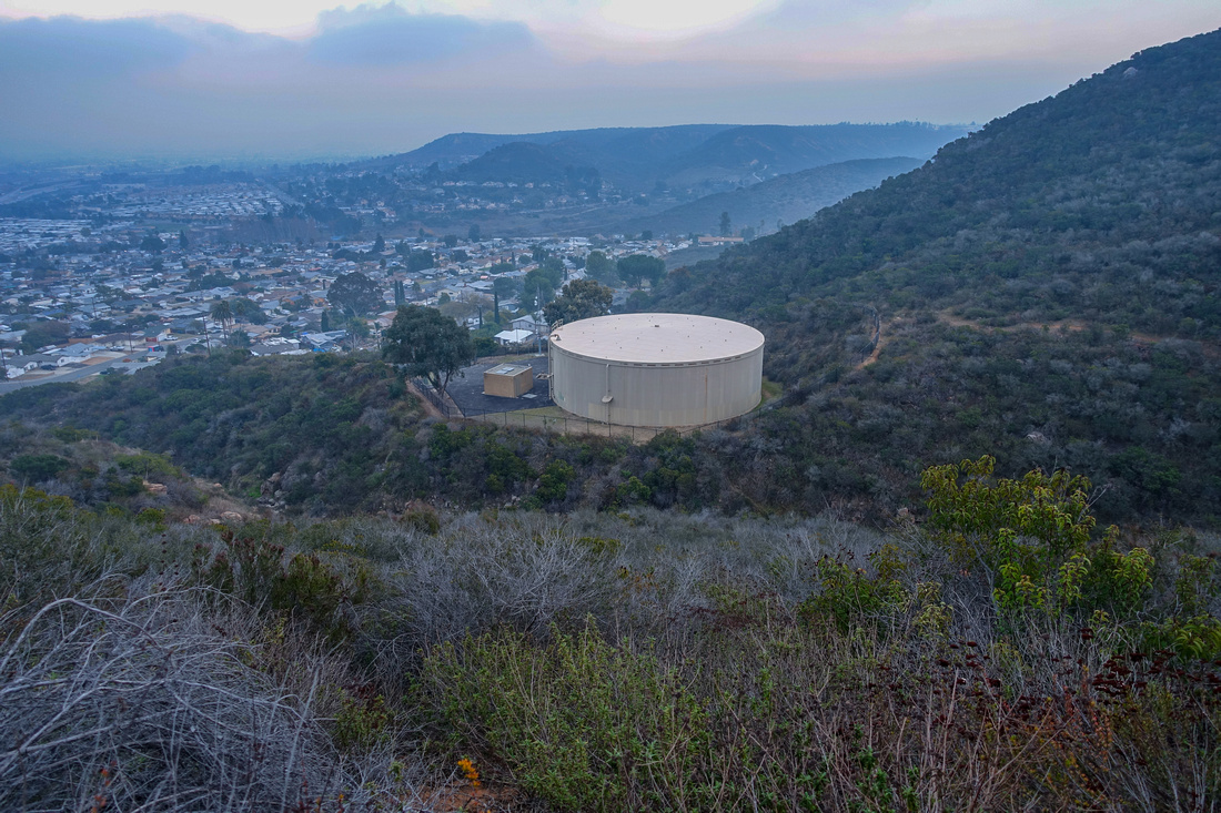 Shantung Water Tower
Water Tower at top of Shantung Drive. There are no signs/markings; if you wish to ascend Pyles this way, look for Waypoint "4 - Watertower" on GPS track, download on Top of Page Shantung Water Tower
Water Tower at top of Shantung Drive. There are no signs/markings; if you wish to ascend Pyles this way, look for Waypoint "4 - Watertower" on GPS track, download on Top of Page |
Abstract
| Overall Difficulty | D3 | Some steep and rocky sections. Couple of easy scrambling steps for Pyles north side | |||
| Scenery | Sweeping 360 Panorama of Mission Trails Regional Park and San Diego County | ||||
| Trail/Marking | Very Good | Well defined trail with signed junctions for Cowles and Pyles official trails. Exploratory but generally well defined and brushed route for Pyles north side | |||
| Suggested Time | 4 hrs | For loop presented here (see map). Add an hour if returning from Pyles back the same way | |||
| Elevation | Start: 105m Max: 485m (Mt. Cowles) Total: ~590m | Round Trip: ~10km (Pyles North Side loop) | |||
| Gear | Day Hikers or full hiking boots. Hiking pole very helpful for stability on rocky sections and rough Pyles north side descent | ||||
| Water | No reliable source of water. Carry 1-3L depending on season | ||||
| Dog Friendly | Yes | Dogs are allowed, but must be leashed at all times in Mission Trails Regional Park | |||
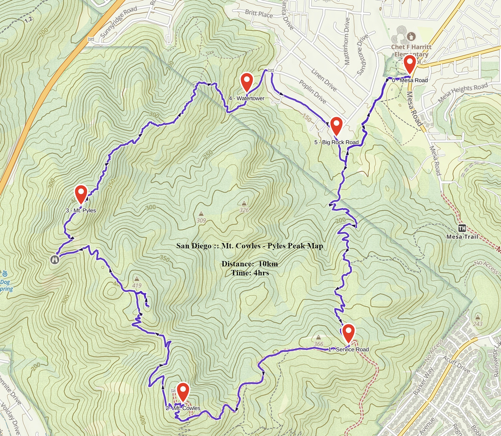 Mt. Cowles - Pyles Peak GAIA Map
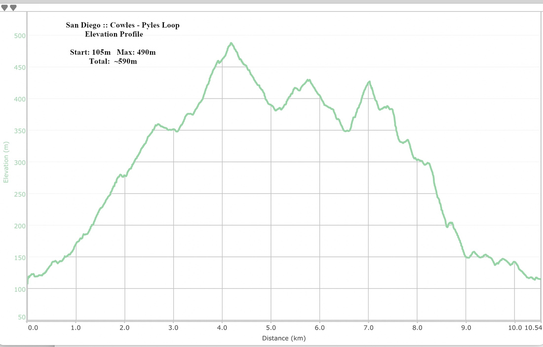 Cowles Pyles Loop Elevation Profile
Standard Mt. Cowles Trail
Usual route up Mt. Cowles via SW slopes starts from junction of Navajo Road and Golfcrest Drive in La Mesa and inserted here for completeness. Parking lot is limited and usually full; long line of cars parked at shoulder of Golfcrest Drive sometimes stretches for several 100's meters. There are apparently frequent car break-ins too. Ultra busy trail follows moderate switchbacks with little variation to the summit; dodging endless gong-show of hikers is by far the biggest crux. I've climbed Cowles this way just once and will likely never do it again from this side. It takes about an hour for reasonably fit person, ~40min down.
 Cowles Trail
Typical section of standard Cowles Trail
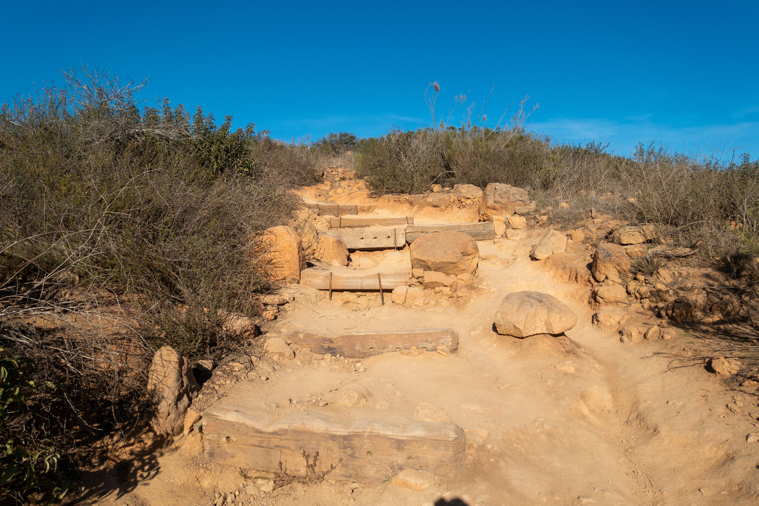 Cowles Trail
Eroded moderately steep bit past all switchbacks just before Cowles summit
Cowles Trail
Eroded moderately steep bit past all switchbacks just before Cowles summit