Google Map |
USA :: San Diego :: Kwaay Paay |
GPS Track |
|
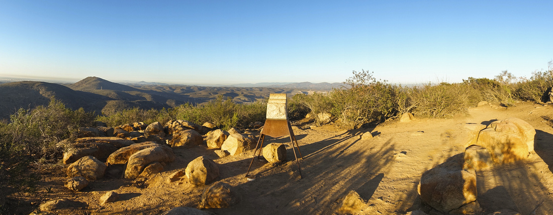
Panoramic View north from Kwaay Paay Summit; new Monument Signs were installed on all Mission Peaks in 2018 |
| Trip Summary | |||
January 6, 2022
Kwaay Paay is 4th highest peak in Mission Trails Regional Park. The name comes from local Kumeyaay Native language, meaning 'leader'. It is a short trail and worthy after-work jaunt if you are local. It is still decent exercise and final rise to the summit, more steep than perhaps expected, will provide decent albeit short cardio. There are two trailheads, both on north end of Father Junipero Serra Trail (driveable 1-way from Visitor Center). West trail starts from Old Mission Dam Historic Site which is well worth a visit. This parking lot is small and fills easily. East Trail starts from Gate at Bushy Hill Drive and there is large parking lot outside the gate, as well as street parking. These trailheads are less than kilometer apart. Both trails join up about 1/3rd of the way up. I recommend parking the car at Bushy Parking lot, hiking up via east trail then on descent take west trail to Mission Dam and walking the road back to parking. Trail is easy to follow but watch for snakes in summer. Summit area is wide with Monument installed in 2018. Fence prohibits venturing beyond the summit area; if you decide still to explore, faint trail through the bush has seen some use. It will lead to rocky outcrop ~5min from summit area with westerly views and great spot to watch the Sunset (last photo in gallery). |
|
Gallery |
|||
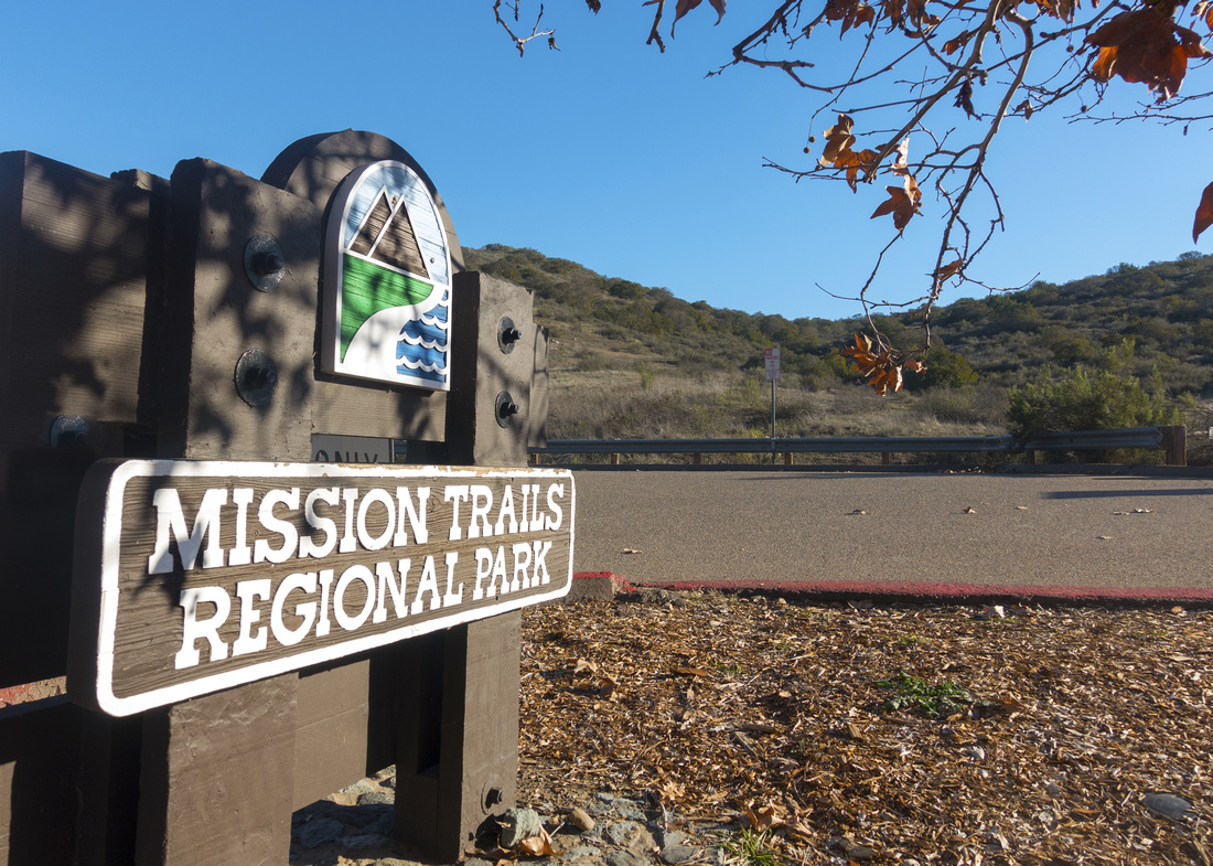 Mission Trails Sign Mission Trails Sign
|
|||
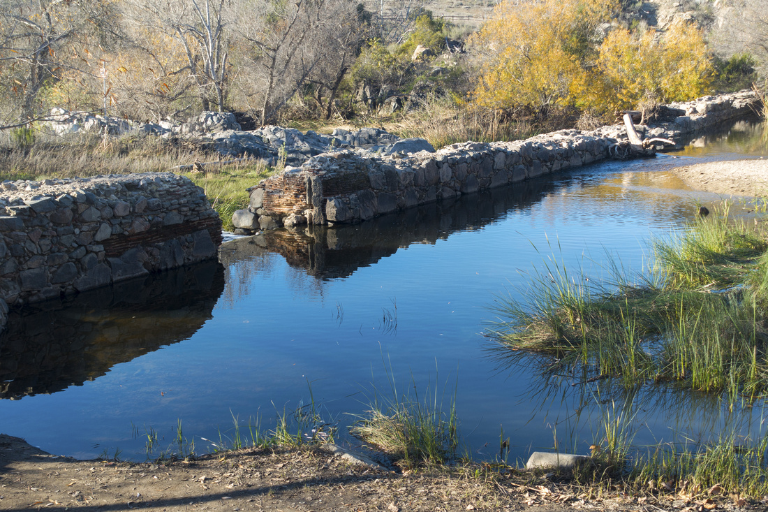 Mission Dam
 Historical Site, well worth a look, before the hike Mission Dam
Mission Dam Historical Site, well worth a look, before the hike |
|||
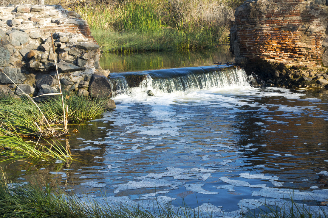 Mission Waterfall
Small Waterfall behind Old Mission Dam Mission Waterfall
Small Waterfall behind Old Mission Dam |
|||
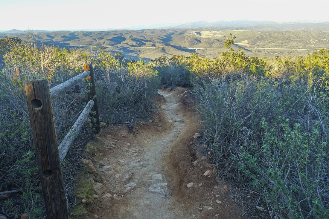 Kwaay Paay Trail
Looking back from typical section of the trail. Clemente Canyon Freeway (Hwy 52) behind Kwaay Paay Trail
Looking back from typical section of the trail. Clemente Canyon Freeway (Hwy 52) behind |
|||
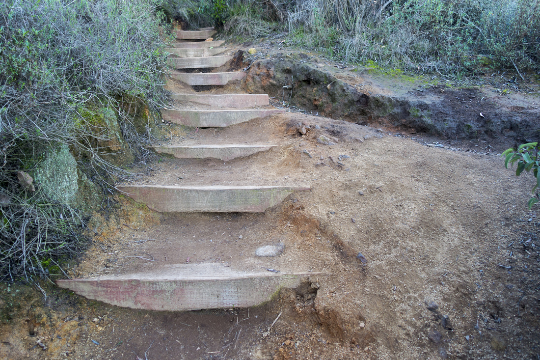 Wooden Staircase
 to prevent erosion on moderately steep final part before the summit Wooden Staircase
Wooden Staircase to prevent erosion on moderately steep final part before the summit |
|||
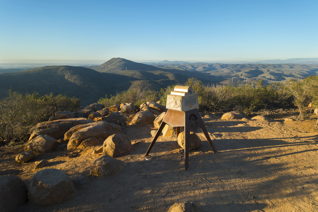 Summit Monument
Kwaay Paay Summit Monument looking NW across San Diego County Inland Summit Monument
Kwaay Paay Summit Monument looking NW across San Diego County Inland |
|||
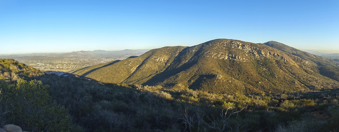 Mission Gorge Panorama
Panoramic view SE across Mission Gorge towards Mt. Cowley (background center right), highest peak in the park. Mission Gorge Panorama
Panoramic view SE across Mission Gorge towards Mt. Cowley (background center right), highest peak in the park. |
|||
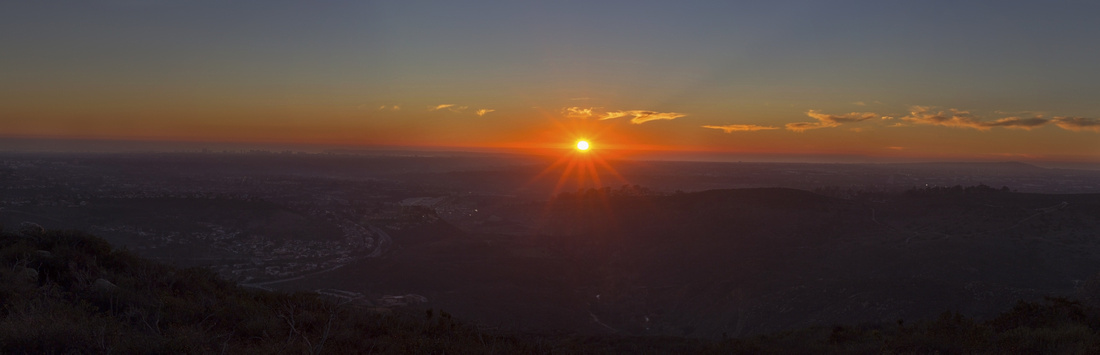 San Diego Sunset Panorama
Summit Panorama across hazy San Diego County as sun dips below Pacific Ocean Horizon San Diego Sunset Panorama
Summit Panorama across hazy San Diego County as sun dips below Pacific Ocean Horizon |
Abstract
| Overall Difficulty | D2 | Short hike on established trail with moderately steep section below the summit | |||
| Scenery | Sweeping Panorama of Mission Gorge and San Diego County. Historic Mission Dam at west Trailhead | ||||
| Trail/Marking | Excellent | Well defined trail with signed junctions | |||
| Suggested Time | 2 hrs | Plus time to explore old Mission Dam | |||
| Elevation | Start: 100m Max: 350m Total: ~270m | Round Trip: ~4.5km | |||
| Gear | Day Hikers are sufficient. Hiking pole helpful for stability descending steeper bit below the summit | ||||
| Water | Dry hike. Carry 1L, more in summer heat | ||||
| Dog Friendly | Yes | Dogs are allowed, but must be leashed at all times | |||
 Kwaay Paay GAIA Map
 Kwaay Paay Elevation Profile