Google Map |
USA :: San Diego :: Mount Fortuna |
GPS Track |
|
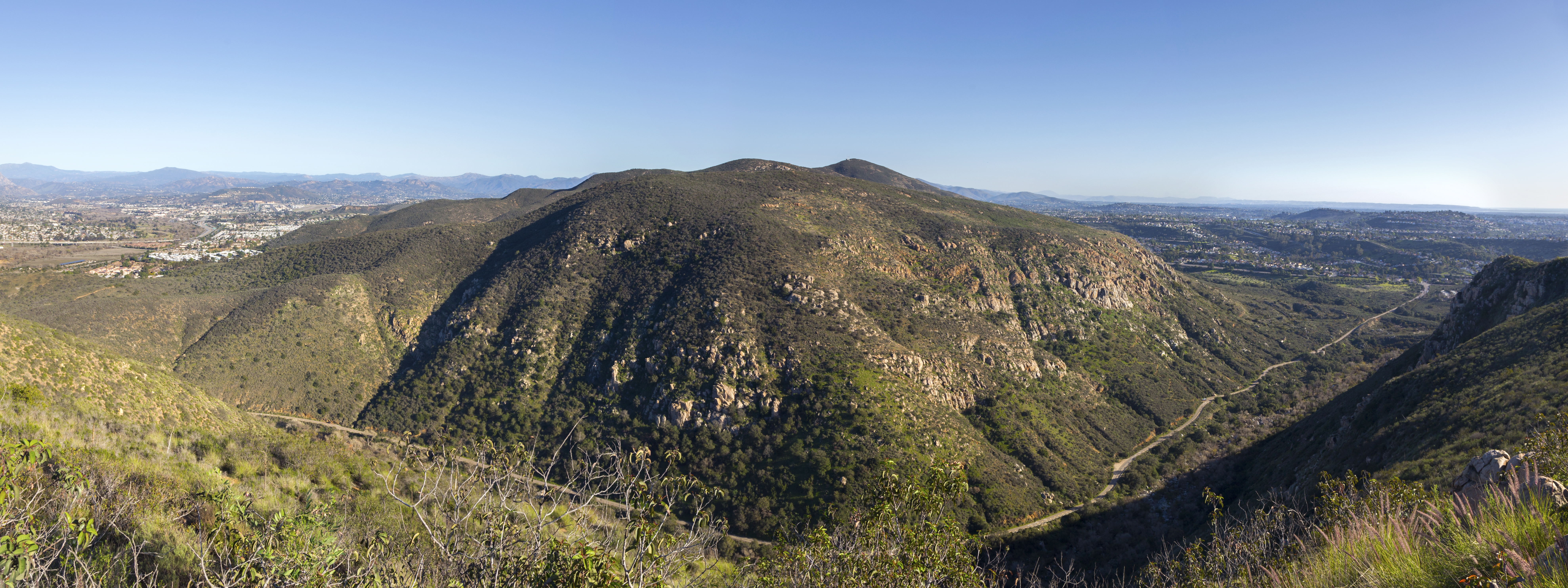
Panoramic View south from North Fortuna with trademark Mission Monument Sign. South Fortuna directly across, Mt. Cowles behind to the right |

| Trip Summary | |||
January 10, 2022
Twin summits of Mount Fortuna is arguably the most challenging outing in Mission Trails Regional park. There are several routes up; on my trip I started from Mission Dam, then after crossing bridge across San Diego River followed Oak Canyon trail to Fortuna Saddle junction and up. Posted Distance from the saddle to either peak is 0.6 miles, so about a kilometer or ~15min. North summit is higher. I first went up South Peak, then back to the saddle and up North Peak. For variety I returned by descending North Peak to Perimeter Trail, then followed Perimeter to North Oak Creek and back to Saddle Junction. This is best shown on map -- see link on top left corner of this page. In hindsight alternate descent was probably not worth as portions of Perimeter Trail paralleling I-52 are brutally steep going up and down several times; it was better to return the same way I went up (North Oak Canyon is quite nice though). Note that portions of Oak Canyon are fairly rocky and even hands are needed at couple of times. I have not seen seasonal waterfall but in spring after rainy winter it might be flowing. Hazards include poison oak along the way, but the biggest challenge however is dodging the unnecessary park gate closing - posted 5 pm in Feb '22. I parked in front of gate at Bushy Hill Road, but apparently some people are oblivious to posted signs as several cars were trapped behind closed gate around 6pm when I exited. My suggestion is: Save yourself trouble and potentially rushing your trip in order to beat the closure time and simply park at Bushy Hill Road, then walk Father Junipero for about 500m to Mission Dam. Photo gallery notes are self-explanatory as far as trip details go.
Side Note: Mission Trails Regional Park (MRTP) offers certificate to anyone who completes "Hiking the 5 Peak Challenge of Mission Regional Park". These 5 peaks are: Cowles, Kwaay Paay, North Fortuna, South Fortuna and Pyles. (At time of this writing only one I haven't been to is Pyles). Summit photos need to be emailed to [email protected] Most people take separate trips like I did, but apparently 5% - mostly trail runners - do it in a day! For full details see MRTP site |
|
Gallery |
|||
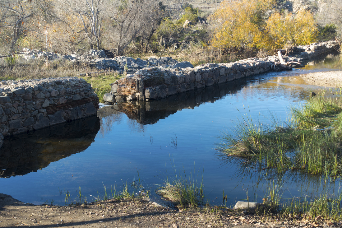 Mission Dam Mission Dam Mission Dam Historical Site, one of several possible Fortuna trailheads, well worth a visit
 |
|||
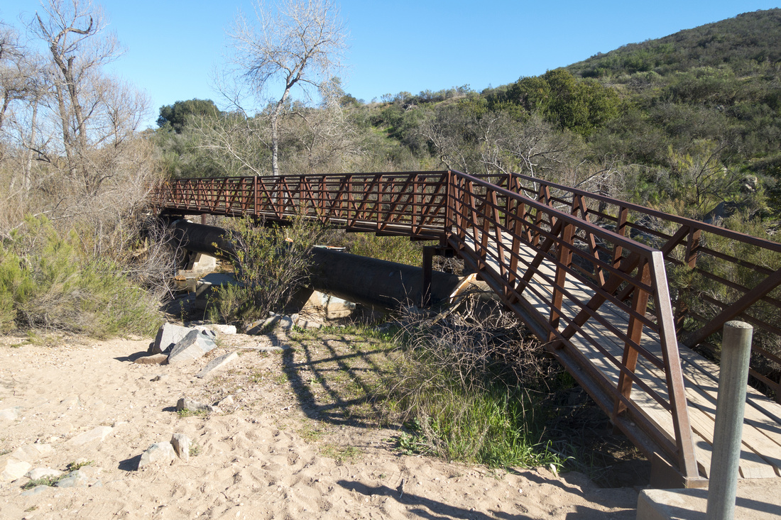 San Diego River Bridge
Bridged crossing of San Diego River just downstream of Mission Dam San Diego River Bridge
Bridged crossing of San Diego River just downstream of Mission Dam |
|||
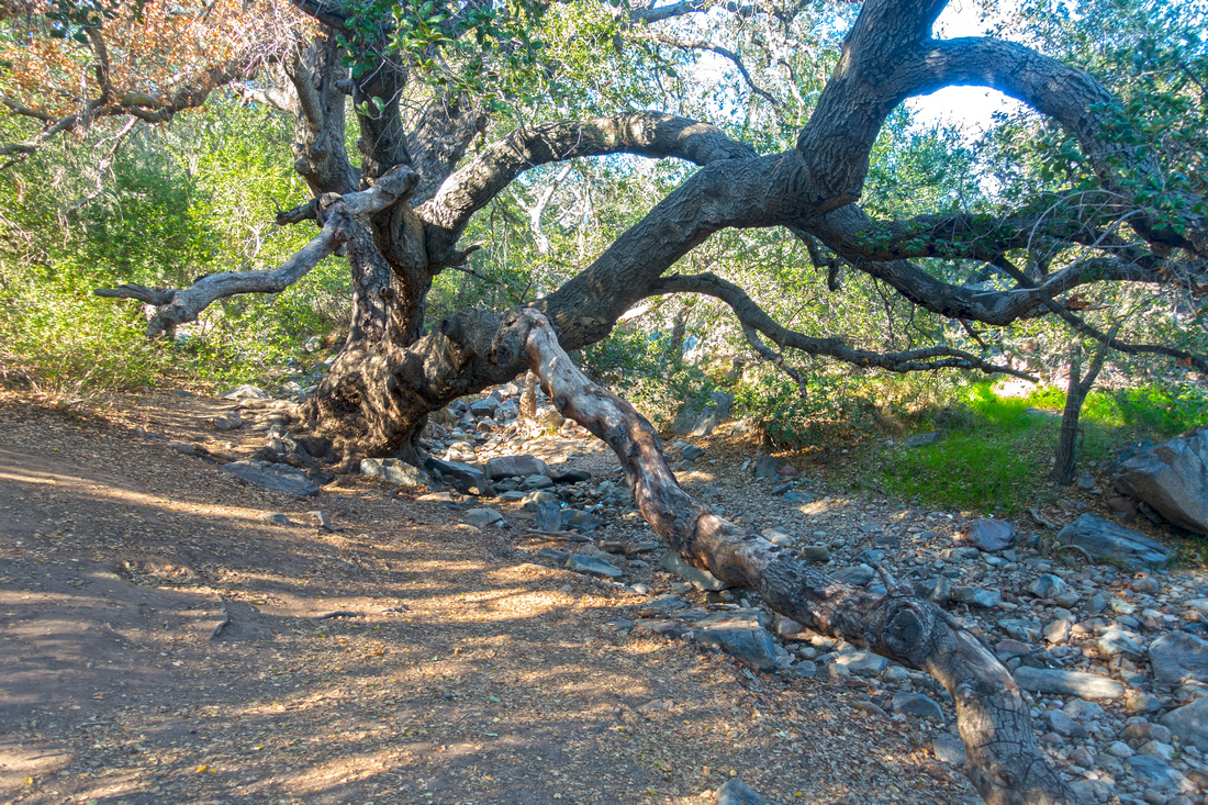 Giant Oak
Large Oak tree in South Oak Canyon, also labelled on Google Maps Giant Oak
Large Oak tree in South Oak Canyon, also labelled on Google Maps |
|||
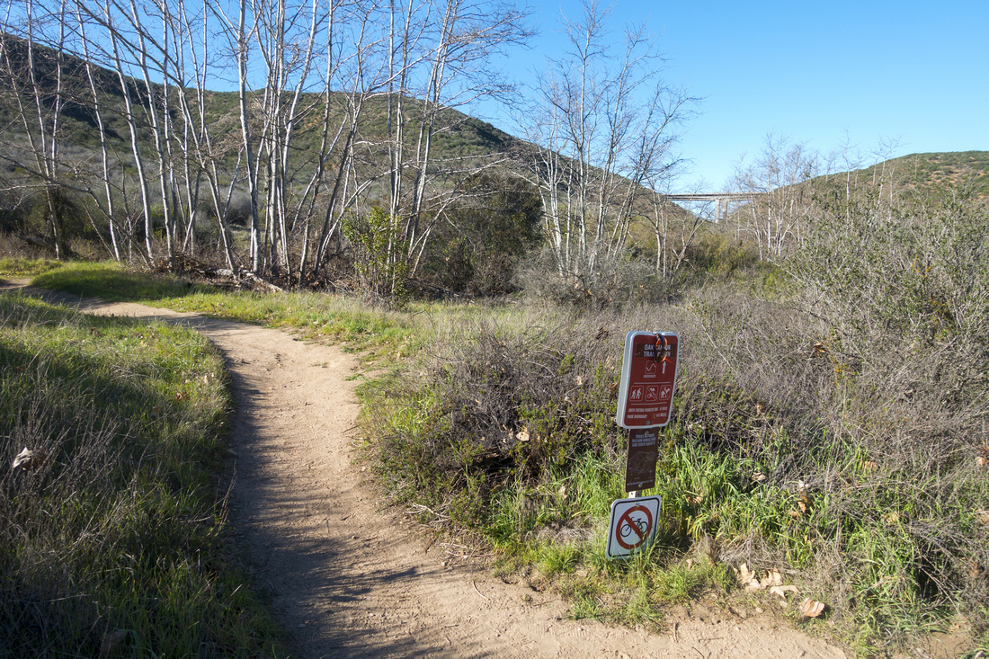 Saddle Junction
Junction with Fortuna Saddle. North Oak Canyon is to the right, and possible loop return. Note I-52 bridge upper center right Saddle Junction
Junction with Fortuna Saddle. North Oak Canyon is to the right, and possible loop return. Note I-52 bridge upper center right |
|||
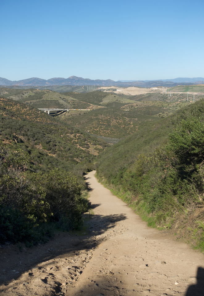 Fortuna Saddle
View down steep trail just below Fortuna Saddle where most elevation gain lies Fortuna Saddle
View down steep trail just below Fortuna Saddle where most elevation gain lies |
|||
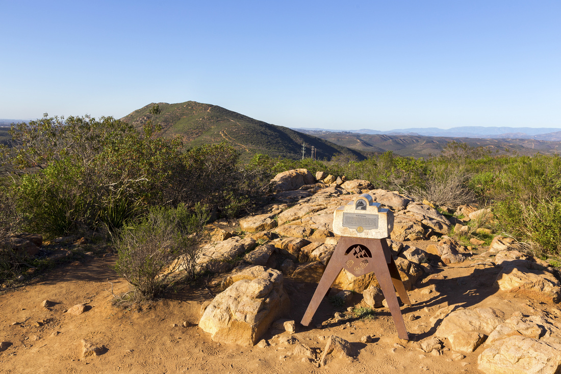 South Fortuna
 with Trademark Mission Summit Monument. North Fortuna upper center left. Fortuna Saddle is low point left of power poles South Fortuna
South Fortuna with Trademark Mission Summit Monument. North Fortuna upper center left. Fortuna Saddle is low point left of power poles |
|||
 |
|||
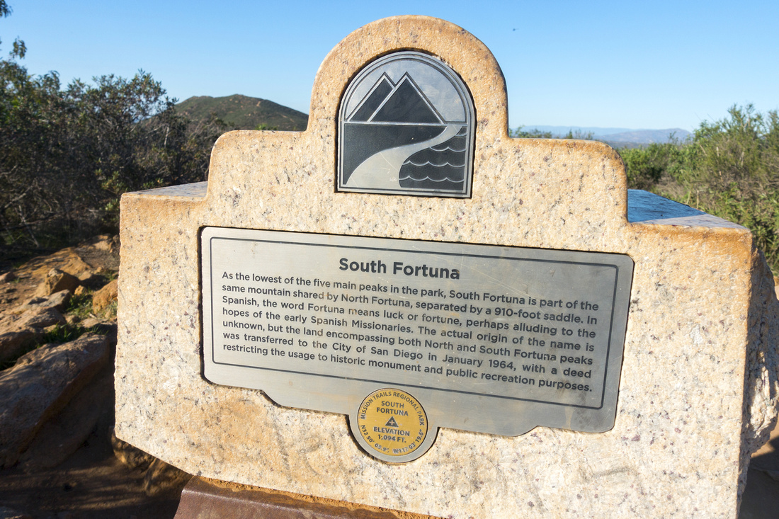 Fortuna Monument
Closer look at South Fortuna Summit Monument Fortuna Monument
Closer look at South Fortuna Summit Monument |
|||
 North Fortuna
Summit post at North Fortuna looking back to South Fortuna; takes about half an hour between the two. Cowles behind North Fortuna
Summit post at North Fortuna looking back to South Fortuna; takes about half an hour between the two. Cowles behind |
|||
 |
|||
 North Fortuna Descent
Trail descending north side across small bump towards Perimeter Trail. Note I-52 center right North Fortuna Descent
Trail descending north side across small bump towards Perimeter Trail. Note I-52 center right |
|||
 North Fortuna Trail
Looking back North Fortuna descent trail from Perimeter Trail junction North Fortuna Trail
Looking back North Fortuna descent trail from Perimeter Trail junction |
|||
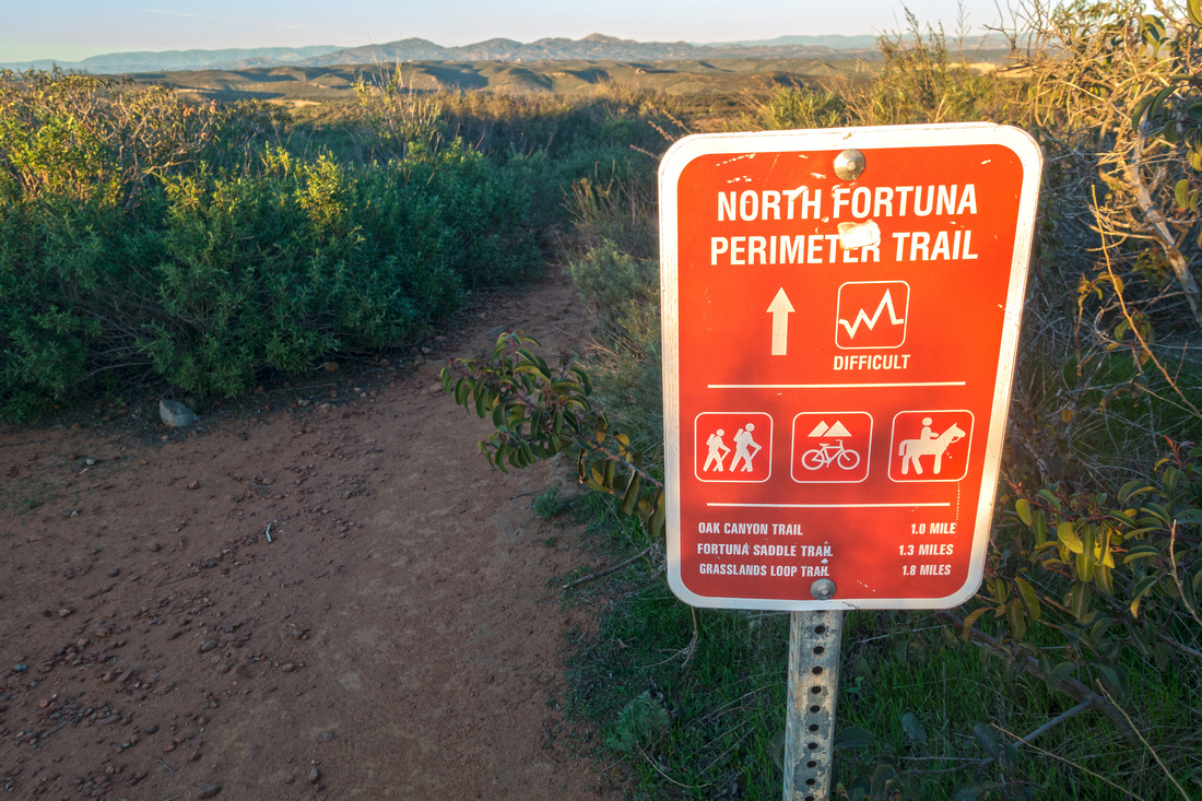 Perimeter Trail
Park Table at junction of North Fortuna and Perimeter Trails Perimeter Trail
Park Table at junction of North Fortuna and Perimeter Trails |
|||
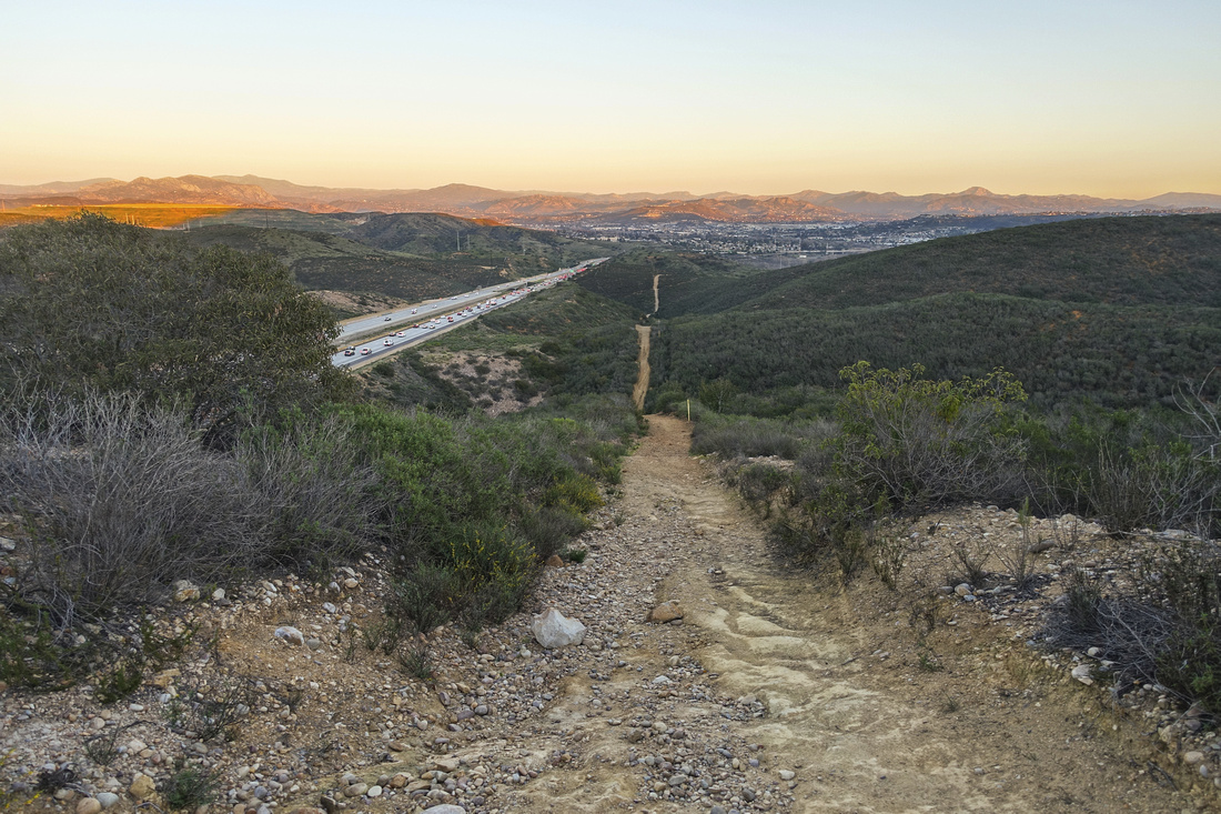 Perimeter Trail
Rough and too long stretch of Perimeter Trail with several steep drops. Noisy I-52 rush hour to the left Perimeter Trail
Rough and too long stretch of Perimeter Trail with several steep drops. Noisy I-52 rush hour to the left |
Abstract
| Overall Difficulty | D3 | Steep and crumbly sections of trail below Fortuna saddle and on alternate North Fortuna descent to Perimeter Trail. Some light boulder hopping in South Oak Canyon | |||
| Scenery | Sweeping 360 Panorama of Mission Trails Regional Park and San Diego County. Historical Mission Dam at start | ||||
| Trail/Marking | Very Good | Well defined trail with signed junctions. Map is helpful (free of charge in Mission Visitor Center) | |||
| Suggested Time | 4 hrs | For loop presented here (see map) starting from Mission Dam and looping back via Perimeter Trail. Other Options might take different time | |||
| Elevation | Start: 100m Max: 395m (North Fortuna) Total: ~480m | Round Trip: ~12km (Perimeter Loop) | |||
| Gear | Day Hikers or full hiking boots. Hiking pole very helpful for stability in South Oak Canyon and if returning via Perimeter Trail | ||||
| Water | San Diego River and Seasonal waterfall in South Oak Canyon (water must be treated). Drinking fountains available at Mission Dam. Carry 2L, more in summer | ||||
| Dog Friendly | Yes | Dogs are allowed, but must be leashed at all times in Mission Trails Regional Park | |||
 Mount Fortuna GAIA Map
 Mount Fortuna Elevation Profile