USA :: San Diego :: Laguna Meadows |
|
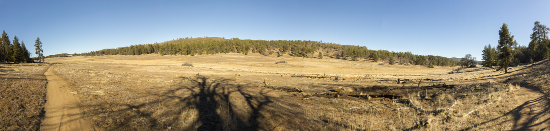
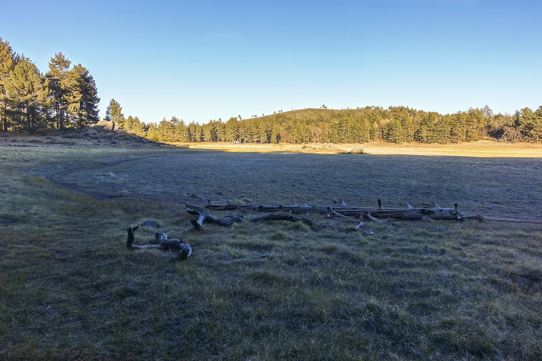
Expansive meadow north of Big Laguna Lake offering scenic and peaceful alpine wondering |
|||
|
Expansive Meadows Southern California Style. Highly recommended for few hours or full day of casual wondering in grand alpine environment, not typically associated with this part of the world. Access is via Sunrise Highway, linking I-8 with SR 79 to Julian. Lying at altitude of near 6000 ft area sometimes receives significant snowfall in winter months, but it usually doesn't last long. Including neighbouring Cuymaca Rancho California State Park, I visited half a dozen of times in January/February and never encountered any difficulties. Laguna lies in Cleveland National Forest and valid Park Pass is required; ironically this pass won't be valid in Cuyamaca which is under state management (go figure).
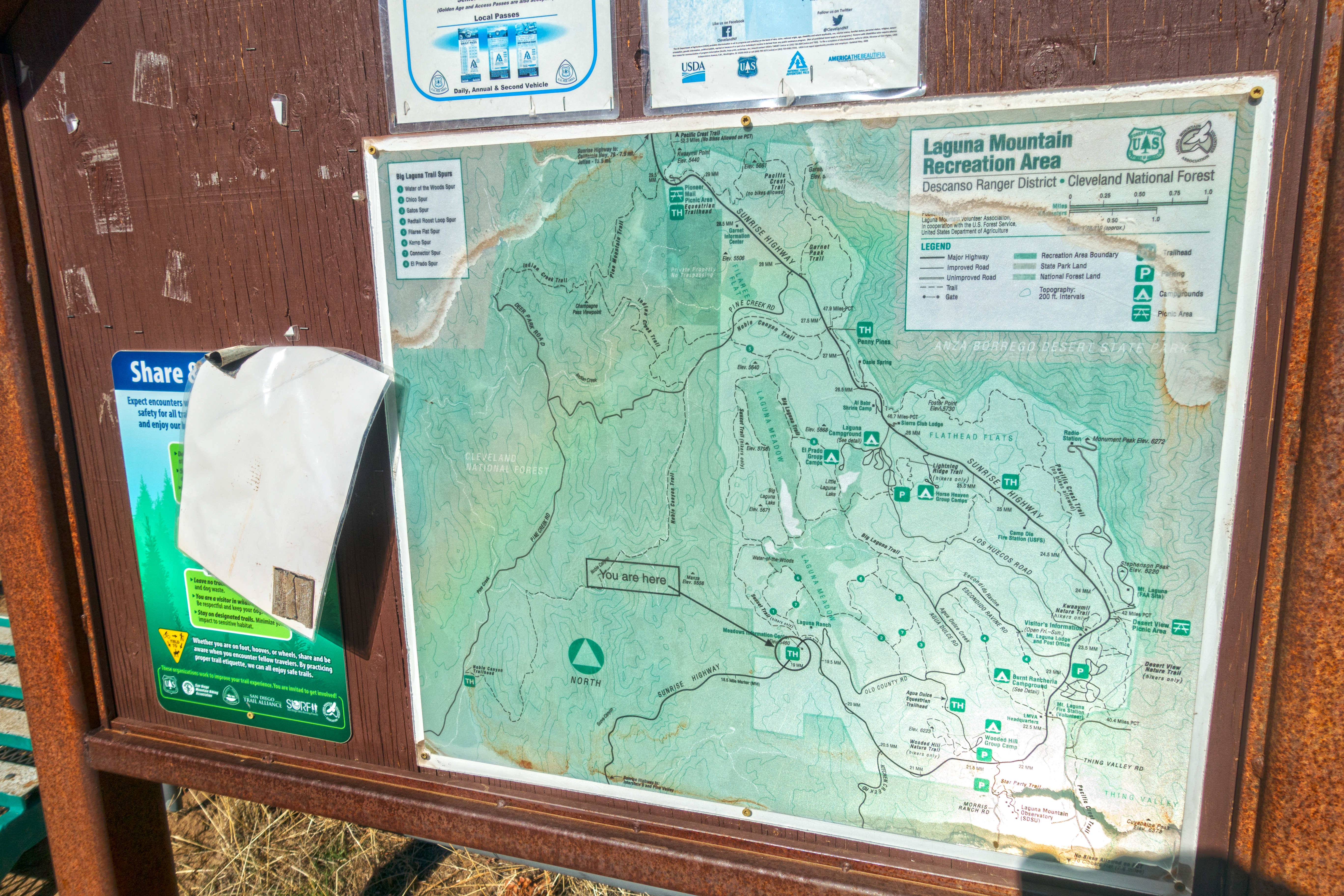
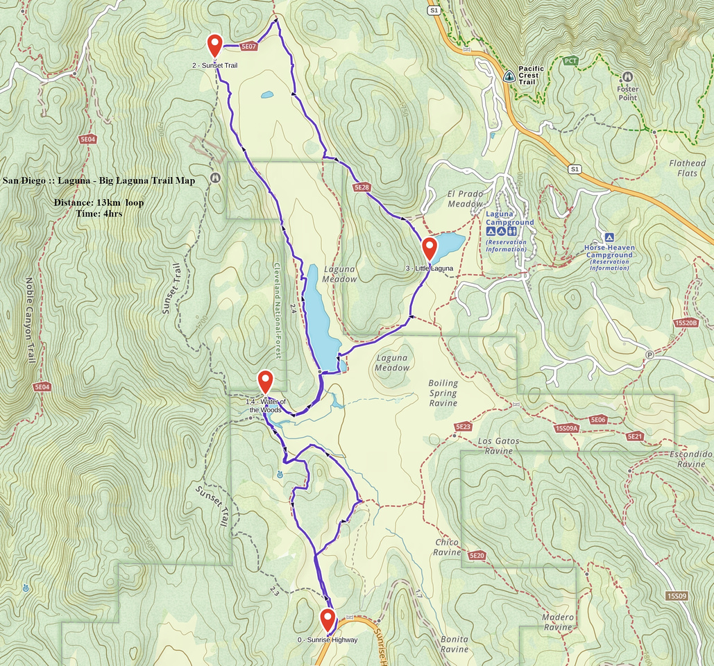
Drive I-8 east of San Diego and take exit 47 at Laguna Summit onto Sunrise Highway. Road is paved, but twists and turns; when icy it could be tricky. If visiting first time, I recommend stopping at Visitor Center. Hiking maps are sold for $2 only - but same copy exists on Sunset Trailhead (see gallery). There are also couple of campgrounds near main Laguna Rec center open (and used) year round. Trails described in this report start from Sunrise Trailhead 4km south of Visitor Center and explore expansive Big Laguna meadow. There is no dedicated parking lot, but plenty of space on both side of the road exist; it does fill up on sunny weekends. These two routes are just some of possible options; use map and your imagination to design your own itinerary. Big Laguna Meadow can also be reached from Campground as well as Penny Pines Trailhead by following Noble Canyon Trail. Whichever direction you chose, do not miss Big Laguna Lake and meadow that lies north of the lake; it is one of most peaceful and beautiful alpine areas I've visited outside Canada.
|
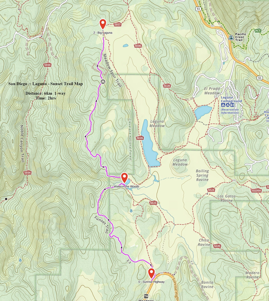
| Sunset Trail | ||
|
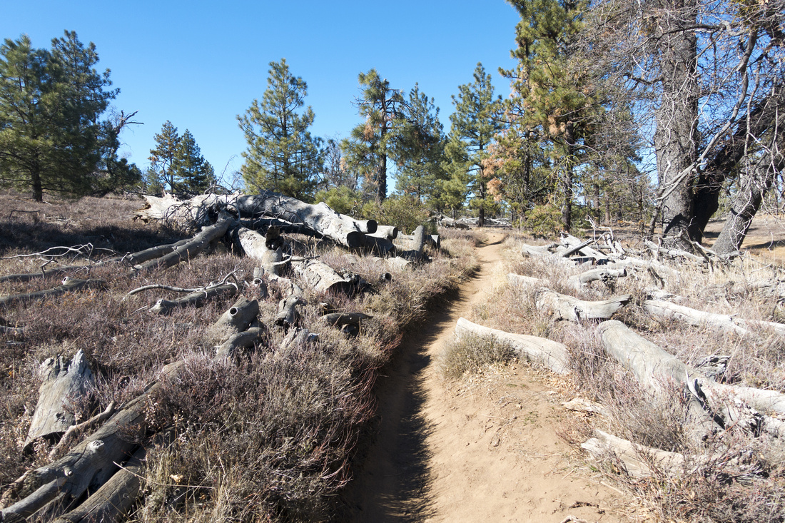
Sunset trail is only 'hiker only' trail in Laguna meadows; others, including Big Laguna, are shared with equestrians and mountain bike riders. It also spends more time in the woods, but forest is generally semi open and you are never without views for too long. About 5 minutes past the cattle guard gate at trailhead there is junction; Big Laguna trail turns right, while Sunset continues straight. They will meet again at "Water of the Woods" - about 35-40min from the start. Sunset trail then climbs forested ridge and trail is occasionally bit rocky. Cresting up views west across Cuyamaca Rancho State Park open up and this is where Sunset is best enjoyed, and how trail got its name. Trail then descends to top of Big Laguna Meadow, just a bit over 6km from trailhead. You can then return via Big Laguna Trail either side of Big Laguna Lake, or continue to Penny Pines trailhead (2 cars needed).
If wanting to experience Sunset from Sunset trail, I suggest hiking to top of Big Laguna Meadow via Big Laguna trail then returning via Sunset, timing your hike to be on top of ridge around Sunset time. You will hike last half an hour back to the trailhead with headlamp, but terrain is easy and this will not be a problem. |
||
| Gallery | ||
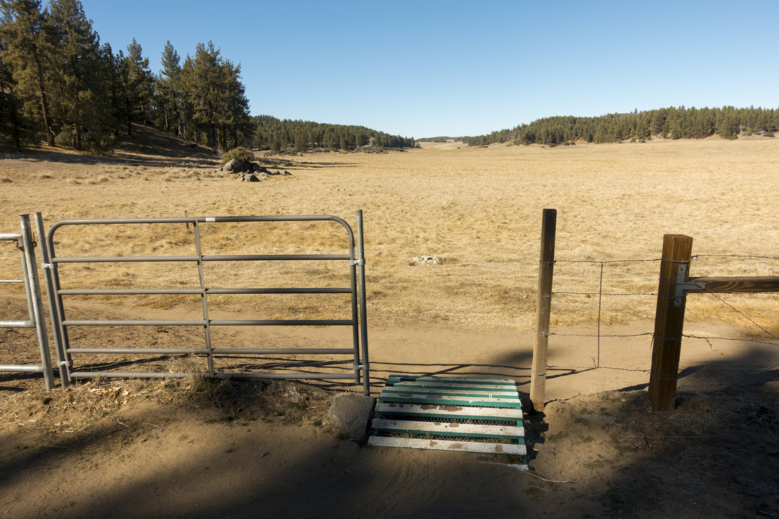
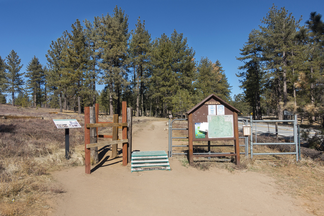 Sunset Trailhead Sunset Trailhead Trailhead with catleguard gate and trail kiosk on west side of Sunrise Highway couple of km south of main Laguna recreation area
 |
|||
 |
|||
 Sunset Trail
Typical section of Sunset Trail through semi-open forest Sunset Trail
Typical section of Sunset Trail through semi-open forest |
|||
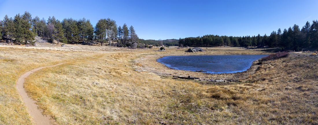
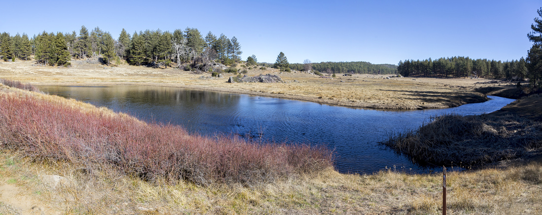 Water of The Woods
Water of the Woods ~2.5km from trailhead. Big Laguna trail rounds the lake upper center, while Sunset continues left (out of photo) Water of The Woods
Water of the Woods ~2.5km from trailhead. Big Laguna trail rounds the lake upper center, while Sunset continues left (out of photo) |
|||
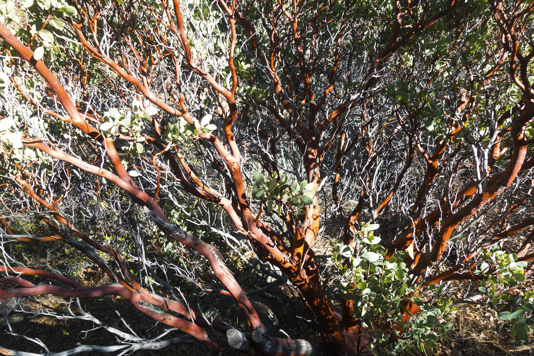 Manzanita Tree
Typical low Manzanita tree along Sunset Ridge Manzanita Tree
Typical low Manzanita tree along Sunset Ridge |
|||
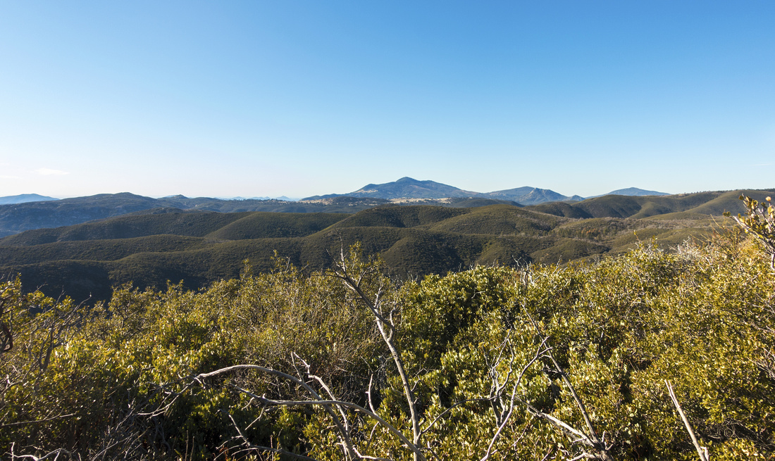 Cuyamaca Panorama
Open Views to Mount Cuyamaca hiking open west ridge. Sunsets here can be spectacular & this is how trail got its name Cuyamaca Panorama
Open Views to Mount Cuyamaca hiking open west ridge. Sunsets here can be spectacular & this is how trail got its name |
|||
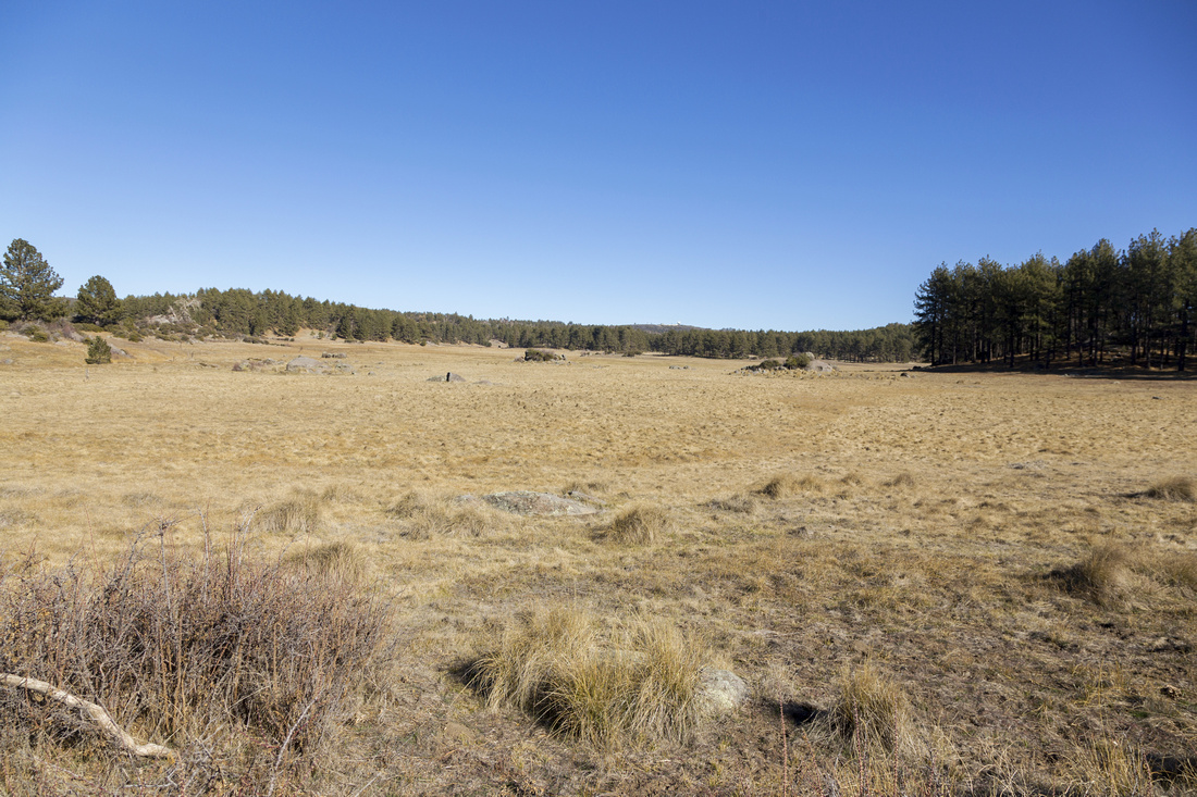
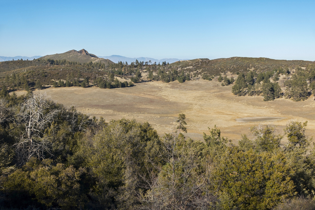 Laguna Meadows
North end of Big Laguna meadow as Sunset trail descends from the ridge towards the junction with Big Laguna Trail. Garnet Peak center left Laguna Meadows
North end of Big Laguna meadow as Sunset trail descends from the ridge towards the junction with Big Laguna Trail. Garnet Peak center left |
 Laguna Sunset Trail GAIA Map
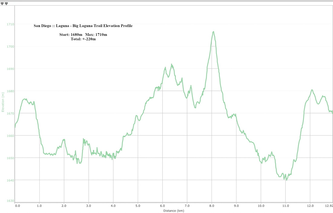
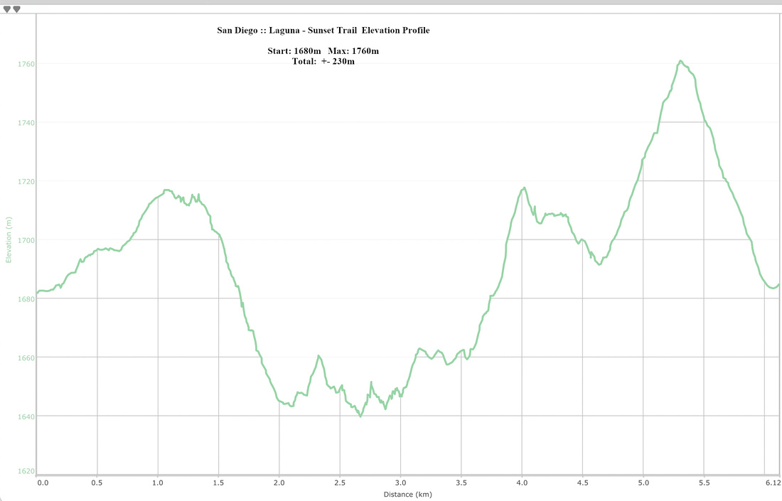 Laguna - Sunset Trail Elevation Profile
| Big Laguna Trail | |||
|
Starting from Sunset Trailhead, Big Laguna turns right ~5 min from the trail kiosk, then meandering casually descends to south end of Big Laguna meadow. It is simply spectacular with open views casually meandering on west side of the meadow, past Water of the Woods, and then onto Big Laguna Lake - main highlight. Little Laguna connector turns right here, and this will be return direction if you opt for clockwise loop as I did. For photographers of special interest will be scenic north side of the lake where grass / marsh humps have created very photogenic spot. I visited on two occasions with different light conditions and enjoyed the visual both times - see gallery. Continuing past the lake do not miss isolated tree smack in the middle of grassland (if still there!). Past junction with Sunset Trail, Big Laguna reaches junction with Penny Pines connector then loops back on east side of the meadow. On next junction you can continue straight (shorter); on my hike I turned left and walked over forested rise to Little Laguna Meadow, then circled back to Big Laguna lake that way. Some topo maps show Little Laguna Lake here, but on my visit in early February '22 it was just a dried out mud. Back at Big Laguna trail by the lake return same way you came or via Sunset trail from Water of the Woods.
|
|||
| Gallery | |||
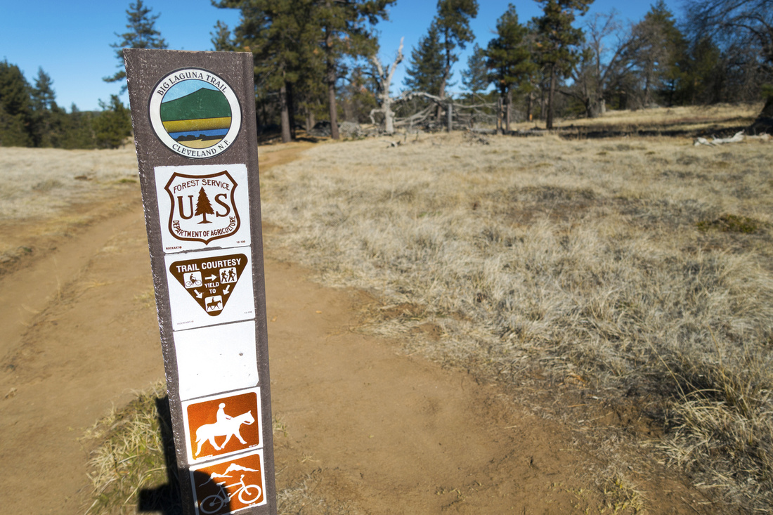 Trail Marker
Big Laguna Trail Marker at Sunset Trail junction near trailhead Trail Marker
Big Laguna Trail Marker at Sunset Trail junction near trailhead |
|||
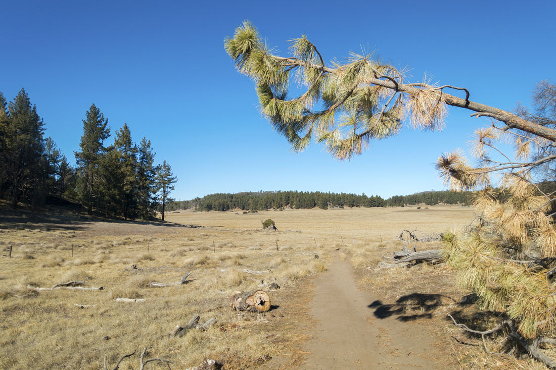 Laguna Trail
Trail reaching Big Laguna Meadow which is followed on left (west) side for several kilometers Laguna Trail
Trail reaching Big Laguna Meadow which is followed on left (west) side for several kilometers |
|||
 Cattle guard
One of several cattle guards along the way. Trail skirts on left side of photo towards Water of the Woods Cattle guard
One of several cattle guards along the way. Trail skirts on left side of photo towards Water of the Woods |
|||
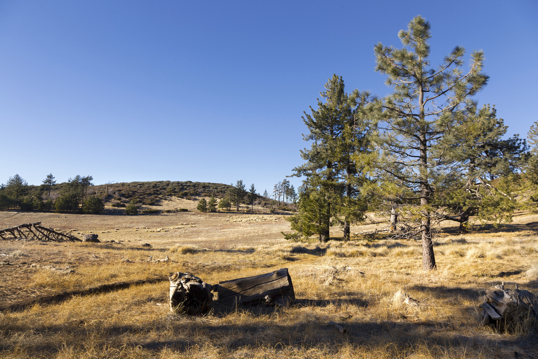
 Big Laguna Meadow
Gorgeous hiking in winter sunshine at south end of Big Laguna Meadow Big Laguna Meadow
Gorgeous hiking in winter sunshine at south end of Big Laguna Meadow |
|||
 Water of the Woods
Big Laguna trail looping around Water of the Woods at Sunset Trail junction Water of the Woods
Big Laguna trail looping around Water of the Woods at Sunset Trail junction |
|||
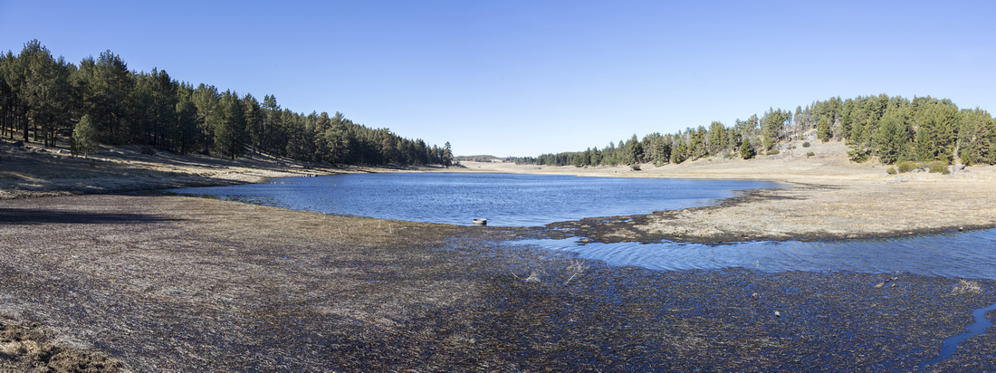 Big Laguna Lake
South End of Big Laguna Lake. Main trail stays on left (south) side, while Little Laguna connector comes in from the right. Spur trail runs on other side of the lake giving plenty of loop options. Colony of ducks make this area permanent home, but are easily scared by humans Big Laguna Lake
South End of Big Laguna Lake. Main trail stays on left (south) side, while Little Laguna connector comes in from the right. Spur trail runs on other side of the lake giving plenty of loop options. Colony of ducks make this area permanent home, but are easily scared by humans |
|||
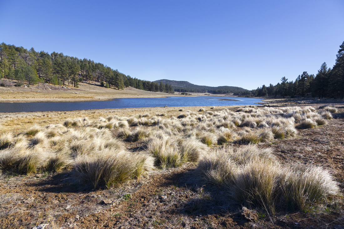 Big Laguna Lake
North end of Big Laguna Lake looking back among low marsh is very peaceful and photogenic spot Big Laguna Lake
North end of Big Laguna Lake looking back among low marsh is very peaceful and photogenic spot |
|||
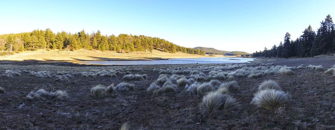 Big Laguna Lake
Same spot as above, but under different light conditions as afternoon shadows have already moved Big Laguna Lake
Same spot as above, but under different light conditions as afternoon shadows have already moved |
|||
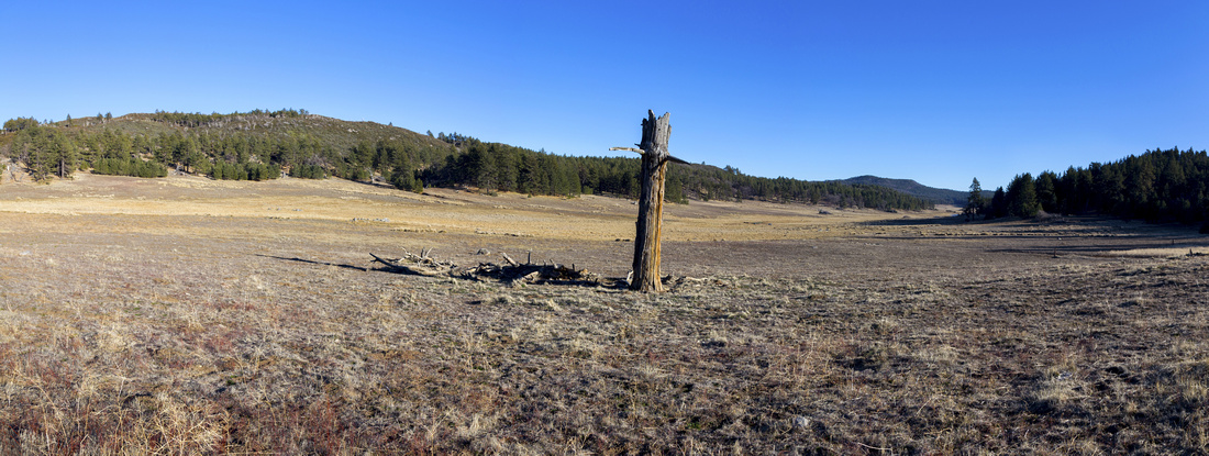 Lonely Soldier
Isolated Dead Tree in middle of upper Big Laguna Meadow looks quite stunning Lonely Soldier
Isolated Dead Tree in middle of upper Big Laguna Meadow looks quite stunning |
|||
 Laguna Alpine
Scenic and peaceful environs at top of Big Laguna Meadow as trail circles back on east side. Penny Pines connector is roughly center Laguna Alpine
Scenic and peaceful environs at top of Big Laguna Meadow as trail circles back on east side. Penny Pines connector is roughly center |
|||
 Little Laguna
 Meadow on loop return, already in shadow. Campground is just left of center, note tiny camper dots Little Laguna
Little Laguna Meadow on loop return, already in shadow. Campground is just left of center, note tiny camper dots |
|||
 Big Laguna Trail GAIA Map
 Big Laguna Trail Elevation Profile
| Noble Canyon | ||
|
Alternate approach starting from Penny Pines Trailhead on Sunrise Highway. It is probably the least scenic approach of 3 presented on this page. After crossing the highway enter the gate and soon watch for junction on left (south) side. This trail rises gently towards Big Laguna Meadows, eventually joining lake trail on north side; junction is signed. I did this as second hike of the day in late Jan '24 as winter sun already left valley in the shadows. With no soul in sight - except colony of loons - I circled the lake CW then returned the same way (see Google Map). Very tranquil and beautiful - yet another testimony how special this area is that needs to be experienced in different season and times of day to fully appreciate the beauty. |
||
| Gallery | ||
 Big Laguna Twilight
Looping around Big Laguna looking north on exceptionally tranquil early evening in Jan '24. Noble Canyon Trail emerges at other side roughly center Big Laguna Twilight
Looping around Big Laguna looking north on exceptionally tranquil early evening in Jan '24. Noble Canyon Trail emerges at other side roughly center |
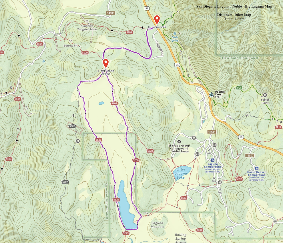 Noble - Big Laguna GAIA Map
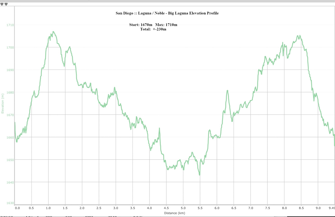 Noble - Big Laguna Elevation Profile
Abstract
| Overall Difficulty | D2 | Rolling meadows with short bits of gentle elevation gain/loss | |||
| Scenery | Alpine Grassland and Several Lakes. Cuyamaca Ranco State Park from Sunset Ridge | ||||
| Trail/Marking | Excellent | Wide and Well defined trail with Trailhead Map and marked junctions | |||
| Suggested Time | 4hr | Many variations for shorter/longer trip exists. Suggested time is for top of Big Laguna - Sunset / Little Laguna loops | |||
| Elevation | Start: 1680m Max: 1760m (Sunset Ridge) Total: (+-220) | ~13 km loop return | |||
| Gear | Day Hikers are optimal. MTB for Big Laguna only | ||||
| Water | Water of the Woods or Big Laguna Lake, but water must be treated. Carry ~1L | ||||
| Snow Factor | Mount Laguna can receive substantial snowfall after winter snow storms. It usually melts fast but might present slippery conditions | ||||
| Dog Friendly | Yes | Dogs must be kept on leash throughout Mount Laguna Recreation Area / Cleveland National Forest | |||