Google Map |
Rockies :: Yoho :: Paget Peak North Ridge |
GPS Track |
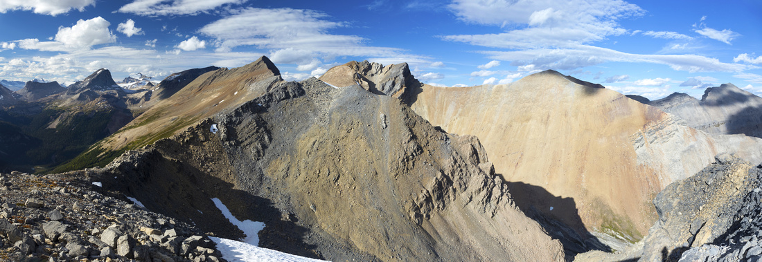 
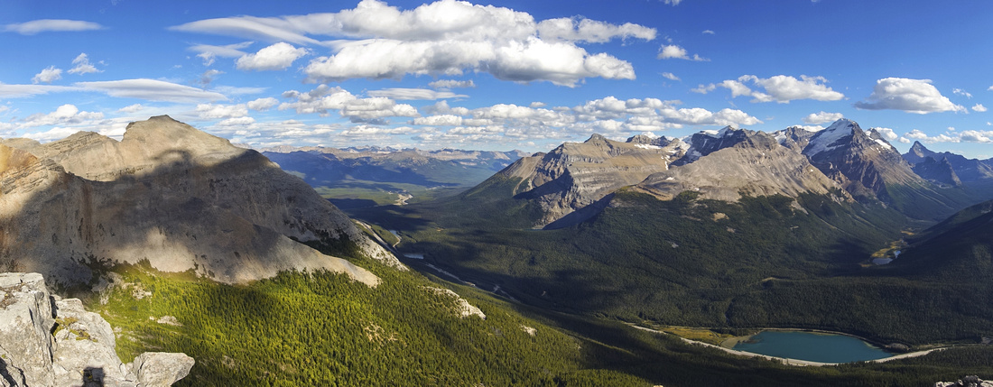
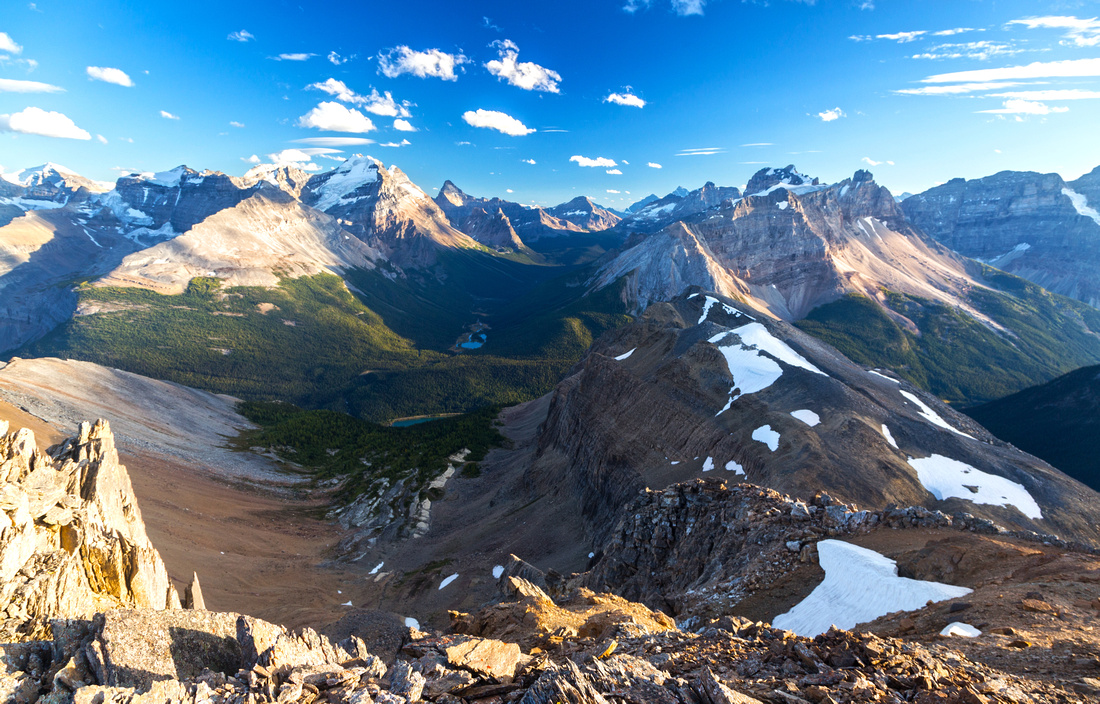
North Ridge from Paget Peak summit extending over several bumps to Bath Glacier viewpoint (orange cone on right side of prominent "V" just left of center). Mt. Niles and distant Mt. Balfour on the left |
|||
| Trip Summary | |||
September 11, 2020Paget Peak is easy ascent above abandoned fire lookout on north side of Kicking Horse River valley, just west of Alberta / BC Provincial Border. Most people return after reaching 2580m summit, but as the outing is short it is well worth continuing north eventually leading to much more superb viewpoint that includes rare aerial perspective of Bath Glacier. On return it is possible to trash down to Sherbrooke Lake or utilize talus bench avoiding all the ups and downs along the ridge. Whole outing is nothing but a steep hike with huge scenic rewards.
Parking lot is just south of Wapta Lake tourist area - watch for signs on north side (right side when coming from Lake Louise). Note there is no access to/from eastbound lane of Trans-Canada Highway! Thus on return you must drive down all the way to Spiral Tunnels tourist area before making U-turn. If coming from Field at start, make U-turn to westbound lane at Wapta Lake. Official trail starts at east end of parking lot by the gate. Hike for ~30min to signed Sherbooke Lake junction, then take right branch for Paget Lookout. Trail is undemanding with some unnecessarily long switchbacks, eventually topping at site of abandoned Fire Lookout and end of official trail. Roughly half of elevation is gained by this point. After taking in the views from strategically placed bench, find trail continuing to Paget Peak just behind lookout building. Immediately it becomes much steeper as it rises towards large talus slope. This slope is the "crux" -- lose and steep bits in upper part, with several "trails" eventually joining back on top. No further difficulty is encountered till sub-summit, which is just south end of very long ridge. This is NOT official Paget summit, although most people probably turn back right here. Peakbaggers -- and pretty much everyone else! -- should continue for 5-10 minutes to next bump along the ridge; it has cairn and register. Summit is rounded with lots of space and phenomenal views; fantastic spot for lunch. Entire length of North Ridge is visible from here, ending at orange bump still some distance away.
If not returning right away, continue north by losing initially ~80m then regaining it to next bump. Brief boulder field at low point does not present much problems. Even if not going all the way it is highly recommended to get at least to this point - views are superior and you can easily drop to bench below speeding up the return. Descent to saddle below North side ends at snowpatch that persists till late summer depending on season & can be used to replenish water supply that has been probably depleted by now. Final ascent up cream colored rock is steepest yet, but surprisingly easy. Boulders are stable and entire part is just a hike. Summit had two cairns at time of my visit, but no register. View is simply phenomenal; rugged Canadian Rocky Mountain wilderness with many distant peaks, and main prize -- aerial view of Bath Glacier that could not be spotted until now. Peak directly to the north is south end of long ridge, ending with Mt. Daly (Kane difficult, approached from Niles meadows seen to the left). Before returning hike a bit along the ridge towards Daly till it becomes too rough to continue; jagged cliffs above Bath Glacier are spectacular, but could not be appreciated fully from high point.
For return there are 3 options: 1) Back the same way 2) Drop to Sherbrooke lake joining Niles meadows trail near north end of the lake and 3) Talus bench below the ridge that is very straightforward and joins in Paget trail just above the talus slope below sub-summit. I came back via third option and highly recommend it. Sherbrooke Lake variant looked interesting but it was not possible to tell how much bushwhacking one would encounter in lower end, which is also prime grizzly bear habitat.
|
|
Gallery |
|||
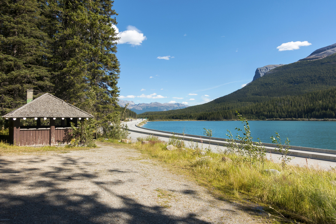 Sherbrooke / Paget trailhead parking by Icefields Parkway just south of Wapta Lake pullout
 |
|||
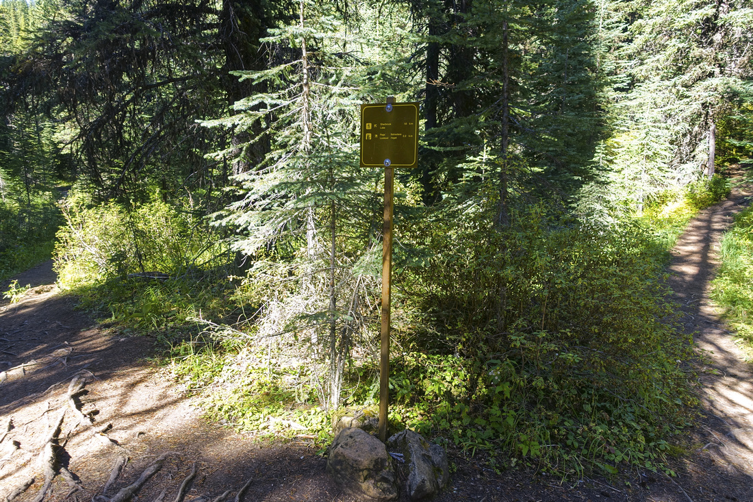 Signed junction about 30 min from trailhead; Sherbrooke Lake left, Paget Lookout right
 |
|||
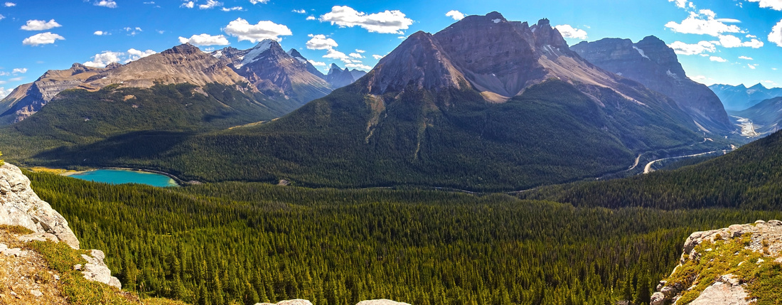 Panoramic views of Kicking Horse River valley from viewpoint below Paget Lookout. Cathedral Peak and Cathedral Crags just right of center, Louise area peaks behind to the left with long valley leading to Lake O'Hara in between. Wapta Lake (trailhead) extreme left
 |
|||
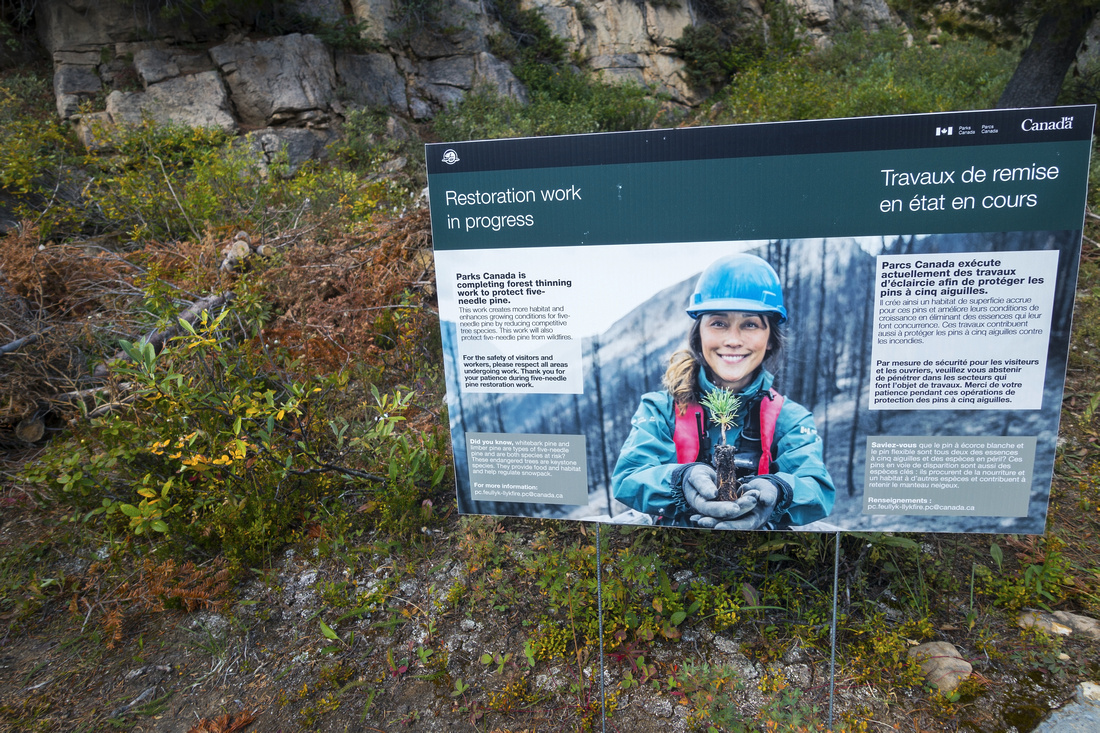 Parks Canada Trailside Sign about Forest thinning to protect Five-needle pine
 |
|||
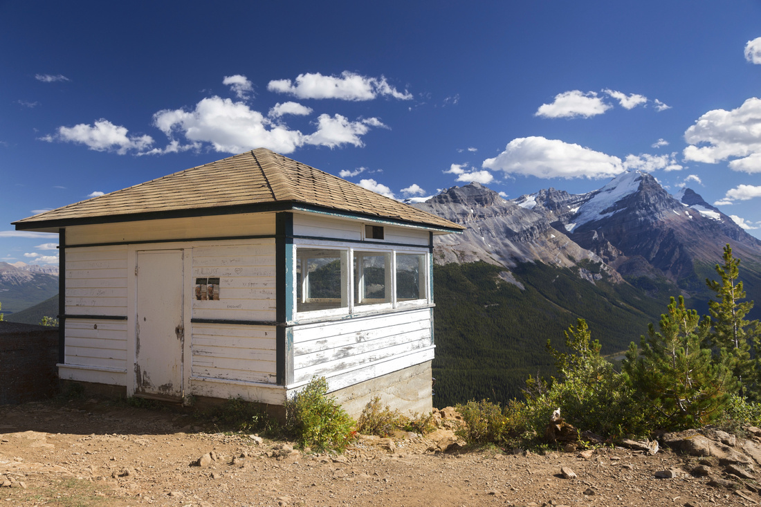 Paget Fire Lookout, about an hour of brisk pace from trailhead. Half of elevation is gained to this point
 |
|||
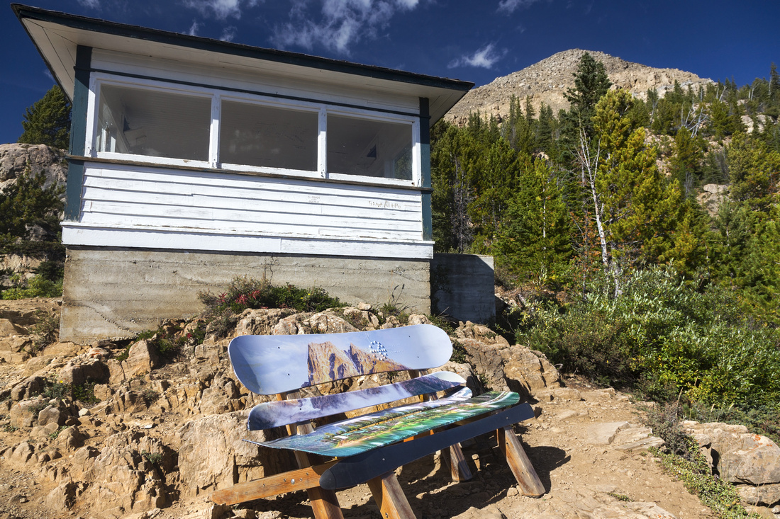 Colorful bench made of old ski boards below Fire Lookout. Paget Peak above upper right
 |
|||
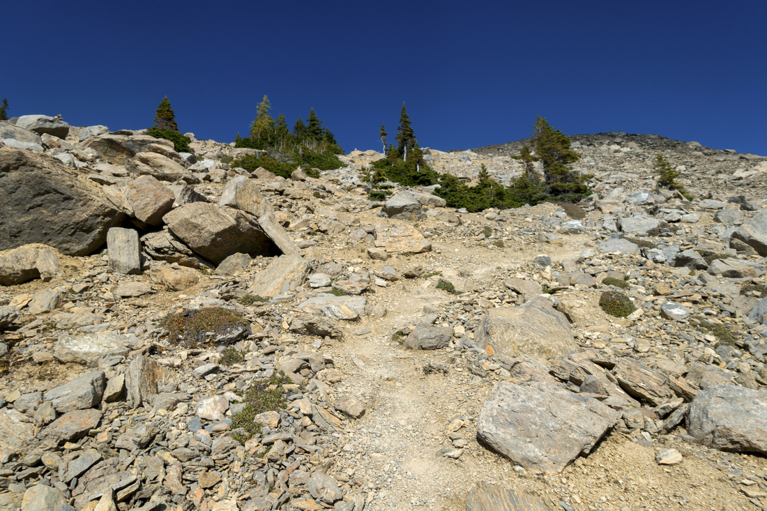 Steep Talus trail above the lookout switchbacks towards Paget Peak subsummit upper right
 |
|||
 Panoramic view east from lower summit of Paget Peak. Mt. Bosworth center left
 |
|||
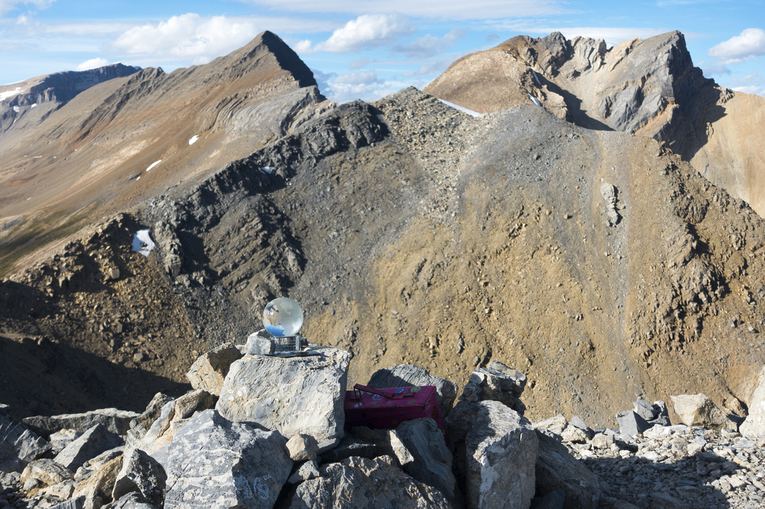
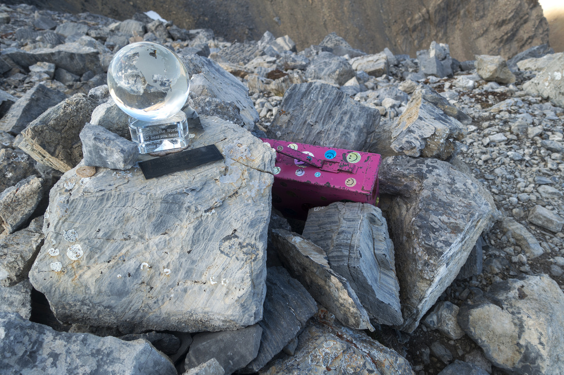 Pink Register (and magic Crystall Sphere!) at Paget Peak summit
 |
|||
 Glaciated North Peak of Mt. Victoria from Paget Peak. Mt. Huber behind to the right. Narao Peak long ridge left foreground
 |
|||
 Telephoto towards Mt. Niles (left) and distant Mt. Balfour (just right of center). Mt. Daly scramble route from Niles meadows center
 |
|||
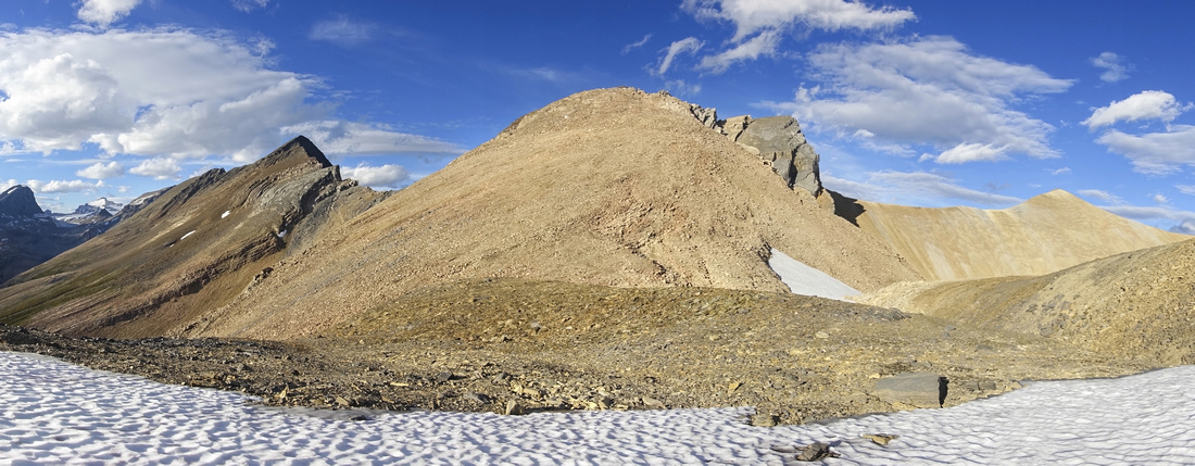
 North Ridge from Paget Summit: continue at least to next bump (strict center, above pink register - takes only 30 min). North end is about 1:20 - 1:30 away, orange colored cone at right side of prominent "V" shaped gap
 |
|||
 Sherbrooke Lake from Paget North Ridge. Alternate bench return that avoids all ups/downs along the ridge below by snowpatch on left side
 |
|||
 Crossing Snowfield at Saddle below North end of Paget Ridge. Takes ~30min from here to the "summit"
 |
|||
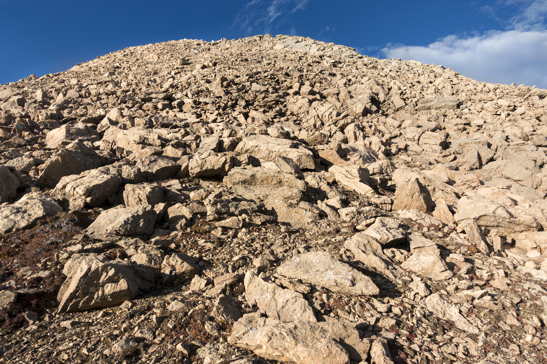 Ascending rubbly slopes below North End. Rock is mostly stable and easier than expected, with bit of lose talus near the top
 |
|||
 Looking back from North End of the Ridge. Paget Peak just right of center. Lake O'Hara valley behind left
 |
|||
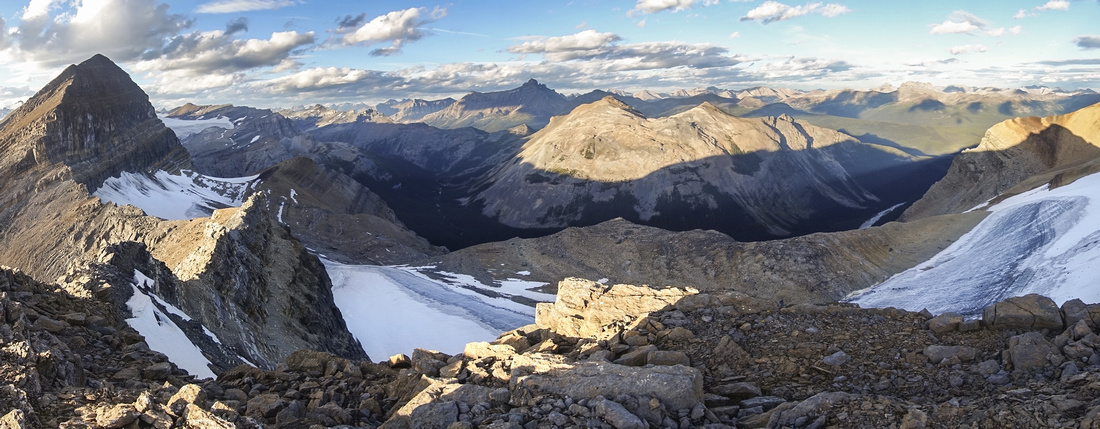 Panorama north with Bath Glacier below. Waputik peak center, south end of Mt. Daly ridge extreme left
 |
|||
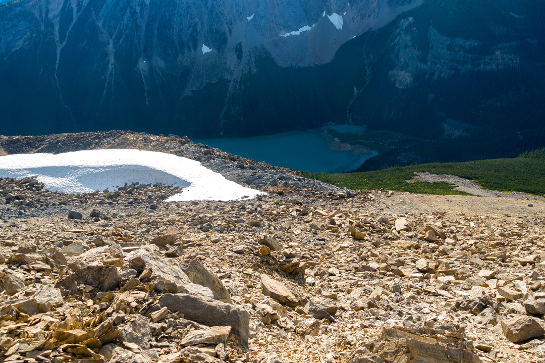
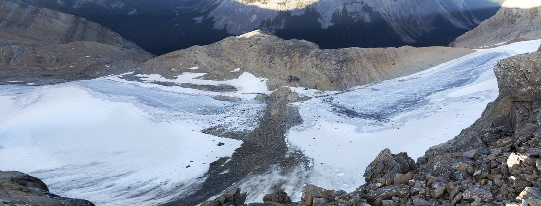 Bath glacier aerial view. This glacier is prominent for a long time when driving from Banff to Lake Louise, but few get to see it from this angle
 |
|||
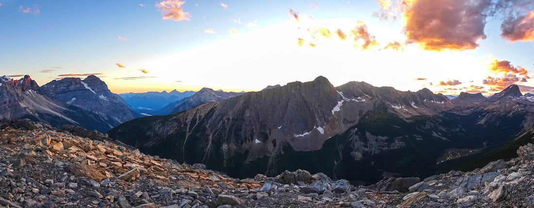 Colorful westerly sunset skies on alternate bench return below Paget ridge. Mt. Ogden across, Mt. Niles extreme right. Mt. Stephen towering above Kicking Horse River valley to the left
 |
Abstract
| Overall Difficulty | D4 | Moderately steep talus slope with one lose section above Paget Lookout. Couple of easy scrambling steps on ridge crest. Boulder / Talus scramble below north end of the Ridge. Some micro-terrain route finding on alternate bench return | |||
| Snow Factor | S3 | Some avalanche danger on slopes above Paget Lookout. Feasible as winter snowshoe ascent | |||
| Scenery | Panoramic views of Kicking Horse River valley and glaciated Lake Louise area peaks from Paget Lookout. Sherbrooke Lake and distant peaks of Yoho National Park from the ridge including Ogden Peak, Mt Niles / Daly and many others. Aerial view of Bath Glacier from north end of the Ridge | ||||
| Trail/Marking | Very Good / None | Official wide park trail to Fire Lookout followed by cairned route. No trail / cairns beyond Paget Peak but way is obvious. | |||
| Suggested Time | 7-8 hr | Time for entire ridge traverse. If going only to Paget Peak 5 hours is enough | |||
| Elevation | Start: 1560m Max: 2730m Total: ~1330m | Round Trip: ~15km | |||
| Gear | Full Hiking boots and poles. Gaiters helpful for talus slopes. | ||||
| Water | Couple of creeks near the beginning but generally dry hike. Seasonal snow patch persist deep into later part of the summer below north end of the ridge. Carry at least 2L above Paget Lookout | ||||
| Dog Friendly | Yes | Standard back-country travel precautions. Initial part to Paget Fire lookout is very quite busy - please keep control of your pet. Note that Sherbrooke Lake is prime grizzly bear environment where accidents have happened in the past | |||
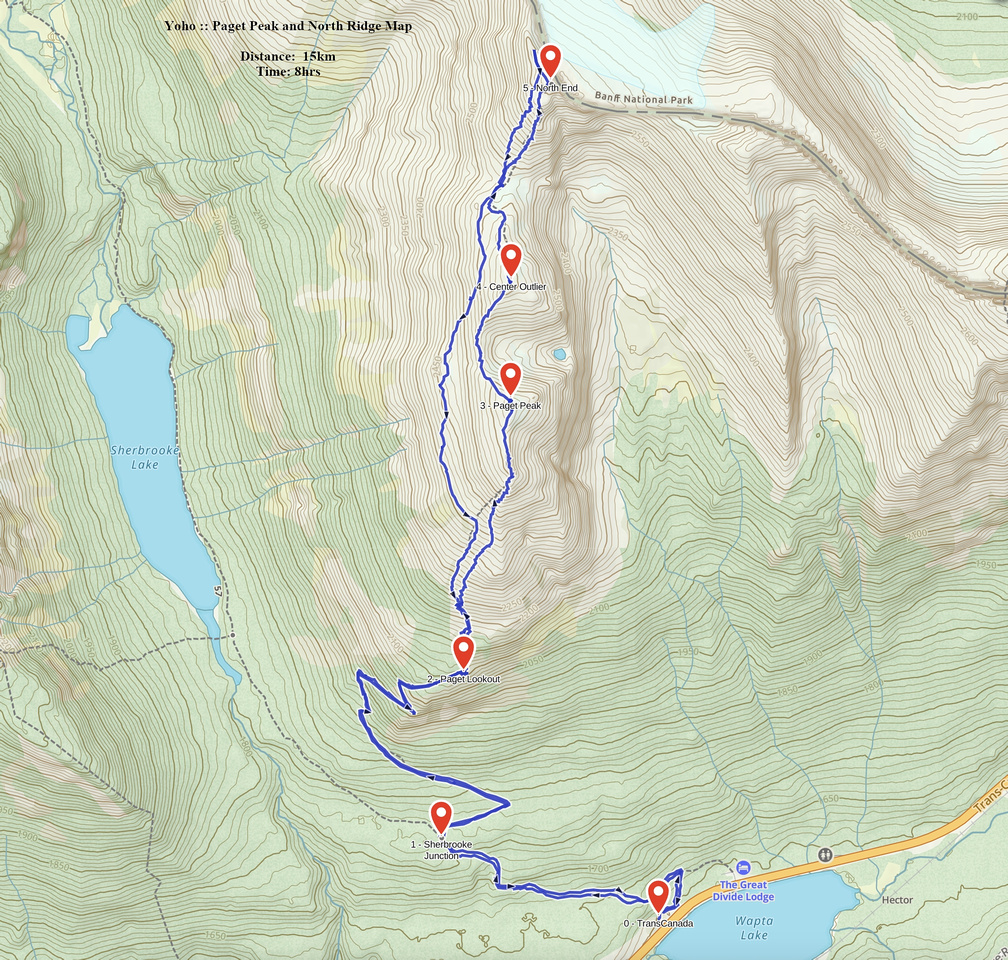 Paget Peak and North Ridge GAIA Map
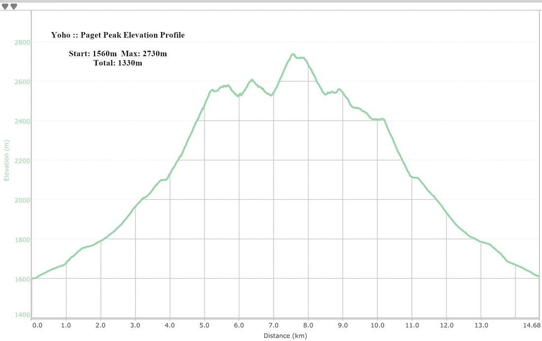 Paget Peak Elevation Profile