Google Map |
Rockies :: Yoho :: Mt. Niles |
GPS Track |
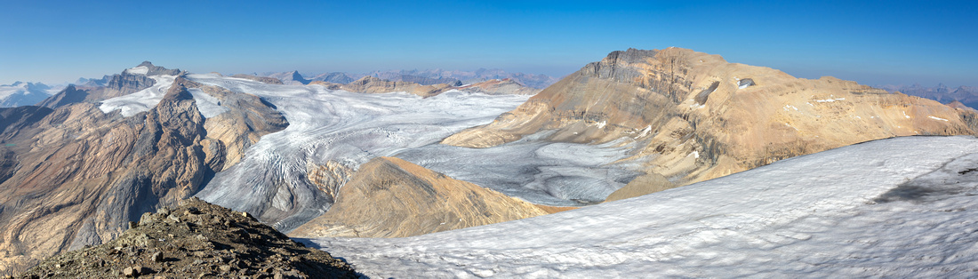 
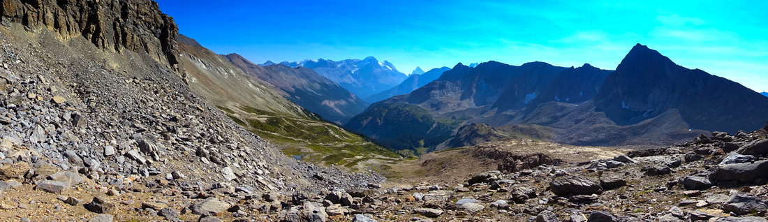
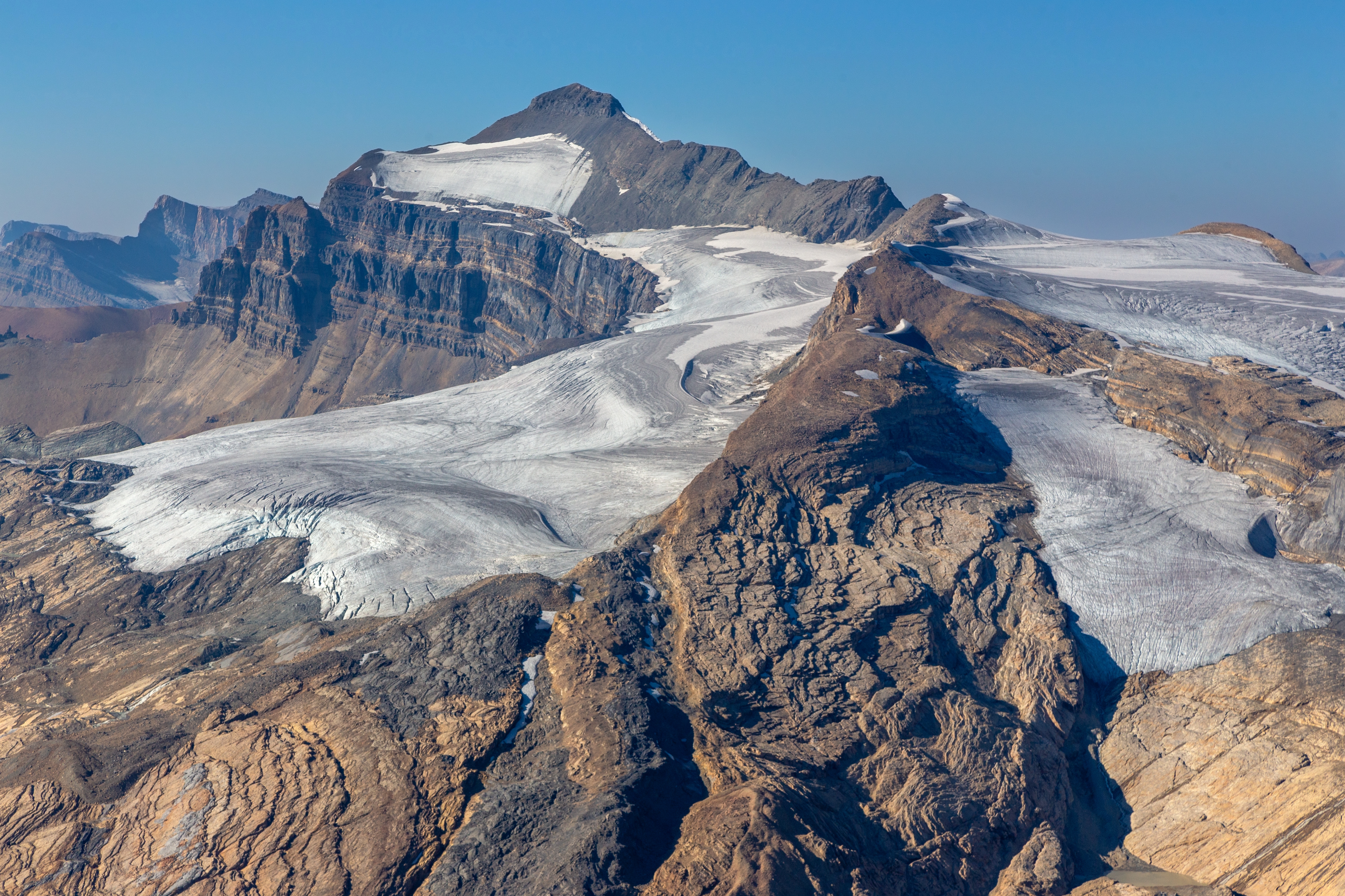
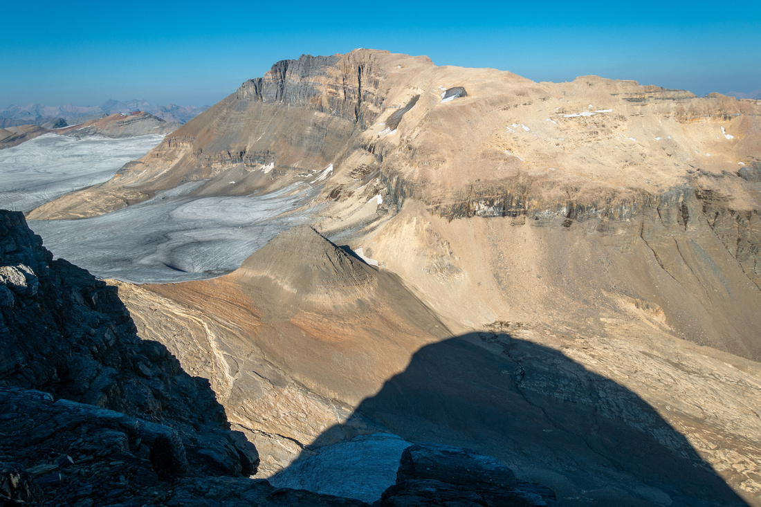
Mt. Niles summit Panorama. Ridge-like Mt. Daly right, Waputik Iciefield below. Distant Mt. Balfour left |
|||
| Trip Summary | |||
September 7, 2024Mt. Niles is terrific hiker peak towering high above Waputik Icefield. It is listed as moderate in Kane guidebook, but in my opinion it hardly classifies as scramble as only difficulty is typical Rockies Talus slope where trails and cairns have developed over time. Approach is via Niles Meadows Hiking Trial; this compact alpine area is well worth the effort even if not planning on hiking further. Despite not being officially maintained past Sherbrooke Lake, Niles trail is well defined and easy to follow. After reaching the meadows in 2:15 - 2:20 of moderate pace with light pack, hike up obvious waterworn gully resembling shallow canyon - dirt trails can be found at both sides. Above the Canyon it is necessary to cross large boulder field in order to reach obvious Pinnacle directly above Niles col where scramble starts; going left (west) side is easier even if slightly longer. The Col is exceptional viewpoint; directly below is secluded Takkakaw Lake, ultimate source of famous Takkakaw Falls in Little Yoho. Hiking down to this extremely rarely visited lake from the col would be straightforward, but such trip would likely require overnight.
From the col turn right; summit is about an hour away. There are no difficulties when dry - I hiked up Niles twice, first in my 40s and second in my 60s and both times did not have to use hands at all. (Hiking Poles are big asset, specially on descent). Rounded summit plateau is very wide and on clear day views are simply fantastic, in particular vast Waputik Icefield below. Kane scramble route up Mt. Daly can be observed by descending briefly on east side - see Gallery. Be careful in case of cornices as there are steep cliffs below. Return is the same way, although there is also alternate class 3 route breaching cliffs on east side thus allowing loop of a sort. I have not climbed this way and can not confirm the accuracy - if not sure better to descend the same way to Niles col and hike out that way back to the Meadows.
It would be well worth hauling overnight gear to Niles Meadows; then besides Niles/Daly scrambles also have ample time to explore spectacular ridges surrounding the area. Obtaining Parks Canada wilderness permit would probably be problematic though. |
|
Gallery |
|||
 Sherbrooke Lake
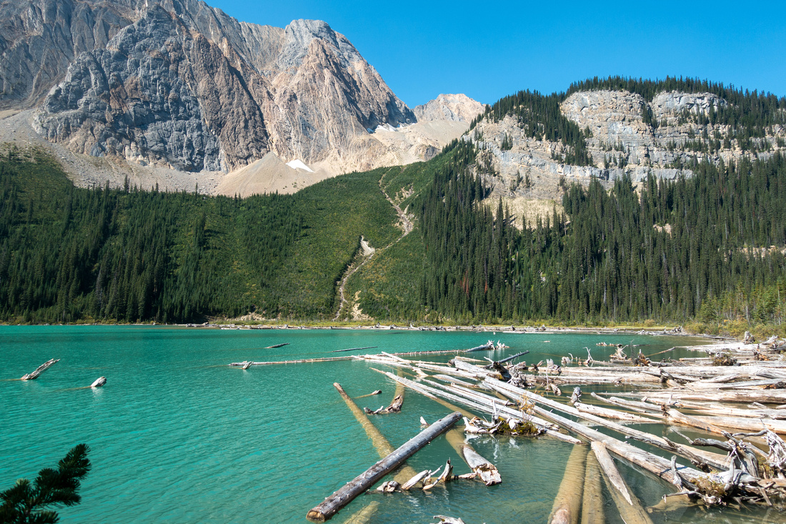
Driftwood at north end of Sherbrooke Lake ~1hr from Trailhead with Mt. Ogden towering behind Sherbrooke Lake
Driftwood at north end of Sherbrooke Lake ~1hr from Trailhead with Mt. Ogden towering behind |
|||
 Sherbrooke Falls
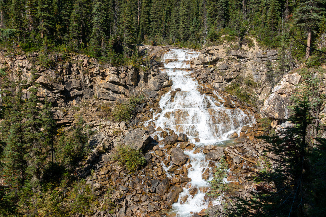
Cascading Sherbrooke Creek ~15min past north end of the Lake Sherbrooke Falls
Cascading Sherbrooke Creek ~15min past north end of the Lake |
|||
 Lower Meadows
Crossing lower Meadows ~30min above Sherbrooke Lake. Both creek crossings were bridged as of Sep '24 Lower Meadows
Crossing lower Meadows ~30min above Sherbrooke Lake. Both creek crossings were bridged as of Sep '24 |
|||
 Makeshift Bridge
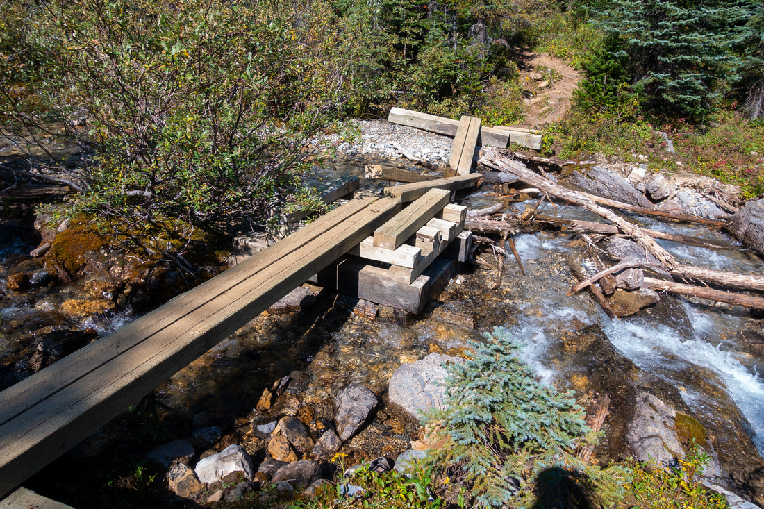
Final crossing of young Sherbrooke Creek just before final climb to Niles Meadows Makeshift Bridge
Final crossing of young Sherbrooke Creek just before final climb to Niles Meadows |
|||
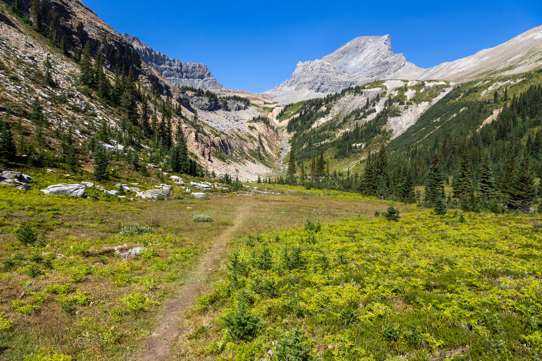 Nles Meadows
Very beautiful Niles Meadows 2:15 - 2:20 of fast pace from Trailhead. Mt. Niles upper right Nles Meadows
Very beautiful Niles Meadows 2:15 - 2:20 of fast pace from Trailhead. Mt. Niles upper right |
|||
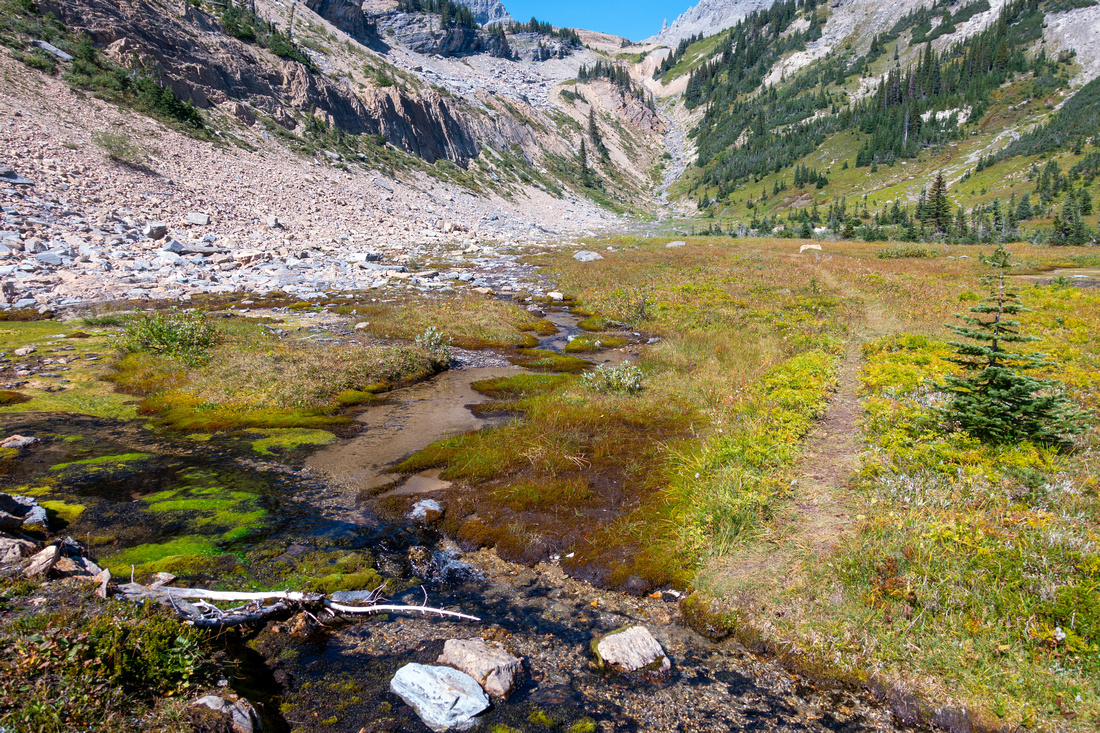 Niles Meadows
Upper Niles Meadows with fresh water - great place for bivi. Route continues up canyon-like drainage in center. Note obvious Pinnacle higher up Niles Meadows
Upper Niles Meadows with fresh water - great place for bivi. Route continues up canyon-like drainage in center. Note obvious Pinnacle higher up |
|||
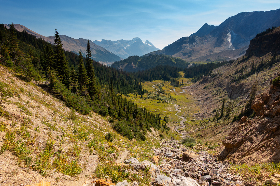 Niles Canyon
Looking back at Niles Meadows. Faint trail can be found at both sides of the Drainage Niles Canyon
Looking back at Niles Meadows. Faint trail can be found at both sides of the Drainage |
|||
 Niles Alpine
Alpine above the Drainage and last chance to fill-up water. Mt. Daly route branches here towards low col upper right; continue straight for Mt. Niles Niles Alpine
Alpine above the Drainage and last chance to fill-up water. Mt. Daly route branches here towards low col upper right; continue straight for Mt. Niles |
|||
 Boulder Field
View back while crossing Boulder Field below Niles Col. Elegant Auditor Peak center right Boulder Field
View back while crossing Boulder Field below Niles Col. Elegant Auditor Peak center right |
|||
 Niles Col
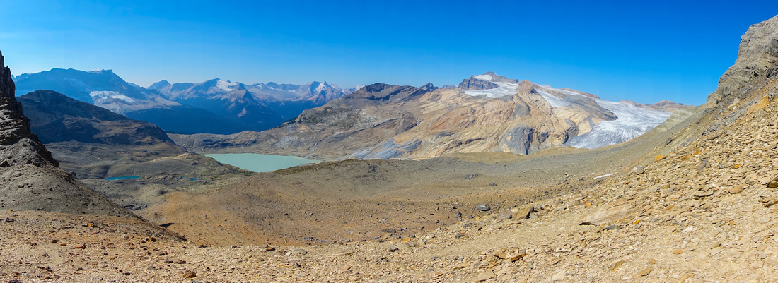
Terrific Panorama North from Niles Col. Takkakaw Lake, ultimate source of Takkakaw Falls, below. Iceline center left, Waputik Icefield right Niles Col
Terrific Panorama North from Niles Col. Takkakaw Lake, ultimate source of Takkakaw Falls, below. Iceline center left, Waputik Icefield right |
|||
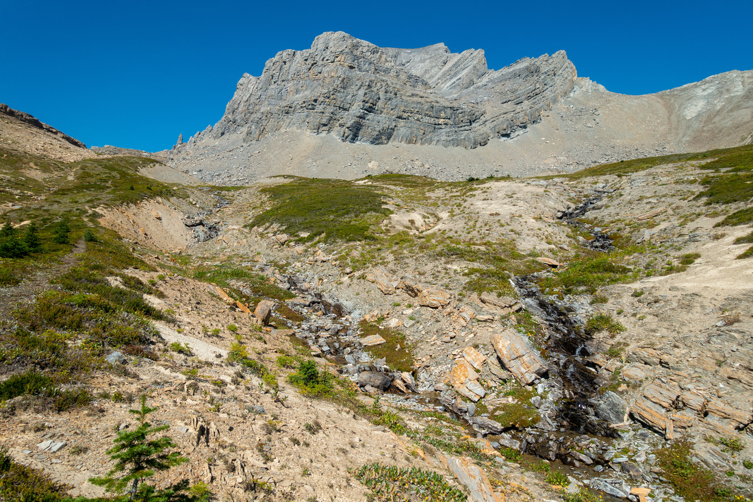
 Pinnacle
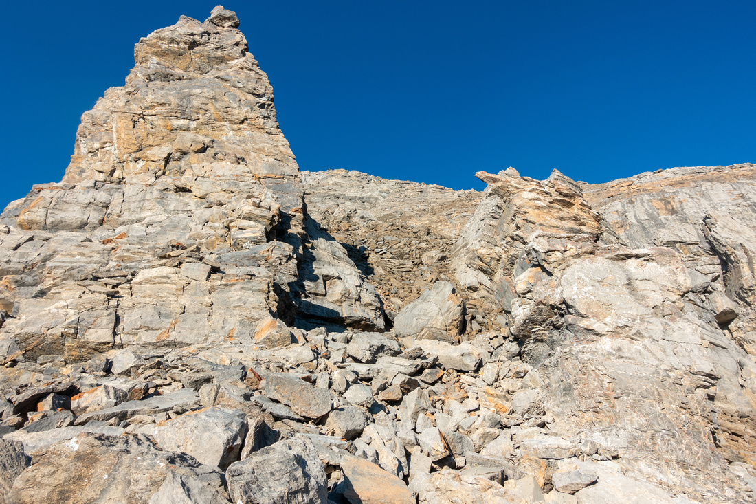
Start of Scramble Route above Niles Col. It takes ~1hr to the top. Trail with cairns can be found most of the way. Pinnacle
Start of Scramble Route above Niles Col. It takes ~1hr to the top. Trail with cairns can be found most of the way. |
|||
 Niles Scramble
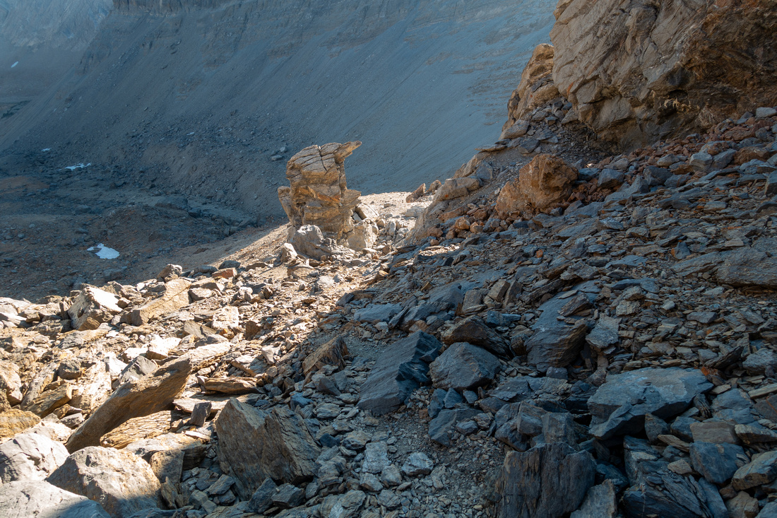
Looking down to Niles col while scrambling around the Pinnacle Niles Scramble
Looking down to Niles col while scrambling around the Pinnacle |
|||
 Upper Talus
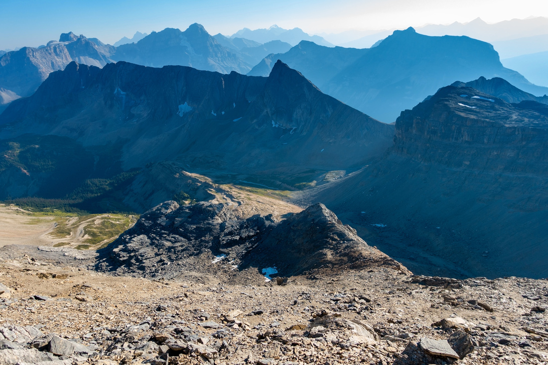
Taking a breather on upper Talus slope with somewhat smoke obscured views. Niles Meadows center left Upper Talus
Taking a breather on upper Talus slope with somewhat smoke obscured views. Niles Meadows center left |
|||
 Niles Summit
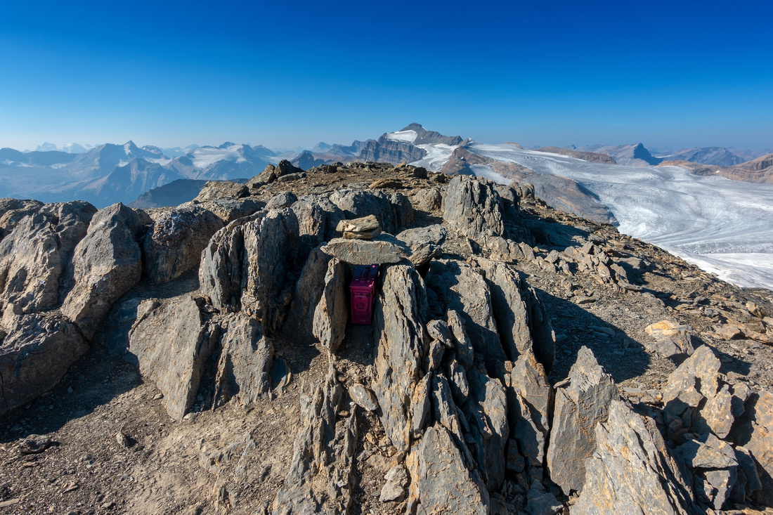
Pink Register tucked inside rocks at 2975m summit of Mt. Niles Niles Summit
Pink Register tucked inside rocks at 2975m summit of Mt. Niles |
|||
 Niles Panorama
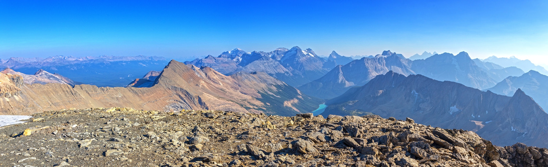
Southerly Panorama from Niles summit looking towards Louise Group. Sherbrooke Lake below now appears quite far away Niles Panorama
Southerly Panorama from Niles summit looking towards Louise Group. Sherbrooke Lake below now appears quite far away |
|||
 |
|||
 Mt. Daly Route
View of Mt. Daly Scramble Route from just below Niles summit on East Side with Niles glacier below in the shade Mt. Daly Route
View of Mt. Daly Scramble Route from just below Niles summit on East Side with Niles glacier below in the shade |
|||
 |
|||
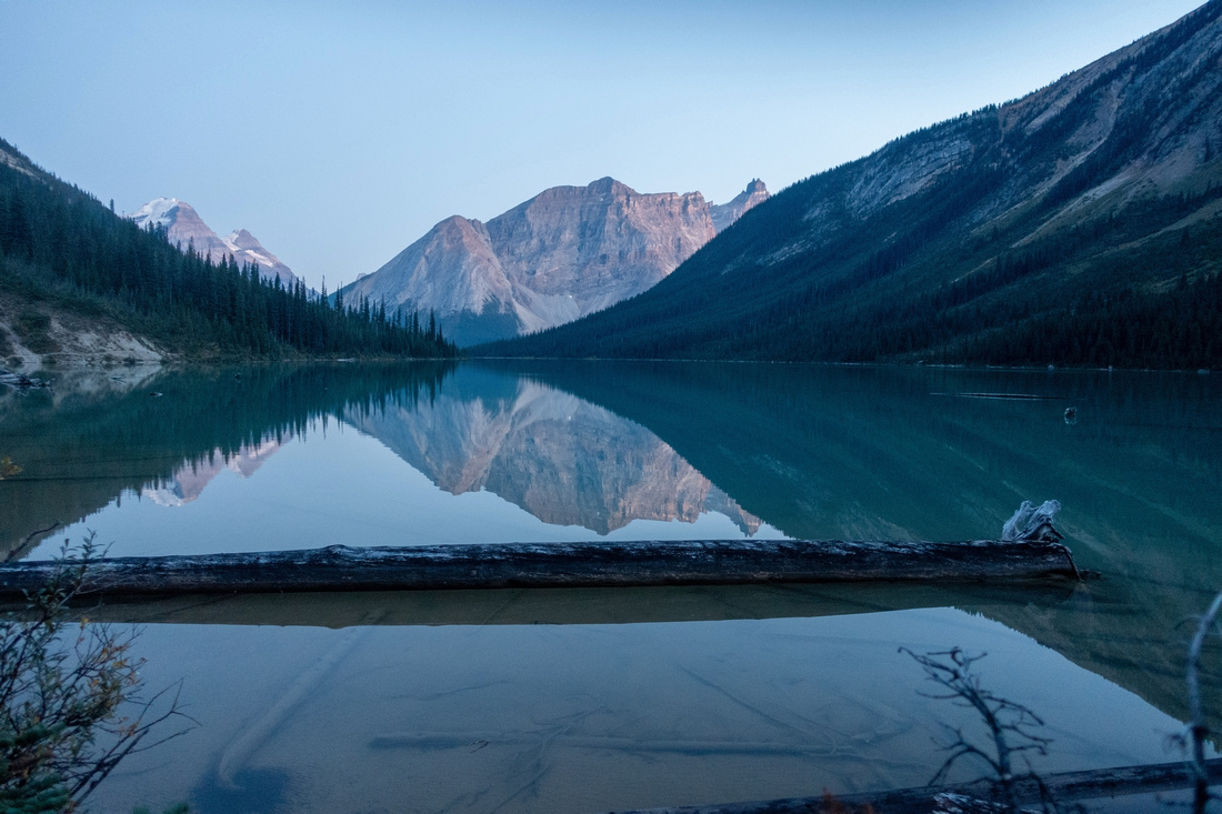 Sherbrooke Twilight
Vanguard Peak and Cathedral reflected in Sherbrooke Lake calm water on return Sherbrooke Twilight
Vanguard Peak and Cathedral reflected in Sherbrooke Lake calm water on return |
Abstract
| Overall Difficulty | D6 | Some deadfall and non-bridged creek crossings. Shifting boulder fields. Moderately steep talus slope. Considerable overall length and elevation gain | |||
| Snow Factor | S5 | Possibility of steep snow and summit cornice. Not feasible as winter trip due to remoteness. Steep slopes above Niles col would be huge avalanche trap. | |||
| Scenery | Sherbrooke Lake and Creek. Very scenic Niles Meadows. Takkakaw Lake and Waputik Icefield with distant Mt. Balfour. Lake Louise group. Aerial view of standard Mt. Daly scramble route. | ||||
| Trail/Marking | Fair | Official trail to Sherbrooke Lake followed by non-maintaned but fairly well defined trail to Niles Meadows. Route above with snippets of trail and cairns | |||
| Suggested Time | 10-11 hrs | Day trip return time. 2.5hrs 1-way for Niles Meadows (overnight bivi) | |||
| Elevation | Start: 1630m Max: 2975m Total: ~1550m | Round Trip: ~24km | |||
| Gear | Full Hiking boots and poles. Gaiters helpful. Helmet recommended above Niles col | ||||
| Water | Sherbrooke Creek and Tributaries. Watercourse draining alpine above Niles Meadows. No water source past Niles col. Carry ~1-1.5L | ||||
| Dog Friendly | Yes | Standard back-country travel precautions. Sherbrooke Lake / Niles Meadows are prime grizzly bear environment where accidents have happened in the past. | |||
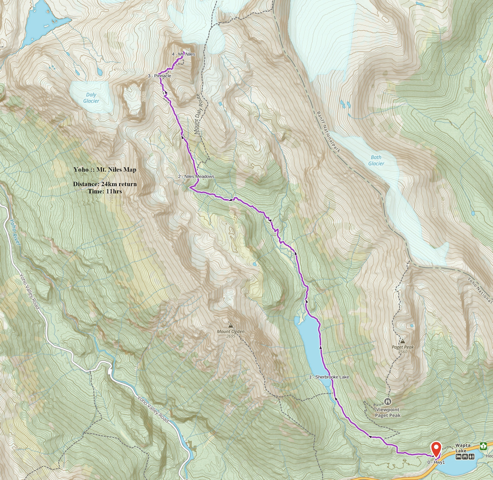 Mt. Niles GAIA Map
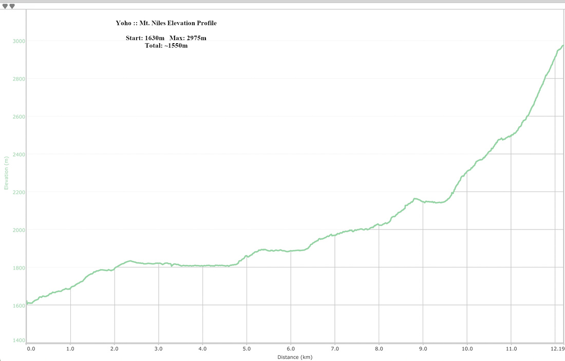 Mt. Niles Elevation Profile