Google Map |
Rockies :: Yoho :: Iceline |
GPS Track |
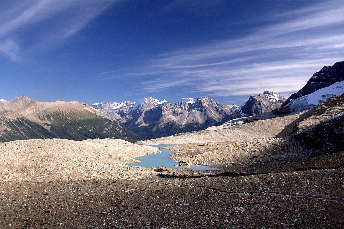 
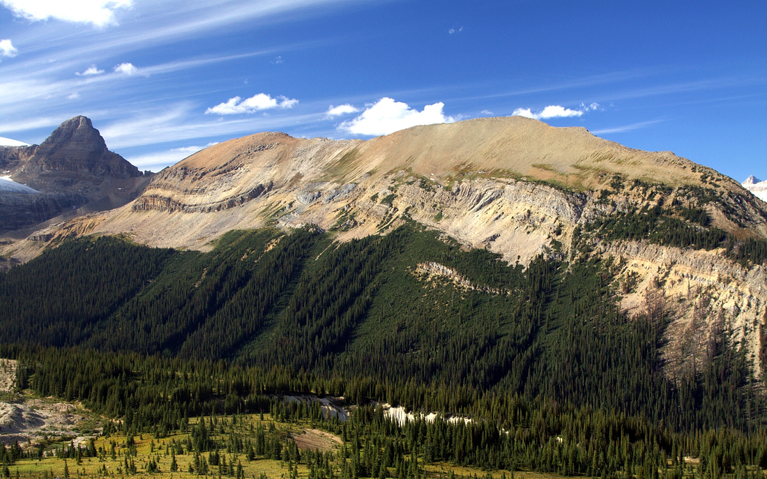
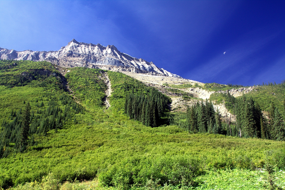
View back across glacial landscape from "Iceline Summit" towards distant O'Hara peaks group. Emerald glacier extreme center right |
|||
| Trip Summary | |||
Multiple Dates, last Aug 17 2022Iceline is true Rockies classic. If you are going to do 1 hike in Yoho National Park, make it this one. Starting near tourist busy - but magnificent - Takakkaw Falls trail climbs to vast glacial landscape below the Presidents with sweeping views across Little Yoho Valley. Usual turnaround point is "Iceline Summit" - small moraine bump as main trial starts turning NW towards Little Yoho Valley. Loop return options both include standard Little Yoho valley trail - shorter via Celeste Lake and longer via Stanley Mitchell Hut. Energetic hikers can also extend the day by hiking over Whaleback to Twin Falls and return via Yoho Valley Trail. Note that Takakkaw Road is not plowed which makes winter access much more difficult - although it is done by cross-country skiers fairly regularly in winter.
Trailhead is by Whiskey Jack Hostel near the end of Takakkaw Road. If you have never seen Takakkaw Falls, it is well worth elbowing with tourist hordes as they are truly magnificent (falls, not the elbows!) If planning on doing the loop it is probably best to park at one of Takakkaw tourist lots then walk back 10-15min to Whiskey Jack. If hiking out the same way one can park at shoulder by Whiskey Jack turnoff (Parks Canada might prohibit this in the future; note that hostel parking is reserved for guests). Iceline trail rises moderately through forest passing signed lower Yoho Lake junction (keep right), then after reaching treeline upper Yoho Lake junction ~3km. Now the beauty of this hike truly begins as views are spectacular. Aerial view of Takakkaw Falls, distant O'Hara peaks and several peaks directly east (Niles, Daly, Balfour to name a few). Trail contours below Presidents glacier; there are several non-bridged tarn outflow crossings that require easy rock hop. Marked Celeste junction is reached in about 2.5 hr of moderate pace from the trailhead; even if planing hiking out that way, it is worth continuing another ~15min or so to "Iceline Summit" - obvious bump few minutes along moraine ridge from the main trail, and probably best viewpoint of the day.
For Celeste return note there is unavoidable creek crossing just before Little Yoho trail junction and bridge is known to be out occasionally - check the state beforehand. It will take ~1hr from Iceline junction of gradual descent through meadows and pine forest to lower Celeste Junction at Little Yoho Trail. Stanley Mitchell Hut loop return is the most recommended option as most scenic part of Iceline, for myself at least, lies beyond "Iceline Summit". Largest glacial tarn - more like real lake - is here. Crossing might be problematic depending on season, but I always preferred walking around the lake as it offered great reflections of distant Mt. Balfour (see gallery). Trail eventually swings in westerly direction and switchbacks down forested slopes to Stanley Mitchell Hut; turn right and hike out to Laughing Falls / Yoho Valley Trail and back to Takakkaw (3.5 - 4 hrs from Iceline Summit). Note that Little Yoho Trail has been incorrectly labelled Iceline Trail on Google Maps as of summer '22. |
|
Gallery |
|||
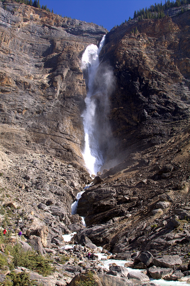 Takakkaw Falls
Magnificent Takakkaw Falls, second highest in Canada (after Della Falls on Vancouver Island, BC) Takakkaw Falls
Magnificent Takakkaw Falls, second highest in Canada (after Della Falls on Vancouver Island, BC) |
|||
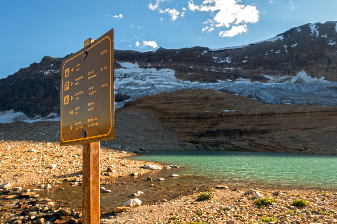
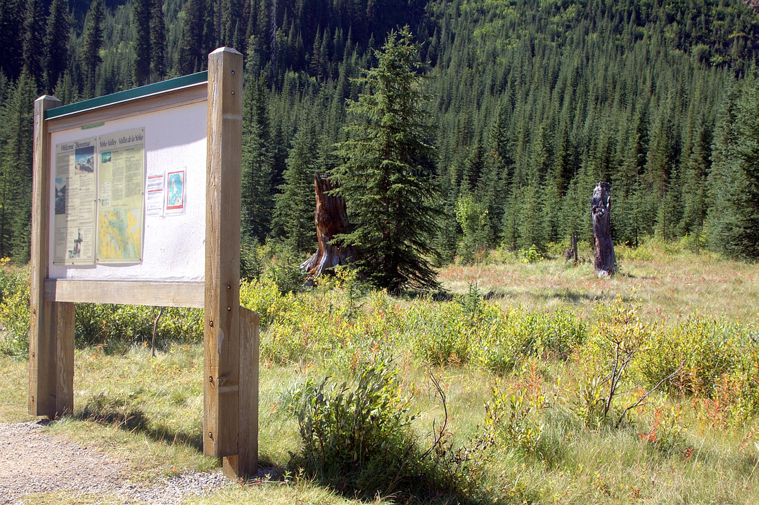 Whiskey Jack Trailhead
Park Table by Whiskey Jack Hostel - Iceline Trailhead Whiskey Jack Trailhead
Park Table by Whiskey Jack Hostel - Iceline Trailhead |
|||
|
|
|||
|
|
|||
|
|
|||
|
|
|||
|
|
|||
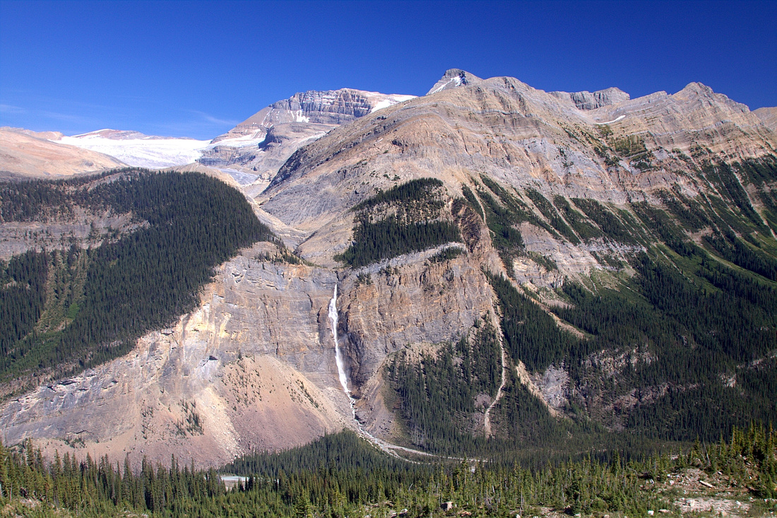
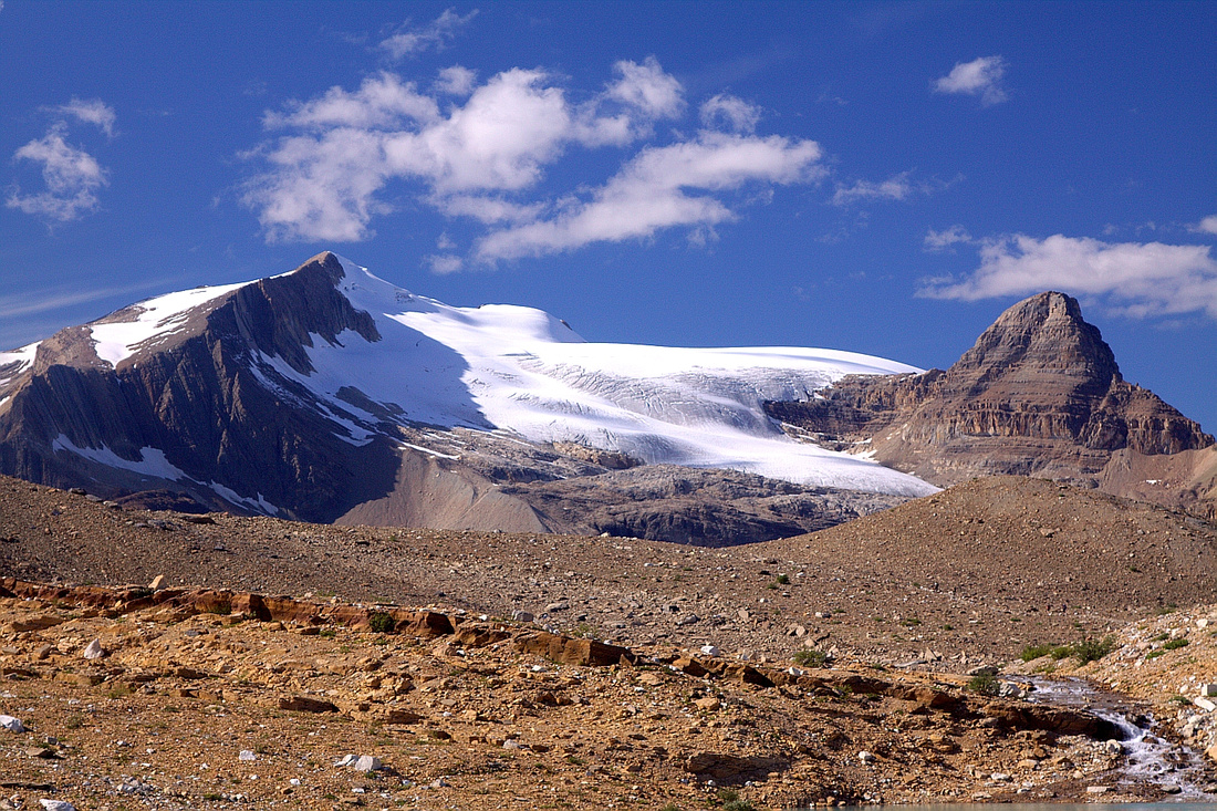
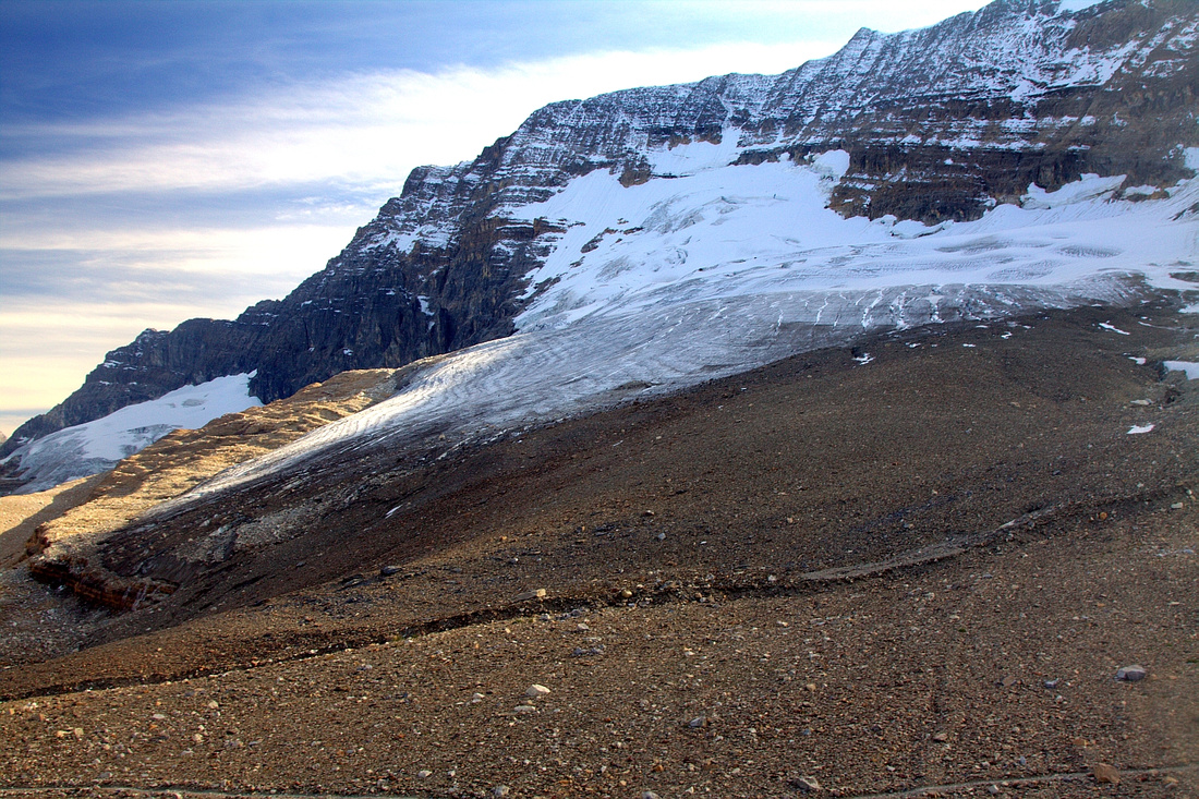 Presidents Glacier
Contouring below Presidents Glacier; this is why it's called Iceline! Presidents Glacier
Contouring below Presidents Glacier; this is why it's called Iceline! |
|||
|
|
|||
|
|
|||
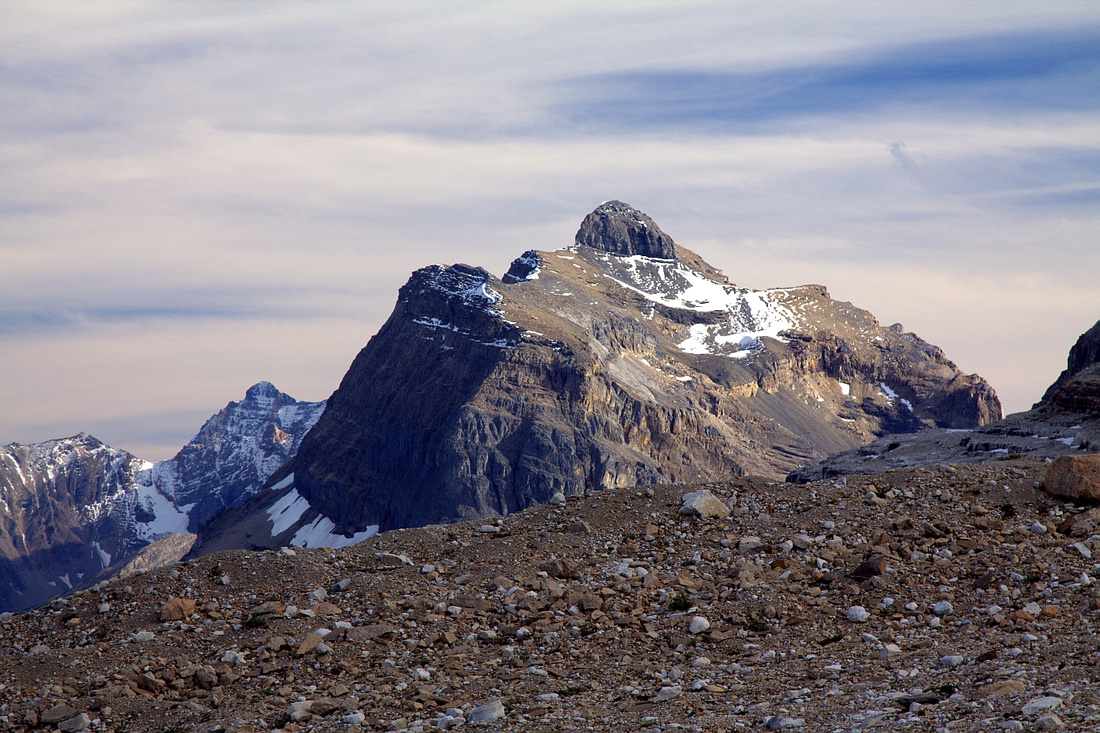
 Whaleback
 Ridge Telephoto from Iceline Summit; Isolated Peak extreme upper left Whaleback
Whaleback Ridge Telephoto from Iceline Summit; Isolated Peak extreme upper left |
|||
 Celeste Junction
Marked Celeste Junction ~15min from Iceline Summit Celeste Junction
Marked Celeste Junction ~15min from Iceline Summit |
|||
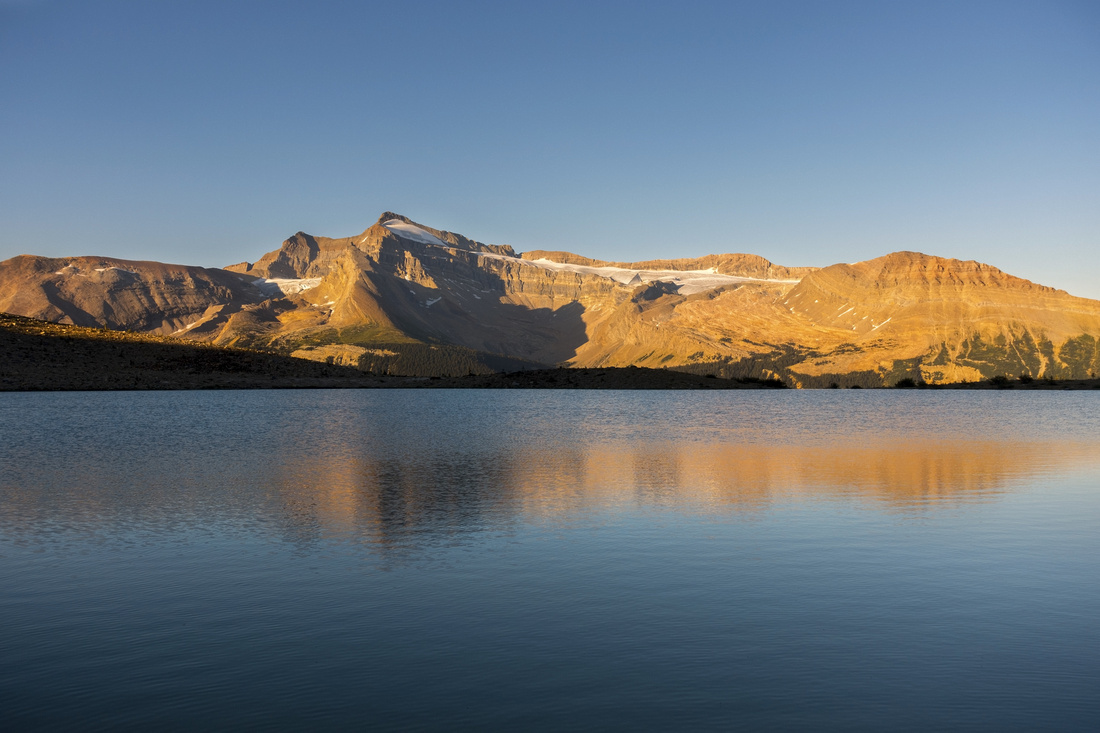
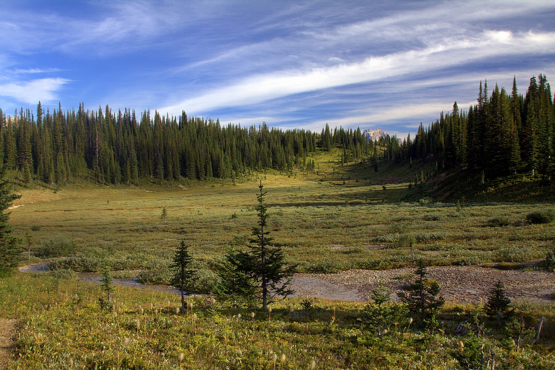
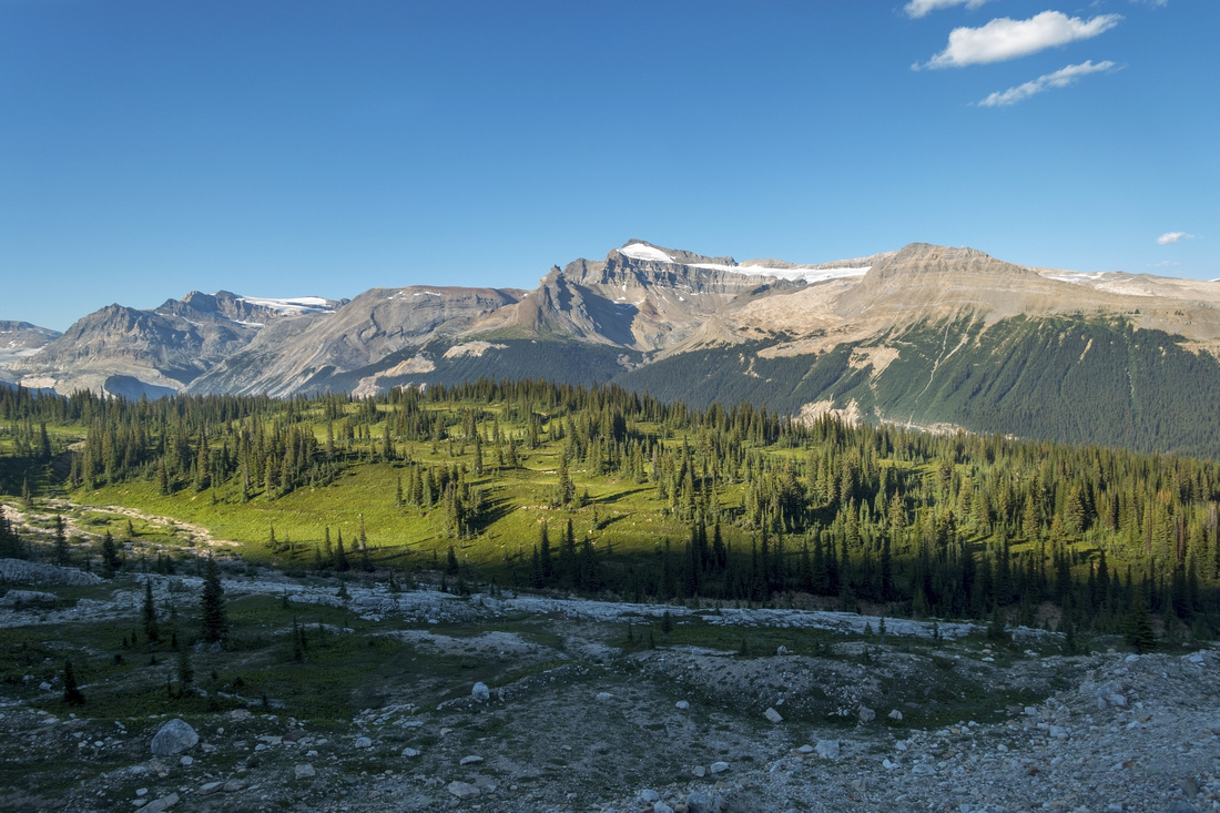 Celeste Meadows
 from Iceline Summit Celeste Meadows
Celeste Meadows from Iceline Summit |
|||
|
|
|||
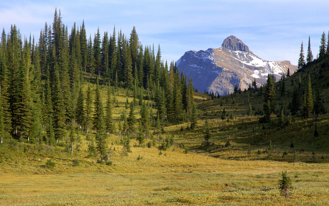 Wapta Peak
View of Wapta Peak from Celeste Meadows Wapta Peak
View of Wapta Peak from Celeste Meadows |
|||
 Celeste Lake
Hiking by Celeste Lake ~20min above Little Yoho Trail on alternate loop return Celeste Lake
Hiking by Celeste Lake ~20min above Little Yoho Trail on alternate loop return |
|||
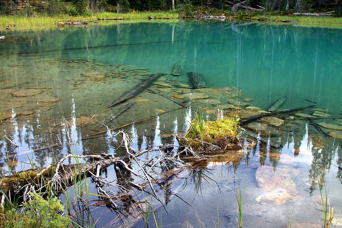
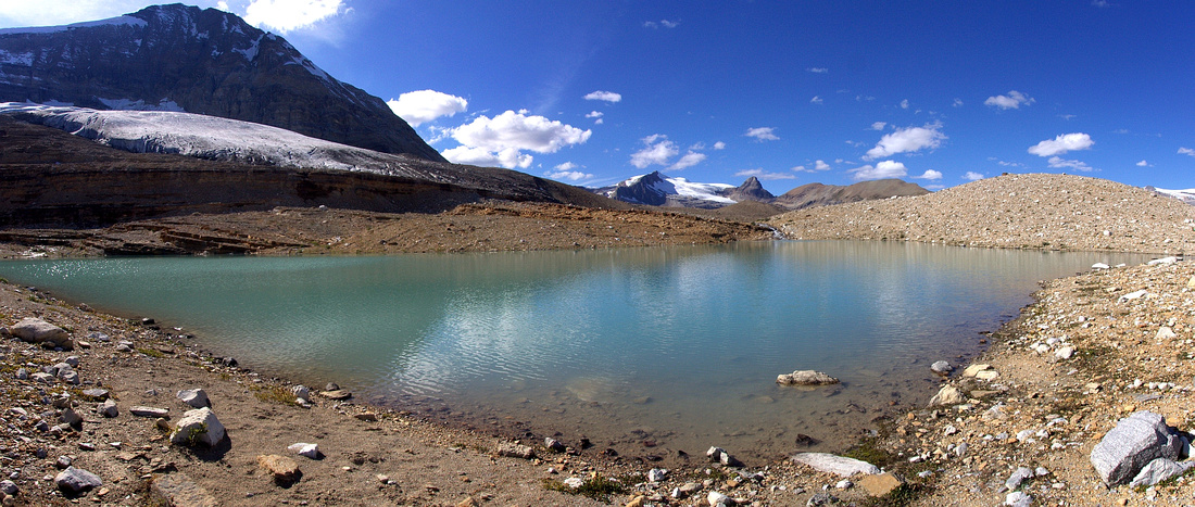
 Infinity Pool
Mt. Balfour reflected in largest Iceline tarn on drop to Stanley Mitchell Hut. This kind of view is why it is worth hiking around the tarn, even if outflow crossing is feasible Infinity Pool
Mt. Balfour reflected in largest Iceline tarn on drop to Stanley Mitchell Hut. This kind of view is why it is worth hiking around the tarn, even if outflow crossing is feasible |
|||
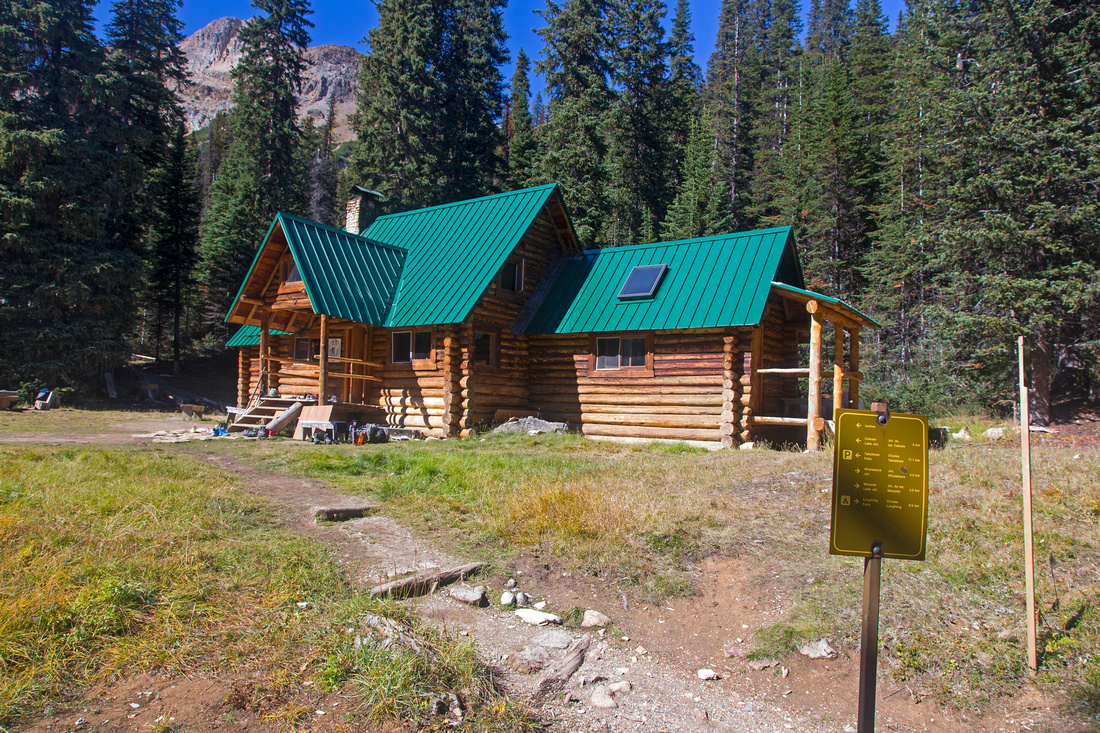 Stanley Mitchell Hut
 in Little Yoho Valley, one of most popular ACC Huts Stanley Mitchell Hut
Stanley Mitchell Hut in Little Yoho Valley, one of most popular ACC Huts |
|||
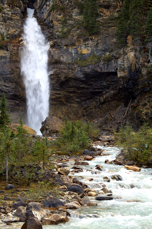 Laughing Falls
 at Junction of Little Yoho and Yoho Valley Trails Laughing Falls
Laughing Falls at Junction of Little Yoho and Yoho Valley Trails |
Abstract
| Overall Difficulty | D3 | Trail hiking with some rocky sections and several unbridged creek crossings. Moderate grade, total distance / elevation gain depends on chosen return route | |||
| Snow Factor | S3 | Not a reasonable winter option due to length of approach (Takakkaw road not plowed in winter) | |||
| Scenery | Essential Rockies. Aerial view of Takakkaw Falls and several distant Yoho NP Peaks. Glacial landscape and Emerald glacier | ||||
| Trail/Marking | Excellent | Official park trail with signed junctions | |||
| Suggested Time | 5-7 hr | 5 hr if returning same way from Iceline summit, 6 hr for Celeste Lake loop, 7h for Little Yoho loop | |||
| Elevation | Start: 1520m Max: 2235m Total: ~930m | Round Trip: 22km (Little Yoho Loop, less for other options) | |||
| Gear | Hiking boots and poles. Gaiters might be helpful for creek crossings | ||||
| Water | Several Glacial outflow creeks. Carry max 1L | ||||
| Dog Friendly | Yes | Standard back-country precautions. Please keep dog on leash for courtesy to other hikers as this is popular trail | |||
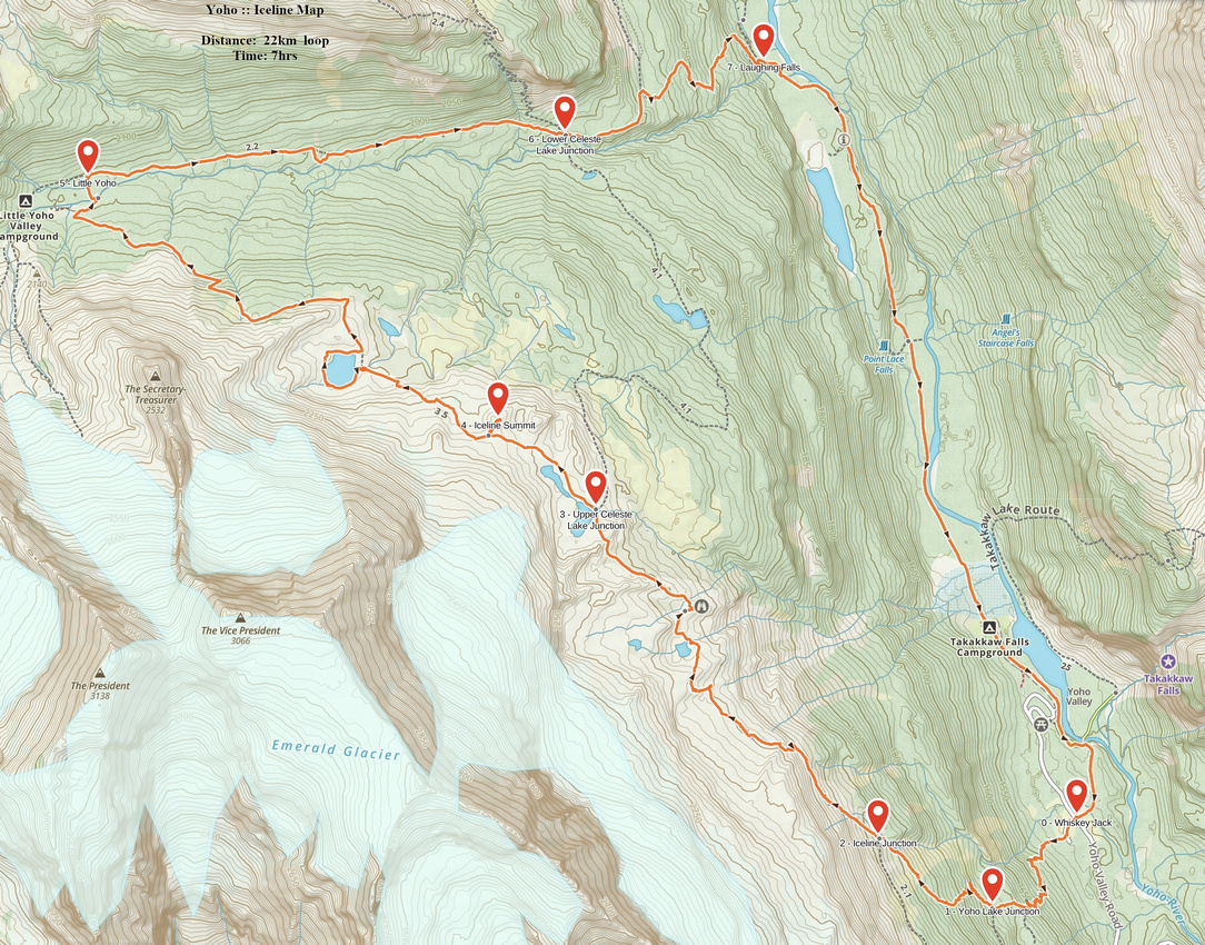 Iceline GAIA Map
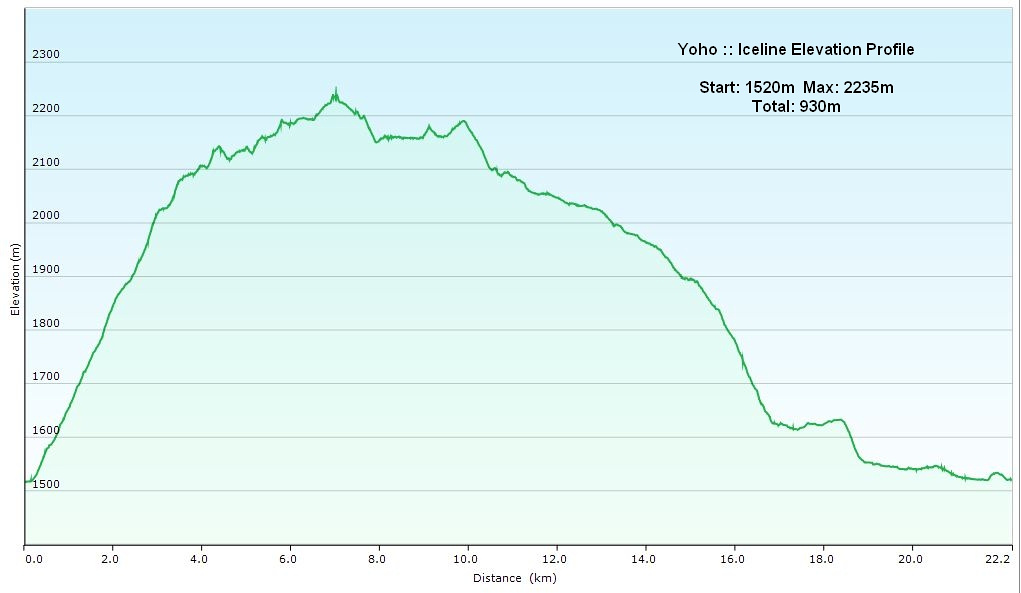 Iceline Loop Elevation Profile