Google Map |
Rockies :: Yoho :: Emerald Peak |
GPS Track |
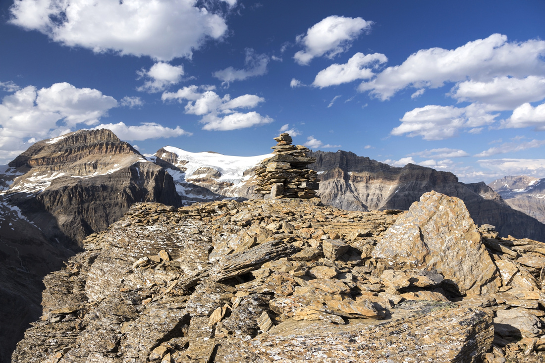 
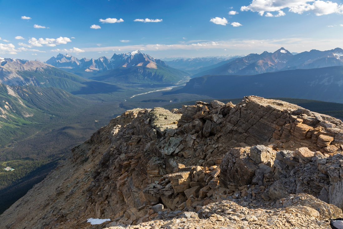
Emerald Peak Summit Cairn; Presidents Glacier behind, Marpole Peak to the left |
|||
| Trip Summary | |||
August 8, 2019Emerald Peak is terrific summer scramble above Emerald Lake. Normal approach is via official Parks trail to Hamilton Lake, also documented in Patton/Robinson Canadian Rockies trail guide. Trail ends at the lake, but as usual this is just a stepping stone to several scrambling routes above the lake. (Even just easy off-trail hike to Carnarvon/Top Hat pass would be terrific extension). Emerald Peak rises ~450m vertical on east side of the lake and is technically the easiest. Although not included in any official guide-books I know off, it gained popularity due to great Spirko report and bits of path have developed over the years. Loop descent down humongous avalanche slope reaching all the way down to Emerald Lake is recommended and it cuts return time in half.
Follow Hamilton Lake trail starting on west side of Emerald Lake parking lot. Trailhead is slightly tucked behind, just as access road splits in 2 parts entering the parking lot. Area is very popular with tourists in the summer and, depending on time you arrive, you might have problems with parking. Alternative that usually works is to park at Emerald Lake Lodge overnight parking lot -- about 500m before end of the road on west side -- then just walk few minutes up. Hamilton Falls are reached in 10-15 minutes and most of the crowds will peel off here. Several side trails lead to this gorge as trail starts switchbacks. Remainder of the hike to the lake is under tree cover and uneventful. Trail eventually levels off and reaches large boulder slope dropping off Emerald Peak. You could leave trail and ascend here but it would be quite unpleasant -- it is far better to continue all the way to the lake, then ascend from there. 5.5 km and 780m vertical, ~2 hrs to lake outlet. This is good spot to fill water bottle as remainder of the ascent is dry.
From the lake follow bits of trail up grassy knoll on east side, then slanting diagonally across talus slope (cairns) aiming to intercept Emerald Peak ridge. Way is obvious, although bits are fairly steep. Note cairn upon topping up on the ridge in case of returning the same way. Hike up the ridge to sub-summit is very pleasant with grand views around. Upon reaching rocky slope below sub-summit you have a choice. Go directly or bypass on either side. Judging by bits of trail most people bypass on east (Emerald Lake) side. Going over is moderate (class 3) scrambling but presents no real problems. Aim for the notch between 2 summits. From there either bypass on lose east side talus slopes, or again go directly (recommended). This necessitates crawl through the cave and jump across 1.5m wide gap - great fun. Final exit to sizeable summit cairn is easy (class 2) scramble.
Emerald Lake direct descent is as easy as it looks. This avalanche slope is long but straightforward; it will take 2 - 2 1/2 hrs maximum. Upper parts are steepish and bit awkward, but terrain improves lower down with bits of meadow and wildflower carpets in summer. Final part descends stony drainage that curls left and is rocky and lose, although there are side trails on both sides. Finally cross overgrown bushy bit (up to your waist at times!) and exit to paved Emerald Lake shore path. Turn right and walk back to the parking lot. |
|
Gallery |
|||
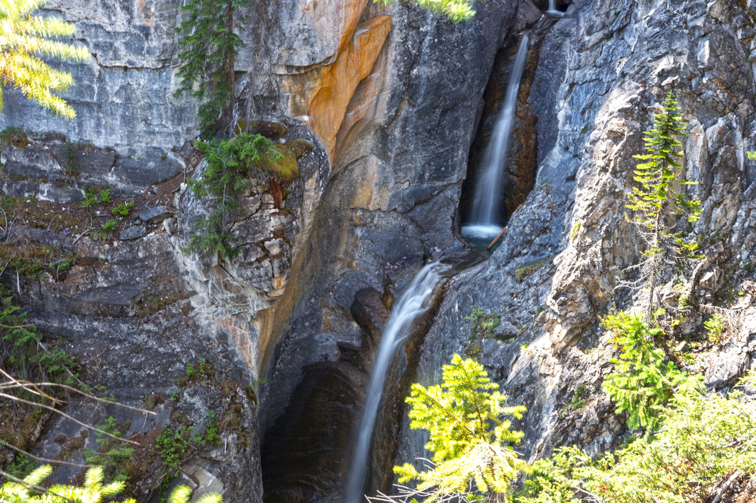
Hamilton Falls reached within 15 minutes. Switchbacks and elevation gain starts here |
|||
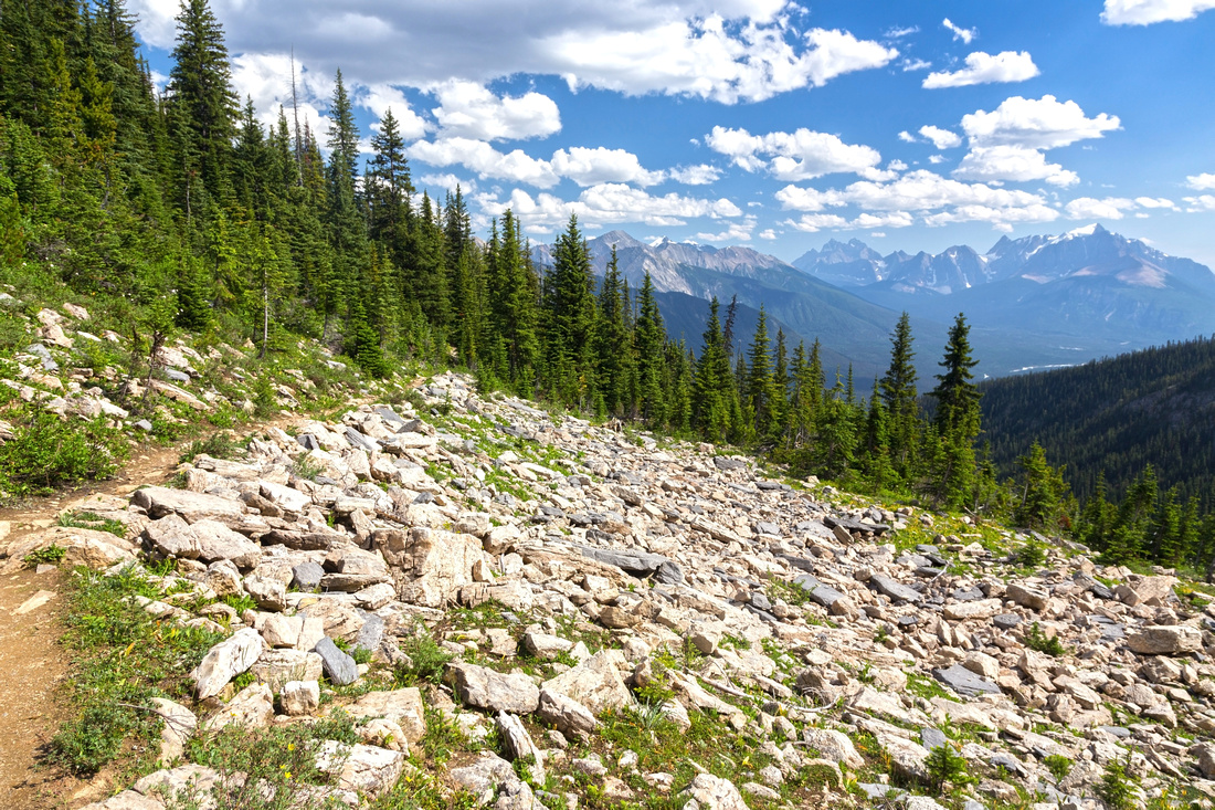
Looking back as trail crosses boulder slope at treeline, after ~1.5hrs of steady ascent |
|||
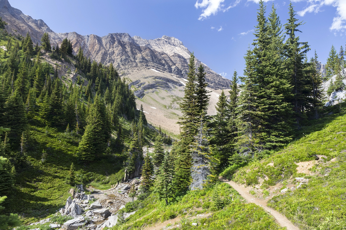
Final descent to Hamilton Lake; Carnarvon Peak behind |
|||
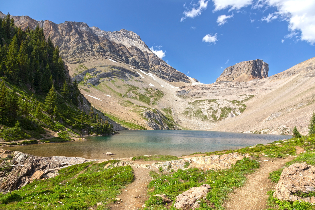
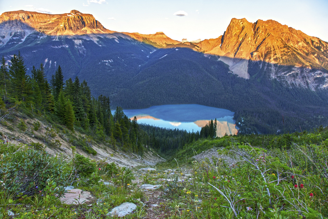
Classic View of Hamilton Lake and end of official Parks trail. Mt. Carnavron (Kane difficult) upper left, Top Hat just right of center |
|||
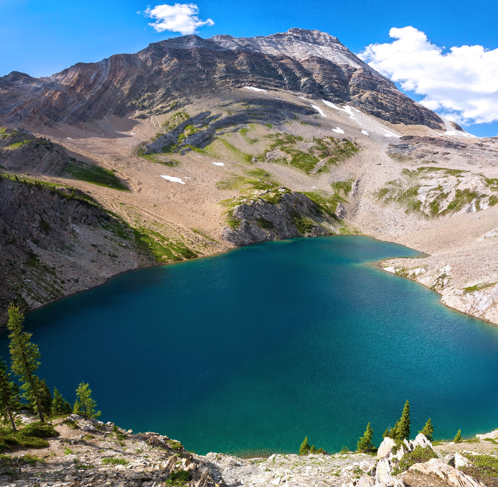
Emerald Peak ~450m vertical above east shore of Hamilton Lake. Sub-summit right, true summit left. Note notch in between |
|||
Terrific view back to Hamilton Lake and Mt. Carnarvon while following bits of trail aiming to intercept Emerald Peak summit ridge |
|||
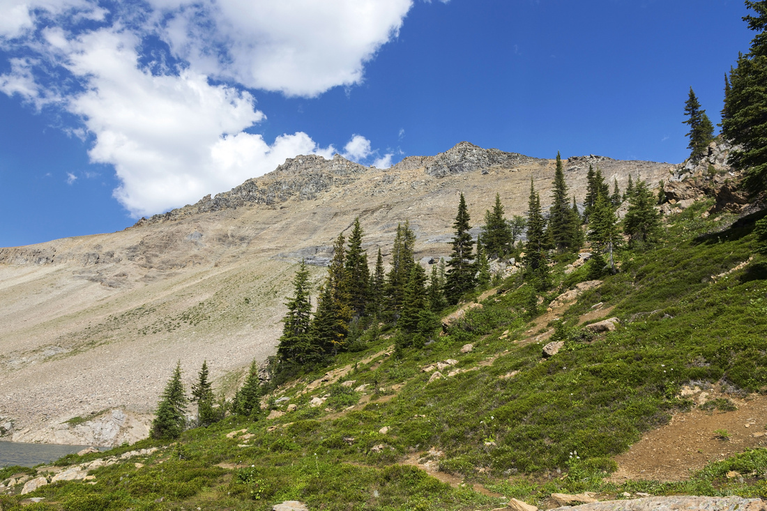
Start of summit ridge with view back to the lake. This photo illustrates best why it is advisable to follow Hamilton trail all the way to the lake as south slopes rising above the trail are fairly steep |
|||
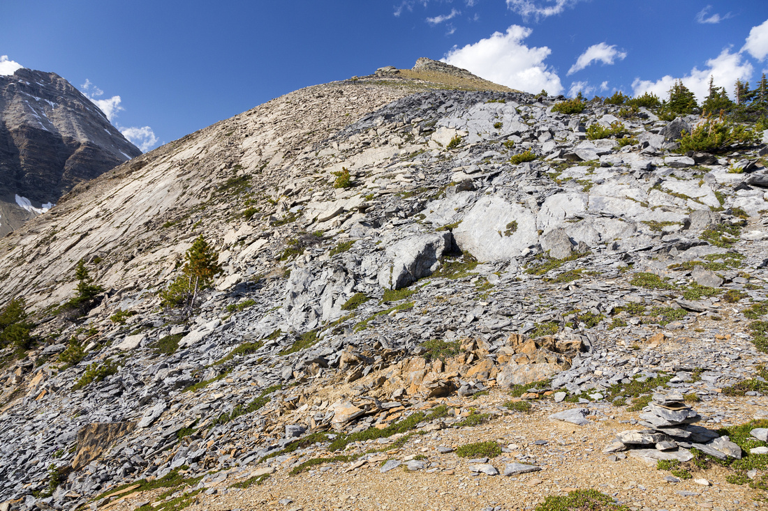
Emerald Peak ridge leading to sub-summit above - terrific hiking on heather and typical Yoho crunchy shale plates higher above. Note cairn (lower right side of the photo) if descending the same way |
|||
Sub-summit west bypass. It is not too lose, but it is better to go over sub-summit or bypass on the other (east) side |
|||
Looking back from the summit to broken ridge past the notch. Gap that must be jumped is roughly center; cave exit to its right and behind. Alternate east side talus bypass left |
|||
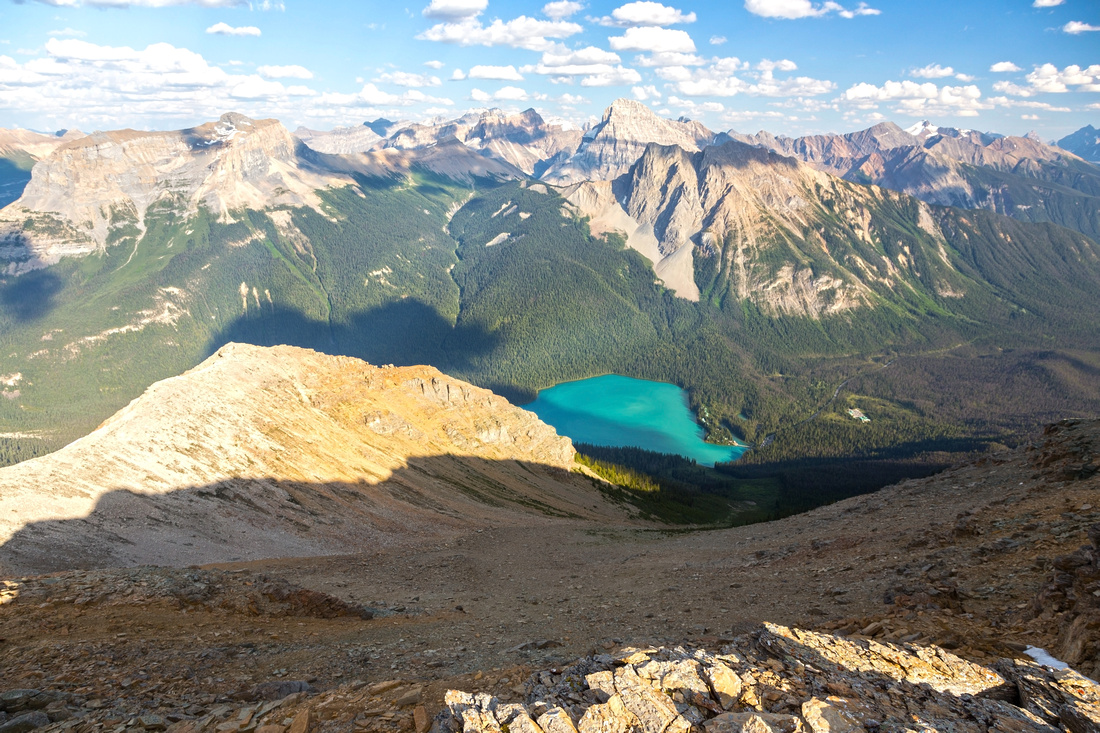
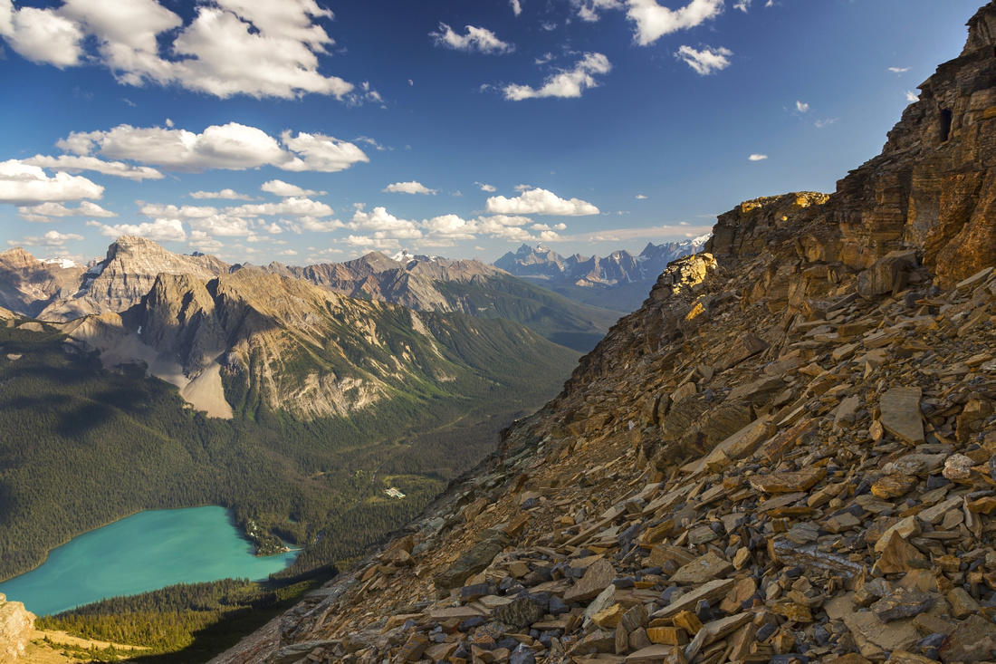
Recommended descent down Huge avalanche slope reaching all the way to Emerald Lake. Wapta Highline across |
|||
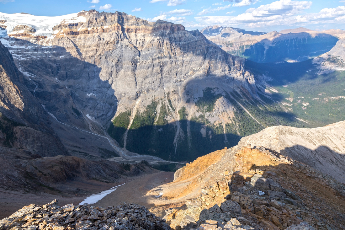
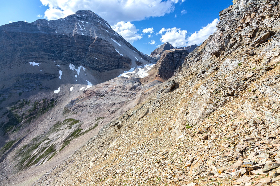
North side of Emerald Peak looking down to Emerald Basin. Presidents above, Yoho Pass upper center right |
|||
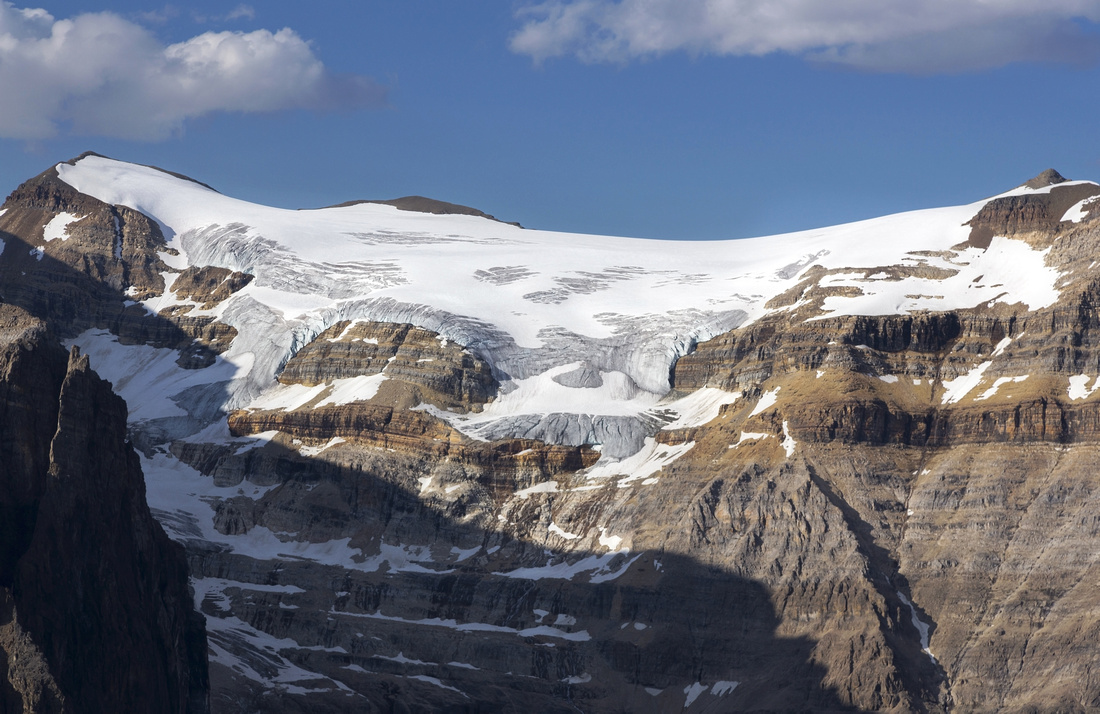
Closer look at awesome Presidents glacier |
|||
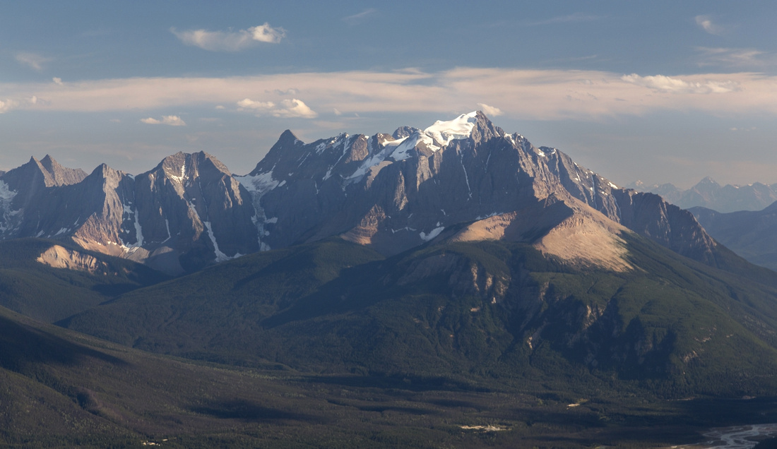
Glaciated Mt. Vaux, one of several Rockies giants along Field-Golden corridor |
|||
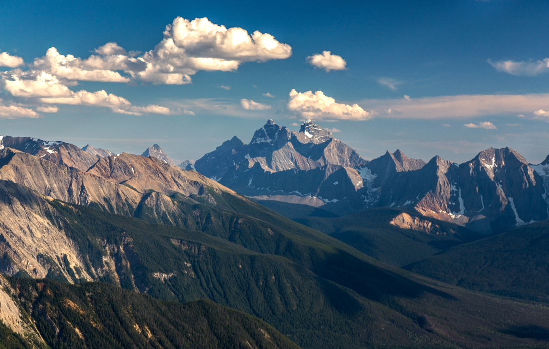
(Mighty, Mighty) Goodsirs |
|||
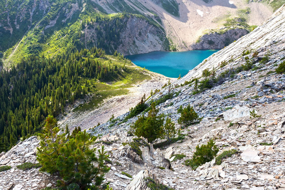
 Starting descent to Emerald Lake direct. Bits of trail here are made by hikers descending to Emerald Lake and NOT indicative of alternate notch bypass which is infrequently used. Terrain is fairly lose here, but improves lower down
 |
|||
Lower third of the drainage as it splits into 2 parts. Follow left side (note bits of trail); bushy right side would be downright awful, even if slightly shorter |
Abstract
| Overall Difficulty | D6 | Steep trail to Hamilton Lake (780m in 5.5km) and talus slopes above. Class 2-3 scrambling on summit ridge. Unstable shifting terrain in upper part of east side drainage descent. Significant overall elevation gain. | |||
| Snow Factor | S3 | Applies for Hamilton Lake side only. East drainage to Emerald Lake is huge avalanche trap and should be avoided, although it provides terrific ski run when snow conditions are stable | |||
| Scenery | Classic Rockies high alpine Lake. Jagged mountain peaks and glaciers. Several distant Rockies giants seen from the summit. | ||||
| Trail/Marking | Excellent / None | Official Park Trail to Hamilton Lake, none after. Occasional cairns with some route-finding | |||
| Suggested Time | 7-8hrs | For loop return via east drainage; longer if returning same way via Hamilton Lake | |||
| Elevation | Start: 1320m Max: 2565m Total: ~1280m | Round Trip: 12 km | |||
| Gear | Full hiking boots (ankle support), poles (stability) and gaiters. Climbing helmet suggested. | ||||
| Water | Hamilton creek at lake outlet, dry otherwise. Carry 2-3L on a hot summer day | ||||
| Dog Friendly | Yes | Standard back-country precautions | |||
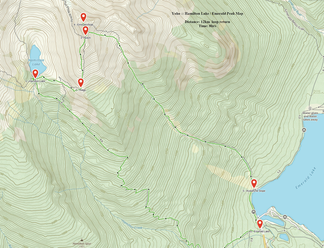 Hamilton Lake / Emerald Peak GAIA Map
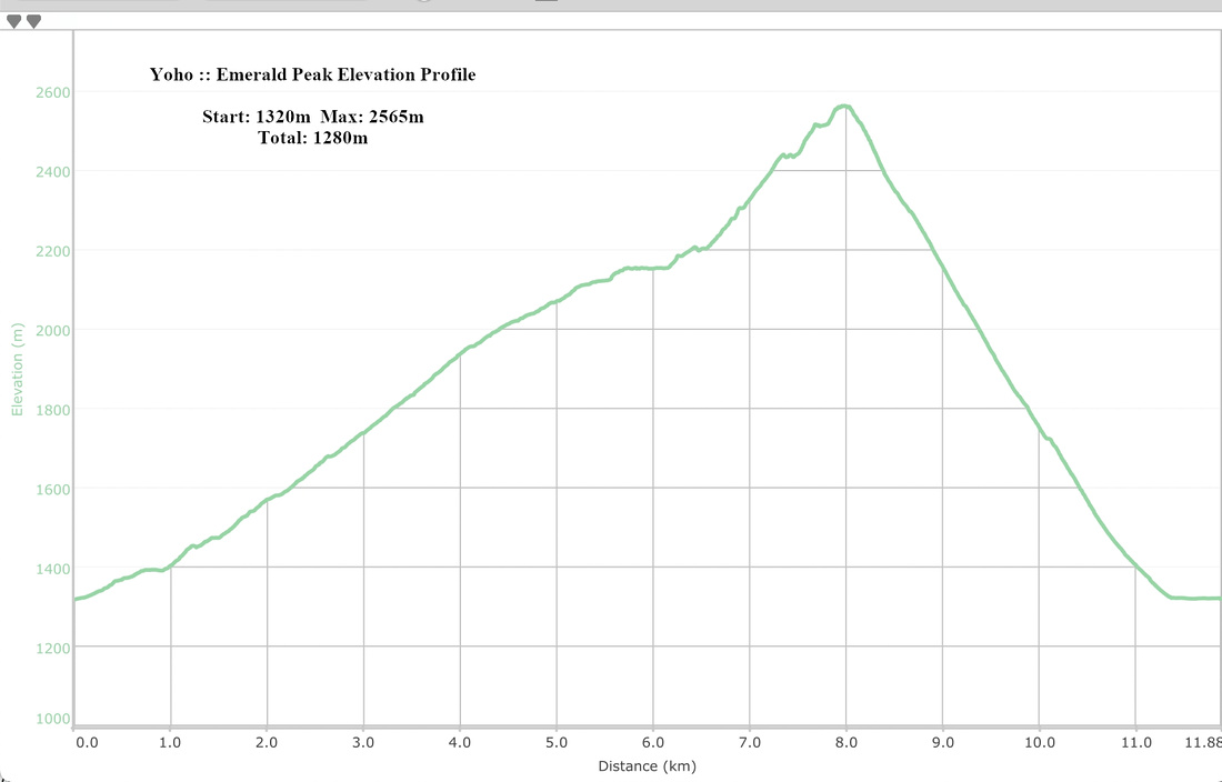 Hamilton Lake / Emerald Peak Elevation Profile