Google Map |
Rockies :: Yoho :: Emerald Lake and Basin |
GPS Track |
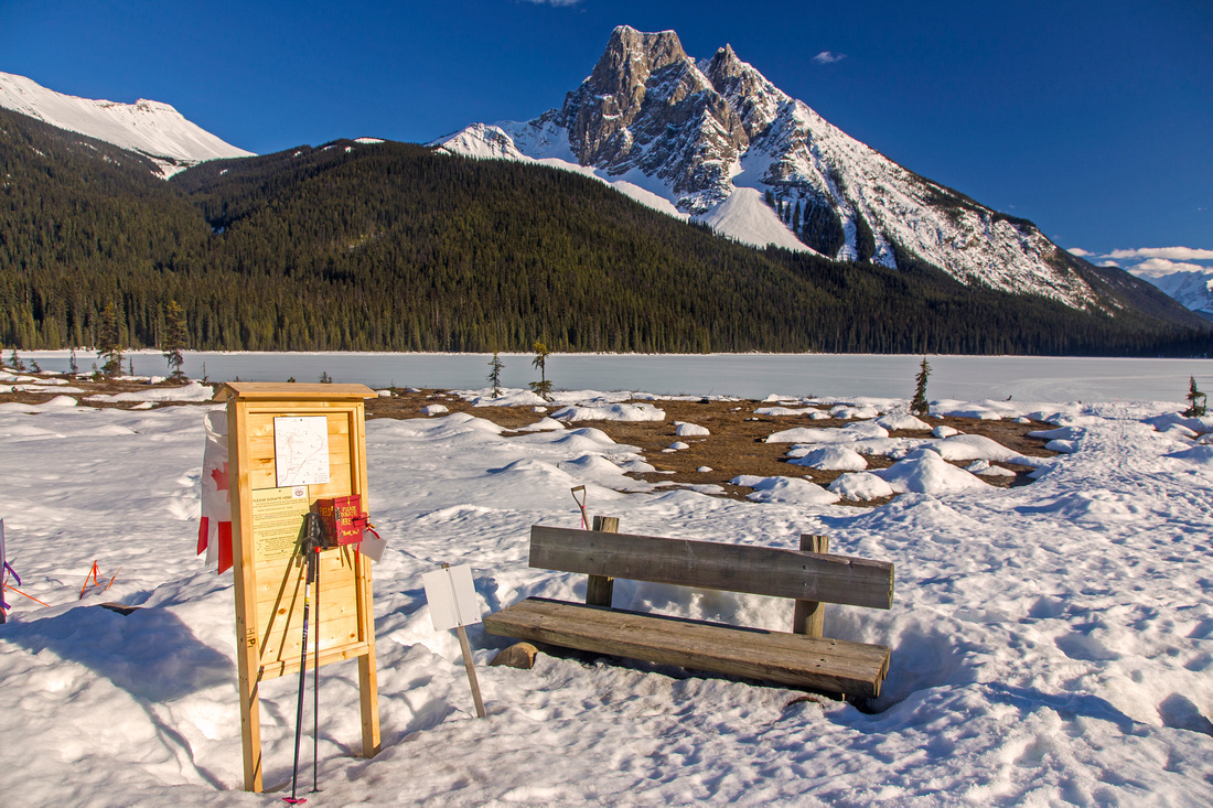 
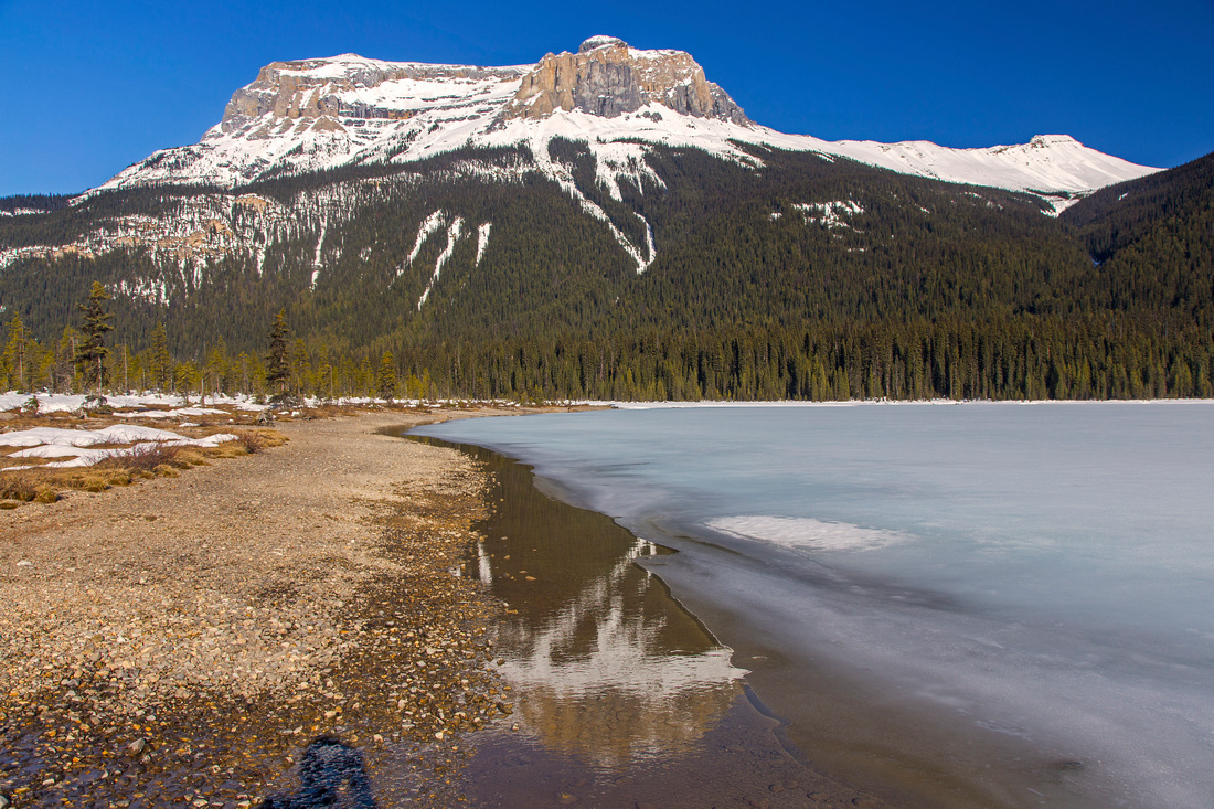
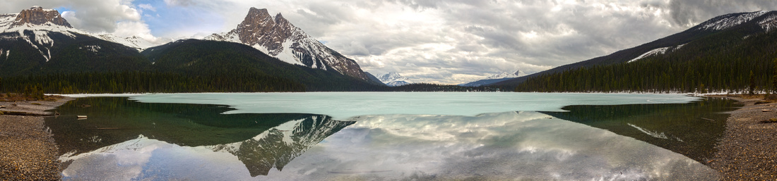
North end of Emerald lake with view to Mt. Burgess |
|||
| Trip Summary | |||
|
Who can resist circuit around Emerald lake? This undemanding ~1hr walk is excellent choice if you are first time in the area and will give you different perspectives of the area. Trail is wide and well defined; as you might expect it is touristy and quite busy in prime season. Traffic drops off halfway around and you might have more solitude on shadier east side. Slightly more challenging option is to hike to Emerald Basin below Marpole Peak and the Presidents; both trips can easily be combined as half-day hike.
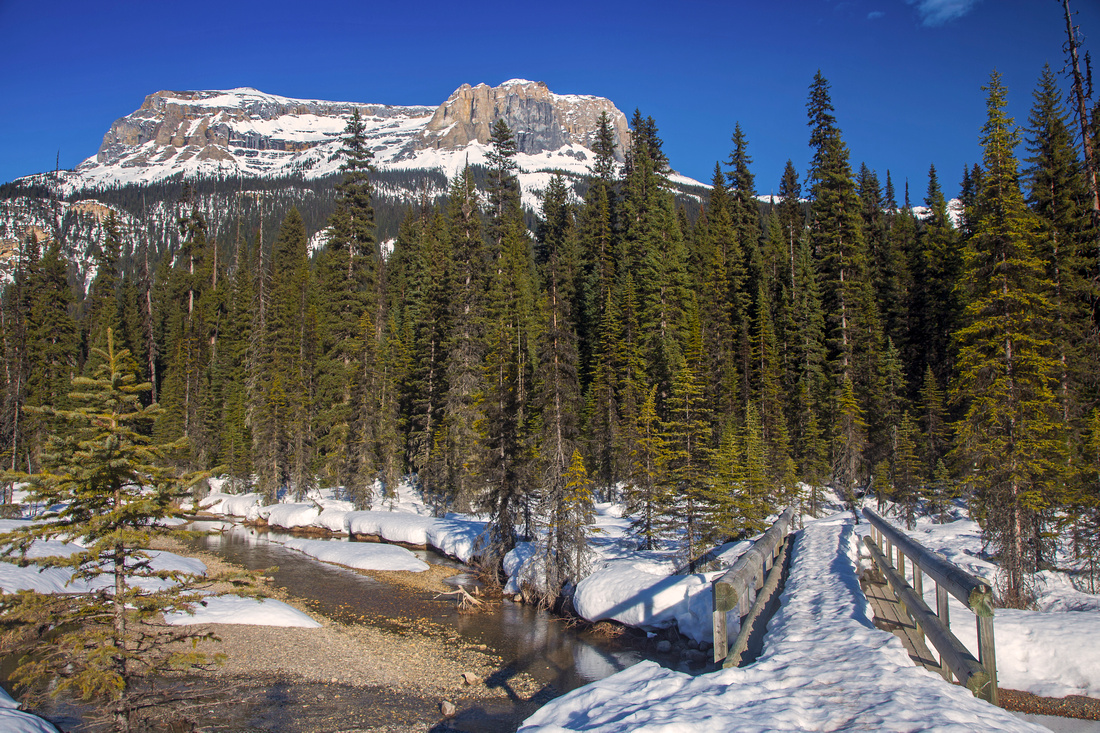
From parking at south end of Emerald lake take signed lakeshore trail, starting just past the bridge over lake outlet (leading to ultra-expensive lodge, where you will finish the circuit). Soon the trail crosses humongous avalanche slope coming down from Emerald Peak. This slope also serves as alternate scrambler descent route in summer conditions. Parks sign warn about avalanche danger. Trail continues on the other side with many benches inviting for a snooze! North end of lake is most beautiful part; braided flats with great views of Wapta Mountain and Mt. Burgess - both Kane scrambles. Lake trail continues to the bridge, then turns right and heads back along shadier and more wet east side. There are still several nice openings where you can exit to the shore and enjoy different views of the lake. At south end just past Burgess Pass junction trail turns right and hikes back to the lodge (ignore "parking lot" branch and go right). Cross lodge complex and bridge back to the start.
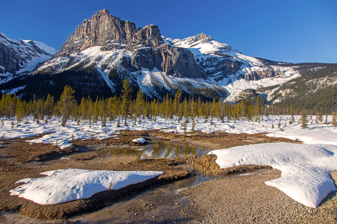
Signed Emerald Basin junction is just as lakeshore trail turns right at north end. Park sign says it is 2.9km to the basin. After initial flat section trail turns left and ascends to the basin. This bit is moderately steep but fairly short. Due to relatively low elevation there is plenty of typical BC lush vegetation and old growth forest complete with moss and several species of fungi in summer conditions. Trail levels off and offers several viewpoints before slightly descending to head of the basin and disappearing among glacial streams coming down from Presidents glacier. This is the turnaround point, although you can explore a bit more towards Marpole peak. Note twin waterfalls on the left side of the basin; above is south Marpole peak that can easily be scrambled in right conditions. This unmarked route circles the waterfall on the left side, then heads up lose talus to the peak high above. Return the same way back to Emerald lake. |
|
Gallery |
|||
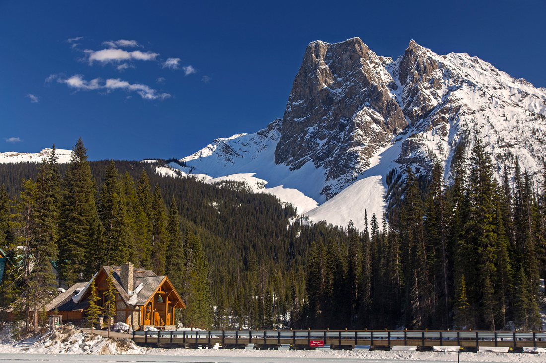 Emerald Lake lodge with Mt. Burgess behind
 |
|||
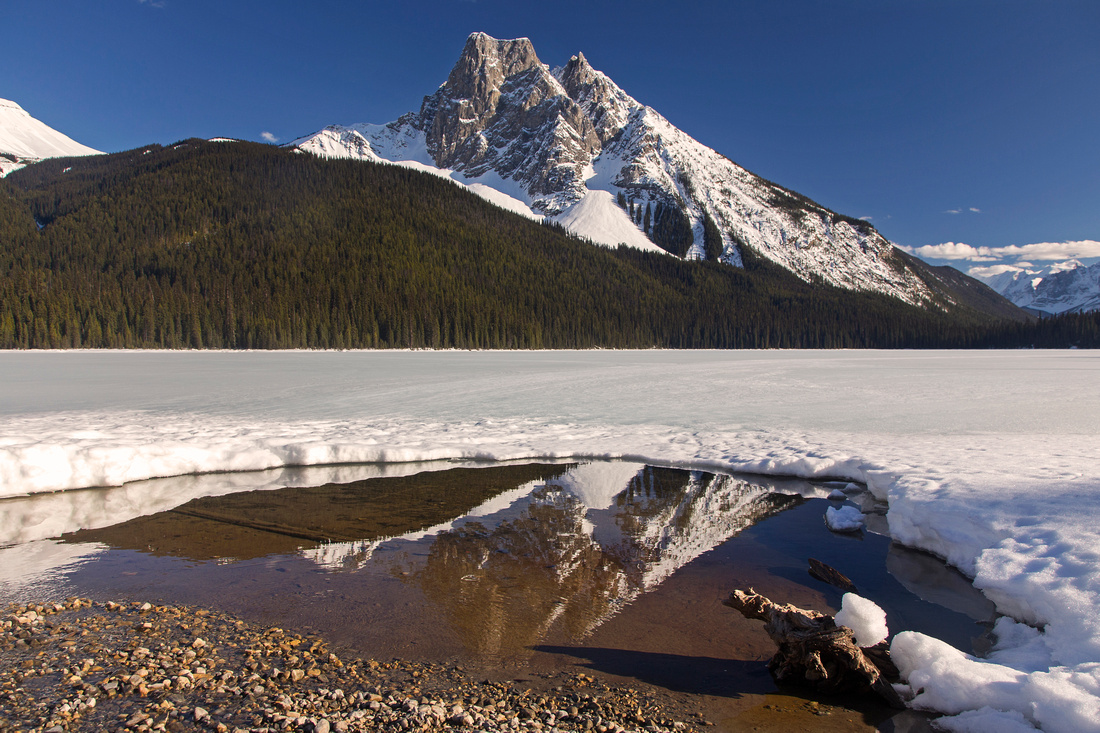
Reflection of Mt. Burgess at north end of Emerald lake |
|||
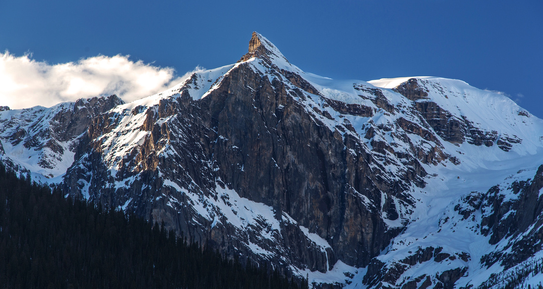
Presidents from north shore of Emerald Lake |
|||
View towards Wapta Highline traversing below Wapta Peak (Kane difficult). Burgess Pass to the right |
|||
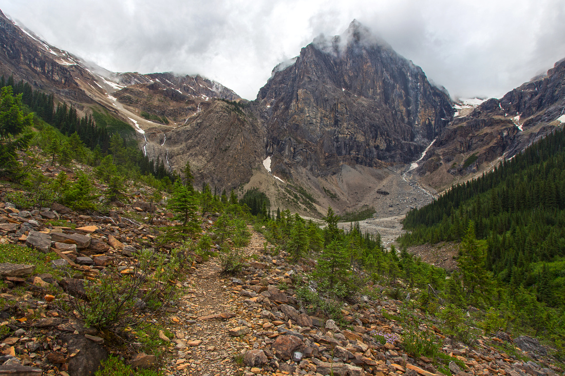
Trail emerging into Emerald Basin below Marpole Peak |
|||
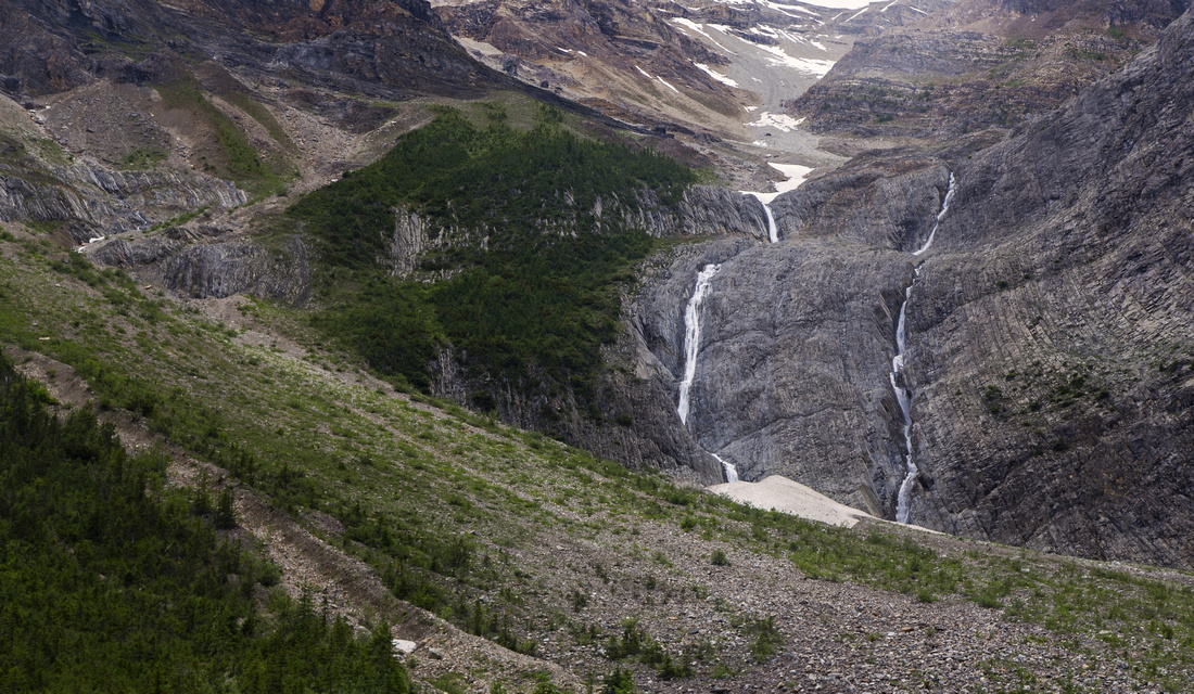
Twin waterfalls below south Marpole Peak in Emerald Basin |
|||
Bridge at east end of Emerald Lake circuit trail |
|||
Marpole peak from east shore of Emerald Lake |
|||
Wide Panoramic from north end of the lake in early 2018 after record winter snowfall year |
Abstract
| Overall Difficulty | D2 | Undemanding mainly flat walk for lake circuit (D1). Moderate elevation gain with bushy and rooty sections to Emerald Basin | |||
| Snow Factor | S2 | Easy snowshoe around the lake in winter conditions, often hard-packed. Harder to Emerald basin with avalanche danger | |||
| Scenery | Spectacular views of Emerald lake from different angles. Presidents, Mt. Burgess, Marpole and Wapta peaks. Desolate rocky Emerald Basin | ||||
| Trail/Marking | Excellent | Wide park trail around the lake with marked junctions and interpretive signs. East side has many planks across wet, boggy areas. Emerald basin has brief bushy section where caution is required. | |||
| Suggested Time | 3 hrs | Lake circuit can be completed in an hour; add 1.5 -2 hours for (return) trip to Emerald Basin | |||
| Elevation | Start: 1320m Max: 1510m Total: ~350m (incl. Emerald Basin) | Round Trip: 12 km (including Emerald Basin; Lake circuit is ~5km only) | |||
| Gear | Day hikers are sufficient. Poles might be helpful for Emerald Basin | ||||
| Water | Silty drainages throughout. Carry 1L if going to Emerald Basin | ||||
| Dog Friendly | Yes | Please keep dogs under control on busy trail around the lake. Emerald Basin is often frequented by bears - caution. | |||
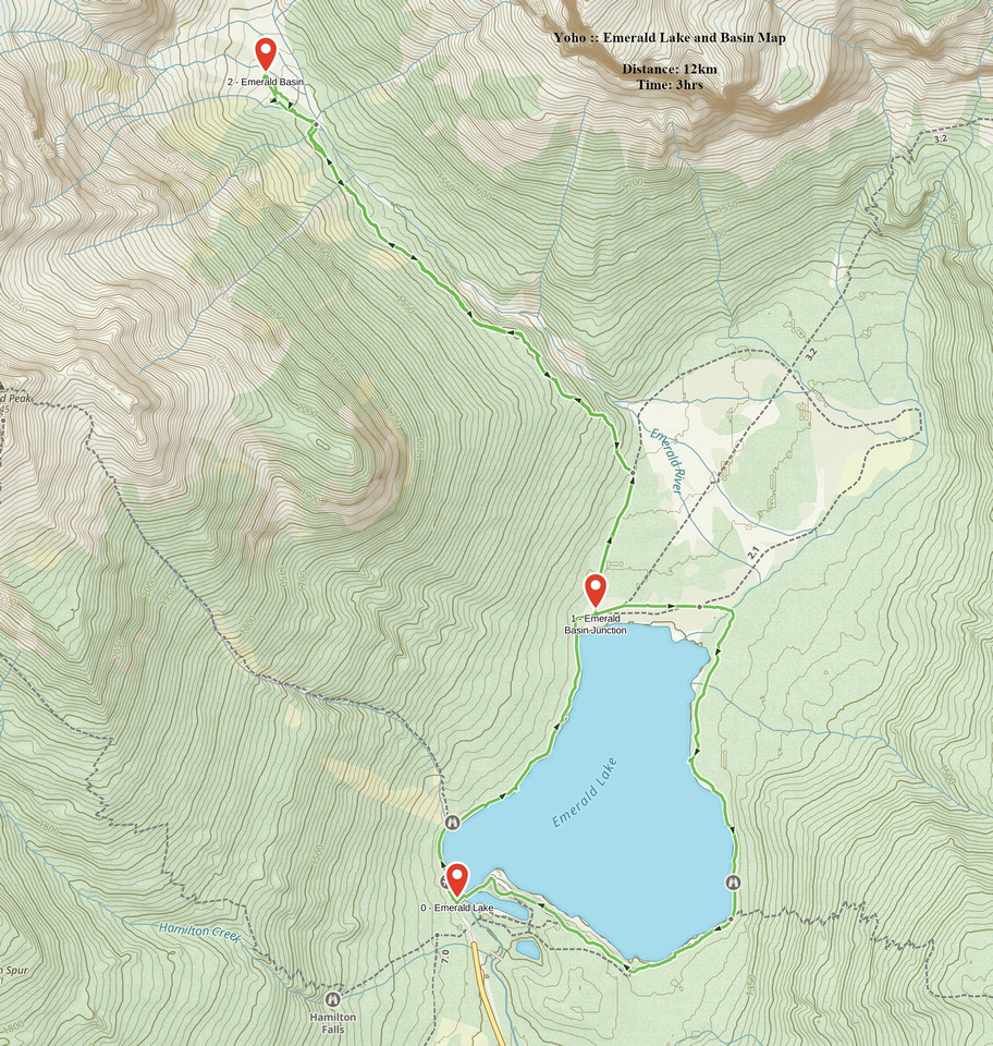 Emerald Lake and Basin GAIA Map
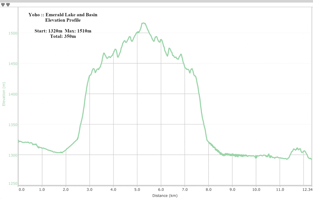 Emerald Lake and Basin Elevation Profile