Google Map |
Rockies :: Yoho :: Cathedral Basin / Consummation Peak |
GPS Track |
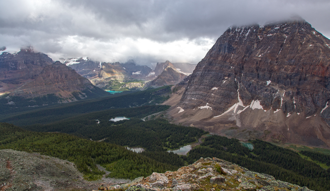 
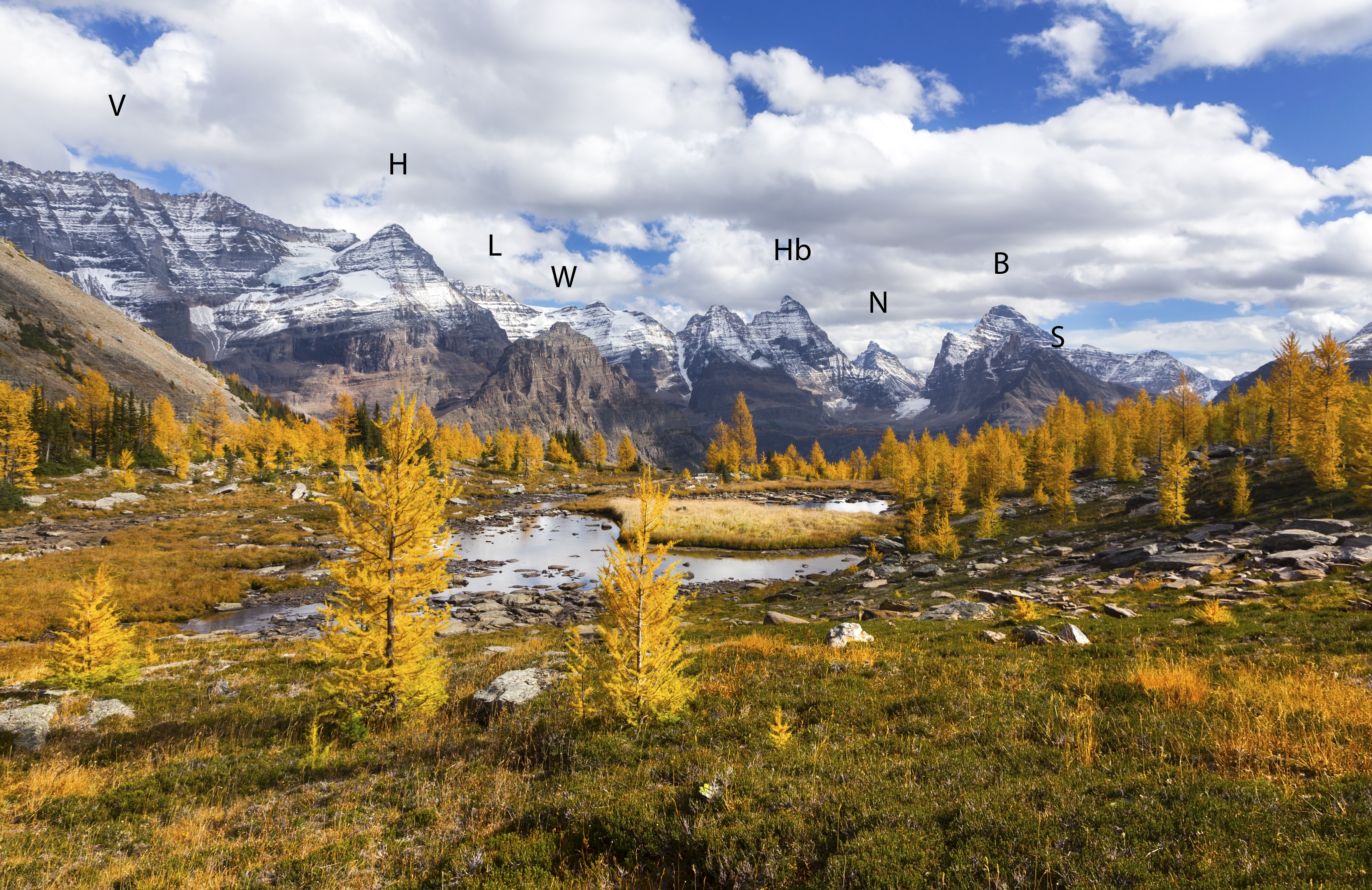
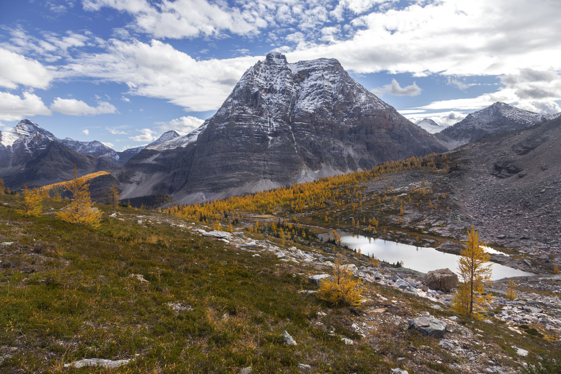
Consummation Peak summit views. Lake O'Hara left of center distance, Linda and Cathedral lakes in lower foreground. Mt. Odaray is big peak to the right |
|||
| Trip Summary | |||
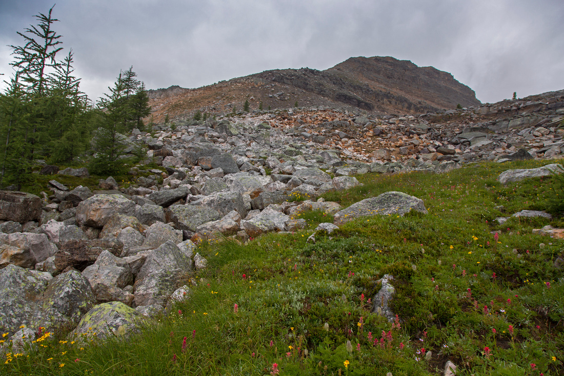
July 28, 2015Consummation peak is infrequently ascended minor summit on north side of Cathedral basin in O'Hara area. Approach is via hiking trail leading to Linda and Cathedral lakes. As for any trip in O'Hara area, pre-requisite is travel on access road that is closed to motorized traffic as well as bicycles. For day-hikers from parking lot on Trans-Canada highway it means additional walk of 9km (times two) - unless you are extremely lucky and can squeeze into the bus should there be any last minute no-shows. Alternative is camping in official O'Hara campground or stay in ACC hut -- for which space is equally hard to get in prime season. Regardless of the way in, journey to upper Cathedral basin where scramble begins is very scenic. In summer meadows are full of wildflowers while in the fall abundant golden larches put whole area on fire. Setting of Cathedral lake below towering Mt. Odaray must be seen to be believed. Scrambling is easy and would likely get "easy" rating in Kane world. There are several options for return - visit to Monica lake at end of Cathedral basin trail is highly recommended, but one can also descend to upper Duchesnay basin then pick-up trail somewhere near last-larch prospect. Hike Cathedral basin trail starting from near km 9 of O'Hara access road; trail from the campground joins in within first kilometer. Go around Linda lake on right (north) side, then continue to Cathedral lake. At Duchesnay junction few minutes past the lake go right. Trail gets steep and rooty - caution is required on descent. Higher up it traverses sizable boulder slope, reminiscent of Baden Powell section from Horseshoe Bay to Eagle bluffs in North Shore Vancouver. Follow the cairns. Views really open up here and entire O'Hara core area comes into the view. Beyond boulder slope trail levels up and traverses sub-alpine below south ridge of Consummation. Although you can probably charge up anywhere, best way is to continue along the trail some 10-15 minutes past boulder slope to the clearing from where entire south ridge can be seen. Leave the trail here and ascend grassy hillside. Couple of cairns lead through lower boulders to base of talus slope. Near the top of traverse few meters left through bit of eroding cliffs and intersect south ridge. Turn right and follow easily to the summit plateau that is surprisingly broad and flat. Normal return is same way you came up, but as alternative north ridge can also be descended without much trouble. It is slightly steeper, but does not present problems otherwise. Watch for some lichen covered boulders that can be slippery and tricky when wet. From tarn at base of north ridge you can either turn left and descend to upper Duchesnay basin -- or go right and traverse tricky boulder slope between Consummation and Cathedral prospect. This effort will eventually pay off, as there is lovely grassy terrace beyond it which offers phenomenal views and can be followed all the way to Monica basin. Do be careful as twisted ankle or worse is real possibility. Monica basin has plenty of larches and is very special place to visit in the fall as well. Return from Monica to O'Hara road on Cathedral basin trail should take about 1hr 45 - 2 hr.
Update September '21: I returned to the area in fall of '21 and visited Duchesnay Basin. Duchesnay trail is far less defined and disappears completely at times; there are some cairns along the way. From Cathedral junction it will take ~40min to reach expansive alpine meadow at head of Duchesnay Basin. Access to backside of Consummation Peak is extremely simple from there - grass hiking only (no trail). I fully recommend this approach or return compared to original Cathedral Prospect trail - much more gentle and scenic. If you plan to descend only this way, locating end of Duchesnay trail might be tricky if first time here; from backside of Consummation drop diagonally in westerly direction towards treeline and look for cairn at plateau below, ~20-30min from the Consummation saddle. See pics at end of gallery for visual reference. |
|
Gallery |
|||
 Odaray Reflections
Reflections of Odaray Mountain in calm water of Linda Lake ('21 trip photo) Odaray Reflections
Reflections of Odaray Mountain in calm water of Linda Lake ('21 trip photo) |
|||
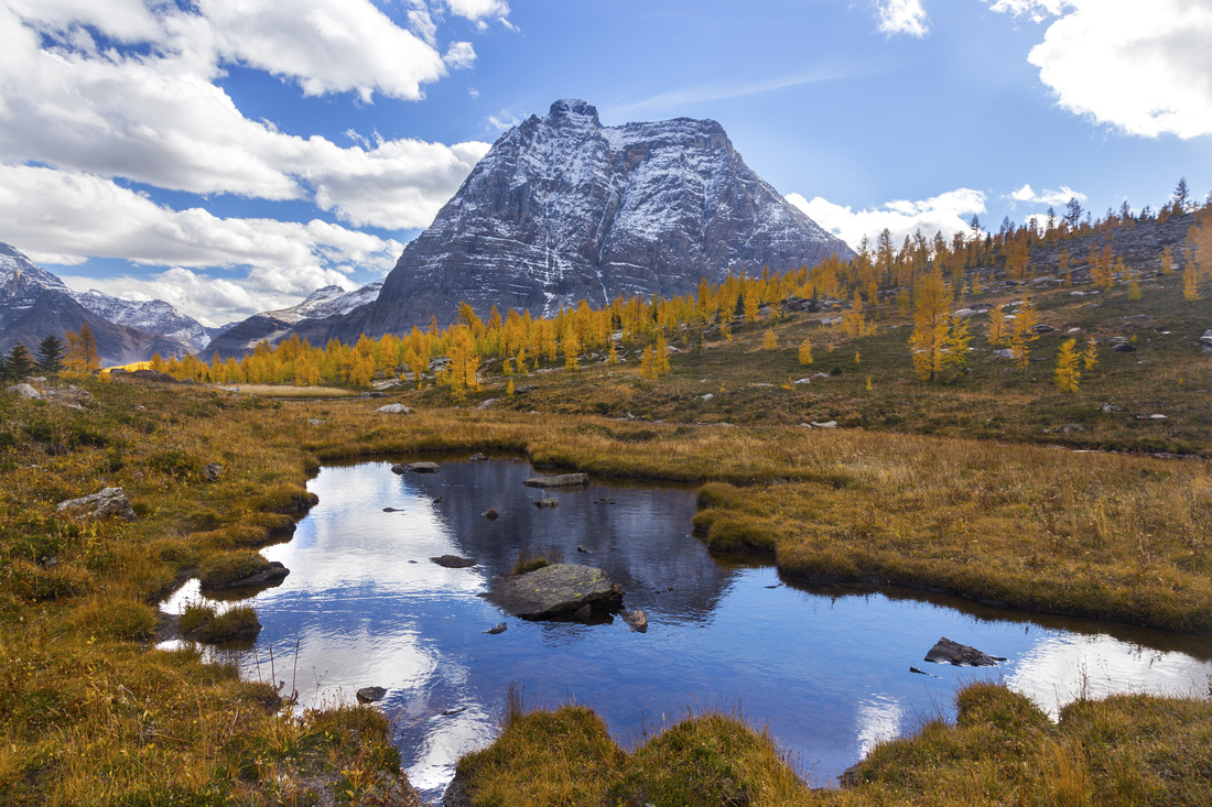
 Cathedral Meadows
Meadows between Linda and Cathedral lakes; Consummation Peak is upper center Cathedral Meadows
Meadows between Linda and Cathedral lakes; Consummation Peak is upper center |
|||
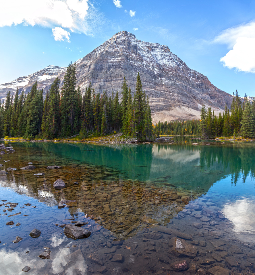
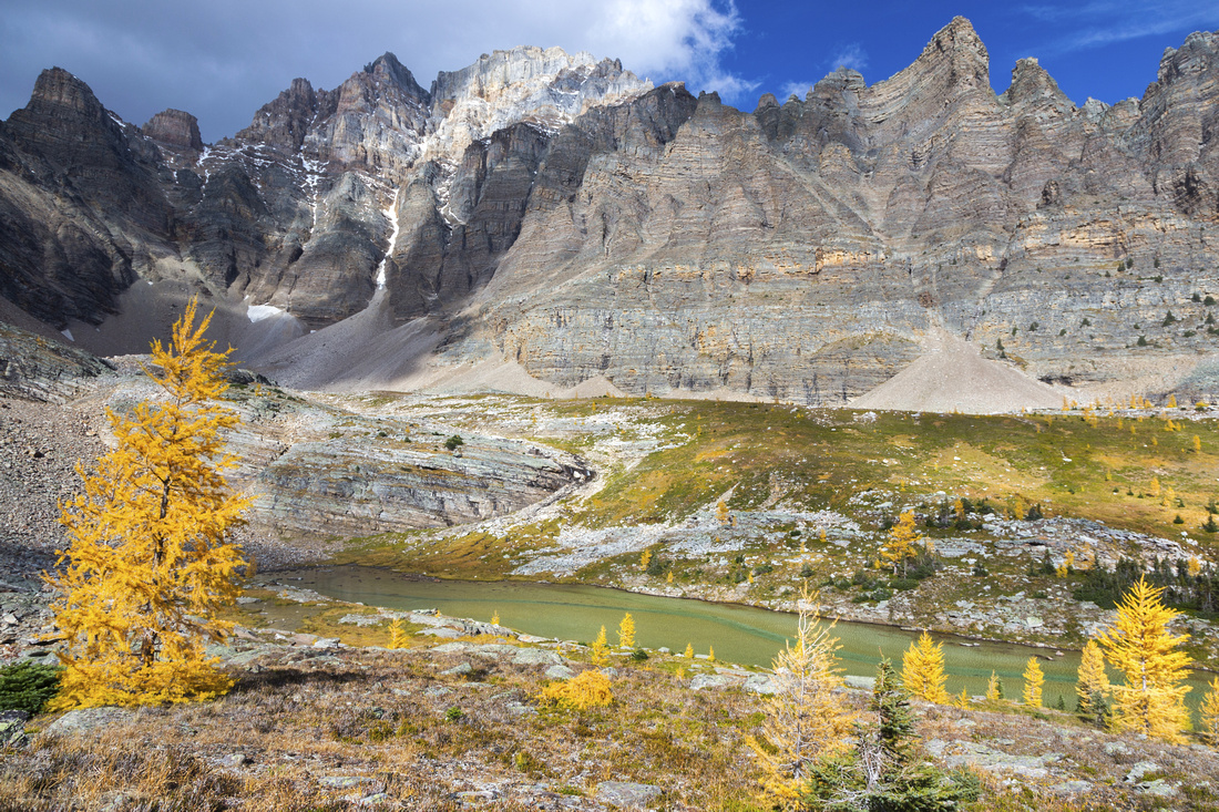
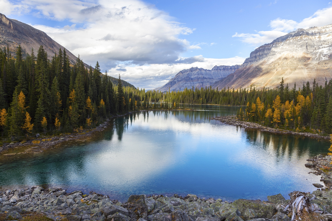
 Cathedral Lake Cathedral Lake
Cathedral lake below towering Mt. Odaray |
|||
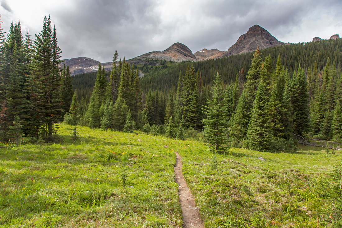
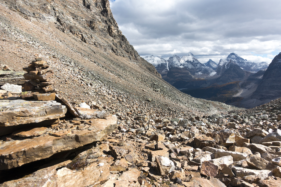
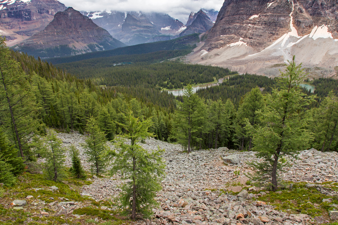 Cathedral Basin Trail Cathedral Basin Trail
Ascending Cathedral basin with O'Hara views behind |
|||
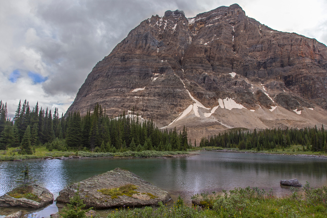
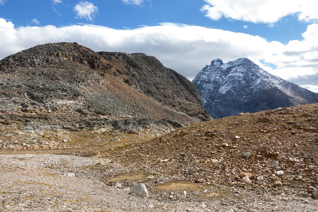
 Consummation Scramble Route Consummation Scramble Route
Consummation peak from Cathedral basin trail |
|||
 Consummation Backside Consummation Backside
View down north ridge of Consummation Peak |
|||
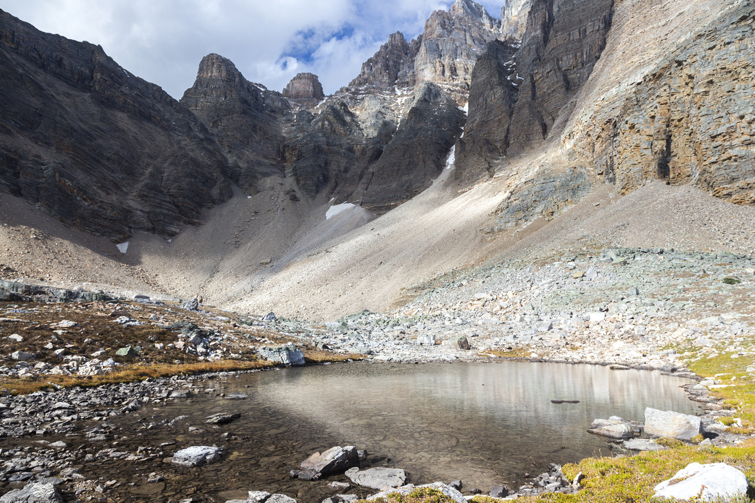
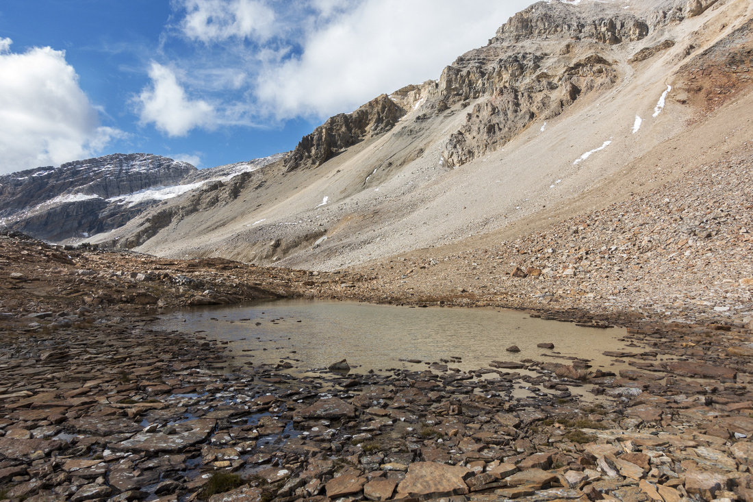 Consummation Tarn Consummation Tarn
Rarely visited 'Consummation Tarn' at backside of the Peak ('21 trip photo) |
|||
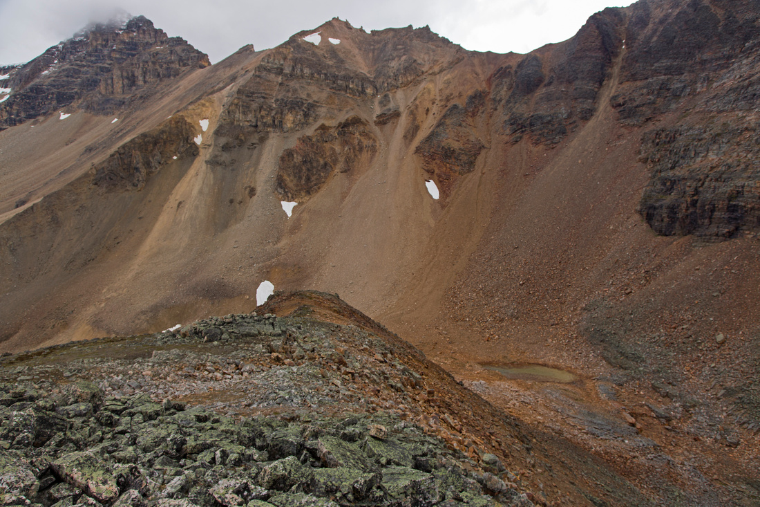
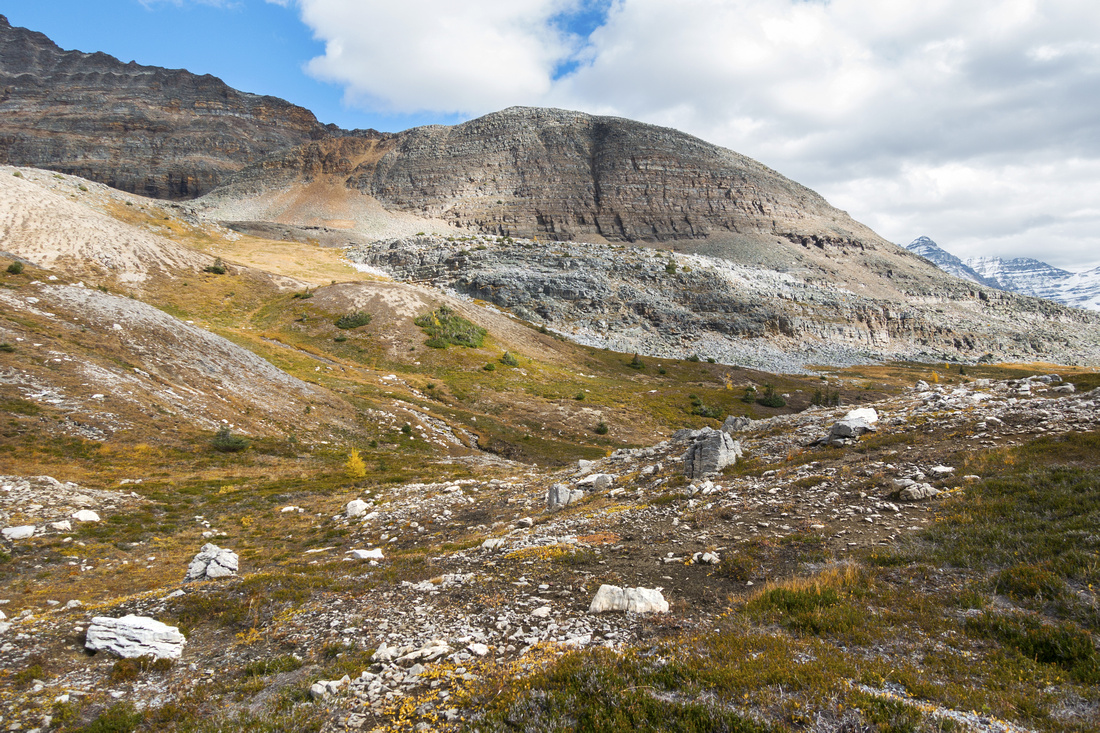
 Consummation Boulder Field
Top of awkward Consummation Boulder Field; aim generally in direction of bench lower center right ('21 trip photo) Consummation Boulder Field
Top of awkward Consummation Boulder Field; aim generally in direction of bench lower center right ('21 trip photo) |
|||
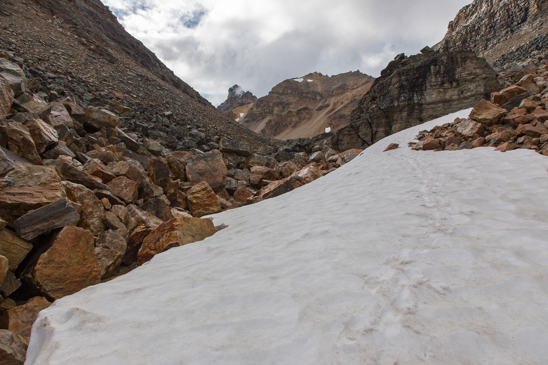 Consummation Boulder Field Consummation Boulder Field
Base of tricky boulder field; it will take ~30min of very focused work. Test every foothold before you commit |
|||
 Monica Lake Monica Lake
Monica lake basin dotted with larches ('21 trip photo) |
|||
 Monica Outlet
Crossing Monica Lake Outlet ('21 trip photo) Monica Outlet
Crossing Monica Lake Outlet ('21 trip photo) |
|||
 Monica Outlet Monica Outlet
Reflection of Mt. Odaray in small tarn by Monica lake outlet ('21 trip photo) |
|||
 |
|||
 |
|||
 |
|||
 Cathedral Tarn
Rarely visited tarn below Cathedral Mountain ('21 trip photo) Cathedral Tarn
Rarely visited tarn below Cathedral Mountain ('21 trip photo) |
|||
 Cathedral Basin
Aerial view of Cathedral basin and Monica Lake with towering Mt. Odaray on other side ('21 trip photo) Cathedral Basin
Aerial view of Cathedral basin and Monica Lake with towering Mt. Odaray on other side ('21 trip photo) |
|||
 Linda Loop Linda Loop
Linda Lake from loop trail connecting with Morning Glory Lakes ('21 trip photo) |
|||
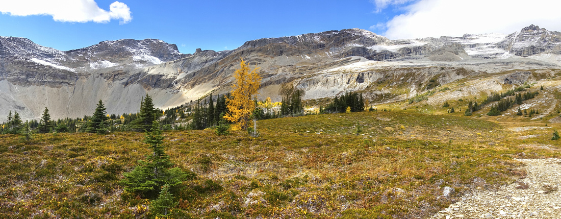 Duchesnay Basin
Alpine Meadow at end of Duchesnay Basin Trail / alternate access for Consummation Peak. Talus slope extreme center left provides mountaineering access for Duchesnay Pass and rarely ascended Duchesnay Peak ('21 trip photo) Duchesnay Basin
Alpine Meadow at end of Duchesnay Basin Trail / alternate access for Consummation Peak. Talus slope extreme center left provides mountaineering access for Duchesnay Pass and rarely ascended Duchesnay Peak ('21 trip photo) |
|||
 Consummation Peak
Easy grass hiking towards backside of Consummation Peak (upper center left) from head of Duchesnay Basin ('21 trip photo) Consummation Peak
Easy grass hiking towards backside of Consummation Peak (upper center left) from head of Duchesnay Basin ('21 trip photo) |
|||
 Consummation Backside
Backside of Consummation Peak after ascending grassy slopes from Duchesnay Basin. Mt. Odaray right of center ('21 trip photo) Consummation Backside
Backside of Consummation Peak after ascending grassy slopes from Duchesnay Basin. Mt. Odaray right of center ('21 trip photo) |
Abstract
| Overall Difficulty | D3(D5) | Trail hiking for Duchesnay and/or Cathedral Basin without Consummation Traverse (D3). Easy scramble on talus and lichen covered boulders for Consummation Peak. Traverse of entire ridge and return via boulder slope between Consummation and Cathedral prospect is lose and more difficult. | |||
| Snow Factor | S3 | Not a reasonable winter option due to length of approach | |||
| Scenery | Linda and Cathedral lakes. Great views of O'Hara area from Consummation. Monica lake below Cathedral dotted with larches | ||||
| Trail/Marking | Good / none | Official park trail to Cathedral basin with marked junctions. Sporadic cairns on Consummation south ridge. Exploratory and more difficult loop return | |||
| Suggested Time | 6 hr | Return time from O'Hara road or campground, including visit to Monica basin. Add 3 hours if walking O'Hara access road | |||
| Elevation | Start: 1930m Max: 2554m Total: ~800m (O'Hara road) | Round Trip: 17km (O'Hara road) | |||
| Gear | Hiking boots and poles. Gaiters helpful on south ridge talus slope | ||||
| Water | Duchesnay and Morning Glory creeks, Monica lake outlet. No water source along Consummation ridge. 1-2L is enough | ||||
| Dog Friendly | Yes | Lose talus slopes should not present the problem. Bears frequent Cathedral/Duchesnay basins | |||
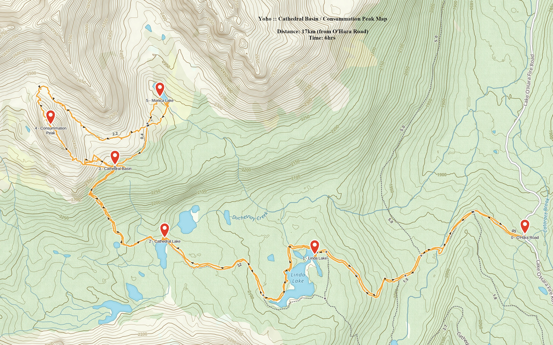 Cathedral Basin / Consummation Peak GAIA Map
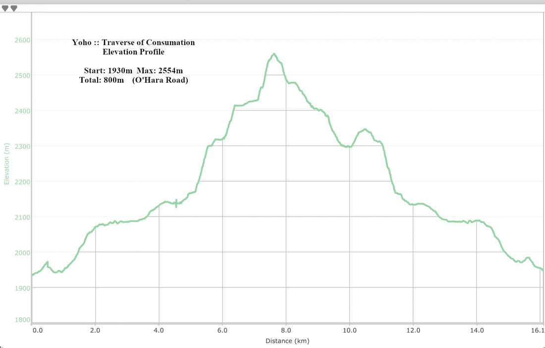 Cathedral Basin / Consummation Peak Elevation Profile