Google Map |
Rockies :: Yoho :: Lake McArthur and Mt. Schaffer |
GPS Track |
|
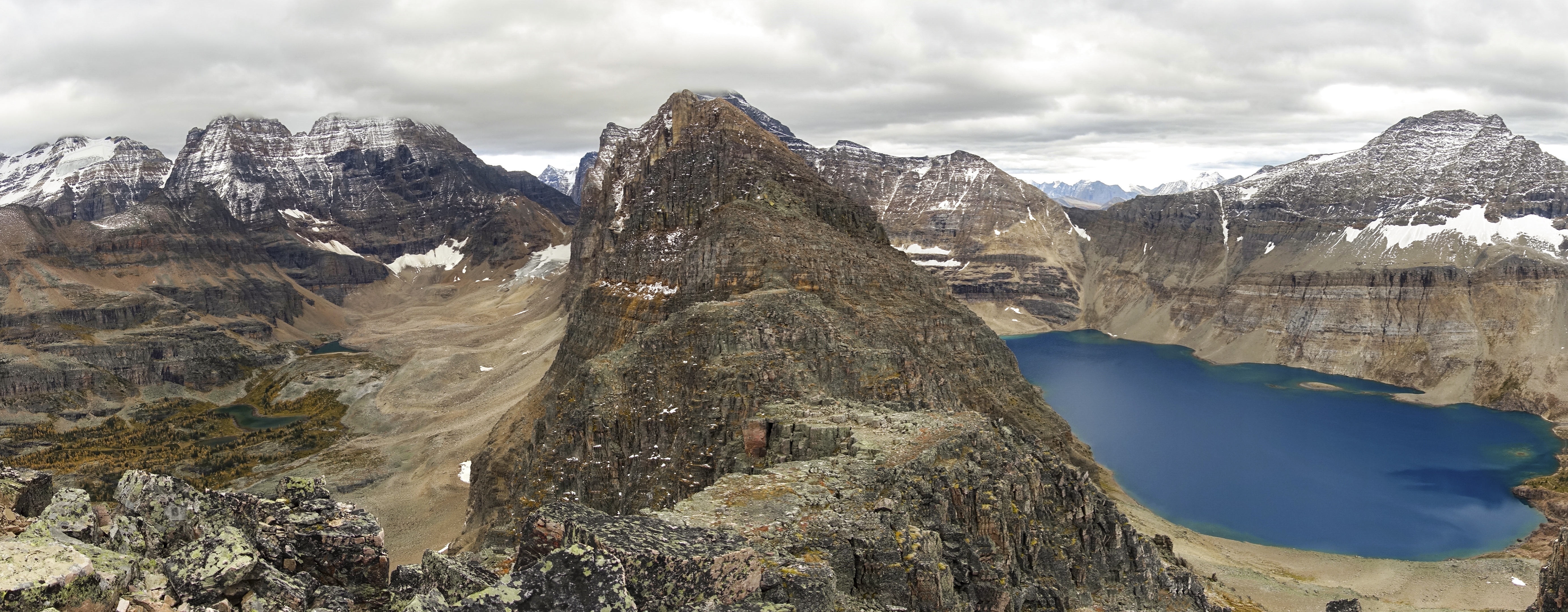
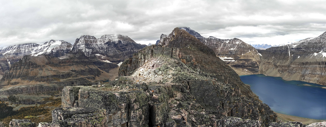
Panoramic view from Mt. Schaffer, looking south at first part of Biddle Horseshoe. Lake McArthur right with Park Mountain above, Opabin Plateau left |
|||
| Trip Summary | |||
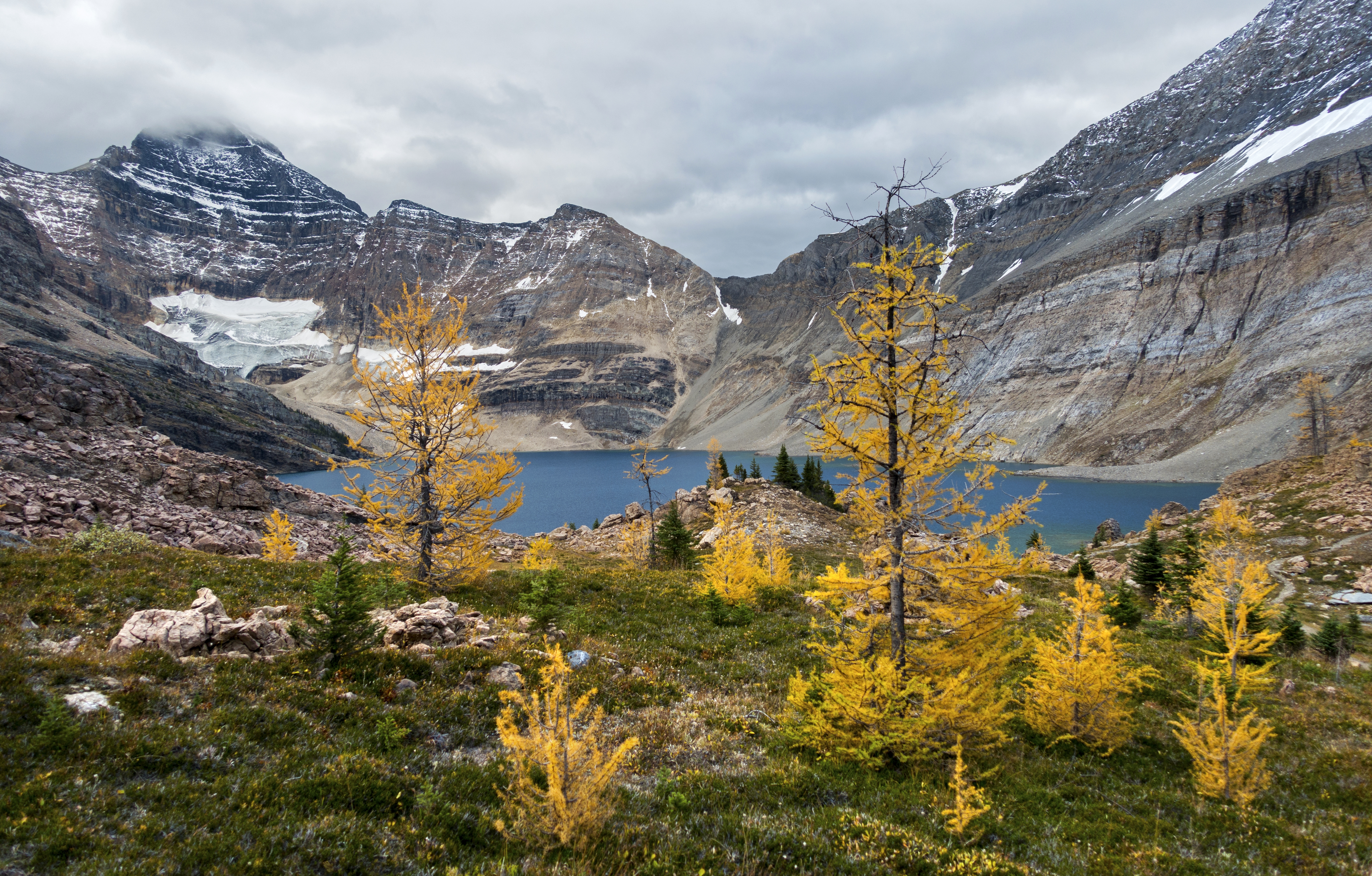
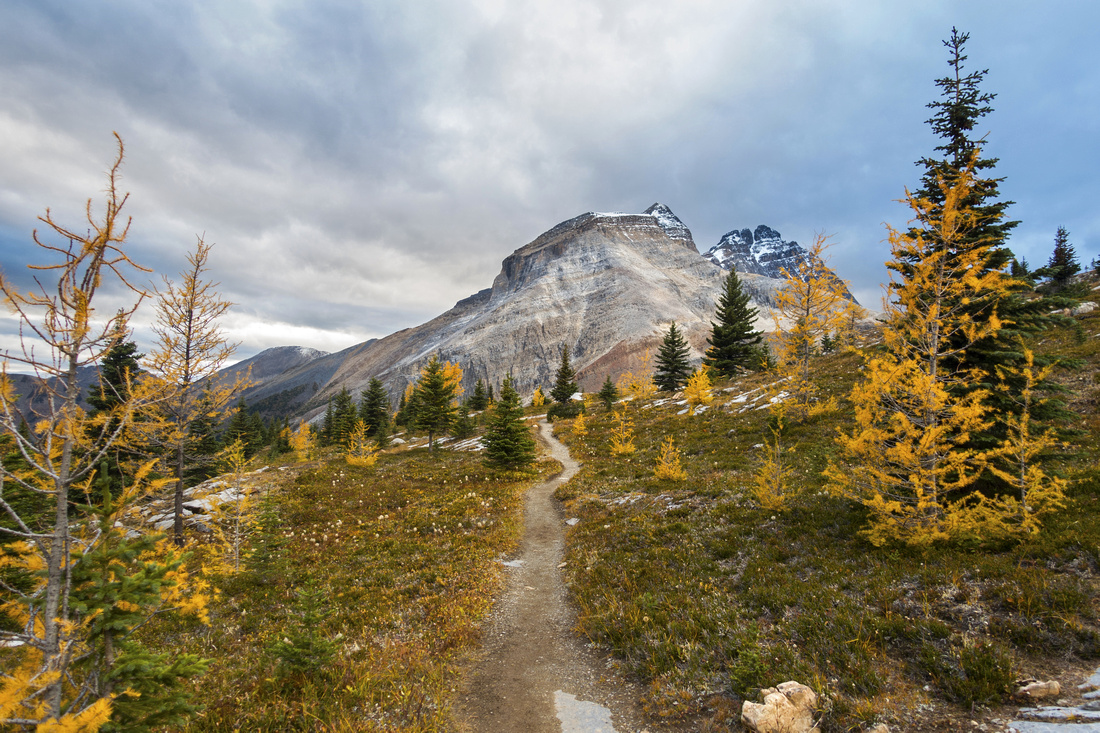
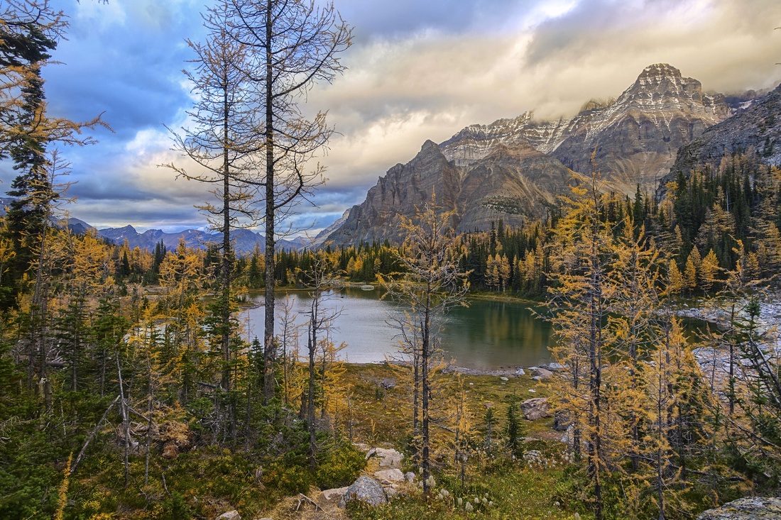
September 29, 2020Lake McArthur is the largest in O'Hara basin and perhaps the most beautiful. It is fairly undemanding hike from Lake O'Hara and return time should not exceed 3 hours, making it perfect candidate when time is short and/or not being able to secure access shuttle bus. Continuing to Mt. Schaffer is more involved, but still feasible as day hike and within domain of competent scrambler. Scenery is amazing, just like anywhere else in O'Hara area, and larches at Schaffer Lake in late September are particularly spectacular.
From end of O'Hara access road by Le Relais shelter, take signed Lake McArthur trail starting opposite Ranger station. Within 5 minutes trail enters expansive meadow (take right fork at "Big Larches Junction") and reaches Elizabeth Parker ACC Hut. Continue straight past Cathedral basin junction then switchback up to Schaffer Lake; major highlight of the day. Note huge grass/talus slope above the lake (gallery pic); some people use this as alternate approach for Mt. Schaffer, but this slope is very steep near the top and not recommended, even for descent. It is much better to enjoy gentle Lake McArthur trail instead. Continue straight towards Odaray junction, then take left turn for McArthur Pass by the sign. Reaching the Pass trail splits into high and low route. Low route is probably prettier but loses bit of elevation; high route traverses boulder slopes above with one or two steps that might call for use of hands and is beautifully engineered. Distances are short and both options are well worth trying out, in a loop perhaps. They eventually join up at end of larch dotted terrace gently sloping down to Lake McArthur.
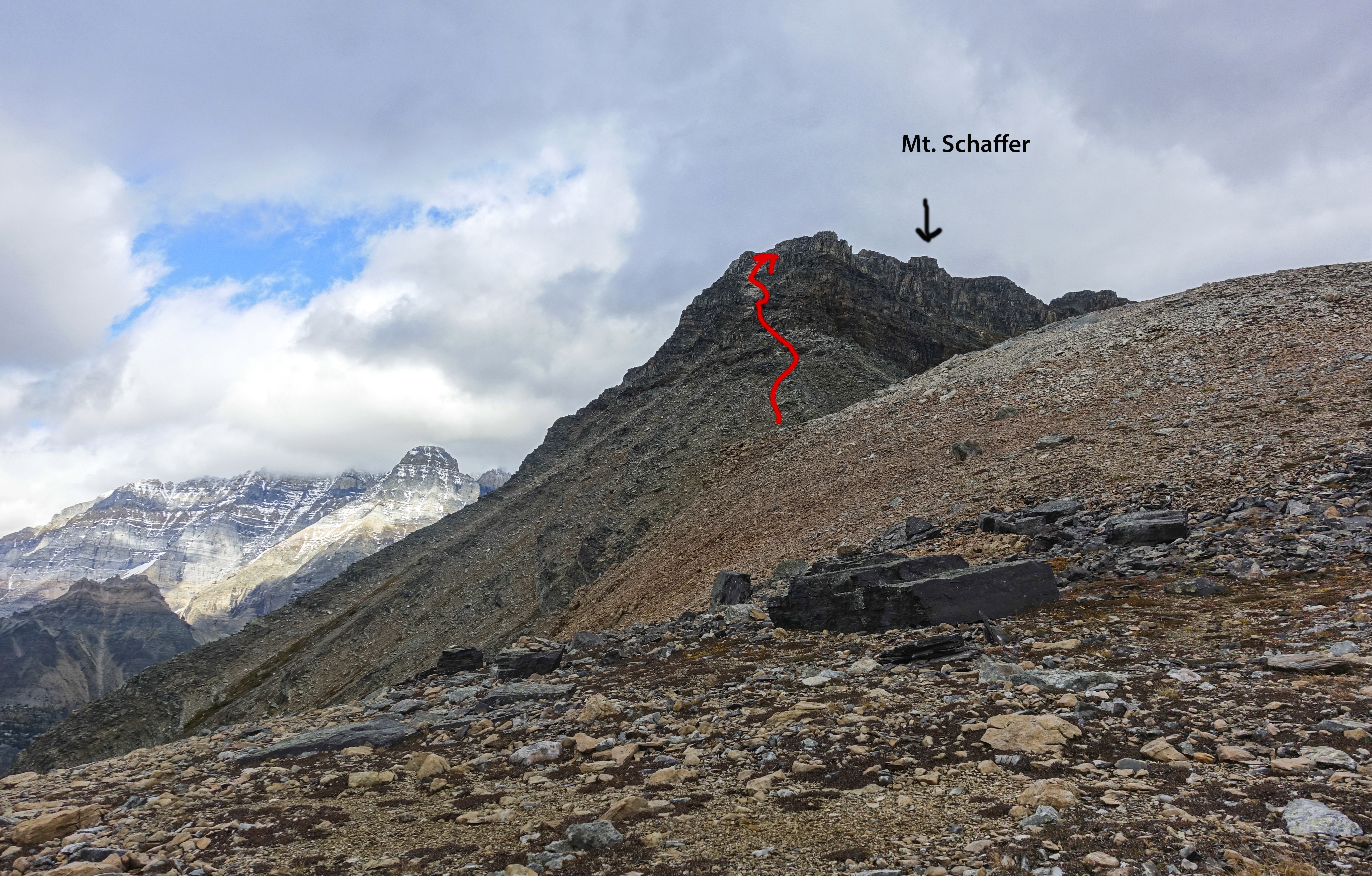
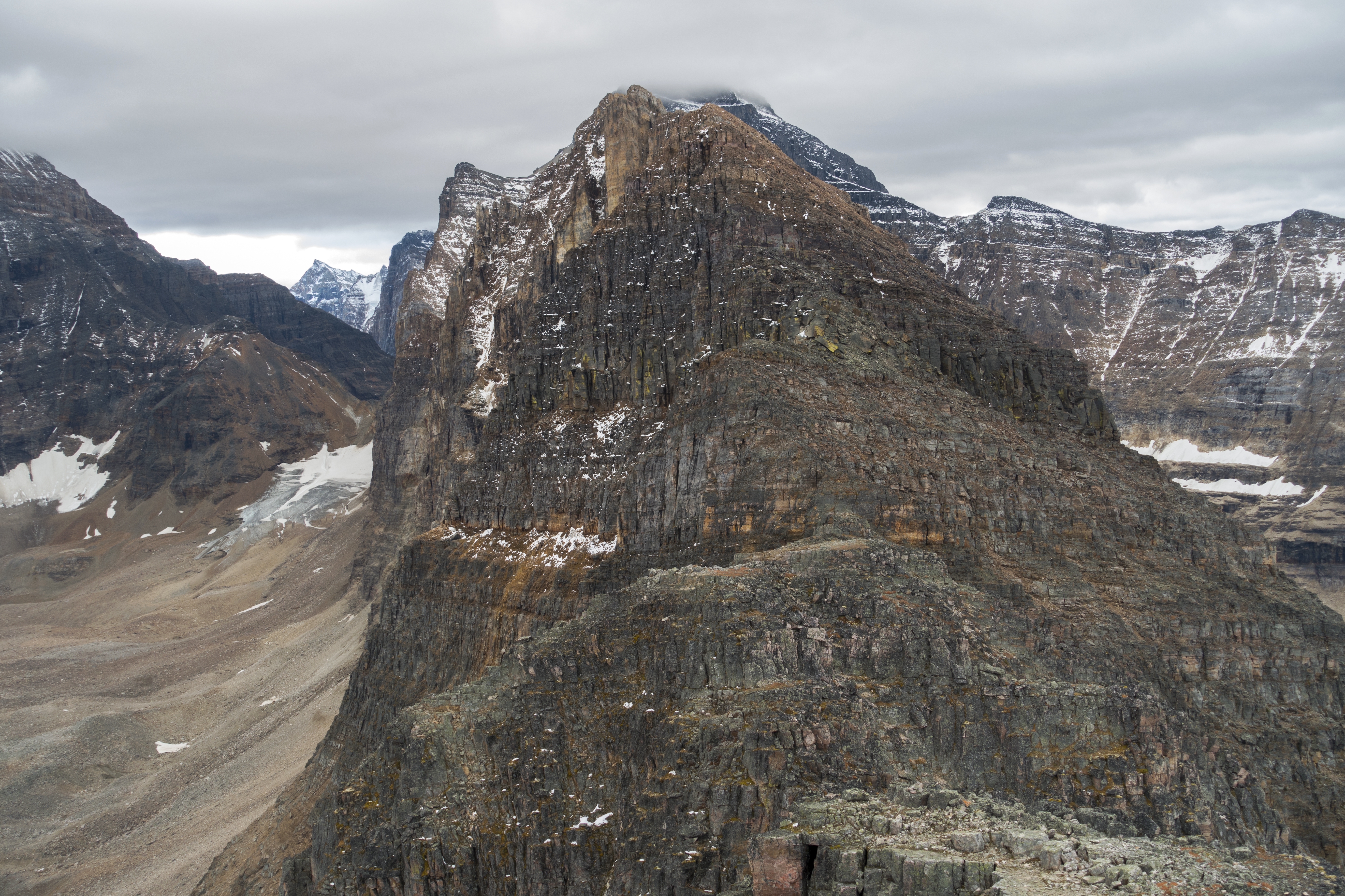
Mt. Schaffer is directly above the lake on left (east) side. It is actually beginning of horseshoe ridge circling high above entire McArthur basin, with towering Mt. Biddle, often beautifully reflected in still McArthur water, being the main prize. This horseshoe is technical, but hikers/scramblers can still explore the first part. Hike up grassy slopes initially transitioning into talus (trail) and eventually topping up on terrace above. Even if not going all the way up it is more than worth getting at least here as aerial views of McArthur basin are nothing short of spectacular. Continue on cairned trail towards Mt. Schaffer. This trail does not always lead in best direction and sections are a bit lose. Staying on crest in lower part works best, then swing climber left when it becomes too steep. Only real scramble bit is class 3 when tackled head on, but it can easily be bypassed on climber right via semi-exposed ledge. Rest is easy and within an hour from Lake McArthur you should reach ridge start. Alpine route from All Souls Prospect joins here (5.6). Summit is ~10 minutes away and is easy scrambling only. 3m rock wall barres the progress, but is easily overcome via little chimney on left side (gallery, class 2). Next bump is the summit; circle on right (west) side then easily clamber up bits of trail to summit cairn and register. Views are spectacular, in particular aerial panorama of Lake O'Hara deep below. It is possible to continue for another 10-15 minutes from the summit, but steep technical wall that requires rope will bare the progress. Return the same way, resisting urge to shortcut directly to Schaffer Lake. |
|
Gallery |
|||
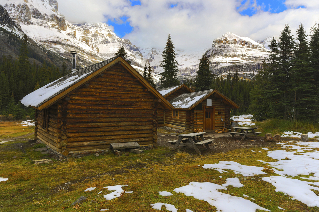 Elizabeth Parker ACC Hut Elizabeth Parker ACC Hut Elizabeth Parker Alpine Club of Canada Hut with snowy Yukness Mtn (right) and Mt. Huber (left) in background
 |
|||
 |
|||
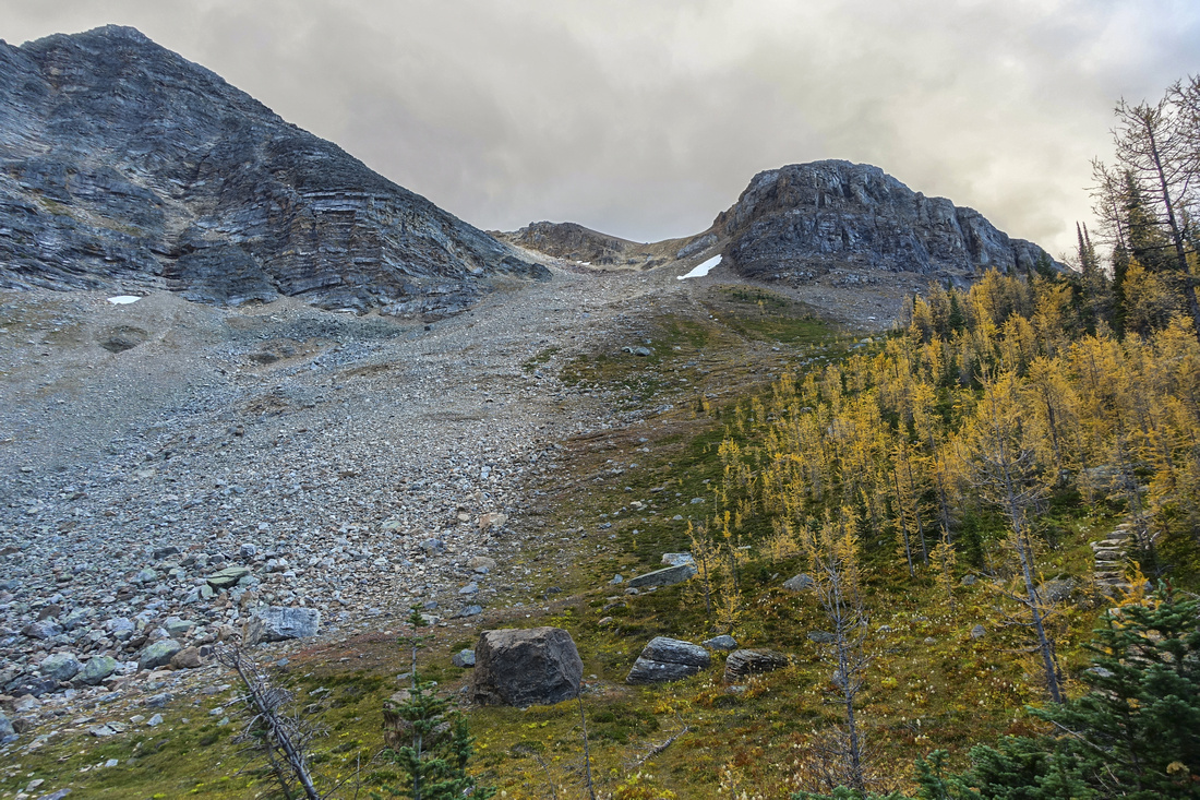 Alternate Mt. Schaffer Approach
Mix grass/talus slope above Schaffer Lake, an alternate approach for Mt. Schaffer - not recommended due to brutally steep part near the top. Far better to follow standard Lake McArthur Trail Alternate Mt. Schaffer Approach
Mix grass/talus slope above Schaffer Lake, an alternate approach for Mt. Schaffer - not recommended due to brutally steep part near the top. Far better to follow standard Lake McArthur Trail |
|||
 |
|||
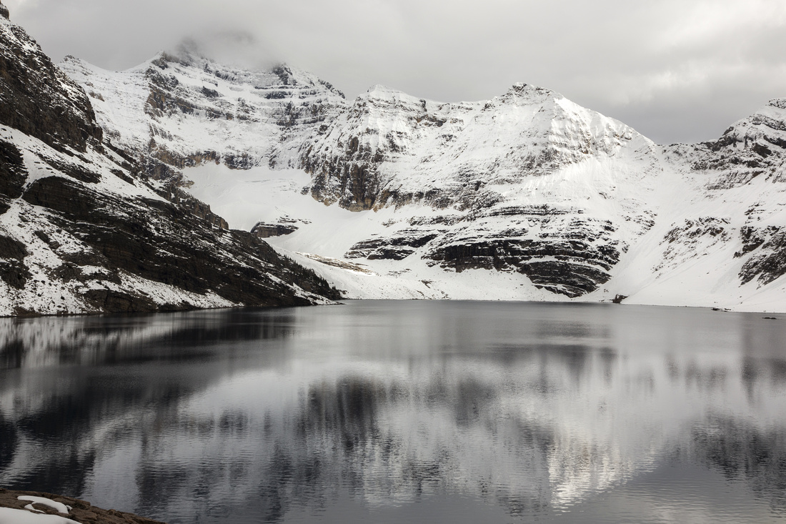 Lake McArthur
Monochrome telephoto across Lake McArthur and Mt. Biddle (Picture taken on a previous year trip) Lake McArthur
Monochrome telephoto across Lake McArthur and Mt. Biddle (Picture taken on a previous year trip) |
|||
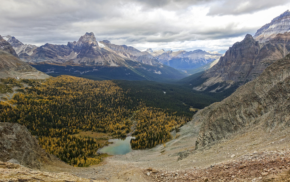
 McArthur Basin Panorama
Panoramic view back to McArthur basin while hiking lower grassy slopes of Mt. Schaffer McArthur Basin Panorama
Panoramic view back to McArthur basin while hiking lower grassy slopes of Mt. Schaffer |
|||
 Schaffer Lake Basin
View down alternate access route from Schaffer Lake; steep part is near the top in bottom part of photo Schaffer Lake Basin
View down alternate access route from Schaffer Lake; steep part is near the top in bottom part of photo |
|||
 |
|||
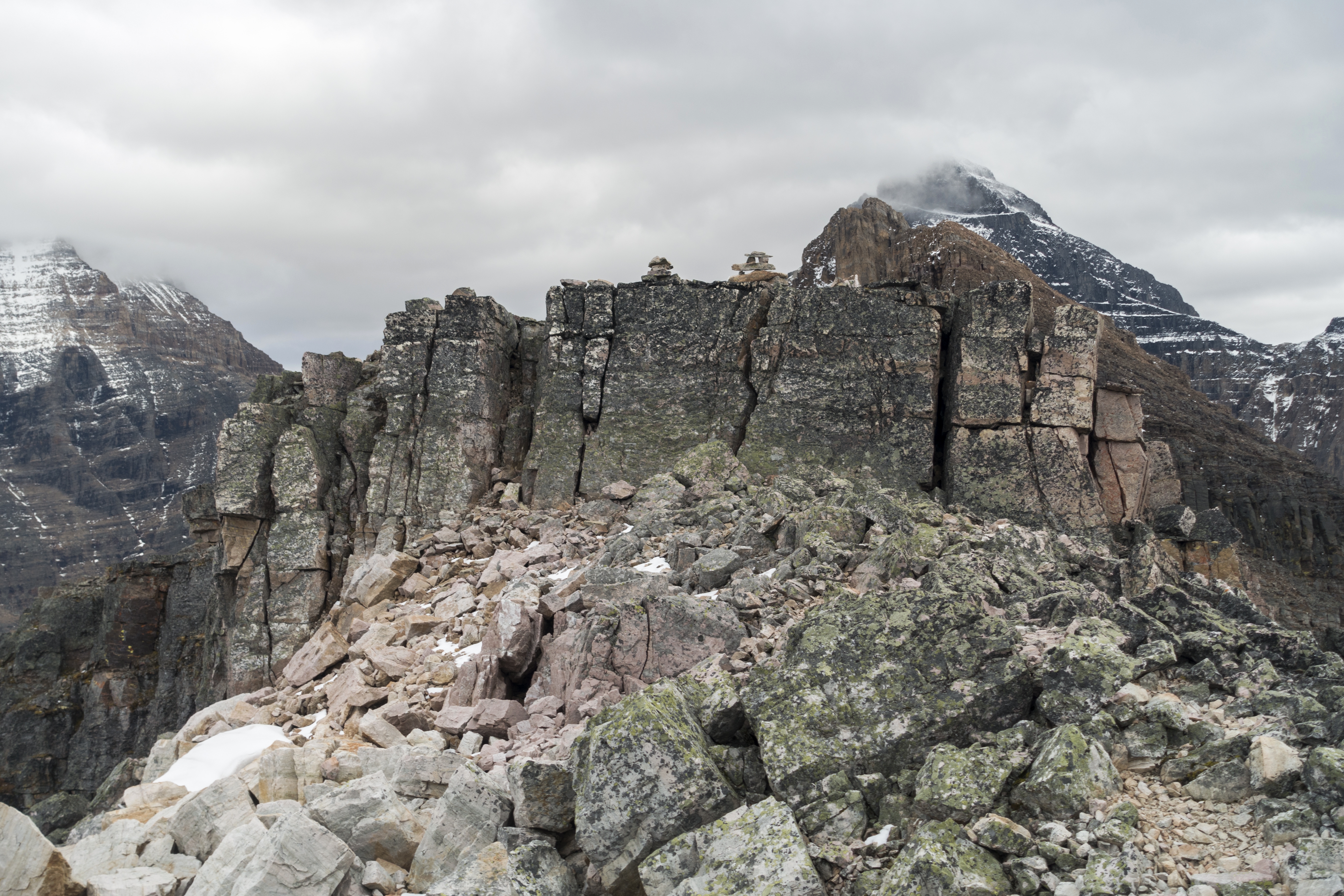
 Mt. Schaffer Ridge
Panoramic View south after topping up on Mt. Schaffer ridge and first part of Mt. Biddle horseshoe. Summit is ~10 minutes away Mt. Schaffer Ridge
Panoramic View south after topping up on Mt. Schaffer ridge and first part of Mt. Biddle horseshoe. Summit is ~10 minutes away |
|||
 |
|||
 |
|||
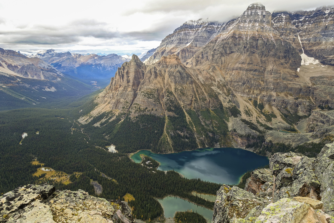 Lake O'Hara Aerial View
Aerial View of Lake O'Hara deep below Mt. Schaffer summit. Wiwaxy peaks and Mt. Huber on the other side Lake O'Hara Aerial View
Aerial View of Lake O'Hara deep below Mt. Schaffer summit. Wiwaxy peaks and Mt. Huber on the other side |
|||
 |
|||
 Lake McArthur Trail
Hiking out after descent via upper Lake McArthur trail. Little Odaray and Mt. Odaray behind Lake McArthur Trail
Hiking out after descent via upper Lake McArthur trail. Little Odaray and Mt. Odaray behind |
|||
 Schaffer Lake
 from alternate descent from upper McArthur trail Schaffer Lake
Schaffer Lake from alternate descent from upper McArthur trail |
Abstract
| Overall Difficulty | D2(5) | Easy maintained trail hiking with couple of rocky sections to Lake McArthur (D2). Class 2 scramble with some lose sections and one easy chimney climb for Mt. Schaffer (D5) | |||
| Snow Factor | S2(4) | Some avalanche danger in upper part of McArthur trail (S2). Springtime ascent of Mt. Schaffer is sometimes done from Elizabeth Parker Hut overnight base, but it requires stable snow (S4) | |||
| Scenery | Schaffer Lake on approach in a pretty larch forest. Beautiful McArthur lake surrounded by Biddle Horseshoe. Aerial view of entire O'Hara basin from Mt. Schaffer | ||||
| Trail/Marking | Very Good / None | Official park trail with marked junctions to Lake McArthur, route with cairns for Mt. Schaffer | |||
| Suggested Time | 6 hr | Return time from Lake O'Hara; 3 hrs is sufficient if going just to Lake McArthur | |||
| Elevation | Start: 2025m Max: 2690m Total: ~750m (O'Hara - Mt. Schaffer) | Round Trip: ~11km (O'Hara - Mt. Schaffer) | |||
| Gear | Full Hiking boots and poles. Gaiters helpful for Mt. Schaffer talus slope. Helmet recommended in a group | ||||
| Water | Couple of creeks on Lake McArthur trail, none for Mt. Schaffer (possible snow patches). Carry ~1L | ||||
| Dog Friendly | Yes | Standard back-country travel precautions. Note that dogs are not allowed on Lake O'Hara bus & you will have to walk the road both ways if you bring the dog | |||
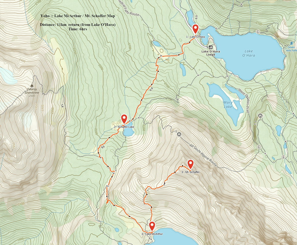 Lake McArthur - Mt. Schaffer GAIA Map
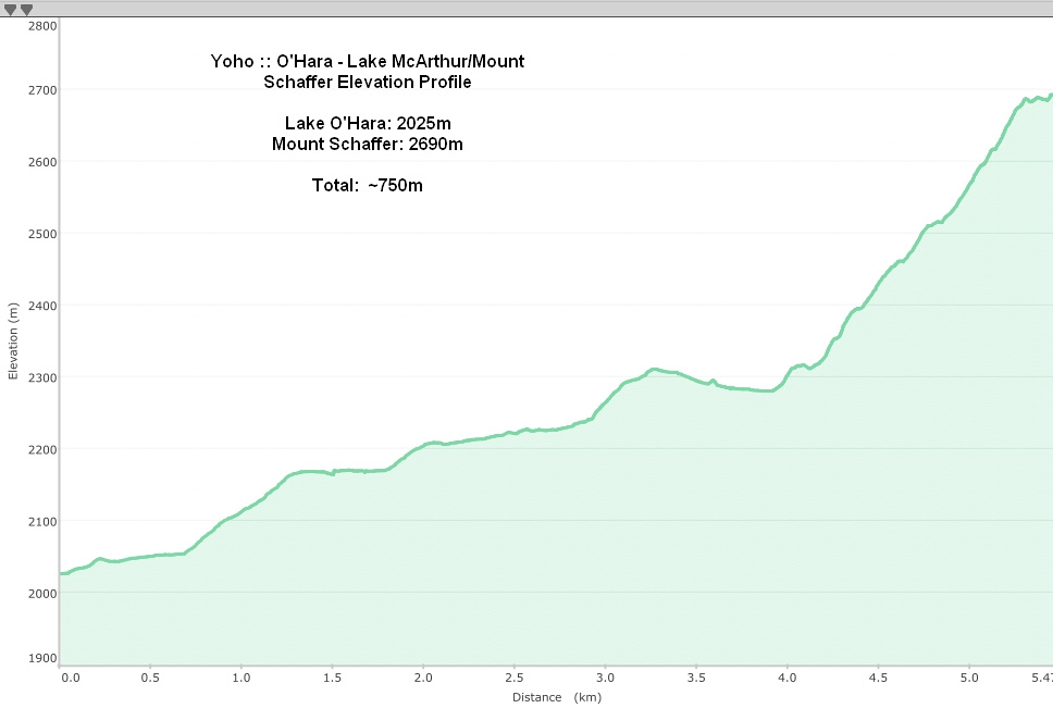 Lake McArthur - Mt. Schaffer Elevation Profile