Google Map |
Rockies :: Banff-Louise ::Eiffel Lake - Wenkchemna Pass |
GPS Track |
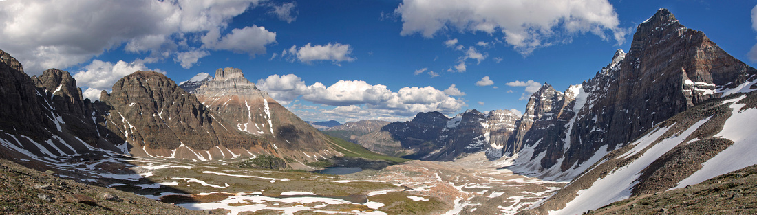 
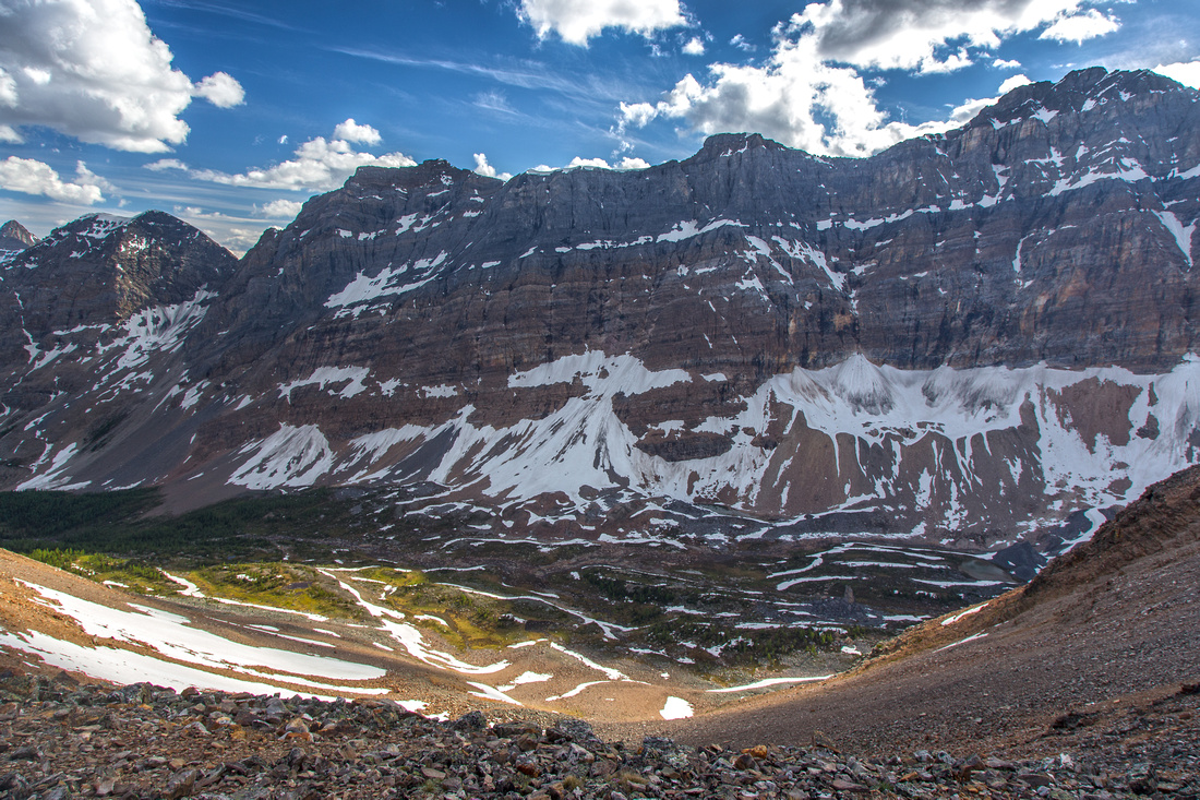
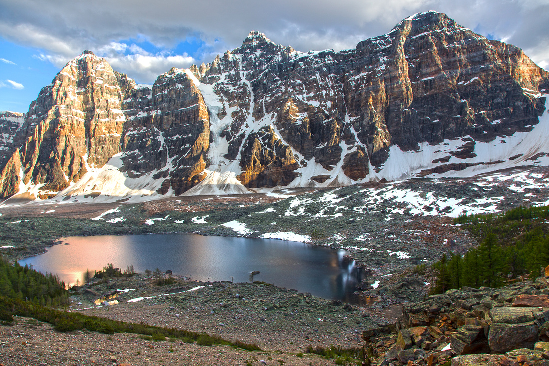
Panoramic view of Valley of Ten Peaks from 2610m windswept Wenhchemna Pass |
|||
| Trip Summary | |||
June 22, 2015
Valley of Ten Peaks is one of most recognizable areas in Banff National Park. Picture of Moraine Lake used to be on 20-dollar Canadian bill for a long time. As such it is also one of most popular - in summer season parking is very hard to find, and vehicles often can often be found at side of Moraine access road for kilometers before the lake. During the prime larch season in 2nd half of September road often gets closed and park shuttles visitors from overflow parking couple of kilometers before Lake Louise turnoff from Trans-Canada (common practice in most popular US National Parks such as Yosemite, Arches, Zion, etc.)
Several prime hiking trail radiate from Moraine Lake parking lot. Parks Canada impose group of 4 restriction for months of July - October. This is hardly necessary since area is so busy any bears have left long time ago. If by yourself or in small group during these months, common practice is to simply tag along with someone to the alpine. Note that in winter Moraine road is not plowed; whole area falls back to nature undisturbed by humans. Cross-country skiing from Lake Louise to Moraine Lake is quite popular in these months.
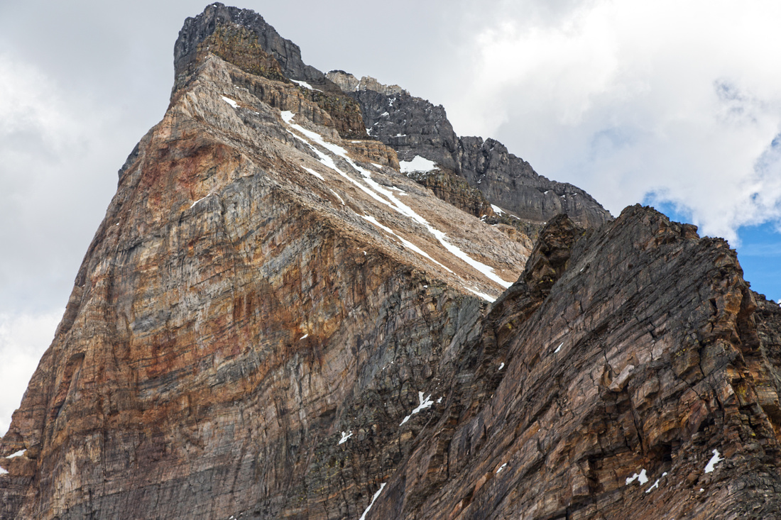
Wenkchemna Pass is high alpine saddle between Mt. Neptuak and Wenkchemna Peak (Peaks 9 and 10) at top of the valley. Maintained park trail climbs above Moraine Lake to junction with Larch Valley/Sentinel Pass, then traverses below slopes of Eiffel Peak and Mt. Wastach to upper valley. Some people hike just to eiffel lake, but it is worth continuing to the pass which is farther away than it looks. Slopes below the pass hold snow till mid summer. On the other side of the pass rough trail drops down to Prospector Valley then links via Opabin Pass with Lake O'Hara in Yoho National Park. Note that other side of Opabin Pass holds pocket glacier and is not hiking anymore if you should attempt such traverse. Other options from the pass include scrambling up the ridge of either Wenkchemna Peak (#10) or Mt. Neptuak (#9). Both are initially scrambles, but progressively become more and more difficult. Attaining the summit is in the realm of rock climbers, but it is recommended to climb at least a bit above the pass for ever improving views. Highly recommended day trip in Louise area, but don't expect solitude.
Note: As of summer '23, driving to Moraine Lake is not allowed anymore. Parks Shuttle, Tour Buses or Cycling are alternatives. |
|
Gallery |
|||
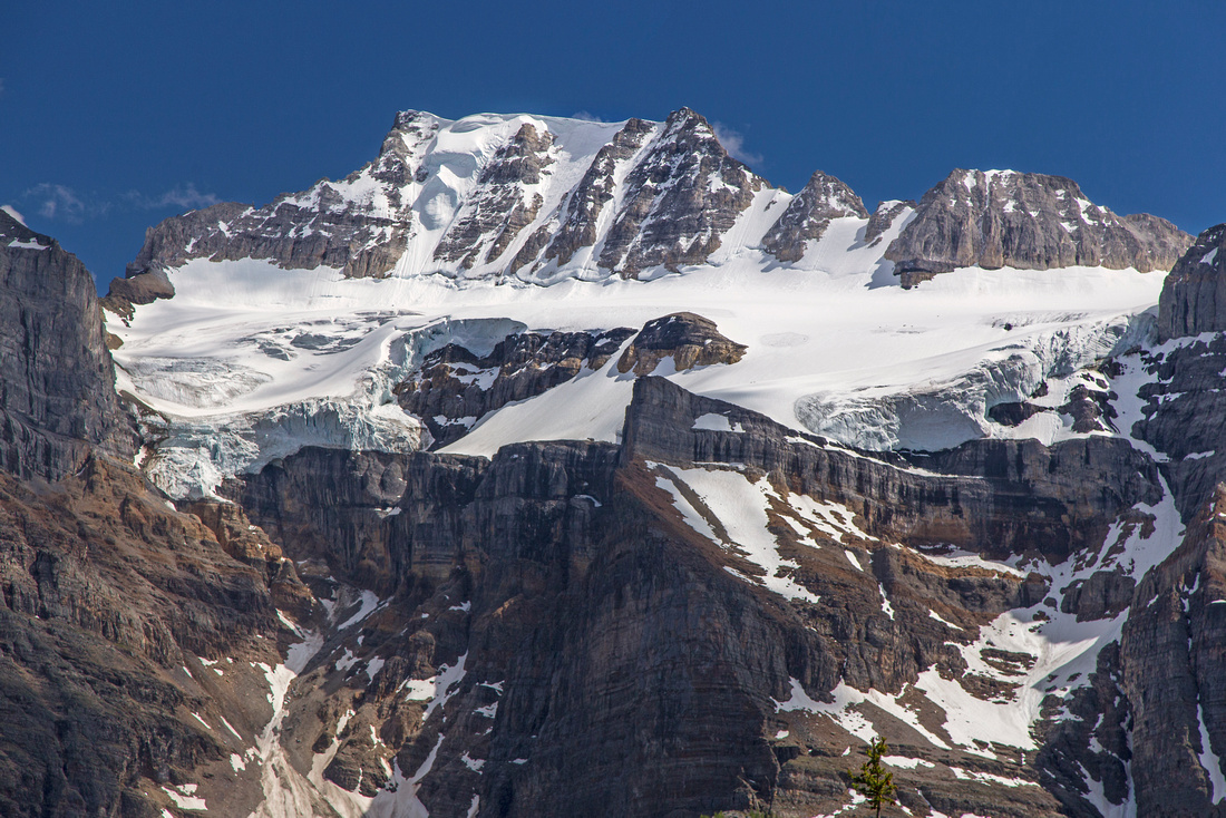 View of Fay glacier 15 min past Larch Valley Junction
 |
|||
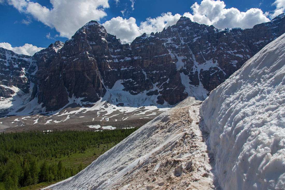 Crossing avalanche slopes below Eiffel peak
 |
|||
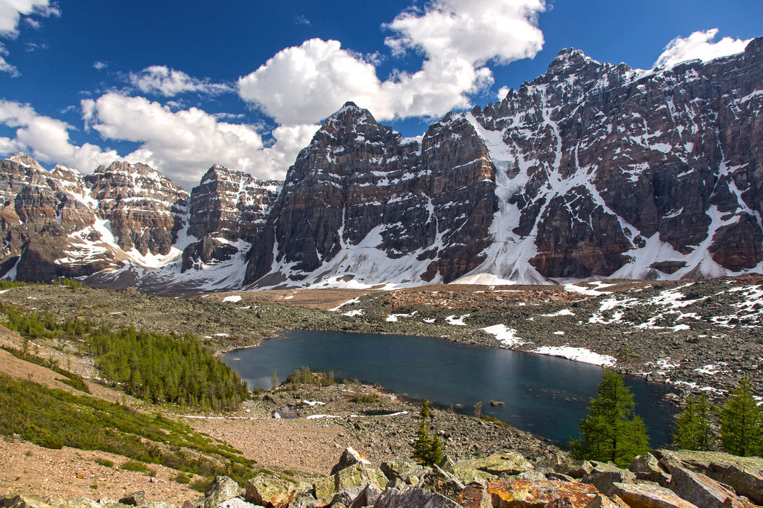 Classic view of Eiffel lake framed by Ten Peaks
 |
|||
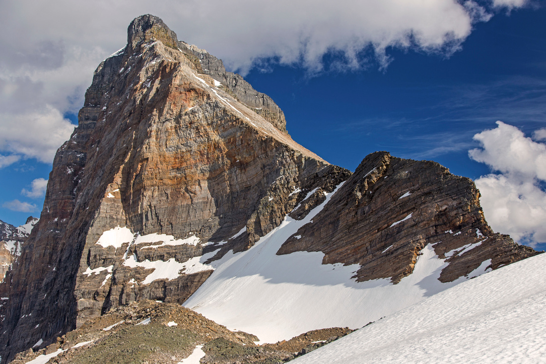
 Telephoto of Mt. Deltaform - arguably most recognizable of the Ten Peaks
 |
|||
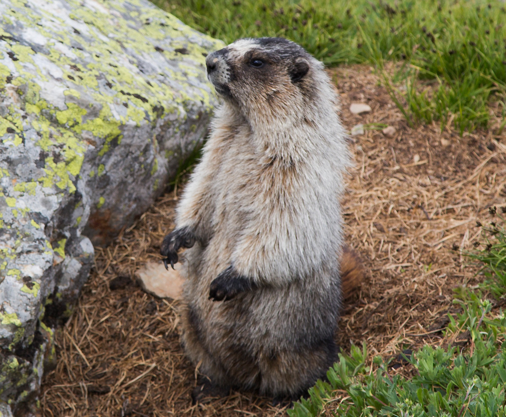 Marmots in upper valley - they will steal your lunch!
 |
|||
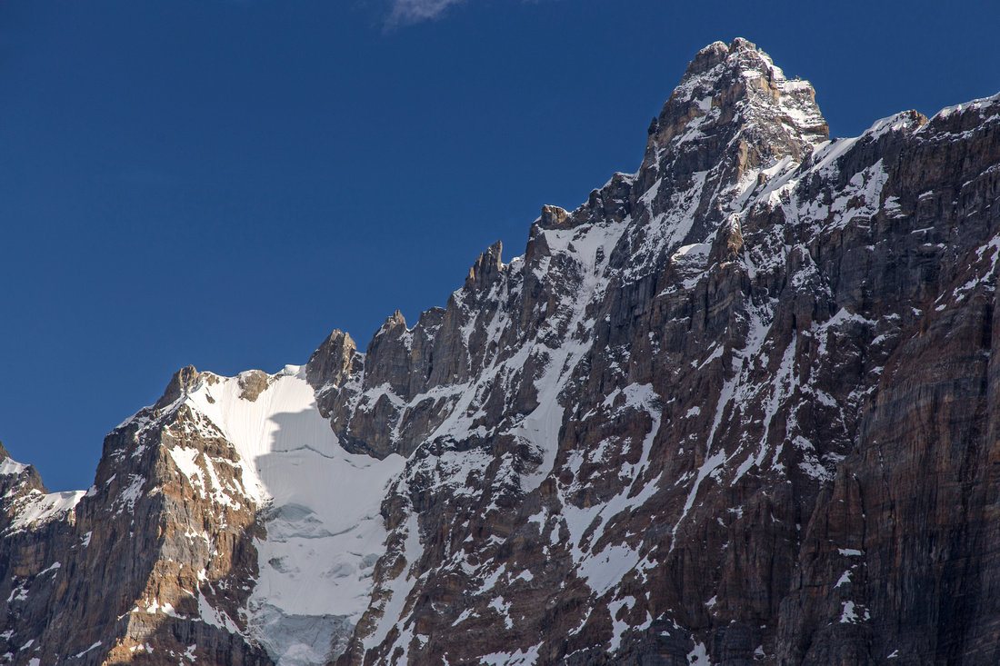
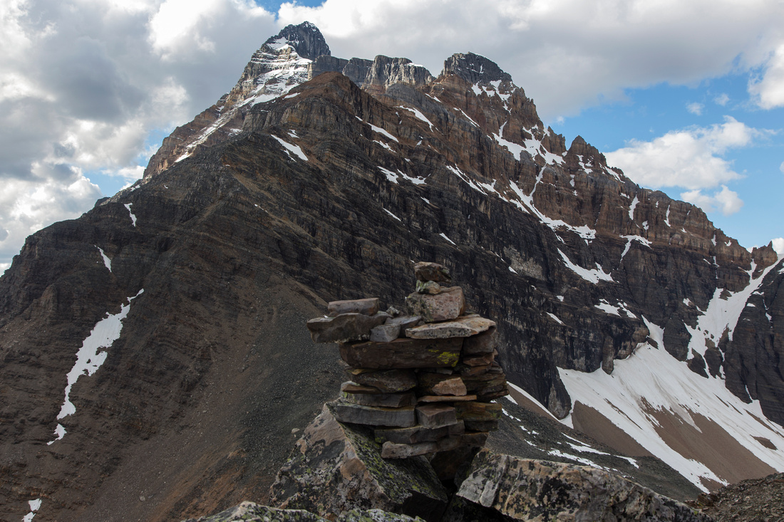
 Mt. Neptuak (Peak #9) from Wenkchemna Pass
 |
|||
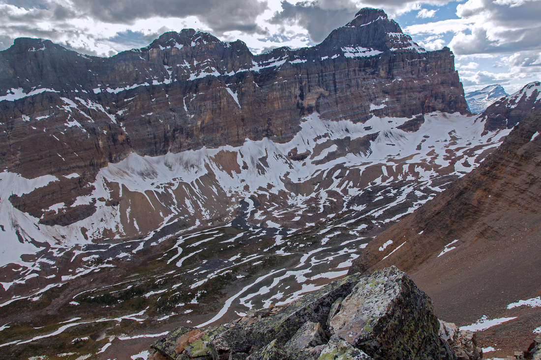
 Prospector Valley at other side of Wenkchemna Pass
 |
|||
 Wenkchemna Peak and Mt. Hungabee from Neptuak ridge
 |
|||
 Prospector Valley and Opabin Pass from Neptuak ridge
 |
|||
 Upper Neptuak ridge - not a scramble anymore
 |
|||
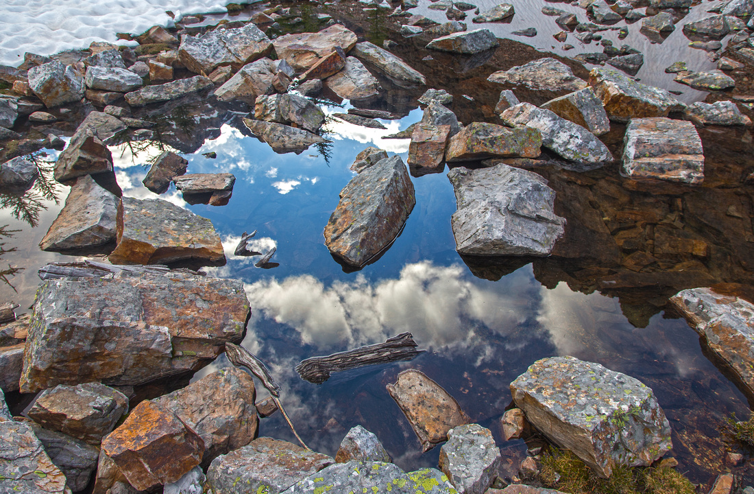 Trailside tarns near Eiffel lake - perfect spot for a break
 |
|||
 Late afternoon shot of Eiffel lake on return
 |
Abstract
| Overall Difficulty | D3/D4 | Gentle trail hiking. Crossing of avalanche slopes below Eiffel peak. Some steeper sections below the pass with possibility of snow till mid-summer. Optional scramble on each side of the pass | |||
| Snow Factor | S3 | Winter trips not likely as Moraine lake road is not plowed. Avalanche slopes below Eiffel peak | |||
| Scenery | Fantastic scenery throughout. One of best places in fall larch season, but also most popular - expect company | ||||
| Trail/Marking | Excellent | Well defined and marked park trail to the pass | |||
| Suggested Time | 7 hr | Return time for Wenkchemna Pass, without exploring ridges on both side. Hiking just to Eiffel Lake is ~4 hr return trip | |||
| Elevation | Start: 1860m Max: 2610m Total: ~850m (Wenkchemna Pass) | Round Trip: ~19km | |||
| Gear | Light hikers when dry. Full boots and gaiters early in summer due to snow patches in upper valley | ||||
| Water | Drainages off Eiffel and Wastach peaks. Several creeks in upper valley. Carry 1-2L | ||||
| Dog Friendly | Yes | Standard griz country precautions. Please keep dogs on leash! | |||
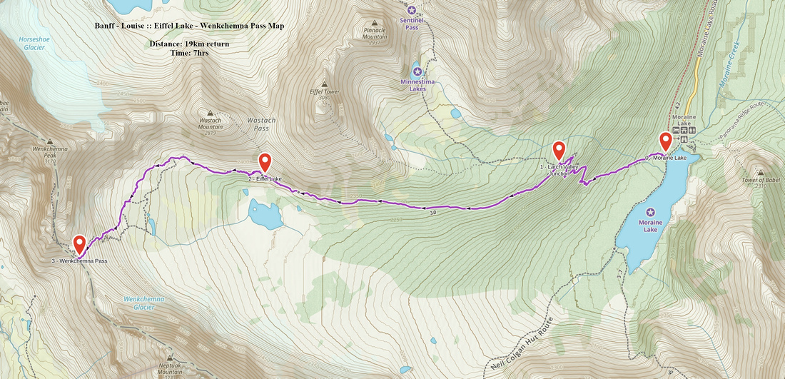 Eiffel Lake - Wenhchemna Pass GAIA Map
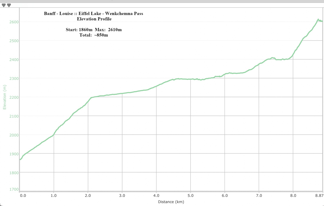 Eiffel Lake - Wenkchemna Pass Elevation Profile