Google Map |
Rockies :: Kananaskis :: Snow Peak |
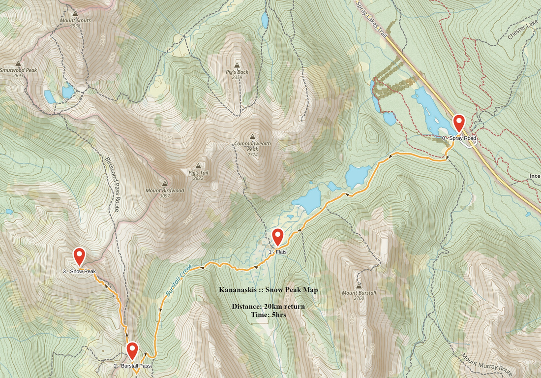
GPS Track |
|
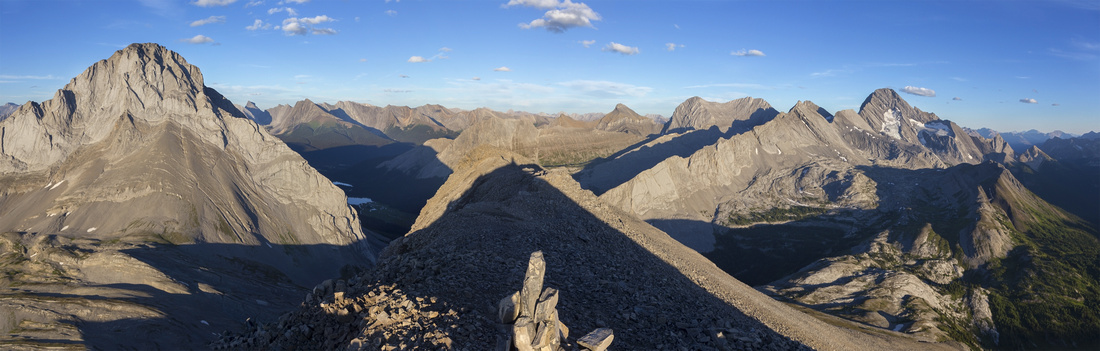
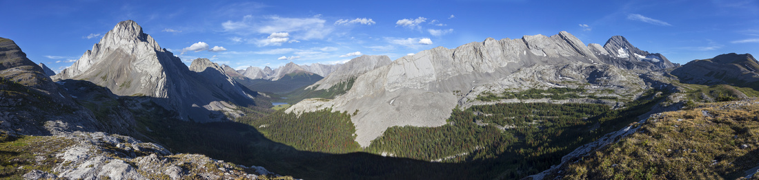
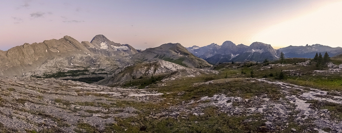
Panoramic view east from Snow Peak summit. Burstall Pass environs lower right, Sir Douglas above. |
|||
| Trip Summary | |||
Aug 30, 2022Snow Peak is great easy ascent in scenic Burstall Pass environs. Mid to late September is optimal time because of abundant golden larches. The pass itself is popular and crowded hike, but solitude can be found by heading higher and gaining 2790m high summit without any real problems. Crux of the day might as well be driving horrible Spray road with waves of potholes and waterbars that despite constant grading gets worse every year. Some people climb Snow Peak year-round, but there is considerable avalanche danger in winter/spring -incl. Burstall pass approach itself- so snow conditions must be stable.
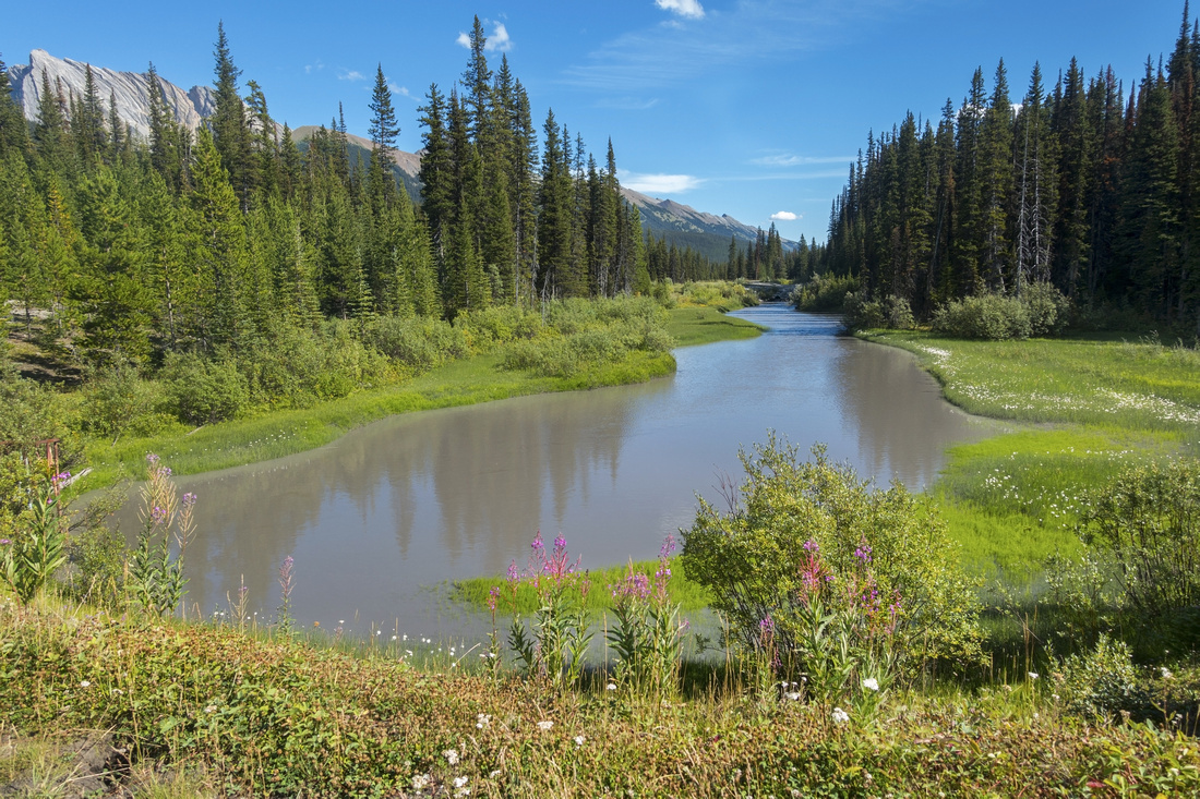
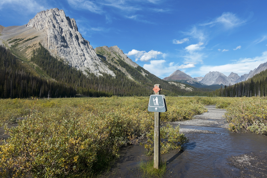
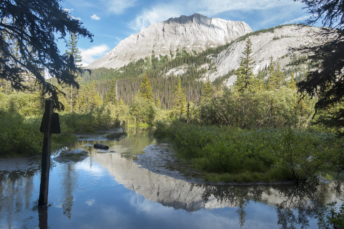
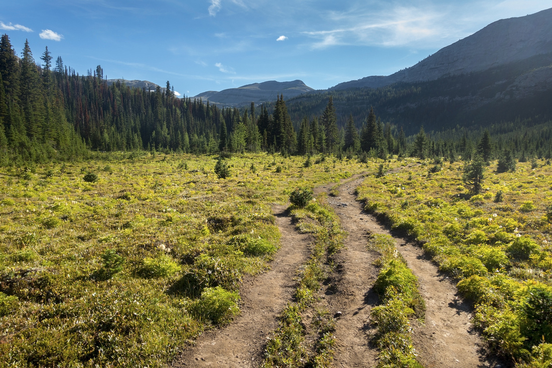
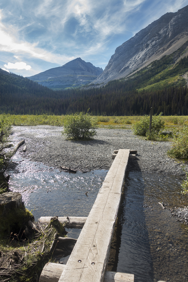
Parking is opposite marked Chester Lake parking lot, some 20km north of Kananaskis Lakes junction and 46km south from Canmore. Initial portion of Burstall trail is ~4km hike on old logging road; cycling is allowed, but not really worth the trouble as distance is short. Just before bike locks short detour to the right leads to overlook of twin Burstall Lakes. Trail then descends to alluvial flats with multiple water channels formed by melting ice of Robertson Glacier to the south (see gallery). Conditions change every year so just pick what seems the easiest path; there are several hiking signs along the way. Largest pool is directly on the other side before trail re-enters the forest; in the past I've bypassed in on both right and left side. Back to dry land, trail ascends moderately for about half an hour and enters open meadows. This is also prime grizzly bear territory and accidents have occurred in the past - carry your bear spray and make noise. Snow Peak is directly above with skyline ascent ridge. Remainder to the hike to Burstall Pass is incredibly scenic; specially view back to elegant Mt. Birdwood.
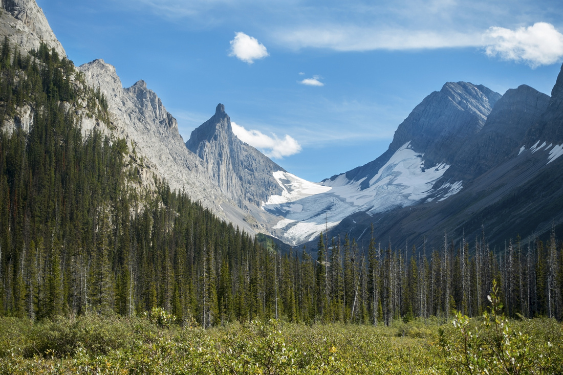
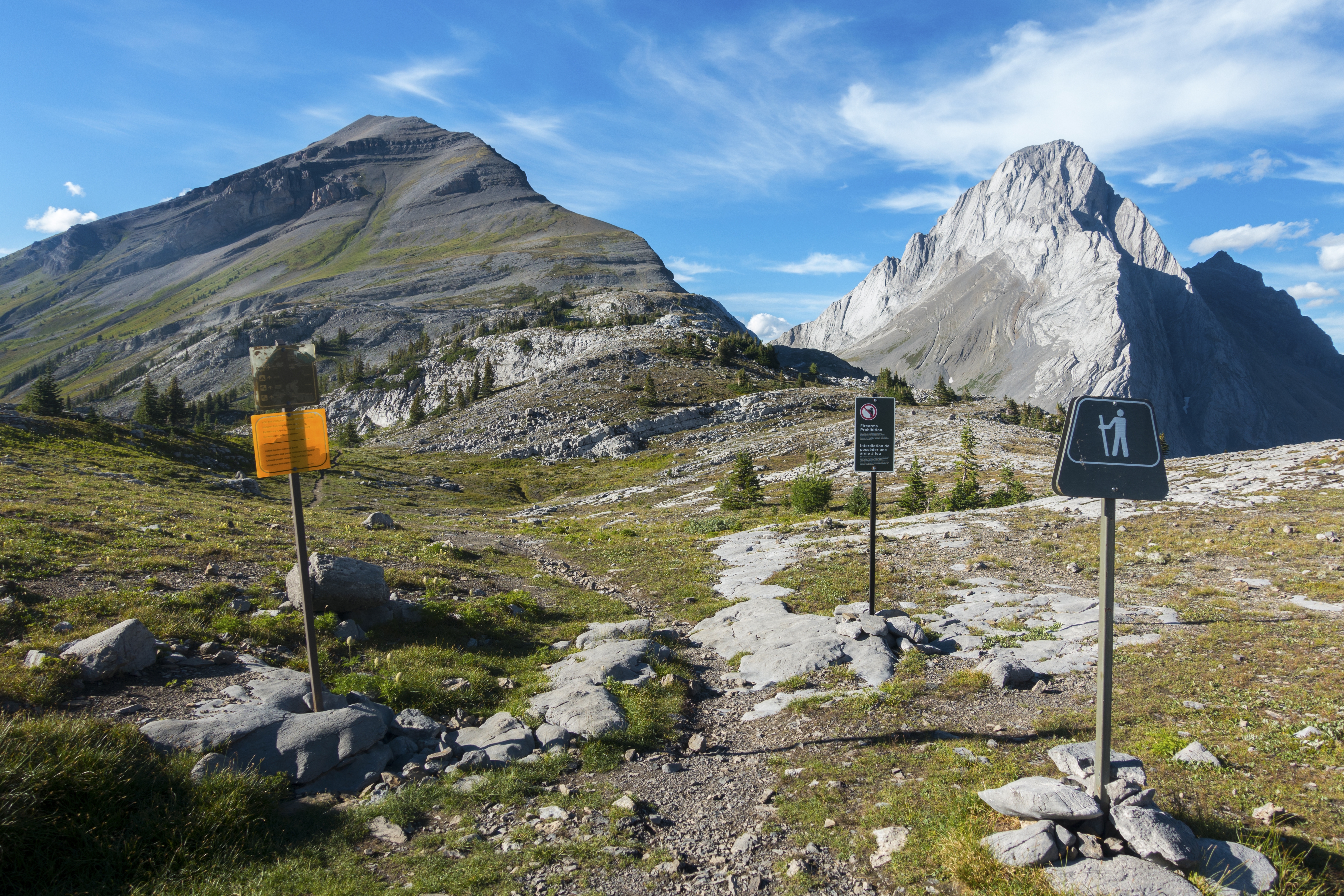
Leave Burstall trail at Banff National Park boundary and head directly towards Snow Peak talus slopes. Climb is hands free, but central portion is fairly steep and hiking poles will be big asset. Final part before summit ridge is the only scrambly bit - crumbling rock band best tackled head on; short class 2, with mild exposure to the right. Final walk to the summit cairn is wide and trouble free. Summit views are fantastic and include distant Mt. Assiniboine, Royal Group to the SW, while Sir Douglas towers on the other side of Burstall Pass deep below. Leman Lake can be spotted to the west, along with valley leading to historic Palliser Pass. Return is the same way and descent back to the Pass will be considerably faster (1.5 hr up, 1hr down).
|
|
Gallery |
|||
 Mud Lake Mud Lake Crossing Mud Lake Dam near Trailhead
 |
|||
|
Reaching Alluvial Flats ~4km from Trailhead; Trail re-enters forest on the other side. Snow Peak center |
|||
 Commonwealth Peak
Looking back at Commonwealth Peak (upper left) while crossing the flats. Hiking signs generally lead in easiest direction Commonwealth Peak
Looking back at Commonwealth Peak (upper left) while crossing the flats. Hiking signs generally lead in easiest direction |
|||
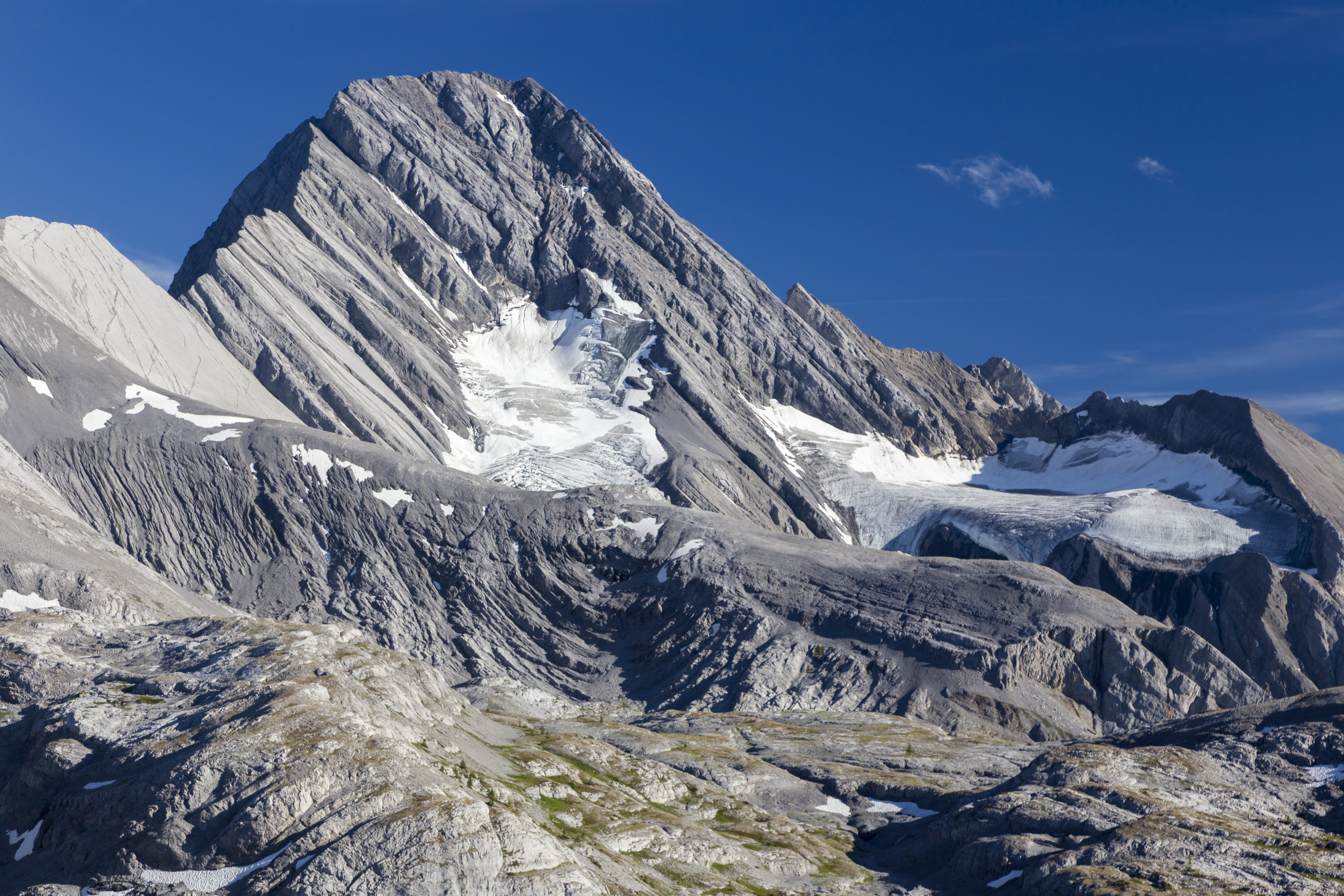
 Robertson Glacier
Roberston Glacier ice melt causing all the water channels hikers must navigate while crossing the flats Robertson Glacier
Roberston Glacier ice melt causing all the water channels hikers must navigate while crossing the flats |
|||
 Mt. Burstall
View back to Mt. Burstall as trail re-enters forest Mt. Burstall
View back to Mt. Burstall as trail re-enters forest |
|||
 Alpine Meadow
Beautiful Hiking in Alpine meadow after climbing from the Flats. Burstall Pass is saddle upper center & takes 35-40min from here Alpine Meadow
Beautiful Hiking in Alpine meadow after climbing from the Flats. Burstall Pass is saddle upper center & takes 35-40min from here |
|||
 Mount Birdwood
View back to Mount Birdwood (L), Pigs Tail (center, shade) and Commonwealth Peak (R) Mount Birdwood
View back to Mount Birdwood (L), Pigs Tail (center, shade) and Commonwealth Peak (R) |
|||
|
|||
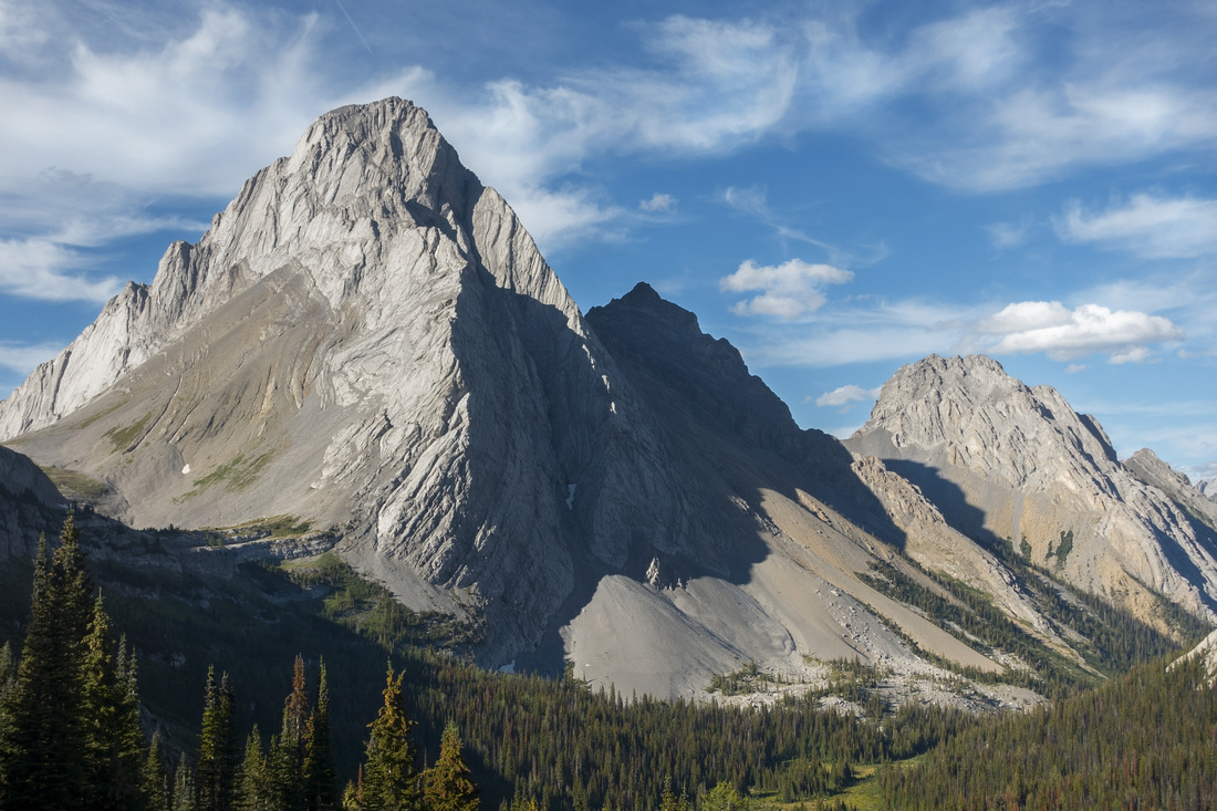
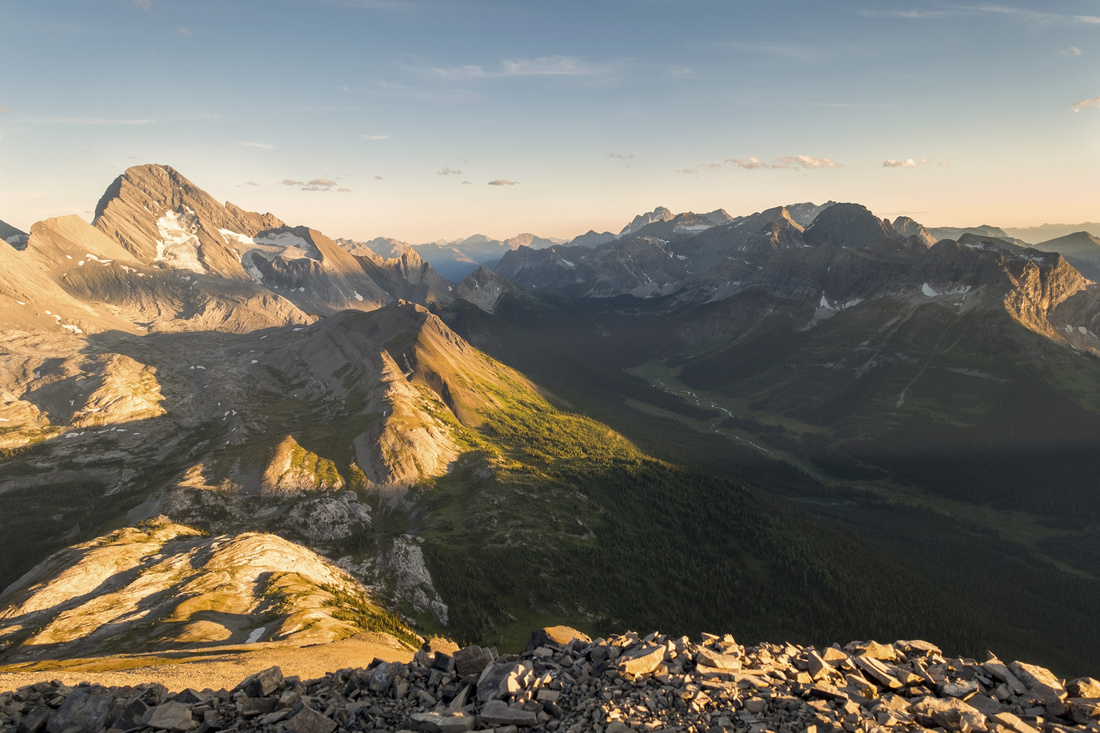
 Burstall Environs
Panoramic view east from base of Snow Peak talus slope. Length of approach valley center left. Mt. Birdwood left, Sir Douglas far right Burstall Environs
Panoramic view east from base of Snow Peak talus slope. Length of approach valley center left. Mt. Birdwood left, Sir Douglas far right |
|||
|
|||
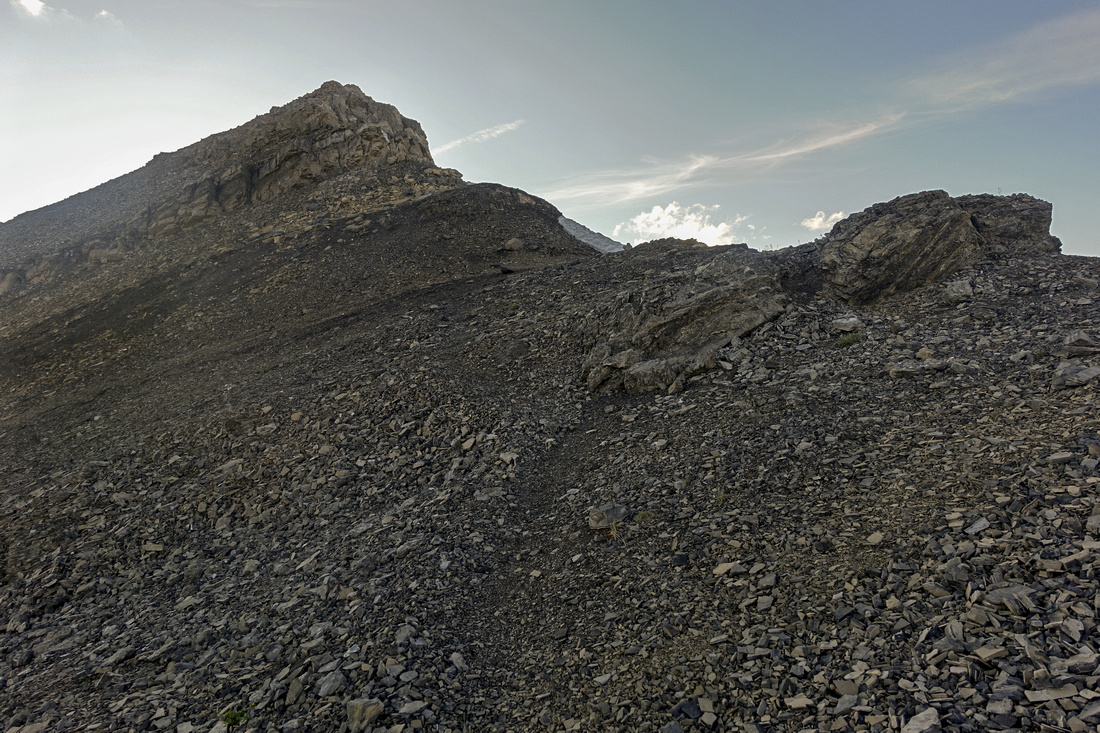 Snow Scramble
Upper Part of Snow Peak ascent, above the steep part. Crux is crumbling rock band center left, best tackled straight up (stiff class 2) Snow Scramble
Upper Part of Snow Peak ascent, above the steep part. Crux is crumbling rock band center left, best tackled straight up (stiff class 2) |
|||
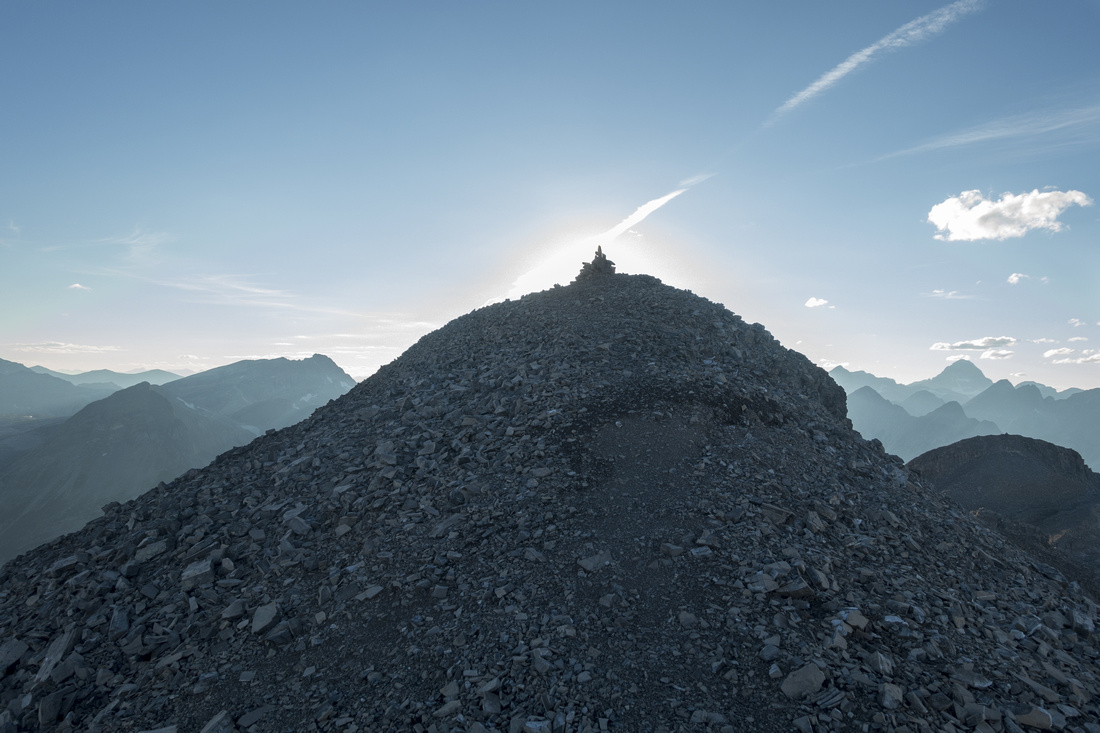 Snow Summit
Final easy ridgewalk to 2790m Snow Peak summit cairn Snow Summit
Final easy ridgewalk to 2790m Snow Peak summit cairn |
|||
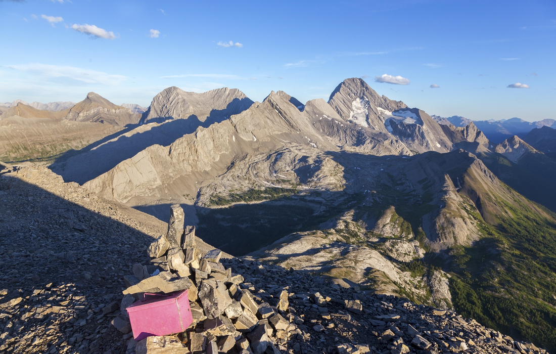 Snow Summit
Ever present Pink Register by Snow Peak Summit Cairn. Burstall Pass lower center, Sir Douglas above Snow Summit
Ever present Pink Register by Snow Peak Summit Cairn. Burstall Pass lower center, Sir Douglas above |
|||
 Palliser Pass
Long Valley on west side leading to Palliser Pass. Royal group behind, King George prominent peak distant upper center. Palliser Pass
Long Valley on west side leading to Palliser Pass. Royal group behind, King George prominent peak distant upper center. |
|||
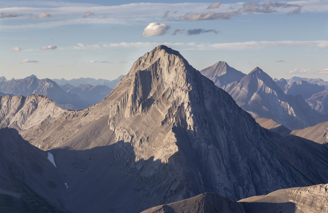 Mt. Smuts
Infamous Mt. Smuts, technical ascent that somehow got classified as scramble & now attracts hordes of social media hikers fighting for bragging rights. Unless you are 5th class rock climber, do yourself a favor and go elsewhere Mt. Smuts
Infamous Mt. Smuts, technical ascent that somehow got classified as scramble & now attracts hordes of social media hikers fighting for bragging rights. Unless you are 5th class rock climber, do yourself a favor and go elsewhere |
|||
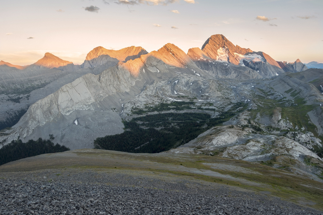 Sunset Alpenglow
Descending broad talus slope back to Burstall Pass with sunset light reflecting of Sir Douglas Sunset Alpenglow
Descending broad talus slope back to Burstall Pass with sunset light reflecting of Sir Douglas |
|||
 Burstall Alpine
Golden Hour hiking back to Burstall Pass trail. "Burstall Pass Peak" distant center Burstall Alpine
Golden Hour hiking back to Burstall Pass trail. "Burstall Pass Peak" distant center |
Abstract
| Overall Difficulty | D5 | Official trail with tricky alluvial flats crossing. Steep talus with one brief rockband near the top elevating trip to scramble level. | |||
| Snow Factor | S4 | Avalanche prone steep slopes, including Burstall Pass trail where deaths have occurred in spring conditions | |||
| Scenery | Fantastic Burstall Pass alpine, also prime golden larch area in late September. Many distinct Kananaskis Peaks, including Mt. Birdwood, Sir Douglas and distant Royal Group. Palliser Pass / Leman Lake on west side of Continental Divide | ||||
| Trail/Marking | Excellent / None | Official trail to Burstall Pass and BNP Boundary. Scree trails with occasional cairn on Snow Peak ascent ridge | |||
| Suggested Time | 5hrs | Hikers Summit. Add ~1hr if continuing to true summit | |||
| Elevation | Start: 1895m Max: 2790 m Total: ~950m | Distance: 20km return | |||
| Gear | Full hiking boots and poles. If water is high on Flats crossing, old sandals might be useful (but usually not required) | ||||
| Water | Alluvial Flats channels and Burstall creek (difficult access). Burstall Pass area and Snow Peak ascent are dry. Carry ~2L | ||||
| Dog Friendly | Yes | Standard back-country travel precautions. Keep good control of your dog as Burstall environs are prime grizzly bear habitat, as well as for courtesy for other hikers as this is popular trail | |||
 Snow Peak GAIA Map
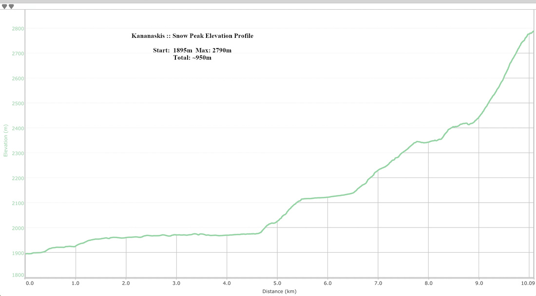 Snow Peak Elevation Profile