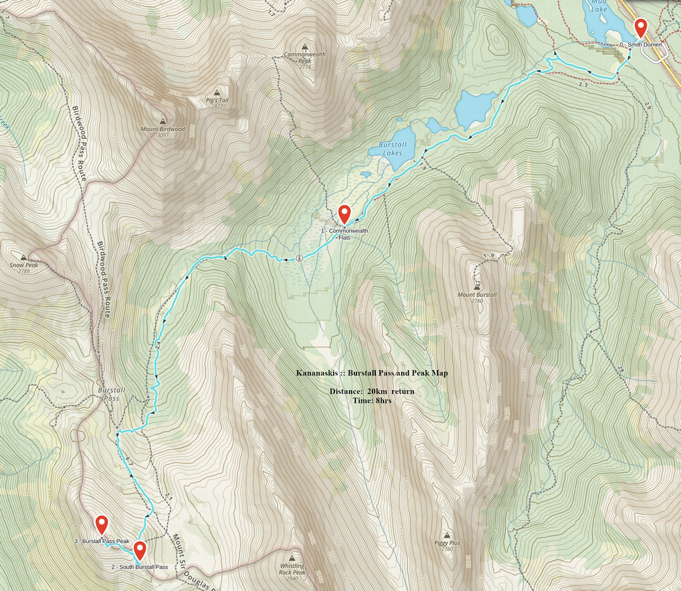
Google Map |
Rockies :: Kananaskis :: Burstall Pass and Peak |
GPS Track |
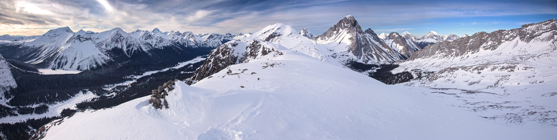 
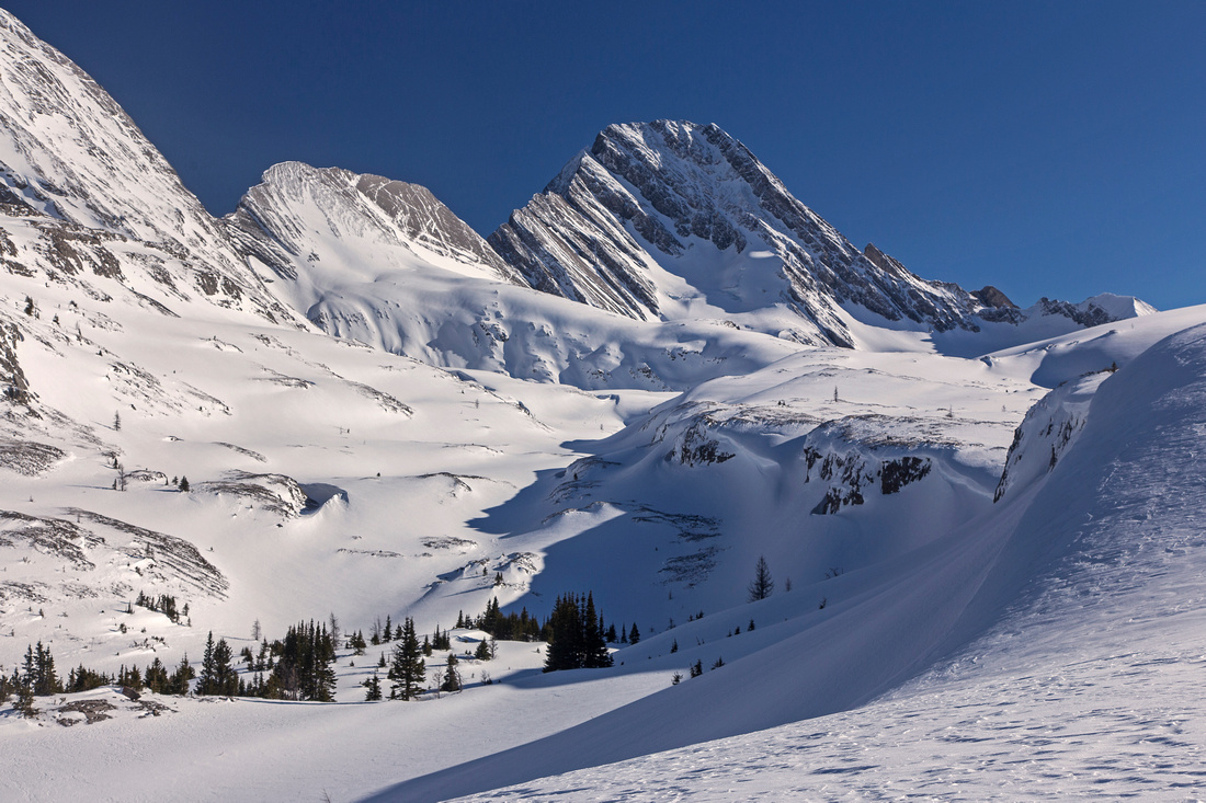
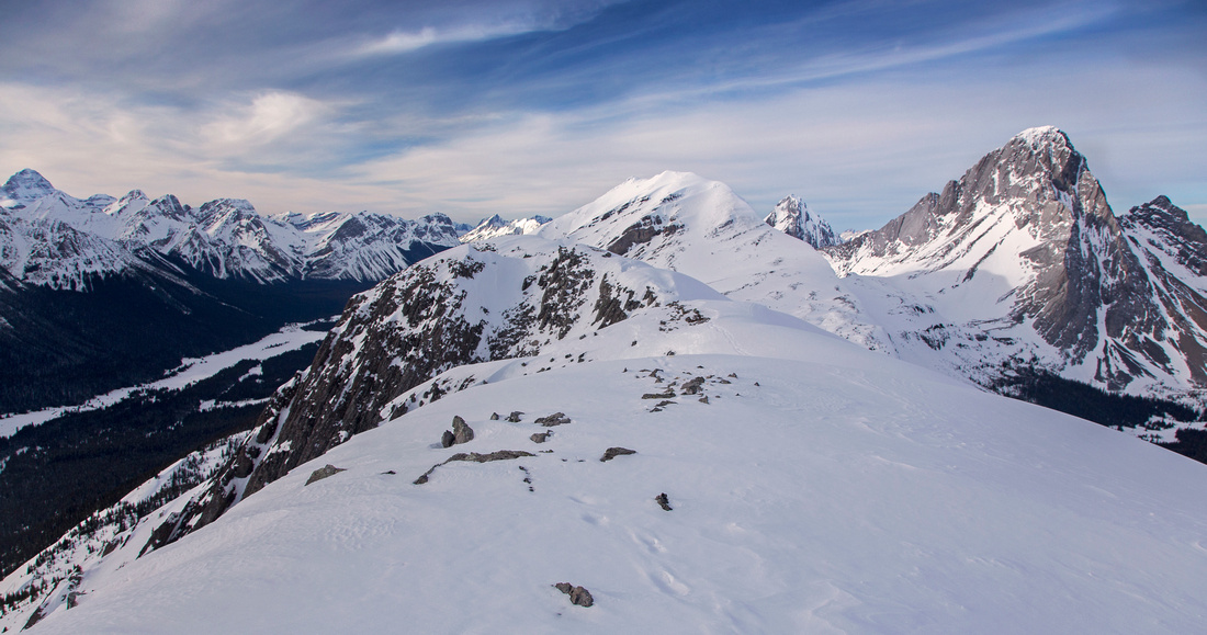
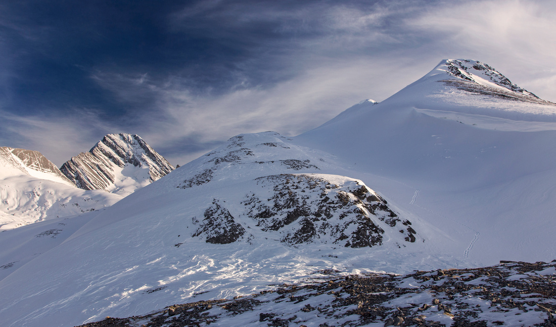
"Burstall Pass Peak" Panorama on a winter snowshoe trip. Palliser valley left, Leman Lake above. Snow Peak distant center, Mt. Birdwood to its right |
|||
| Trip Summary | |||
February 25, 2016"Burstall Pass Peak" is unofficial name for ridge rising SW of Burstall Pass. It is feasible as year-round trip. In summer it is very pleasant and trouble free extension that escapes the crowds at the pass. In winter conditions trip becomes more serious. Birdwood meadows on Burstall Pass approach have seen fatalities in the past due to avalanches coming off Snow Peak. In addition, couple of steep snow slopes must be ascended (and descended!) above the pass -- snow conditions must be stable. Summit ridge has 2 high-points, but south bump above South Burstall Pass is higher. It is possible to gain the ridge by climbing slopes directly above Burstall Pass, but this is more steep and difficult; in addition traverse between north and south summits has one brief narrow spot. Easier option is to hike to South Burstall Pass, then gain south summit from there. On descent, shelf directly below the ridge can be followed for loop return to Burstall Pass. For such option note that there is one steep and possibly corniced slope directly above the pass that must be negotiated and falls closer to realm of mountaineering. Park at standard Burstall Pass parking lot on west side of Smith-Dorrien highway, some 20km north from junction with Hwy 40 at Kananaskis Lakes. Walk wide logging road to Commonwealth Flats for about an hour; in summer this part can be cycled. Crossing of flats can be challenging in summer due to numerous braided channels. Several logs help with crossings, but conditions change often and you might get your feet wet; consider taking hiking boots off and bringing sandals. Above the flats trail rises steeply for about 20 minutes to Birdwood meadows. In winter this is challenging skiing, not suited for beginners. Alternate ski route follows creek to the right. Once in meadows views open up and objective is visible - it still appears far away. Views of Mt. Birdwood and Snow Peak are amazing! Winter route stays closer to Whistling Rock ridge on the left side, due to high avalanche risk below Snow Peak. It will take about 2 hrs to Burstall Pass in summer, closer to 3 in winter conditions. Recommended approach for the ridge is to hike to South Burstall Pass first. This is the most scenic part of the trip, as majestic Sir Douglas is directly in front of you. Little rise above the pass is great spot for a break and good chance to study climber approach for Sir Douglas that goes either under or over the rib extending from Whistling Rock Ridge. "Burstall Pass Peak" ridge is directly above to the west. Two slopes separated by flat bench must be ascended; neither one presents real problem, but second one can be awkward depending on snow conditions in winter. Final summit ridge is broad and gentle and quickly leads to the cairn. Views that include length of Palliser valley and distant Royal group - already in B.C. - are phenomenal. There are couple of options for loop return. More challenging is to traverse entire ridge, then descend the north end. Alternatively descend the way you came up to the bench running parallel with summit ridge then turn left and hike towards Burstall Pass. This is generally trouble-free as several short cliff bands can be skirted without much trouble. However final snow slope above Burstall Pass is steep, often corniced in winter and might not be feasible; evaluate the conditions from Burstall Pass on approach. |
|
Gallery |
|||
 Views from Commonwealth flats back towards Chester group
 |
|||
 Entering Birdwood meadows. Peak center left, still far away
 |
|||
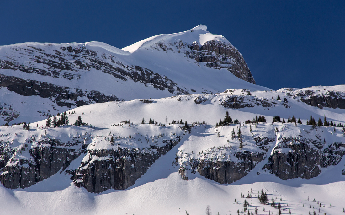 Huge cornice on Snow Peak. This is high risk avalanche area
 |
|||
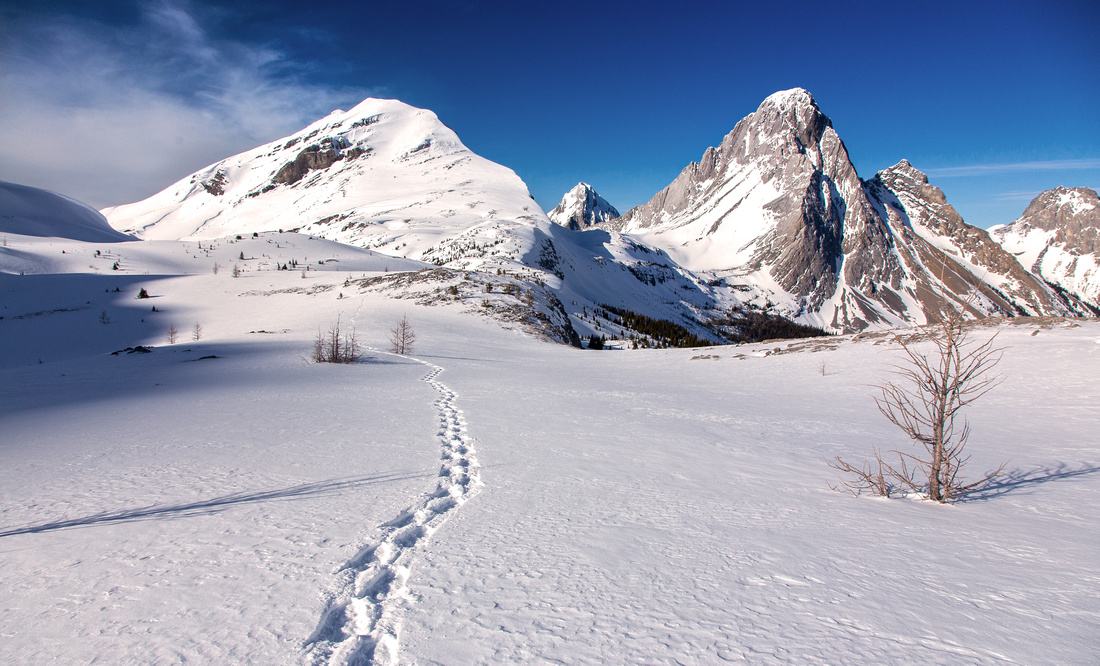
 Hiking towards South Burstall Pass. Sir Douglas looks amazing
 |
|||
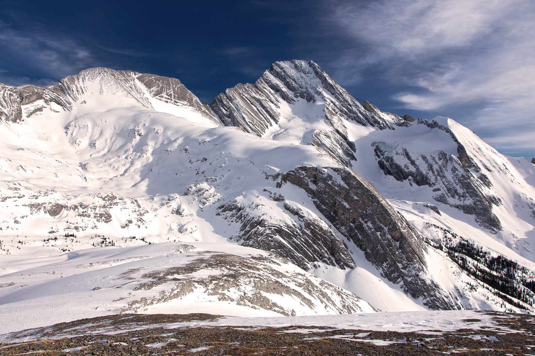
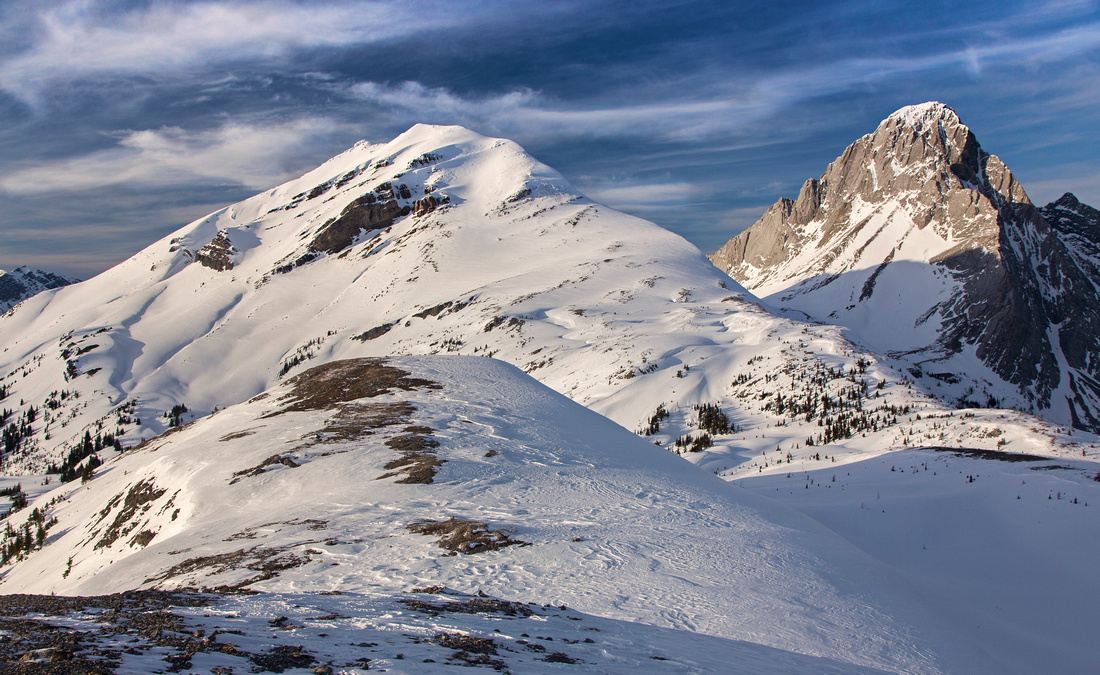
 View back towards Snow Peak (left) and Mt. Birdwood (right)
 |
|||
 Majestic Sir Douglas from rise above South Burstall Pass
 |
|||
 Looking back at final part of ridge just before the summit
 |
|||
 Summit view north. Mt. Birdwood to the right
 |
|||
 Summit view west to Palliser valley. Leman lake left of center
 |
|||
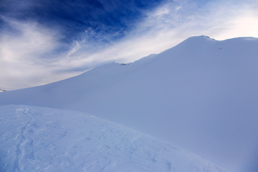 Surreal view of snowy ridge while hiking back on upper shelf
 |
|||
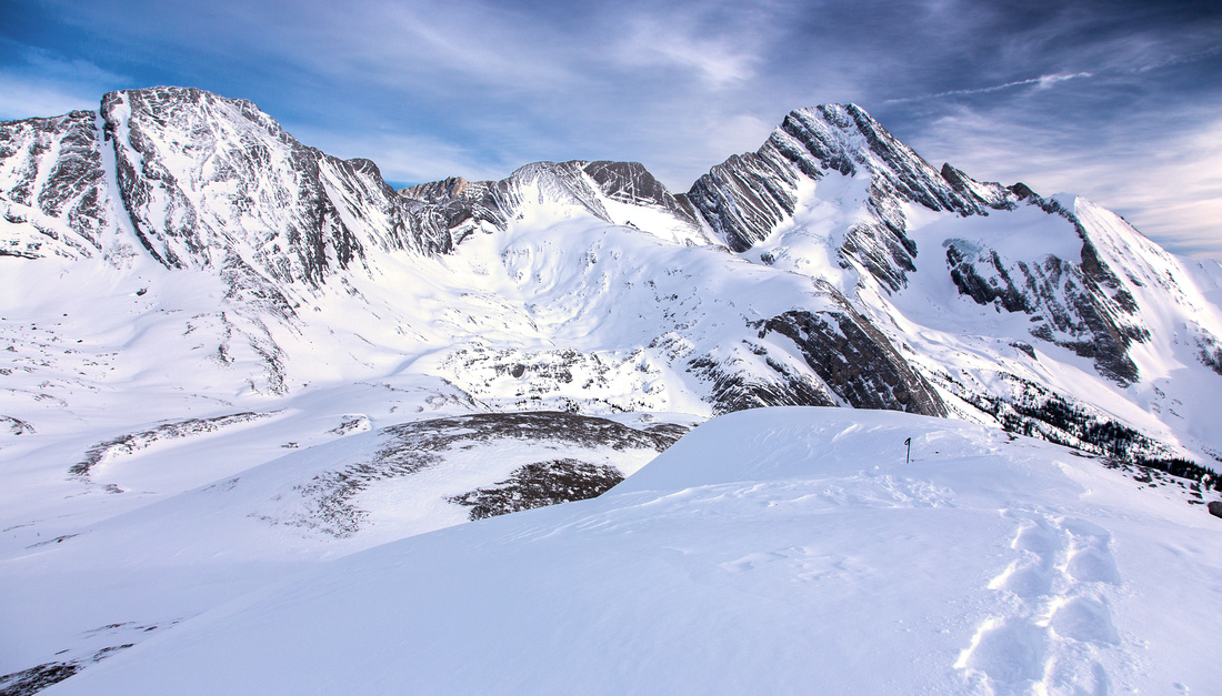
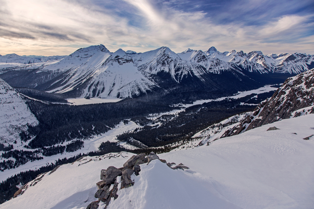
 Snow Peak and Mt. Birdwood. Burstall Pass center right
 |
|||
 View back to north end of "Burstall Pass Peak" ridge
 |
Abstract
| Overall Difficulty | D4 | Trail hiking to Burstall Pass, steep talus / grass slopes afterwards. Minor rock bands can be avoided. Boggy crossing of Commonwealth Flats in summer | |||
| Snow Factor | S4 | High-risk avalanche area in Birdwood meadows. Several steep slopes above Burstall Pass. Snow conditions must be stable | |||
| Scenery | Spectacular alpine area with far reaching views from summit ridge. Views of Sir Douglas from South Burstall Pass are phenomenal | ||||
| Trail/Marking | Very good/none | Logging road followed by crossing of braided water channels in Commonwealth flats and established trail to Burstall Pass. Occasional cairns thereafter | |||
| Suggested Time | 7-8 hr | Return time including approach via South Burstall Pass and loop return by traversing entire ridge, or shelf below. | |||
| Elevation | Start: 1900 m Max: 2580 m Total: ~800 m | Round Trip: ~20 km | |||
| Gear | Full hiking boots and poles. Skis are preferred to snowshoes for winter trip. Gaiters very helpful in summer for muddy crossing of Commonwealth flats. Avalanche gear in winter | ||||
| Water | Water can be filtered in Commonwealth flats, but dry hike otherwise. Carry 2-3L | ||||
| Dog Friendly | Yes | Standard back-country travel precautions | |||
 Burstall Pass and Peak GAIA Map
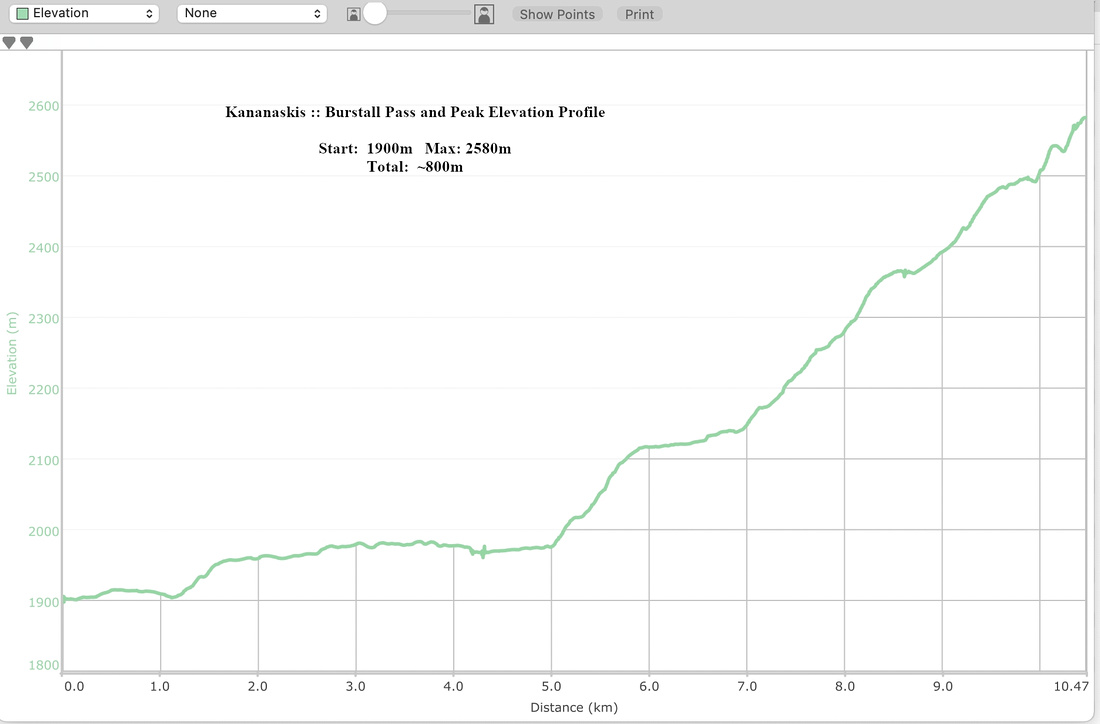 Burstall Pass Peak Elevation Profile