Google Map |
Rockies :: Kananaskis :: Opal Ridge South |
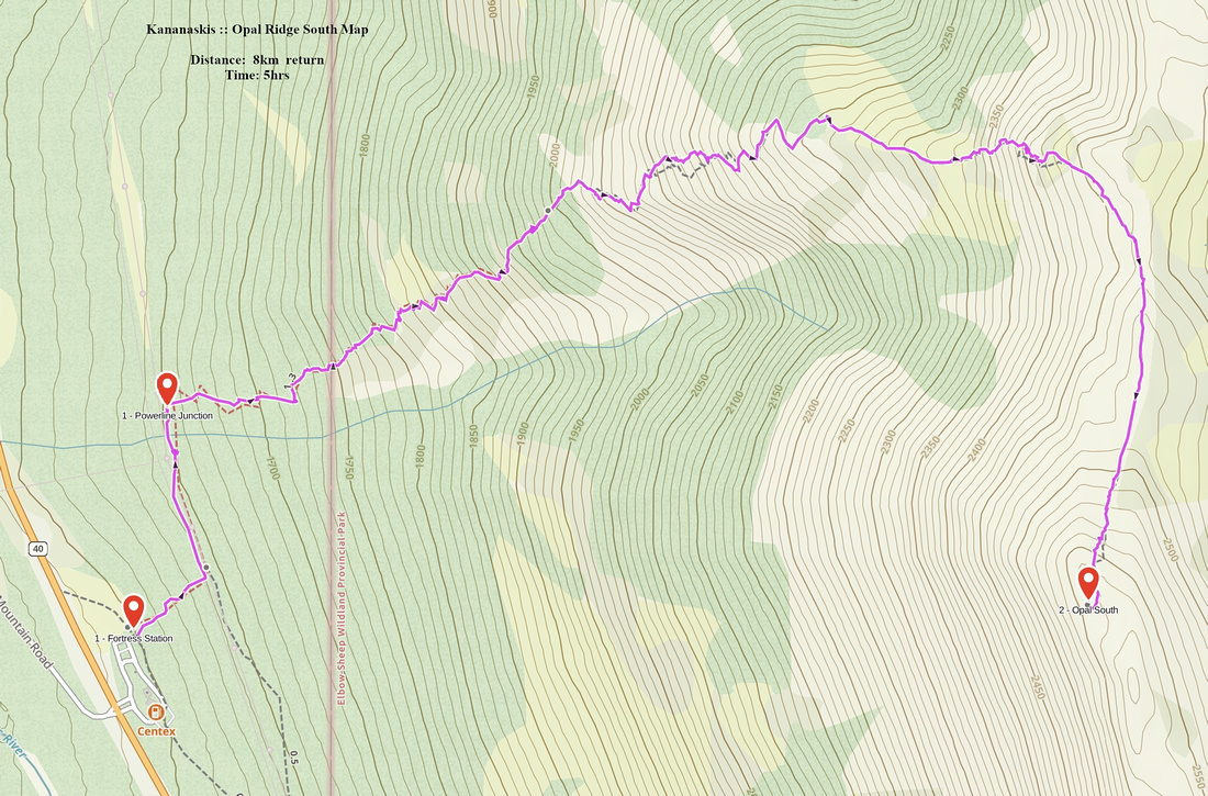
GPS Track |
|
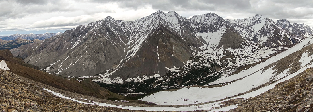
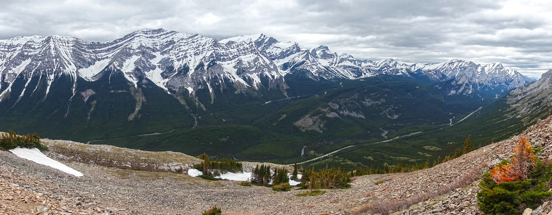
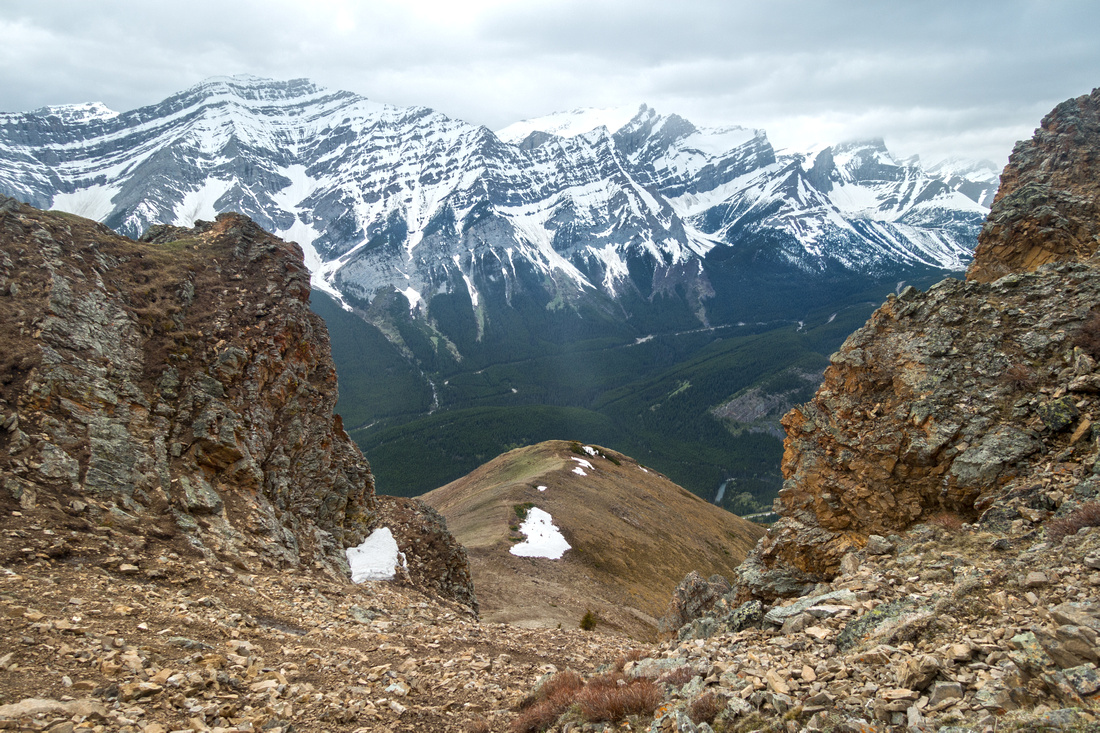
Snowy Opal Range Panorama from Ridge Highpoint. Mt. Denny center, Potts and Evan Thomas to the right |
|||
| Trip Summary | |||
Multiple Dates, last June 9, 2022Long ridge extending between Rocky and Grizzly creek drainages on east side of Hwy40 corridor. Highest point, commonly referred as "Opal Ridge South" directly above Fortress Junction, is popular ascent on unofficial trail starting from north end of Fortress Service Station parking lot. It has been described in both Daffern and Kane guidebooks. Grade is steep, but manageable; however it is not simple hiking as there are several short cliff bands that call for use of hands. Ridge itself is delightful with great views across alpine valley hidden on east side towards several Opal Range Peaks, including Mt. Denny, Potts and Evan Thomas. Possible extensions include loop return via Grizzly Creek to the south - simple hiking after snow has melted. Traverse to North end is much more complicated and technical, but within realm of difficult scrambling only. Although I've seen reports of people charging up in winter, this is NOT recommended as steep and exposed slopes are avalanche prone. It is best to wait till snow has melted, usually by end of May.
Find trail heading on left (north) side of drainage directly behind parking lot. Trail rises steeply and soon intersects the powerline; turn left. First junction to the right reached within 10 minutes is not the correct one; continue for couple of minutes and correct turnoff will be just after the creek crossing (rock-hop, only water source of the day). Trail is well defined but steep with several sections that require use of hands. Crux is about halfway up, steep rock wall that can be skirted on either side. There are several scree trails branching here; cairns/flags usually indicate easiest direction. After brief traverse of alpine plateau above, trail leads to "The Gates" - moderately angled scree fan rising without any problems through rock pinnacles to the Ridge. Highest Point, known as "Opal Ridge South" is ~15 minutes of delightful ridgewalk to the south. On my first ascent in 2006 there was just a cairn on top, but nowdays there is usually register testifying popularity of this route.
If returning via Grizzly creek, it is easiest to traverse entire ridge to the south; there will be scree trail most of the way. Then trash down to saddle and pick up faint trail descending back to Hwy40, some 3km from Fortress Junction - walk or bicycle. It is worth familiarizing yourself with this variation in case you plan scrambling Denny or Potts in the future (both included in 3rd edition of Kane scrambles, and much more serious undertakings compared to Opal Ridge only). |
|
Gallery |
|||
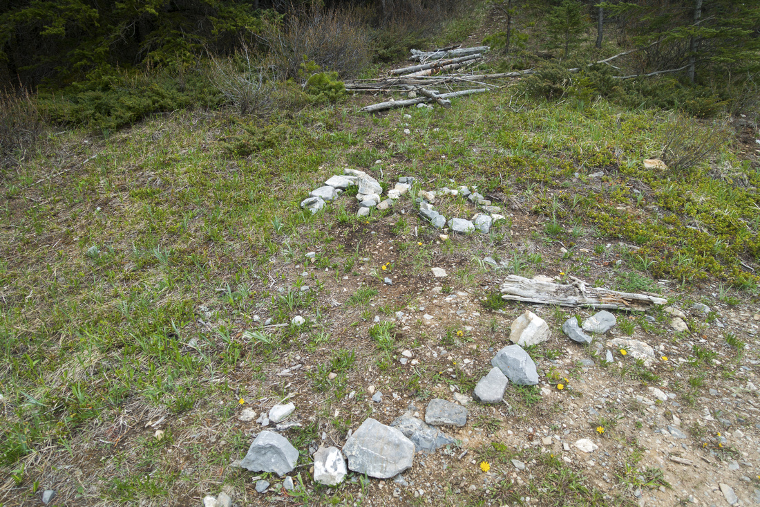 Wrong Way Wrong Way Barred junction along the powerline - correct turnoff is couple of minutes further
 |
|||
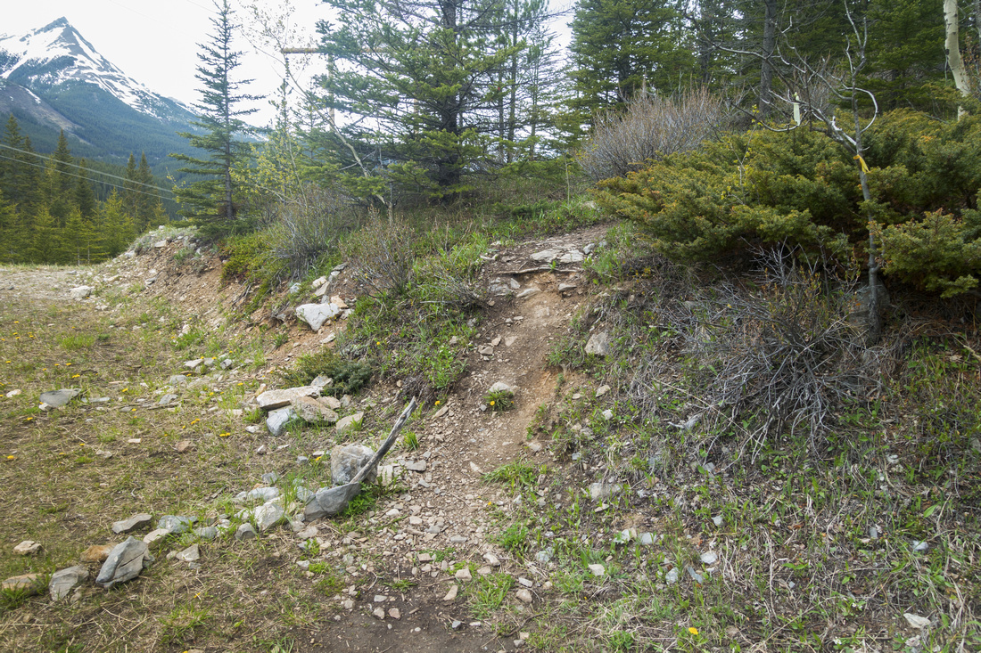 The Right Way!
Start of Opal South trail proper, immediately after crossing the creek drainage The Right Way!
Start of Opal South trail proper, immediately after crossing the creek drainage |
|||
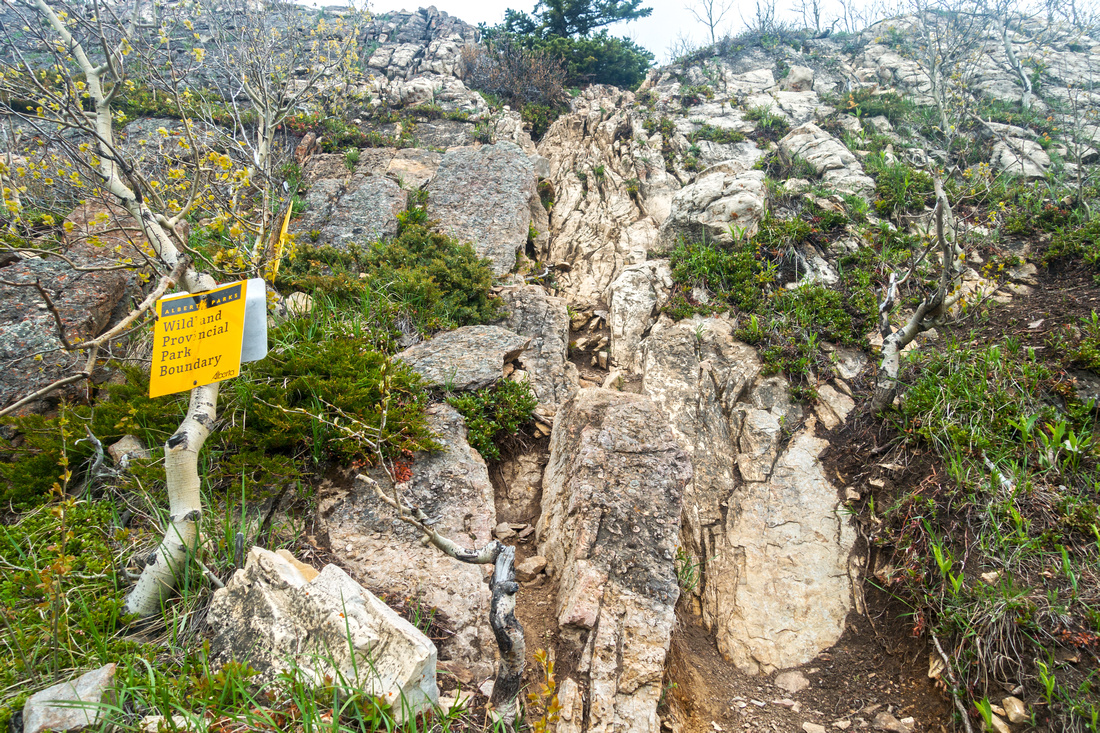 Bluff Scramble
One of several short cliff bands that call for use of hands, but are not difficult Bluff Scramble
One of several short cliff bands that call for use of hands, but are not difficult |
|||
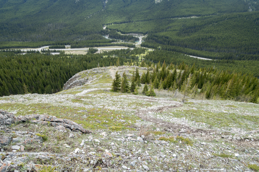 Fortress Junction
View back down to Fortress Junction as steep trail gains elevation fast Fortress Junction
View back down to Fortress Junction as steep trail gains elevation fast |
|||
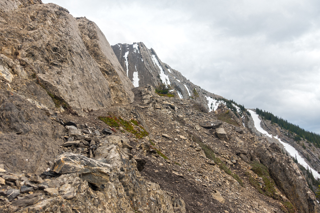
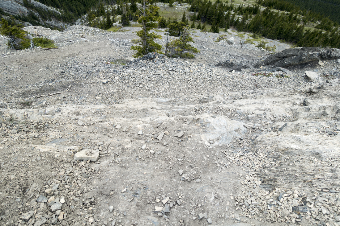 Scree on Slab
Looking down eroded part as scramble part begins; caution needed if descending this way Scree on Slab
Looking down eroded part as scramble part begins; caution needed if descending this way |
|||
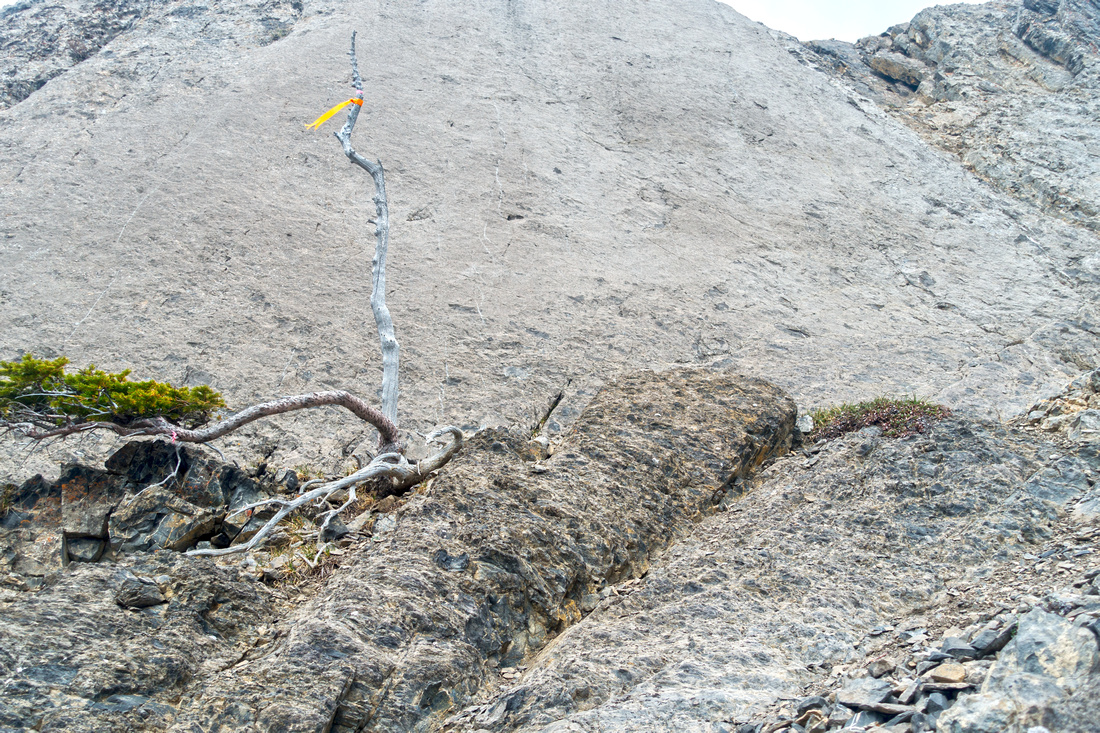 Crux Wall
Scramble Crux - 5 meter high rock wall that can be bypassed on either side on convenient ledges Crux Wall
Scramble Crux - 5 meter high rock wall that can be bypassed on either side on convenient ledges |
|||
 Crux Wall
Looking north at base of Crux Wall towards Fortress Ridge area; Mt. Kidd South in the distance Crux Wall
Looking north at base of Crux Wall towards Fortress Ridge area; Mt. Kidd South in the distance |
|||
 Crux Wall
Looking south at base of Crux Wall; Opal South distant center above. Easiest breach is to turn left and up by that green patch in the middle Crux Wall
Looking south at base of Crux Wall; Opal South distant center above. Easiest breach is to turn left and up by that green patch in the middle |
|||
 Steep Grade
Higher up views start opening up towards K-Lakes area; Opal South Highpoint upper center left Steep Grade
Higher up views start opening up towards K-Lakes area; Opal South Highpoint upper center left |
|||
 Alpine Basin
Short Alpine Basin after the Scramble Part. Route ascends moderately angled scree fan through "The Gates", just right of obvious Rock Promontory, roughly center Alpine Basin
Short Alpine Basin after the Scramble Part. Route ascends moderately angled scree fan through "The Gates", just right of obvious Rock Promontory, roughly center |
|||
 Kananaskis Trail
Hwy40 Corridor Traversing the Alpine Basin towards "The Gates". Grizzly diggings are very common here Kananaskis Trail
Hwy40 Corridor Traversing the Alpine Basin towards "The Gates". Grizzly diggings are very common here |
|||
 The Gates
View back through "The Gates" - ascent is as easy as it looks (in dry conditions) The Gates
View back through "The Gates" - ascent is as easy as it looks (in dry conditions) |
|||
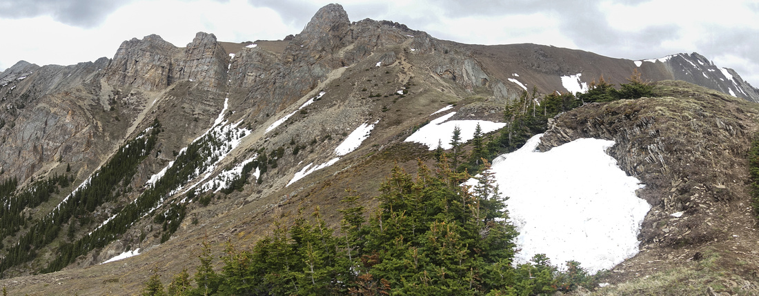
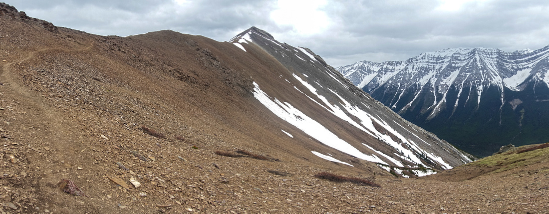 Opal Ridge
Final part leading to Opal South Highpoint is very enjoyable Ridgewalk; note scree trail left Opal Ridge
Final part leading to Opal South Highpoint is very enjoyable Ridgewalk; note scree trail left |
|||
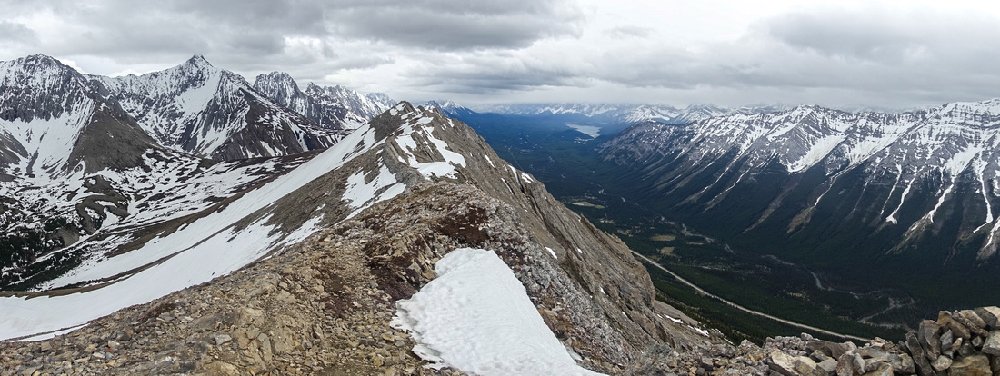 Opal Ridge
Panoramic view of Opal Ridge South from the Highpoint, which usually has summit register Opal Ridge
Panoramic view of Opal Ridge South from the Highpoint, which usually has summit register |
|||
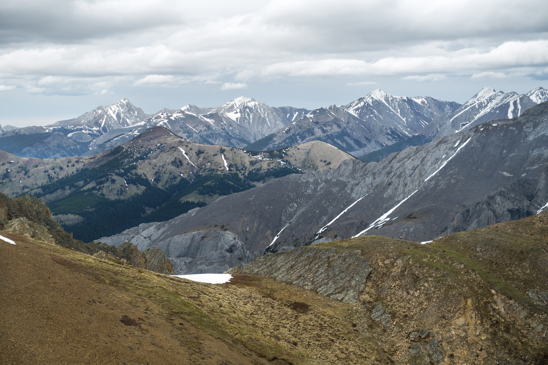
 K-Lakes
Aerial Telephoto towards Kananaskis Lakes area from Opal South K-Lakes
Aerial Telephoto towards Kananaskis Lakes area from Opal South |
|||
 Summit Register
Seems like a custom on Alberta Summits - Registers filled with all kinds of goodies Summit Register
Seems like a custom on Alberta Summits - Registers filled with all kinds of goodies |
|||
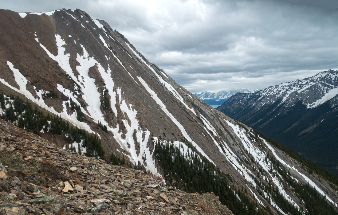
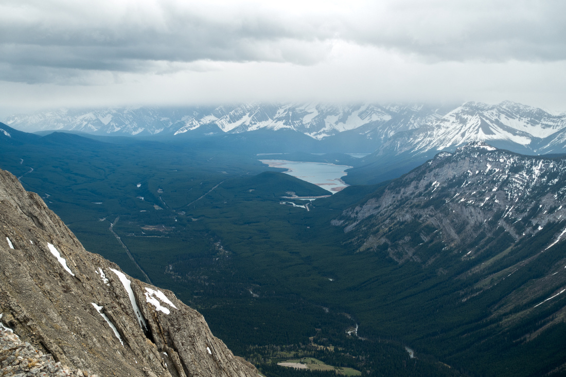
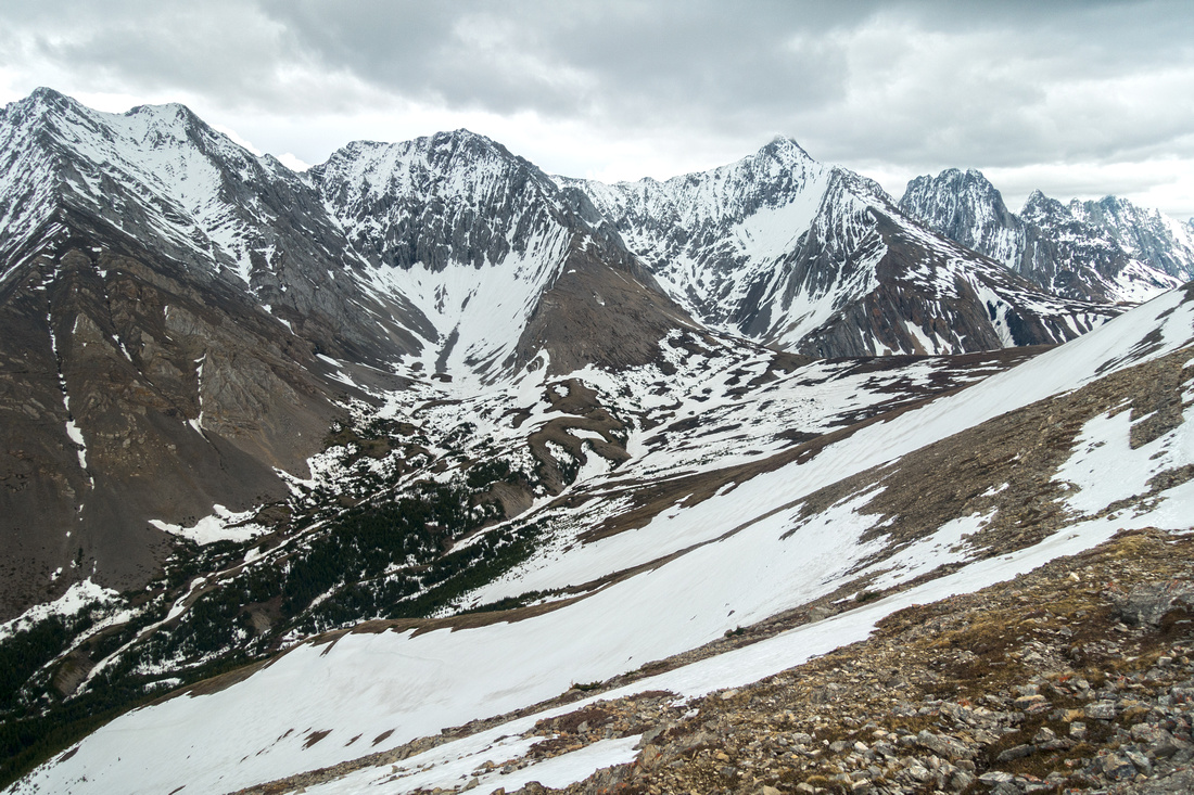 Opal Range
Looking down alpine cirque below Mt. Denny (L), Potts (C) and Evan Thomas (R). Alternate loop return descends to high col just right of center, then hikes out via Grizzly creek drainage Opal Range
Looking down alpine cirque below Mt. Denny (L), Potts (C) and Evan Thomas (R). Alternate loop return descends to high col just right of center, then hikes out via Grizzly creek drainage |
|||
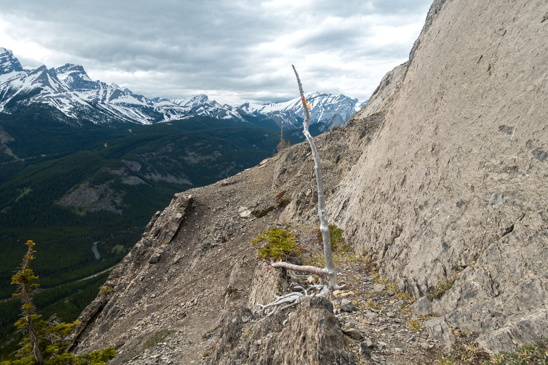
 Opal Ridge North
North part of Opal Ridge; easy hiking ends in 10-15 minutes and gets quite spicy after that Opal Ridge North
North part of Opal Ridge; easy hiking ends in 10-15 minutes and gets quite spicy after that |
|||
 Mackay Hills
Telephoto towards Mackay Hills (roughly center) from end of easy Opal North ridge section Mackay Hills
Telephoto towards Mackay Hills (roughly center) from end of easy Opal North ridge section |
Abstract
| Overall Difficulty | D5 | Extended steep grade with several short cliff bands (class 2/3). Scree on slab. | |||
| Snow Factor | S4 | Steep west slopes prime candidate for avalanche release; wait till snow melts | |||
| Scenery | Hwy40 corridor with distant Kananaskis Lakes. Pretty alpine cirque below Opal Range | ||||
| Trail/Marking | Good / None | Reasonably well defined trail with occasional cairns/flags. Several eroded variations through cliff bands | |||
| Suggested Time | 5hrs | Return time same way; add ~1hr if planning loop via Grizzly creek | |||
| Elevation | Start: 1600m Max: 2610 m Total: ~1050m | Distance: ~8km (return, same way) | |||
| Gear | Full hiking boots and poles. Gaiters/Icers, depending on conditions | ||||
| Water | Creek drainage near the start, but dry afterwards. Carry 1-2L, depending on season | ||||
| Dog Friendly | Yes | Standard back-country travel precautions. Grizzly bears frequent the area | |||
 Opal Ridge South GAIA Map
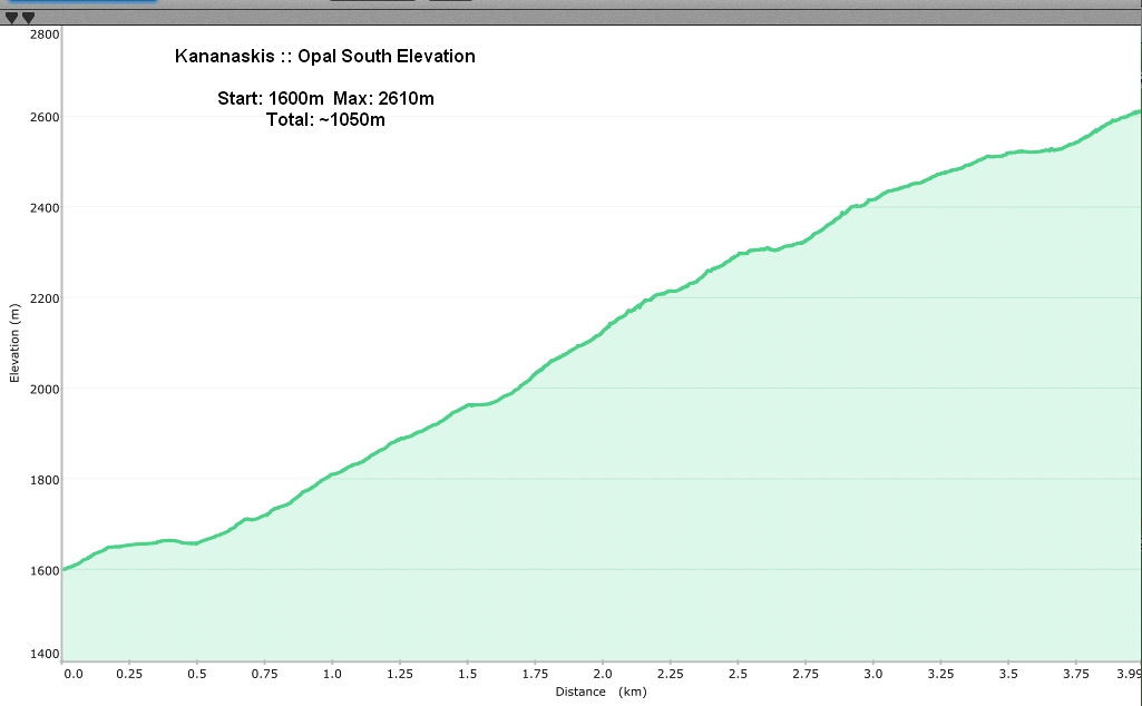 Opal South Elevation