Google Map |
Rockies :: Kananaskis ::Marmot Creek / Hummingbird Plume Lookout |
GPS Track |
|
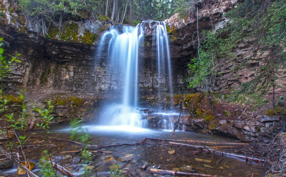
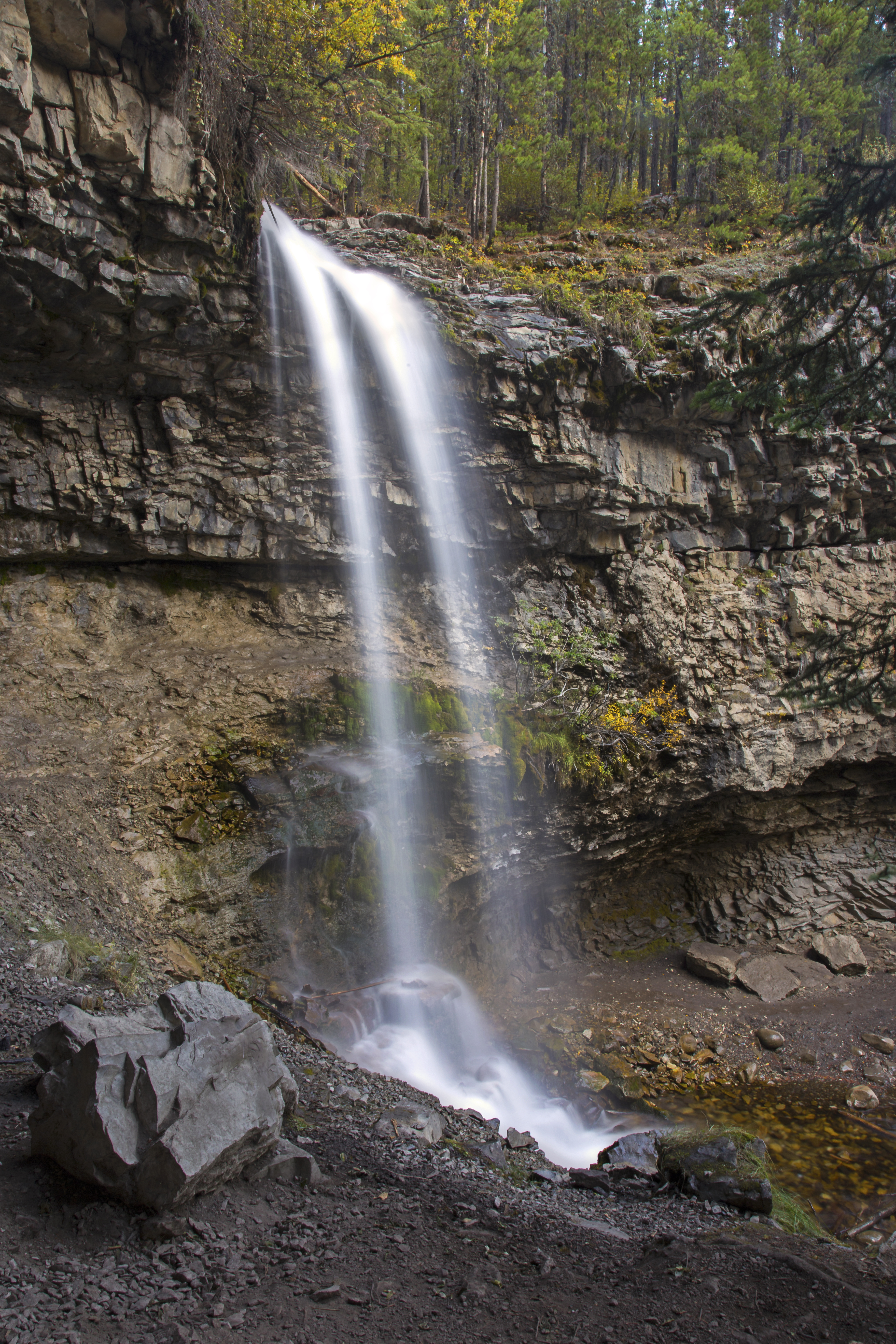
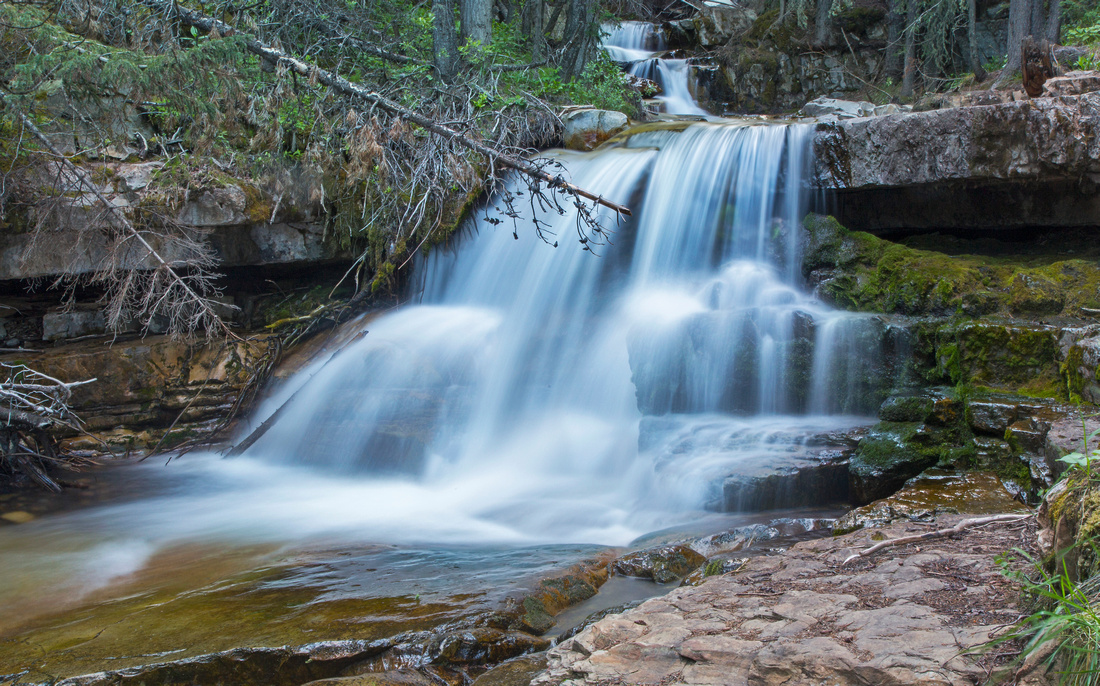
Upper Marmot Creek Waterfall. Trail climbs up and over on the right side |
|||
| Trip Summary | |||
Multiple Dates, Last May 12, 2022Marmot Creek is hidden gem in close proximity of Kananaskis Village and Nakiska ski-area. While majority of visitors walk only to Troll Falls, real reward lies in continuing above and up the creek. This is the trip for photographers; few other areas in K-country offer so many beautiful waterfalls and cascades in such a short proximity! The trip is short and can easily be completed as after-work hike or in case of inclement weather. Loop return via Marmot X-country ski road is possible, but necessitates one potentially tricky creek crossing. Several options for extending the day exist, but they all involve walk on forest enclosed roads; historic Hummingbird Plume lookout being one of them.
Start at north end of Stoney Trail - turnoff is on right side of Nakiska ski area access road, immediately after Kananaskis Village turnoff. You can follow Stoney Trail along the powerline or hike forest trail on left (west) side, but more pleasant and scenic approach is to follow Hay Meadows trail on the right side leading to popular Raptor viewing site. Each spring and fall Golden Eagles, Hawks and other birds use this corridor as their migratory route; see Rocky Mountain Eagle Research Foundation (RMERF) site for more details. There are some beautiful open views of Kananaskis River and G8 summits on east side here. Upon reconnecting with Stoney Trail follow signs to Troll Falls. This is beautiful waterfall any time of the year, but do not expect solitude. After practicing your photography skills (did you bring the tripod?) cross the creek to north side on good wooden bridge. Steep trail climbs on the right side then levels off and continues up the creek. There are many side trails descending to creek level, but major waterfall is reached about 10-15 minutes above Troll Falls. Several beautiful gorges lie above - if coming for the first time, leave yourself plenty of time to explore in relaxed pace. Final part is deep and beautiful canyon; be careful as slip and fall would certainly be fatal. Finally you reach the site of old bridge which has been destroyed in 2013 floods. This is the turnaround point. If you desire loop return, find the spot to cross the creek shortly after the site of old bridge. Trail climbs on the other side and soon exits to Marmot Ski road. Turn left and descend on a wide forest trail back to powerline and Stoney trail. Winter visit to the area is well worth because of impressive frozen ice at Troll Falls and upper Marmot Waterfall. Micro-spikes are a MUST. AB Parks have much improved the trail above Troll Falls and there are now wooden railings and staircases to upper waterfall (lead photo on this page). There is also wooden bridge crossing Troll Falls outlet - no need for log jam hopping anymore. Skogan Pass trail is wide and well groomed; this loop return is recommended in winter conditions.
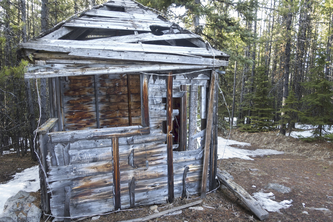
Hummingbird Plume Lookout: Turning right at Marmot Junction leads to about 40-45 minutes of steady but moderately angled ascent to junction up Skogan Pass trail to powerline; Sunburst trail continues on the other side to Hummingbird Plume lookout. Going is entirely on the road with limited views and not overly exciting. Final part on Sunburst trail is steeper than expected - over 150m vertical is gained to the lookout. Old structure dating back to 1930's was still standing in 2022. Walking few meters to edge of forest will grant open views of several front range peaks across Hwy40 corridor. On return upon reaching Skogan Pass trail it is possible to drop down the powerline directly to Stoney Trail (Daffern calls this "Balam" in Kananaskis Country Trail Guidebook); I descended that way once and can not recommend it - scared exploration road, brutally steep at times that stays mostly under tree cover.
|
|
Gallery |
|||
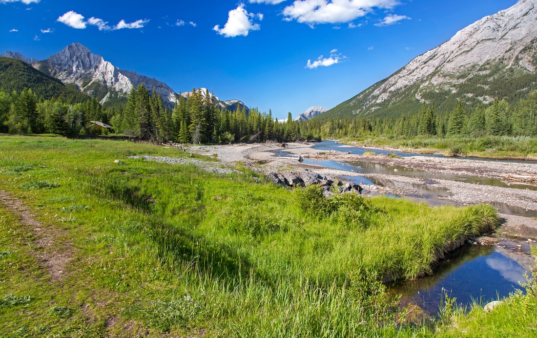 Hay Meadows Hay Meadows Hiking in Hay Meadows by Kananaskis River with view of Mt. Lorette
 |
|||
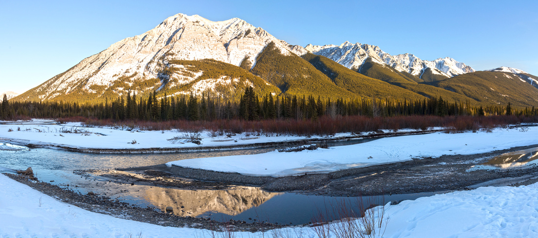 Raptor Lookout Site
Panoramic view of G8 summits at east side of Kananaskis River in winter from Raptor Lookout site Raptor Lookout Site
Panoramic view of G8 summits at east side of Kananaskis River in winter from Raptor Lookout site |
|||
 |
|||
 Troll Falls
. Marmot Creek trail climbs on right side Troll Falls
Troll Falls. Marmot Creek trail climbs on right side |
|||
 |
|||
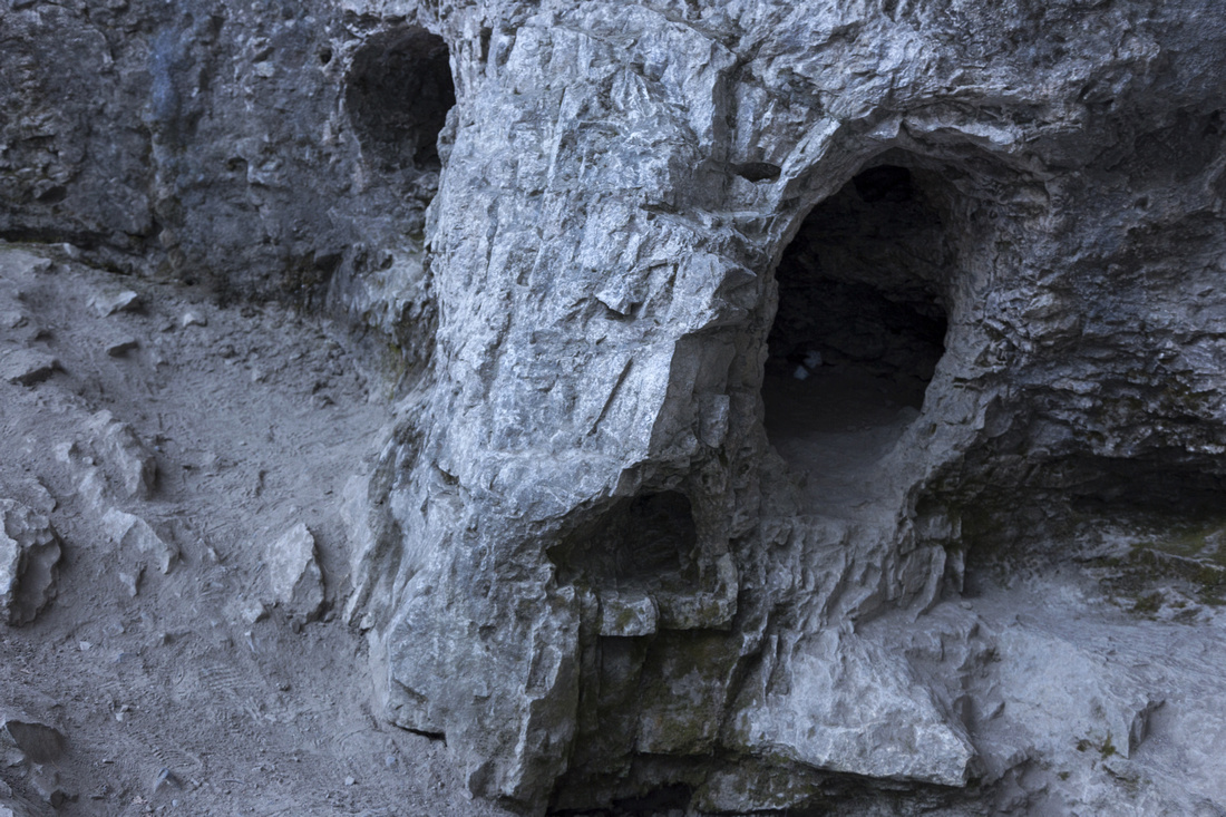 Troll Cavern
Rock cave Troll Falls owe their name to Troll Cavern
Rock cave Troll Falls owe their name to |
|||
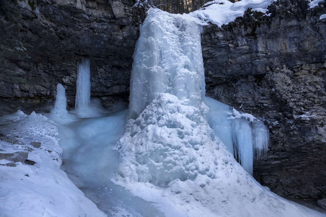 Frozen Troll Falls
 in Winter Frozen Troll Falls
Frozen Troll Falls in Winter |
|||
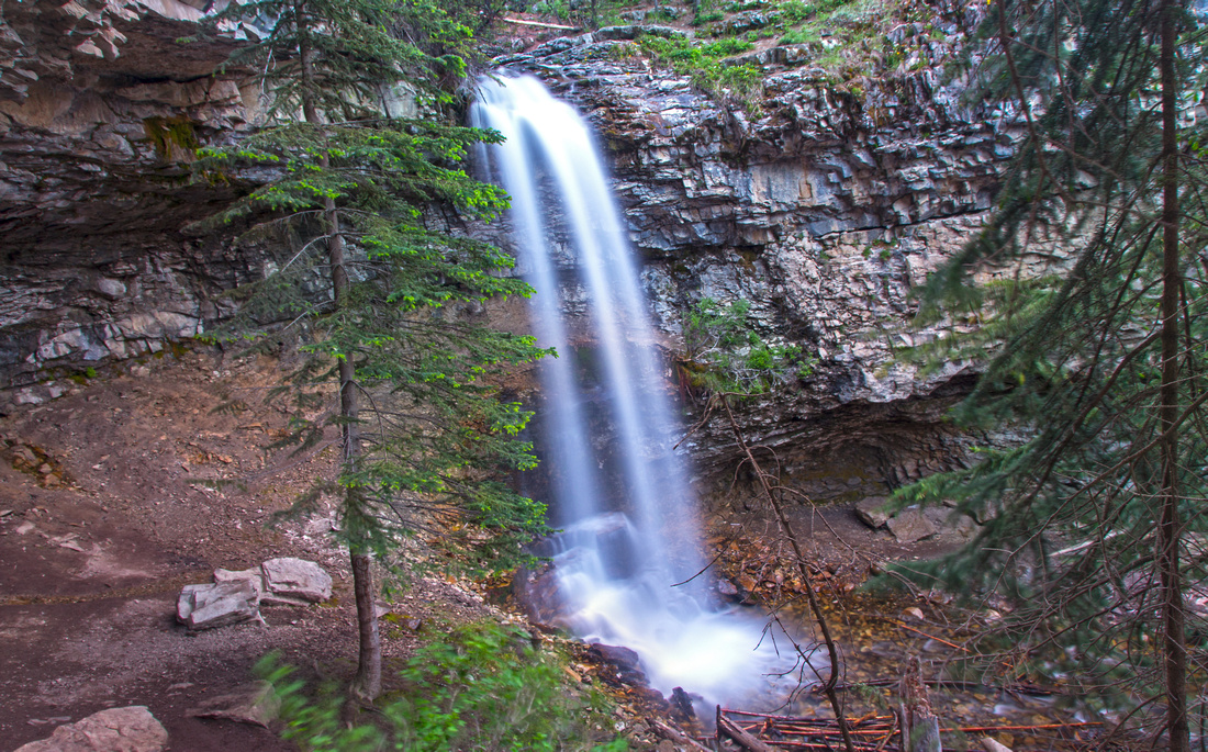
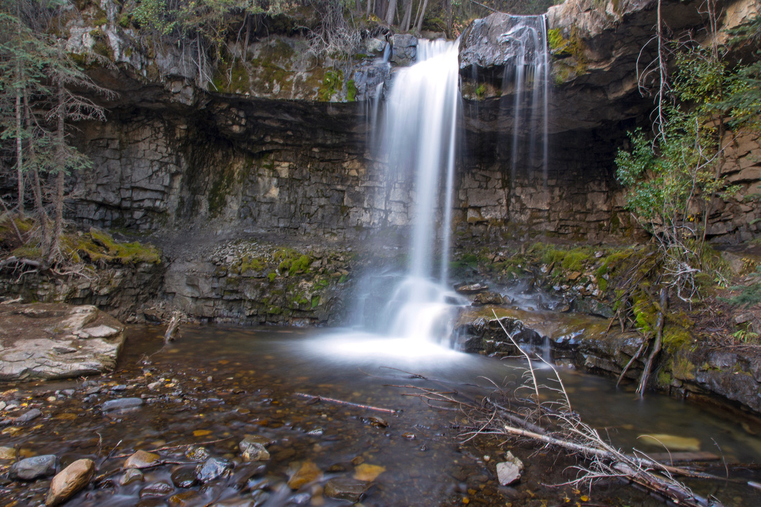 Upper Marmot Waterfall
Upper Marmot waterfall ~10 minutes above Troll Falls Upper Marmot Waterfall
Upper Marmot waterfall ~10 minutes above Troll Falls |
|||
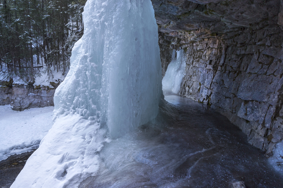 Ice Corridor
Icy corridor behind frozen upper Marmot Falls in winter Ice Corridor
Icy corridor behind frozen upper Marmot Falls in winter |
|||
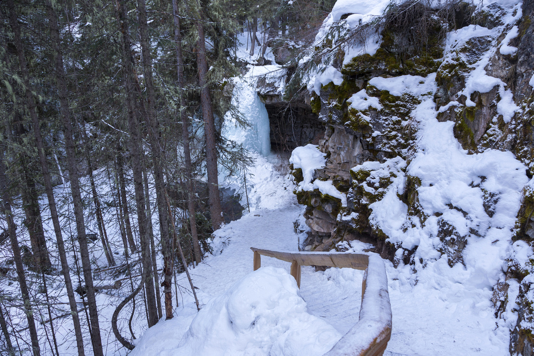 Upper Falls Trail
Wooden Railing with Icy Staircase above upper Marmot Falls in Winter Upper Falls Trail
Wooden Railing with Icy Staircase above upper Marmot Falls in Winter |
|||
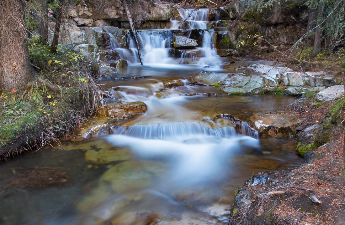 Marmot Creek Cascades
Lovely cascades in middle part of Marmot Creek Marmot Creek Cascades
Lovely cascades in middle part of Marmot Creek |
|||
 Marmot Creek Cascades
One of several smaller falls in upper part of Marmot Creek Marmot Creek Cascades
One of several smaller falls in upper part of Marmot Creek |
|||
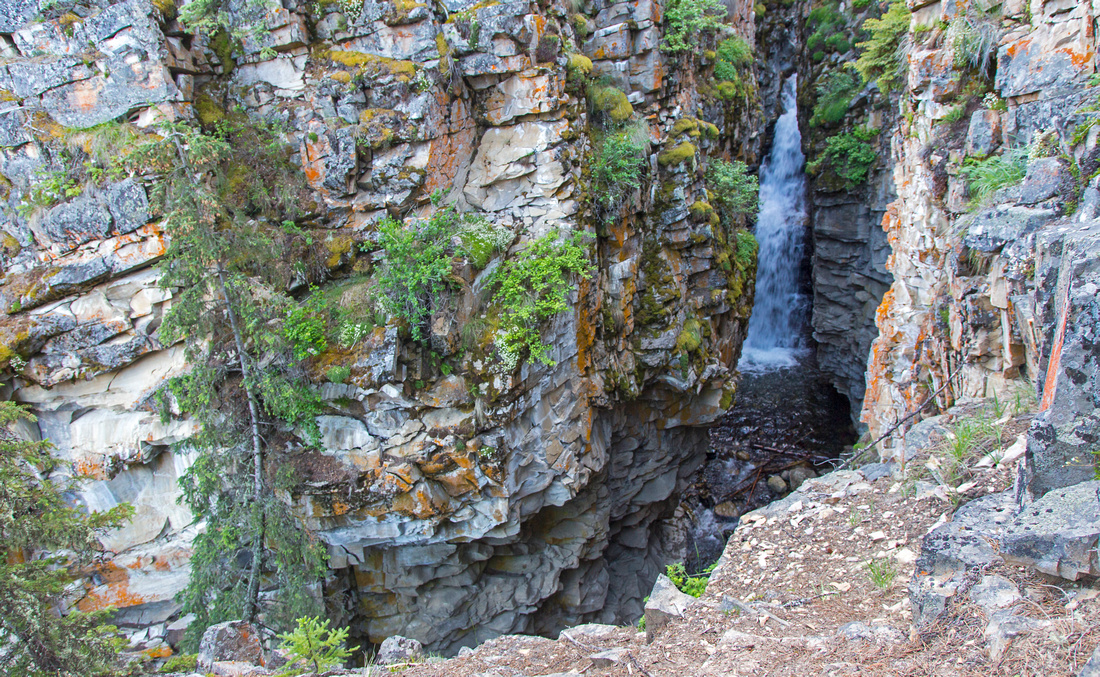 Marmot Creek Canyon
Deep Canyon just before upper creek crossing Marmot Creek Canyon
Deep Canyon just before upper creek crossing |
|||
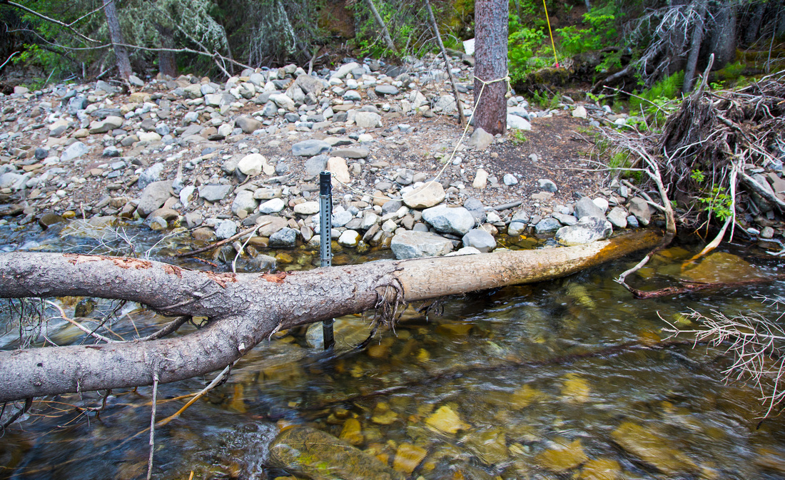 Marmot Creek Crossing
Creek crossing on slick log above the waterfalls. Marmot road is 5 minutes away Marmot Creek Crossing
Creek crossing on slick log above the waterfalls. Marmot road is 5 minutes away |
|||
|
Old Hummingbird Plume Fire Lookout wooden structure, still standing as of May 2022 |
Abstract
| Overall Difficulty | D3 | Occasionally steep and scrambly bits on creek banks. Unbridged rock-hop of Marmot Creek below Troll Falls. Creek crossing on slick log with help of handline in upper part (optional). | |||
| Snow Factor | S3 | Marmot creek will be icy in winter and require micro-spikes for traction. Snowshoes for approach and/or loop return | |||
| Scenery | Spectacular set of waterfalls. Open viewpoint of Kananaskis valley and several major peaks in Nakiska area. Historic lookout site with good views across Hwy40 corridor | ||||
| Trail/Marking | Good | Wide trail with marked junctions to Troll Falls followed by narrow but well defined trail up the creek. Orientation issues for navigating maze of X-country ski trail on optional loop return | |||
| Suggested Time | 3-5 hr | Hike itself will take 2-3 hours, but you will want to spend extra time for photographing the waterfalls! Add ~2hrs for Hummingbird Plume extension | |||
| Elevation | Start: 1450m Max: 1610 (1965m) m Total: ~250m (550m) | Round Trip: ~7 km (12km) | |||
| Gear | Light hikers. Single hiking pole could be helpful for stability. Micro-spikes and perhaps snowshoes in winter. | ||||
| Water | Marmot Creek. Hike is short - no need to carry more than 0.5L | ||||
| Dog Friendly | Yes | Troll Falls trail is very popular - please keep control of your pet. | |||
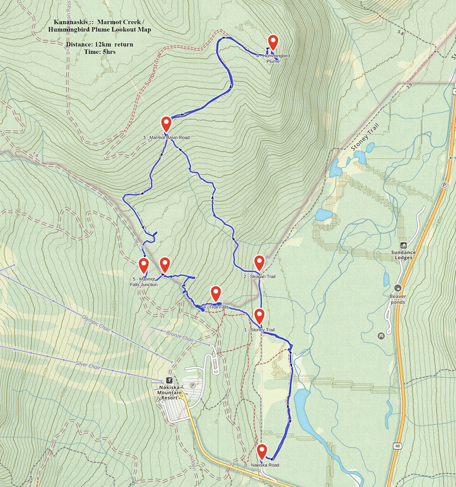 Marmot - Hummingbird GAIA Map
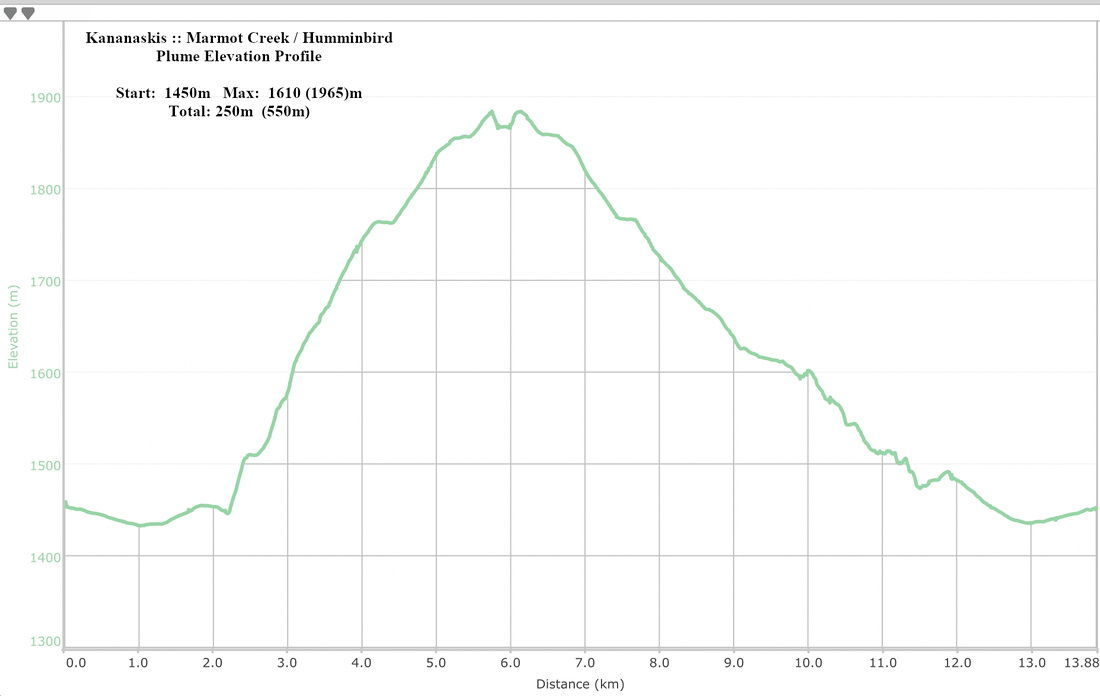 Marmot - Hummingbird Elevation Profile