Google Map |
Rockies :: Kananaskis :: Little Lougheed |
GPS Track |
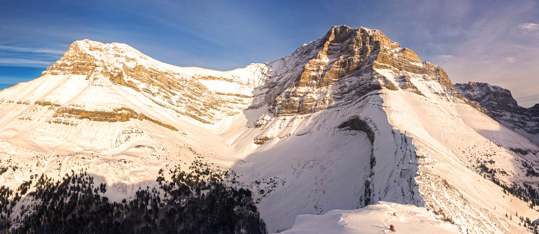 
Lougheed Towers from summit of Little Lougheed |
|||
| Trip Summary | |||
January 7, 2017Little Lougheed is unofficial name for outlier west of Mt. Lougheed seen as one drives south along Smith-Dorrien corridor near West Wind Pass trailhead. It is great little ascent year-round with similar overall metrics as more popular Ha Ling, EEOR or Windtower. Payout in form of amazing scenery is more than worth the effort. Despite fair amount of elevation gain this is a short trip and can easily be completed as after-work trip from Canmore. Main obstacle is boulder field halfway up, best bypassed on mildly exposed ridge to climber right side. Final talus slope is quite lose and requires caution on descent, but presents no difficulties otherwise.
Park at shoulder of Spray road near Spencer Creek ~40 min from Canmore. It is unmarked, but obvious -- drainage flowing between Mt. Sparrowhawk (south) and Mt. Lougheed (north). This drainage can also be used for summer scramble of Mt. Lougheed. Follow trail on north side of the creek to the bridge but do not cross to the south side. Instead continue along the left side for another 5-10 minutes, then start ascending steep hillside; cairn marks start of faint but recognizable and slightly eroded trail. Moderate at first it steepens higher up, then reaches base of huge boulder field (first pic in the gallery). Most parties seem to traipse up this boulder field, but it is far better to ascend ridge to its right side. This ridge has few easy scrambling steps and one spot is mildly exposed, but much easier than it looks. About 1 hr above Spencer Creek you reach top of boulder field and re-enter the forest. From here going is easier. Several openings on the right side provide amazing views of Mt. Lougheed, Mt. Sparrowhawk and upper Spencer Creek valley. After reaching treeline ascent steep and lose talus slope to obvious summit; it is easiest and least steep to traverse diagonally R-L then turn right and walk across connecting ridge to the summit cairn. Views of Lougheed Towers from the summit are amazing to say the least. Summit area is large, and unless strong winds that frequently blow here force you to leave you might wish you brought bivi sack for overnight stay!
Descent is the same way you came up and will be twice as fast. Be careful descending upper talus slope as twisted or worse ankle is distinct possibility. Hiking poles are great asset here. |
|
Gallery |
|||
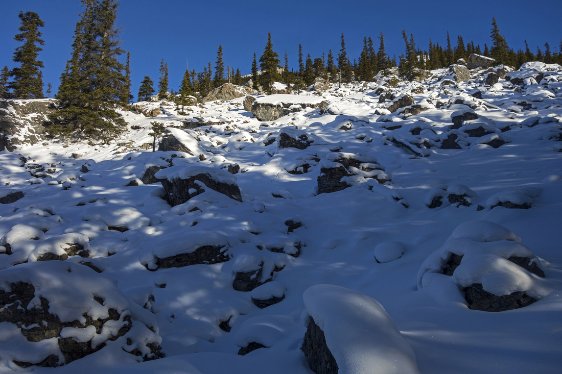 Base of large boulder field 1/2 hr from Spencer Creek
 |
|||
 Open views north along the ridge above boulder field
 |
|||
 Halfway up; Mt. Lougheed right, Little Lougheed center left
 |
|||
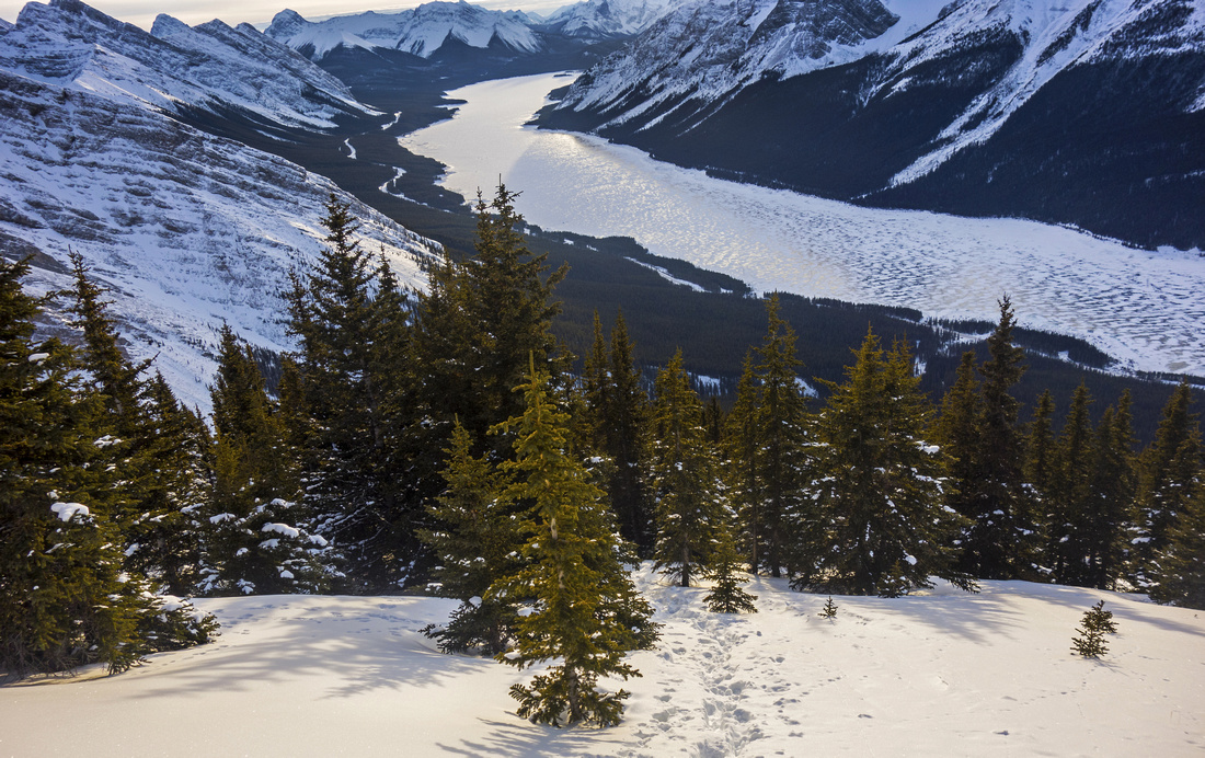
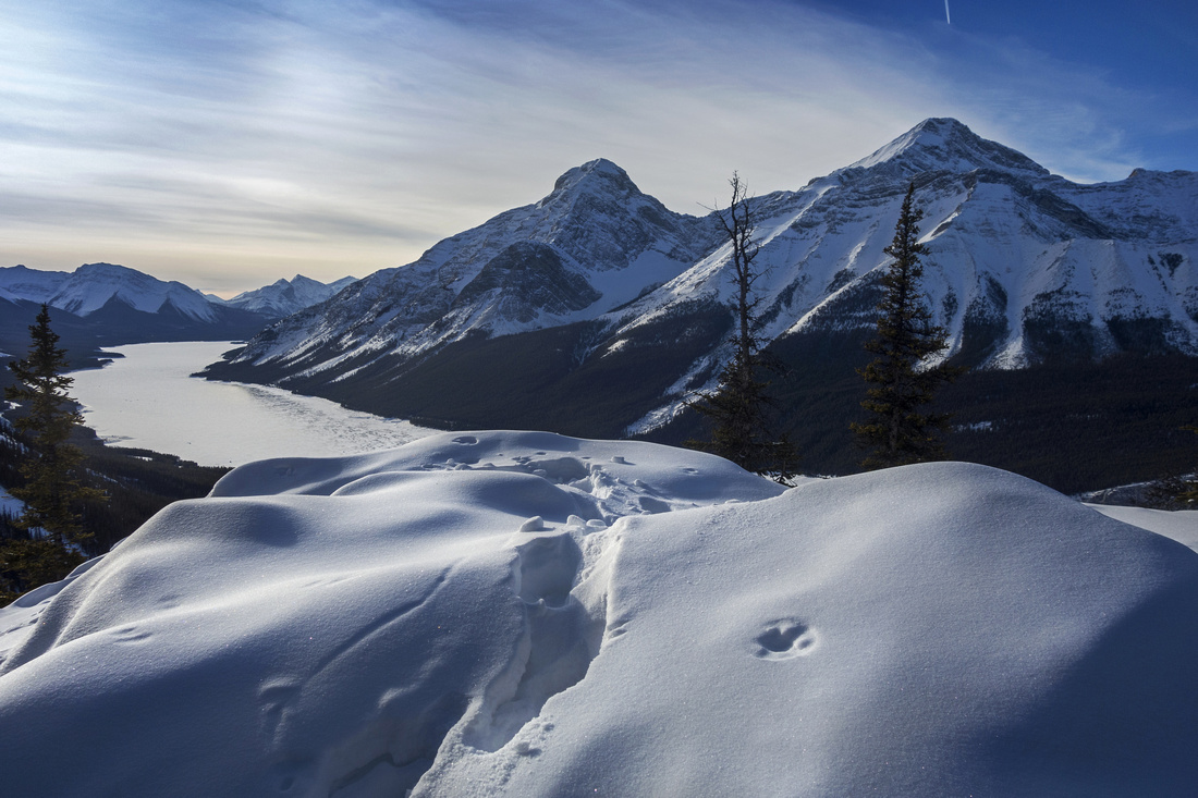 View back to Spray Lakes, Mt. Nestor and Goat Mtn
 |
|||
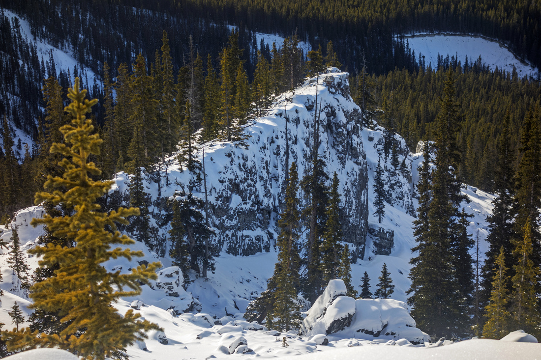 Looking back at ascent ridge above boulder-field
 |
|||
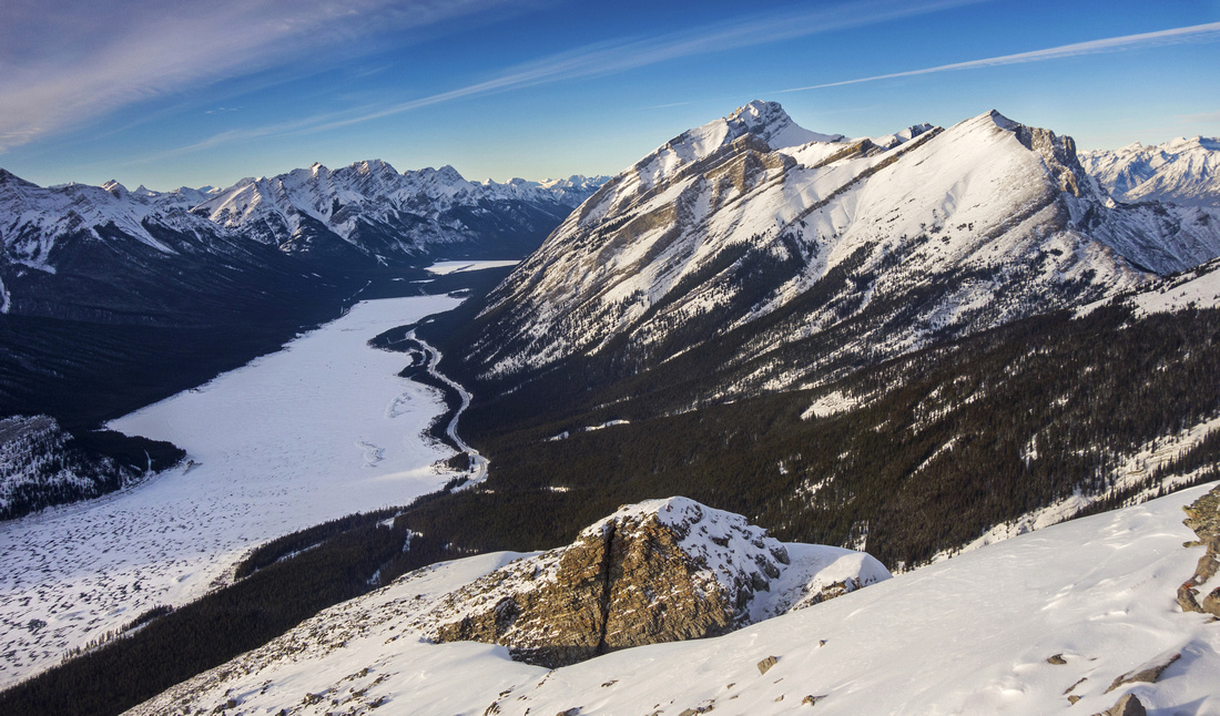
 Mt. Sparrowhawk and upper reaches of Spencer creek
 |
|||
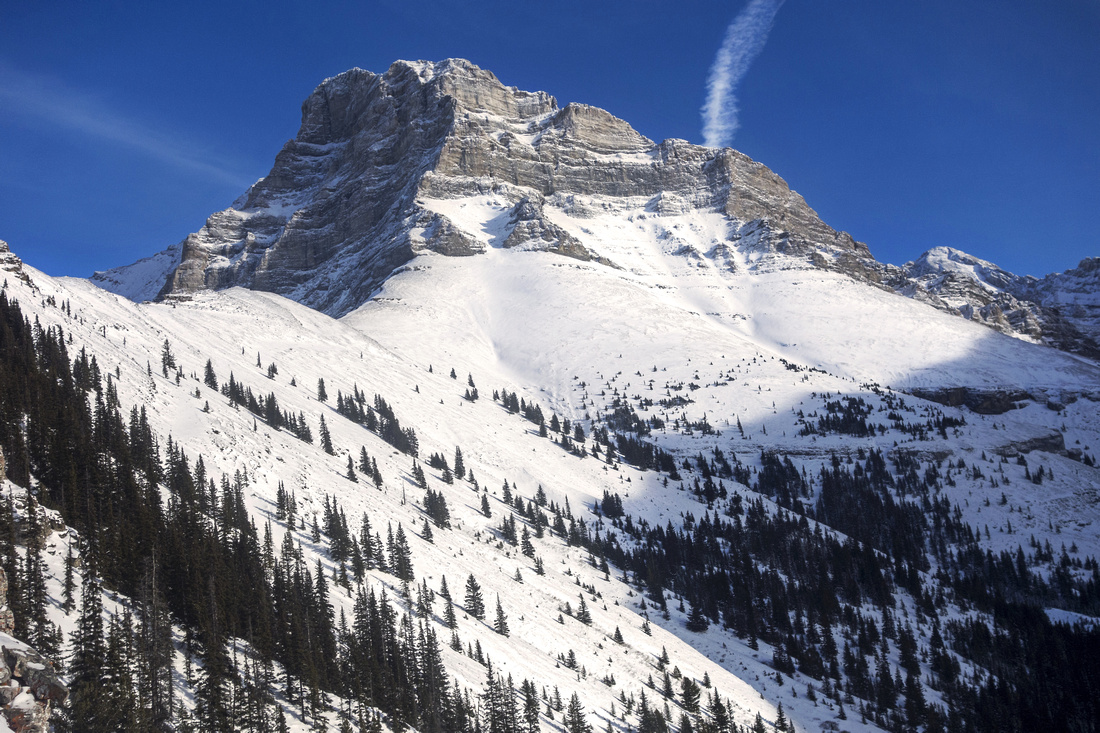 In-your-face Mt. Lougheed from clearing on upper ridge
 |
|||
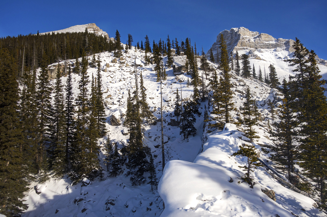
 Looking back as route exits treeline and starts final ascent
 |
|||
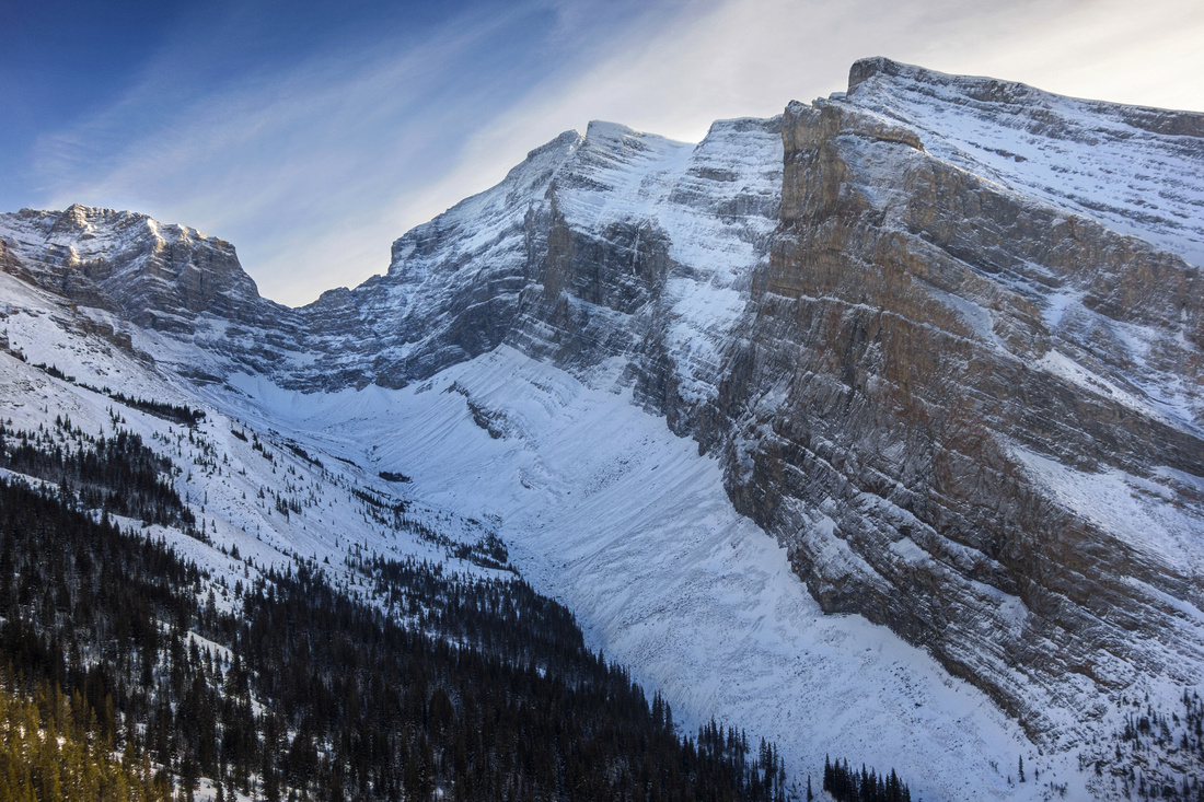
 View of Big Sister and Rimwall near the summit
 |
|||
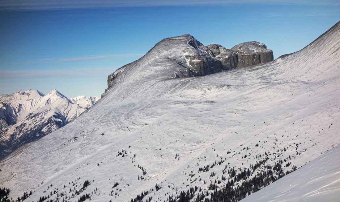 Zoom on Windtower easy ascent slopes
 |
|||
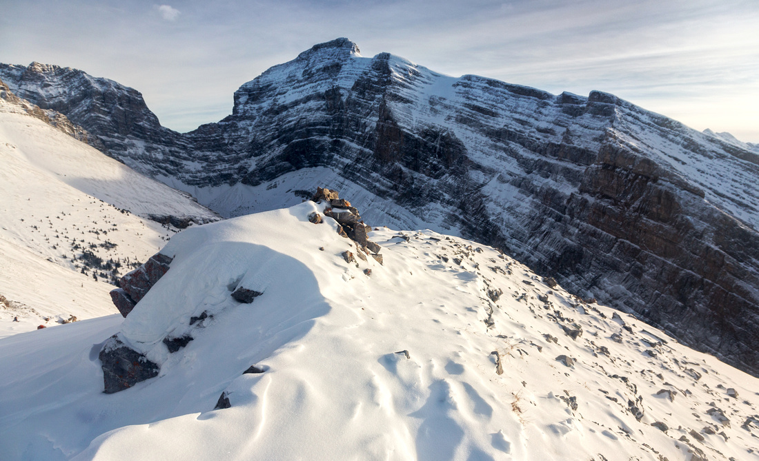 Final few mildly corniced steps leading to summit cairn
 |
|||
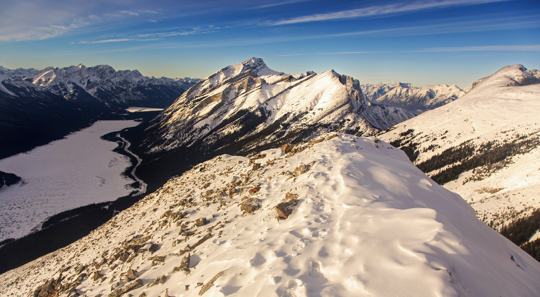 Summit view north; "V" gap center-right is West Wind Pass
 |
|||
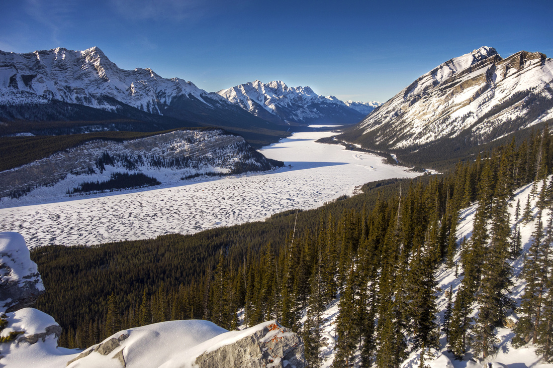
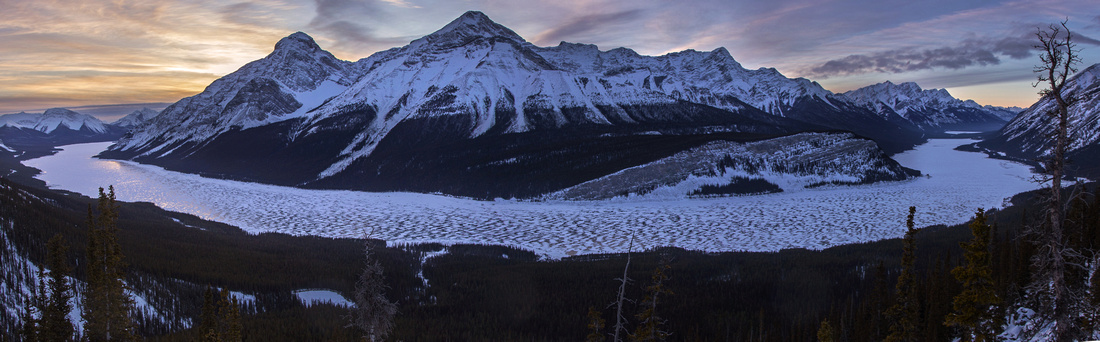 Spray Lake pano on descent
 |
|||
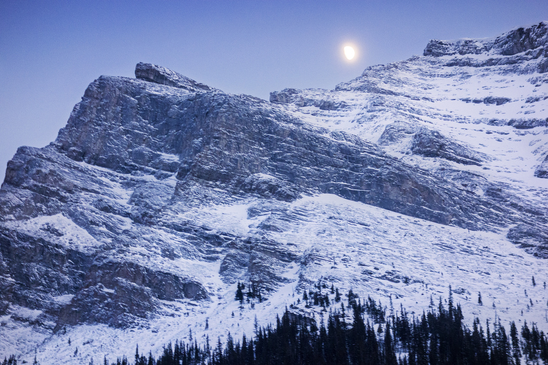 Moonrise above Mt. Sparrowhawk
 |
|||
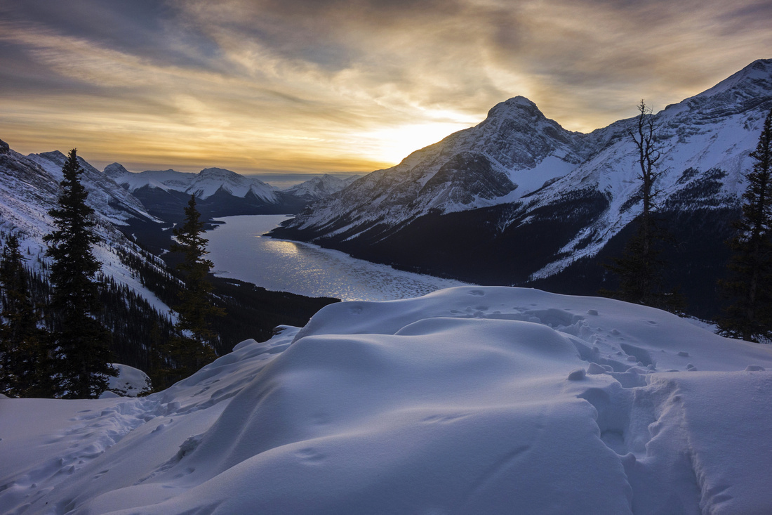 Amazing sunset colors on descent
 |
Abstract
| Overall Difficulty | D4 | Steep off-trail ascent - 800m vertical in 3km. Couple of narrow steps with mild exposure (ridge route), or tricky boulder field halfway up. Final talus slope below summit is lose and poses stability problems on descent | |||
| Snow Factor | S3 | Route is often windblown and can be booted up without snowshoes. Ascent ridge is for large part below treeline, but final talus slope below summit is open and could be avalanche trap in right conditions. | |||
| Scenery | Sweeping panorama of Spray Lakes and Smith-Dorrien corridor. In-your-face towering Mt. Lougheed and Mt. Sparrowhawk | ||||
| Trail/Marking | Poor/None | Initial trail in Spencer creek following by off-trail ascent with occasional flags/cairns | |||
| Suggested Time | 5 hrs | Return time with descent twice as fast as ascent | |||
| Elevation | Start: 1725 Max: 2490m Total: ~800m | Round Trip: ~6km | |||
| Gear | Full hiking boots preferred for ankle support. Hiking poles essential. Snowshoes or micro-spikes in winter. Wind-breaker recommended regardless of season | ||||
| Water | Entire route is bone dry past Spencer creek. Carry 2L | ||||
| Dog Friendly | Yes | Standard back-country travel precautions | |||
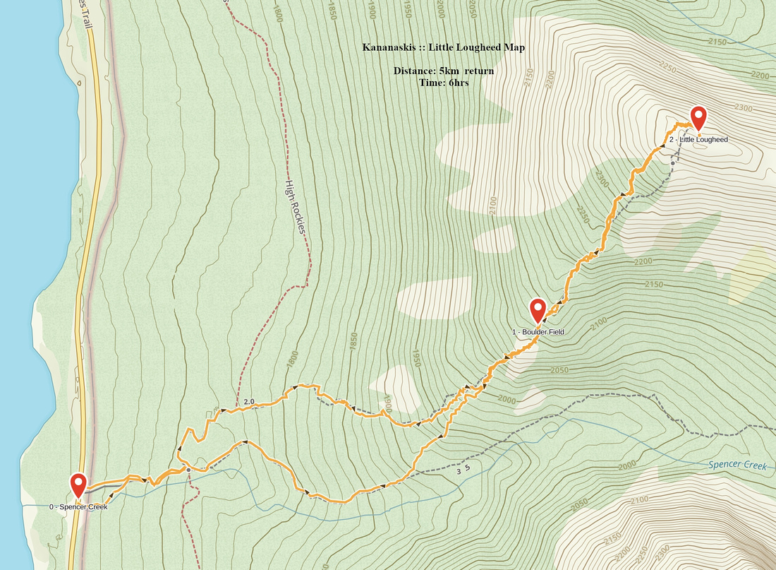 Little Lougheed GAIA Map
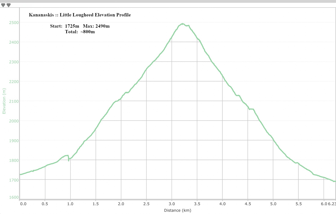 Little Lougheed Elevation Profile