Google Map |
Rockies :: Kananaskis :: Mt. Kidd Lookout |
GPS Track |
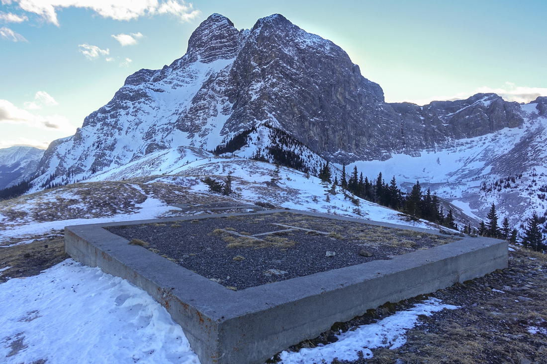 
Helipad at site of former fire lookout; Mount Kidd looming above |
|||
| Trip Summary | |||
January 20, 2021Half-day hike to grassy ridge below north face of Mt. Kidd above Kananaskis Village. Once a site of fire lookout, but nowdays only foundation and helipad remain. Views of Kananaskis Valley and several well known front range peaks are formidable, including Centennial Ridge and aerial view of Ribbon Creek. Trip is feasible year-round, but avalanche conditions need to be checked carefully in winter as open grassy slopes above treeline are very steep. Main difficulty is navigating maze of XC-Ski trails above Kananaskis village. Trip is described in both Daffern K-Country trail guide and Nugara snowshoe guide, but directions are not clear. From junction of Aspen and Kovach XC-Ski trails, key is not to charge in forest straight away but to continue on upper road, watching for flagged trail 10-15 minutes further up --- use GPS track above. Couple of really steep rises below treeline are very awkward, specially in winter. Above decent trail switchbacks open slopes, then ascends the ridge to the lookout. If not windy it is worth continuing for another 15min or so to base of Mt. Kidd cliffs -- 5.7 technical ascent. Views are spectacular, in particular in-your-face Mt. Allan Centennial Ridge. Go early in winter as sun hangs low on horizon behind Mt. Kidd and puts whole are in shade quite early (as evident from gallery pics). |
|
Gallery |
|||
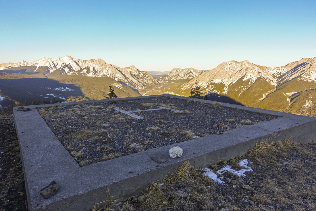 Kananaskis Valley Kananaskis Valley Looking north from the helipad to Hwy 40 corridor and Foothills
 |
|||
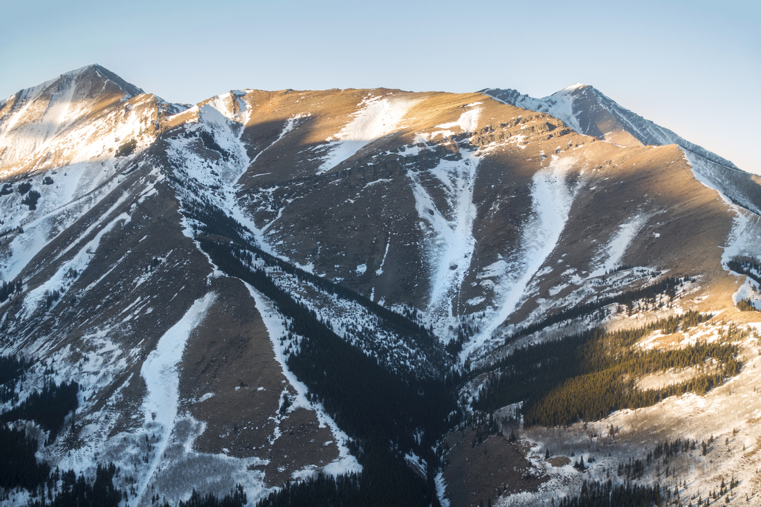 Centennial Ridge Centennial Ridge Mount Allan Centennial Ridge; Mt. Collembola upper right
 |
|||
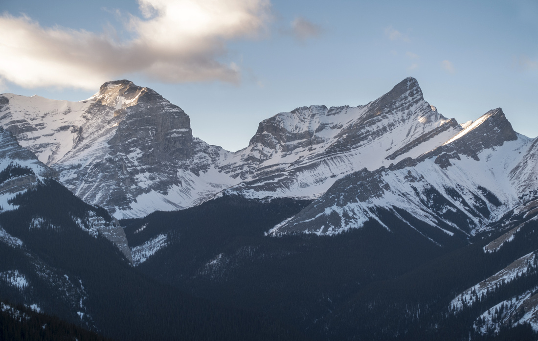 Sparrowhawk and Wind Sparrowhawk and Wind Mount Sparrowhawk (L), an easy scramble from Spray Lakes on the other side. Wind Mountain (R) normally approached via Ribbon creek is difficult
 |
|||
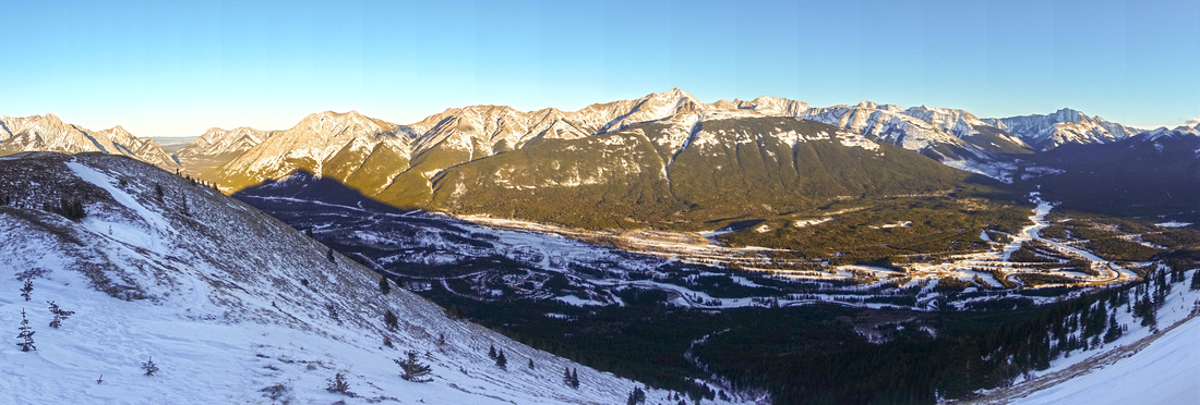 Kananaskis Valley Panorama Kananaskis Valley Panorama Panoramic view of Kananaskis Valley further along the ridge; Kananaskis village below. Evan-Thomas creek and distant Mt. Fisher to the right
 |
|||
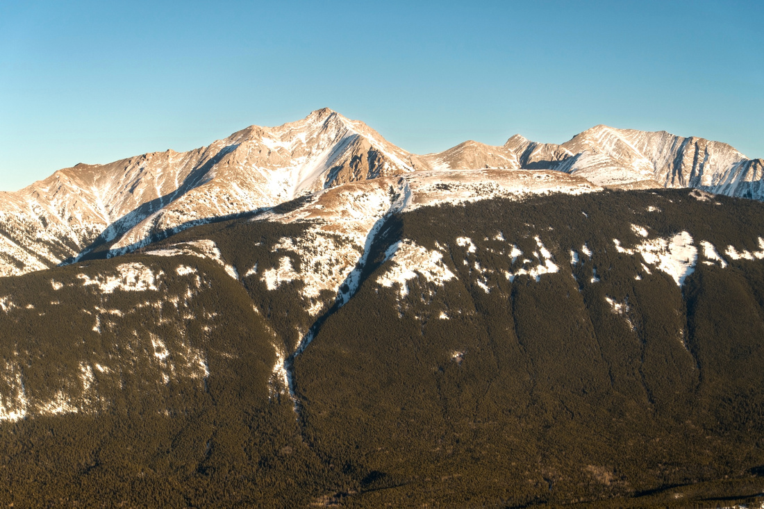 Old Baldy Old Baldy Old Baldy Telephoto; mostly easy scramble on east side of the valley
 |
|||
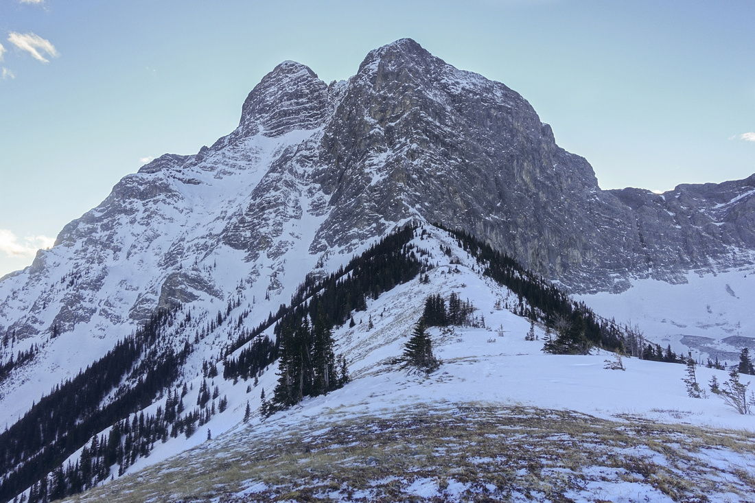 Kidd Cliffs Kidd Cliffs North Ridge of Mt. Kidd, 5.7 technical climb. Normal scramble route (climber descent) is on the other side and mostly a slog
 |
Abstract
| Overall Difficulty | D4 | Very steep east grassy slopes. Some awkward moves below treeline. Strong winds often blast final ridge with no shelter | |||
| Snow Factor | S4 | Real avalanche danger on open ascent slopes. Check the conditions. Bypass in the woods further north, suggested by guidebooks, would be awful slog. Go elsewhere if avalanche danger is high | |||
| Scenery | Mt. Kidd towering cliffs. Aerial view of Ribbon creek and Mt. Allan Centennial ridge. Several well-known Kananaskis peaks that include Mt. Sparrowhawk, Wind Mountain and Ribbon Peak | ||||
| Trail/Marking | Poor | Maze of confusing XC Ski country trails in lower part; flagged route afterwards. Direction above treeline is obvious | |||
| Suggested Time | 4-5 hr | Return time to the lookout site; add 45 min if continuing to base of Mt. Kidd | |||
| Elevation | Start: 1510 m Max: 2140 m Total: ~650m | Round Trip: ~6 km | |||
| Gear | Hiking poles extremely helpful. Snowshoes often not necessary in winter, but traction (micro-spikes) will be helpful. GPS suggested (use download link above) to correctly identify start of trail | ||||
| Water | Dry hike. Carry 1.5L in summer | ||||
| Dog Friendly | Yes | Standard back-country precautions | |||
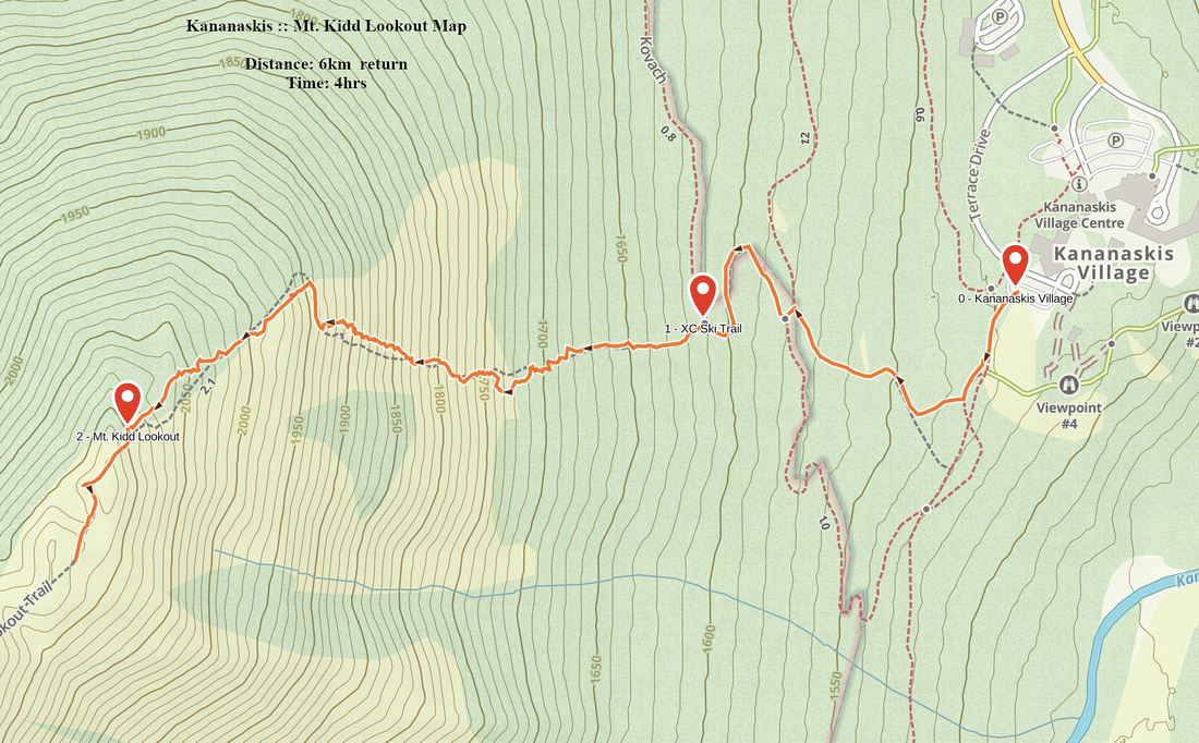 Mt. Kidd Lookout GAIA Map
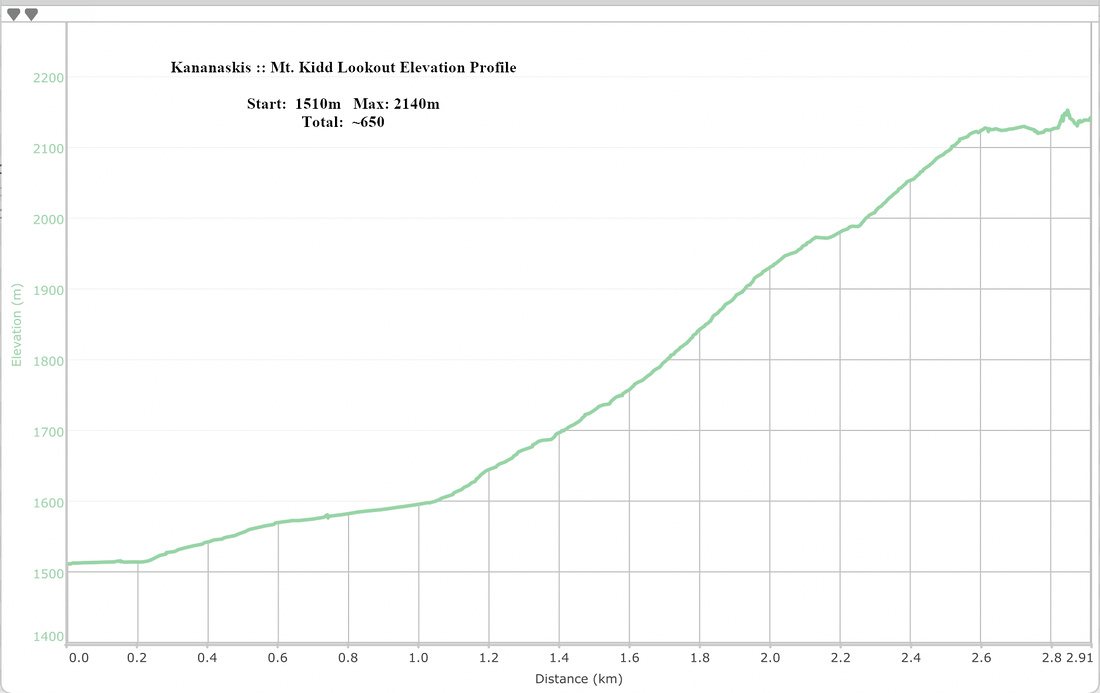 Mt. Kidd Lookout Elevation Profile