Google Map |
Rockies :: Icefields :: SE Lyell Glacier |
GPS Track |
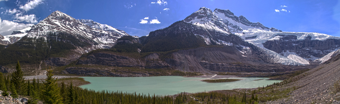 
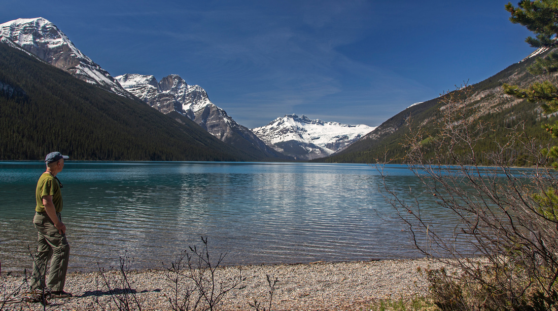
Glacial pond at base of SE Lyell Glacier; Mons drainage and normal climber approach for Mt. Forbes left |
|||
| Trip Summary | |||
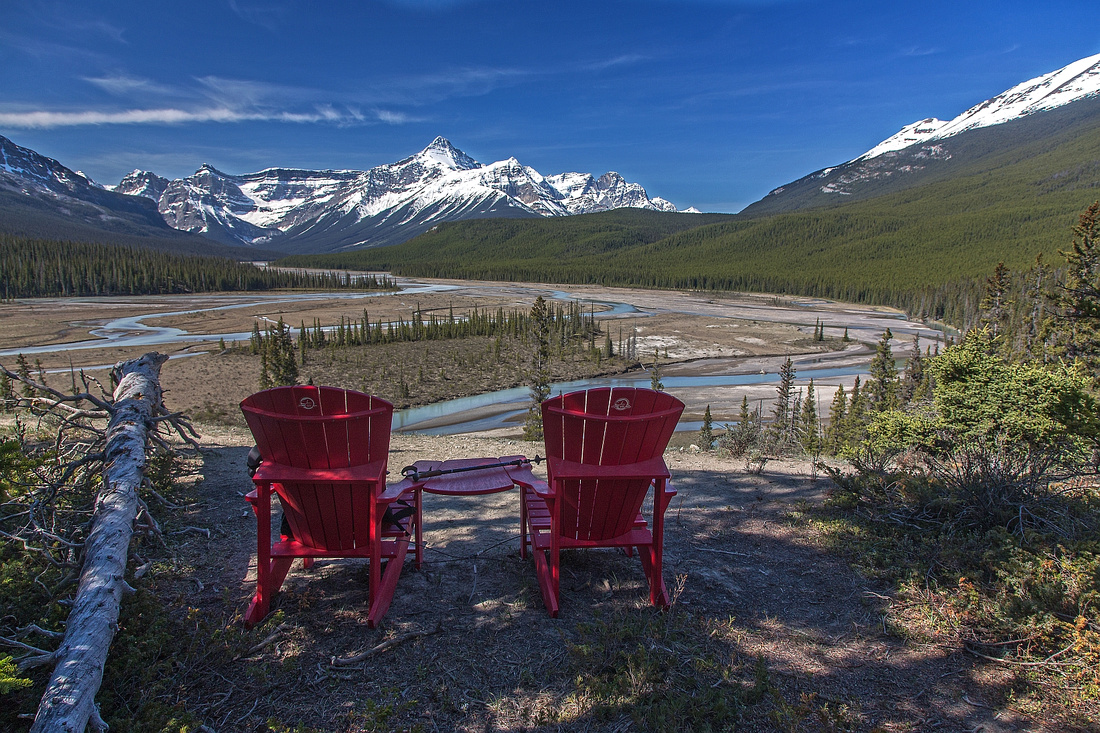
May 22, 2015Long day trip or backpack in the heart of Banff National park up the glacial valley between Mt. Forbes and Mt. Sullivan/Mt. Erasmus and ending at toe of south-east Lyell Glacier. Main prize: Total feeling of remoteness culminating with views not enjoyed by too many. First part of the journey is popular early (and not so early) season backpack to Glacier Lake. Starting from trailhead just off Saskatchewan River Crossing, wide and well-defined trail leads for 9km (about 2 hours, moderate pace) to the lake. Main interest from scenic point of view in this section is 1) Crossing of North Saskatchewan River on "de-luxe" bridge in about 1km from the parking, and 2) Fabulous viewpoint of Howse River, another 1km further along the trail. Couple of red Adirondack chairs have been placed here; it is super-tempting to forget about the hike and spend the day enjoying the views instead! Past the viewpoint trail descends to river flats and briefly travels level, then begins long and gradual rise to top of hill below Survey Peak. Several bridged stream crossings and chance to refill water bottles here. Trail is muddy and braided as it levels on maximum elevation for the day (about 1670m). Dip on the other side is shorter and steeper; keep this in mind for return! Just before the lake, there is signed junction -- old horse path that leads down the outflow of Glacier lake to Howse river. In winter this is preferred mean of travel, as it avoids "Survey hill" and stays flat offering open views along the way. Glacier lake is one of largest in Banff National Park and situated in very pristine settings. Back-country campground is at east end of the lake (turn left at sign as trail reaches shoreline). There is outhouse, food cache, firepit and couple of picnic benches near the beach. There are no tent pads (May 2015), and flat ground is bit hard to find; however there is rustic "Elkaholic" cabin that can be used as shelter in emergency. It is open (no door), so please respect this site as Cultural Resource protected under National Park Act. Length of valley leading to toe of Lyell glacier can be seen from the beach near the firepit. Rough trail continues on north side of the lake. There are some ups and downs and minor bushwhack. West end of the lake is reached in about an hour from the campground; cairns lead across large washout (result of 2013 spring floods). From here journey is not so straightforward. Initially faint path continues across the flats for 20 minutes or so, then ends abruptly at Glacier River. Climbers heading for Mt. Forbes or Lyells are advised to ford here; hikers destined for Lyell glacier should keep at north side of the valley. Faint trail starts few meters upstream, but deteriorates soon hoping over the roots and across dense shrubs. Couple of flags can be seen, but goal is to cross water channel to the left side as soon as possible. There are couple of possibilities; easiest one is wide log that can be safely navigated even with blindfold. This log is another 15-20 minutes from climber crossing, or about 40 minutes from west end of Glacier Lake. Beyond the crossing there is no trail, but direction is obvious. Higher up the valley faint paths come and go; eventually you reach site of old intermittent camp (about 9-10 km from Glacier campground). Views across the valley to ice-flows descending from Mt. Forbes -highest in Banff National Park- are amazing! Beyond the old camp there is still another half an hour, and it is the hardest part. Lots of bush to contend with. Best way is to stay low close to river bank; if you are lucky you might be able to string several short meadows flowing into each other. An odd cairn might be encountered as well. Head of valley appears close, but this final section is longer than it seems; tiredness that has set by now (specially if day-hiking from Saskatchewan River Crossing) adds to ordeal. Finally trees and shrubs thin out and there is good view across the valley to the bottom of drainage descending from Mons glacier. Ahead is larger than expected milky blue lake directly under the toe of Lyell glacier. It pays off to scramble a bit for unobstructed panoramic view. This is very special place indeed and sights not seen by too many. If time allows there is room for further exploration; it is possible to navigate along north side of the lake to toe of glacier or ascend moraine higher for better views. Climbers sometimes cross flats here (instead 20 minutes past west end of Glacier lake); presumably there is trail heading up Mons drainage that leads over class 3 terrain to coral bivi at base of roped climbing. Return is the same way, and if day hiking from Saskatchewan River Crossing it will feel twice as long. However shade will set on north side of the valley and breeze usually picks up in late afternoon allowing to cool off. If backpacking, 3 day backpack is optimal: First day to the lake and setup the camp, second day for journey to Lyell glacier, and third day to hike out. |
|
Gallery |
|||
 Mt. Murchison and North Saskatchewan River
 |
|||
 Howse River lookout about 30 min from the trailhead
 |
|||
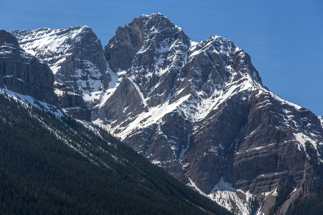
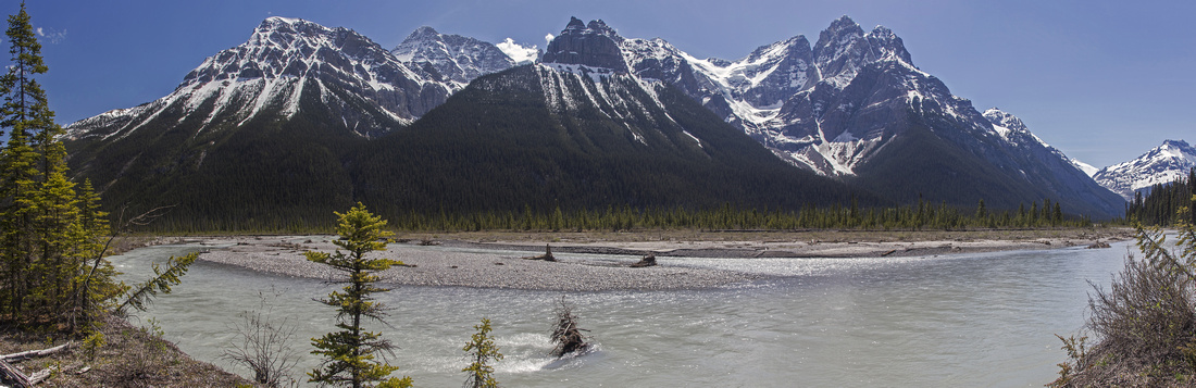
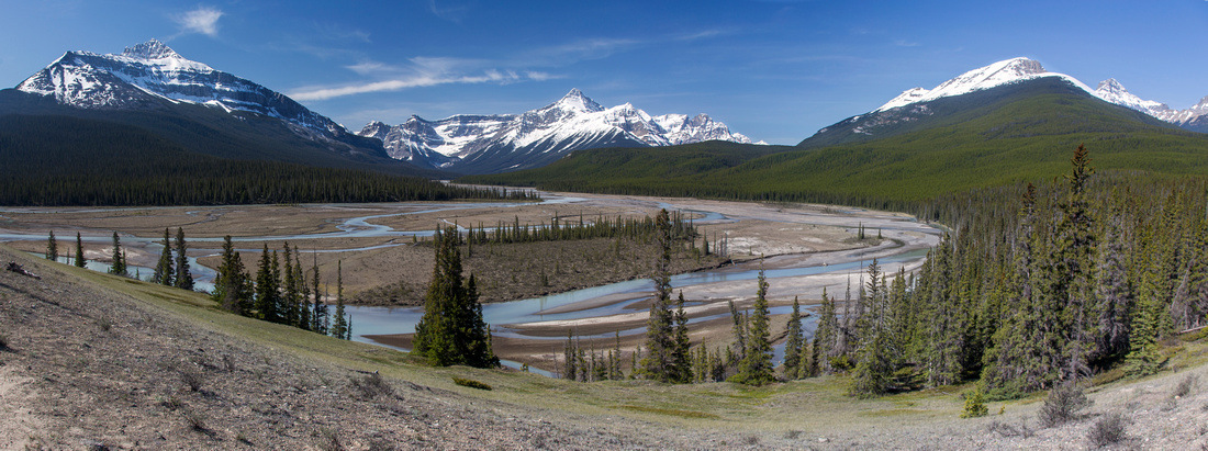 Howse River Flats. Mt. Sarbach left, Outram center, Survey Peak right
 |
|||
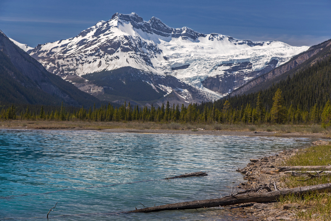
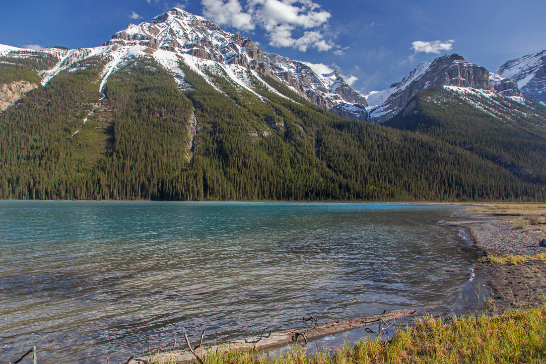
 Glacier lake looking west to Lyell glacier
 |
|||
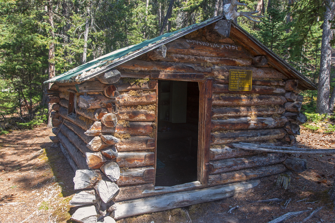 "Elkaholic" cabin at Glacier Lake campground
 |
|||
 West end of Glacier Lake looking at Division Peak
 |
|||
 Mighty Mt. Forbes - highest in Banff National Park
 |
|||
 Beach at west end of Glacier Lake
 |
|||
 Glacier River ~20 - 30 min from west end of the lake
 |
|||
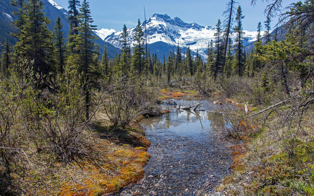 Braided channels in upper valley
 |
|||
 East ice fall of Mt. Forbes
 |
|||
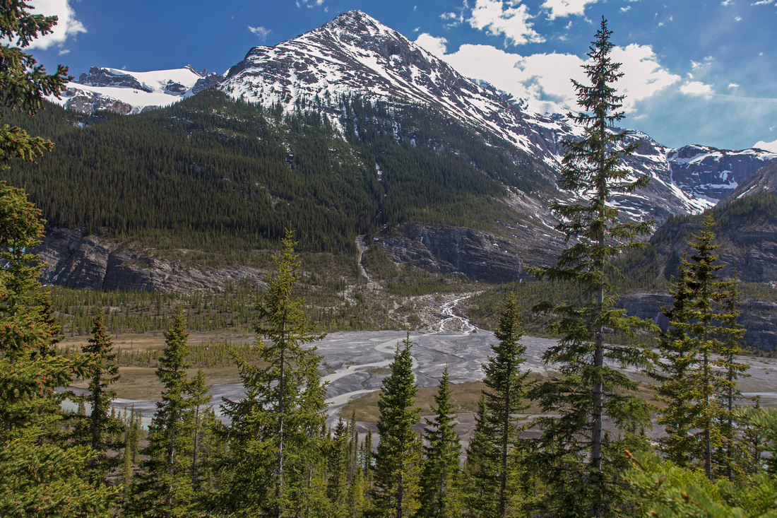 Mons drainage near toe of Lyell glacier
 |
|||
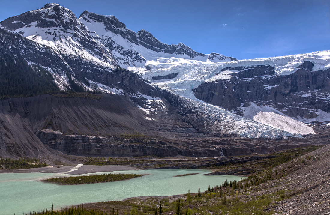 Classic view of Lyell glacier from moraine slope on north side of the valley
 |
|||
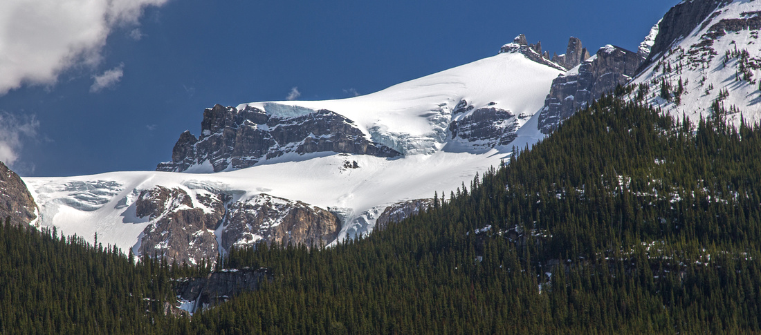
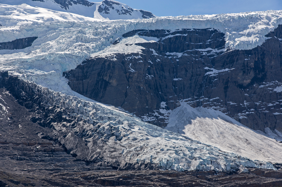 Zoom on terminus of south-east Lyell glacier
 |
|||
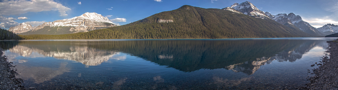 Glacier Lake on return. Mt. Sarbach right
 |
Abstract
| Overall Difficulty | D4(D6) | Wide park trail with moderate elevation gain. Some muddy sections. Bushwhack and crossing of glacial streams. If day-hiking to Lyell glacier, due to total length (40Km) trip would deserve D6 rating | |||
| Snow Factor | S2 | Glacier lake frequently visited on skis or snowshoes. Day trip to Lyell glacier not feasible due to short amount of daylight | |||
| Scenery | Spectacular Howse River viewpoint. Large back-country lake in very pristine settings. Amazing view of Lyell glacier. Remote wilderness valley with glacial streams and views to some of the highest peaks in Banff National Park | ||||
| Trail/Marking | Excellent / Poor | Well defined trail to Glacier Lake. Rough path around the lake disappearing in upper valley; occasional cairns | |||
| Suggested Time | 12 hr | Return time for Lyell glacier. Hiking just to the Glacier Lake is 2 hr (each way) | |||
| Elevation | Start: 1470m Max: 1670m Total: ~950m (Lyell Glacier return) | Round Trip: 40.5km (Lyell Glacier) | |||
| Gear | Full hiking boots or day hikers. Gaiters and long sleeves/pants helpful for bushwhack in upper valley. Skis in winter | ||||
| Water | Several side-streams on Glacier Lake trail. Seasonal streams and Glacier river in upper valley. No need to carry more than 1L at any time | ||||
| Dog Friendly | Yes | Standard griz-country precautions | |||
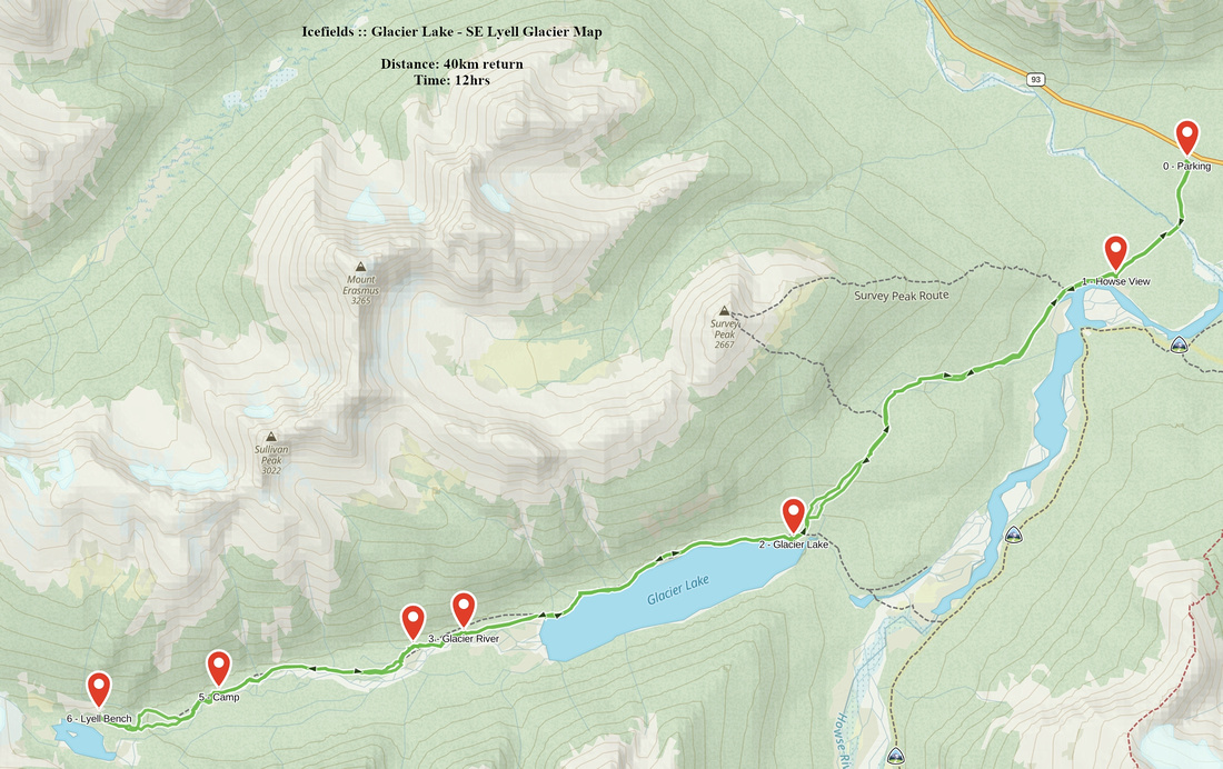 Glacier Lake - SE Lyell Glacier GAIA Map
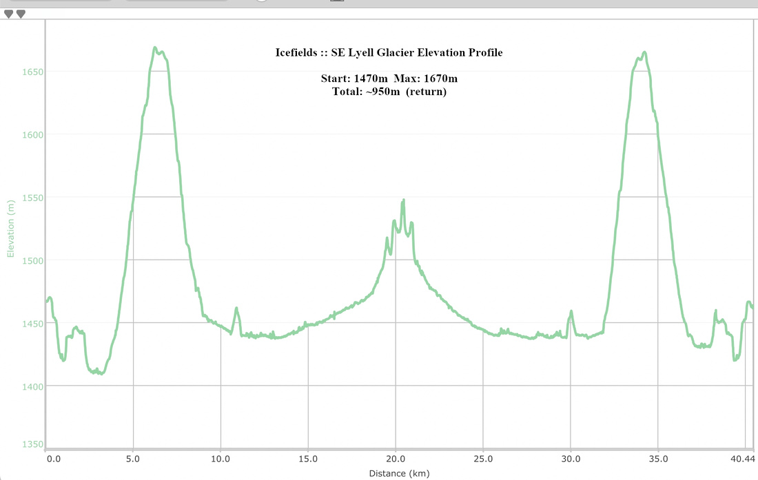 Glacier Lake - SE Lyell Glacier Elevation Profile