Rockies :: Banff-Louise :: Sundance Canyon |
|
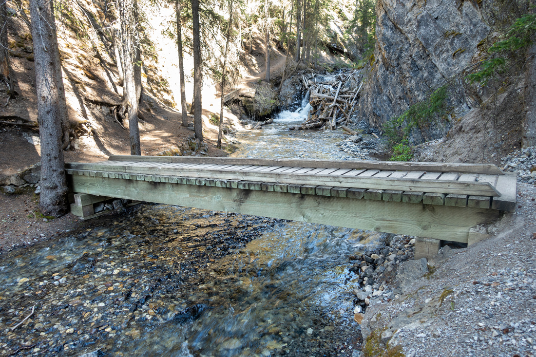
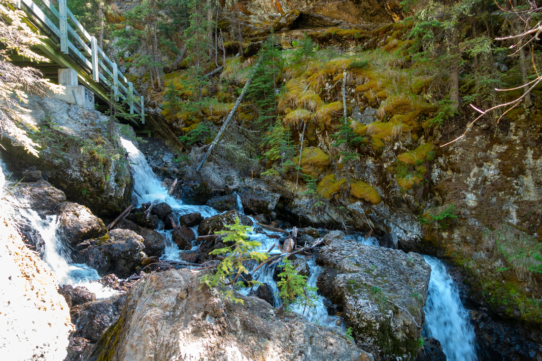
Sturdy Wooden Bridge in upper Sundance Gorge after brief steep rise |
|||
| Trip Summary | |||
June 5, 2023
Family outing in Banff vicinity that benefits from excellent paved approach, suitable for cycling, leading to short, but perhaps more scenic than expected Canyon gorge at west base of Sulphur Mountain. Parking is at Cave & Basin Historic Site, birthplace of Canadian National Parks. For first time BNP visitors tour of Visitor Center is recommended (fee). There are also some interesting marsh boardwalks leading to Bow Valley viewpoints below the facility. Sundance Canyon trail is wide, mostly flat paved pathway that offers nice views of Bow River. After some 20-25min of walking is junction: left deactivated mountain road leading to top of Sulphur Mountain -- see "Cosmic Ray" on this website. To the right is Healy creek connector with Brewster Trail; frequented by horses, and not recommended even for cycling. Brief rise leads to end of paved path in another 10 minutes or so, passing forested "Sundance Pass" along the way with Spray River trail junction along the way. Bike locks are provided at the end as proceeding into the Canyon on bicycle is not allowed.
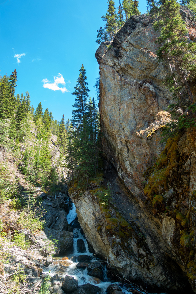
Loop trail can be walked either way, but CW is preferred. Initial part is quite interesting, narrow gorge with steep cliffs and small waterfalls. Trail crosses several wooden bridges back and forth, before settling for more mellow walk in upper gorge. Return leg is forested but it does offer one Bow Valley viewpoint before switchbacking down to bike locks; total some 2km of easy hiking. I haven't been here in winter yet but I think ice scenery might be worthwile visit. |
|
Gallery |
|||
 Cave and Basin Cave and Basin Cave and Basin terrace looking north towards Mt. Norquay (L) and Cascade Mountain (R)
 |
|||
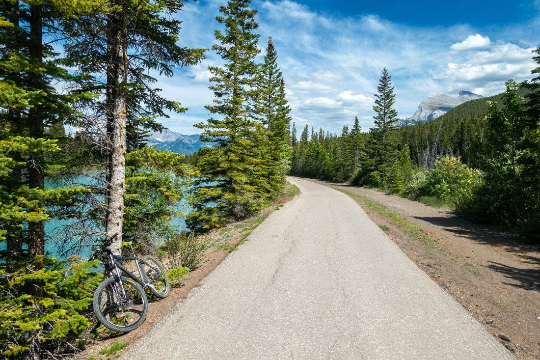 Cycling Path
Cycling very enjoyable approach path by Bow River; Rundle Mtn upper right Cycling Path
Cycling very enjoyable approach path by Bow River; Rundle Mtn upper right |
|||
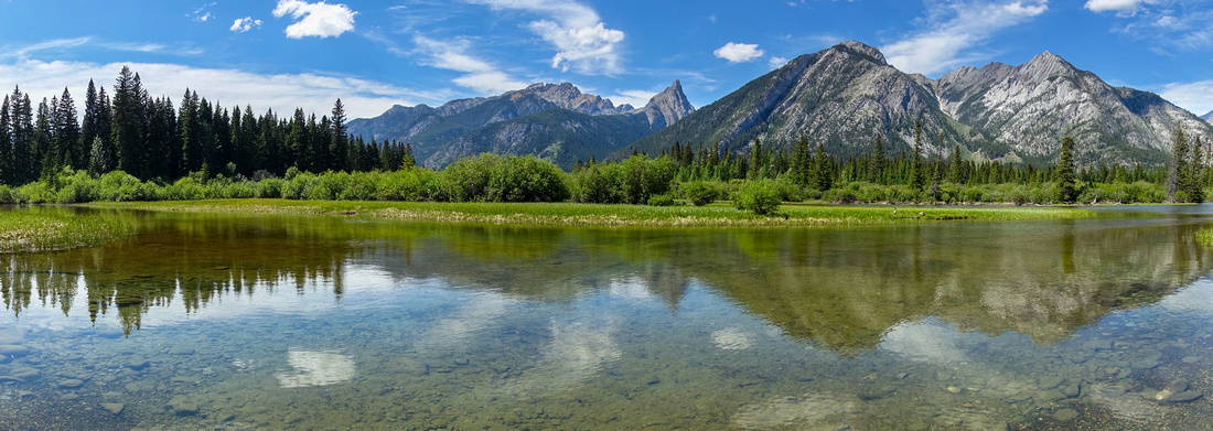 Bow Valley Panorama
 along the cycling trail. Mt. Norquay right of center; pointed peak in Mt. Edith, to its left Cory Pass and Mt. Cory Bow Valley Panorama
Bow Valley Panorama along the cycling trail. Mt. Norquay right of center; pointed peak in Mt. Edith, to its left Cory Pass and Mt. Cory |
|||
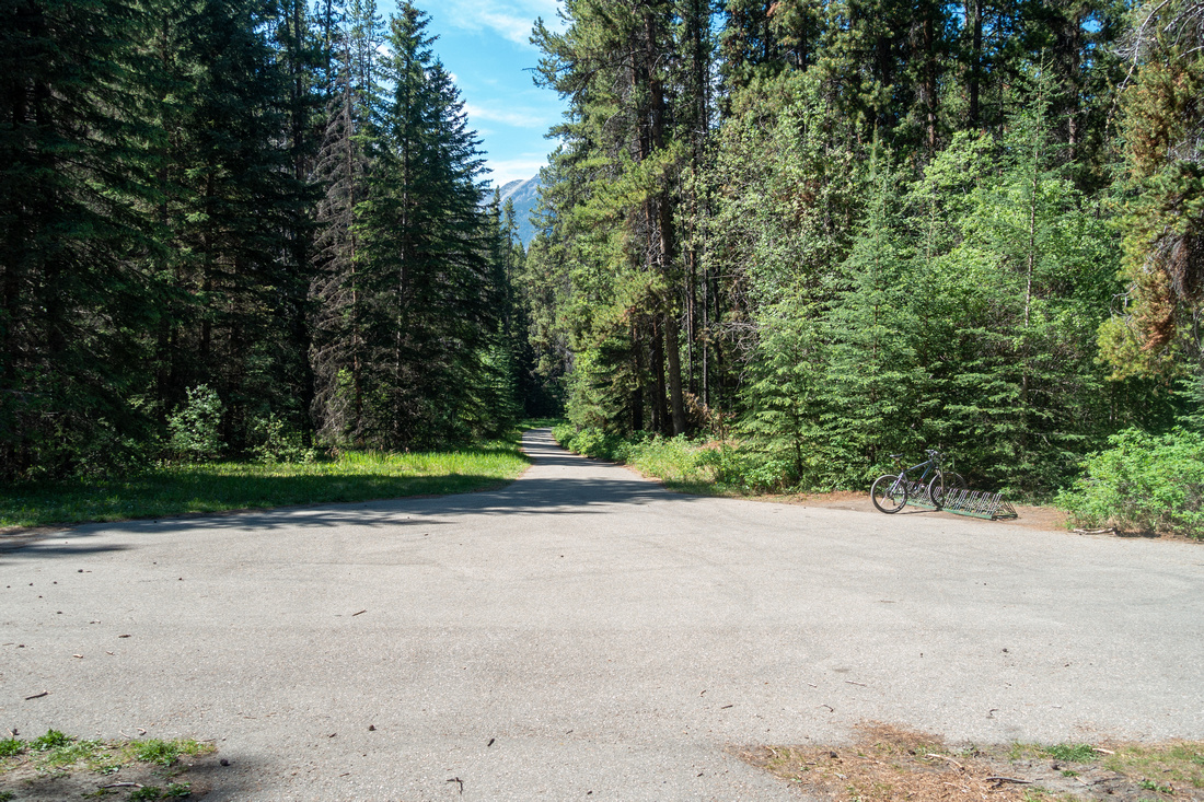 Sundance Canyon Trailhead
Bike Locks at end of Cycling Path, looking back Sundance Canyon Trailhead
Bike Locks at end of Cycling Path, looking back |
|||
 Sundance Canyon
BNP Table at trailhead before crossing first bridge (CW direction) Sundance Canyon
BNP Table at trailhead before crossing first bridge (CW direction) |
|||
|
Brief but steep rise on left side of the Canyon with some high cliffs on the other side |
|||
 Sundance Canyon
Upper gorge with bridge crossing back to right side Sundance Canyon
Upper gorge with bridge crossing back to right side |
|||
 Sundance Logjam
Boardwalks as trail flattens in upper gorge with debris choking the creek Sundance Logjam
Boardwalks as trail flattens in upper gorge with debris choking the creek |
|||
 Cave and Basin
Sign at Cave and Basin Visitor Center on Return Cave and Basin
Sign at Cave and Basin Visitor Center on Return |
|||
Abstract
|
Overall Difficulty |
Easy approach on paved trail, suitable for cycling. Brief steep rise on initial part of the Canyon |
||||
|
Snow Factor |
Possible icy sections in winter / shoulder season |
||||
|
Scenery |
Nice Bow Valley panorama on approach. Cliffs and small waterfalls in the Canyon |
||||
|
Trail/Marking |
Excellent |
Paved trail then wide trail with official BNP signs |
|||
|
Suggested Time |
2-3 hrs |
Return time including cycling from Cave & Basin. Add an hour if walking the approach road |
|||
|
Elevation |
Start: 1475m Max: 1545m Total: ~70m (Canyon) |
Round Trip: 2 km (Canyon Loop) + 4.5km (Approach) | |||
|
Gear |
Road or Mountain bike for approach (optional). Day Hikers. Spikes could be helpful in winter |
||||
|
Water |
Sundance Creek. No need to carry more than 0.5L |
||||
|
Dog Friendly |
Yes |
Please keep control of your pets for courtesy to other hikers |
|||