Rockies :: Banff-Louise :: Sulphur Mountain
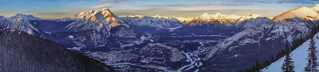 
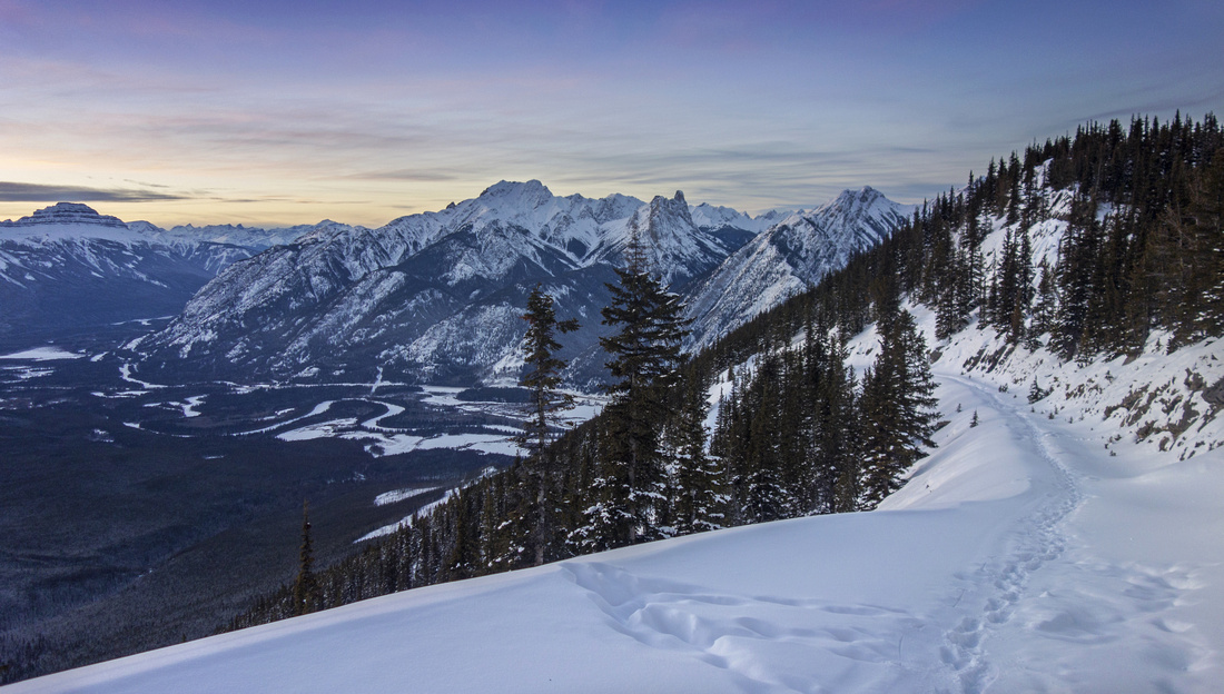
Classic View of Banff and Bow Valley from Sanson Peak - highest point of Sulphur Mountain |
|||
| View from Sulphur mountain rising above Banff Townsite is visual synonym with Banff NP. Cave and Basin National Historic Site at its base is the birthplace of Canada National Parks. Today Brewster operated gondola deposits thousands of tourists each summer to the summit, effortlessly granting one of most expansive views in the Canadian Rockies. Hiking is still pleasant option during scheduled gondola maintenance times when you have to work for the views and often can have them to yourself. Popular trail switchbacks under the gondola line; more mellow (and far more scenic!) option is from the back utilizing old Sulphur Mtn. Service road. With 2 cars both can be combined for very satisfactory loop trip. Most choose to take (free) ride down. Regardless of the way up, visit to Sulphur Mountain Cosmic Ray station perched on top of Sanson Peak and accessed via easy boardwalk from upper gondola terminal is a must.
|
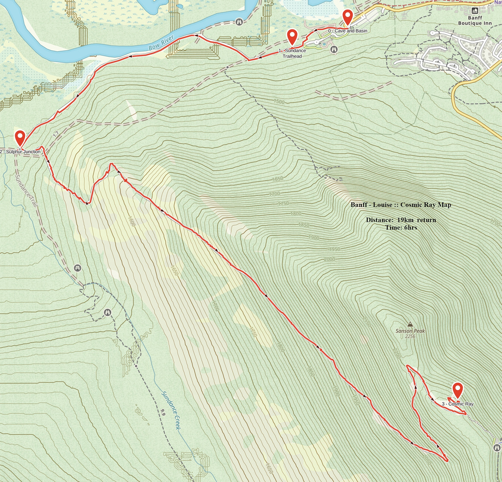
| Cosmic Ray | GPS Track | |
January 13, 2017
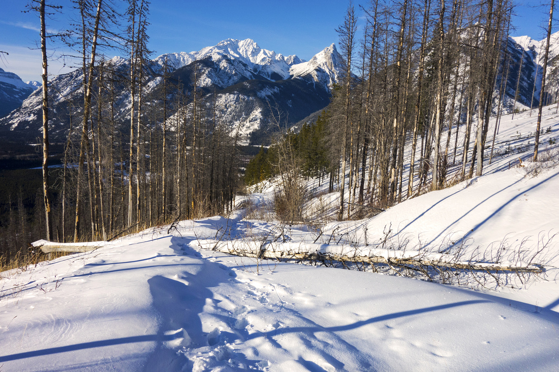
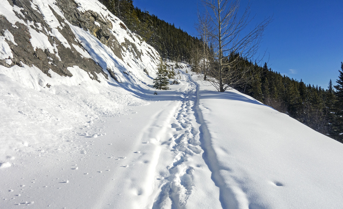
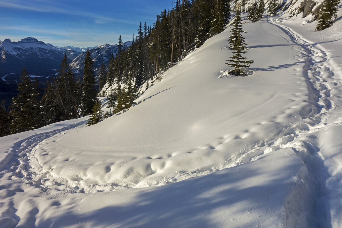
"Cosmic Ray" is fancy name for old Sulphur Mountain service road that runs along its backside. It got its name due to high-altitude geophysical laboratory built on Sanson peak and later utilized as Weather observatory. This road is well seen as one drives east towards Banff past Sunshine ski-area junction. Access is via Sundance canyon trail starting from Cave and Basin National Park Headquarters. Its main advantage are open and sunny west slopes that are more scenic than more frequently used front side. Hike is easy, but total elevation gain of over 900m requires certain level of stamina. It is better to utilize Cosmic Ray for descent, if doing the loop. In that case be aware that distance from Cave and Basin parking and Lower Gondola terminal is over 4km and will have to be walked if you have only 1 vehicle.
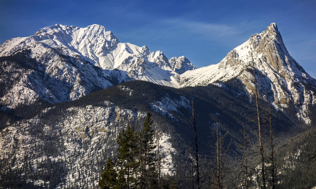
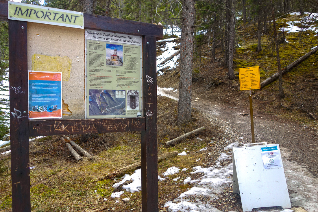
From Cave and Basin parking lot walk through the complex (swarming with tourists in summer months) and find Sundance Canyon trailhead at opposite end. ((Lower boardwalk is popular bird-watching marsh walk, and well-worth if you have time). Follow wide paved path enjoying open views across Bow Valley towards Mt. Norquay along the way. After ~25 minutes you come to marked 4-way junction. Sundance Canyon continues straight; turn left onto Sulphur Mountain road that starts ascent immediately. After couple of switchbacks you cross old burn area and settle for long diagonal ascent. Views here back towards Mt. Edith, Mt. Cory, Mt. Bourgeau and Pilot Mountain are well worth a break. There is possibility of some deadfall higher up, but it presents difficulty only for descending skiers. After about an hour of walking road finally switchbacks left, then in 10 minutes right and soon reaches the upper boardwalk. Welcome back to civilization.
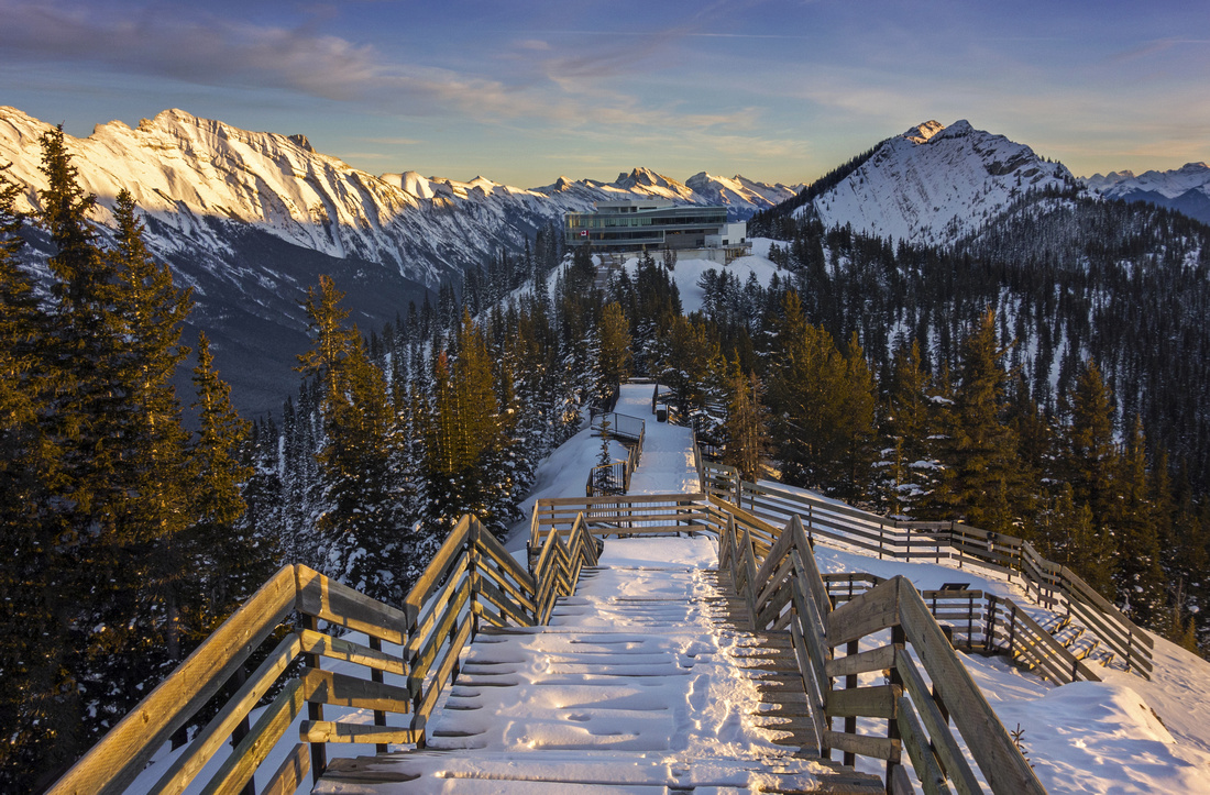
Turn left and ascent the stairs to top of Sanson Peak; this area is extremely busy during full tourist season, but in winter --depending on your timing-- you can have it to yourself. Finally reach the Cosmic Ray station. Structure is not in use anymore and is now recognized as National Historic site. Views are fantastic, specially during the sunset -- see the gallery above. Upper Gondola terminal is 10 minute walk east, and if open can offer (pricey) refreshments and food --- did you bring any money? Finally either return the same way (twice as fast), or ride the gondola down. Hike down Gondola trail is steep and recommended only for ascent.
Update early 2021: Parks Canada have been doing prescribed burning and clearing of lower slopes all winter; Cosmic Ray has been closed (including Sundance Canyon). Always check with Parks Canada website before heading out on an official trail |
||
 View back in lower part as road crosses old burn area
 |
|||
 Zoom view of Mt. Edith (R) and Mt. Cory (L)
 |
|||
 Typical section halfway up; travel is open with great views
 |
|||
 Wide switchback about 30 minutes from the top
 |
|||
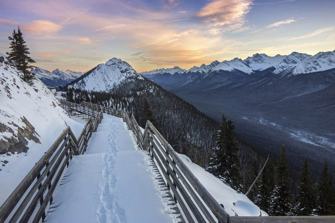
 Boardwalk below Sanson Peak
 |
|||
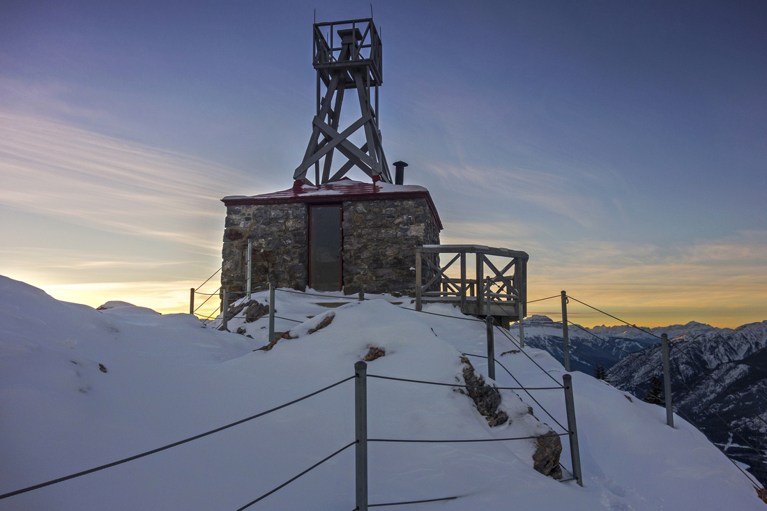 Cosmic Ray Station
 |
|||
 Peek inside Cosmic Ray
 |
|||
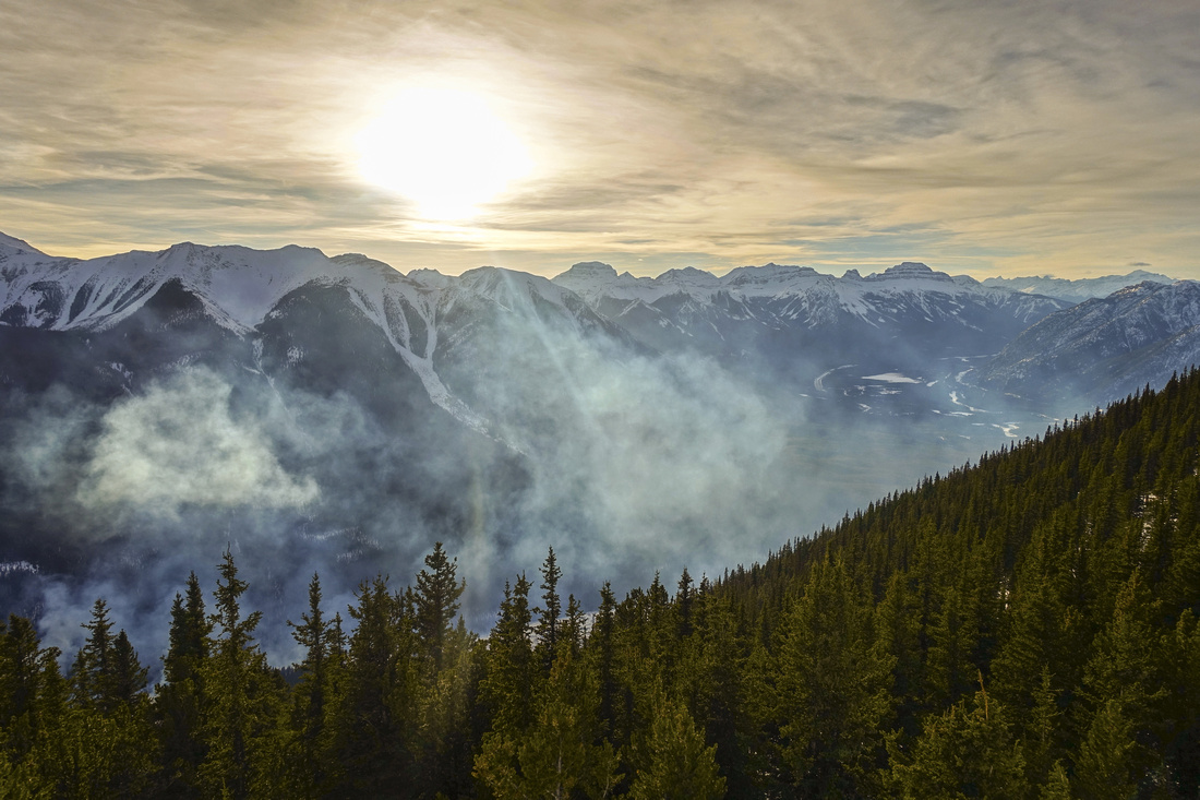
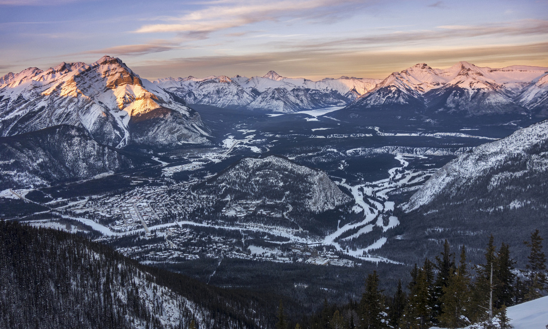 Banff and Bow Valley
 |
|||
 Cascade Mountain lit by last rays of the setting Sun
 |
|||
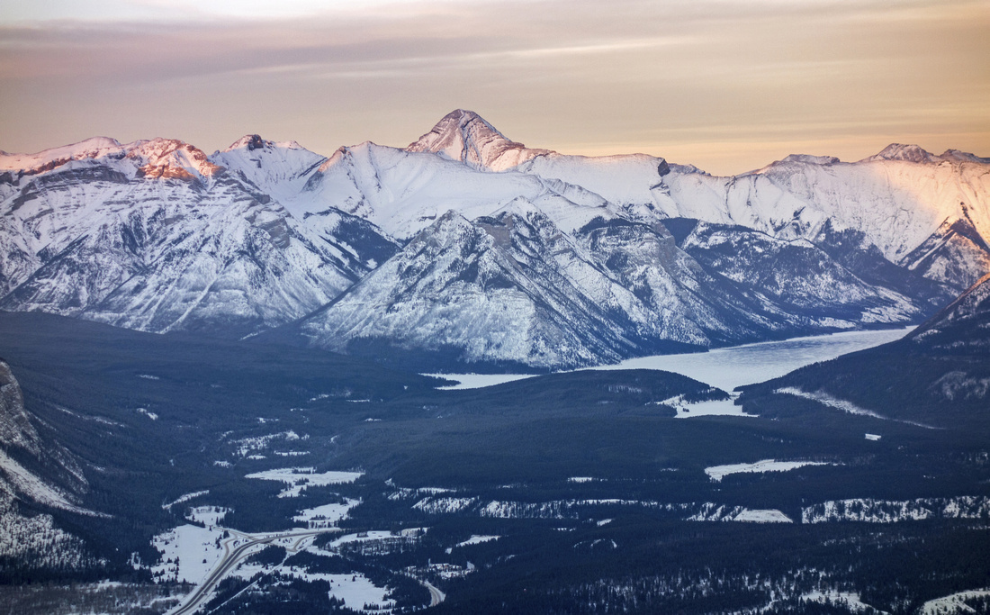 Zoom to Lake Minnewanka; Mt. Aylmer (3162 m) above
 |
|||
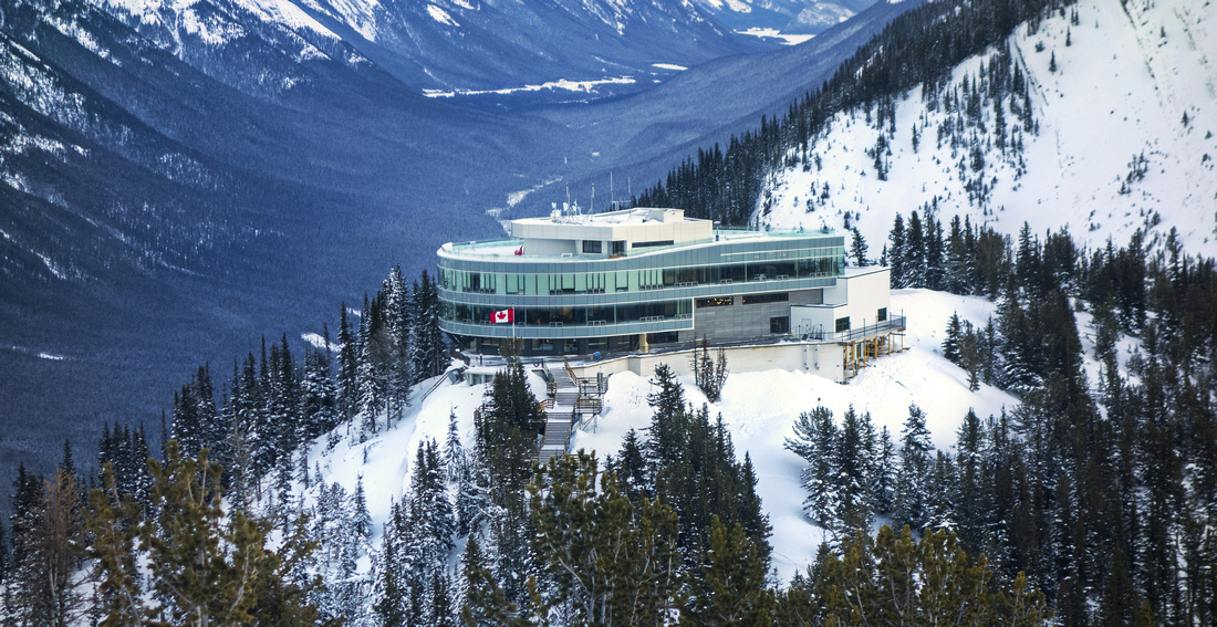 Upper Gondola Terminal
 |
|||
 Burning sunset skies above Sundance Range
 |
|||
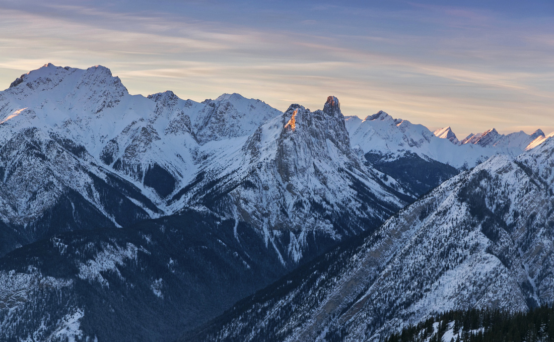 Mt. Edith and Mt. Louis (center)
 |
|||
 Descent into the Sunset
 |
Abstract
| Overall Difficulty | D3 | Moderately steep ascent via old service road. Hike is without difficulties, but overall distance and elevation gain guarantee a fair amount of workout. | |||
| Snow Factor | S2 | Forested westerly aspect does not pose significant avalanche danger. Frequented by local skiers in winter months. | |||
| Scenery | Spectacular summit views of Banff townsite and many well-known surrounding peaks. Sunny westerly slopes with great views of Sundance range. | ||||
| Trail/Marking | Excellent | Paved wide trail to Sundance Canyon followed by old service road, occasionally narrowing to trail. All junctions are marked | |||
| Suggested Time | 5-6 hrs | If returning the same way. Ascent usually takes ~3 hrs (more in winter); descent is twice as fast | |||
| Elevation |
Start: 1400m (Cave and Basin) Max: 2300m Total: ~920m |
Round Trip: 19km (descent same way, on foot) | |||
| Gear | Light hikers sufficient when dry. Snowshoes often not required in winter. | ||||
| Water | Dry ascent so carry all the water - 2L recommended. You can refill in gondola terminal on top (when open). | ||||
| Dog Friendly | Yes | Dogs not allowed in gondola if you are planning to ride down | |||
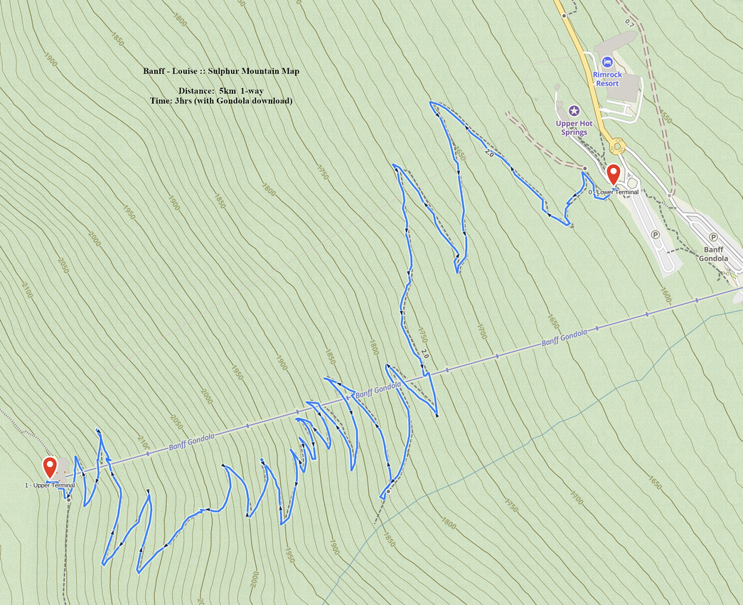
 Cosmic Ray GAIA Map
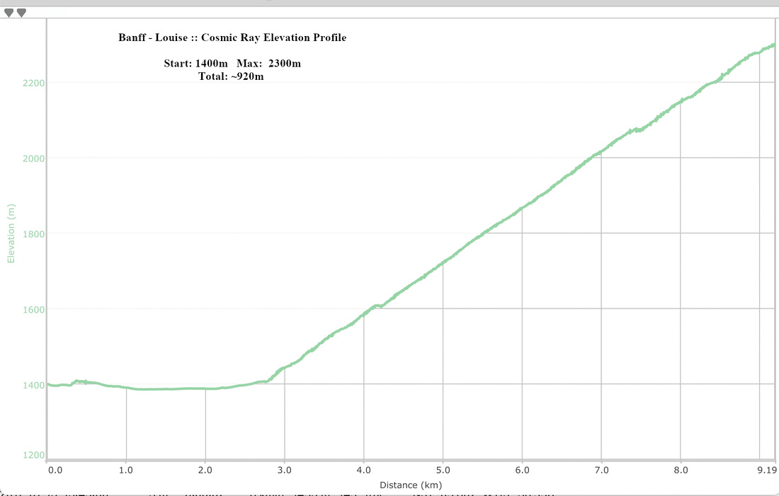 Cosmic Ray Elevation Profile
| Gondola Trail | GPS Track | |||
March 12, 2021
Banff version of Vancouver Grouse Grind, although nowhere as steep and far more scenic. Starting from lower Gondola terminal gently graded switchbacks ascend forested slopes below Gondola Tram line. Locals frequently ascend (or trail-run) this year-round. It can get quite icy in winter, so spikes are good idea. Download used to be free in off-season, but as of this writing (March '21) download is half price; locals can still download free, with government ID. It is a nice leg stretcher and with little luck can provide quite nice sunset views above Sundance Range. When snow free, it is possible to hike south up the ridge towards what some call "true summit of Sulphur Mountain". I have not done that as my trips were always in winter, but reportedly it is mildly exposed towards the end with couple of class 3 steps. |
||||
 Sulphur Mountain Trailhead
Trailhead Table. From parking at upper Gondola Terminal walk up wooden stairs towards Sulphur Hotsprings Sulphur Mountain Trailhead
Trailhead Table. From parking at upper Gondola Terminal walk up wooden stairs towards Sulphur Hotsprings |
|||
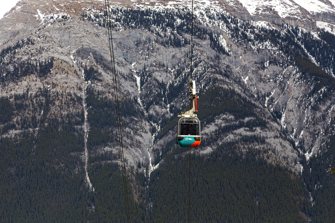 Sulphur Gondola
Nice view of Sulphur Gondola against Rundle Mtn backdrop roughly halfway up the mountain Sulphur Gondola
Nice view of Sulphur Gondola against Rundle Mtn backdrop roughly halfway up the mountain |
|||
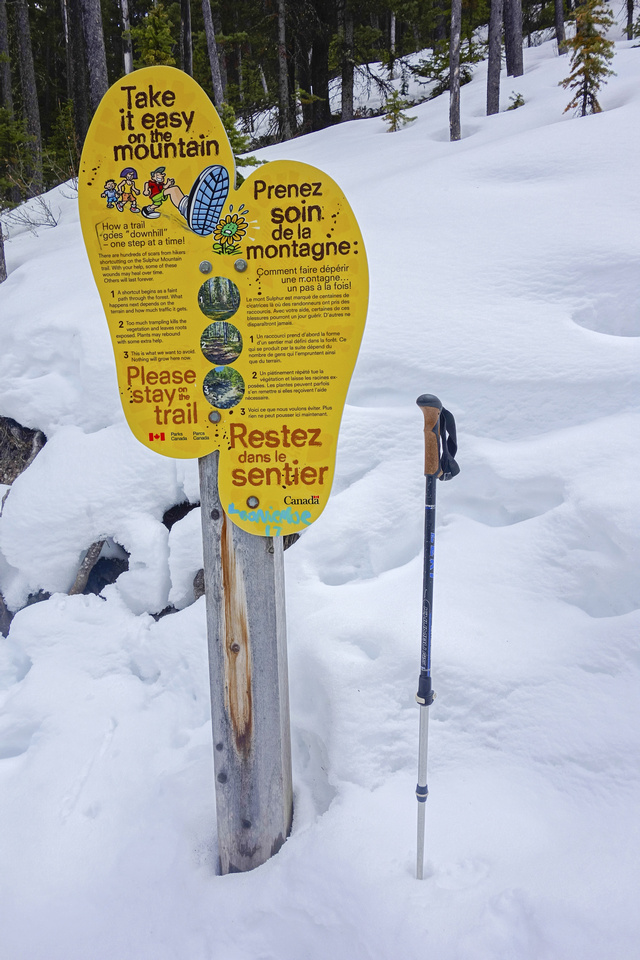 Trail Sign
Park Sign asking hikers to stay on trail to prevent erosion. Despite this, there are many shortcuts between switchbacks - please refrain from doing this and obey the posted signs for everyone benefit Trail Sign
Park Sign asking hikers to stay on trail to prevent erosion. Despite this, there are many shortcuts between switchbacks - please refrain from doing this and obey the posted signs for everyone benefit |
|||
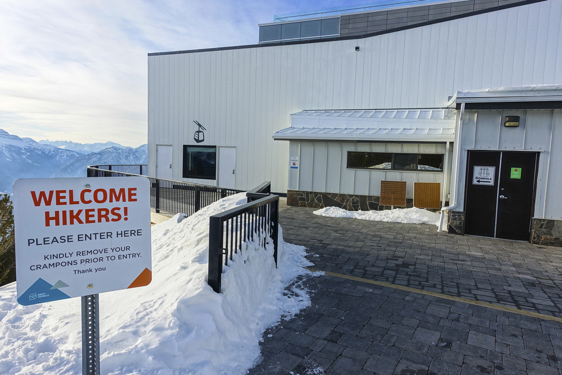 Upper Terminal
Sulphur Mountain Trail topping up at platform behind upper terminal. Walk to the front on the left side Upper Terminal
Sulphur Mountain Trail topping up at platform behind upper terminal. Walk to the front on the left side |
|||
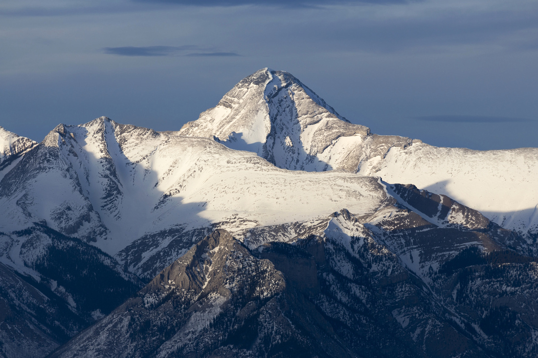 Mount Aylmer
Nice view of Mount Aylmer (3162m, highest in Banff vicinity) from upper floor of gondola building. Mount Astley Ridge in foreground, accessed via off-trail scramble from Stewart Canyon Mount Aylmer
Nice view of Mount Aylmer (3162m, highest in Banff vicinity) from upper floor of gondola building. Mount Astley Ridge in foreground, accessed via off-trail scramble from Stewart Canyon |
|||
 Sundance Burn
Parks Canada performing prescribed deadfall burn in Sundance valley - part of forest wildfire management Sundance Burn
Parks Canada performing prescribed deadfall burn in Sundance valley - part of forest wildfire management |
|||
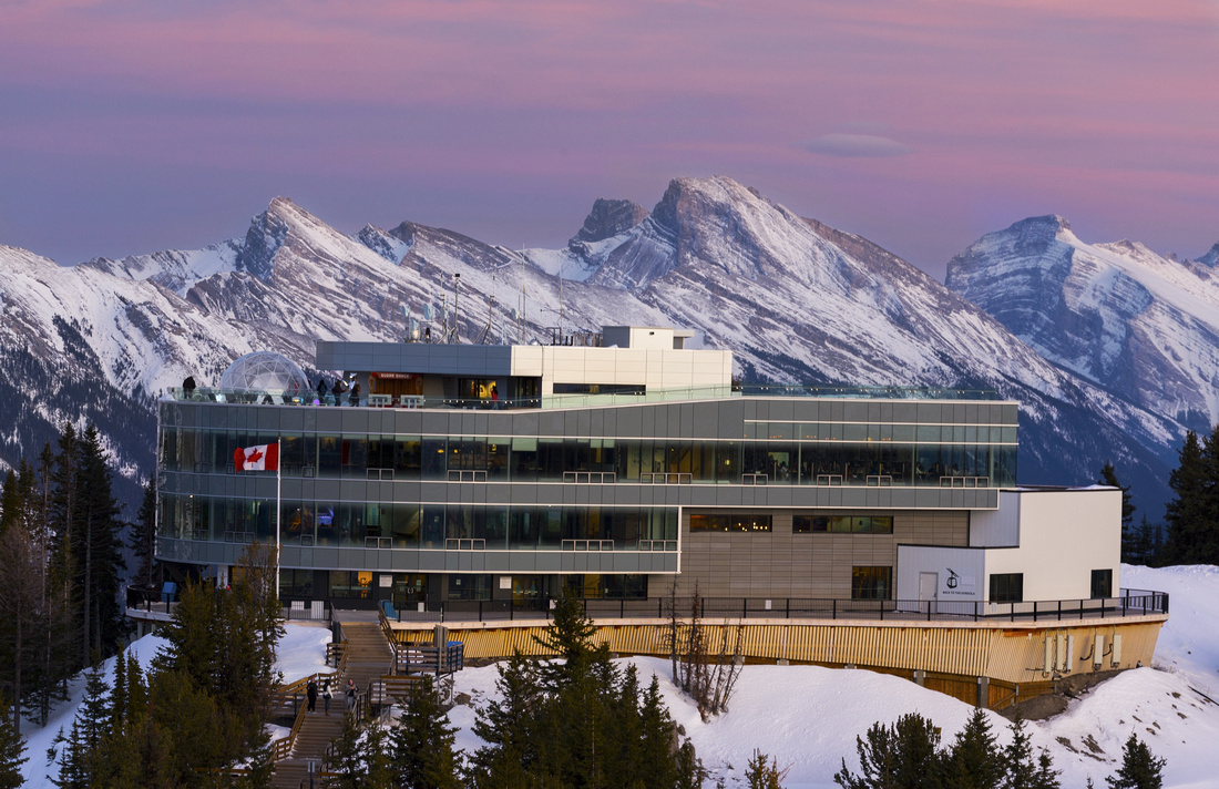 Gondola Building
Upper Gondola Terminal against beautiful crimson colored sunset sky. Facility was open during COVID but restaurant / viewing platform seating was limited and face covering was required Gondola Building
Upper Gondola Terminal against beautiful crimson colored sunset sky. Facility was open during COVID but restaurant / viewing platform seating was limited and face covering was required |
Abstract
| Overall Difficulty | D3 | Gentle and wide switchbacks, slightly steeper towards the end | |||
| Snow Factor | S2 | No avalanche danger. Frequently icy from overuse during winter / shoulder season | |||
| Scenery | Limited views with occasional glimpse towards Rundle Mountain. Spectacular summit panorama | ||||
| Trail/Marking | Excellent | Wide switchbacks with official trail table / signs | |||
| Suggested Time | 3 hrs | With gondola download, including visit to Cosmic Ray / hike up the boardwalk. Add max 1 hr if returning on foot, considerably longer if doing a loop via Cosmic Ray | |||
| Elevation |
Start: 1590m Max: 2250m Total: 690m |
Distance: 5.3km (1-way) | |||
| Gear | Light hikers sufficient when dry. Snowshoes often not required in winter, but spikes often necessary | ||||
| Water | Dry ascent, but trip is short - carry 1L maximum. You can refill in gondola terminal on top (when open). | ||||
| Dog Friendly | Yes | Dogs not allowed in gondola if you are planning to ride down | |||
 Sulphur Mountain GAIA Map
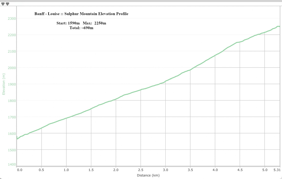 Sulphur Mountain Elevation Profile