Rockies :: Banff-Louise :: Aylmer Lookout / Pass / Mountain |
|
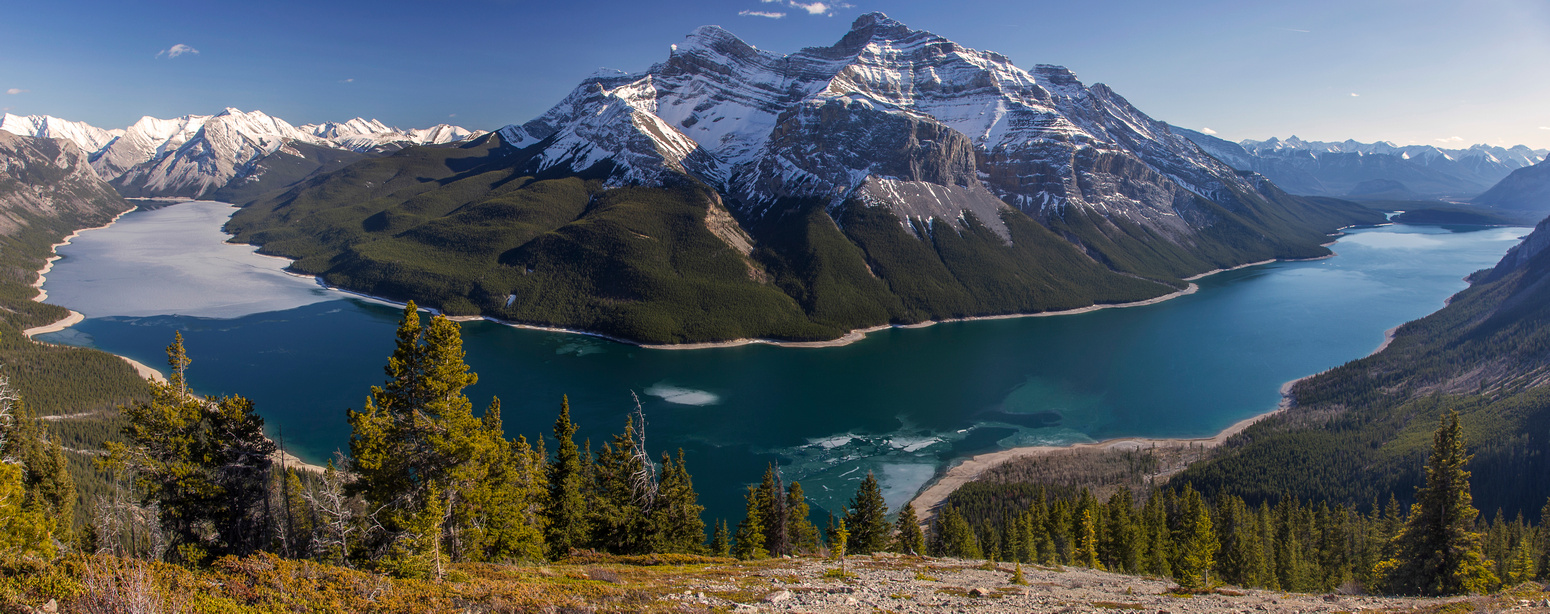
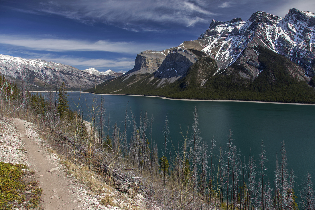
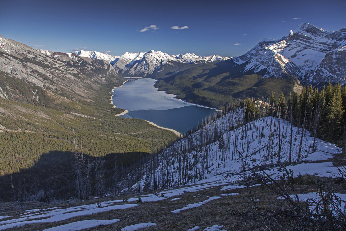
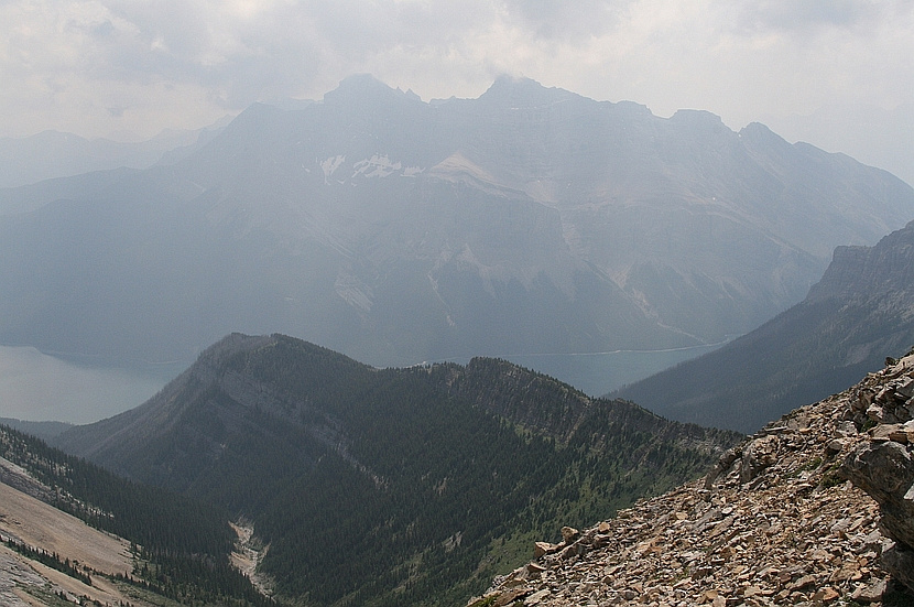
Panoramic view to Lake Minnewanka from Aylmer Lookout. Mt. Inglismaldie and Mt. Girouard on the other side |
||||||
| Trip Summary | ||||||
Multiple Dates, last October 1, 2021
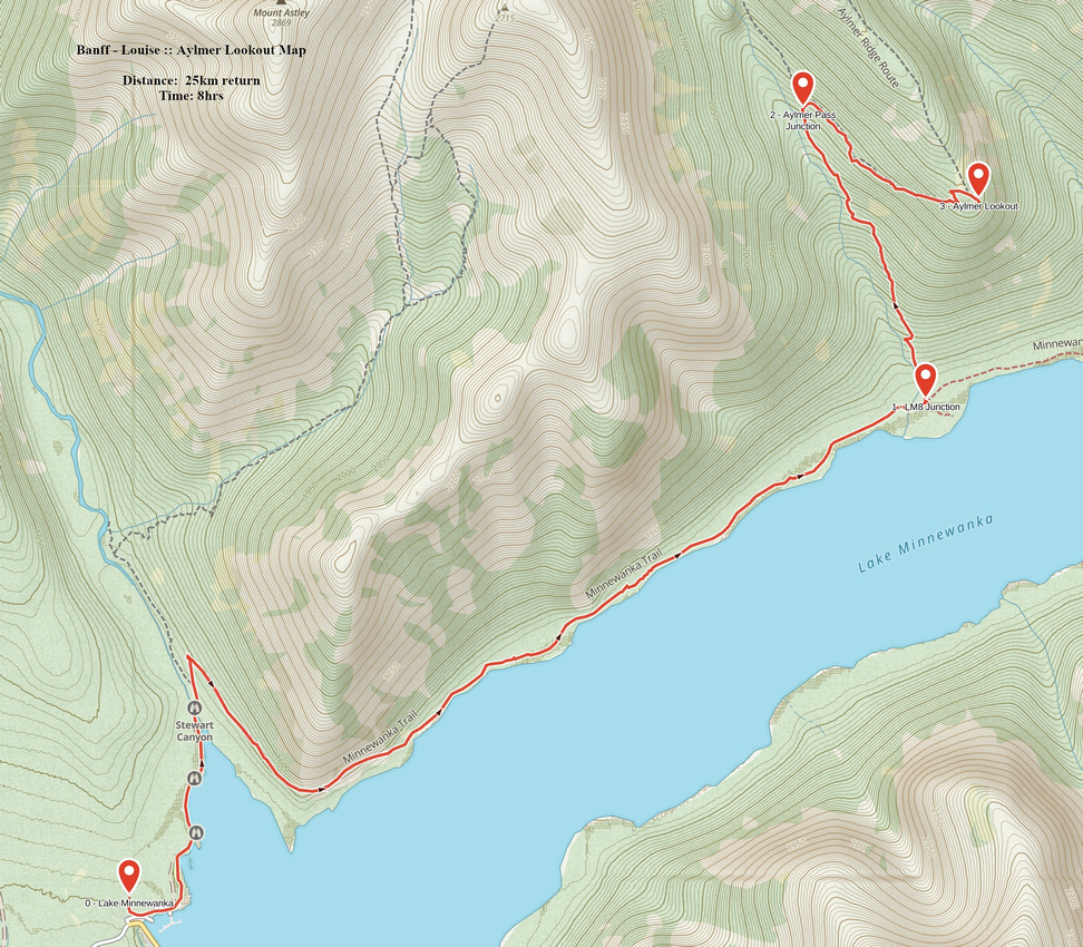
Lake Minnewanka is largest body of water in Banff vicinity. Drive time from junction with Trans-Canada is only 15 minutes; as such it is very popular and tends to be overcrowded by tourists in summer months. All kinds of development await at west end of the lake -- 2 huge parking lots, concessions, picnic grounds and floating platforms from where boat tours can be chartered. Main trail from hikers perspective follows north side of the lake and is shared with mountain bikes. Initial portion is particularly busy, but after crossing Stewart canyon on good wooden bridge (no damage in 2013 floods) crowds thin out. Aylmer trail branches from LM8 junction at km 7.8 - about 1hr 40 min of steady pace (45 minutes on bike). If you bike, only uphill is past Stewart bridge until trail levels out on shoulder; one narrow and potentially unstable bit here. Section near LM8 junction has been washed out pretty badly in 2013 floods and most riders will have to get of their bikes here. Back-country campground is down on the right side, while shoreline trail continues to East End of Lake Minnewanka / Ghost Lakes. Fantastic viewpoint / break spot is only few minutes up Aylmer Pass trail on right (east) side - 4th and last Photos in the gallery. 3 possible options exist; all an be done as long day-hike from Minnewanka parking; less strenuous option is multi-day backpack with "basecamp" at LM8 or LM9 back-country campground.
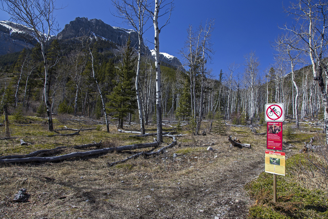
Note that Parks Canada regularly restricts access to parties of 4 or more in later part of summer when berries are ripe, as Aylmer Pass area is prime grizzly habitat. LM8 campground is also closed in these months.
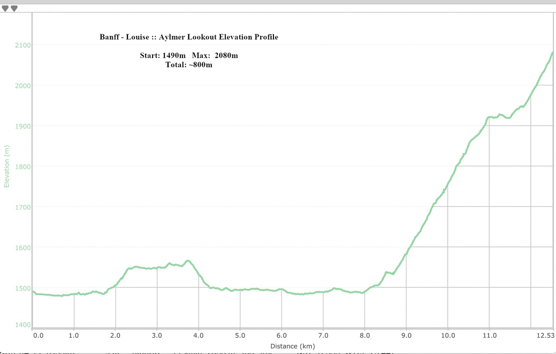
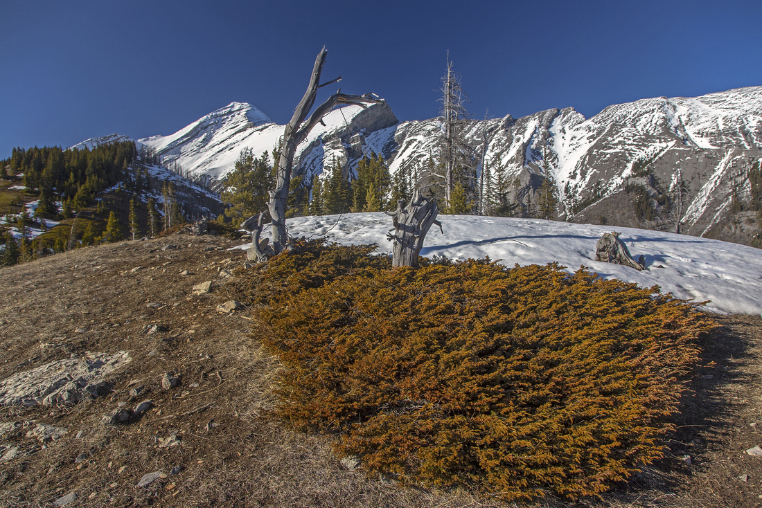
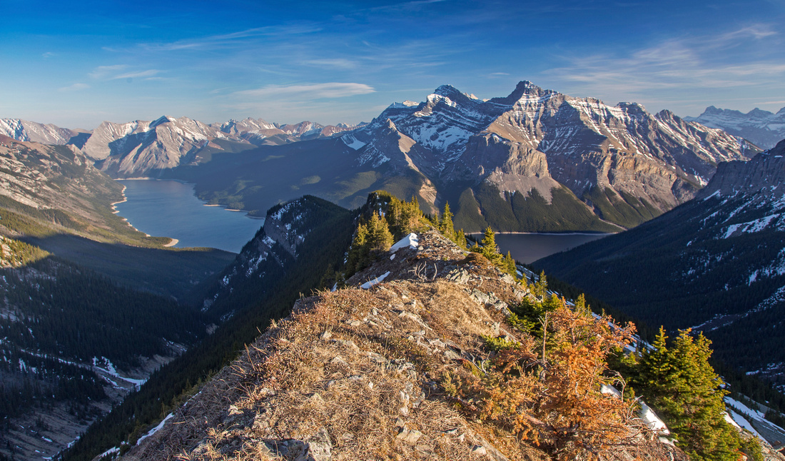
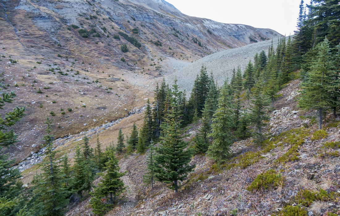
Ascent to the lookout past LM8 junction gains about 600 vertical meters, but grade is gentle and trail well defined. Aylmer Pass trail rises steadily for 2.9km to marked Lookout Junction - about 45min of steady pace from LM8; turn right and follow trail contouring back for another 30 minutes to the Lookout with final bit above treeline on set of well-graded switchbacks. No remains of the structure remain, but views are fantastic. Almost entire lake Minnewanka can be surveyed from here, including towering Mt. Girouard and Inglismaldie on south side and mystic Devil's Gap far in the distance to the east. Most hikers return the same way, but if time and energy allow pleasant ridge traverse leading to base of Mt. Aylmer summit block is also possible, with loop return via Aylmer Pass trail. For loop option, follow sparsely treed ridge north towards Mt. Aylmer. There is some minor bushwhacking along the way, but no real problems. After about an hour ridge opens up allowing great views of summit block. Watch for grassy gully on left (west) side - no trails exist here, so just follow line of lesser resistance, perhaps hoping back and forth couple of times across the main drainage. This descent eventually joins with Aylmer Pass trail - turn left here and hike down to lookout junction. It will take 4-5hrs for this loop from LM8, 3hrs (max) for lookout only
Aylmer Mountain
Mt. Aylmer, highest peak in Banff vicinity (3160m), is straightforward scramble in dry conditions, but guaranteed to sap your energy due to overall length (~35 km) and cumulative elevation gain ( ~1700 vertical). Mountain bikes and long summer days are strongly recommended for summit bid. Conditions should be dry. Although Kane scrambles book advocates Aylmer Pass approach, Lookout option is far far better. From end of the ridge easiest option is to sidehill loose talus slopes to the right towards final summit scree cone. Alternate option is to stay on ridge crest in its entirety; after curling right it leads to considerable drop off down ledges and small rock steps. This bit is difficult scrambling and is not really worth. Final bit is typical scree trudge, similar to ascent of nearby Mt. Cascade. Roughly 1 1/2 hours from end of the ridge (3 hours from the lookout). On return direct drop to Aylmer Pass trail will be considerably faster than traversing ridge back to the Lookout.
Aylmer Pass
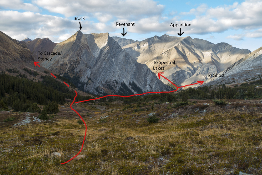
From lookout junction trail continues rising steadily for another ~3km. ~15minutes before the Pass large grassy gully comes from the right (east) side - ridge loop return. Nearing the Pass trail reaches treeline, then drops across intervening saddle. From here trail in considerably less defined. Aylmer Pass is long alpine saddle stretching for several kilometers. BNP Boundary is right at the Pass. Note that snow lingers considerably longer here & Pass might be still snowbound when Lookout & Ridge are bare dry. If time allows continue down the Pass from ~20-30minutes to unexpected and beautiful waterfall (see gallery). With light pack suggested return time from LM8 is 3-4 hrs. Country further north just begs for further Exploration, but it is largely off-trail. Most attractive destination are rarely visited Spectral Lakes that are sometimes used as wild bivouac for ascent of Apparition Mountain and Mt. Revenant; this area is also accessible from Ghost side and described in Daffern K-country trail guidebook. |
||||||
|
Gallery |
|||
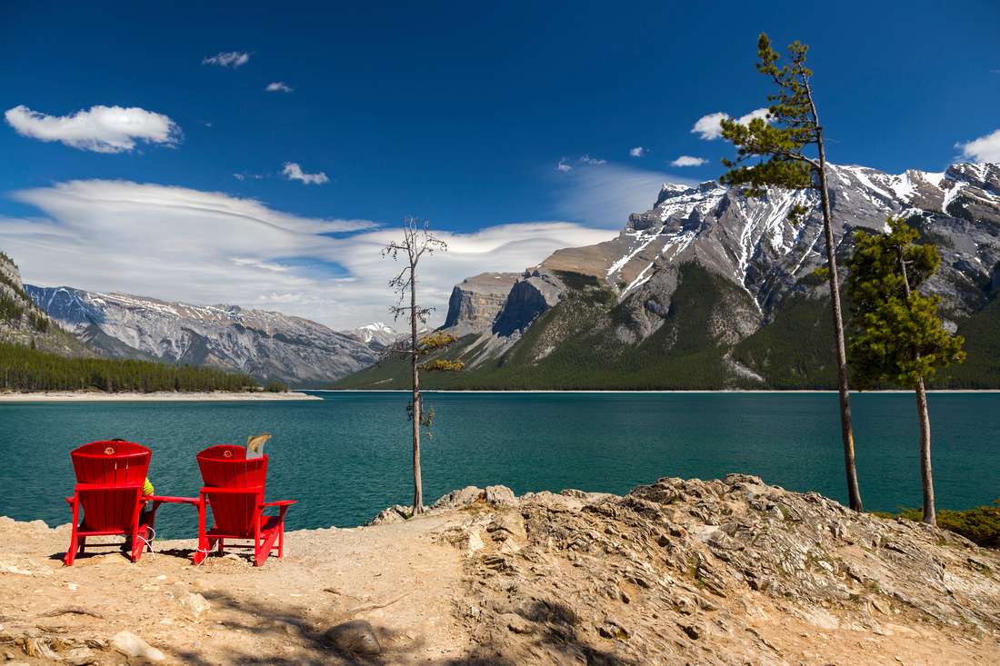 Red Adirondacks Red Adirondacks Red Adirondack Chairs at Lake Minnewanka Tourist area
 |
|||
 Minnewanka Trail
Highpoint on lakeside trail about 40 min from the parking Minnewanka Trail
Highpoint on lakeside trail about 40 min from the parking |
|||
 LM8 Junction
Aylmer Pass junction near LM8 campground; Lakeshore trail continues straight, go left and up for Aylmer Lookout / Peak / Pass LM8 Junction
Aylmer Pass junction near LM8 campground; Lakeshore trail continues straight, go left and up for Aylmer Lookout / Peak / Pass |
|||

|
|||
 Mount Inglismaldie
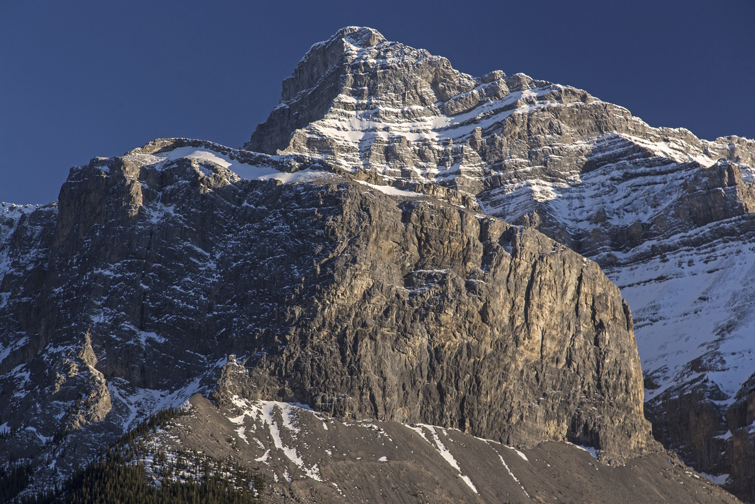
Mt. Inglismaldie telephoto from Aylmer Pass trail Mount Inglismaldie
Mt. Inglismaldie telephoto from Aylmer Pass trail |
|||

|
|||
 Aylmer Lookout Trail
Breaking treeline near the Aylmer lookout Aylmer Lookout Trail
Breaking treeline near the Aylmer lookout |
|||

|
|||
 Aylmer Lookout
Site of old lookout structure; Mt. Aylmer left of center Aylmer Lookout
Site of old lookout structure; Mt. Aylmer left of center |
|||
 Looking back from starting up the ridge above Aylmer lookout. Occasional trail can be found in the forest
 |
|||
 Aylmer Ridge
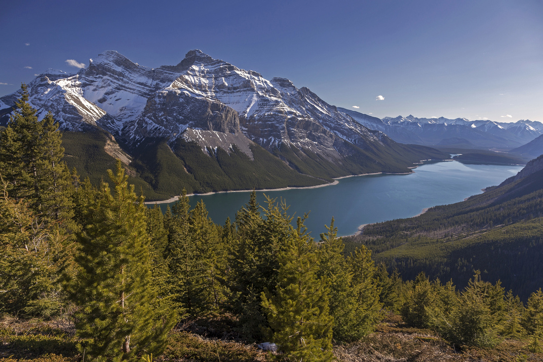
View back to Lake Minnewanka at the end of Aylmer ridge. Aylmer Pass approach joins in about here and is recommended loop descent Aylmer Ridge
View back to Lake Minnewanka at the end of Aylmer ridge. Aylmer Pass approach joins in about here and is recommended loop descent |
|||
 Scramble Ledge
, mainly straightforward but loose, bypassing difficult part on climber right. An old low-res photo Scramble Ledge
Scramble Ledge, mainly straightforward but loose, bypassing difficult part on climber right. An old low-res photo |
|||
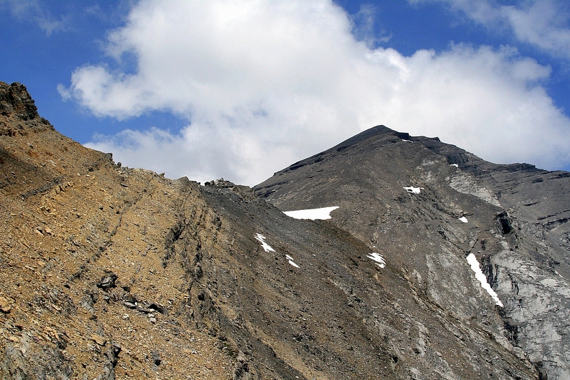
 Near Aylmer Summit
Length of approach ridge from Aylmer Lookout (center left) from near the summit. An old low-res photo Near Aylmer Summit
Length of approach ridge from Aylmer Lookout (center left) from near the summit. An old low-res photo |
|||
 Aylmer Saddle
Aylmer Pass treeline; Trail becomes less defined from here Aylmer Saddle
Aylmer Pass treeline; Trail becomes less defined from here |
|||
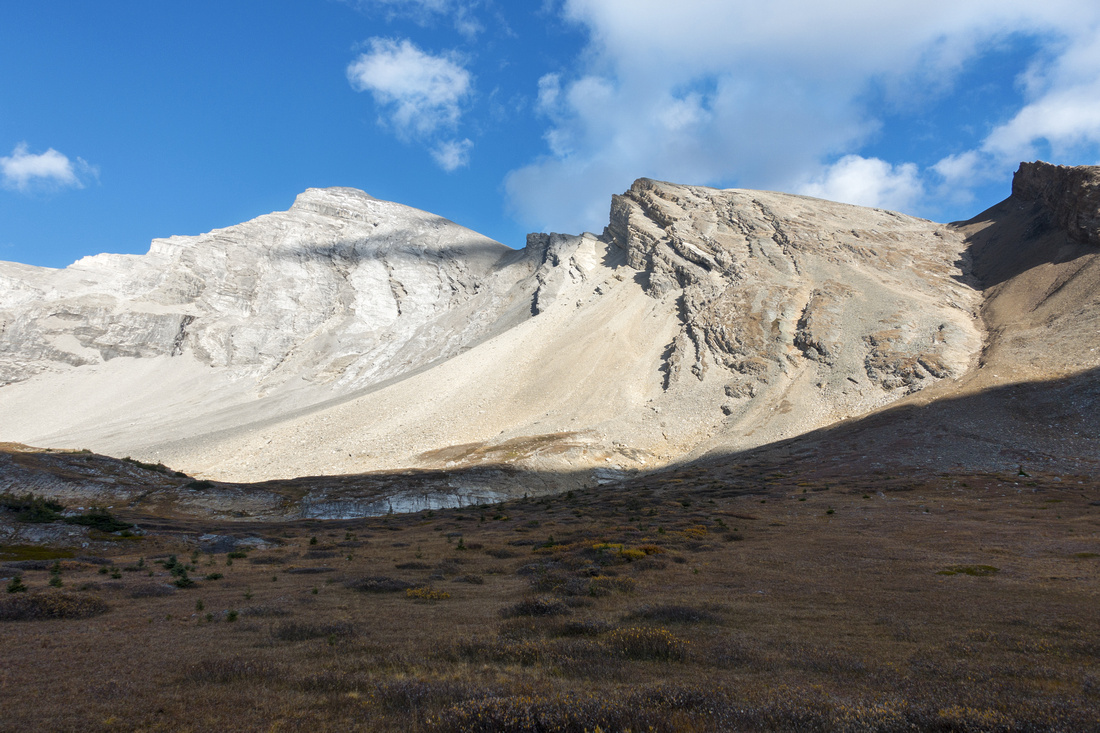 Aylmer Pass
Aylmer Mountain from long alpine meadow at Aylmer Pass Aylmer Pass
Aylmer Mountain from long alpine meadow at Aylmer Pass |
|||
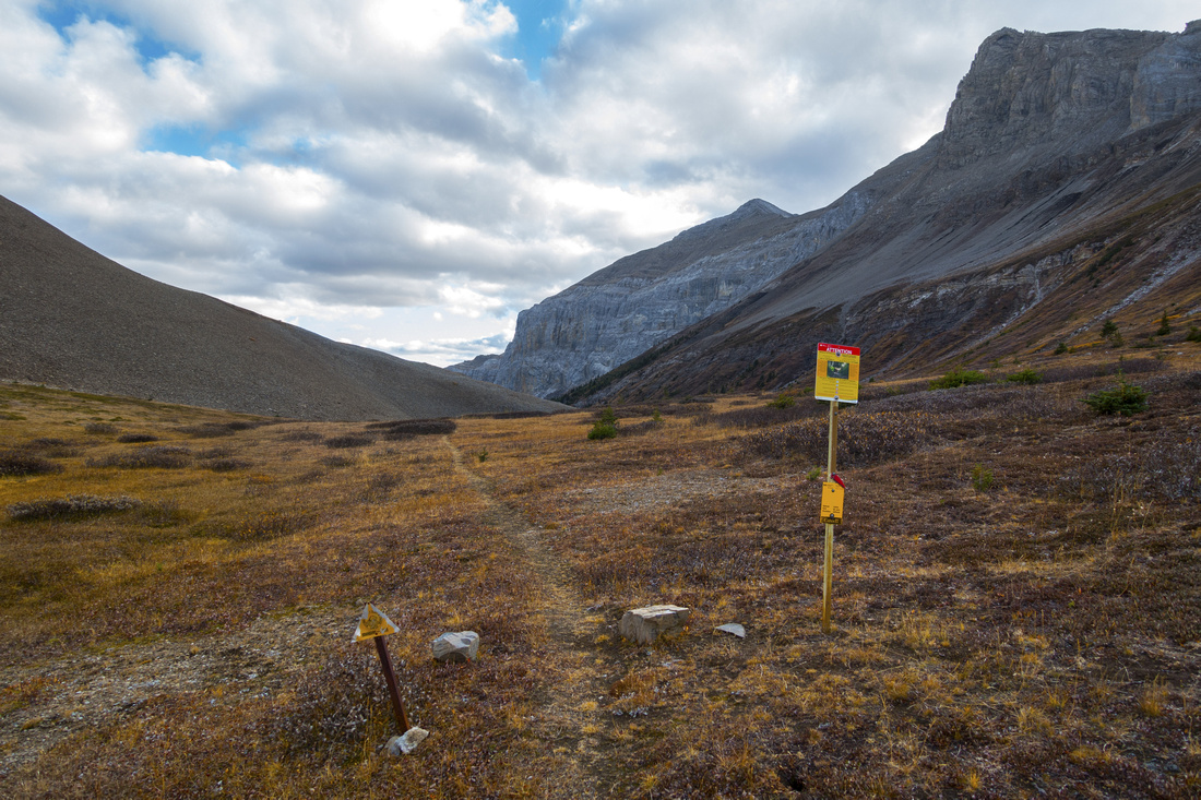 BNP Boundary
Banff National Park boundary at Aylmer Pass, looking back towards Minnewanka BNP Boundary
Banff National Park boundary at Aylmer Pass, looking back towards Minnewanka |
|||
 Beyond Aylmer Pass
Many options for further exploration at north side of Aylmer Pass Beyond Aylmer Pass
Many options for further exploration at north side of Aylmer Pass |
|||
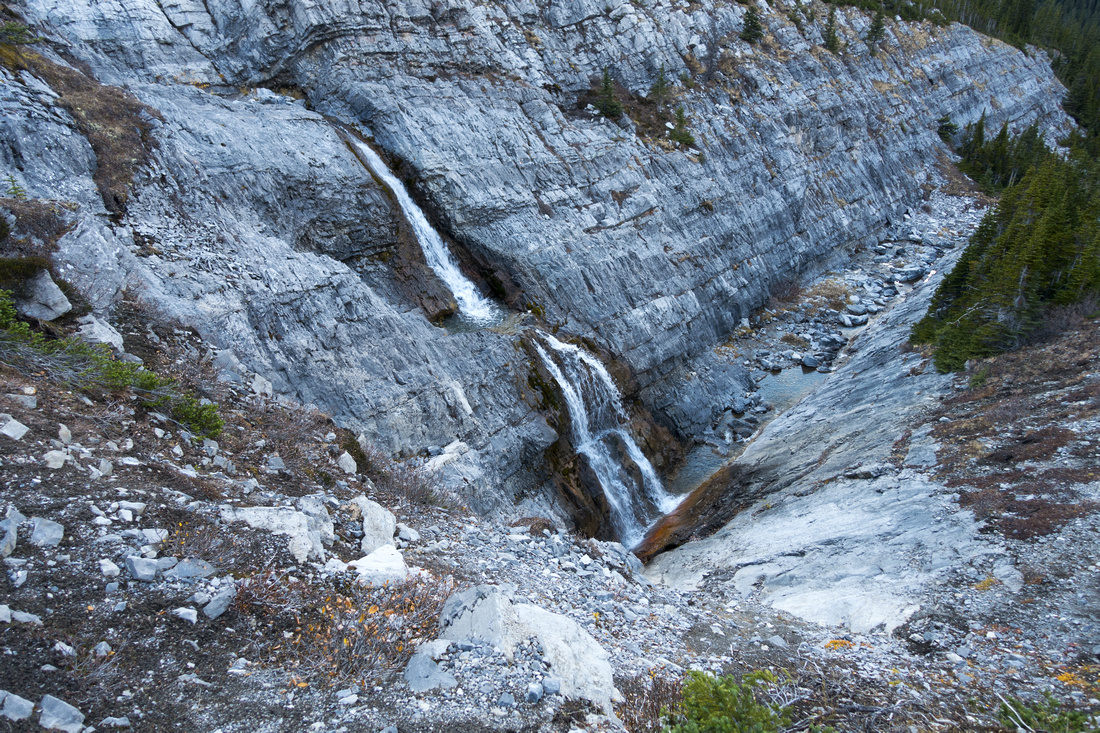 Aylmer Waterfall
Lovely Cascades ~1.5km north of Aylmer Pass; trail pretty much vanishes here Aylmer Waterfall
Lovely Cascades ~1.5km north of Aylmer Pass; trail pretty much vanishes here |
|||
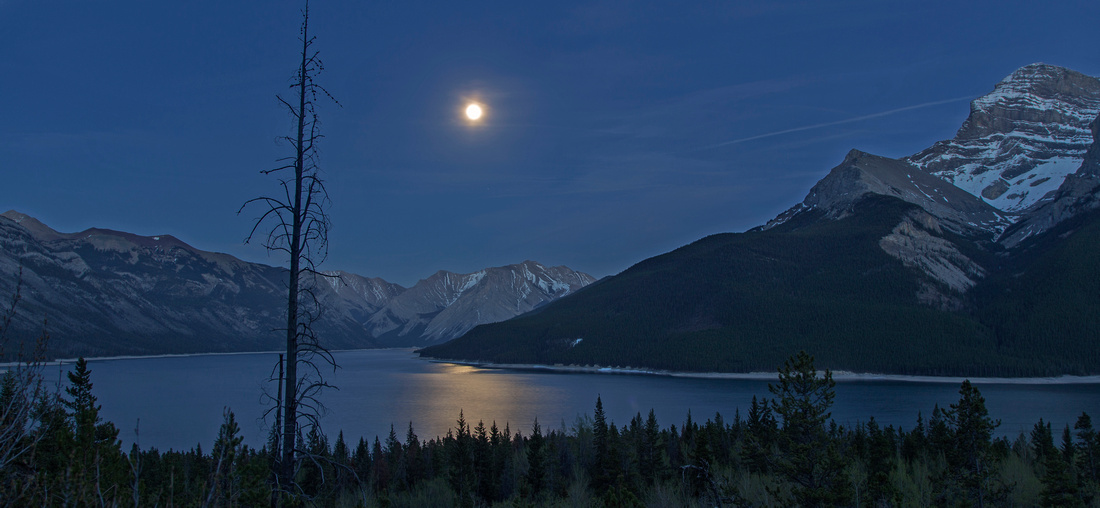 Full Moon Hiking
Full moon over Lake Minnewanka from viewpoint above LM8 junction Full Moon Hiking
Full moon over Lake Minnewanka from viewpoint above LM8 junction |
Abstract
| Overall Difficulty | D4(6) | Walk on wide and mainly flat trail shared with mountain bikes for 8km, followed by moderately steep ascent to the lookout and Pass. Scramble of Mt. Aylmer is very long day trip (D6) with crux being diagonal traverse of loose talus slope below final summit block | |||
| Snow Factor | S3 | Moderately steep but treed slopes above LM8 junction. Low avalanche risk (lookout only). Ascent of Mt. Aylmer not feasible in winter conditions due to overall length of approach and shortness of daylight. | |||
| Scenery | Amazing panoramic views of Lake Minnewanka. Good views of Mt. Girouard, Mt. Inglismaldie and Fairholme range. Far reaching views from Aylmer Pass into peaks of Palliser Range and Front Ranges. | ||||
| Trail/Marking | Very good | Wide park maintained trail. All junctions are marked. Faint trail and occasional cairns on Lookout Ridge | |||
| Suggested Time | 8-9 hr | Return time on foot to Aylmer Lookout or Pass Mountain biking first 8km will shave at least couple of hours. Very long day (12+ hours) if scrambling Mt. Aylmer - start early! | |||
| Elevation | Start: 1490m Max: 2080m (Lookout), 2285m (Pass), 3160m (Peak) Total: ~800m (Lookout), ~1000m (Pass), ~1700m (Peak) | Round Trip: 25km (Lookout), 30km (Pass), 32km (Peak) | |||
| Gear | Hiking boots and poles; mountain bike (optional) | ||||
| Water | Seasonal stream(s) near LM8 junction; not always available. Lake water can be filtered. Snow patches higher up, depending on season | ||||
| Dog Friendly | No | Although not officially forbidden, dogs are not recommended because of dense wildlife corridor | |||