Google Map |
Rockies :: Banff-Louise :: Stoney Mountain |
GPS Track |
|
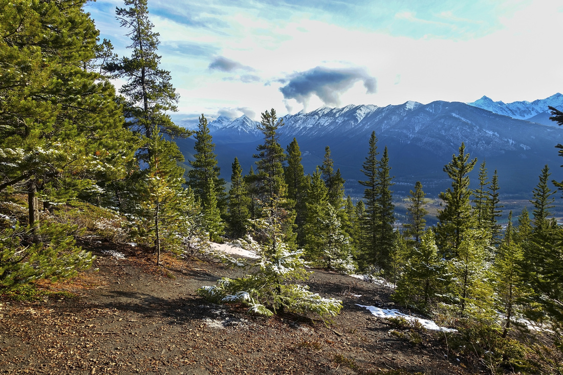
Opening and Sulphur Mountain Viewpoint ~10 min before Stoney Trail Highpoint |
|||
| Trip Summary | |||
November 6, 2020
Many years this forested bump east of Banff townsite was called "Stoney Squaw". Summer of 2020 brought new found era of political correctness and "Squaw" has been dropped. It is one of 2 easy accessible peaks in Banff area (the other being Tunnel Mountain). You drive directly below it on Trans-Canada. It is an easy, mostly forested walk starting from Norquay Ski Area parking lot and whole thing takes little more than an hour. There are some options including loop return with bit of wondering on official Lower Stoney trail, that eventually descends to Buffalo Paddock below Cascade Mountain and Trans-Canada Highway but it is used mainly by mountain cyclists.
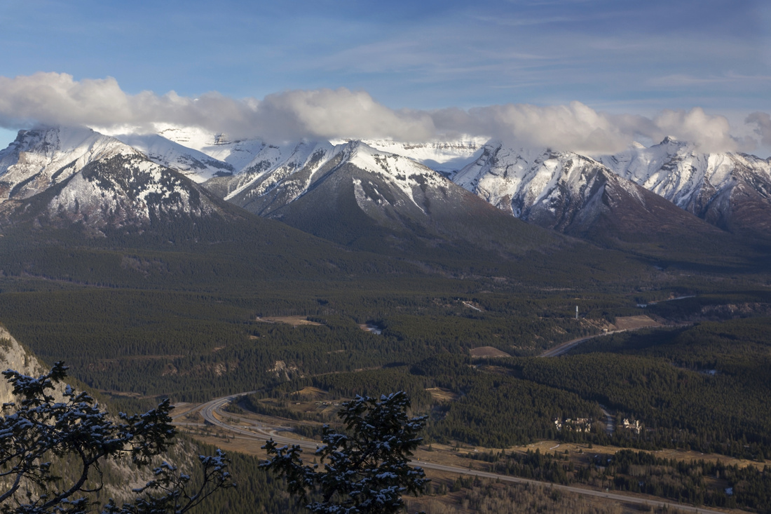
Drive up sharp switchbacks from Banff west overpass to Mount Norquay Ski Resort. Trailhead is on the right (south) side of huge parking lot, right at the beginning - so if you don't plan on loop return, don't drive further up. This is also trailhead for more adventurous objectives, such as Cascade Amphitheater and Mountain, Forty Mile Creek backpack, Elk Lake, etc. Stoney Trail heads into the forest to the right side of Cascade Amphitheater Trail Table and is mostly forested in its entirety. Going is easy, although there are some rooty sections. In about 30 mins trail reaches small ridge and makes hairpin turn (hikers sign points in right direction). Opening with nice views of Sulphur Mountain and general Banff area is reached in another 10 minutes. Trail then turns left and reaches Stoney Mountain "Summit", which is just forest enclosed rocky plateau with openings east towards Palliser Range peaks, rising east of Lake Minnewanka. Imposing Cascade Mtn. is to the left and scramble crux exposed traverse can readily be studied from here.
Return the same way, or for variety continue east and complete loop. This alternate return is completely forested and offers no views. Initial drop from Stoney "summit" is poorly defined, but good trail soon develops and descends to marked Lower Stoney Junction (Waypoint 2 on GPS Track) within half an hour. Out of curiosity I followed this trail down the cutline to Trans-Canada / Buffalo Paddock junction (Waypoint "3 - Cascade Junction" on GPS Track), but this extension offers little except for bit more exercise. It is probably better to simply drop down open grassy hill to Mount Norquay ski lodge, then walk back to the car |
|||
|
Gallery |
|||
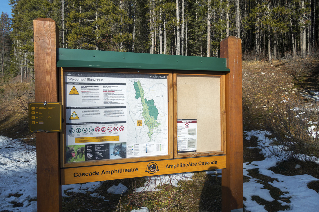 Cascade Trailhead Cascade Trailhead Cascade Amphitheatre Trail Table at south side of Norquay Parking Lot. Stoney Trailhead is to the right, just out of picture
 |
|||
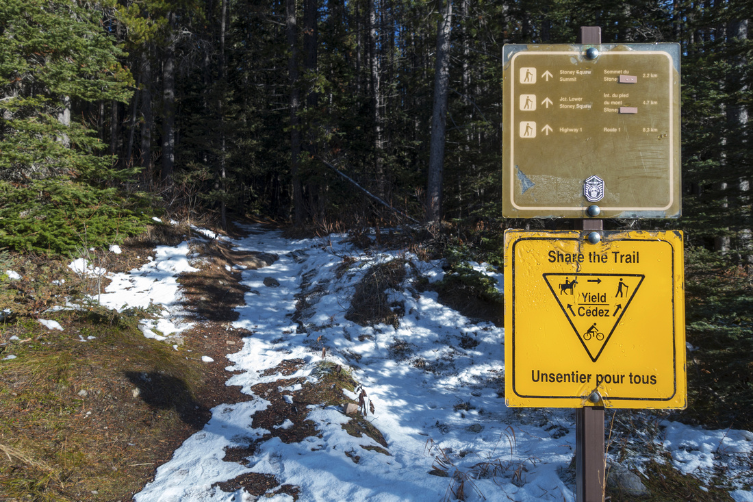 Stoney Trailhead
 with posted distances. Trail, sometimes shared with mountain cyclists, continues straight into the forest Stoney Trailhead
Stoney Trailhead with posted distances. Trail, sometimes shared with mountain cyclists, continues straight into the forest |
|||
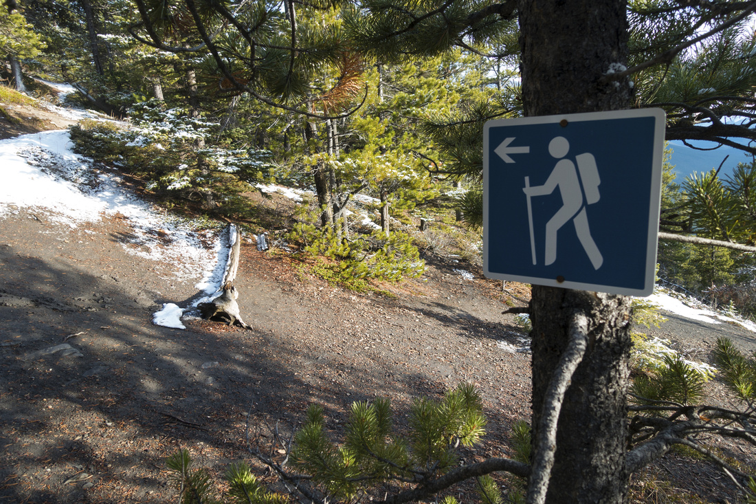 Hiker Sign
 table as trail reaches Sulphur Mountain viewpoint Hiker Sign
Hiker Sign table as trail reaches Sulphur Mountain viewpoint |
|||
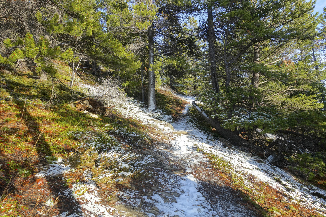 Stoney Trail
Pleasant, semi-open section of Stoney trail ~5 minutes before the highpoint Stoney Trail
Pleasant, semi-open section of Stoney trail ~5 minutes before the highpoint |
|||
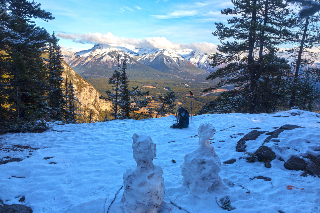 Stoney Mountain "Summit"
Highpoint on Stoney Mountain Trail - just an opening in trees with views east as Trans-Canada makes hairpin turn at Minnewanka/Banff junction Stoney Mountain "Summit"
Highpoint on Stoney Mountain Trail - just an opening in trees with views east as Trans-Canada makes hairpin turn at Minnewanka/Banff junction |
|||
 |
|||
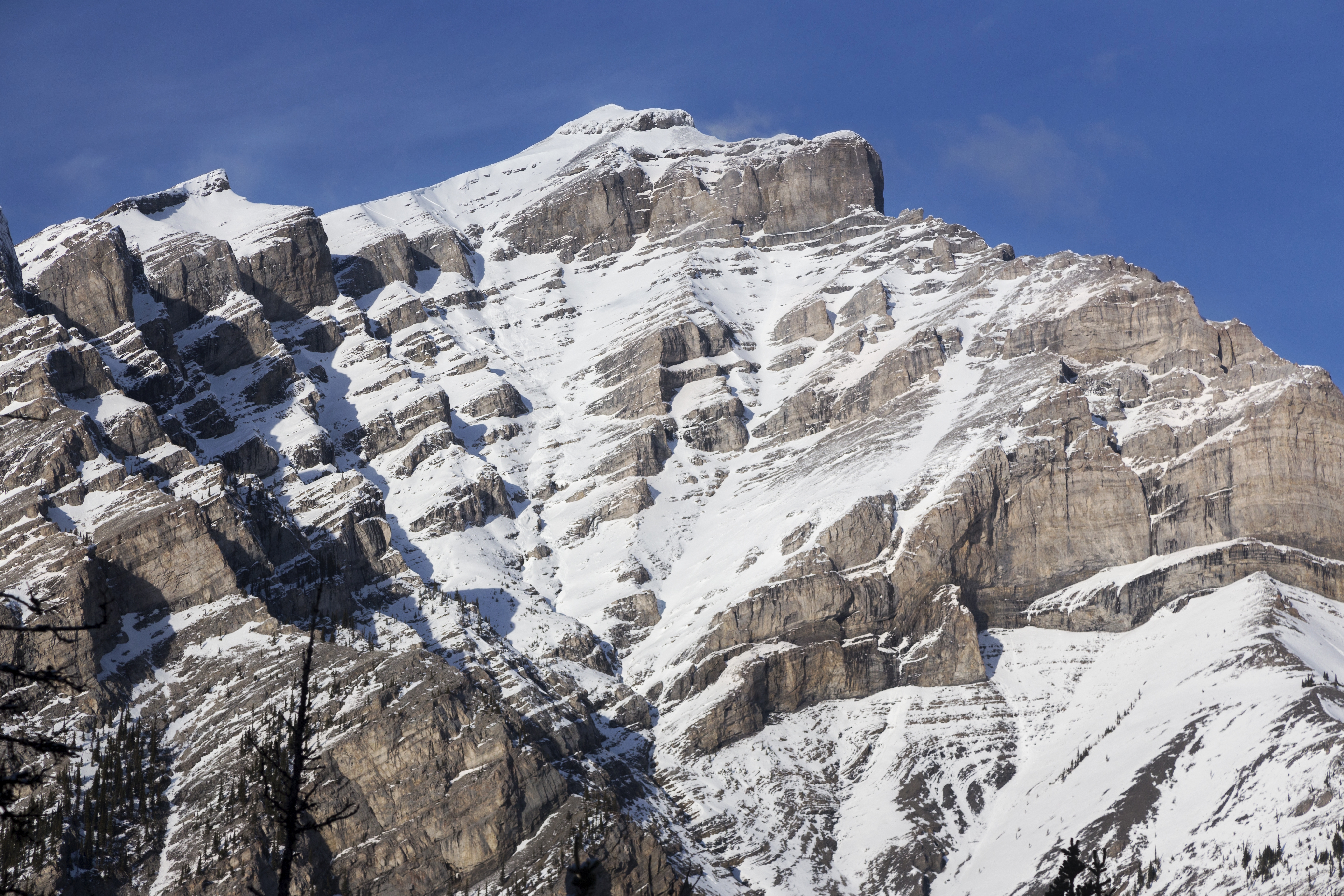
 Minnewanka Peaks
Telephoto of Peaks rising east of Lake Minnewanka. Johnson Lake can be seen in valley, lower center Minnewanka Peaks
Telephoto of Peaks rising east of Lake Minnewanka. Johnson Lake can be seen in valley, lower center |
|||
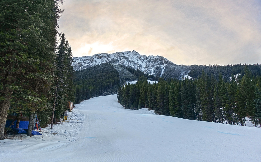 Mount Norquay Ski Run
 on loop return Mount Norquay Ski Run
Mount Norquay Ski Run on loop return |
|||
Abstract
| Overall Difficulty | D1/2 | Trail hiking with modest elevation gain and some rooty sections. Suitable for families | |||
| Snow Factor | S1 | Forested Trail with no avalanche danger, usually well compacted throughout the winter & not requiring snowshoes | |||
| Scenery | Cascade Mountain and Peaks west of Lake Minnewanka from Stoney summit. Good view of general Banff area and Sulphur Mountain (lead photo) | ||||
| Trail/Marking | Very Good | Official Parks Canada trail with signed junctions. Initial section east of Stoney summit on loop return poorly defined | |||
| Suggested Time | 1.5-2 hrs | Leisure pace with loop return; 1 hr only if returning the same way | |||
| Elevation | Start: 1725m Max: 1905m Total: ~250m (loop) | Distance: (loop): 5 km | |||
| Gear | Day hikers sufficient. Snowshoes typically not necessary. Micro-spikes helpful in shoulder season | ||||
| Water | Dry Hike, but short -- carry 0.5L | ||||
| Dog Friendly | Yes | Standard back-country travel precautions. Please keep dogs on leash for courtesy to other hikers | |||
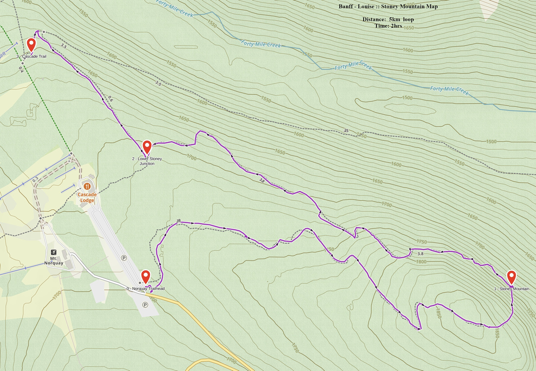 Stoney Mountain GAIA Map
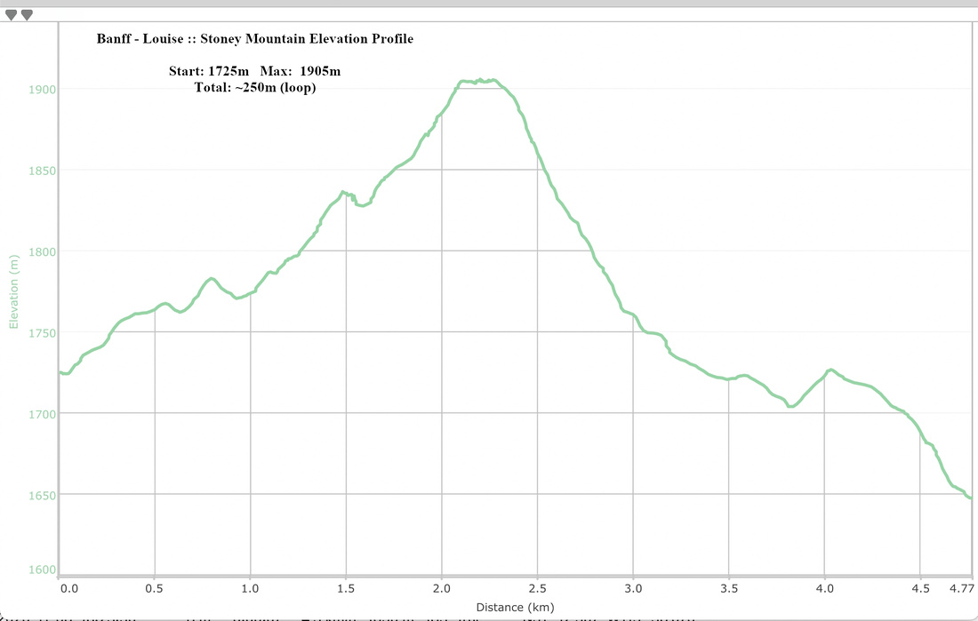 Stoney Mountain Elevation Profile