Rockies :: Banff-Louise :: Tunnel Mountain |
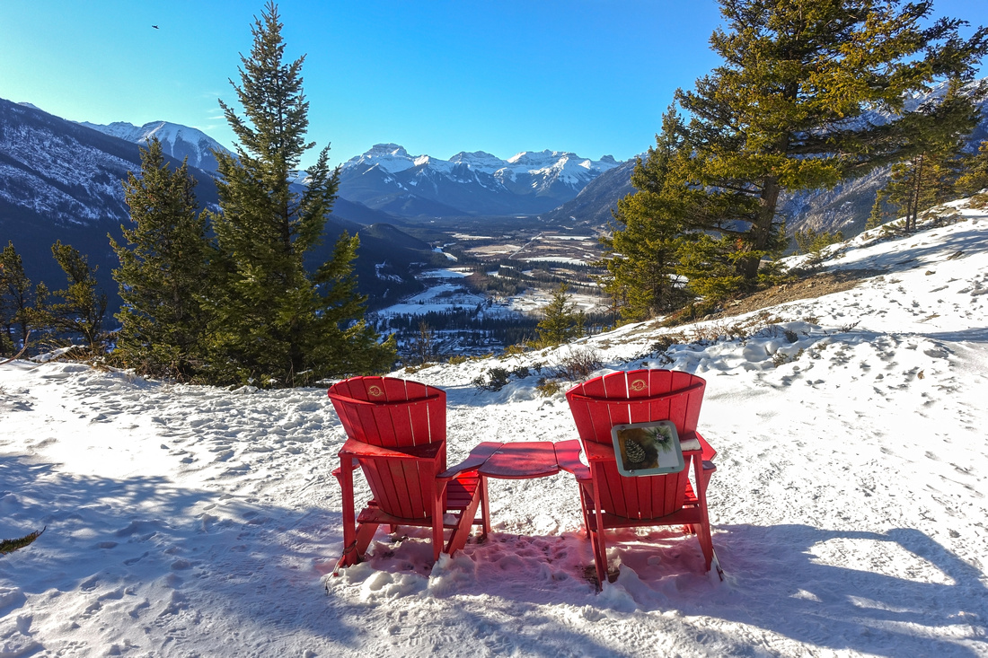 
Red Adirondack Chairs at viewpoint looking west towards Banff Townsite just below summit of Tunnel Mountain |
|||
| Trip Summary | |||
November 18, 2019
Tunnel Mountain is extremely accessible and popular after-work leg stretcher. Regardless if you approach Banff from east or west, it is visible as low forested hill below Rundle Mountain just east of Banff townsite. It is hard to call it "Mountain", but it was named such in late 19 century by CP Rail that thought they would have to drill tunnel when laying rail tracks. They went around, but name stayed. In summer one can drive up Tunnel Mountain road and start from "upper trailhead", but after snowfall normal and official trailhead is from parking along Julien drive (that leads to Banff center and loops over on north side of Bow river). Locals usually simply walk up from town, but there is also parking lot with limited space by trailhead.
Walk up from Julien to Tunnel drive, then continue up several wide switchbacks. In winter this area will often be icy as result of trail popularity. Please don't shortcut and follow official trail in order to prevent erosion. After about 35-40 min trail reaches south shoulder then swings on shady east side. Couple of excellent viewpoints are here with impressive Rundle Mountain towering above Banff Golf Course and distant Peaks of Fairholme Range across Bow Valley corridor on horizon. Just below the summit is clearing with great view of Banff and peaks of Louise Corridor. Red Adirondacks are perfect spot for break, but it will be unlikely nobody will be using them! Finally loop around to rocky plateau highpoint, passing by Parks Canada sign congratulating you on reaching named summit in Canadian Rockies.
If busy surroundings on the summit are not to your liking, you can drop NW on semi-forested ridge to lower meadow with great views of Cascade Mountain. Return the same way. If you did not leave vehicle at one of Trailheads and walked from Banff, pleasant option -- if you have time -- is to walk around on Tunnel Mountain drive to Banff Springs Hotel viewpoint then loop back to Banff Avenue Bridge and refreshment in one of many eateries there. |
|
Gallery |
|||
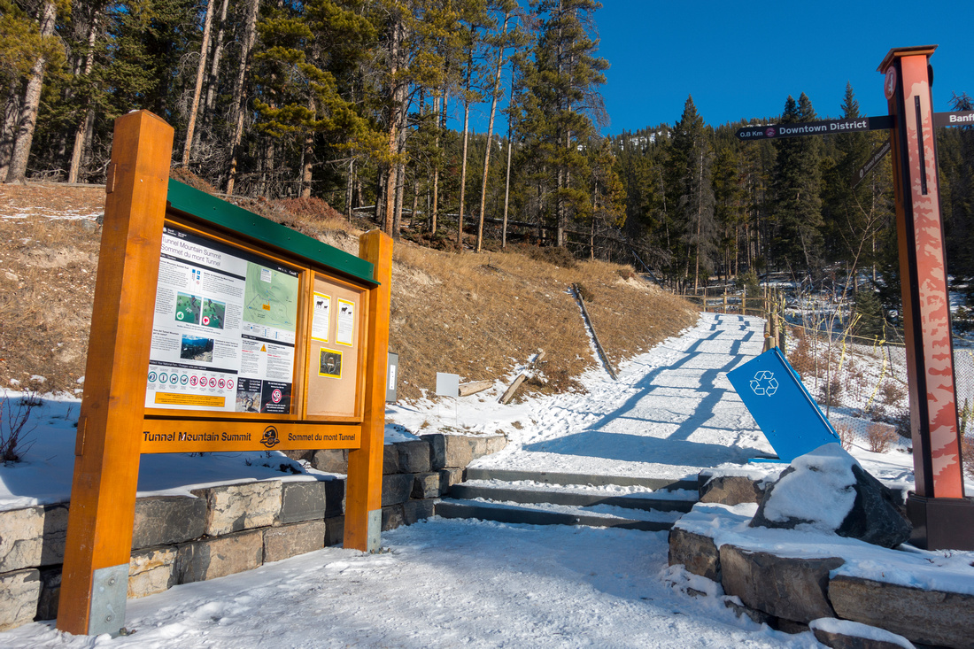 True (lower) trailhead on St. Julien drive with official Parks Canada info kiosk
 |
|||
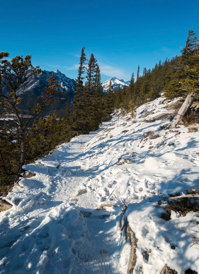 Upper Part of Trail, just before switchback to east side, looking back
 |
|||
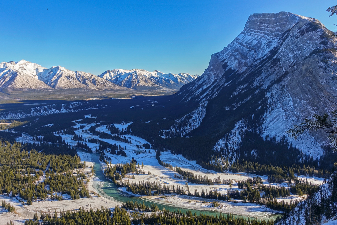 Snowy Mt. Rundle and distant Peaks of Fairholme range from one of several viewpoints on east side
 |
|||
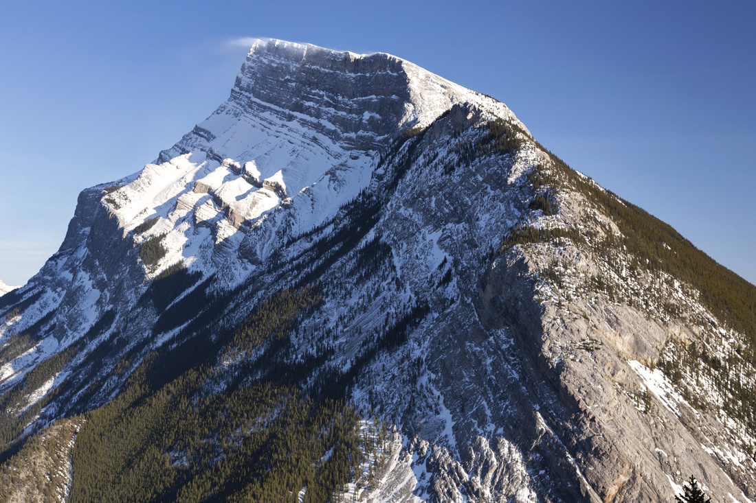 Mt. Rundle Telephoto; note snow drifts on summit ridge
 |
|||
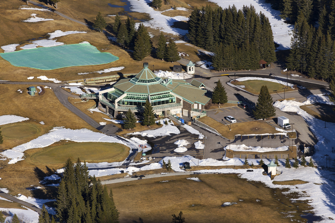 Banff Golf Course Telephoto below Rundle Mountain
 |
|||
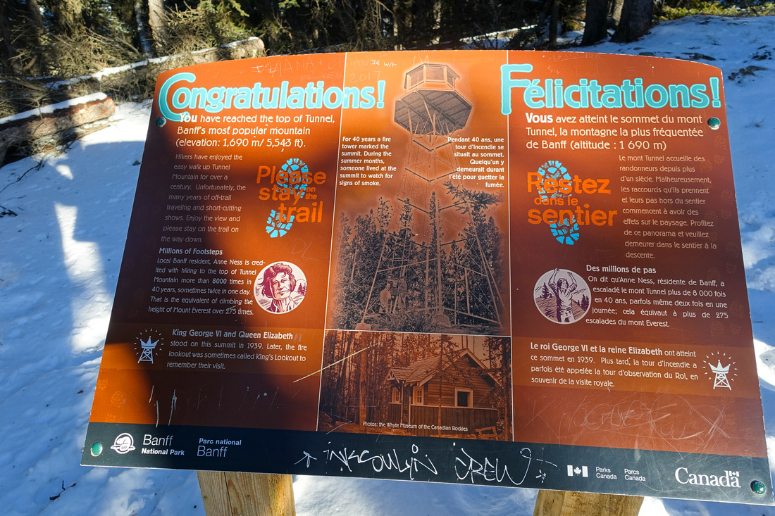 Parks Canada congratulating hikers on reaching official Rockies summit
 |
|||
Abstract
| Overall Difficulty | D1/2 | Short low angle switch-backing ascent on wide trail | |||
| Snow Factor | S2 | Well broken trail throughout the winter but possible icy sections, specially on switchbacks | |||
| Scenery | Very nice views of Rundle Mountain and Distant Peaks of Fairholme Range from east side. Banff panorama from the summit | ||||
| Trail/Marking | Excellent | Official Parks Canada trail, wide and well defined with signposts. Expect no solitude regardless of season | |||
| Suggested Time | 2 hr | Assuming start from lower trailhead and including break time on summit. Longer if hiking from Banff townsite or extending the day by walking Tunnel Mountain Drive to Banff Springs Hotel / Bow Falls | |||
| Elevation | Start: ~1450m (lower trailhead) Max: 1700m Total: ~250m | Round Trip: ~5km | |||
| Gear | Light hiking shoes or even runners. Yak Trax strongly advised throughout the winter | ||||
| Water | Dry but short hike -- 0.5L should suffice even in summer | ||||
| Dog Friendly | Yes | Busy trail so please be respectful to other hikers | |||