Google Map |
Rockies :: Banff-Louise :: Solstice Lake |
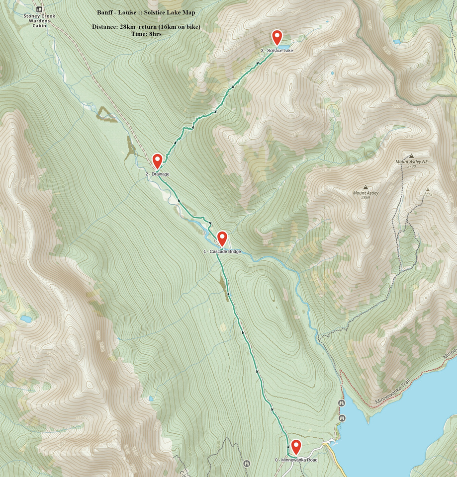
GPS Track |
|
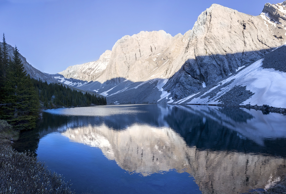
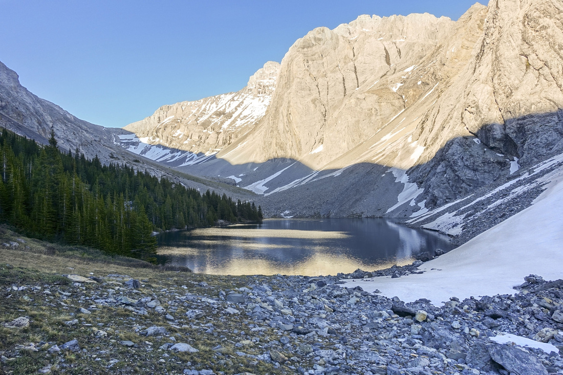
Solstice Peak reflected in calm water of "Solstice" Lake as evening shadows are moving in seldom visited cirque below Spectral Peak |
|||
| Trip Summary | |||
June 26, 2022
"Solstice" Lake lies in rarely visited alpine cirque between Spectral and Solstice Peaks in Palliser Range. Name is unofficial and self-coined: Initial inclination might be to call it "Spectral Lake", but as there are named Spectral Lakes at east side (accessed via Ghost or Aylmer Pass), "Solstice" is more appropriate. This hike is not feasible for anyone that needs trails; bushwhack up the drainage leading to the lake is quite demanding, although not desperate but micro-terrain finding skills are essential. Mountain bike for Cascade Fireroad portion is essential. Although years pass by nobody venturing this way, few hardy souls have used Solstice valley as approach for Spectral Peak ascent. Reward for difficult day is very beautiful alpine valley and total feeling of solitude. Bivouac by the lake would be possible, assuming one is prepared to cycle with overnight gear, then bushwhack for several hours with heavy load.
Cycle Cascade Fireroad for ~8km, crossing the bridge at 5.5km mark. See this report for more details about that part. Access drainage is ~2.5km past the bridge, first one on right (east) side. Use GPS if unsure - download link at top of the page. On my trip I followed left (north) side and was able to pick up occasional animal trail. Heaviest bushwhack was in lower part as there were many downed dry trees - watch for sharp spikes when crossing over. It is best to stay high above the creek as long as possible, but eventually you'll have to drop down to creek level as cliff bares the progress. Ensuing part is the most uncomfortable, with sidehilling and rock hopping - continue as best as you can, reaching first large avalanche slope on left (north) side ~2 hrs from the Fireroad. I continued in creek level but progress was quite painful due to avalanche debris and heavy alder bashing. Easiest way is to trash back up above the creek as soon as feasible and intercept grassy semi-open ledge ~100m vertical above the creek. Travel becomes much less tedious and even enjoyable - I discovered this on return only. Lake lies in cirque below sheer cliff on right side now coming into view. Drop back to creek level, then rock hop to the other side - delightful alpine meadow hiking accompanied by marmot whistles makes last bit very enjoyable and all the troubles will be forgotten now. Most people will need at least 3 hours to this point from the Fireroad
The lake lies at other side of small rise, and is very serene. This would be logical bivi spot. If continuing into upper valley, another half an hour of stubborn forest must be navigated at north side of the lake. Scramble of Spectral peak is presumably difficult and lose, but I can not vouch for this part as I have not done it myself. Descent back to Fireroad and Bicycle will not be much faster because of all the bush and deadfall. This outing is recommended for self-reliant explorer-type individuals not afraid to rough it up and with strong sense of adventure. |
|
Gallery |
|||
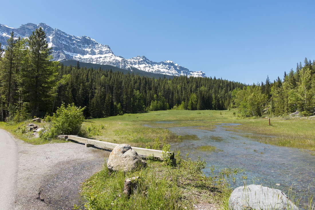 Cascade Meadows Cascade Meadows Pullout ~1km before Lake Minnewanka Parking lot. Cascade Fireroad is at far side of Meadow
 |
|||
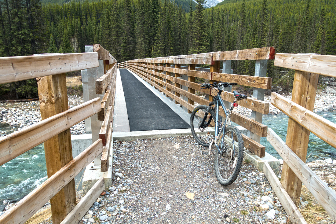 Cascade Bridge
Cascade River Bridge ~5.5km from Minnewanka Road Cascade Bridge
Cascade River Bridge ~5.5km from Minnewanka Road |
|||
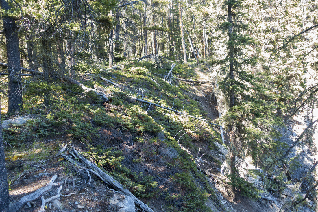 Bushwhacking
 on north side of Drainage above the Canyon Bushwhacking
Bushwhacking on north side of Drainage above the Canyon |
|||
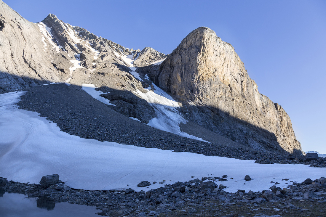
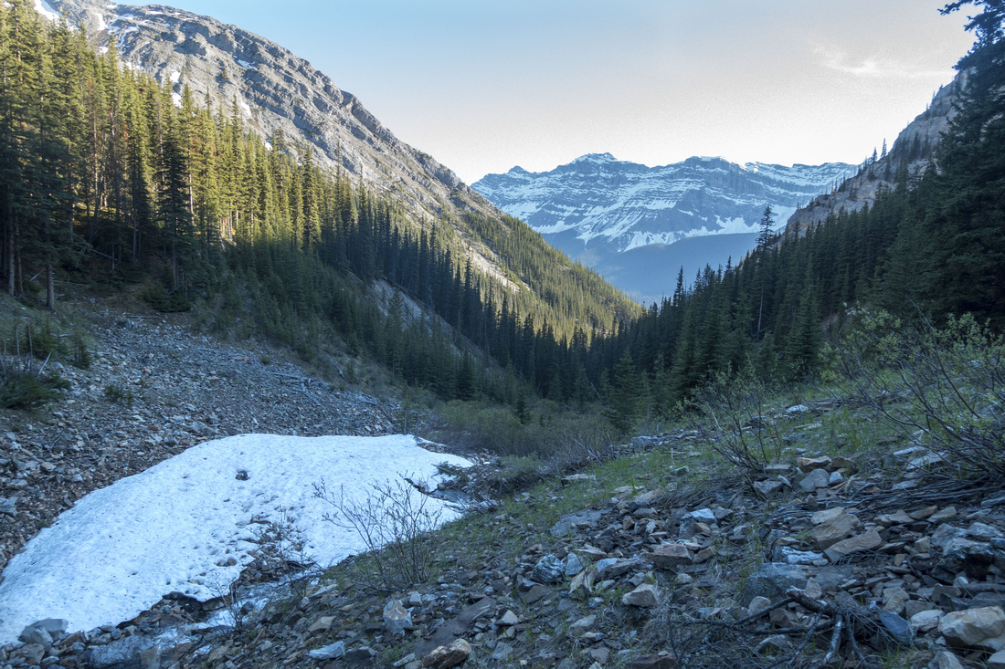 Avalanche Slope
Looking back at ascent drainage while crossing avalanche slope below Spectral Ridge. Instead of continuing up the creek, best option is to trash up talus slope climber left (north), then follow semi-open grassy ledge to the lake. Avalanche Slope
Looking back at ascent drainage while crossing avalanche slope below Spectral Ridge. Instead of continuing up the creek, best option is to trash up talus slope climber left (north), then follow semi-open grassy ledge to the lake. |
|||
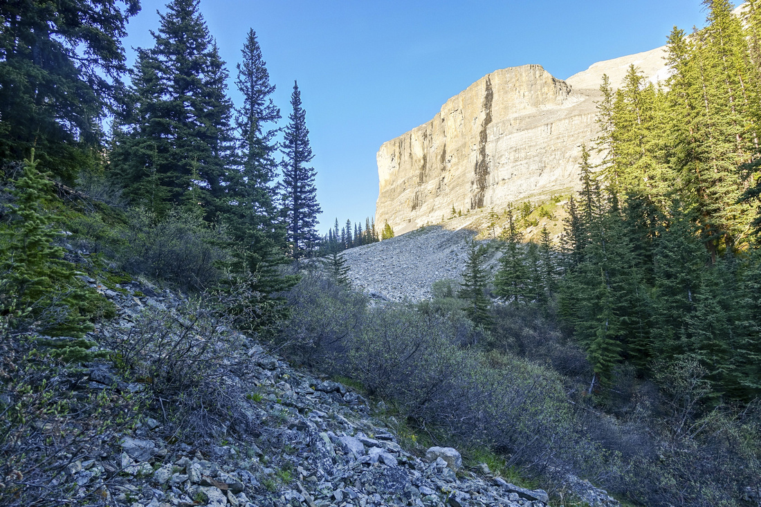 Alder Bash
Staying in Creek level leads to uncomfortable Alder bash. "Solstice" Lake is ~30min away, below sunlit cliff at center of the photo Alder Bash
Staying in Creek level leads to uncomfortable Alder bash. "Solstice" Lake is ~30min away, below sunlit cliff at center of the photo |
|||
 Alpine Meadow
Very enjoyable hiking on right (south) side of the creek for final part before the lake Alpine Meadow
Very enjoyable hiking on right (south) side of the creek for final part before the lake |
|||
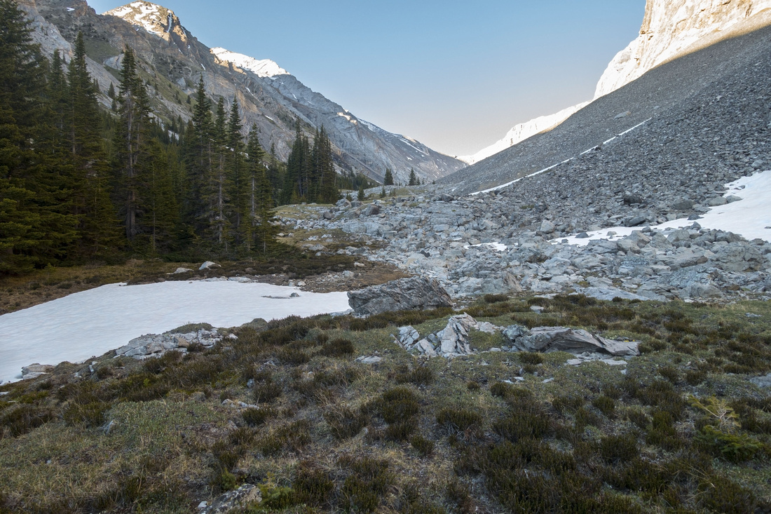
 Solstice Lake
"Solstice" Lake basin as you first see it topping up small grassy ridge. Spectral Peak route continues through the woods on left side Solstice Lake
"Solstice" Lake basin as you first see it topping up small grassy ridge. Spectral Peak route continues through the woods on left side |
|||
 Solstice Cliff
Huge Talus slope on south side with Landmark Rock buttress center right Solstice Cliff
Huge Talus slope on south side with Landmark Rock buttress center right |
|||
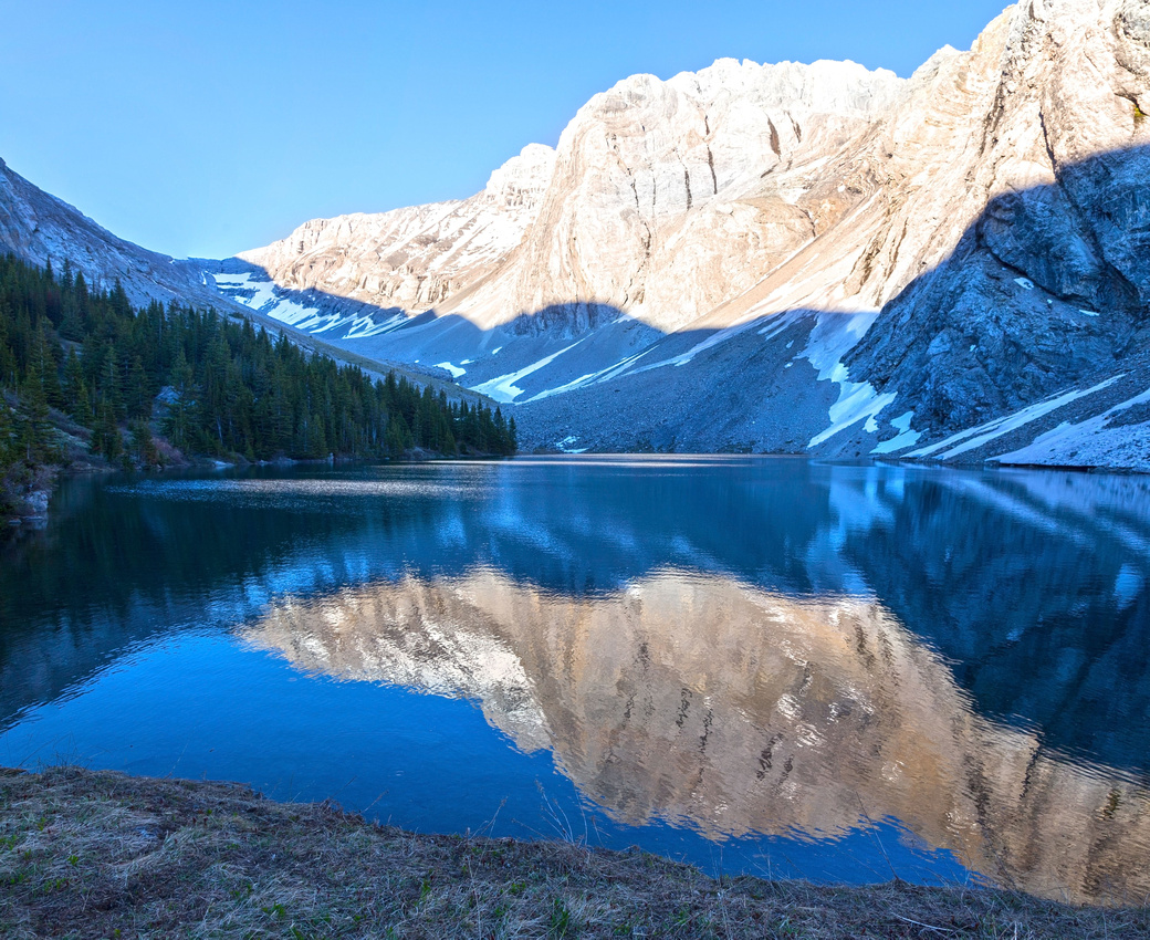 Solstice Lake
Beautiful early evening reflections of Solstice Peak in calm lake water Solstice Lake
Beautiful early evening reflections of Solstice Peak in calm lake water |
Abstract
|
Overall Difficulty |
Exploratory Off trail bushwhack with side-hilling and creek crossings. |
||||
|
Snow Factor |
Significant risk crossing avalanche slopes in upper part of access drainage. Not likely winter trip |
||||
|
Scenery |
Secluded alpine cirque and beautiful back-country lake |
||||
|
Trail/Marking |
None |
Wide Cascade Fireroad for ~8km, followed by entirely off-trail bushwhack. No markings/cairns whatsoever |
|||
|
Suggested Time |
8-9 hrs |
Return time to the lake only, assuming cycling Cascade Fireroad. Add 3-4 hrs for Spectral Peak |
|||
|
Elevation |
Start: 1460m Max: 2240m Total: ~950m (+850, -100) |
Round Trip: 28km (16km on bike) | |||
|
Gear |
Mountain bike for approach. Full hiking boots with poles. Gaiters, long pants/sleeves essential for bushwhack. GPS helpful |
||||
|
Water |
Cascade River and "Solstice" Lake drainage. 1L should be enough |
||||
|
Dog Friendly |
No |
Dogs not recommended as it is not practical for mountain cycling; In addition Cascade FR is busy wildlife corridor. |
|||
 Solstice Lake GAIA Map
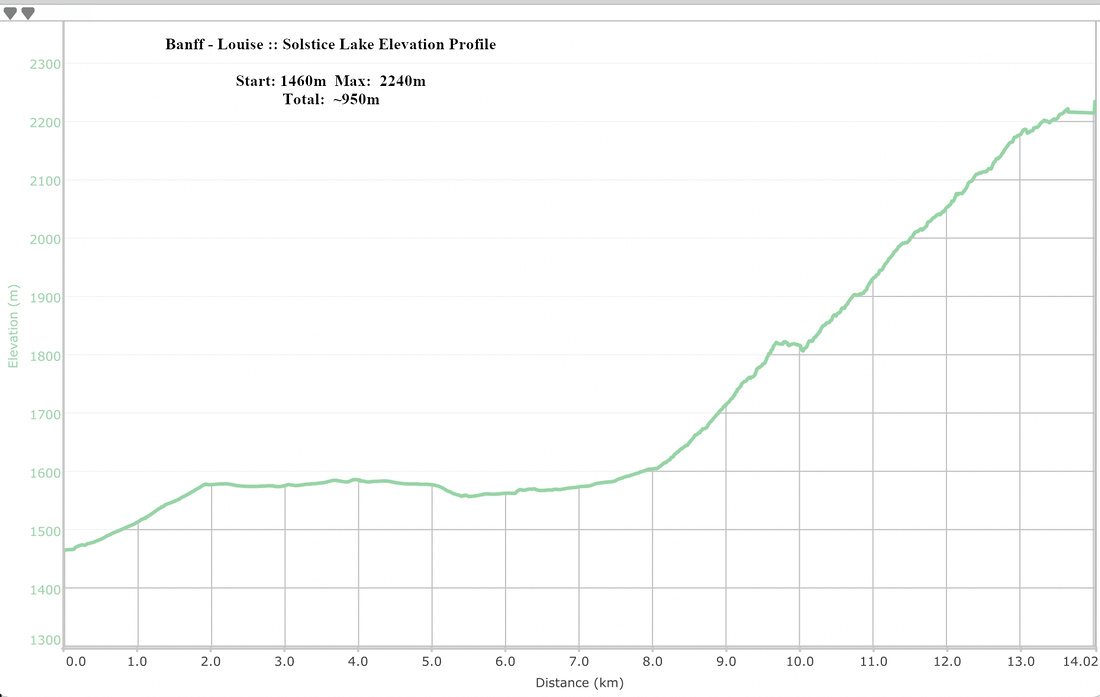 Solstice Lake Elevation Profile