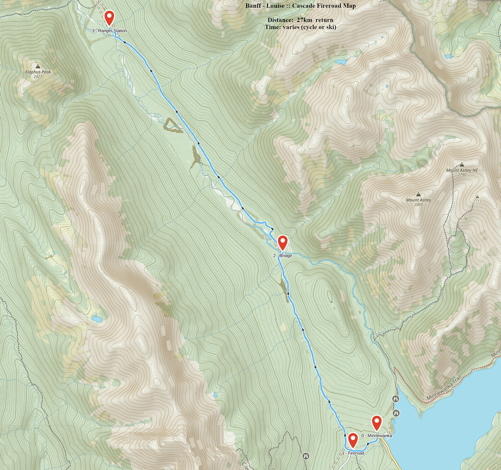
Google Map |
Rockies :: Banff-Louise :: Cascade Fireroad |
GPS Track |
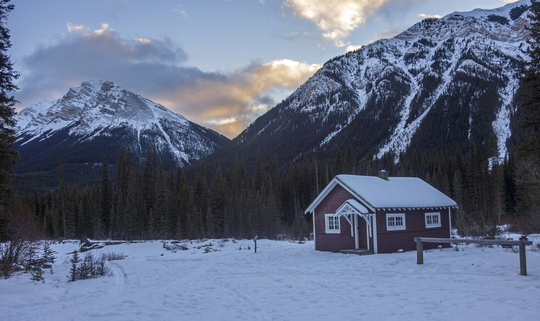 
View from the porch of Stoney Creek Ranger cabin at 13.5 km. Second (not used) building lower right; North end of Cascade Mtn. upper left |
|||
|
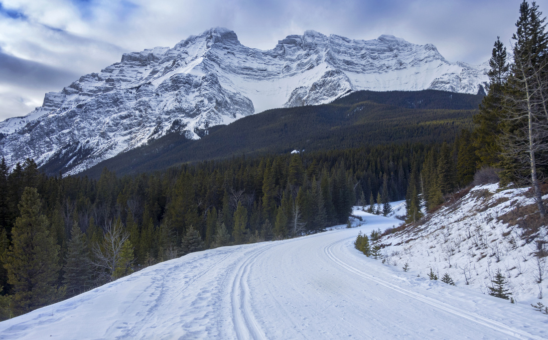
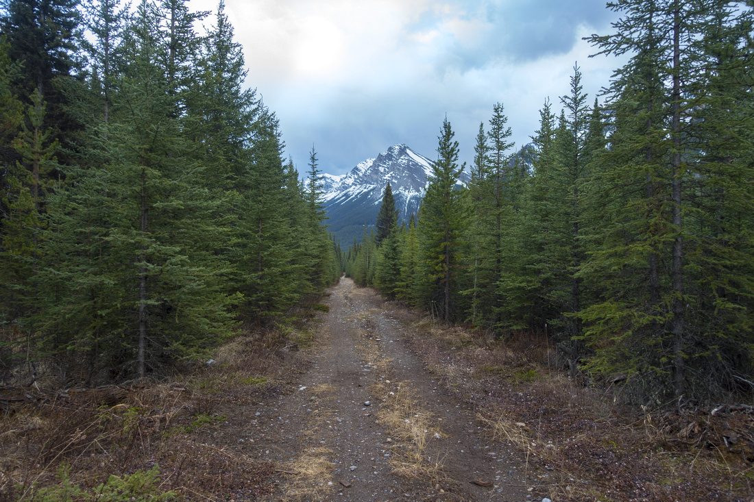
Cascade Fireroad is one of prime cross-country ski or mountain biking trips in Banff National Park. Old Road is mostly flat; main elevation gain is near the start from Minnewanka road. For winter trips it is usually track-set in both directions to the bridge at km6; beyond it is often just single track. With full day on disposal it is worth skiing or cycling to Stony Ranger cabin for good exercise as well as bit of history of Banff NP. If cycling, Stony Creek bridge ~1km past Ranger Cabin is worth visiting as well as brief hike on Elk Pass trail to Cascade River Ford. Valley is well sheltered and safe in winter conditions. In summer it is good mountain-biking trip, but be aware that it is also popular horse-back riding route. Expect company on sunny winter weekends. Loop return via Elk Pass Trail to Norquay Ski Area is sometimes done as summer backpack, but this trip can not be recommended as views are mostly limited considering significant overall distance. Alternate extension is rarely done ascent of Elaphus Peak; this is very long day and best left for late summer because of non-trivial ford of Cascade River. It is also possible to make several day backpack ending at Ya-Ha-Tinda area, but transport logistics for such trip are formidable.
Cross Country SkiingJanuary 20, 2017
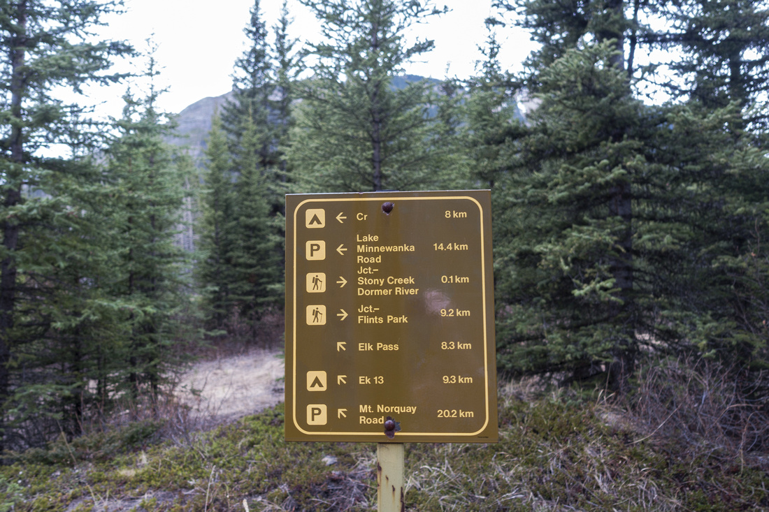
Park at Lake Minnewanka. In winter old Minnwanka Road is closed, so you will have to drive in via Two Jack Lake. Walk around the gate and ski down the road to first major curve; Cascade Fireroad starts on the right (north) side. Ski up the road. Incline is gentle for ~2km and then completely flattens out. At km 6 brief descent brings you to the bridge over Cascade River; this is usual turnaround point for shorter half-day trips. Continuing on the other side going is pretty much similar. For next couple of kilometers there is often some debris from trees that considerably slow you down on skis. Around km 10 portion of the road is sometimes iced and caution is needed; you might have to take skis off. Finally just past km 13 watch for side spur descending to Cascade River on the left side to the Stony Creek Ranger Cabin. There is horse coral, outhouse and second building (not used). Cabin is often vacant and locked; if using the porch for your lunch break, please leave no trace behind you. If you have extra time and energy, Fireroad is usually trackset for another ~1km to the bridge over Stony Creek. Return is the same way and it will be faster as there is more downhill |
|
Gallery |
|||
 Skiing Minnewanka Road
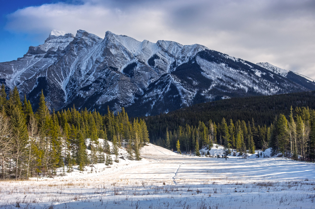
Skiing down Lake Minnewanka Road with great view of Cascade Mtn. Fireroad start ahead, lower right Skiing Minnewanka Road
Skiing down Lake Minnewanka Road with great view of Cascade Mtn. Fireroad start ahead, lower right |
|||
 Mount Inglismaldie
View back to Mt. Inglismaldie from start of Cascade Fireroad Mount Inglismaldie
View back to Mt. Inglismaldie from start of Cascade Fireroad |
|||
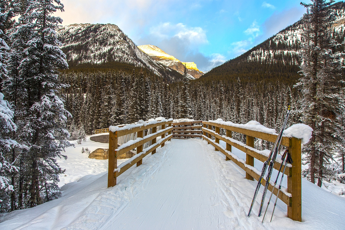 Cascade Bridge
Cascade River Bridge just past 6km mark and optional turnaround point Cascade Bridge
Cascade River Bridge just past 6km mark and optional turnaround point |
|||
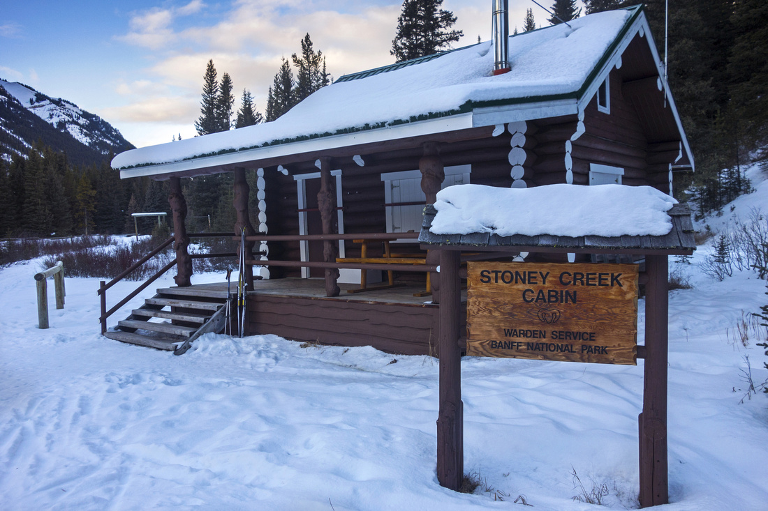 Stony Creek Warden Cabin
 at km 13.5, roughly 1km before Stony Creek. There is some confusion between "Stoney" (photo) and "Stony", more commonly found on maps and guidebooks Stony Creek Warden Cabin
Stony Creek Warden Cabin at km 13.5, roughly 1km before Stony Creek. There is some confusion between "Stoney" (photo) and "Stony", more commonly found on maps and guidebooks |
|||
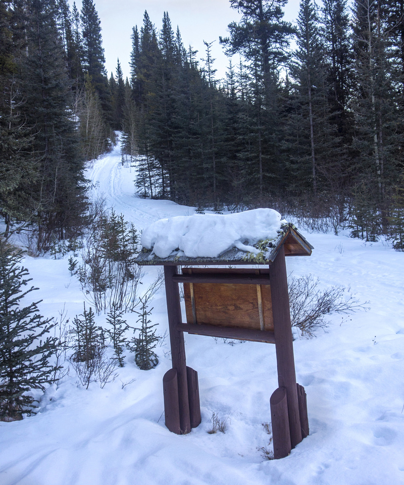 Warden Cabin Access
Descent from Cascade Fireroad to the Stony Ranger Cabin Warden Cabin Access
Descent from Cascade Fireroad to the Stony Ranger Cabin |
|||
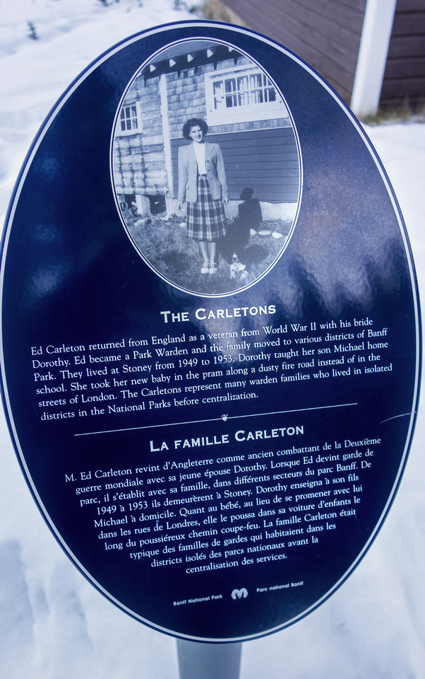 Stony History
Stony Cabin History Stony History
Stony Cabin History |
|||
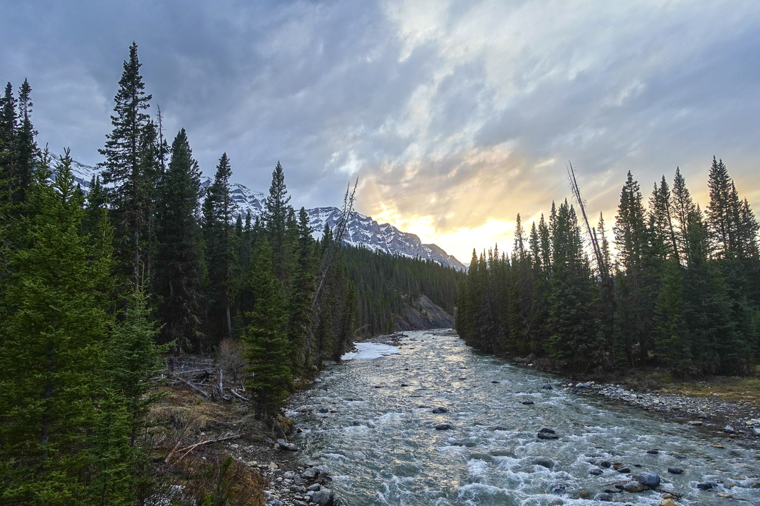
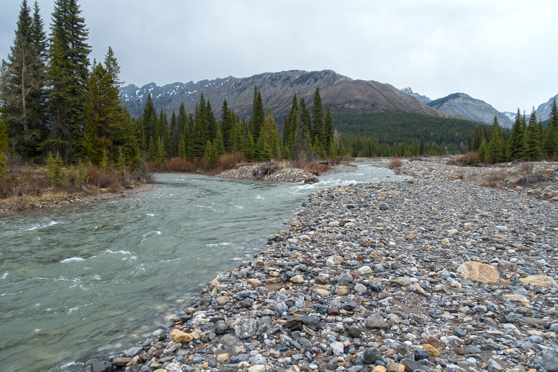
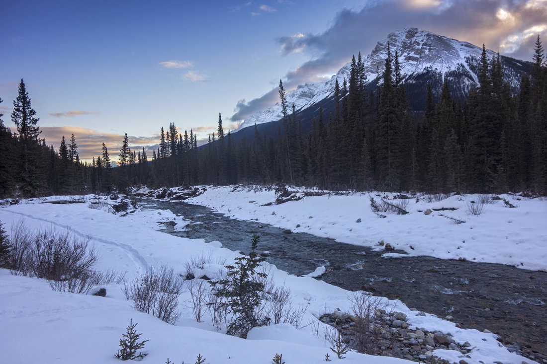 Cascade River
 just below Ranger Cabin with North end of Cascade Range above Cascade River
Cascade River just below Ranger Cabin with North end of Cascade Range above |
|||
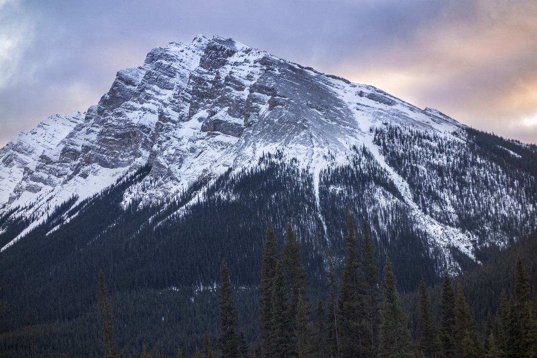 Cascade Range
 North End Telephoto. Elk Pass trail to Norquay area passes through the gap just off far right side of photo Cascade Range
Cascade Range North End Telephoto. Elk Pass trail to Norquay area passes through the gap just off far right side of photo |
|||
|
|
Mountain BikingMay 21, 2021
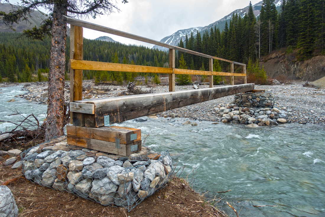
After snow has melted mountain biking Cascade FR is great back-country trip. Starting from official trailhead at upper Bankhead on Lake Minnewanka road adds ~1km (each way). After joining winter route, first couple of km are steady uphill and you might have to push depending on your leg strength (great coasting on return!). Grade then flattens passing by several ponds before dropping down to Cascade Bridge. This is good spot for a break and back-country CR6 campground, just after crossing the bridge, is excellent spot. Beyond road is more rough with more steady uphill approaching Stony Ranger Cabin. Just before end of cycling at Elk Pass junction there was large washed out section (May '21). If first time here, it is well worth doing a bit of exploring on foot. Scenic Stony creek bridge is ~100m further up the road, while hiking 0.7km down Elk pass trail brings you to Cascade River ford, passing decaying and quite photogenic old Stony bridge (see gallery). Return will be much faster; on my trip I took almost 2hrs going in, but less than an hour cycling back. |
|
Gallery |
|||
 Cascade Bridge
 just past 6km mark. Even if it possible to cycle through it is worth getting off the bike as crossing is very scenic Cascade Bridge
Cascade Bridge just past 6km mark. Even if it possible to cycle through it is worth getting off the bike as crossing is very scenic |
|||
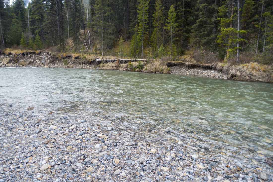
 Cascade River
View of Cascade River from the Bridge looking north. CR6 back-country campground is in the wooded area on the right side Cascade River
View of Cascade River from the Bridge looking north. CR6 back-country campground is in the wooded area on the right side |
|||
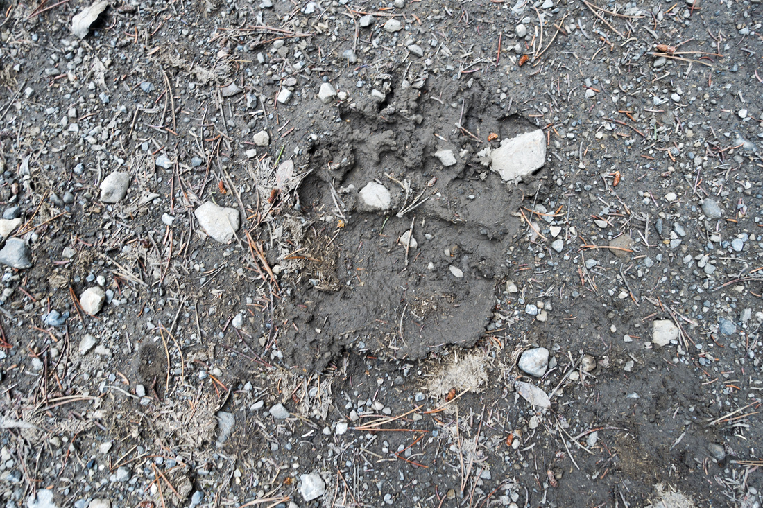 Bear Tracks
Cascade Valley is wildlife corridor frequented by bears, cougar and wolves. Make lots of noise when cycling! Bear Tracks
Cascade Valley is wildlife corridor frequented by bears, cougar and wolves. Make lots of noise when cycling! |
|||
 Muddy Corridor
Looking back at typical section of Cascade FR approaching end of cycling at Stony Creek Muddy Corridor
Looking back at typical section of Cascade FR approaching end of cycling at Stony Creek |
|||
 Elk Pass Junction
Elk Pass junction 1km past Ranger Cabin turnoff Elk Pass Junction
Elk Pass junction 1km past Ranger Cabin turnoff |
|||
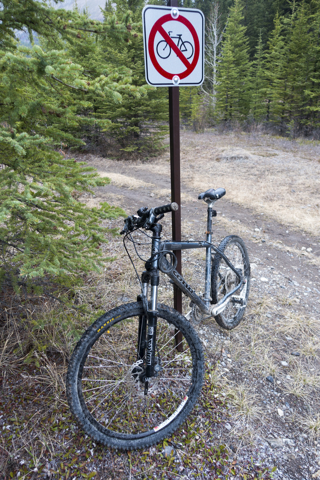 Cycling End
End of Cycling Sign ~100m before Stony Creek Crossing; there is something quite amusing about this photo Cycling End
End of Cycling Sign ~100m before Stony Creek Crossing; there is something quite amusing about this photo |
|||
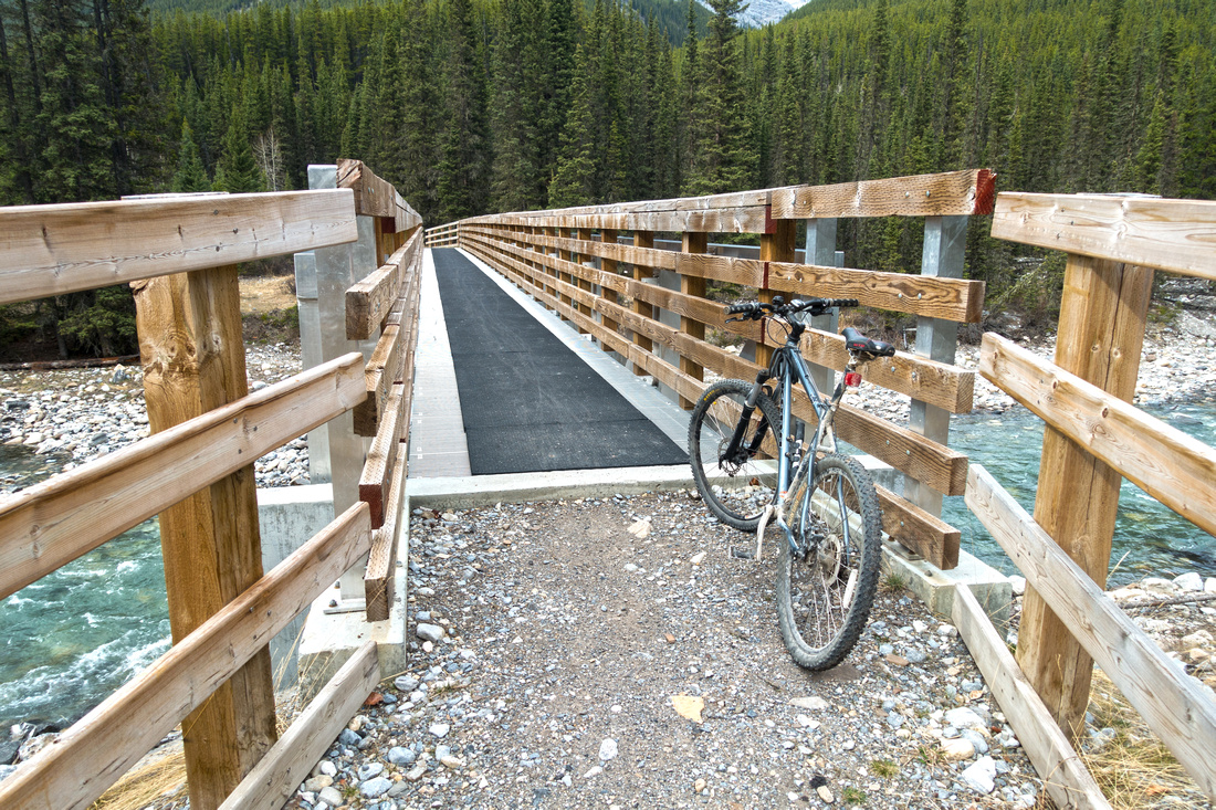
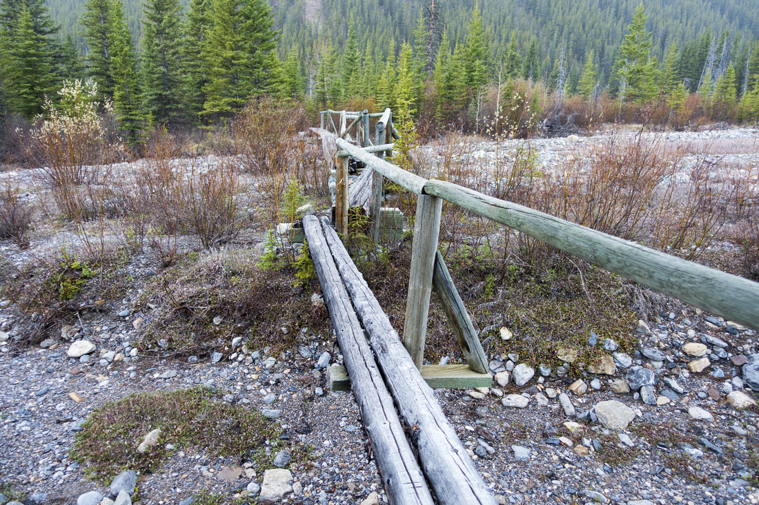
 Stony Creek Bridge
Stony Creek bridge. Old one was swept away in spring runoffs 2020 and this is brand new one; a rarity when it comes to Parks maintaining back-country facilities. Dormer Pass Junction and CR15 campground is nearby Stony Creek Bridge
Stony Creek bridge. Old one was swept away in spring runoffs 2020 and this is brand new one; a rarity when it comes to Parks maintaining back-country facilities. Dormer Pass Junction and CR15 campground is nearby |
|||
 Old Stony Bridge
Decaying old bridge over dried channel of Stony creek, already on Elk pass trail Old Stony Bridge
Decaying old bridge over dried channel of Stony creek, already on Elk pass trail |
|||
 Cascade Ford
Non-trivial ford of Cascade River; Elk Pass trail continues on the other side. Dangerous during spring runoffs and best left for late summer Cascade Ford
Non-trivial ford of Cascade River; Elk Pass trail continues on the other side. Dangerous during spring runoffs and best left for late summer |
|||
 The Confluence
Confluence of Cascade River (L) and Stony Creek (R) The Confluence
Confluence of Cascade River (L) and Stony Creek (R) |
|||
|
|
Abstract
| Overall Difficulty | D2/3 | Mostly flat with some up/down parts. Usually trackset during X-country ski season. Section north of Cascade Bridge is more rough. Recommended as ski or bike trip only. | |||
| Snow Factor | S2 | Road travels valley floor far away from mountain slopes. Possibility of iced sections around km 10 | |||
| Scenery | Good views of Cascade Mountain on descent from Minnewanka parking. Scenic Bridge just past 6km mark. Elaphus Peak, Stony Creek and Cascade River | ||||
| Trail/Marking | Excellent | Old fireroad with no route-finding issues. Official start from upper Bankhead has trail table and map. Start from MInnewanka road is not marked | |||
| Suggested Time | varies | Depending on skiing and cycling ability and how far you want to go. Half-day for Cascade Bridge, full day for Stony Creek / Ranger Cabin and extensions | |||
| Elevation | Start: 1490m Max: 1700 m Total: +390m, -190m | Round Trip: ~27km | |||
| Gear | x-country ski gear, or mountain bike | ||||
| Water | Cascade creek. Carry no more than 1L | ||||
| Dog Friendly | No | Dogs not practical for x-country skiing or mountain cycling; In addition Cascade FR is wildlife corridor. | |||
 Cascade Fireroad GAIA Map
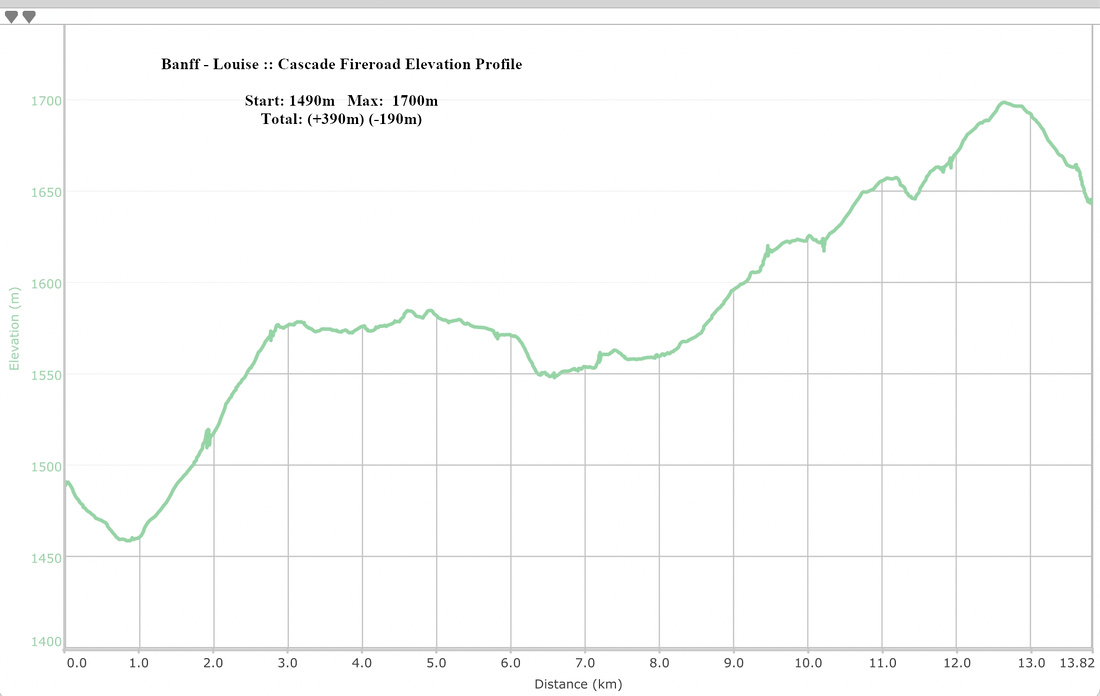 Cascade Fireroad Elevation Profile