Google Map |
Rockies :: Banff-Louise :: Silverton Falls |
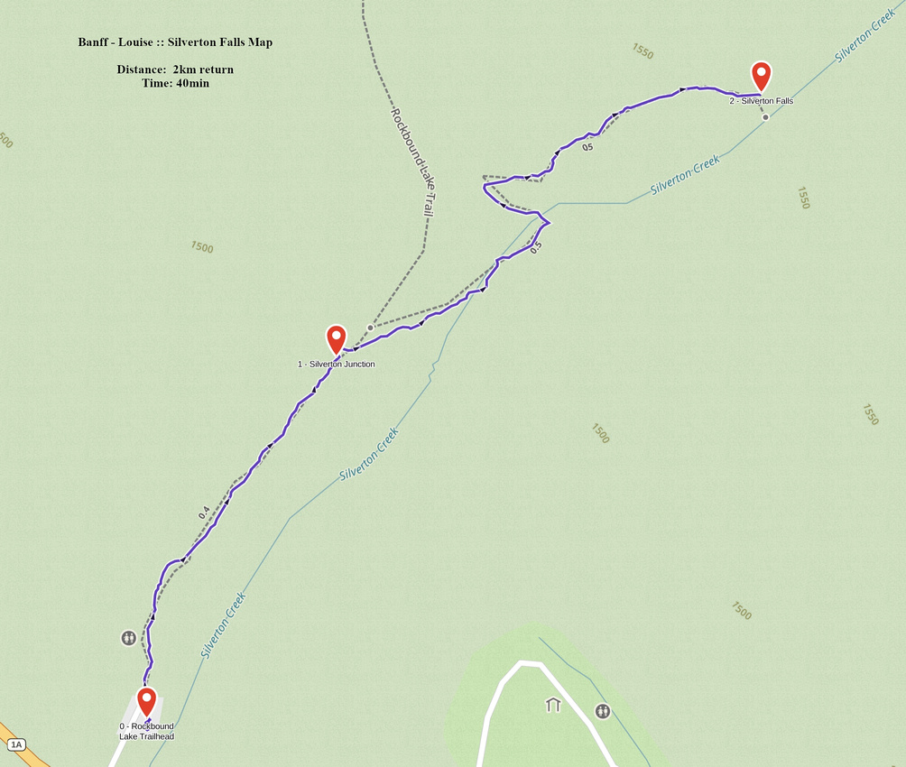
GPS Track |
Frozen Silverton Falls at end of approach Hiking trail in December |
|||
| Trip Summary | |||
Dec 20, 2024
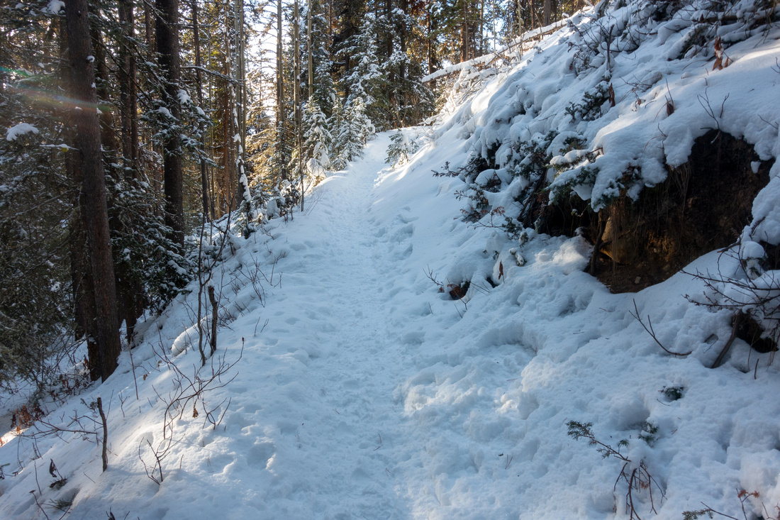
Very short walk starting from Rockbound Lake trailhead on Bow Valley Parkway. Many hikers - myself included - have probably ignored Silverton while rushing towards more "worthy" Castle Mountain objectives. In summer this trail might appeal as family walk to folks staying at nearby Castle Junction Chalets. In winter scenery is different and much more peaceful than nearby Johnston Canyon - that remains a Zoo year round. From parking follow signed Rockbound Trail for ~5min or so to a signed Junction, and go right. After short flat stretch, trail switchbacks gaining a bit of elevation, then traverses semi open slope to the viewpoint. Area is a bit narrow and if busy you might need to wait in line. Do not try to trash down into the gorge to the base of the Falls as it is dangerous and accident prone. Return the same way, then extend the day by hiking somewhere else. I combined Silverton with Castle Lookout (~10min drive north) and this combo worked quite well - suit yourself. |
|
Gallery |
|||
 Rockbound Lake Trailhead
 near Castle Junction on Bow Valley Parkway Rockbound Lake Trailhead
Rockbound Lake Trailhead near Castle Junction on Bow Valley Parkway |
|||
 Silverton Junction
Signed Junction ~5min from Parking. Left for Rockbound Lake, Right for Silverton Falls Silverton Junction
Signed Junction ~5min from Parking. Left for Rockbound Lake, Right for Silverton Falls |
|||
|
|
|||
 Silverton Overlook
End of Silverton Hiking Trail, less than 1km from Trailhead, with little wiggle room - likely tourist jam in summer Silverton Overlook
End of Silverton Hiking Trail, less than 1km from Trailhead, with little wiggle room - likely tourist jam in summer |
|||
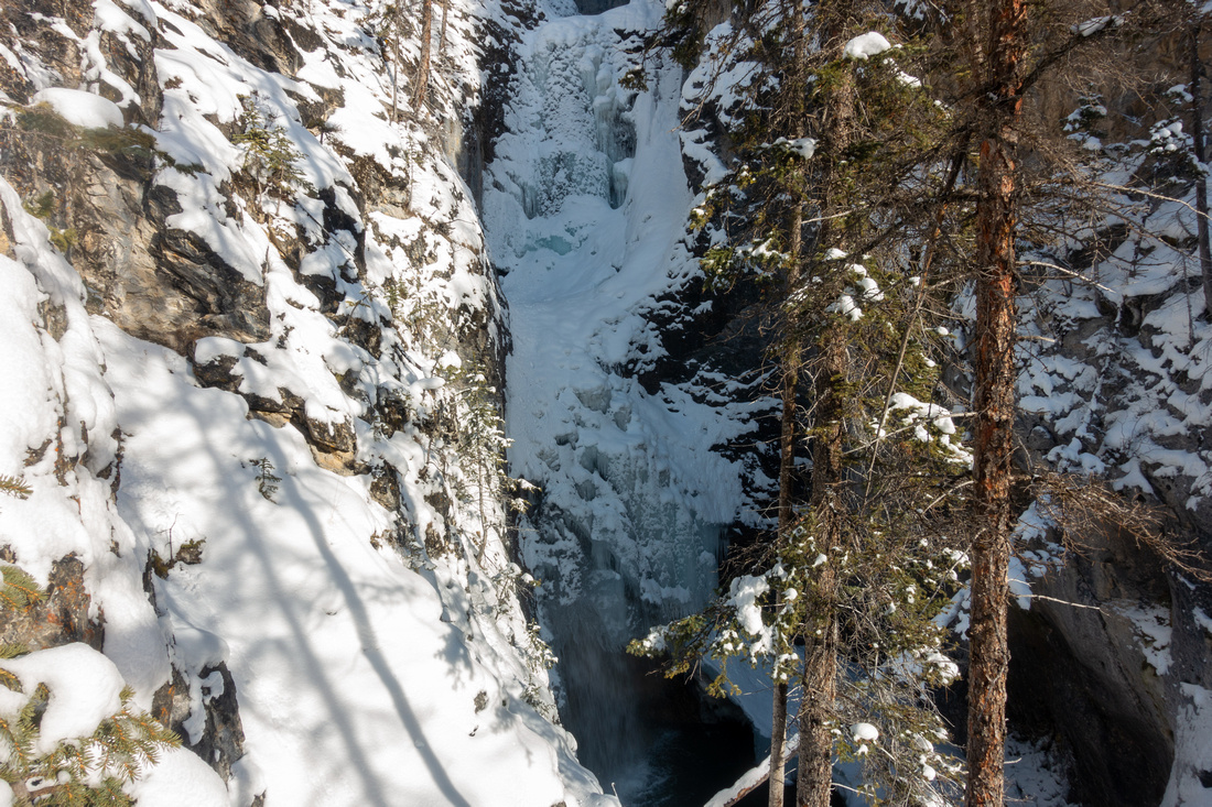
 Silverton Falls
Frozen Silverton Falls are quite impressive. It might be possible to trash down to the base, but very difficult (and dangerous) Silverton Falls
Frozen Silverton Falls are quite impressive. It might be possible to trash down to the base, but very difficult (and dangerous) |
|||
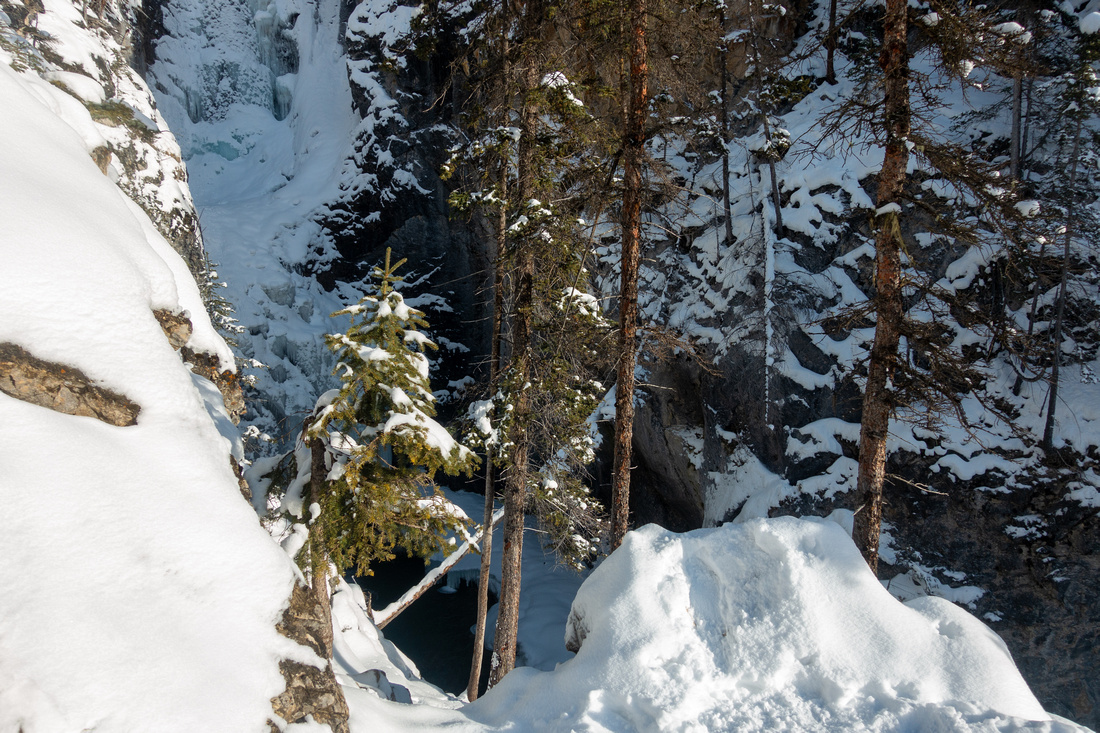
 Silverton Falls
 Telephoto; Ice climbers seem to prefer Johnston Canyon Icefalls Silverton Falls
Silverton Falls Telephoto; Ice climbers seem to prefer Johnston Canyon Icefalls |
Abstract
| Overall Difficulty | D1 | Short forested walk on well defined trail. Final viewpoint is a bit exposed | |||
| Snow Factor | S1 | Trail normally hard packed in winter. Mind footing on final approach to viewpoint | |||
| Scenery | Narrow gorge resembling more popular nearby more popular Johnston Canyon Icefalls | ||||
| Trail/Marking | Excellent | Well defined trail with signed trailhead and junction | |||
| Suggested Time | 1 hr | Relaxed pace incl. break at viewpoint | |||
| Elevation | Start: 1440m End: 1530m Total: ~90m |
Round Trip: ~2km |
|||
| Gear | Running shoes or day hikers. Micro-spikes might be useful for icy sections in winter | ||||
| Water | Short trail, carry small water bottle with snack | ||||
| Dog Friendly | Yes | Please keep control of your pet as this is popular area for courtesy to other hikers | |||
 Silverton Falls GAIA Map
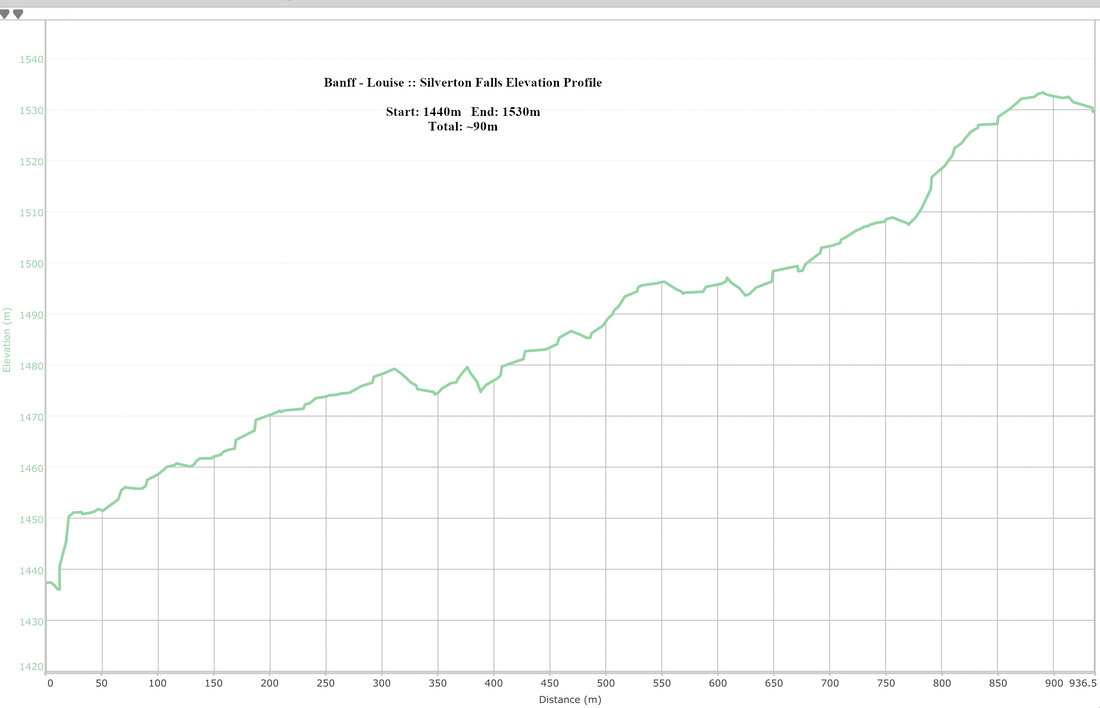 Silverton Falls Elevation Profile