Rockies :: Banff-Louise :: Castle Mountain
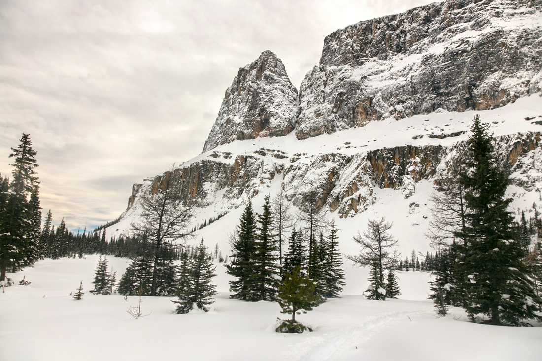 
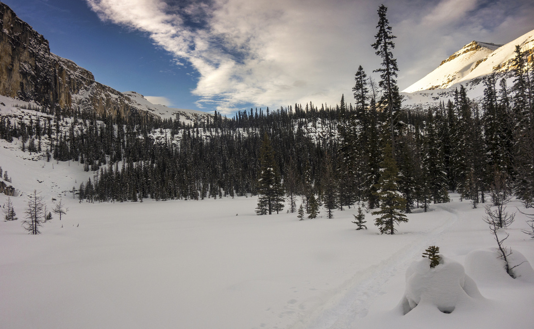
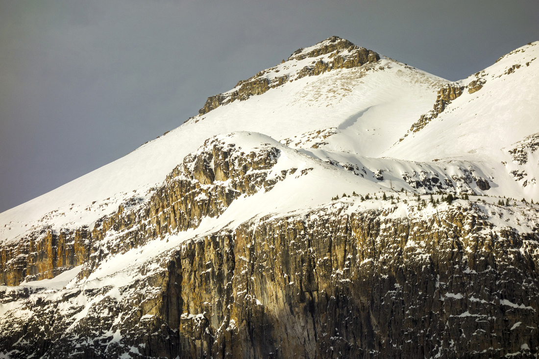
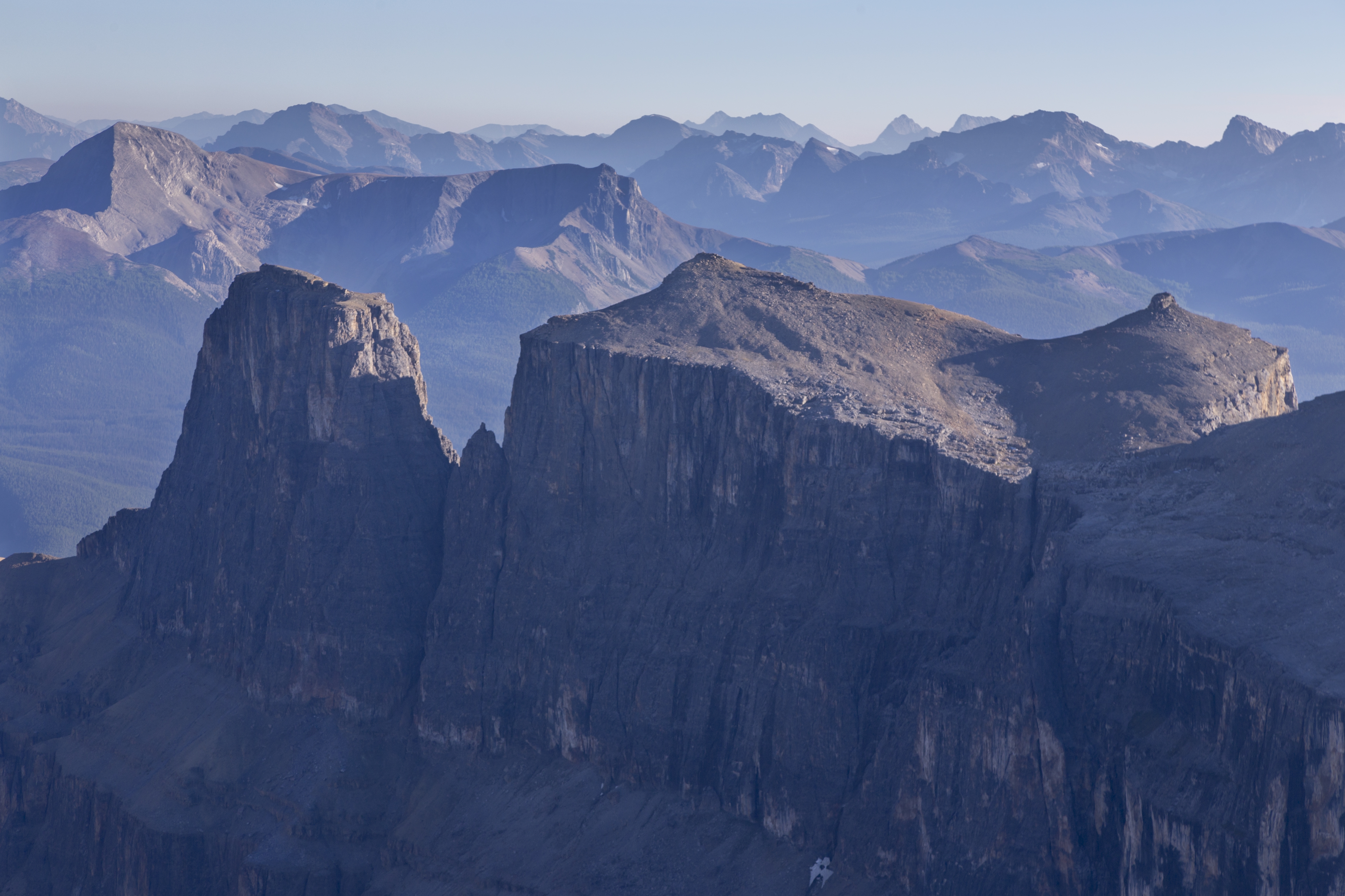
Eisenhower Peak from Rockbound Lake Amphitheater during winter snowshoe trip |
|||
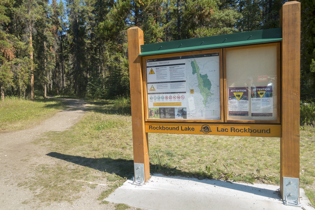
| Castle Mountain is stunning eye-catcher halfway between Banff and Lake Louise. West cliffs appear impenetrable when seen from tourist pull-out on Trans-Canada highway, but tucked in the backs is beautiful amphitheater hosting aptly named Rockbound Lake. Area has been open wide by Alan Kane "Scrambles" guide and several peaks around the Amphitheater made an entry. It is also popular by rock-climbers that use Hut on Goat Plateau below Eisenhower Tower (named in 1979 in honor of World War II general Dwight Eisenhower). More adventurous hiking objectives include one way traverse over Television Peak to Protection Mtn as well as exploratory backpacks to Mitella Lake and Baker Creek. For all trips official parking lot is just south of Castle Mountain Chalets on east side of Bow Valley Parkway
|
| Rockbound Lake | GPS Track | |
Multiple Dates, last Sep 10, 2022
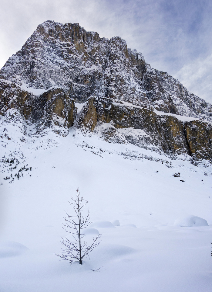
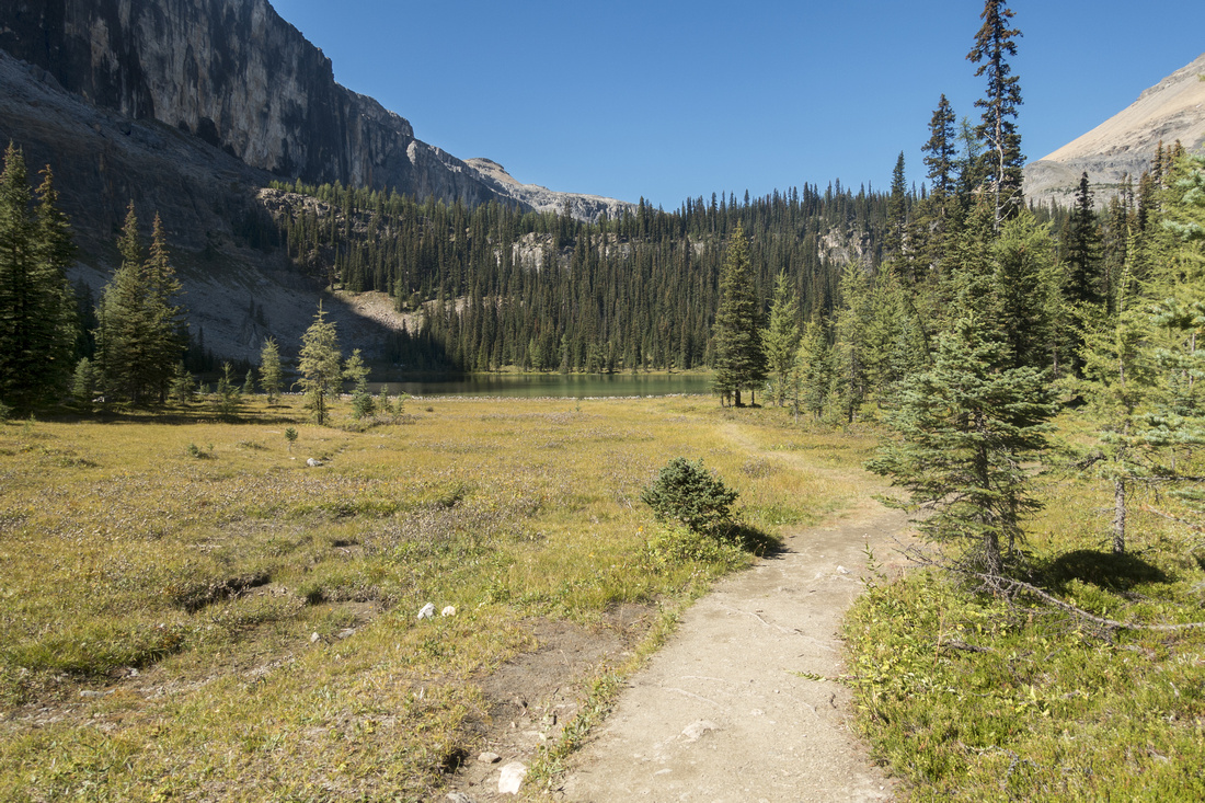
Rockbound Lake Trail is reminiscent to Garibaldi Lake hike in BC Coast Mountains. Many see it just as approach to several Kane scrambles above the Amphitheater, but it is also worthy destination on its own. In winter it is an excellent choice in high-risk avalanche conditions, as most of the approach is below treeline. Although return distance is fairly long, travel is generally easy and can be done fast - specially on return. Scenery gradually unfolds as trail approaches Tower Lake below formidable Eisenhower Tower. The only difficulty is steep, but brief, headwall above Tower Lake; hard to believe some are able to ski this part in winter! Many larches on south side of Rockbound Amphitheater also make this an excellent Fall destination. It is one of my favorite trails in the area, despite unjustified "Don't waste your time" rap in certain circles.
From the parking lot follow wide trail passing Silverton Falls junction near the start. Trail angles left and starts approach towards south end of Castle Mountain massif. About 2.5km, ~40 mins is wide switchback and trail steepens. Elevation gain is steady, but moderate. There are occasional glimpses of Bow Valley and Pilot Mountain along the way. Around 5km mark trail switches again and starts approach towards Rockbound Amphitheater; grade soon levels out. Meadows and creek crossing on wooden planks are near; water bottles can be refilled here. Soon after is the clearing and only risky point in winter conditions; sizeable avalanche slope coming off Eisenhower Tower. This section is short and you are through in 1-2 minutes. Just under 2 hours is emerald colored Tower Lake -- popular with fishermen and very beautiful, specially early in the morning as sun hits east cliffs of Castle Massif. At north end of Tower Lake trail swings left just past old sign that reads "1/2 mile to Rockbound Lake". Ensuing Headwall is steep but short. Trail switchbacks back and forth couple of times; steepest portion is near the top, and often fairly awkward in the winter. Above the Headwall trail descends through stands of larch trees to south end of Rockbound Lake and vanishes out.
Best spot for break are slabs halfway around the south shore. From here ascent route to mid-plateau circling the lake can be studied. Pyramid shaped peak directly above is Helena Ridge and is the least demanding of all objectives above the lake. Neither are particularly safe though in winter conditions. Return the same way will be considerably faster from the way up; it can also be hiked without problems with headlamp in case of long day trips above the lake. Gallery contains mix from different summer and winter trips. |
||
 Rockbound Trailhead
Rockbound Lake Trailhead at Castle Junction on Bow Valley Parkway Rockbound Trailhead
Rockbound Lake Trailhead at Castle Junction on Bow Valley Parkway |
|||
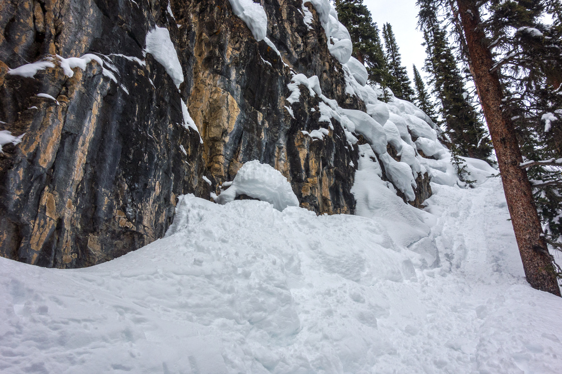
 Avalanche Slope
Crossing Avalanche slope approach to Tower Lake. Shelf halfway up is called "Goat Plateau" and is often used as base for technical route up Eisenhower Tower, 5.6 YDS Avalanche Slope
Crossing Avalanche slope approach to Tower Lake. Shelf halfway up is called "Goat Plateau" and is often used as base for technical route up Eisenhower Tower, 5.6 YDS |
|||
 Tower Lake
Trail approaching Tower Lake with good view of Rockbound Headwall behind Tower Lake
Trail approaching Tower Lake with good view of Rockbound Headwall behind |
|||
 Tower Lake
 in winter settings Tower Lake
Tower Lake in winter settings |
|||
 Rockbound Headwall
Awkward steep ascent of Headwall above Tower Lake Rockbound Headwall
Awkward steep ascent of Headwall above Tower Lake |
|||
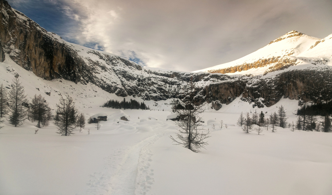 Rockbound Amphitheater
Entering Rockbound Amphitheater above the Headwall Rockbound Amphitheater
Entering Rockbound Amphitheater above the Headwall |
|||
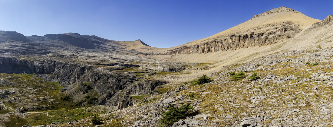
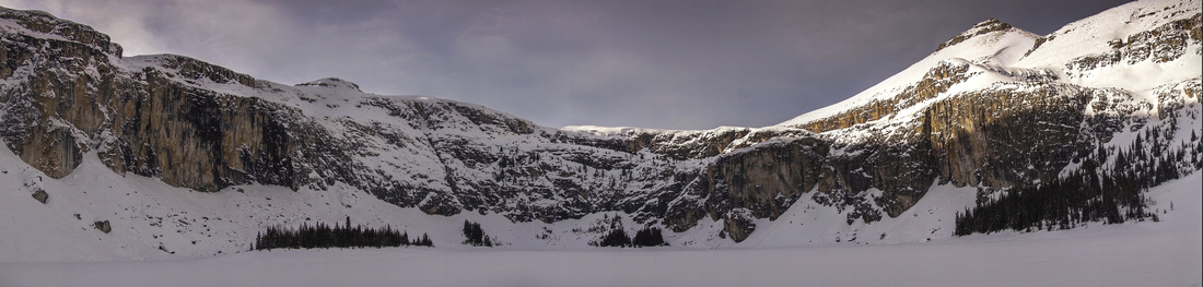 Rockbound Amphitheater
Panoramic view of Rockbound Amphitheater Rockbound Amphitheater
Panoramic view of Rockbound Amphitheater |
|||
 Helena Ridge
Closer look at Helena Ridge from Rockbound Lake; not feasible winter trip due to avalanche danger Helena Ridge
Closer look at Helena Ridge from Rockbound Lake; not feasible winter trip due to avalanche danger |
|||
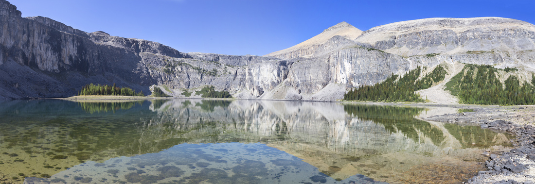 Rockbound Panorama
Rockbound Lake Panorama in early September '22 Rockbound Panorama
Rockbound Lake Panorama in early September '22 |
|||
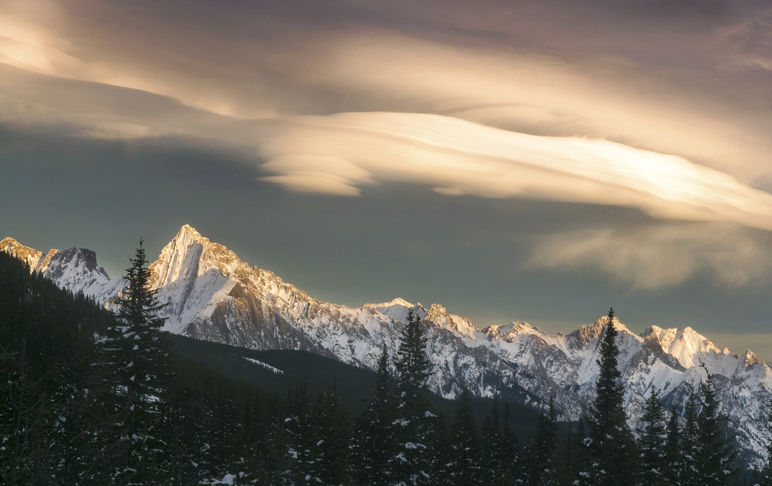 Chinook Skies
Chinook sunset skies past Tower Lake on return Chinook Skies
Chinook sunset skies past Tower Lake on return |
|||
Abstract
| Overall Difficulty | D3 | Fairly easy but longish approach to Tower Lake . Steep Headwall below Rockbound Lake | |||
| Snow Factor | S2 | Straightforward snowshoe or (more difficult) ski to Tower Lake. One brief crossing of avi slope below Eisenhower Tower, but otherwise low risk. More difficult from Tower to Rockbound Lake (S3) Fast and physically demanding ski out. Note that in winter Rockbound Lake loses sun early in the afternoon. | |||
| Scenery | Pristine Tower Lake with backdrop of Eisehnower Tower. Spectacular Rockbound Amphitheater with interesting colored cliffs dotted with golden larches in September. Much of the approach is below treeline and view-less. | ||||
| Trail/Marking | Excellent | Official Parks trail with marked junctions | |||
| Suggested Time | 4-6 hrs | Rockbound Lake only. Return time depends on season and transport mode in winter | |||
| Elevation |
Start: 1440m Max: 2220m Total: ~820m |
Distance: ~8.5km (1-way) | |||
| Gear | Light hikers sufficient in summer conditions. Snowshoes or skis in winter. Poles very helpful for Headwall above Tower Lake | ||||
| Water | Creek crossing below Eisenhower Tower ~ 1.5 hrs from trailhead. Tower or Rockbound Lake (filtering). Carry ~1L | ||||
| Dog Friendly | Yes | Standard back-country travel precautions. Trail is popular in summer so leash is recommended. | |||
 Rockbound Lake GAIA Map
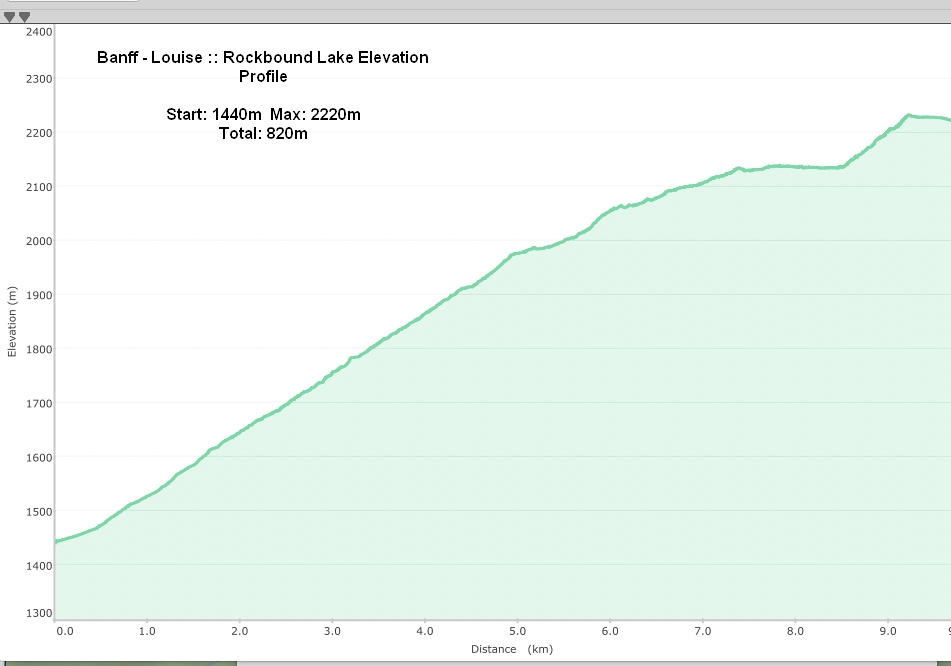 Rockbound Lake Elevation Profile
| Helena Ridge | GPS Track | |
Sep 10, 2022
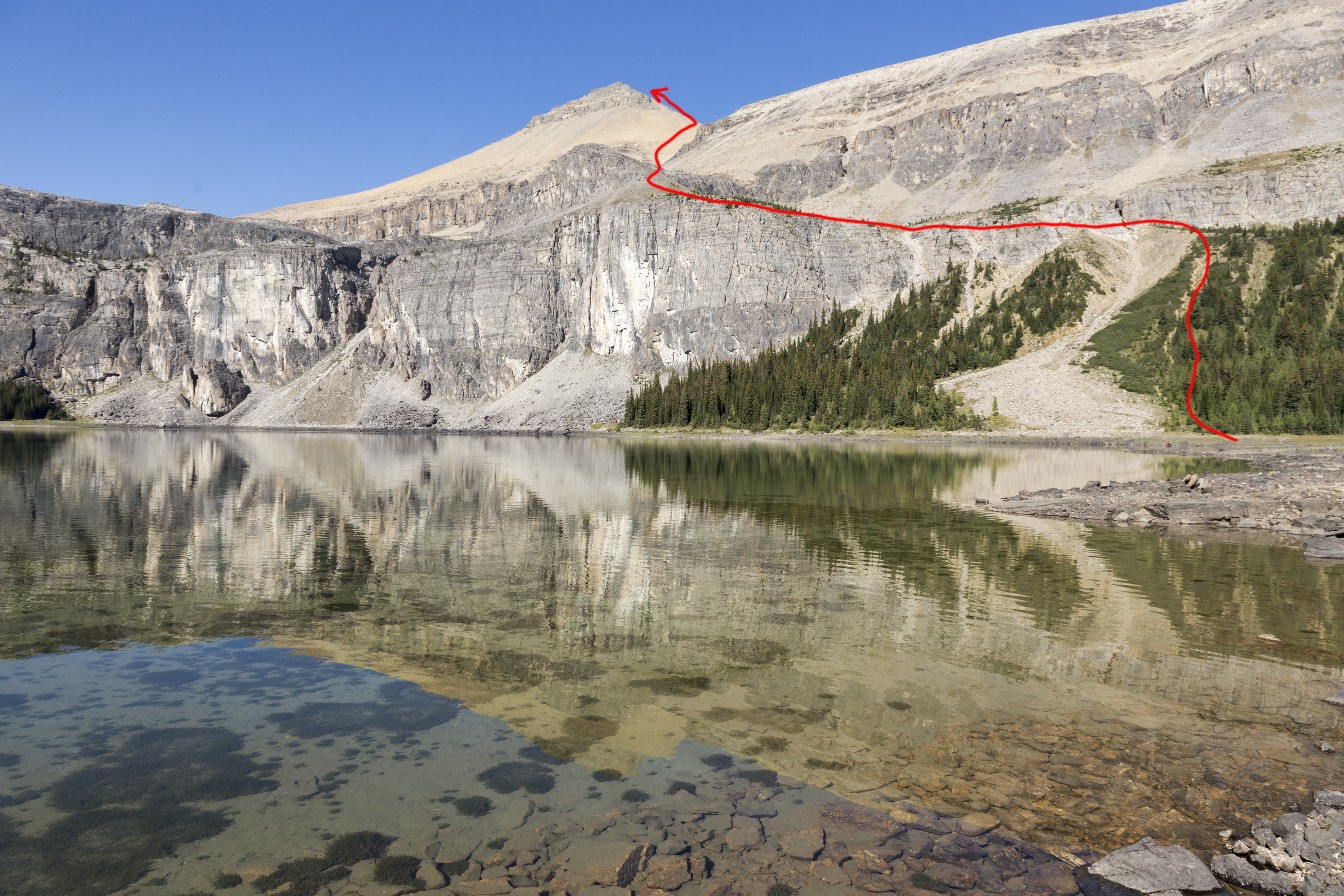
Now named "Helena Peak" on Google Maps, this pyramid-shaped cone towering on Rockbound Lake east side is the closest option from the lake. 1-way distance is only 3km, although almost 700m vertical must be gained so grade is reasonably steep. Whole thing is mostly hiking, with only scrambly bit brief rockbound leading to mid-shelf above the lake (This part is shared with all other options on Rockbound Amphitheater perimeter). Obvious gully leading to saddle below Helena Peak is quite stable and good trail has developed over the years due to (in)famous "Kane effect". Highly recommended extension is hike on broad shoulder at other side of the saddle to Helena South - super pleasant with views as good, if not better, as on main Helena summit.
Head over to east side of Rockbound Lake and cross the outlet, then pick up good trail quickly rising up semi-open slope. Hiking poles are great help. After topping up, trail turns sharp left and traverses top of scree below crumbling rock band - crux of the day. Continue on wide and well defined trail to top of grassy hill, then leave it as it starts looping on north side of Rockbound Amphitheater and head up Helena access gully. After reaching the saddle, turn left and tackle final slope leading to Helena Peak. Final part has bit of broken rock that calls for occasional use of hands for stability; cairns help along the way. Oddly highest point has only minor cairns, while main tower-like rock feature that also had register on my visit is few minutes lower to the east. Views are fantastic, in particular wide panorama of Sawback Range. Note that Luellen Lake can not be seen from Helena, but is visible from highline ridge connecting Helena with Stuart Knob.
Return is the same way and will be much faster. If planning on looping back via Stuart Knob (recommended, but more strenuous) descend through bit of broken cliff from highest point on left (west) side. |
||
 |
|||
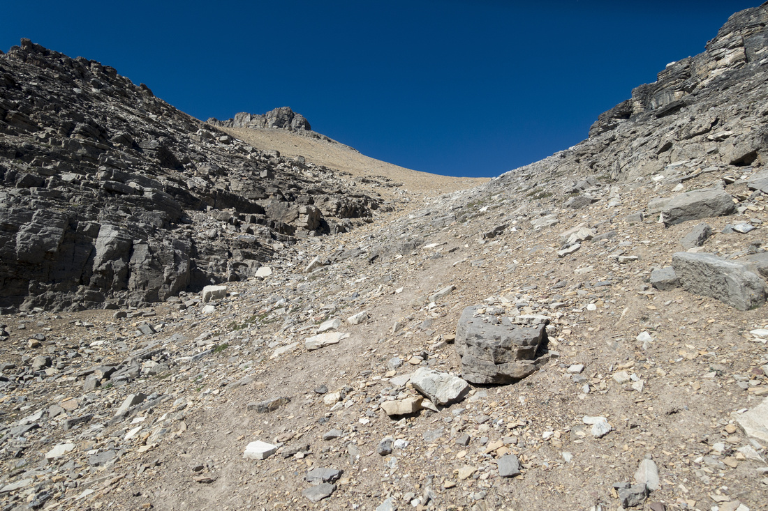
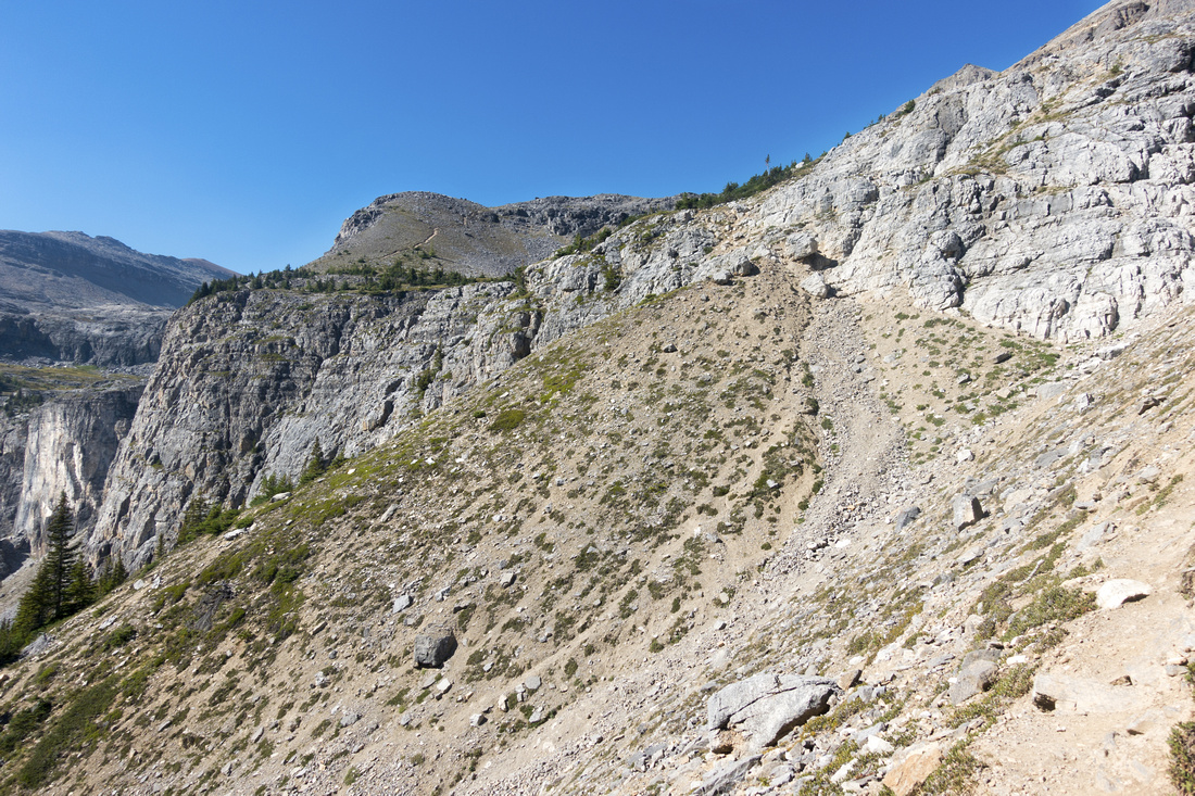 Breaking the cliffband
After hiking up steep forested patch above the lake, trail traverses lose talus then climbs through minor eroded cliffband Breaking the cliffband
After hiking up steep forested patch above the lake, trail traverses lose talus then climbs through minor eroded cliffband |
|||
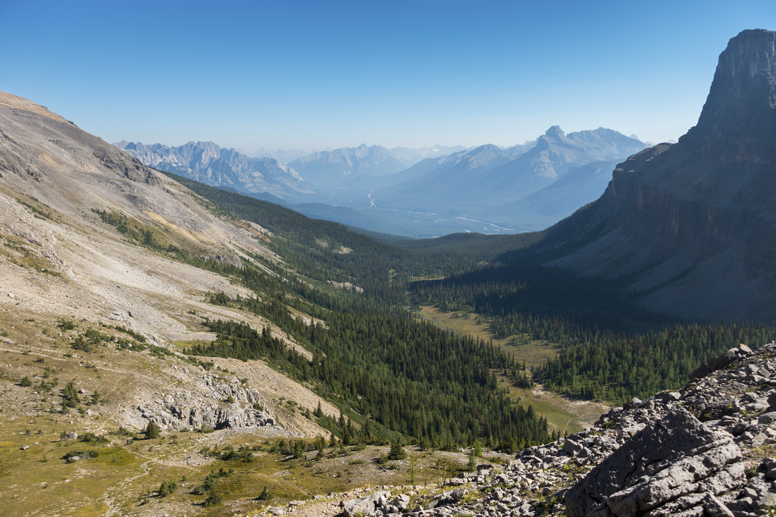 Bow Valley
View back to hazy Bow Valley; Rockbound Lake trail runs roughly center. Pilot Mountain behind Bow Valley
View back to hazy Bow Valley; Rockbound Lake trail runs roughly center. Pilot Mountain behind |
|||
 Upper Shelf
Leaving main Castle Mountain trail and that loops to the left. Stuart Knob center, Helena upper right Upper Shelf
Leaving main Castle Mountain trail and that loops to the left. Stuart Knob center, Helena upper right |
|||
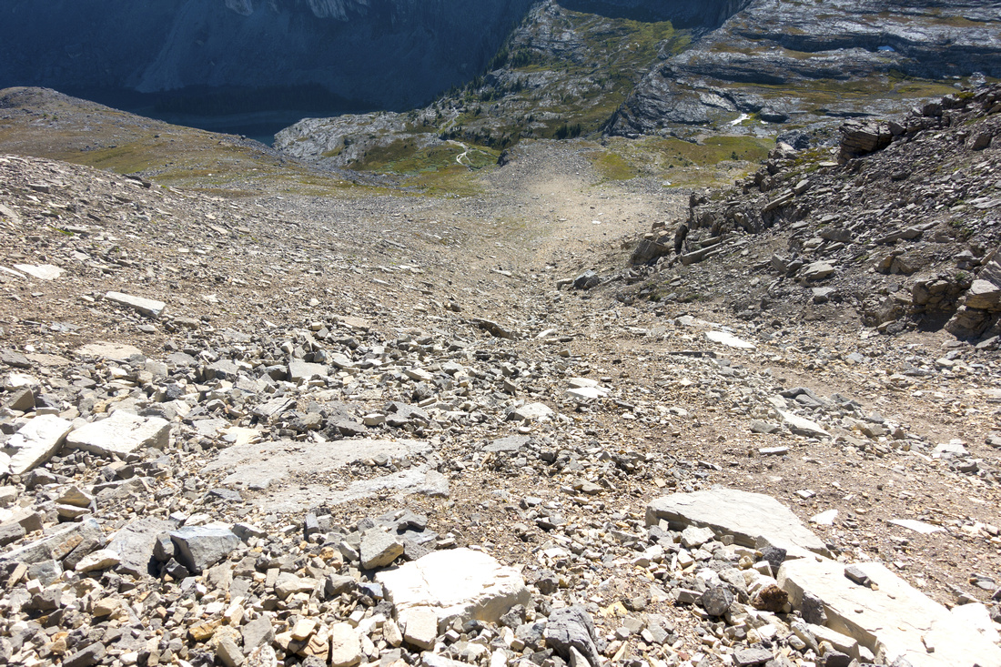
 Talus Scramble
Ascending moderately steep, but not lose, talus towards Helena Peak Talus Scramble
Ascending moderately steep, but not lose, talus towards Helena Peak |
|||
 Talus Scramble
Looking down Helena access gully. Descending this part is much faster. Rockbound Lake in shade upper right Talus Scramble
Looking down Helena access gully. Descending this part is much faster. Rockbound Lake in shade upper right |
|||
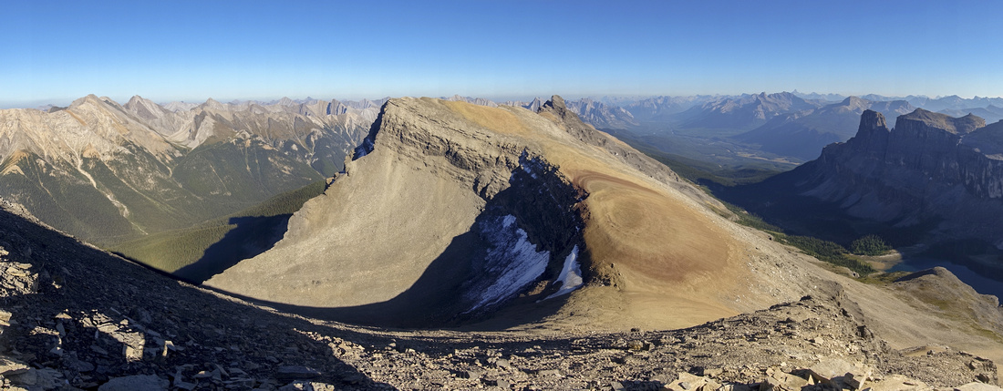 Helena Ridge Panorama
Panoramic view south from talus slope below Helena Peak. Gentle ridge at other side of low saddle is pleasant side trip Helena Ridge Panorama
Panoramic view south from talus slope below Helena Peak. Gentle ridge at other side of low saddle is pleasant side trip |
|||
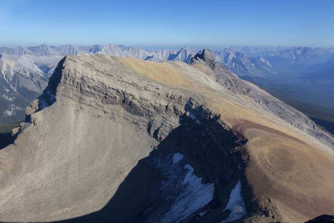
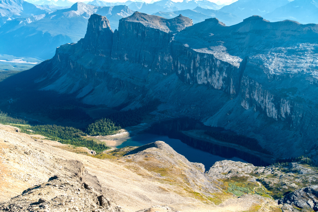 Castle Mountain
Aerial view of Castle Mountain and Rockbound Lake from just below Helena Peak Castle Mountain
Aerial view of Castle Mountain and Rockbound Lake from just below Helena Peak |
|||
 |
|||
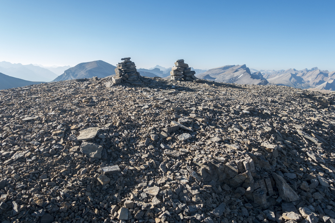 Helena Summit
Helena Peak summit cairns. Oddly enough, much bigger tower-like cairn with register is down the ridge to the right couple of minutes away Helena Summit
Helena Peak summit cairns. Oddly enough, much bigger tower-like cairn with register is down the ridge to the right couple of minutes away |
|||
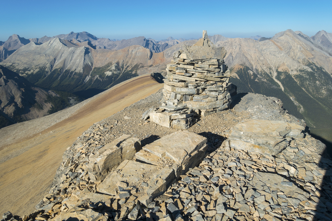 Tower Cairn
Large Tower Cairn with Ammo Register tucked behind the rocks. Jonhston Creek Valley behind Tower Cairn
Large Tower Cairn with Ammo Register tucked behind the rocks. Jonhston Creek Valley behind |
|||
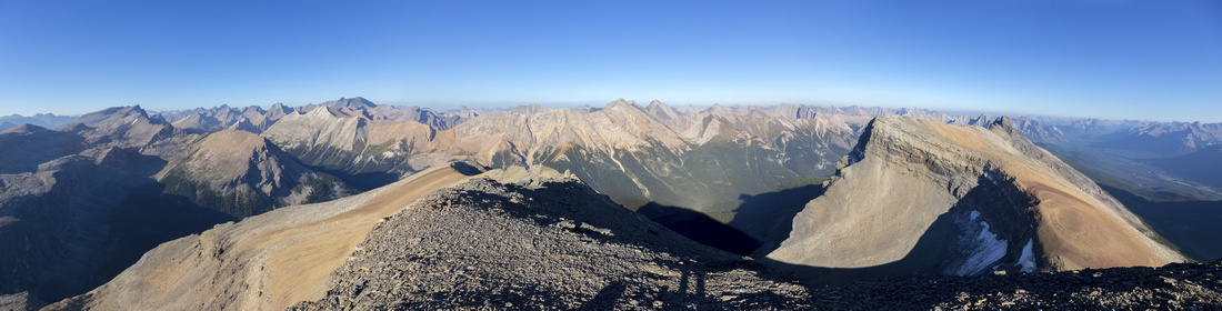 Sawback Range
 Panorama from "Tower Cairn"; Helena South ridge to the right Sawback Range
Sawback Range Panorama from "Tower Cairn"; Helena South ridge to the right |
|||
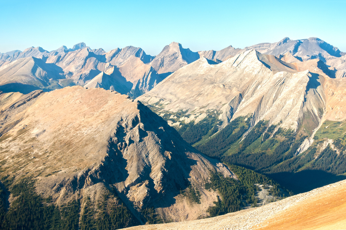 Sawback Range
Closer look at northern part of Johnston Creek Valley leading to Pulsatilla Pass. McBridge distinct peak upper center left, Bonnet Peak extreme right Sawback Range
Closer look at northern part of Johnston Creek Valley leading to Pulsatilla Pass. McBridge distinct peak upper center left, Bonnet Peak extreme right |
|||
 Helena South
South Helena Ridge telephoto. It takes 15-20 min only of gentle hiking from the saddle bottom right Helena South
South Helena Ridge telephoto. It takes 15-20 min only of gentle hiking from the saddle bottom right |
|||
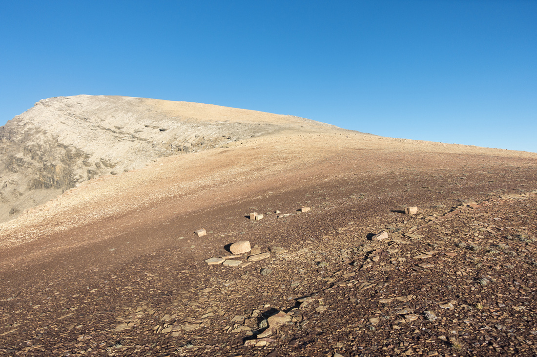 Shale Slope
Helena South gentle angled shale slope after descending back to the saddle; highly recommended side trip Shale Slope
Helena South gentle angled shale slope after descending back to the saddle; highly recommended side trip |
|||
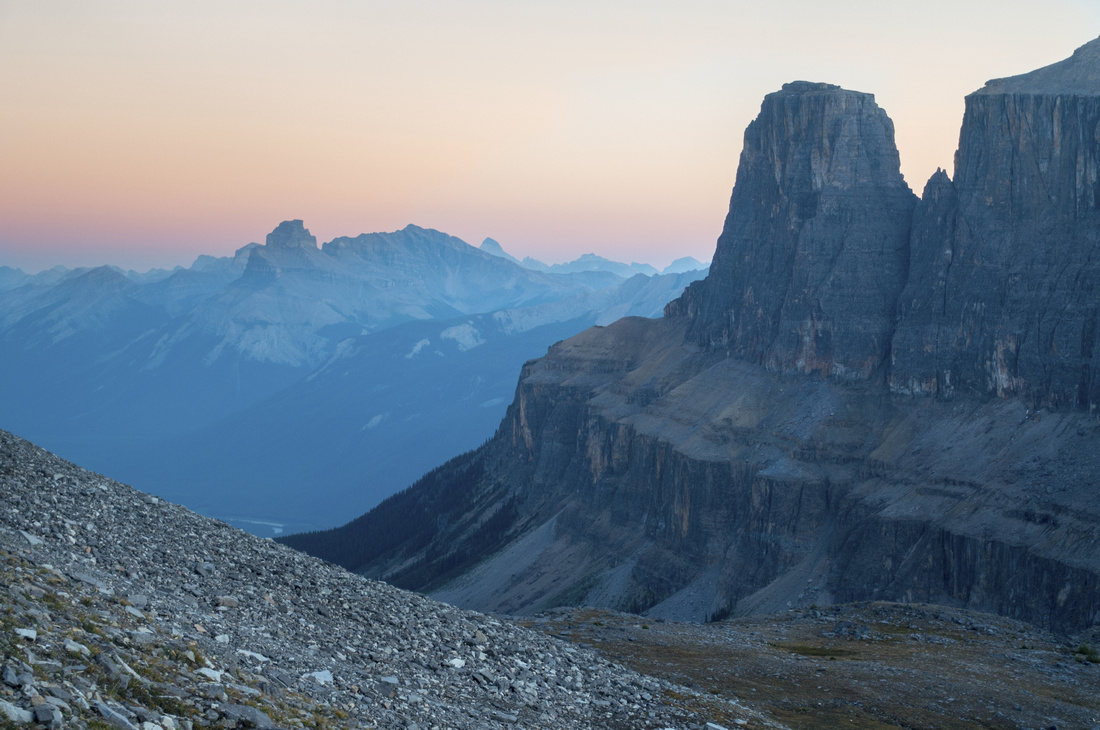 Crimson King
Hazy Sunset skies on descent. Pilot Mtn center left, Eisenhower Tower upper right Crimson King
Hazy Sunset skies on descent. Pilot Mtn center left, Eisenhower Tower upper right |
Abstract
| Overall Difficulty | D5 | Lose crumbling rockband above Rockbound Lake. Steep scree gully for Helena | |||
| Snow Factor | S5 | Serious avalanche danger. Overall length not suitable for snowshoe trip, with stable snow skis might work | |||
| Scenery | Scenic Rockbound Lake Amphitheater. Johnston Creek valley and Banff National Park Sawback Mountain Range | ||||
| Trail/Marking | Fair | "Kane effect" over the years resulted in beaten trail and cairns. Way is obvious | |||
| Suggested Time | 4hrs | Return time from Rockbound Lake only. Add 45min if exploring South Ridge. ~9hrs total time from parking | |||
| Elevation |
Start: 2220m (Rockbound Lake) Max: 2890m Total: ~670m |
Distance: ~3km (1-way from Rockbound Lake) | |||
| Gear | Full Hikers with poles and gaiters. Helmets could be useful with large(r) group, but not really required | ||||
| Water | Seasonal snow patches but no reliable water source past the lakeshore. Carry ~2L | ||||
| Dog Friendly | Yes | Dogs should have no problems ascending steep scree gully. Standard back-country precautions | |||
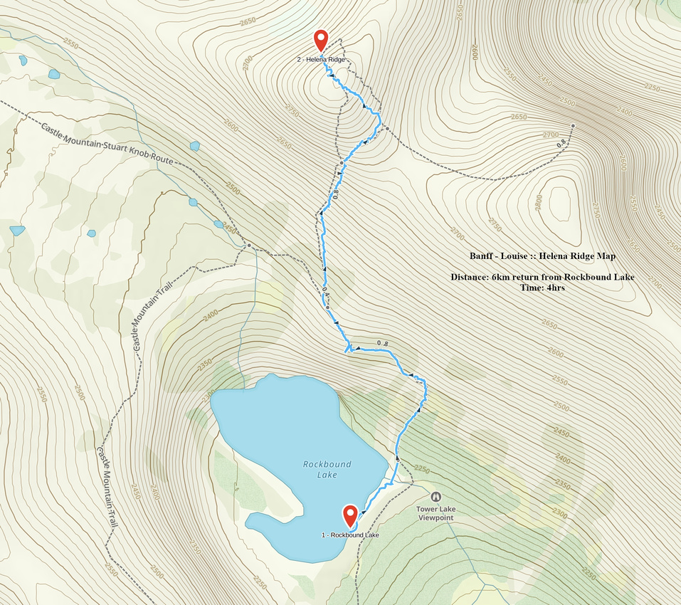 Helena Ridge GAIA Map
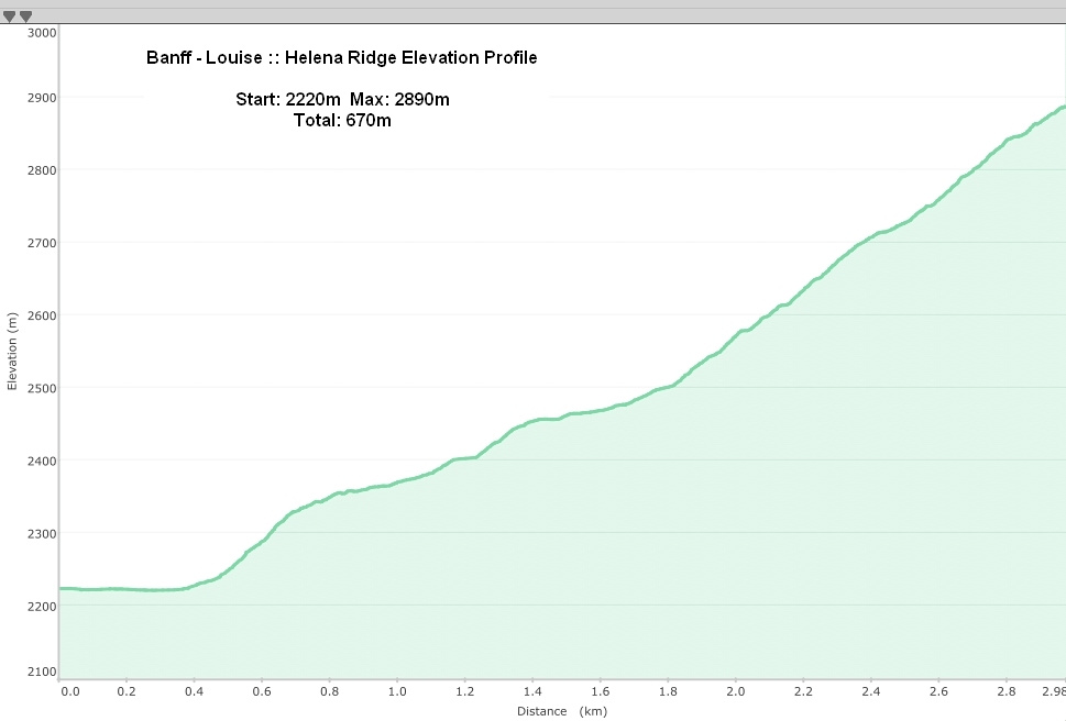 Helena Ridge Elevation Profile