Google Map |
Rockies :: Banff-Louise :: Castle Lookout |
GPS Track |
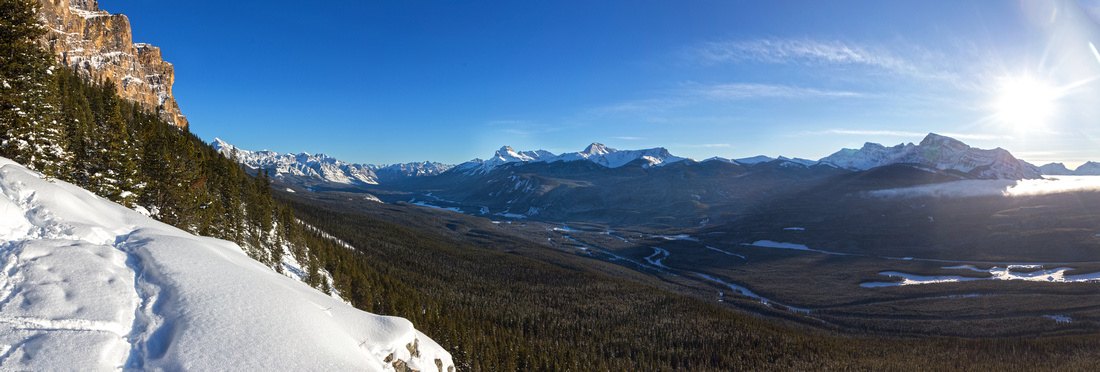 
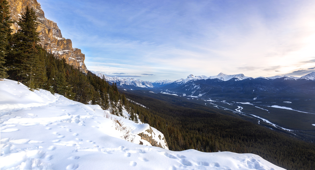
Panoramic of Bow Valley from Castle Lookout. Mount Storm and Kootenay National Park to the right |
|||
| Trip Summary | |||
Multiple Dates, last Jan 20, 2023
Castle Lookout is short and sweet hike ending with superb viewpoint of Bow Valley from western slopes of Castle Mountain. I tend to ascend this little trail regularly ~January timeframe if I am not travelling outside Canada. Starting from official trailhead ~5km north of Castle Junction along Bow Valley Parkway, trail rises moderately through forest passing remnants of old log cabin along the way. Grade is steady, and although not overly steep it does provide good workout. Final part switchbacks open slopes before final brief forested stretch to site of old Fire Lookout and end of official trail. Trip can be done year round, and trail is often well compacted in winter eliminating need for snowshoes. Do examine avalanche conditions as upper slopes are open and exposed.
Interesting continuation is ascent to Goat Plateau above the lookout. ACC Alpine Hut serves as base for technical climbs of Eisenhower Tower looming above. It is possible to do 1-way traverse by descending on east side and linking up with Rockbound Lake trail (2 cars, or bicycle needed). Note that, although large parts of this traverse are just class 3/4 scramble, there is one steep wall directly above Castle Lookout that probably requires a rope. An interesting report with photos can be found here. |
|
Gallery |
|||
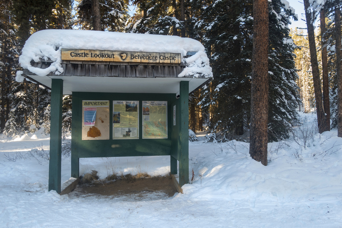 Trail Kiosk
Parks Canada Trail Kiosk at far end of Parking Lot on Bow Valley Parkway 5 km north of Castle Junction Trail Kiosk
Parks Canada Trail Kiosk at far end of Parking Lot on Bow Valley Parkway 5 km north of Castle Junction |
|||
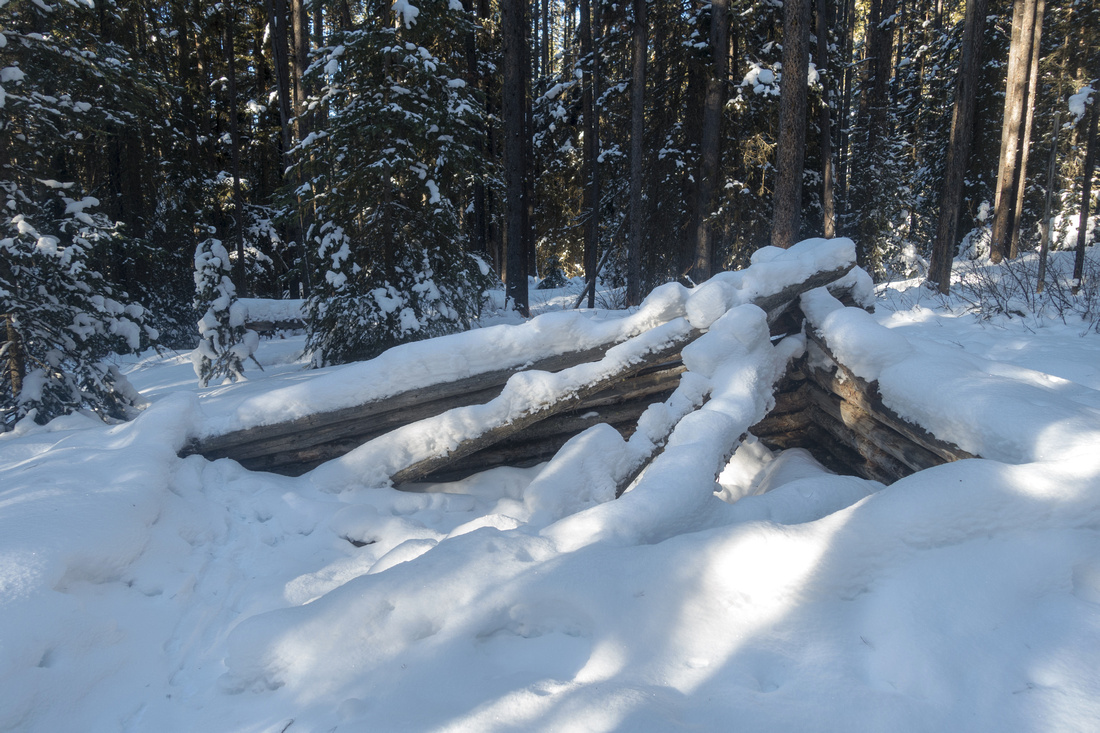 Old Cabin Ruins
Ruins of old log cabin ~20 min from trailhead. Trail becomes more steep from here Old Cabin Ruins
Ruins of old log cabin ~20 min from trailhead. Trail becomes more steep from here |
|||
|
|
|||
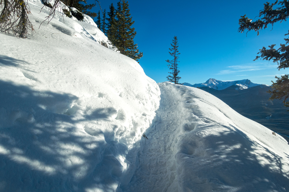
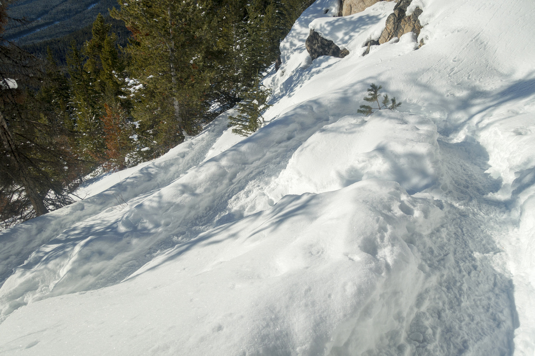 Narrow Switchbacks
Broken trail switchbacking up open slopes in upper part. This part is open to avalanche risk Narrow Switchbacks
Broken trail switchbacking up open slopes in upper part. This part is open to avalanche risk |
|||
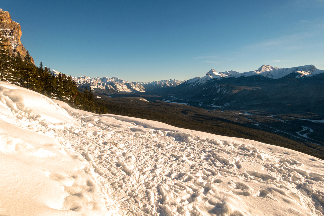
 Final Rise
Final rise after crossing avalanche slope. Lookout and end of trail are ~5 minutes from here Final Rise
Final rise after crossing avalanche slope. Lookout and end of trail are ~5 minutes from here |
|||
 Castle Lookout
Clearing at trail end with views south down Bow Valley towards Banff. Climber access to Goat Plateau continues on the left side Castle Lookout
Clearing at trail end with views south down Bow Valley towards Banff. Climber access to Goat Plateau continues on the left side |
|||
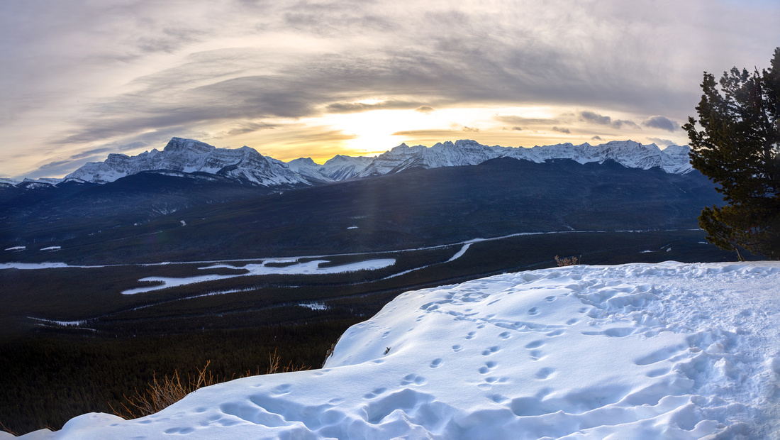
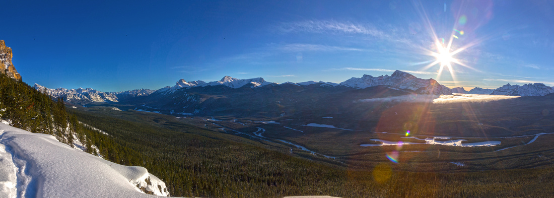 Sun Star
Sun already low on horizon over Storm Mountain on west side of Bow Valley Sun Star
Sun already low on horizon over Storm Mountain on west side of Bow Valley |
|||
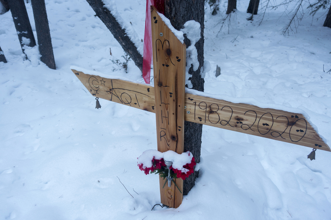 Snowy Memorial
Memorial Cross near Trailhead on Return Snowy Memorial
Memorial Cross near Trailhead on Return |
|||
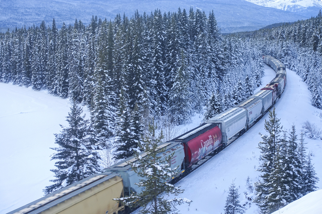 CP Rail Line
Canadian Pacific Rail Line from Tourist Picnic area on drive back to Castle Junction CP Rail Line
Canadian Pacific Rail Line from Tourist Picnic area on drive back to Castle Junction |
|||
 Castle Lookout
Jan 2023: View south down Bow Valley from the Lookout Castle Lookout
Jan 2023: View south down Bow Valley from the Lookout |
|||
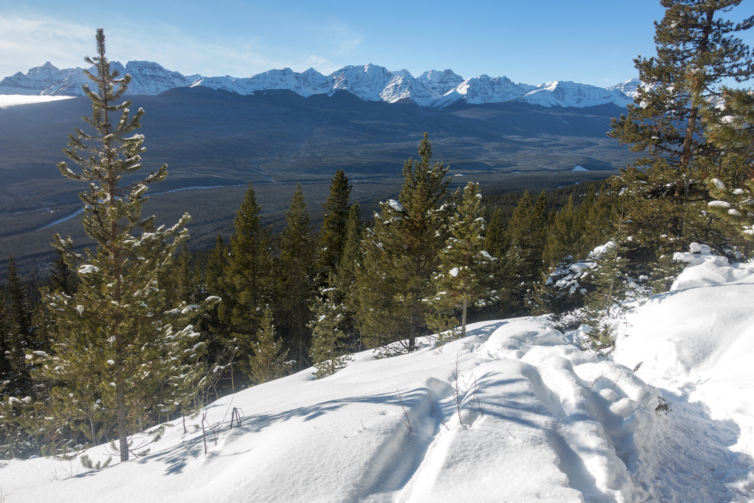
 Castle Lookout
Jan 2023: View south to Louise group (to the right) from the Lookout Castle Lookout
Jan 2023: View south to Louise group (to the right) from the Lookout |
Abstract
| Overall Difficulty | D3 | Short but reasonably steep trail with mildly exposed sections in upper part | ||||||||
| Snow Factor | S3 | Couple of open slopes that could slide in right conditions. Some steep and narrow switchbacks | ||||||||
| Scenery | Sweeping Panoramic view of Bow Valley and distant Kootenay National Park. Base view of Castle Mountain Cliffs | |||||||||
| Trail/Marking | Excellent | Maintained Parks Trail with official trailhead. Continuing past the lookout is much more involved | ||||||||
| Suggested Time | 3hr | Return time to old lookout site at end of maintained trail | ||||||||
| Elevation |
Start: 1455m Max: 2020m Total: 565m |
Round Trip: ~8km | ||||||||
| Gear | Day Hikers or full hiking boots. Hiking poles recommended. Trail often well compacted in winter does not require snowshoes | |||||||||
| Water | Minor creek crossing near trailhead,often flowing in winter too, but dry afterwards. Carry 1L | |||||||||
| Dog Friendly | Yes | Standard back-country travel precautions. Trail is popular and be courteous to other trail users please | ||||||||
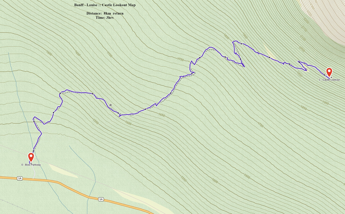 Castle Lookout GAIA Map
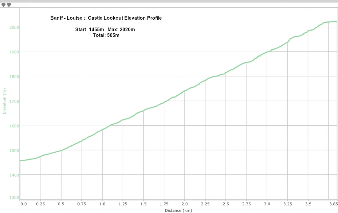 Castle Lookout Elevation