Google Map |
Rockies :: Alberta Foothills :: Deer Ridge |
GPS Track |
|
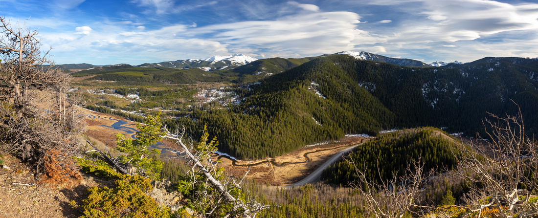
Deer Ridge south end Panorama. Sibbald Creek Flats below, Cox Hill just right of upper center. Snowy Moose Mountain distant left |
|||
| Trip Summary | |||
May 10, 2024Pleasant loop traverse across Forested Ridge starting from Sibbald Lake Day Use. Usually done early in Season when areas to the West are still wallowing in wet snow. Loop can be done either way; most people seem to take CW direction, but I think CCW is better mainly because best view comes late instead of early. Trip is fairly short and can be combined with Eagle Hill for longer outing if desired.
From Day Use Parking walk back to Road junction then go right towards Moose Pond. For CCW direction as photos in Gallery are organized continue on the right side along Eagle Hill trail. (For CW cross Moose Pond Meadows and find trail entering Forest on the other side). Walk in open Aspen Forest is pleasant but often muddy. It is not necessary to walk all the way to signed Deer Ridge junction; instead when reaching obvious cutline 20-25min from Moose Pond head directly left across the Swamp and pick-up Trail on on the other side. Ensuing ascent is the Part most likely to be snowbound early in Season. After reaching the Saddle trail turns left and dries out. Pleasant ridgewalk on well defined trail ascends to forest enclosed ~1715m Higpoint with opening on west side with great views - perfect spot for the break. On the other side trail descends a bit more steeply, then comes to the Fork (unsigned). Turn right and climb to lower South Knob with even better views, then on return continue down the hillside towards Moose Pond. Lower down is the junction (Waypoint '5 - Moose Pond Junction'); turn left and close the Loop in another 10minutes. Trail on the right I took is better defined and leads back to Sibbald Trail near Powderface Trail junction. This is apparently Dawson Creek connector but not really worth unless you are looking for a bit more walking. |
|
Gallery |
|||
 Sibbald Lake Sibbald Lake Sibbald Lake Panorama from Day Use area. Picture from Spring '22; in '24 water level was much lower
 |
|||
 |
|||
|
|
|||
 Barren Aspens Barren Aspens Eagle Hill Trail traversing Aspen Forest Hillside
 |
|||
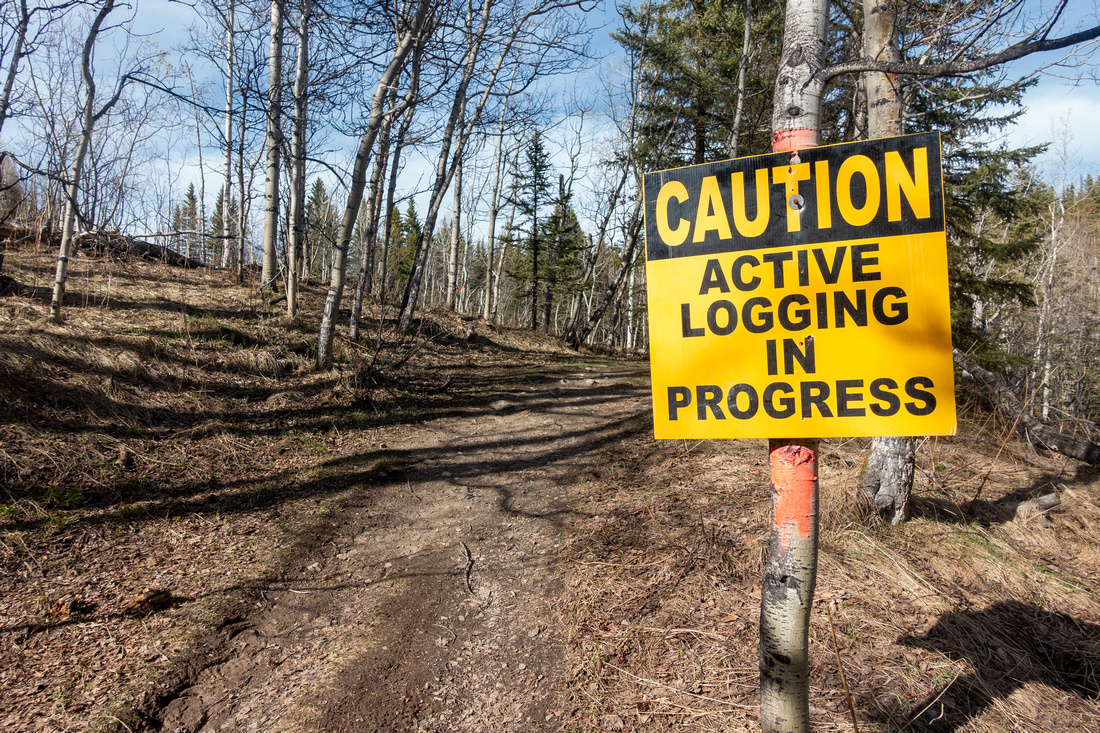 Logging Sign Logging Sign Active Logging seems to multiply exponentially in Alberta Foothills
 |
|||
 Bear Print Bear Print Bear Track in dried Mud on Eagle Hill Trail
 |
|||
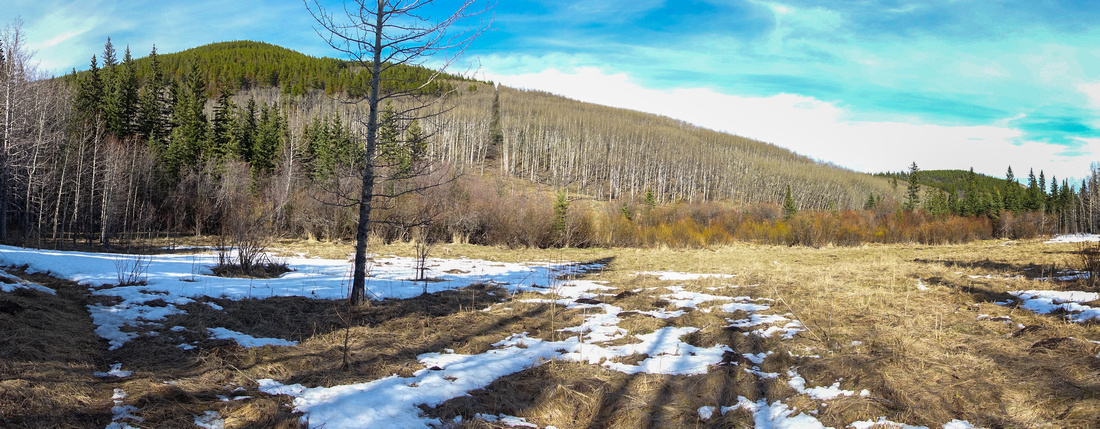 Cutline Meadows Cutline Meadows Looking back after taking a shortcut across swamp wetland; note obvious cutline above. Normal Deer Ridge Trail joins from the left
 |
|||
 Cutline Sign Cutline Sign Orange Diamond Tree Sign points in Deer Ridge ascent direction
 |
|||
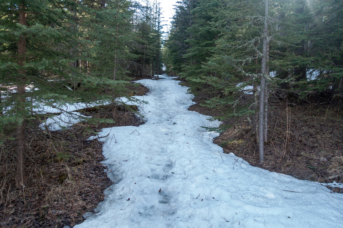 Snowy Cutline Snowy Cutline Starting up snow covered trail towards Deer Ridge. Some postholing is likely here in early season
 |
|||
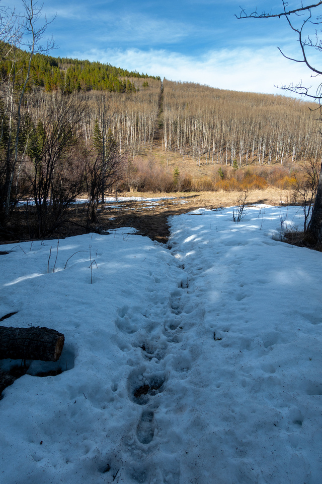 Deer Cutline Deer Cutline One more view back along the Cutline; Eagle Hill Trail is on the other side
 |
|||
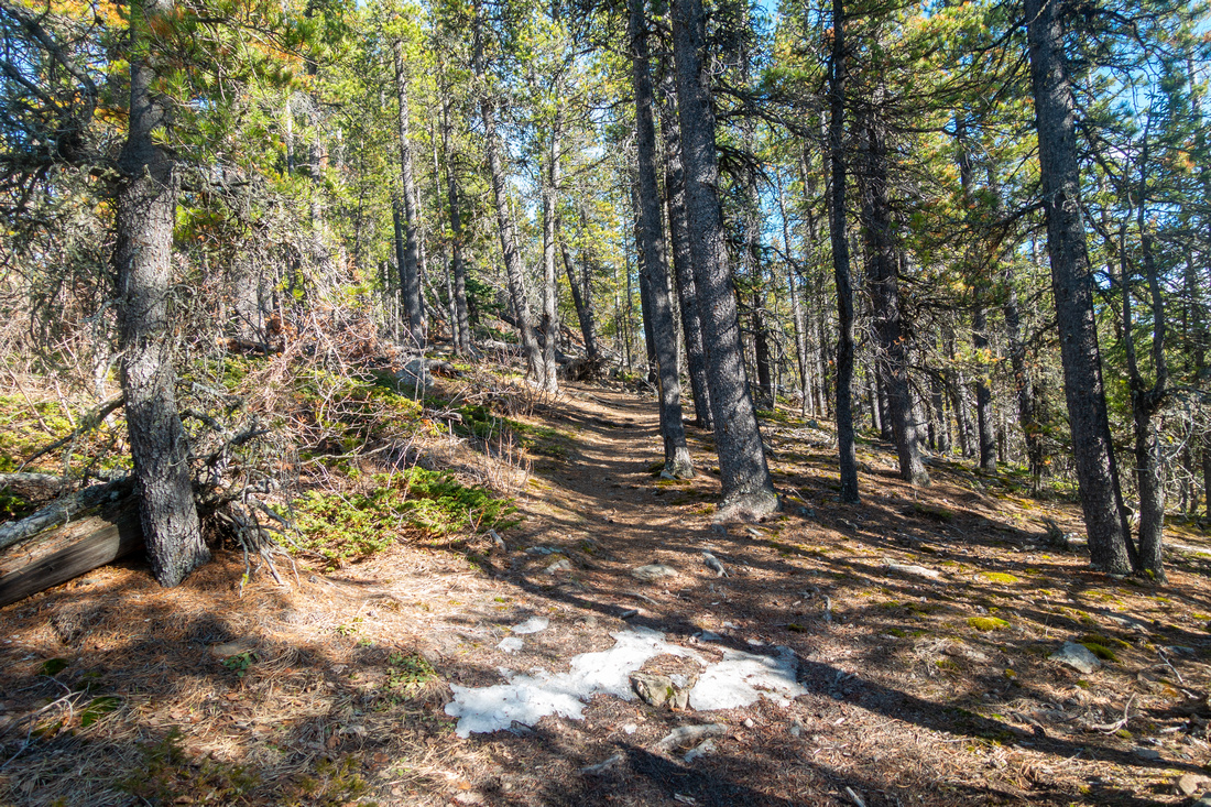 Sunny Ridge Sunny Ridge After reaching the saddle Ridge Trail turns left. This part usually dries out early and is very pleasant to hike
 |
|||
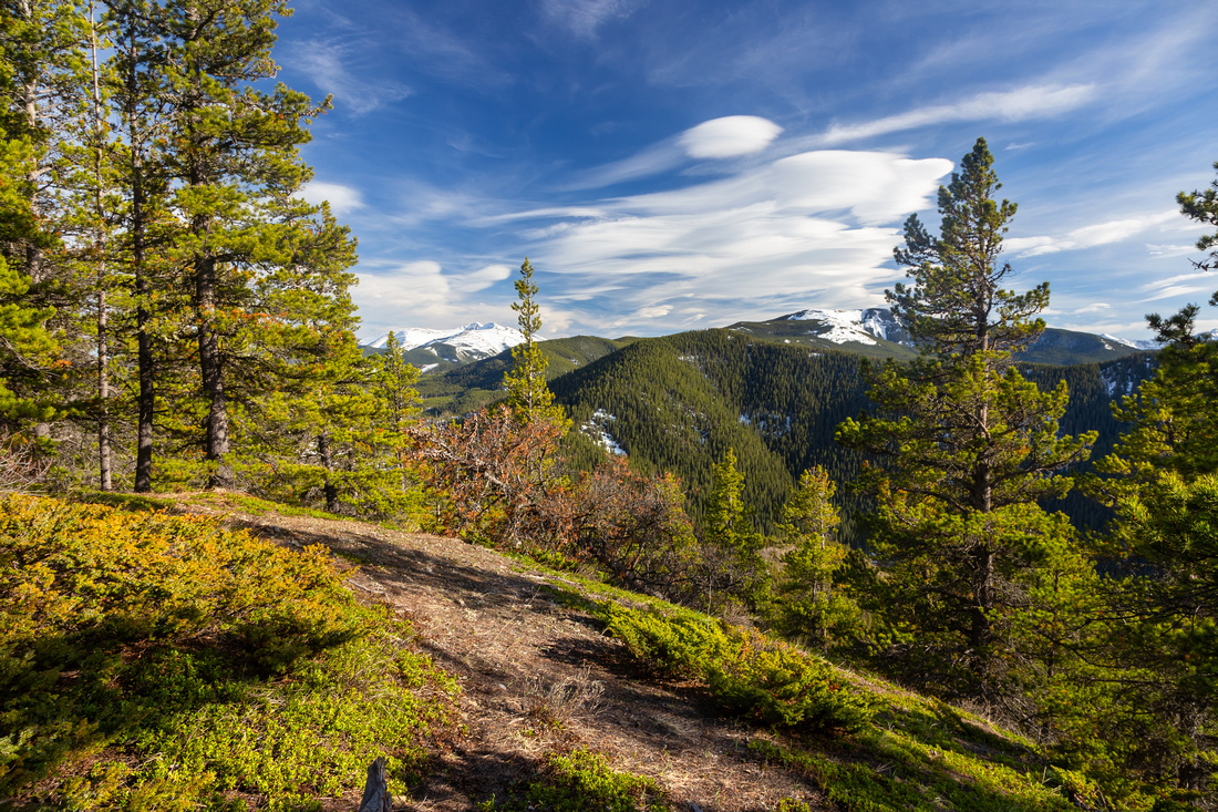 Deer Highpoint Deer Highpoint Clearing at Highest Point of Deer Ridge (1715m) with nice views across to Powderface area
 |
|||
 Moose Mountain Moose Mountain  Snow Covered Moose Mountain from Deer Ridge Highpoint
 |
|||
 Cox Hill Cox Hill Cox Hill Telephoto. Normal route from Dawson Creek would likely involve lots of wet snow on this day
 |
|||
 Sibbald Creek Sibbald Creek  Braided Sibbald Creek Aerial View from Deer Ridge South
 |
|||
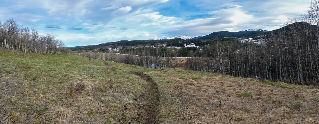 Sibbald Meadows Sibbald Meadows Grassy Hillside on longer alternate return back via Dawson Creek connector to Sibbald Day Use
 |
Abstract
|
Overall Difficulty |
Couple of moderately steep sections. Swamp shortcut crossing (optional). Muddy/snowy parts depending on season |
||||
|
Snow Factor |
Postholing in wet snow possible along the cutline early in Season |
||||
|
Scenery |
Aspen Forests, Foothills and K-county Front Range Peaks |
||||
|
Trail/Marking |
Fair |
Trails generally well defined. Couple of confusing / not marked junctions. Sibbald area Maps not really useful. |
|||
|
Suggested Time |
3 hrs |
Full loop, regardless of direction. Quick OnB jaunt on south side only <2 hrs |
|||
|
Elevation |
Start: 1500m Max: 1715m Total: ~430m |
Round Trip: ~8km | |||
|
Gear |
Day Hikers or Full Hiking boots. Poles / Gaiters helpful. Micro-spikes might be required if icy in early season. Snowshoes likely not necessary even in winter |
||||
|
Water |
Seasonal creeks / snow melt. Ridge Dry. Carry ~1L, more in summer |
||||
|
Dog Friendly |
Yes |
Standard Back-country precautions |
|||
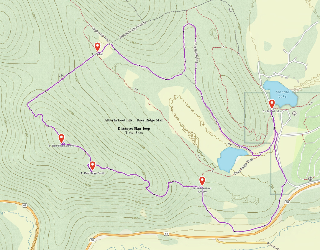 Deer Ridge GAIA Map
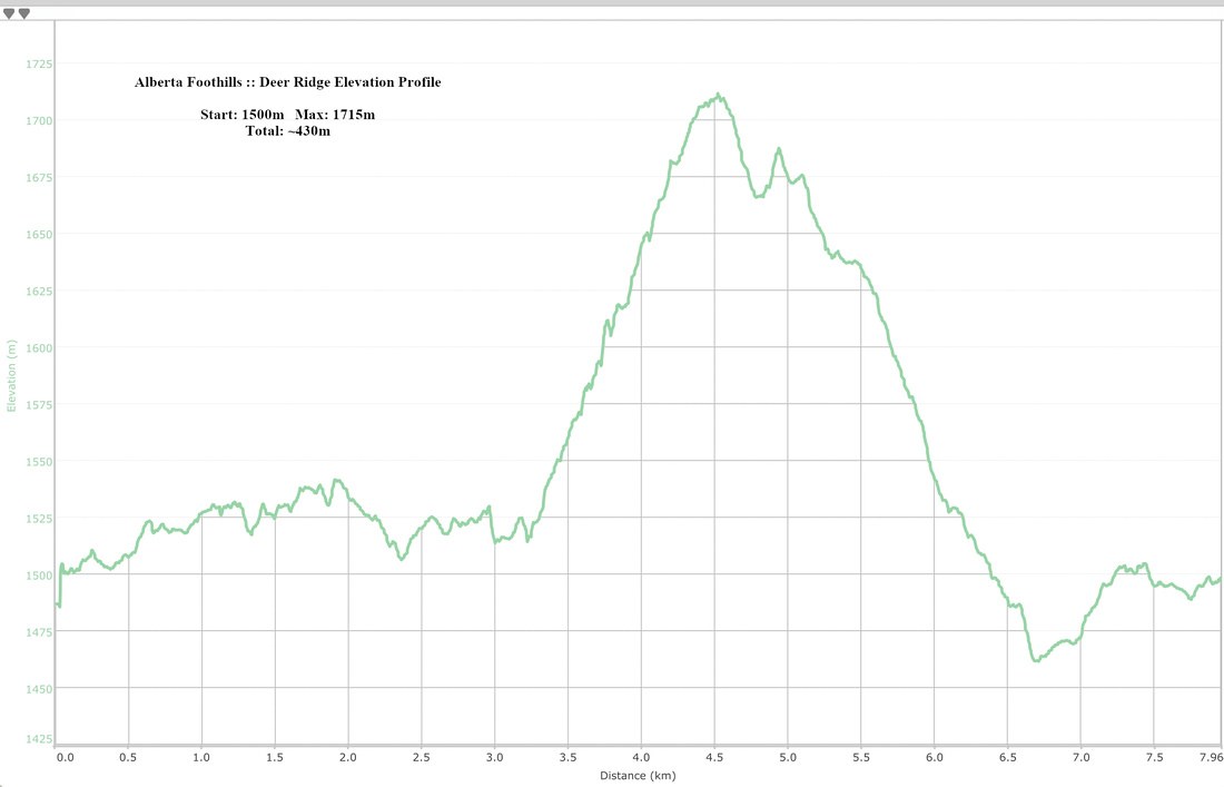 Deer Ridge Elevation Profile
