Google Map |
BC Coast :: North Shore :: Mt. Elsay |
GPS Track |
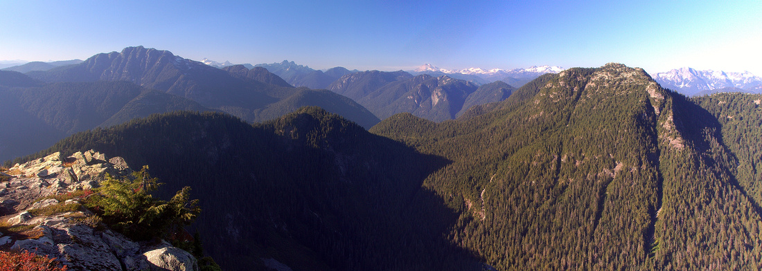 
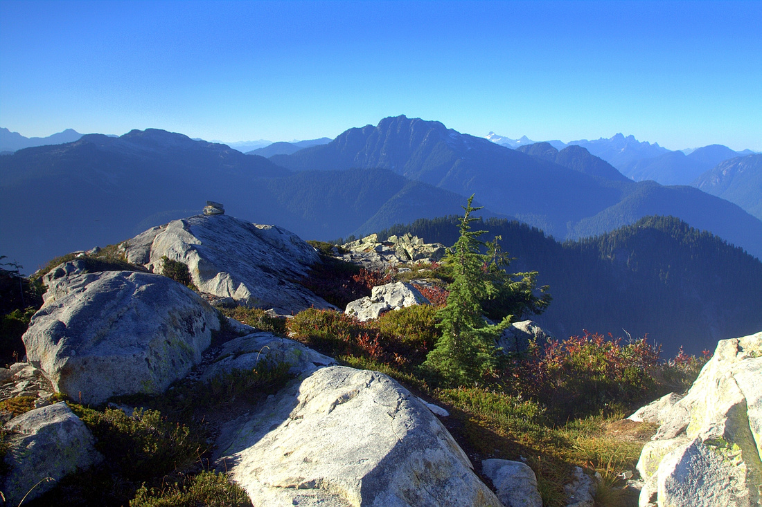
Panoramic view north from Elsay summit. Mt. Bishop right, Cathedral upper left. Rugged Rector - Curate - Vicar ridge curling left foreground |
|||
| Trip Summary | |||
September 17, 2012
Mt. Elsay is great Seymour back-country trip. Quintessential North Shore terrain with great summit views and possibility of loop return add to the appeal. Outing is considerably more difficult than popular Mt. Seymour 3 peaks (that can also be included) and requires full day. Several options exist to extend the day, including Runner Peak scramble; start early if you plan on this one. Long Rector - Curate ridge continuing north to Vicar Lakes is sometimes traversed by hardy souls, but requires overnight and is quite rough.
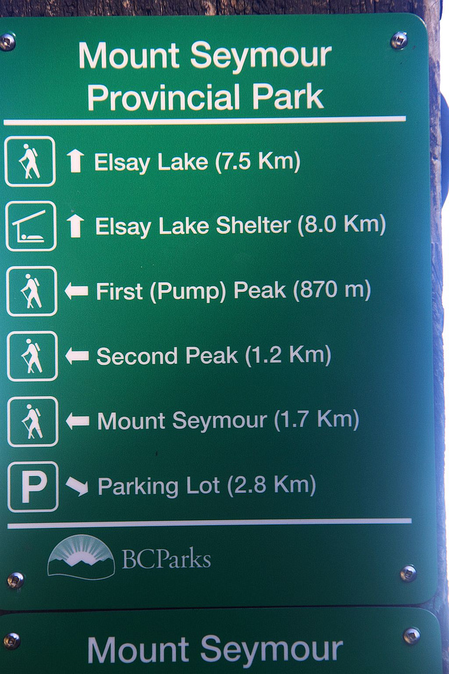
Follow main Mt. Seymour trail past Brockton Point to signed Elsay lake junction; ~45 minutes of moderate pace. At this point you need to chose the direction: CW or CCW. Both have advantages and disadvantages; presented here is CCW loop that approaches via official Elsay lake trail and returns via rough west side route. Continue straight from the junction and in few minutes reach "Devil's Staircase" - steep drop of several hundred meters to base of Runner Peak. This part is frequented with black bears. In winter it can be quite dangerous and accidents, requiring NSR intervention have occurred -- summer trips are preferable. Continue traversing north and watch for orange marker after crossing sizeable boulder slide few minutes before Canadian Pass. Turn left (west) on faint trail and climb up to opening revealing large boulder covered slope leading to Mt. Elsay south ridge. Pick your way across and up; this bit is harder than it looks and it will take at least an hour. Topping up look for south ridge trail, your return route if you decide on loop. Turn right and follow this trail for a short while only. Soon it starts losing elevation and drops to rough Rector-Curate ridge leading to Vicar Lakes; there used to be weathered "Mt. Bishop" sign nailed on tree here. Turn right on faint but flagged path and easily scramble up to Elsay summit crossing granite slabs and couple of tarns that offer seasonal water source. Summit views are phenomenal; descend few meters east for bird-eye view of elusive Elsay lake nested in deep cirque below Mt. Bishop.
On return retrace your steps to ridge trail, then for loop continue north towards Mt. Seymour. Trail becomes faint at times but there are always flags to assure you are on right way. Eventually trail drops steeply to permanent snowpatch below Runner Peak. Runner extension will add 1.5-2 hours to whole outing and is technically considerably more difficult (stiff class 3 below the summit). Trail climbs up on the other side then circles around west shoulder of Seymour main peak then ascends through heather and small rock bluffs to saddle below Mt. Seymour. Turn right and return back over Tim Jones peak, past Pump Peak down to Elsay lake junction and back to your vehicle. |
|
Gallery |
|||
 Fabulous view east just after Brockton point on bright sunny September morning. Several giants of Golden Ears park on horizon, including Robbie Reid and Judge Howay. Buntzen Eagle Ridge in foreground
 |
|||
 Pump Peak junction, about 45min from trailhead. Continue straight on Elsay Lake trail
 |
|||
 Descending Devil's Staircase on Elsay Lake trail. Runner Peak left, Mt. Elsay center, Mt. Bishop far right behind Elsay
 |
|||
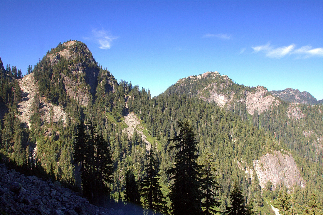
 Closer look at Runner Peak; sort of rite of passage for North Shore scrambler. Normal access is from the other (west) side
 |
|||
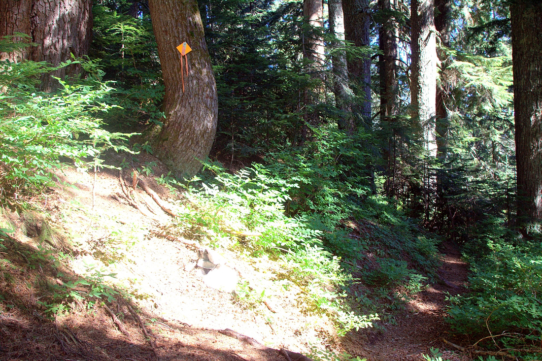 Point where you turn left and start ascending Elsay ridge. Elsay Lake trail continues straight to Canadian Pass few minutes away
 |
|||
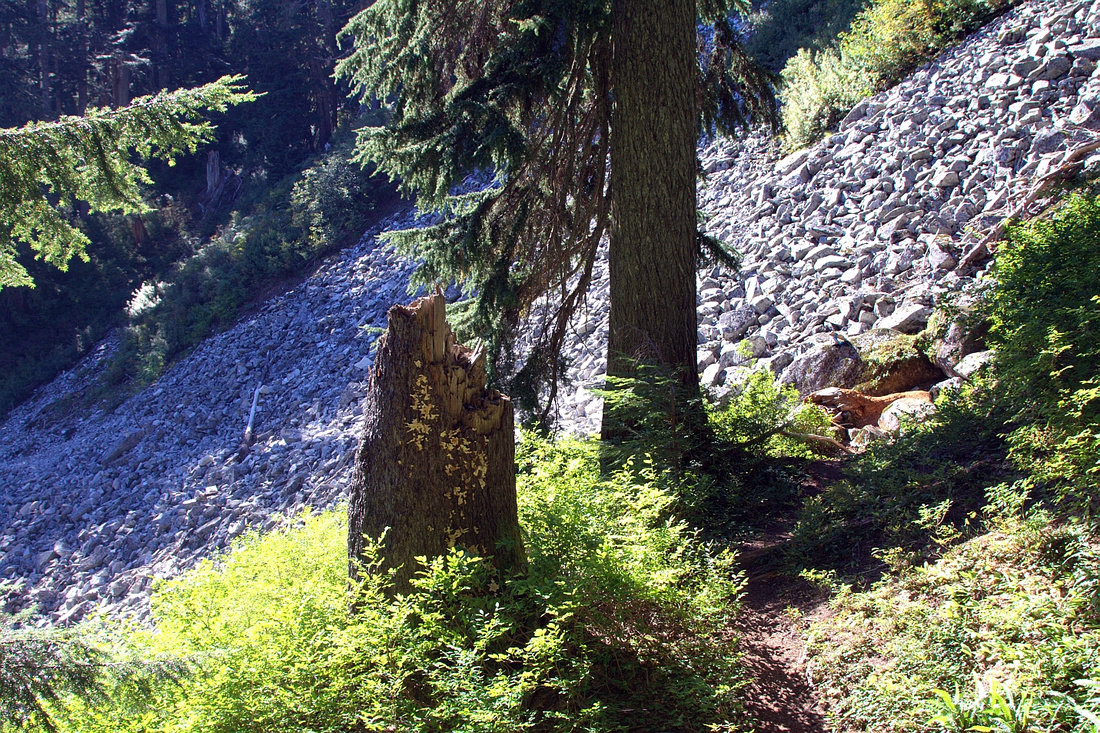 Looking back at boulder field just before junction where you leave Elsay Lake trail
 |
|||
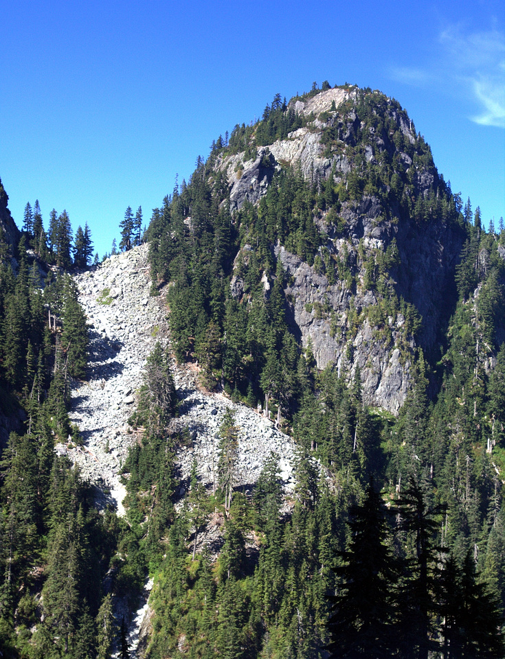
 Boulder Field leading to Elsay ridge - deceptively close; it will take close to an hour. Mt. Elsay upper right
 |
|||
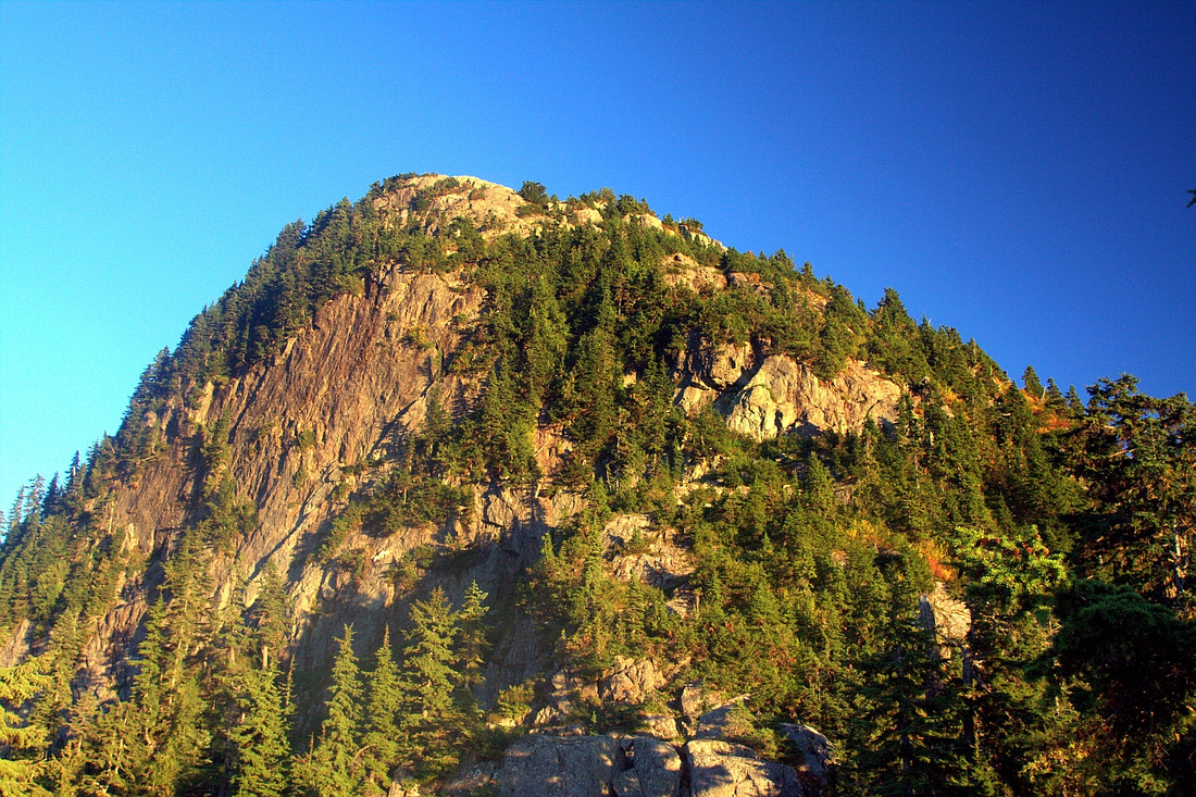
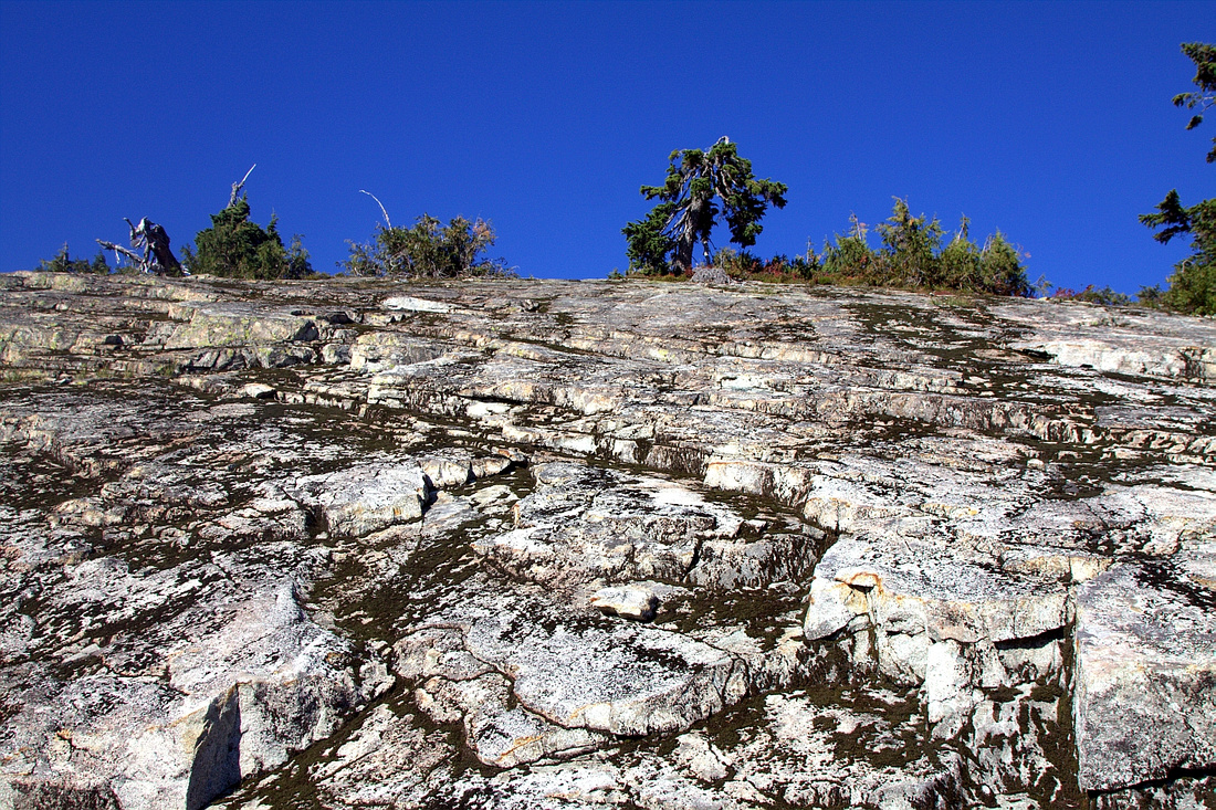 Ascending slabs below Elsay summit -- much easier than this photo might suggest
 |
|||
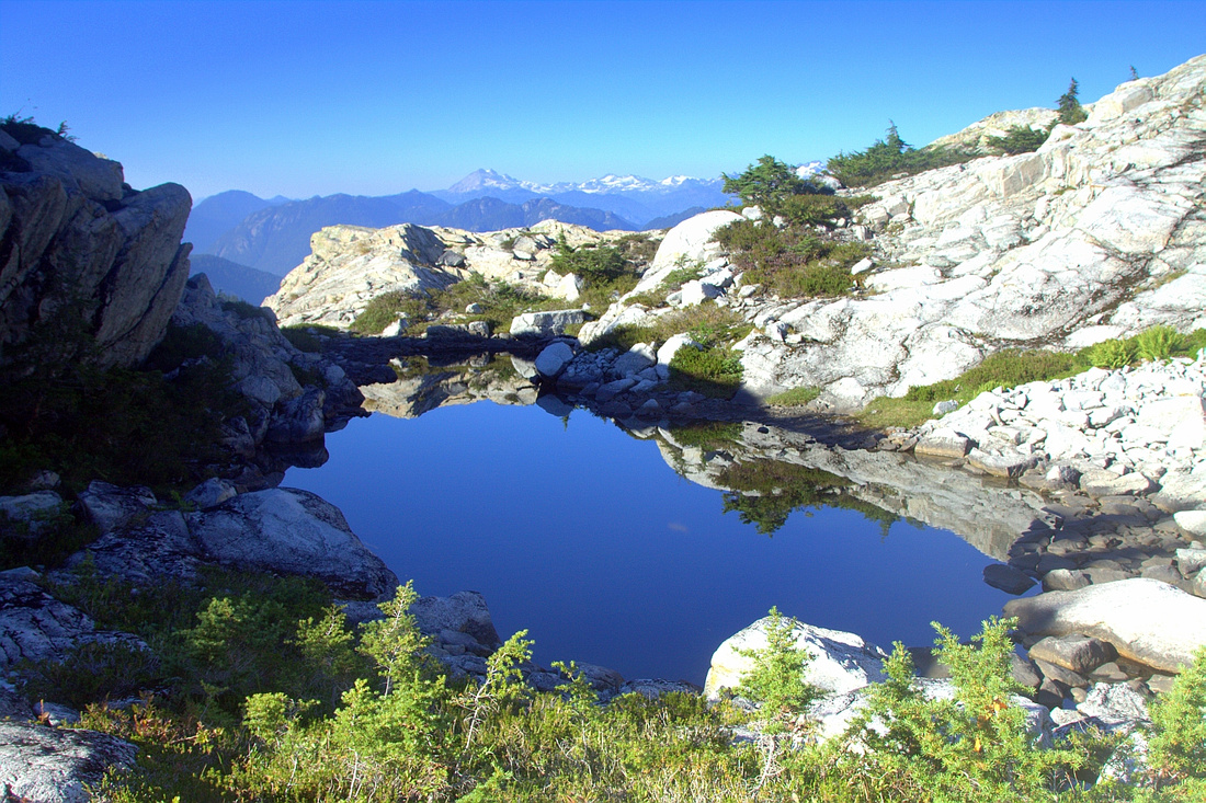 Lovely tarn just below Elsay summit. Distant Mt. Garibaldi on horizon
 |
|||
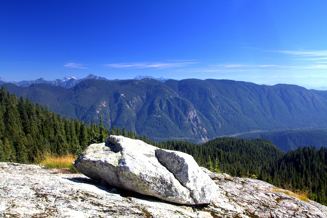
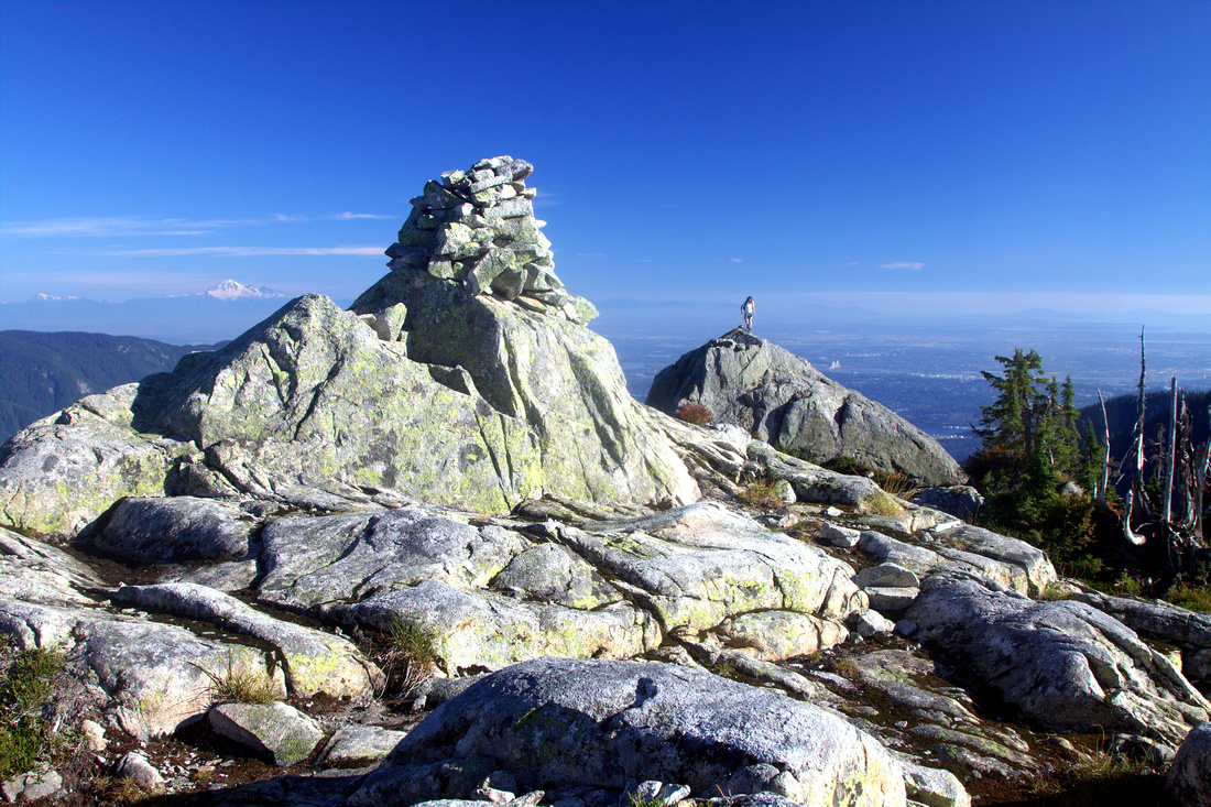 Large cairn on 1390m Elsay summit. Metro Van behind to the right, distant snow cone of Mt. Baker left
 |
|||
 Summit view NW with Rector - Curate ridge center right. Coliseum - Burwell left
 |
|||
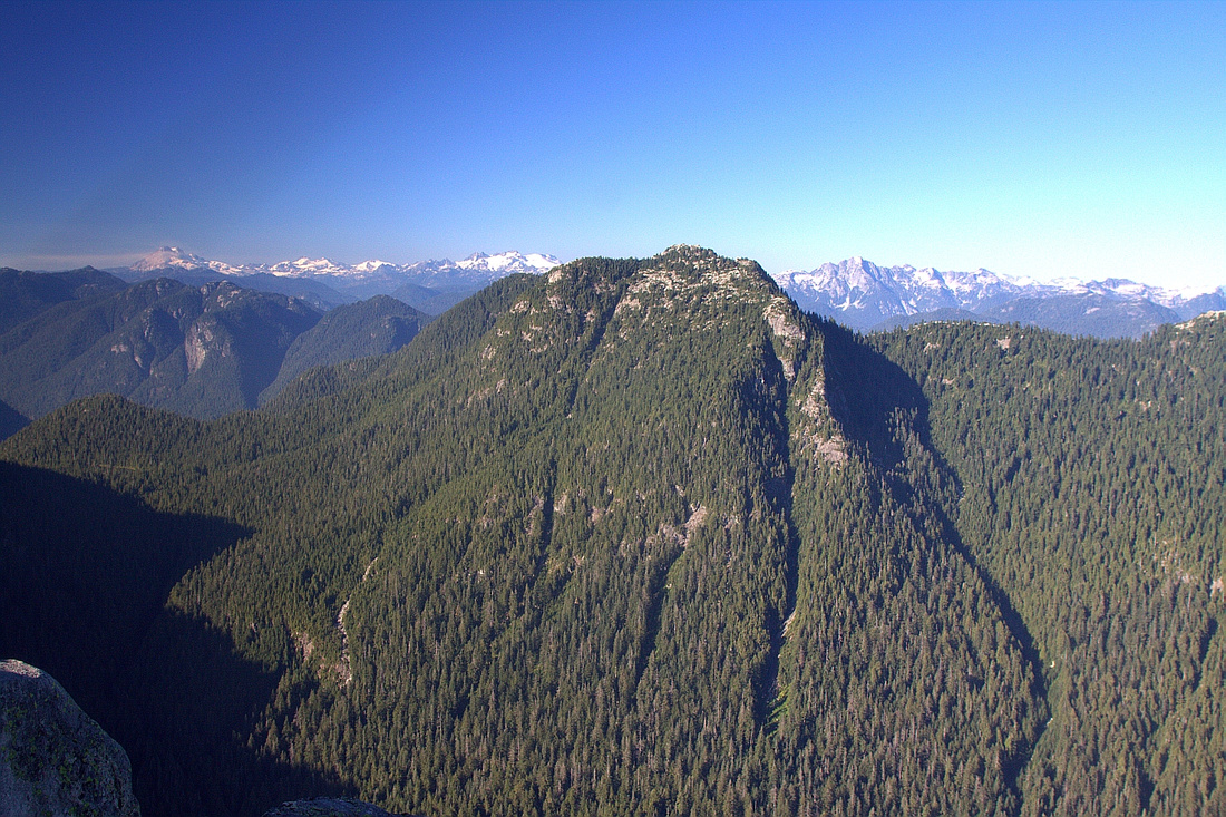 Closer look at Mt. Bishop -- defining North Shore trip in many ways
 |
|||
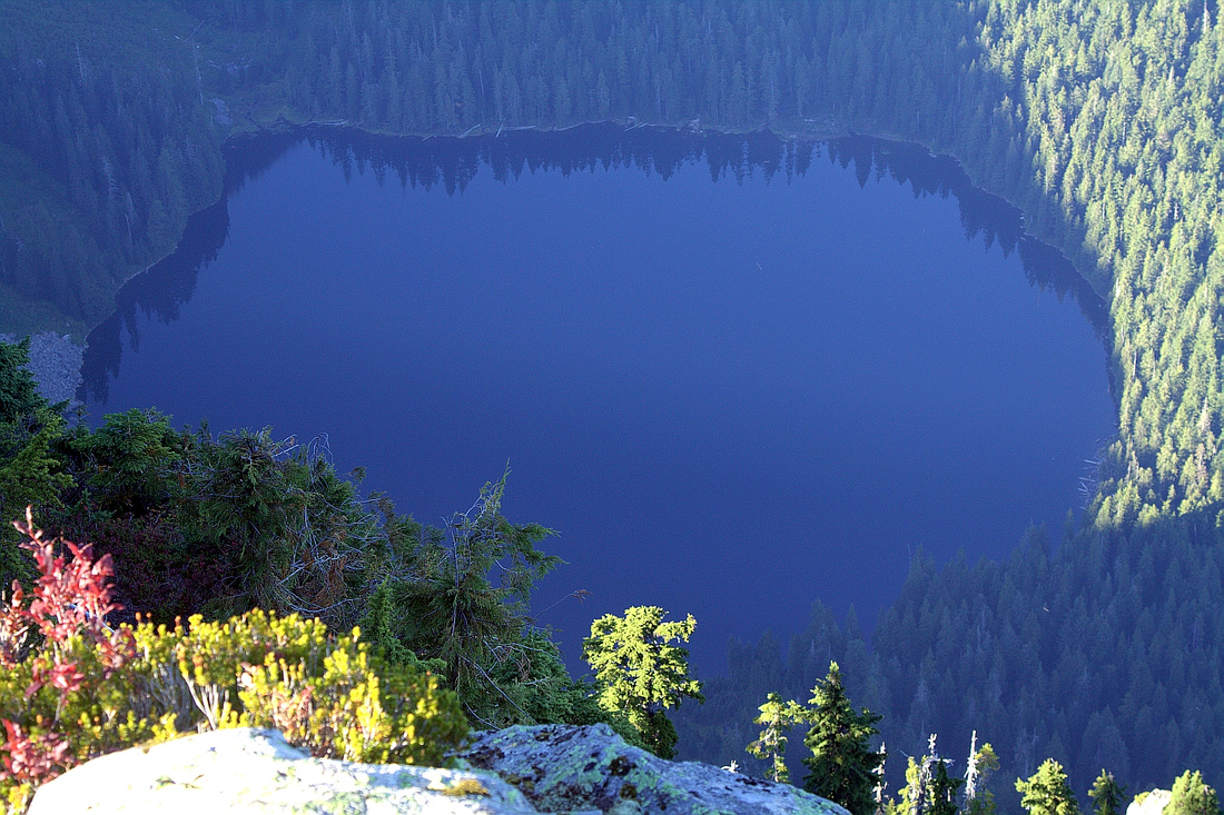 Unexpectedly large Elsay lake. Shelter is at far side of the lake. It is possible to reach Vicar Lakes from there by trashing up NSR flagged route
 |
|||
 Closer look at main peak of Mt. Seymour on return, just as trail starts angling up past Runner snowfield
 |
|||
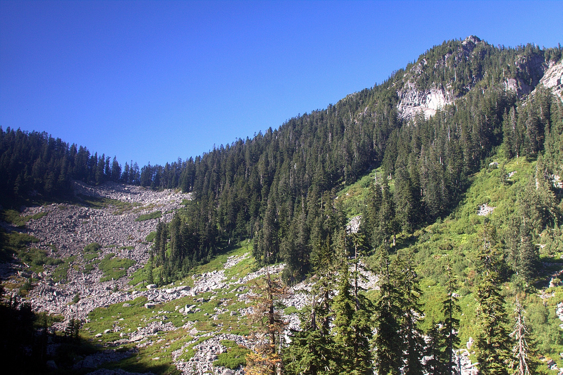
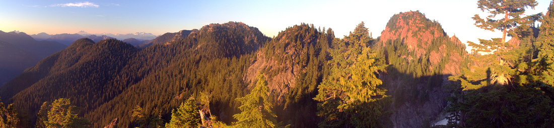 Panoramic view back from west side return. Runner center right, Elsay just left of center
 |
Abstract
| Overall Difficulty | D6 | Rough back-country route, typical for North shore mountains. Little technical scrambling, but considerable overall elevation gain due to up/down nature of terrain | |||
| Snow Factor | S4 | Trip has been done in winter, but several steep snow slopes must be traversed and present avalanche danger. In addition, short daylight hours might present challenge | |||
| Scenery | Classic north shore. Some old growth, tarns and boulder fields. Elsay Lake, Mt. Bishop, Coliseum - Burwell - Cathedral from the summit. Many distant peaks of Garibaldi Park and Tantalus range can be seen on a clear day | ||||
| Trail/Marking | Fair | Seymour and Elsay Lake trails are marked. Rough route with flags for Mt. Elsay and west side return | |||
| Suggested Time | 8-9hrs | East - West loop. East side return (Elsay Lake trail) might shave off bit of time. Add ~45min if tagging all 3 peaks of Mt. Seymour on west side return. | |||
| Elevation | Start: 930m Max: 1390m Total: ~1400m | Round Trip: ~15 km | |||
| Gear | Full hiking boots (ankle support is important). Poles and gaiters are recommended. Crampons and ice-axe in winter suggested | ||||
| Water | Seasonal tarns (water must be filtered!) but no reliable water source. Carry 3-4L on a hot summer day | ||||
| Dog Friendly | Yes | Standard back-country precautions. Seymour area is frequented by black bears | |||
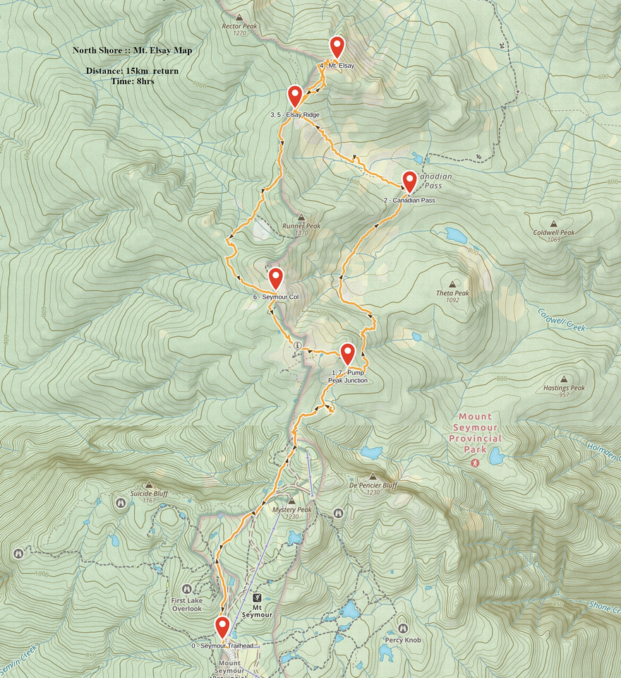 Mt. Elsay GAIA Map
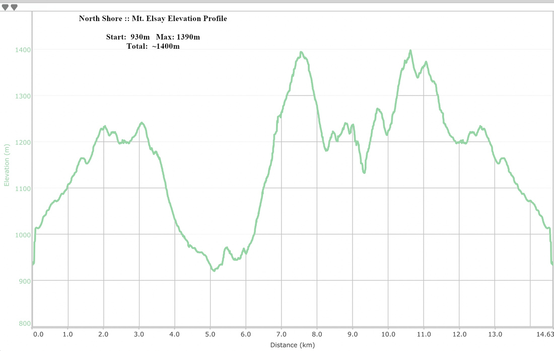 Mt. Elsay Elevation Profile