Google Map |
BC Coast :: North Shore :: Vicar Lakes - Mt. Bishop |
GPS Track |
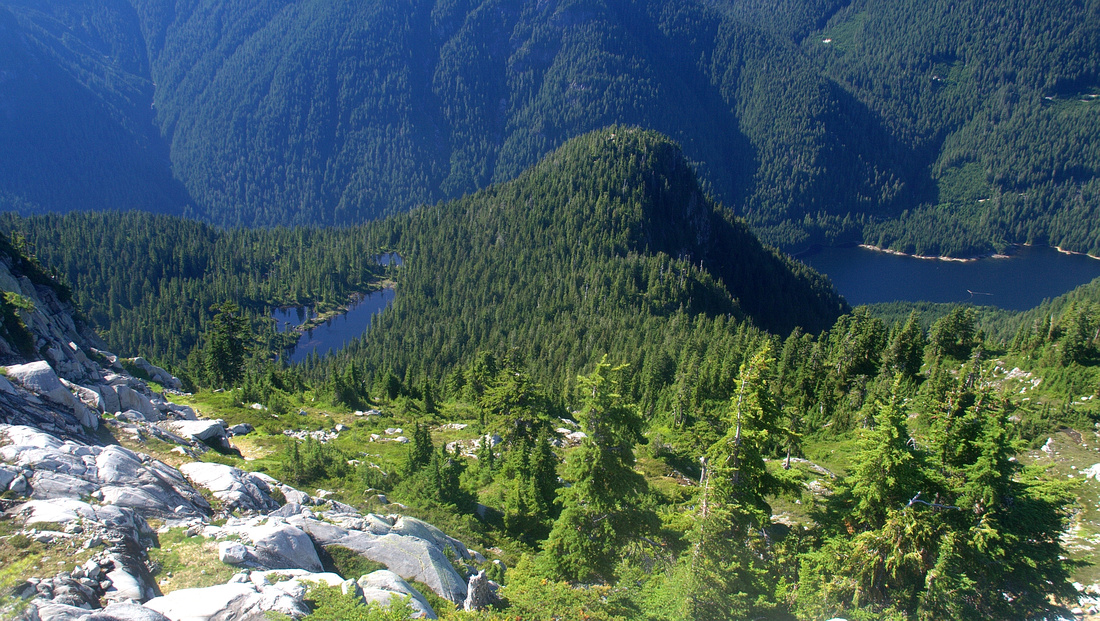 
Upper Ascent Slopes of Mt. Bishop looking back to Vicar Lakes (L) and Seymour Reservoir (R) |
|||
| Trip Summary | |||
August 25, 2012
Mt. Bishop is ultimate North Shore experience! Tucked north behind main Seymour group it is considerably less accessible and logistics make planning a challenge. With bicycle feasible option is approach via LSCR Pathway, followed by very steep hike up Vicar Lakes Trail. Alternative is rugged bushwhack via Elsay - Rector - Curate - Vicar ridge, or rough Elsay lake trail. It is a case of proverbial 6 1/2 - half a dozen. LSCR option is shorter and probably easier but requires a bicycle and hiking awfully steep Vicar Lakes trail. Descending this trail back to your bicycle is downright dangerous. In the other hand Seymour / Elsay "Highline" option is simply too long, and although it has been done as day hike most people will require overnight. Described here is LSCR option, best done in later months of summer when days are long and Vicar Trail has completely dried off.
From LSCR parking near Rice Lake cycle paved Trailway for ~9km, and after crossing Road further 1.5km on dirt to Seymour Hatchery. Cross "Bear Island Bridge"; before bridge construction in 2011 cyclists had either to wade Seymour River or approach via Utility Road after crossing Spur 4 bridge to east side of Seymour River. Climb up (pushing bike likely) to utility road and turn right (south). Vicar Lakes trailhead is some 10 minutes down the road - look for red flagging on left (east) side. Chain your bike and start hiking. First 10-15 minutes of this trail are pleasant enough, passing by impressive "General and His Wife" pair of old growth trees, and just as you start wondering about the bad rap ordeal begins. Brutally steep with frequent bluffs, and while route-finding is not a challenge, physical effort and mental concentration take their toll. On my trip I started counting the ropes but pretty soon lost count - they seemed endless. This section is main reason why trip is not feasible in winter or early spring conditions, specially if you plan descending the same way. After 1.5 hours of torture grade eases and while still gaining elevation trail becomes typical pleasant North Shore experience. Reach Vicar Plateau ~2 hours from the point where you left your bike. Area is very scenic with meadows, lily ponds and several lakes. Upper lake is the largest and there is even very nice peninsula that can be used for sun-tanning or jumping in the water! Save (sun)bathing for return perhaps. Elsay Lake connector or Rector - Curate Highline ridge routes are on south side of the lake in the woods. Turning back at this point would still be good day out, but it would be a shame not to bag Mt. Bishop looming above specially as worst part is already behind.
Cross over to North side of upper Vicar lake and find start of Mt. Bishop trail. There was weathered metal plate nailed on tree in summer of 2012. Trail is occasionally faint but not difficult to follow. After passing east end of upper Vicar lake it starts climbing, and while nowhere as steep as Vicar trail there are still couple of bluffs with ropes. Test ropes before you commit your weight - on my trip one of them gave up sending me sliding down the mud. After about 1.5 hours you finally exit to Alpine. Trail here vanishes; look for cairns to be able to find it back on return. Views back across LSCR to Cathedral / Coliseum / Burwell are phenomenal and this is good spot for a break before tackling final 1/2 hour of ascent. Most parties here make a mistake by ascending meadows on climber left; this route leads to fairly steep cliffs directly below summit of Mt. Bishop. Much easier path is to stay left with very easy scramble that might not even require use of hands. 1500m high summit has large cairn. 360 views are fantastic and one of these cases when all the energy spent seems justified. Aerial view of Vicar lakes (lead photo on this page) in middle of North Shore "jungle" was for me the most memorable.
Return the same way, and keep in mind it will be more difficult due to steepness of terrain, specially lower down on Vicar Lakes trail. After finally reaching your bike, pleasant option is to cycle down Utility road and cross back to west side via Spur 4 bridge, then climb up to LSCR pathway or cycle down Fisherman trail and up to parking lot from there. |
|
Gallery |
|||
 Bear Island Bridge at end of LSCR Cycling Path just before Seymour Hatchery
 |
|||
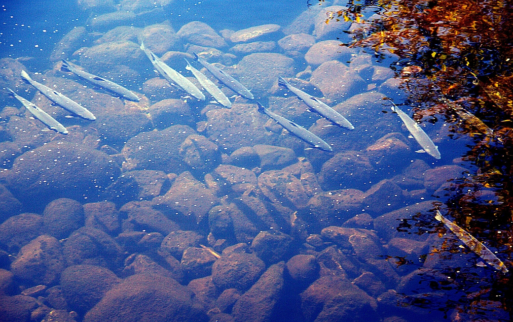 Plenty of Trout in clear shallow water of Seymour River
 |
|||
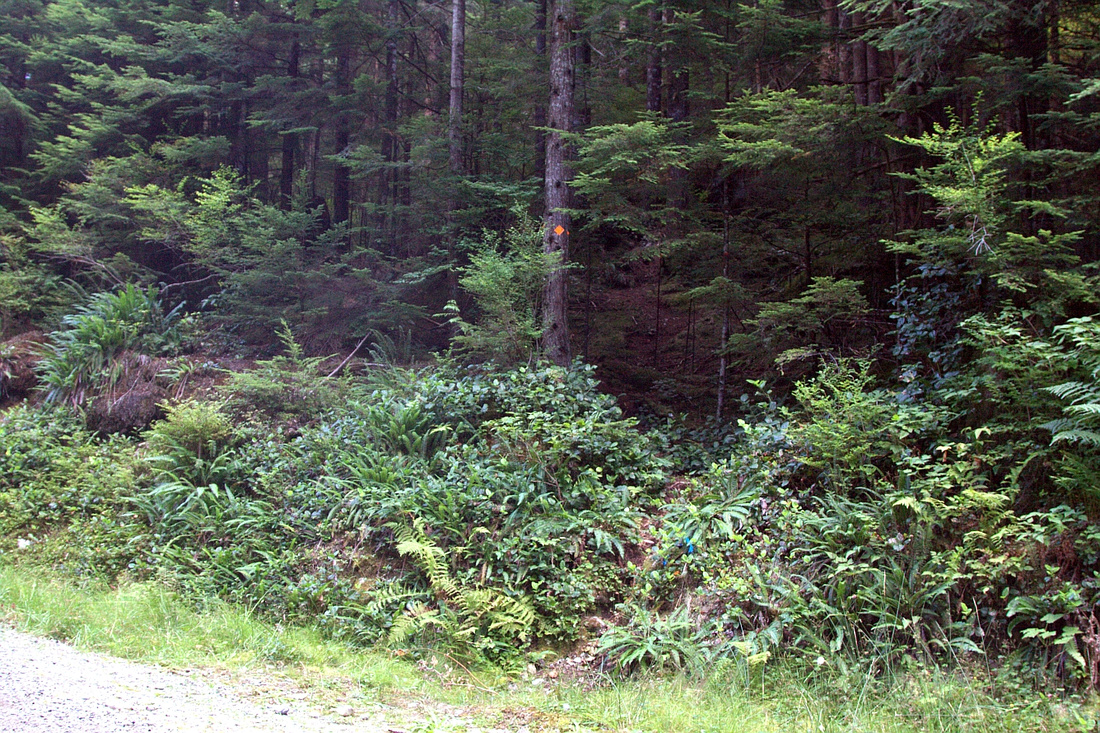 Inconspicuous Vicar Trailhead some 10 minutes south from Bear Island Bridge
 |
|||
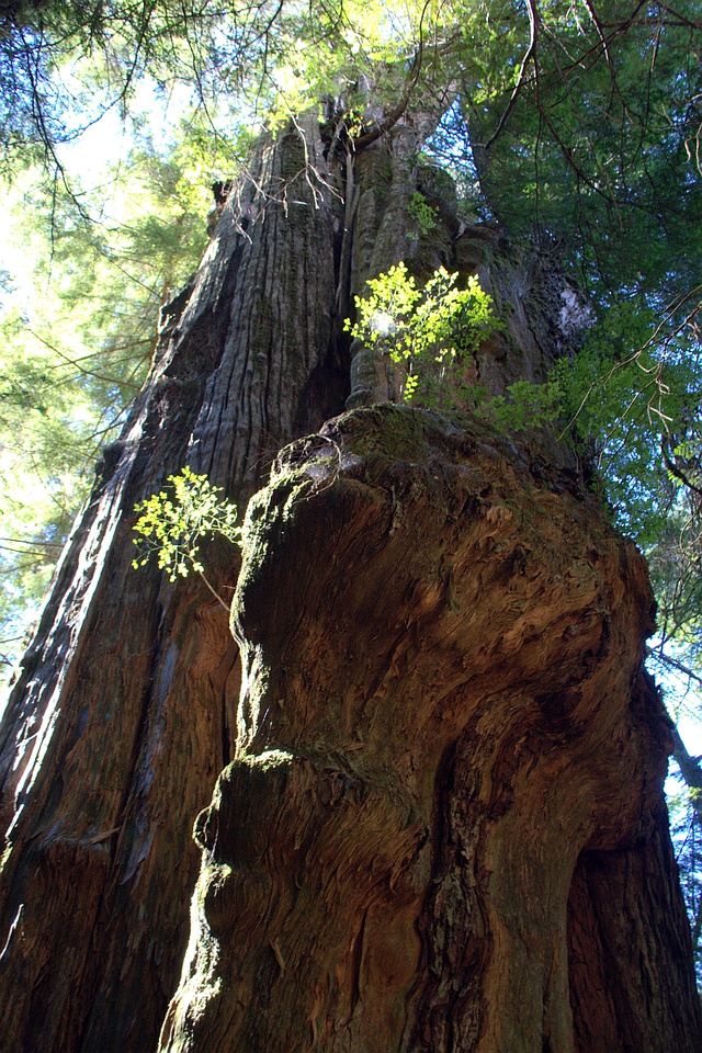 "General and his Wife" just before Vicar Trail steepens up
 |
|||
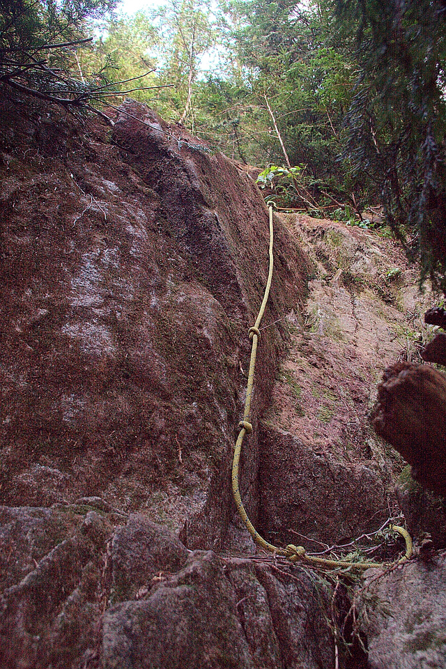 Brutally steep Vicar trail with one of many rock bluffs
 |
|||
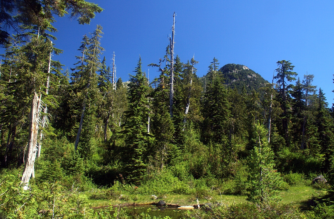 Topping up on Vicar Plateau after almost 2 hours. Area is extremely scenic and this is where efforts really start paying off!
 |
|||
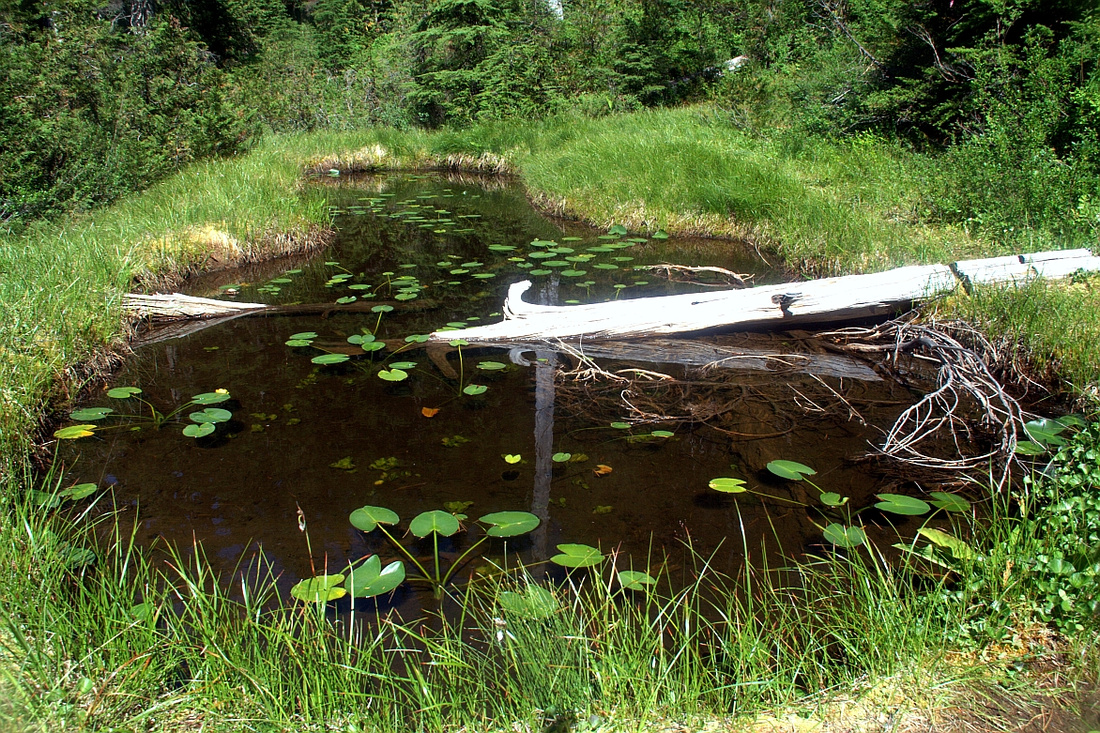 Picture perfect Lilly pond at Vicar Plateau
 |
|||
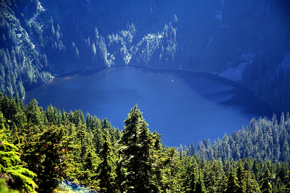
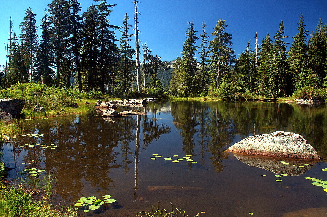 Very scenic lower Vicar Lake looking back
 |
|||
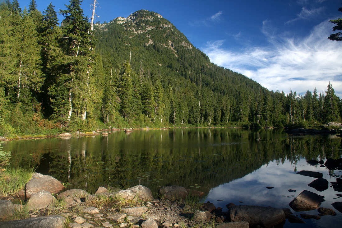 Looking at Mt. Bishop from upper Vicar Lake
 |
|||
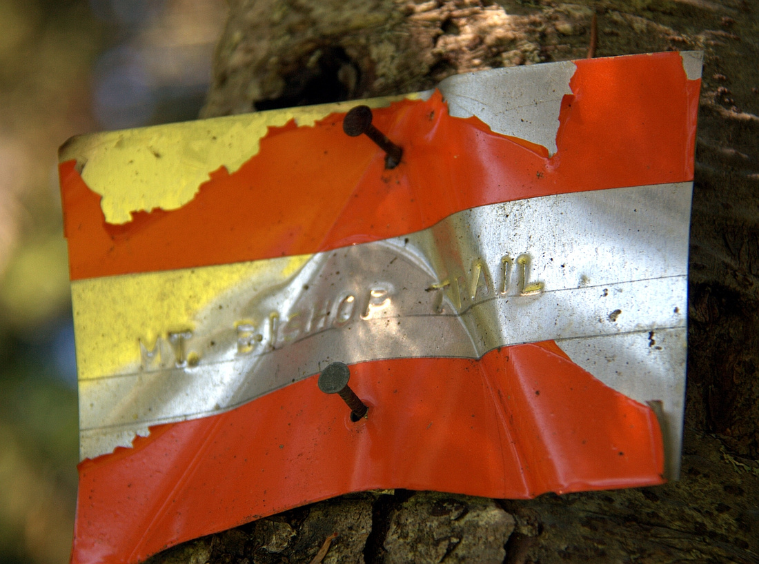 Weather metal plate indicating start of Mt. Bishop trail at north end of upper Vicar Lake
 |
|||
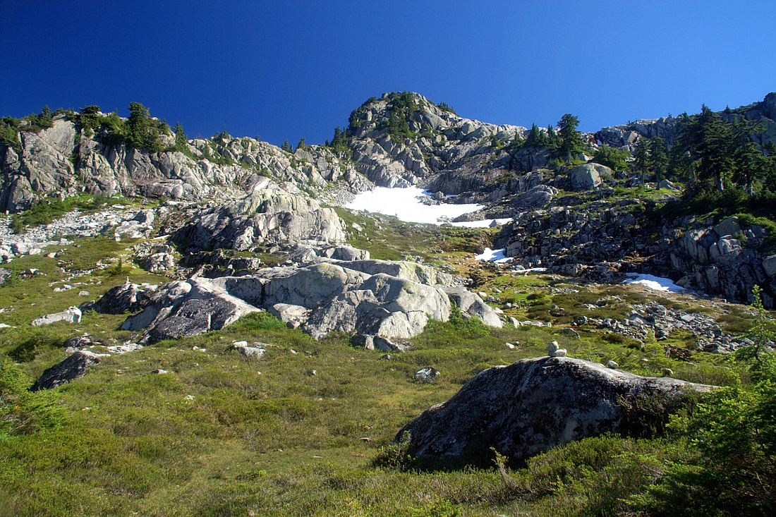 Finally reaching alpine after 1.5 hours from Vicar Lakes. Stay on climber right of snowpatch in upper center and follow ridge to summit ~30min away.
 |
|||
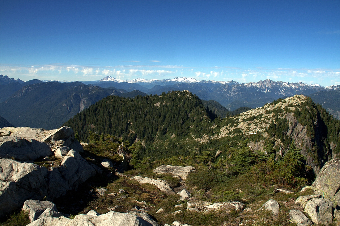
 Looking back at Cathedral (center) and Coliseum / Burwell (left); Lions group in between in the distance
 |
|||
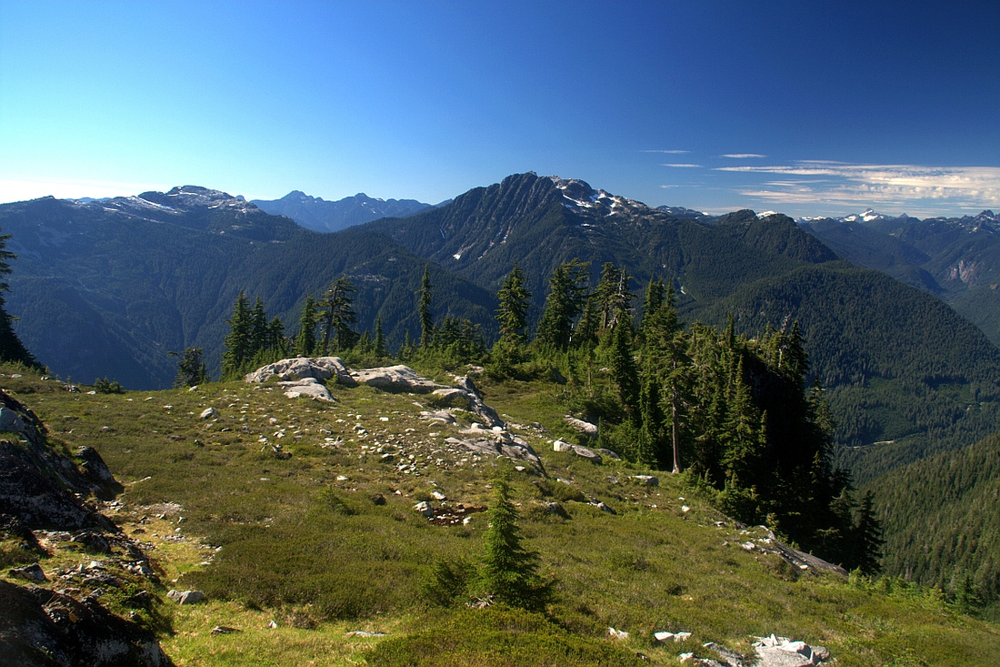
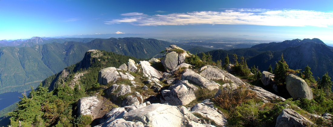 Panoramic view SE from 1500m high summit of Mt. Bishop. Elsay / Seymour right, Indian Arm with long Eagle ridge left. Distant white cone of Mt. Baker on the horizon
 |
|||
 Upper part of Indian Arm. Many distant peaks of Golden Ears park on horizon, including distinct Twin Towers of Mt. Judge Howay
 |
|||
 Looking north; both bumps in near foreground can easily be scrambled too. Distant snowy peaks of Garibaldi park on horizon
 |
|||
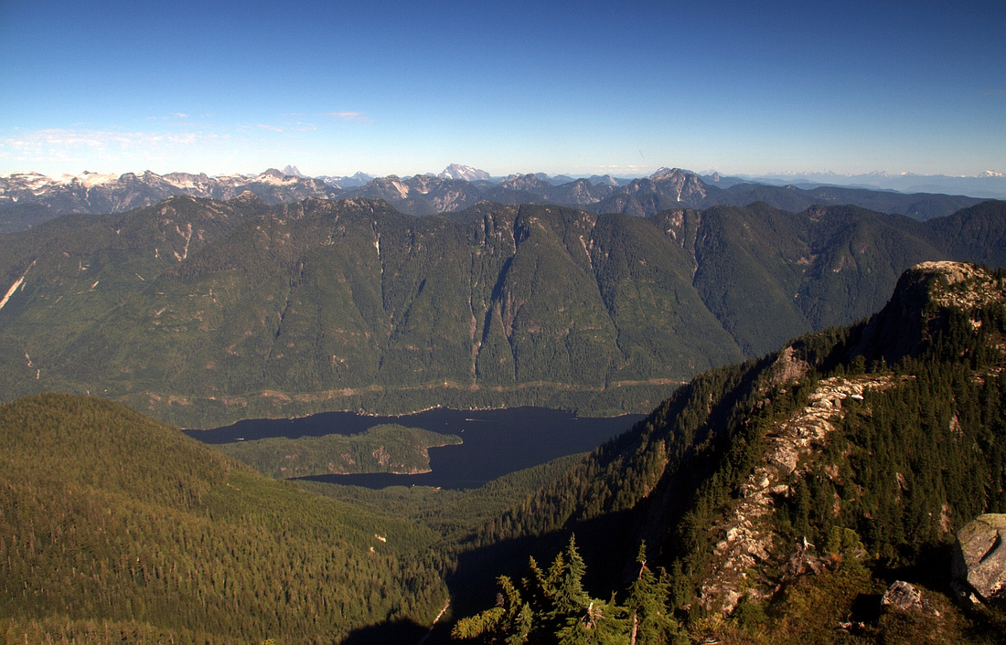
 Elsay lake. Not directly visible from Bishop summit - hike few minutes south for this view
 |
Abstract
| Overall Difficulty | D7 | Brutally steep, even dangerous Vicar Lakes trail with several rock bluffs assisted by ropes. Long day with significant elevation gain | |||
| Snow Factor | S5 | Very steep grade of Vicar Lakes trail makes winter trip difficult and dangerous. It has been done though | |||
| Scenery | Classic North shore. Bluffs, tarns and far reaching views in upper alpine | ||||
| Trail/Marking | Good | Wide LSCR Pathway to Seymour Hatchery. Marked Vicar Lakes trailhead on east side utility road with faint but flagged route after | |||
| Suggested Time | 10-11hrs | Return time including cycling approach / deproach. Alternate highline return via Elsay / Seymour requires overnight | |||
| Elevation | Start: 220m Max: 1500m Total: ~1300m (without cycling) | Round Trip: ~10km (without cycling) | |||
| Gear | Bicycle for LSCR approach (mountain bike not necessary, but will make things easier). Day hikers or full boots and poles. | ||||
| Water | Vicar Lakes and seasonal streams. Carry 2-3L in summer | ||||
| Dog Friendly | No | Dogs will have serious problems scrambling bluffs on steep Vicar trail | |||
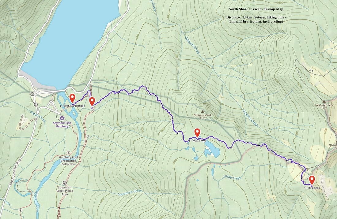 Vicar Lakes - Mt. Bishop GAIA Map
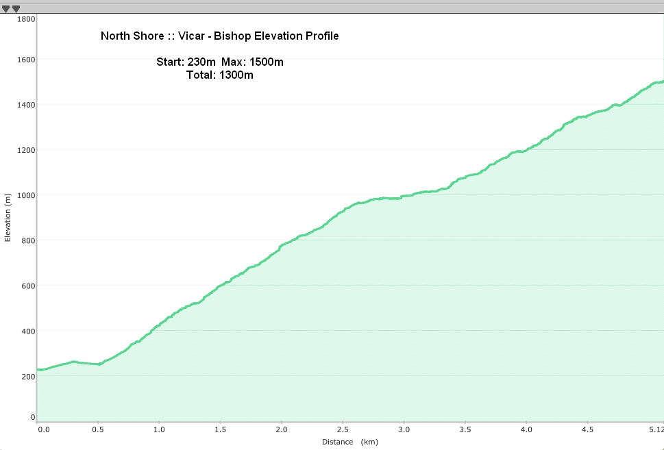 Vicar Lakes - Mt. Bishop Elevation Profile